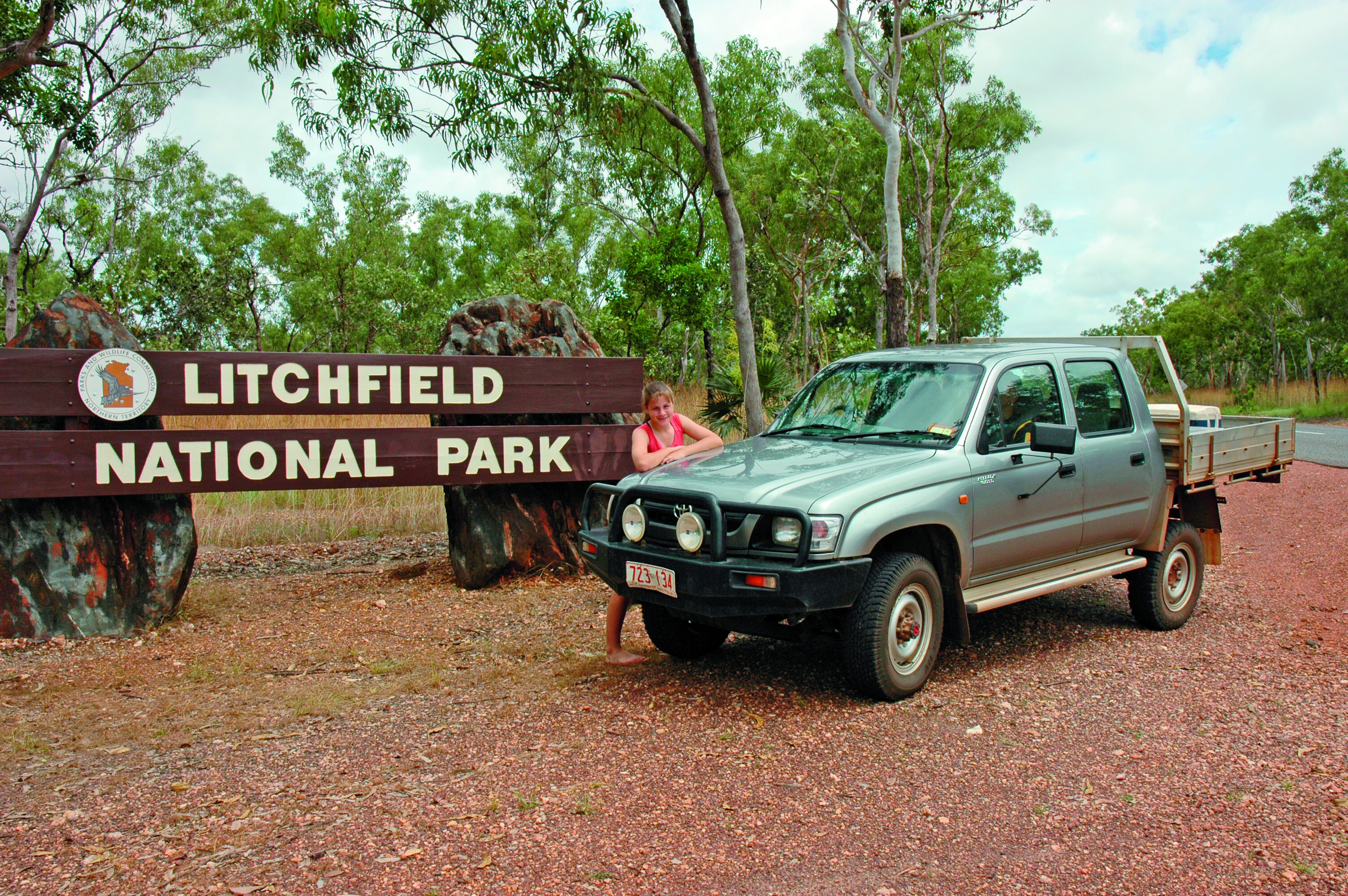
Ask a local in Darwin which is the best national park in the Top End and you will be informed it’s Litchfield. Which is surprising because the attention is always on Kakadu. But again, the locals will tell you that Litchfield is a simple park without the b/s …Don’t get me wrong, Kakadu was my home for the entirety of the 1980s and I love the place. It’s not to be missed on a Top End holiday.However Litchfield has perennial creeks that feed thundering waterfalls and cataracts that, unlike those in Kakadu, never dry. There is also safe swimming in the plunge pools and at the spring-fed Buley Rockhole.
This alone makes Litchfield a favourite day escape for Top Enders during the build-up season, when the soaring temperatures of the coming wet makes having a cooling dip in a crocodile-free swimming hole invaluable. But the 146,000-hectare park is more than a swimming park for a weekend dip; it’s one that has scenic flora and fauna values that are so much a part of the Top End landscape.
SWIMMING HOLES
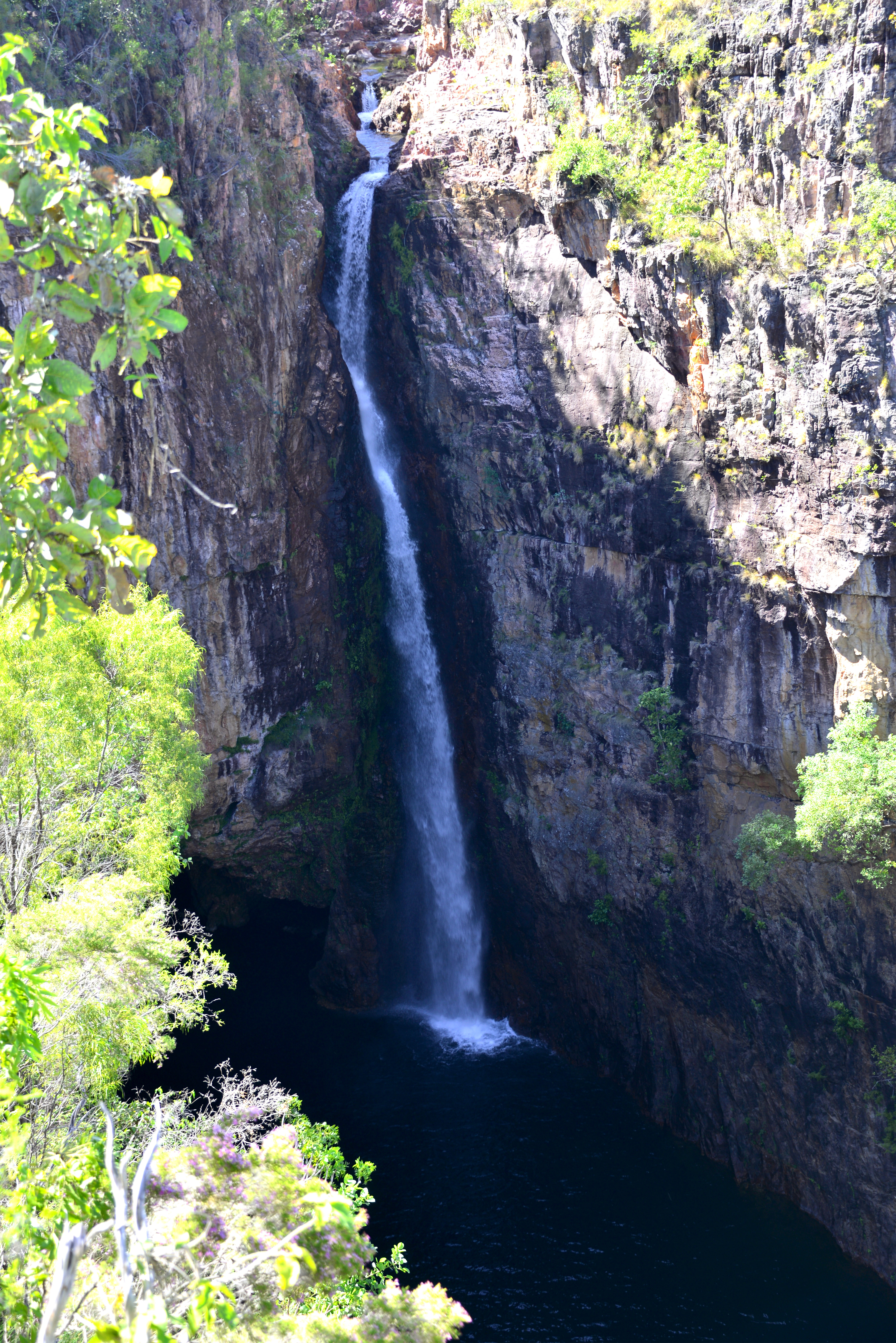
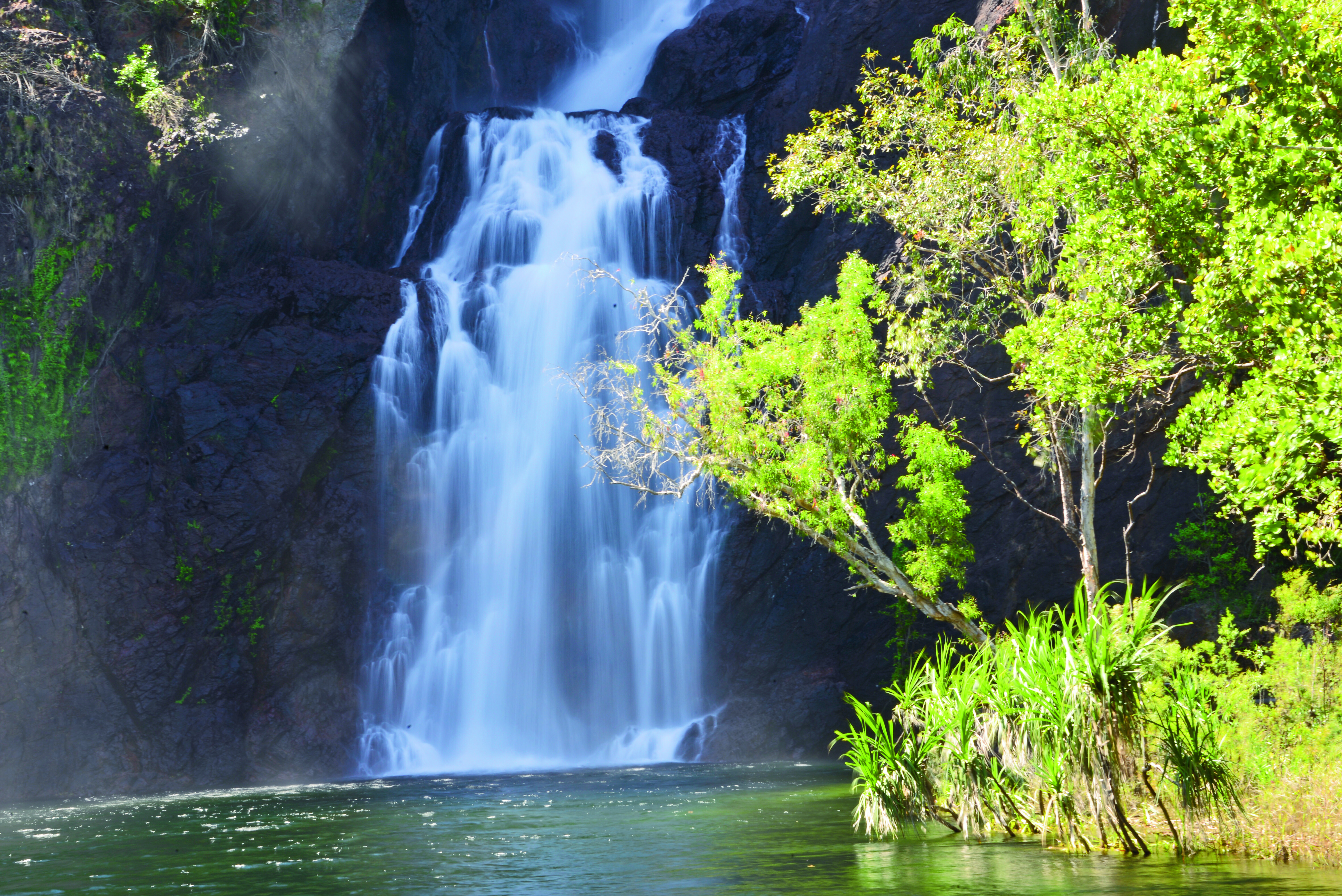
Swimming is popular at Tjaynera Falls (Sandy Creek), below Florence Falls and in Buley Rockhole. Wangi Falls is very popular, but it can be suspect, especially during and after the wet season when saltwater crocodiles make their way upstream into the plunge pool from the nearby Reynolds River. It’s your call …
Powerful currents are also present when the falls are in flood. Some years ago, following a huge ‘knock-em-down’ storm, I was lucky enough to photograph the Wangi Falls in full flood. The falls were roaring and powerful waves, along with spray, were washing the pandanus that line the creek. A bikini-clad English lady turned up to go for a swim. I warned her that the current was too strong and that a crocodile may be in the pool as they often are after a flood. She thanked me and passed it on to several others in her tour group.After enjoying a coffee at the kiosk my wife and I headed back to the car park and were ambushed by a park ranger and a tour driver at our LandCruiser. I was soundly abused for giving the girl some life-saving advice to the point where I told both to shut their mouths or face the consequences, especially when the tour driver told us to go back to Queensland …
Later, I picked up the Northern Territory News at the newsagency and noted the headline: “12-foot crocodile captured in the Wangi Falls plunge pool.” I dropped it on the counter of the park office along with my business card – and told them to Google my credentials. In hindsight, the park people of the Top End have been amazing and very helpful to me over the years, but I suppose there is always a tosser in the pack.The lesson is never swim in one of the rivers and creeks below the escarpment plateau during and after flooding – and take note of the local bushmen. You will live longer in the tropics …
GETTING THERE
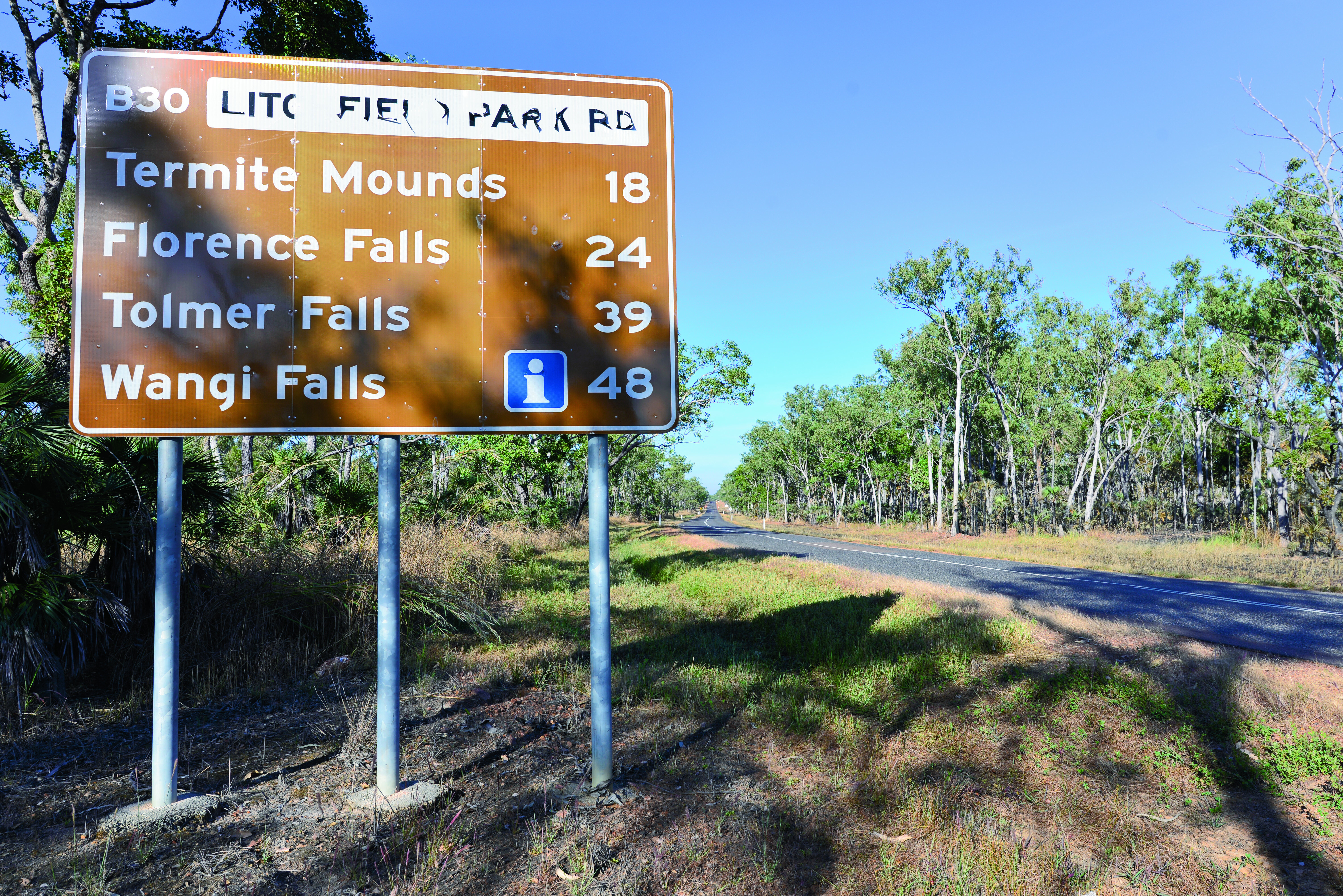
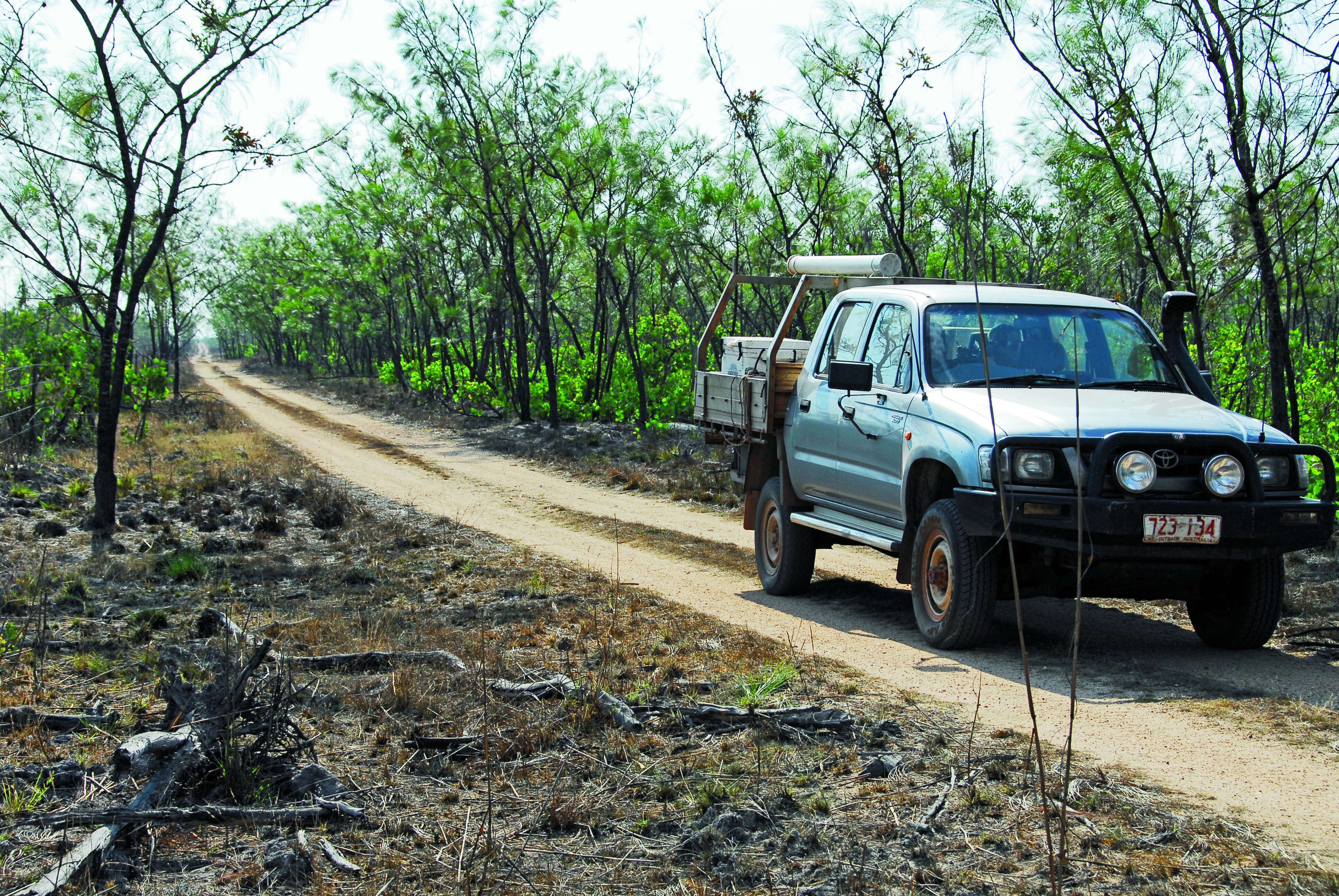
Litchfield is only two hours’ drive from Darwin and, with a mostly sealed ring-road from Batchelor to the Cox Peninsula Road, getting there is simple, whether for a day excursion or an extended camping trip by lodging at one of the park’s campgrounds or those run by private enterprises at both entrances. Meals, cabins and motel accommodation are available on the Litchfield Park Road, east from Batchelor, before the park’s eastern entrance.
Roads are open all year, as is most of the park, but during the wet season the Reynolds and Finniss River often flood the road crossings. Again, common sense rules when the environment is warring with itself. Best stay home when flooding is on the books. The Finniss River, while bridged, is crossed at both the eastern and northern park entrances.
4WD TRACKS
There are several 4WD-only tracks in the park and they are closed during the big wet. These challenging 4WD-only tracks terminate on the Daly River road to the south. The first track leads to the Lost City, Tjaynera Falls and the Blyth Homestead ruins. There is a natural crossing on the Reynolds River on the western track, but be careful there when wading as crocodiles live here. It’s a popular 4WD excursion route to the Daly River.
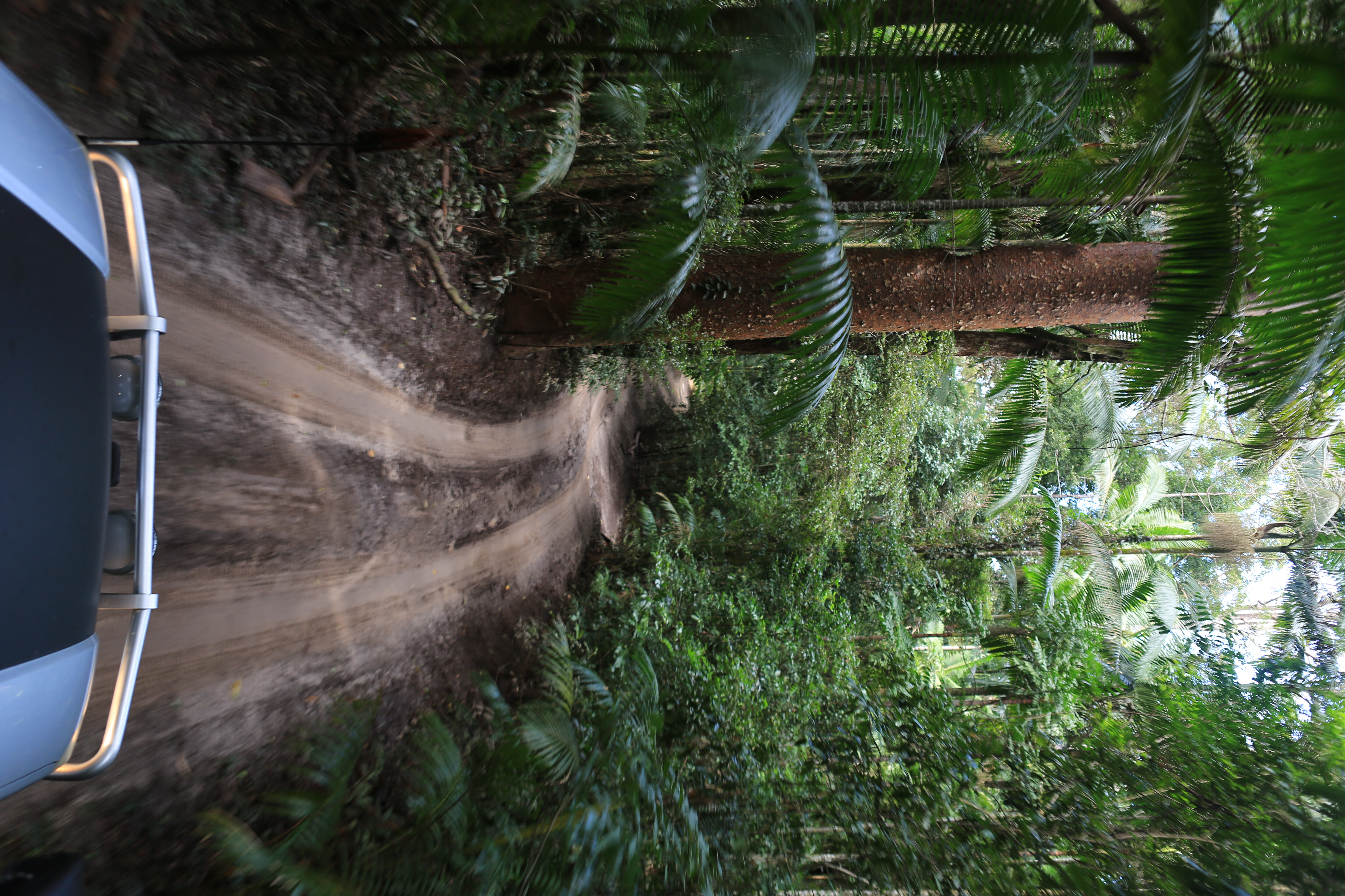
The main park ring-road route is fully sealed and provides access to several waterfalls and swim pools. Florence Falls, Buley Rock Hole, Tolmer Falls and, lastly, Wangi Falls are all located close to the road. There are short walks from the car parks to the falls.Another nice 4WD track is not far past the Finniss River bridge on the Litchfield Park Road. It cuts across monsoon woodlands, over steep hills and terminates on the north bank of the Florence Creek Falls. This 20km track and others to the Daly River are popular with 4WD explorers wanting to get away from the maddening weekend crowds.
WALKS
There are several walks in the park, the most used being the easy boardwalks that terminate at the waterfalls. If planning an extended walk across the plateau or the surrounding monsoon woodlands, you must apply for a permit which is available from the Territory and Wildlife Parks office in Batchelor.
They will want to know your planned route and other details. Carry a Personal Location Beacon (PLR) or sat phone when trekking across the Tabletop Plateau and the monsoon woodlands of the low country.Hiking and walking are very popular due to the scenic terrain and wilderness experience. While there is no marked trail system, rangers will assist with suggestions and more. Existing walks from the car parks do not pose any problems, being no longer than a brief stroll with two hours being the longest. It all depends how much time one spends looking at things along the route.The Rainforest Track at Florence Falls is 2km. It commences at the plunge pool and follows Florence Creek upstream, where lush and verdant gallery rainforest is encountered before it swings back to the pool. Another extends from the campground. Some fitness is required.The Buley Rockhole to Florence Falls track is 1.5km and an easy walk for the fit and young at heart.The Tolmer Falls Track is 1.6km long. It has recently been upgraded and skirts the top of the gorge above the falls, while grand views fold to far western horizons from the new lookout across the woodlands. No access is allowed in the deep rainforest gorge below the falls or the caves that are home to bats.
It’s arguably the most spectacular ’fall in the park. While a thundering 80m cataract in the wet, it drops down to a serene and plume-like waterfall at the end of the dry. The continual mist has created a true rainforest below the falls.The Lookout Walk Track at Wangi Falls is 1.5km and is only suitable for the fit, as it has steep ascents and descends to the top of the 50m high sandstone escarpment. The falls are the most popular with visitors who come here to swim and relax in the big plunge pool that is on the bottom of the twin cascades.
Snorkelling is also popular, but nature can be deceptive, and people have drowned in the strong currents under the falls – and, of course, there is the odd crocodile …
CAMPING
There is organised camping only in the park, with showers and toilets available. No bush camping is allowed, nor are pets. The most popular is the Florence Falls campground. It’s downstream from the falls where a short, steep walk takes you to the plunge pool below the cascading torrent.
Buley Rockpool is nearby. The campground is deemed unsuitable for caravans due to a steep ascent and limited space, but it’s okay for camper trailers.
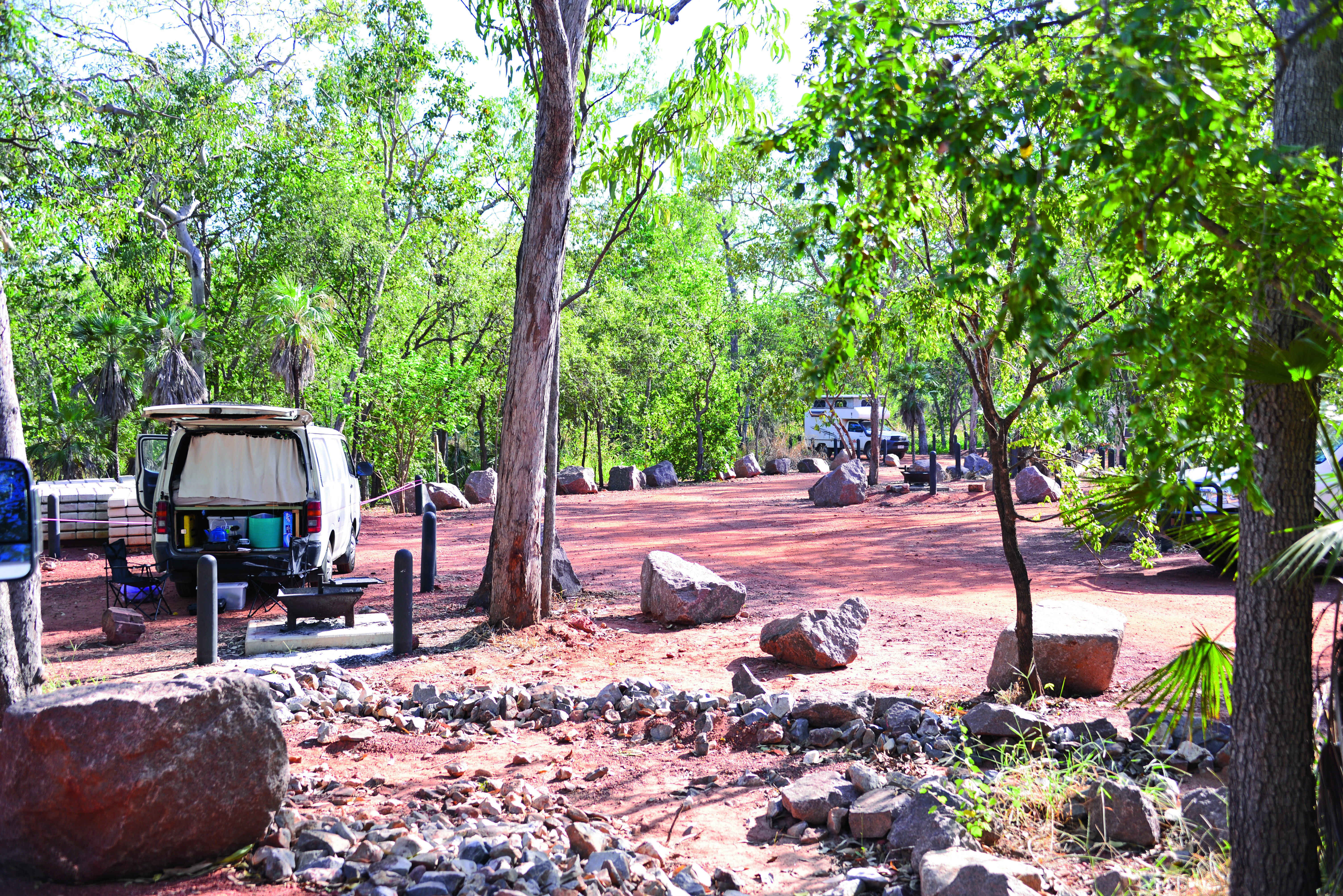
The next campground is at Wangi Falls, with a private campground just outside the park up the road a little. Caravans are suitable for Wangi campground. It has a kiosk with meals, showers and toilets. No powered sites are available. Camping fees apply and must be deposited in the honesty box provided. Rangers check for permits.There is a bush campground at Tjaynera Falls – 4WD-only track. The park campgrounds are managed by ‘Campground Services’, who will demand unpaid fees if you don’t have a ticket.
ROAD ACCESS
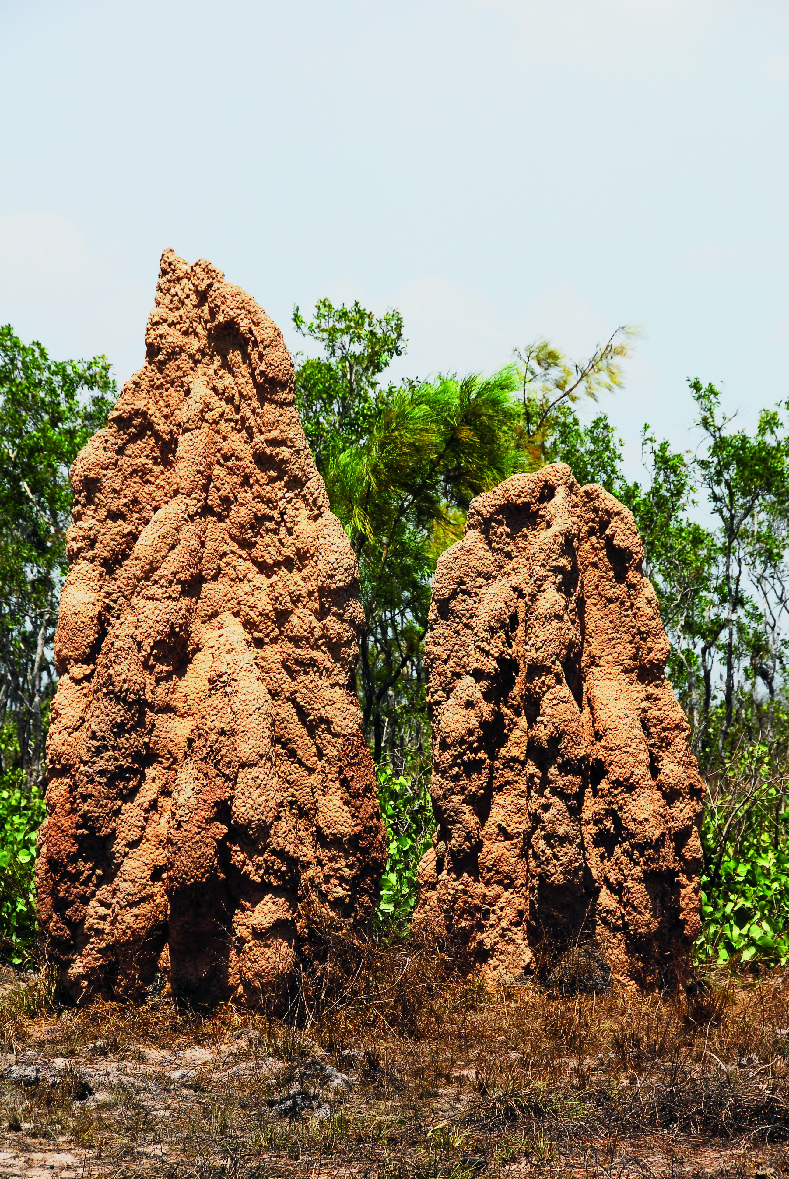
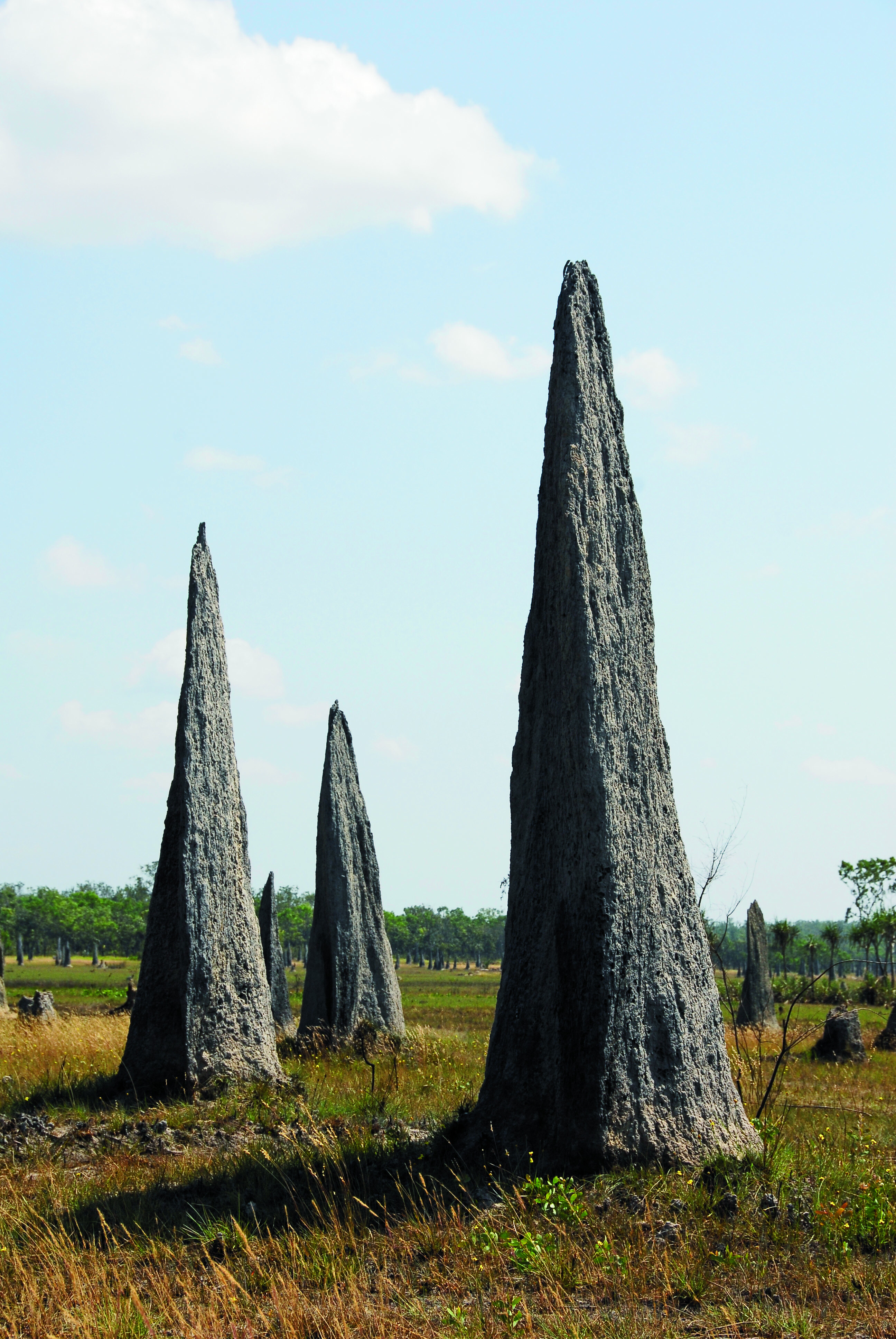
If coming from Batchelor, don’t miss the imposing termite mounds. Both the magnetic and the 4m-high Nasutitermes triodiae termite mounds are represented on the black soil plain. Magnetic mounds, constructed by Amitermes meridionalis termites, take full advantage of the sun and warmth, akin to having air-conditioning in the home. These mounds are orientated 10 degrees east to true north.
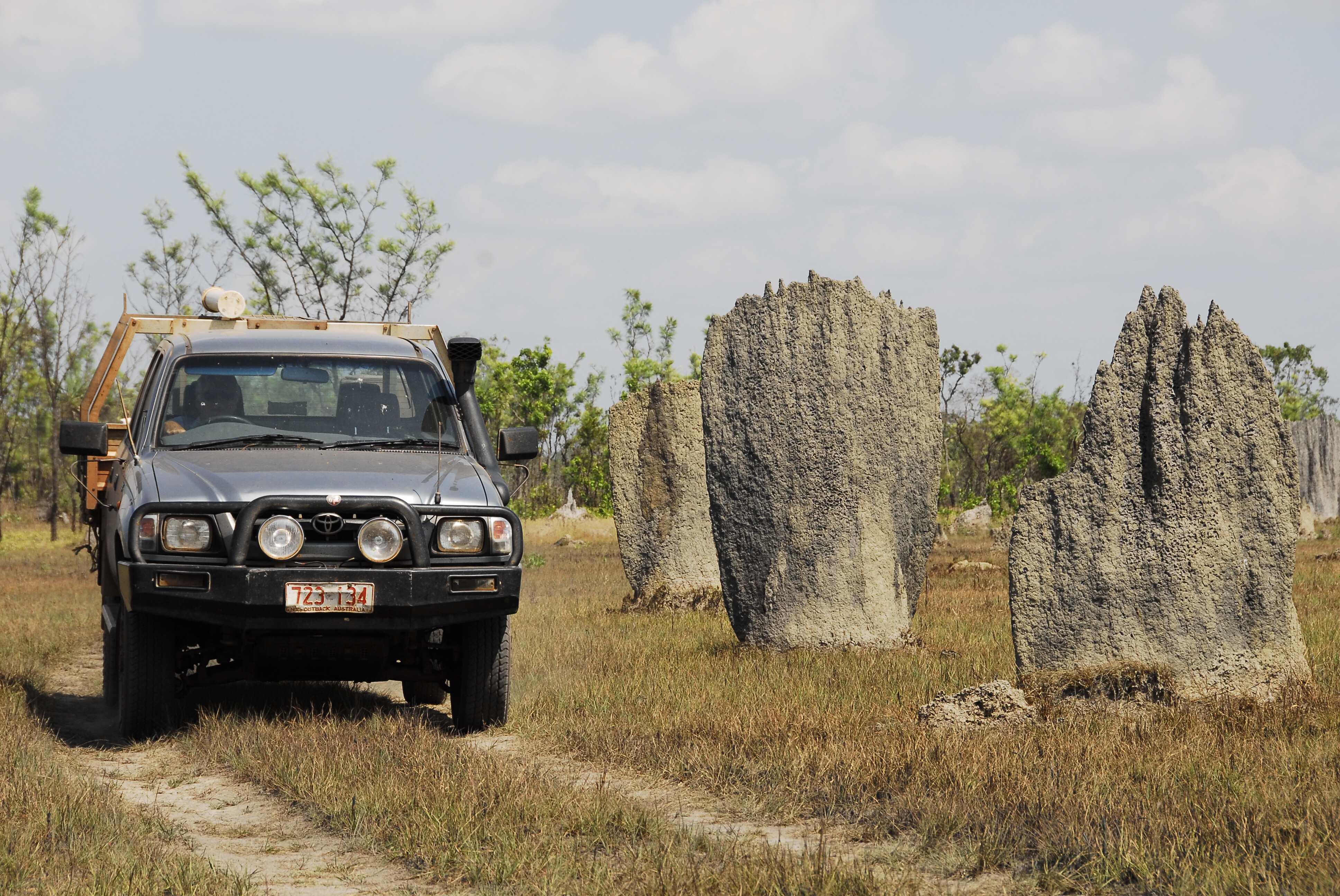
On the way out to the Cox Peninsula Road, keep an eye out for extensive huge magnetic termite cities, soon after crossing the Finniss River bridge.Another attraction is the Tabletop Swamp, where a shallow depression has created ideal conditions for the swamp. It is generally clad with reeds and fringed by paperbark trees. Swamps like this and the natural ‘sponge’ effect of the sandstone tableland are responsible for the slow release of water that feeds the spring-fed creeks and enables the waterfalls to flow permanently, even during the most severe dry season.
The swamp attracts a lot of wildlife, so take the easy walk about it and be surprised by its avian inhabitants in variety and numbers.About 4km past the Florence Falls marker is the Lost City turn-off. It’s 4WD-only country and tracks for 18km through monsoon forest. The track extends beyond the sandstone pillars of the Lost City to the Reynold River Track near the abandoned Blyth Homestead ruins.The Lost City has tall, weathered free-standing sandstone pillars that reach to the top of the gum trees. Nature has created works of art here and taking a gander and a walk about the ‘city’ is a must.Farther on is the Blyth Homestead, a living testimony to how tough and hard things were for the pioneers that dared to challenge the bush and the often-hostile natives. The homestead was built in 1929 and has endured.
You have a choice here of turning north to Wangi Falls or south to the Daly River road, via Tjaynera Falls, which is well-worth the drive. Plan to camp in the bush along the creek.Once past Wangi Falls, several attractions on the last leg to the Cox Peninsula Road are located outside the park. There is a kiosk and campground near the boundary, and beyond it is the private rainforest reserve of the Petherick family. Years ago, I met the now deceased founder of the reserve. Old man Petherick made a living from shooting crocodiles and said he once shot a 15-footer in the Wangi Falls plunge pool … now you know why I don’t swim in it.Bamboo Creek Mine turn-off tracks for about 2km before the old mine site is reached. Copper, tantalite and tin were discovered in the Litchfield region in the 1870s. Mining was active at Mount Tolmer and Bamboo Creek, but mining activity ceased in the 1950s.
Farther on is the Finniss River, turn right after crossing the bridge and be amazed by the beautiful waterhole that appears. Camp here, launch the tinnie and catch a barramundi for tea.The next attractions are the huge cities of magnetic termite mounds. They are located on private land, but no one stops people from viewing the mounds.
HISTORY AND GEOLOGY
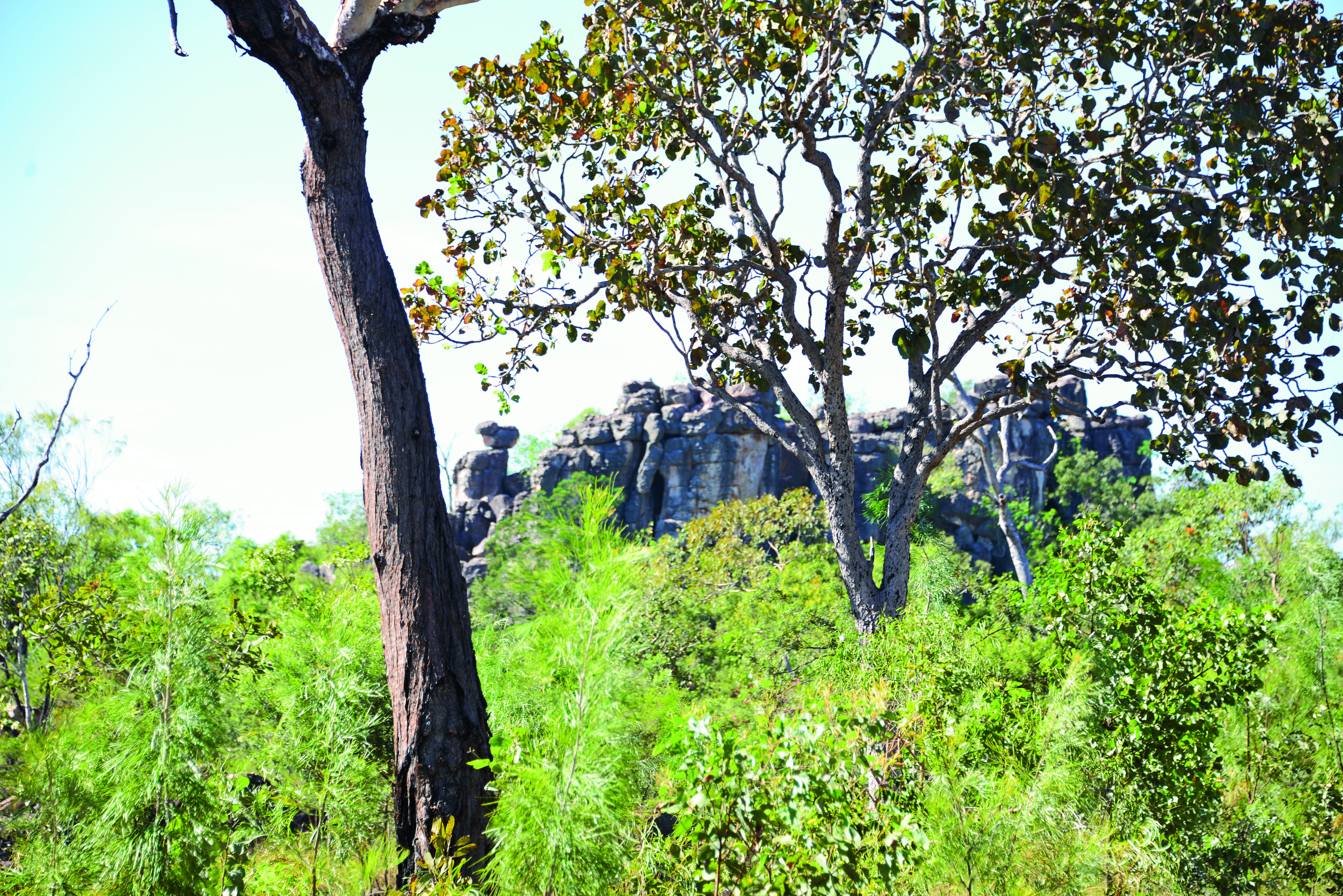
Litchfield was named after Frederick Henry Litchfield, who was the first white man to visit the region in 1865. An able bushman and explorer, Litchfield died in 1873 from gangrene caused by a festering spear wound.During the dry season, traditional cultural burning regimes are practised by park management. Bush tracks may be closed, but generally burns are low key due to the lack of reduced fuel loads that is created by annual burning.It’s odd that for all its size Litchfield is dominated by only two geological formations. The sandstone predominant of the Tabletop Range, a plateau that rises to 50m. It is home to the spring-fed creeks that feed the waterfalls. Elsewhere in the low country, shaded by the plateau, are typical Top End monsoon woodlands.An average of 1450mm of rain falls in the park between November and May. Most of it falls during a two-month period when the monsoon peaks.The tableland lacks a drainage system and its shallow depression – like the Tabletop Swamp and others – along with the natural ability of sandstone sponge effect and a finely balanced aquifer under them, makes the park a wonderful waterfall world.
FAUNA AND FLORA
Fifteen frog species, 58 reptile species, 44 mammal species and 174 species of birds makes the park an interesting spot for wildlife and bird watchers. Bats are found in many of the caves that are under the lee of the escarpments. There is a cave at Tolmer Falls that houses almost 30,000 orange horseshoe bats, considerable because its estimated that only 34,000 occur world-wide.
Aboriginal rock art is present in some caves and rock shelters, though no Aborigines live in the park. Contact the Park ranger for details on rock art.The bats eat insects, which reminds me of the hungry hordes of park mosquitoes. Take Bushman Insect Repellent gel, wear loose-fitting and lightweight clothing, sturdy bush boots, and a wide-brimmed hat when walking in the park, and enjoy all that Litchfield has on offer. You may just agree with the Darwinian that it’s the best park in the Top End …
TOP 5 PLACES TO VISIT
1. Wangi Falls, Florence Falls, Buley Rockhole2. Magnetic termite mounds3. Lost City4. Tolmer Falls5. Blyth Homestead
Snapshot
- Ford Ranger best-selling 4×4 in 2021
- Toyota HiLux top-selling car overall
- Toyota sells more 4x4s than anyone else
As expected, the Ford Ranger was again the top-selling 4×4 in Australia for 2021. It outsold the Toyota HiLux in the month of December by to 3747 units to 2600 to take the yearly tally up to 45,986 Ranger 4x4s to 39,587 HiLuxs.
While Toyota might feel the pain of not having the top-selling 4×4 in the country, the HiLux was the top-selling car in Australia overall (when you combine 4×4 and 4×2 sales) for the sixth year running. Out of interest, Toyota sells more than three times as many 4×2 HiLuxs as Ford sells 4×2 Rangers.
2021 was the 19th year running that Toyota has been Australia’s top-selling vehicle manufacturer and with more 4×4 models in its showrooms than any other manufacturer, it sells more 4×4 vehicles here than anyone else as well.
| December 2021 | ||
|---|---|---|
| 1 | Ford Ranger | 3747 |
| 2 | Toyota Hilux | 2600 |
| 3 | Toyota Prado | 2204 |
| 4 | Isuzu D-Max | 1475 |
| 5 | Mitsubishi Triton | 1431 |
| 6 | Nissan Navara | 1410 |
| 7 | Mazda BT-50 | 996 |
| 8 | Toyota LC79 | 931 |
| 9 | Toyota LandCruiser | 821 |
| 10 | Isuzu MU-X | 784 |
Despite delays for the LandCruiser 300 Series and shortages of other products, 2021 was the biggest year ever for the LandCruiser brand (including LC200, LC300, LC70 and Prado models) with almost 47,932 including individual records for LandCruiser Prado (21,299) and the LandCruiser 70 Series (13,981) – and strong sales for the LandCruiser wagon including the all-new 300 Series.
Also of note for Toyota in December, the Prado is one of only four serious 4×4 vehicles in the FCAI’s Large SUV segment which is largely made up of light-duty SUVs and people-movers. The other being the Toyota Fortuner, Isuzu MU-X and the Ford Everest. Yet the aging Prado was the only vehicle in the category to sell in the triple figures and with 2204 all-4×4 Prados it smashed the others whose sales are bolstered by both 4×4 and 4×2 variants.
You can’t argue with Ford’s determination to keep the Ranger brand strong with a plethora of new and limited-run variants throughout 2021 in what will be the current model’s last full year on sale. The new 2022 Ranger is due mid year and promises to again be a market leader.
In a year of stock shortages and virus-addled sales, there were a number of movers in the overall tally. None more so than the Mitsubishi Triton which was decimated by supply issues in the second part of 2021. The ute that was regularly a third place holder behind the HiLux and Ranger has now been leaped by not only the Prado but also the Isuzu D-Max.
| Yearly total 2021 | ||
|---|---|---|
| 1 | Ford Ranger | 45,986 |
| 2 | Toyota Hilux | 39,587 |
| 3 | Toyota Prado | 21,299 |
| 4 | Isuzu D-Max | 18,639 |
| 5 | Mitsubishi Triton | 16,333 |
| 6 | Toyota LandCruiser | 14,365 |
| 7 | Nissan Navara | 13,044 |
| 8 | Mazda BT-50 | 12,786 |
| 9 | Toyota LC79 | 12,277 |
| 10 | Isuzu MU-X | 10,618 |
Isuzu Ute continues its steady market ride despite being a brand with only two models – the D-Max ute and the MU-X wagon, with both those vehicles making their way in to the Top 10 overall for 2021. This was no doubt helped by a new MU-X hitting the market mid-year and improving supplies of the D-Max.
An indication of how much Australians are flocking to 4×4 utes is that, despite the stock shortages, the Ranger, HiLux, D-Max, Triton, Navara, BT-50 and even the LC79, all sold more units during 2021 than they did in 2020.
Will any of the 4×4 ute brands have anything to challenge the Ranger in 2022? With its new V6-powered Ranger due to arrive in showrooms in June we predict not.
Bring on 2022 by grabbing a copy of 4X4 Australia’s action-packed January edition, headlined of course by a traditional heavyweight bout between Nissan’s Patrol and Toyota’s LandCruiser 300 Series.
The Y62 has been around in its current guise for the best part of a decade, but the old-timer is considerably cheaper than the all-new 300 Series – especially the as-tested Sahara model. Is the 300 worth the extra coin? Read Matt’s comprehensive comparison to find out.
It’s been a busy period for our resident Isuzu D-MAX. This month, we install a Companion 60-litre fridge/freezer and MSA 4×4 towing mirrors. Plus, we finally point the D-MAX towards the outback, where we put it to the test on difficult off-road terrain.
On the new metal front, we steer the Premcar-fettled Navara PRO-4X Warrior – is it the best Navara yet? We think so. Plus, we sink our teeth into the budget-priced, rudimentary LDV T60 Max ute.
A stretched VW Amarok with more than 200kW at the wheels is our hero custom 4×4 of the month, with the hot tourer dripping with quality aftermarket equipment. We also run a microscope over an M43 Power Wagon from the USA, and BAW Automotive’s 79 Series shop truck.
With the used vehicle market hotter than ever, Fraser Stronach takes an in-depth look at the popular 4×4 utes from the past decade, to ensure you don’t end up with a lemon.
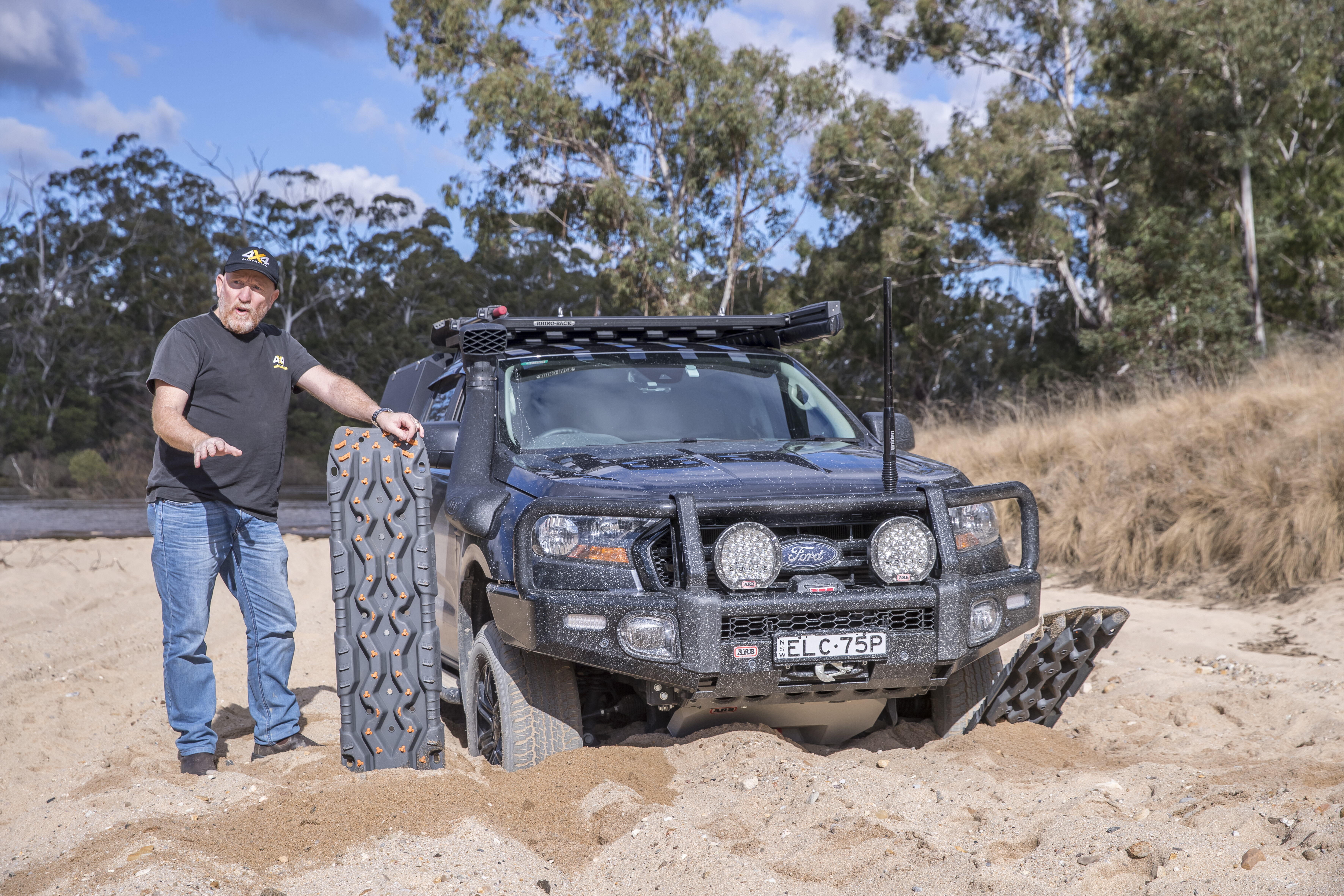
And Deano shows us how to properly use traction boards to get unstuck, in this month’s ‘How To’ instalment. There’s a lot more to it than just throwing them down…
Our main man in the USA, Chris, Collard, has compiled a comprehensive adventure guide for travelling to Baja, California, and across the border to Mexico. It’s an iconic off-road destination and it should be on every 4x4er’s bucket list.
WHAT ELSE IS THERE?
Coast to Coast, SA to WA National Parks of the Wet Tropics, QLD 2021 SEMA Show wrap Guide to off-road jacks Products, news, opinions and more!
The 2022 Jeep Wrangler and the closely-related Gladiator ute have been updated in the US for the new year, along with the Grand Cherokee L which has yet to be launched in Australia.
While the Wrangler and Gladiator updates mainly bring entry-level variants into line with specifications already offered in Australia, Jeep has introduced a 100:1 crawl ratio for the five-door Wrangler Rubicon – up from an already-impressive 77.2:1 offered across the range.
The change is thanks to a shorter 4.88 axle ratio, helping to improve the model’s off-road capability. The change will be applied to vehicles fitted with manual transmissions initially, with automatic cars to follow.
Both the Wrangler and Gladiator have also received a new cabin filter for the US market, which is said to remove 95 per cent of particulates in the air.

There’s no word yet on when the Grand Cherokee L will be arriving, with the all-new model originally slated for an Australian launch in late 2021 – but the SUV has already received an update in North America, with a passenger-side touchscreen being added to its options list, while second-row passengers will now enjoy dual 10.1-inch displays.
In late December, leaked information showed Jeep is preparing to drop both the 3.6-litre Pentastar V6 and 5.4-litre Hemi V8 in favour of a new 3.0-litre twin-turbo inline-six engine, though the carmaker hasn’t officially announced anything at this stage.
Jeep has made some changes to the exterior colour palettes across its range, but no timeline has been given for Australian-delivered cars to receive the minor updates.
Back in 2020, a team of photojournalists released a book simply titled, The Mallee, which beautifully captured the people and places within this region of north-west Victoria. We were so impressed by the book we shared excerpts of it in our Summer 2020 edition of 4X4 Australia magazine.That same team has shifted its focus south of the Mallee for its latest hardcover book, The Wimmera, and the photographers have raised the bar even higher with this stunning publication.The Wimmera lies south of the Mallee to the central western regions in the south, and it runs between the Goldfields in the east to the South Australian border in the west. Primarily farming country, the Wimmera is a haven for travellers who will be enchanted by its rich history.The book whets your appetite for travel, visiting towns long forgotten since their heyday yet still offering plenty for the visitor. The photographers beautifully capture the places and people that call the Wimmera home; the ageing architecture, welcoming country pubs, friendly faces, and natural scenery.
Travelling from town to town, the book often follows old railway routes, revealing what made the places what they once were and what’s changed in modern times. In some cases, a return to the bush, as people leave the cities to create a better life.While not a real four-wheel drive destination or off-road trek on its own, the Wimmera is still worthy of a visit and stay, either as your destination or on your way to more epic adventures.“The Wimmera is a land full of contrasts,” said author Adam McNicol. “From dryland scrub in the north to stately trees and rolling green hills in the south.
“On our travels we learned about the region’s indigenous history, including the celebrated cricket team that toured England in the 1860s. We met fifth and sixth generation farmers and so many people who are proud to call the Wimmera home.”The book has us wanting to get out to explore the Wimmera and western Victoria again, and we’re sure it will have the same effect on you.The Wimmera – A journey through western Victoria is a 243-page hardcover book selling for $59.99 from Ten Bag Press, where you’ll also find The Mallee book. The two books are also available as a boxed set and will make an awesome Christmas gift for anyone who enjoys travel, photography and great yarns.
AVAILABLE FROM: www.tenbagpress.com.au RRP: $59.99 WHAT WE SAY: A beautifully curated book that urges you to get out and explore the region.
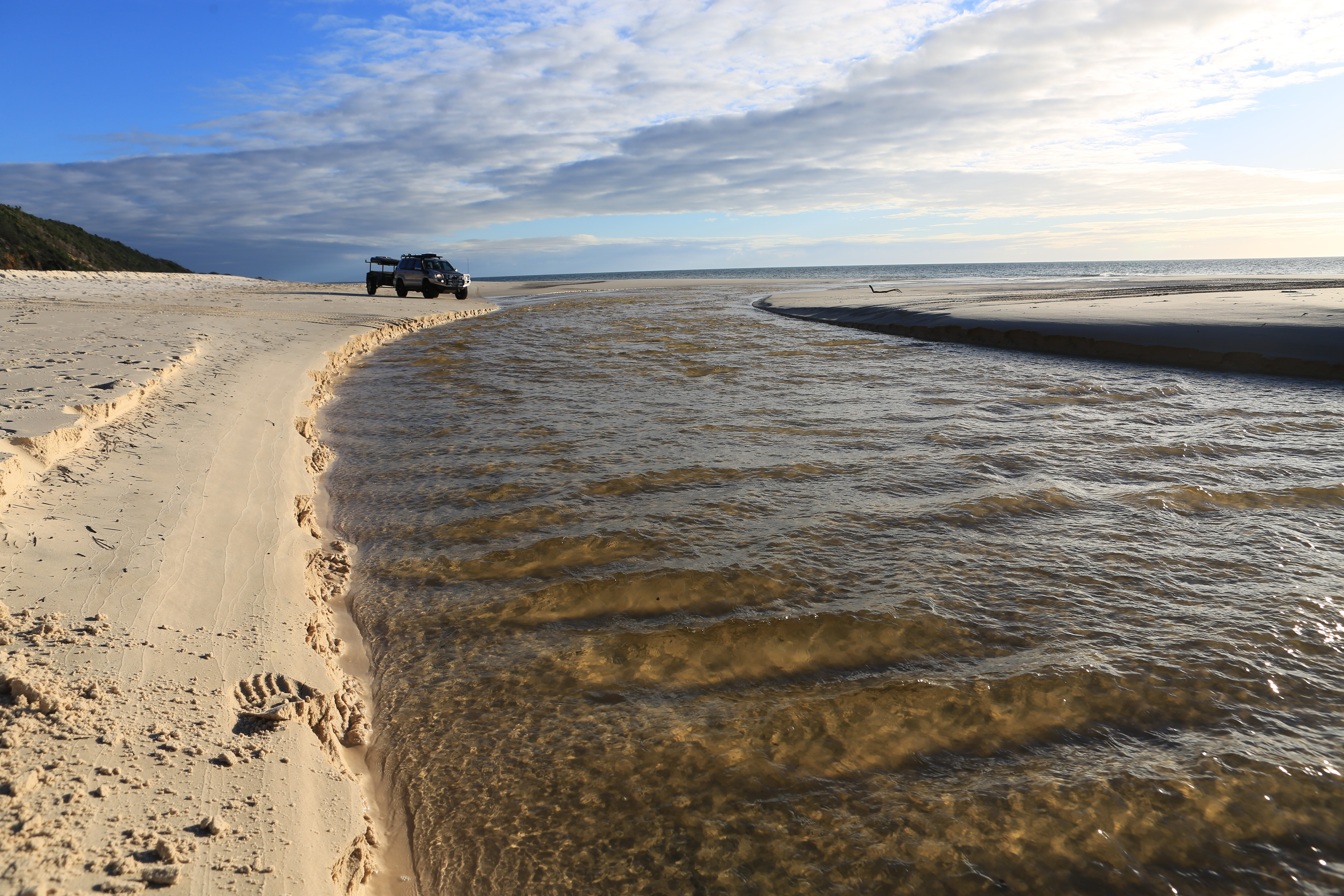
It was the week of my fiftieth birthday. Like me, our crude but simple camping set-up had been sitting idle and collecting dust for too long. The Prado was running a little rough and it, too, needed some fresh air and an escape from all the mask-wearing and talk of lockdowns. A week at Fraser Island (K’gari) was the ticket for us both.Quite literally, K’gari means ‘paradise’ to the Butchulla people, but given all I’d seen and heard on the news last year, would it now be a ‘paradise lost’? Would the lush rainforest, majestic trees and clean and vibrant landscapes be a scorched and distant memory? There was only one way to find out.
CAMPFIRE CHAOS
On October 14, 2020, four beachside campers north of Orchid Beach failed to extinguish their sand-covered but still-smouldering campfire, triggering an 870km² bushfire that ravaged over half the World Heritage-listed island.
It kept airborne and ground-based fire crews busy defending forest and homes for more than six weeks, before several rain events in early December finally extinguished the blaze. Both Kingfisher and Happy Valley communities were evacuated as the fires threatened beach houses and resort communities.
In many eastern beach areas, the fires burned to the shoreline, and most of the northern and western heathlands, swamps and forests were completely burned.
I caught a late afternoon ferry via Inskip Point and camped at Lake Boomanjin. After watching the sunrise across the lake’s tranquil waters, I explored its forested shoreline looking for evidence of the fires.
There were occasional blackened buttresses beneath the lush green, but it seemed the fire had been more cleansing than damaging here, burning slowly and only through the undergrowth. I headed north along the Southern Lakes Drive, one of my favourite forested drives, unsure what devastation may lie ahead.
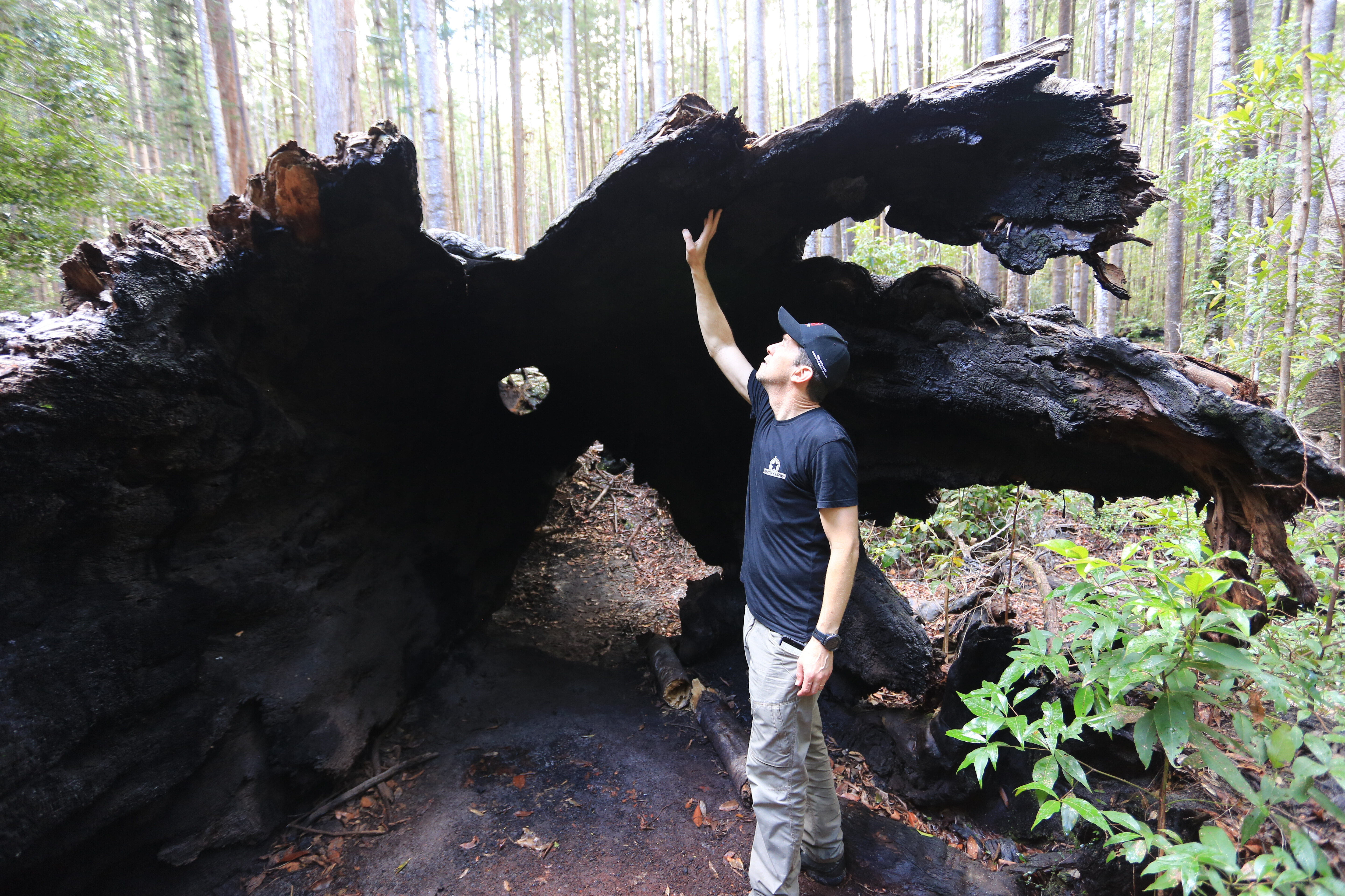
Just a few kilometres south of Central Station, I rounded the bend and stopped suddenly – my worst fears realised. I could still hear the echo of the thunderous crash as this once majestic forest giant was murderously slain by the licking flames.
Its death had been torturously slow, its innards were burnt to a hollow core and the melting roots could no longer point it skywards. After days of torturous smouldering, it had finally submitted to its fate. The now decaying body will feed a new generation of giants, and the freshly punctured canopy will flood in light for the new life.
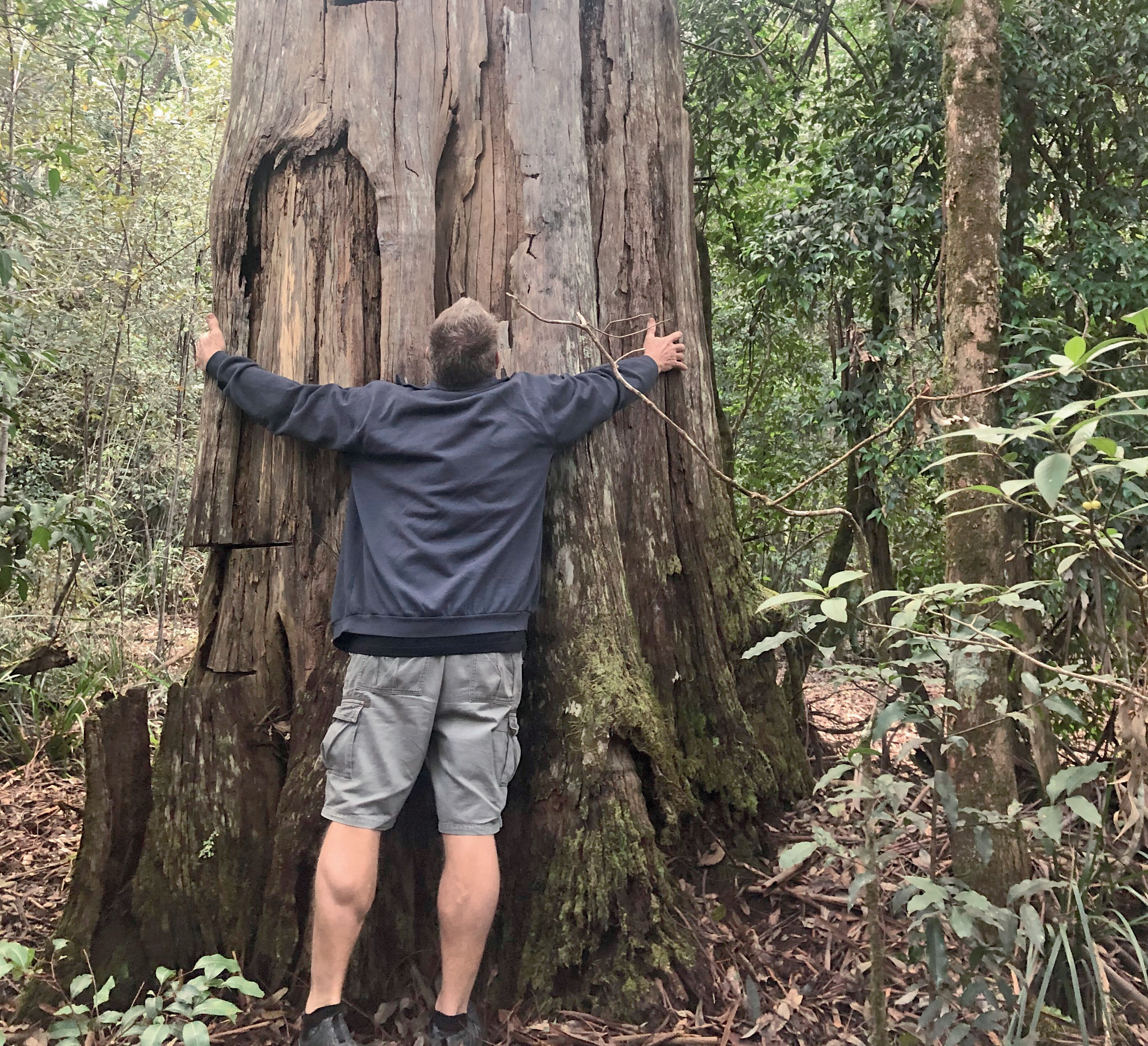
The fire had cleared out the surrounding undergrowth, revealing the thousands of hoop pines planted back in the 1930s. Most had lay hidden for decades beyond the trackside rainforest understorey. Many were snapped like matchsticks and crumpled by the falling giant. With a laid-down diameter of 2.5 metres, it would have taken a whole family to hug the near eight-metre girth.I stood deep inside the buttress and walked a good 30 metres along the hollowed and lifeless trunk. My ‘moment’s silence’ complete and thankful that only the frailest and near-dead trees had been felled by the fire, I pushed on anxiously, still worried for the mass-destruction ahead.
GETTING THERE
Vehicle ferry access is via Inskip Point (mantarayfraserislandbarge.com.au) or River Heads (fraserislandferry.com.au). Cost is around $200 return for a 4WD and trailer.Before you go, be sure to book your vehicle and camping permits online through the Queensland DES website: parks.des.qld.gov.au/parks/kgari-fraser/camping.
See the Great Sandy Marine Park Visitor Guide for info on recreational fishing regulations and Green Zones: parks.des.qld.gov.auBest Map: Hema’s Fraser Island printed map is the best for outlining all the beach camping zones; as is the older Hema Maps or Hema Explorer app, which still include this map.
VERDANT OASIS
I cautiously turned in to the Central Station campsite. It was still green, lush and mossy with an assortment of quality, vacant sites. This shady haven had escaped the flames, as had most of the central rainforest.’
The relentless work of the fire crews had held back the pressing destruction, using the tracks as a fire break and sacrificially backburning as needed. Central Station, the Wanggoolba Creek boardwalk and Lake McKenzie were all kept safe.Much relieved and knowing the dropping tide would mean an easy afternoon run along Seventy-Five Mile beach, I swung east towards Eurong, grabbed a tasty pie and coffee and headed north to find a scenic beach campsite.
My good mate, Scotty, was flying in the next day, touching down on the beach at dawn. I’d have to wait until morning to venture deeper north and farther through the forest. Sadly, the real destruction was still to come.North of Cornwells Road, the fires had been much hotter and burned relentlessly throughout most of the central and northern parts of the island. The taller and wetter parts had fared better, but the fires had ripped through the open hillsides, consuming everything in their destructive path.
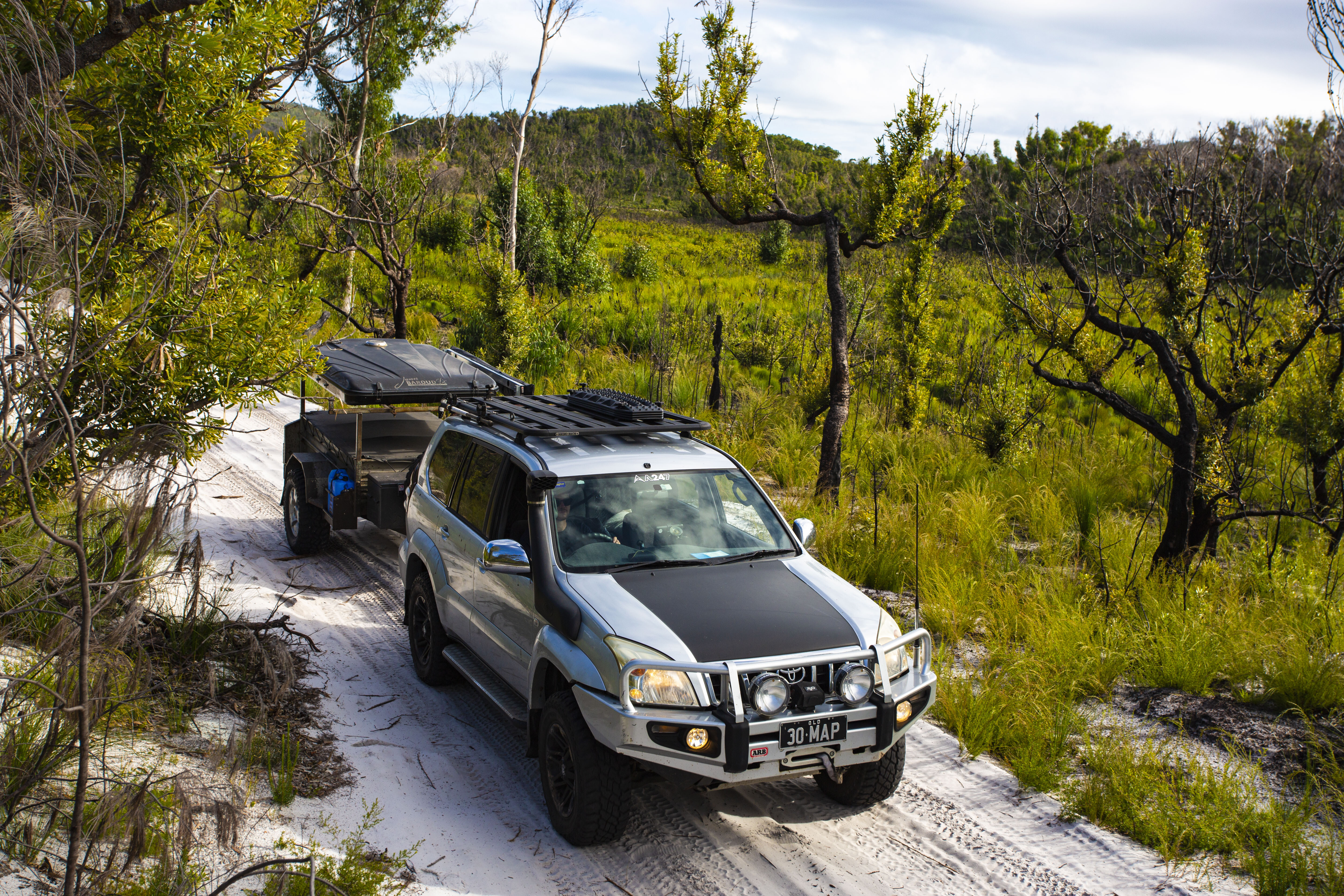
The ‘road closed’ sign at The Valley of the Giants turnoff was an ominous indicator of what lay beyond. We navigated 60km north along the maze of inland trails, following Northern Road for the most part, and criss-crossing Postans, Bogimbah, Moon Point, Bullock and Woralie Roads.
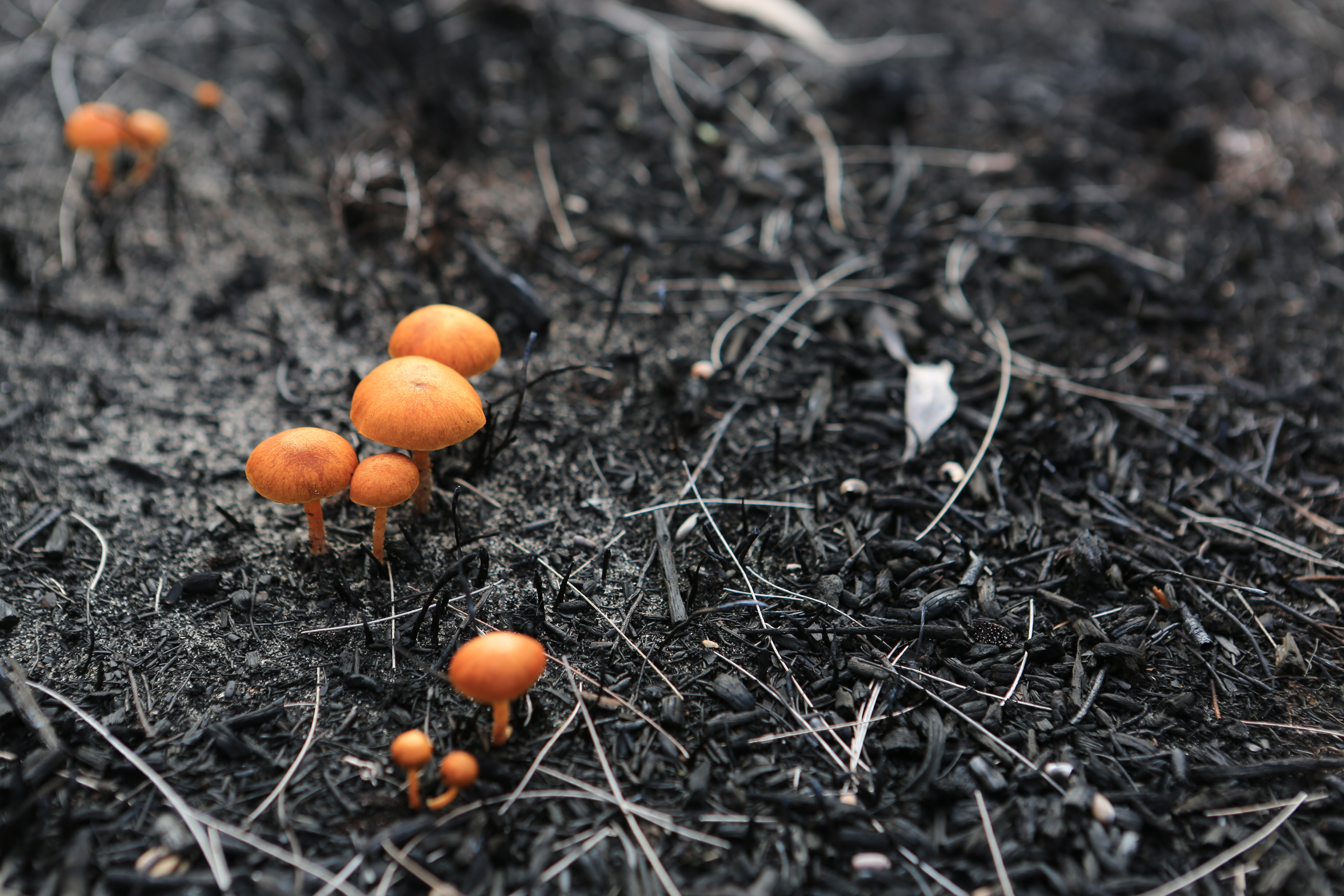
The farther north we went, the blacker the trunks became – even the swamps and grasslands had not escaped the inferno. The December rains had done more than just extinguish the flames. Every blackened branch was now awash with fluorescent, new life. Hellfire had tried to rob K’gari of her paradise beauty, but her radiance was returning in dramatic fashion. The contrast of vibrant green on charcoal black was truly remarkable.I’m amazed at the way Australia’s native vegetation naturally recovers after a devastating bushfire, and the variety of ways it does so. The still-golden scribbly gums seemed immune to the heat, but a closer looked revealed their bases were surrounded by layers of shed, burnt bark.
The woody banksia fruits had burst open with seed, relying on the heat to trigger their germination. The black, ash-laden swamp floor was now littered with tiny, flame-orange mushrooms, releasing rich essential nutrients back into the soil. The once-burnt bracken and grasstrees now exploded with a celebration of fresh green.
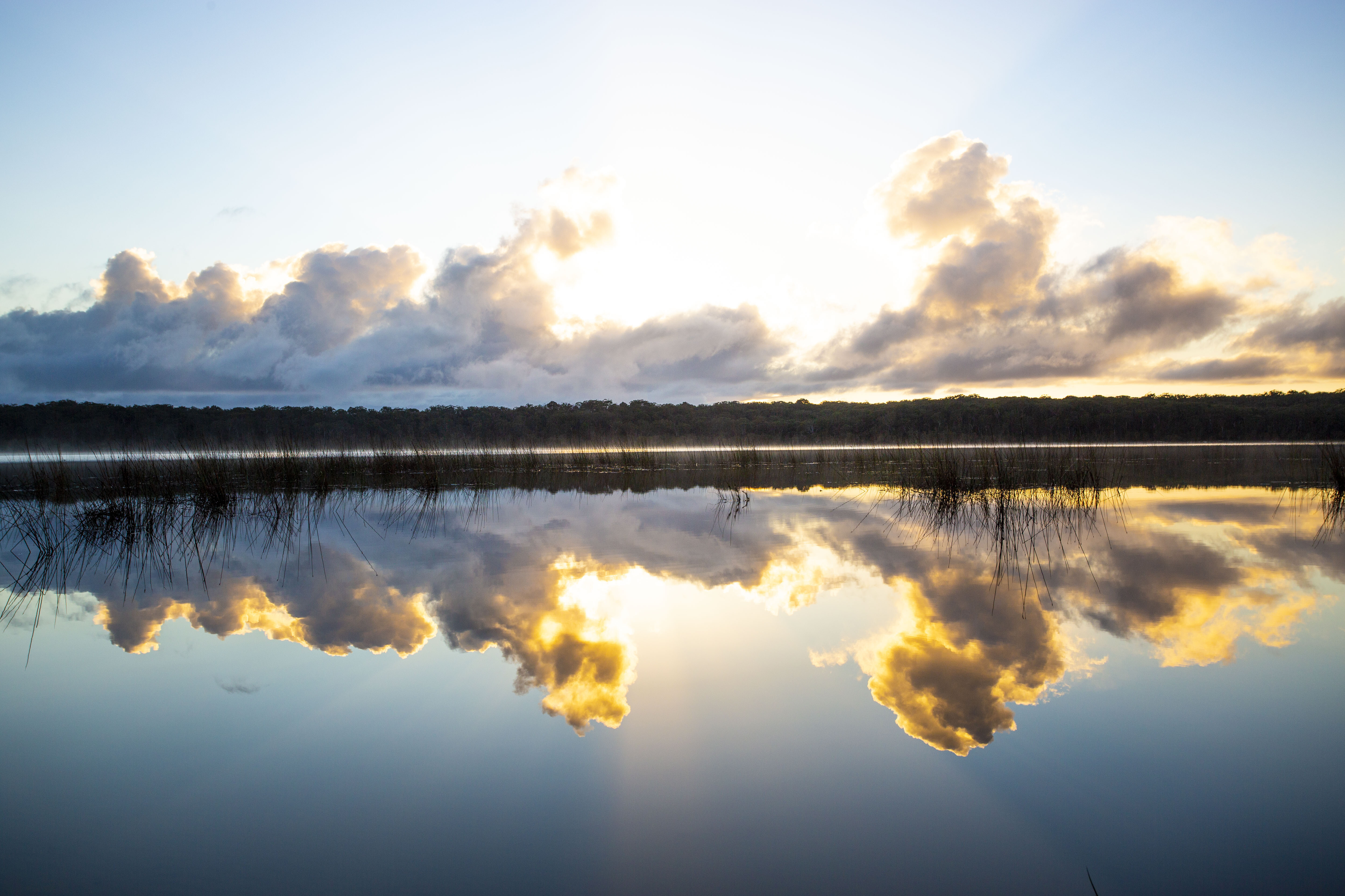
Confident that K’gari was on the road to recovery, we pushed on to the beautiful west coast beaches and set up the swags right on the beach.
Well-protected from the south-easterlies, K’gari’s west coast is the perfect place to turn off your phone, take off your watch and take in every second of the sunset as it melts into the sky-blue water. Watch for whales in the winter months or just silently explore the pure white beach and intimate tidal creeks for endless hours or even days.
FIRE BAN
Be sure to bring a gas stove, as for now, and likely permanently, no more fires are permitted on K’gari. She may not recover so easily next time.
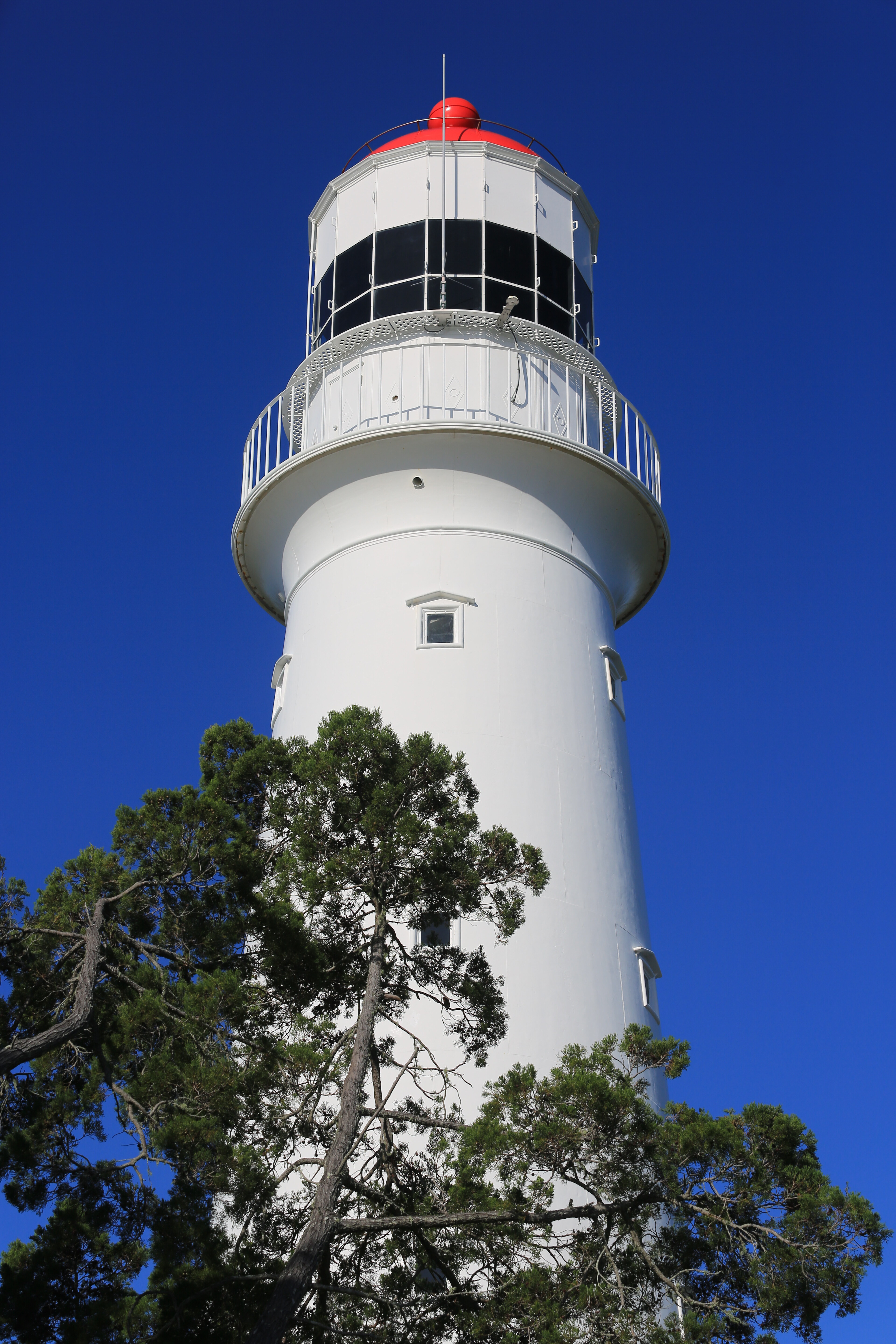
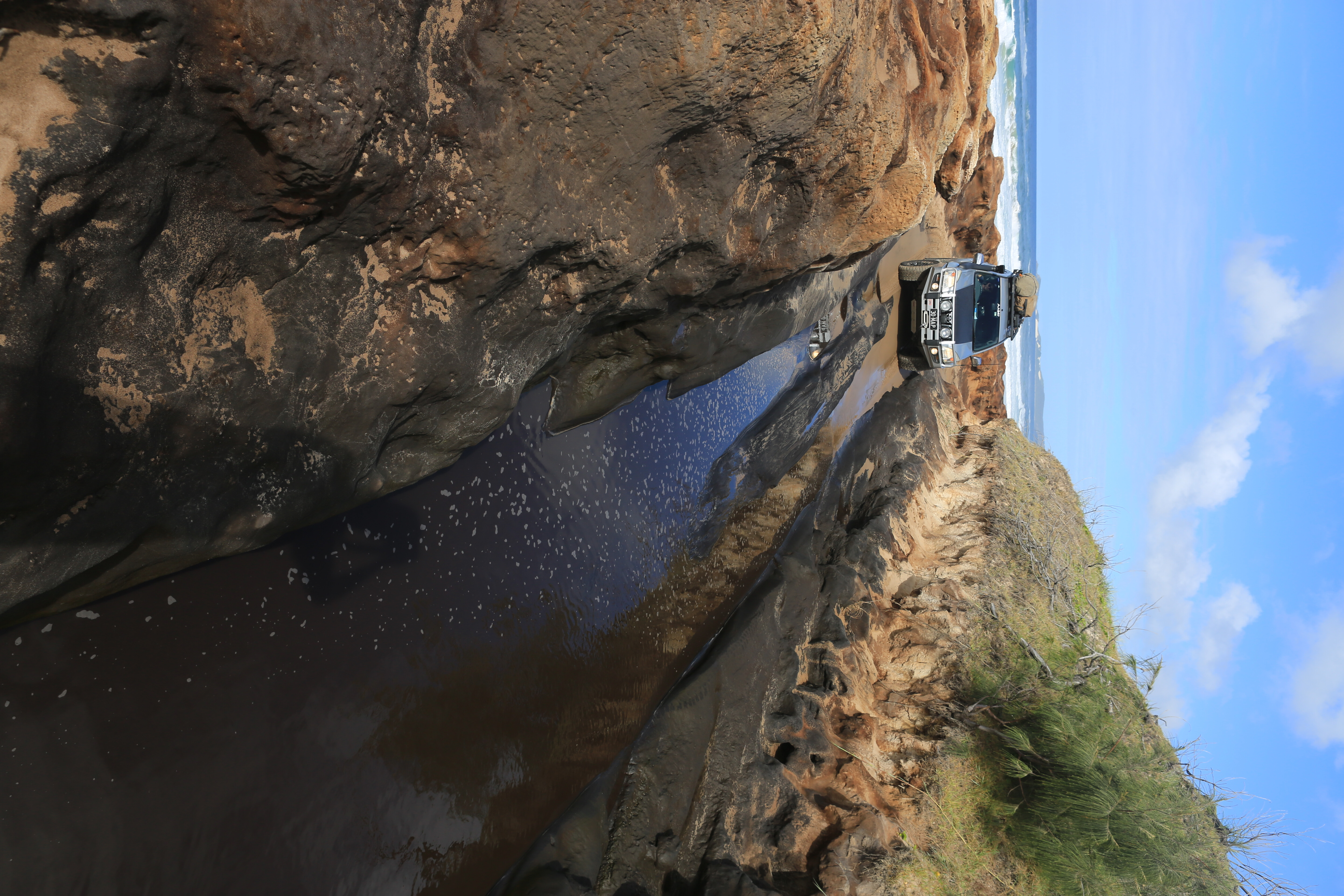
With an early start on our fourth day, we were soon past Indian Head and watching the humpback whales from the Champagne Pools boardwalk, before navigating the northern gateway of Ngkala Rocks. We made short work of the cavern through the coffee rock and the soft sandy bypass, before rounding Sandy Cape and heading west towards the lighthouse.Sandy Cape Lighthouse has long intrigued me. Built in 1870, this 33-metre tall lighthouse is mounted on a 130-metre hill but set kilometres back from the shoreline. The rocky outcrops of Indian Head and Waddy Point always seem more obvious dangers for passing ships.
But the near and present danger in these seemingly sublime waters is the submerged and sandy isthmus of Breaksea Spit, stretching 35km north from Sandy Cape and now the buried graveyard of several century-old ships.
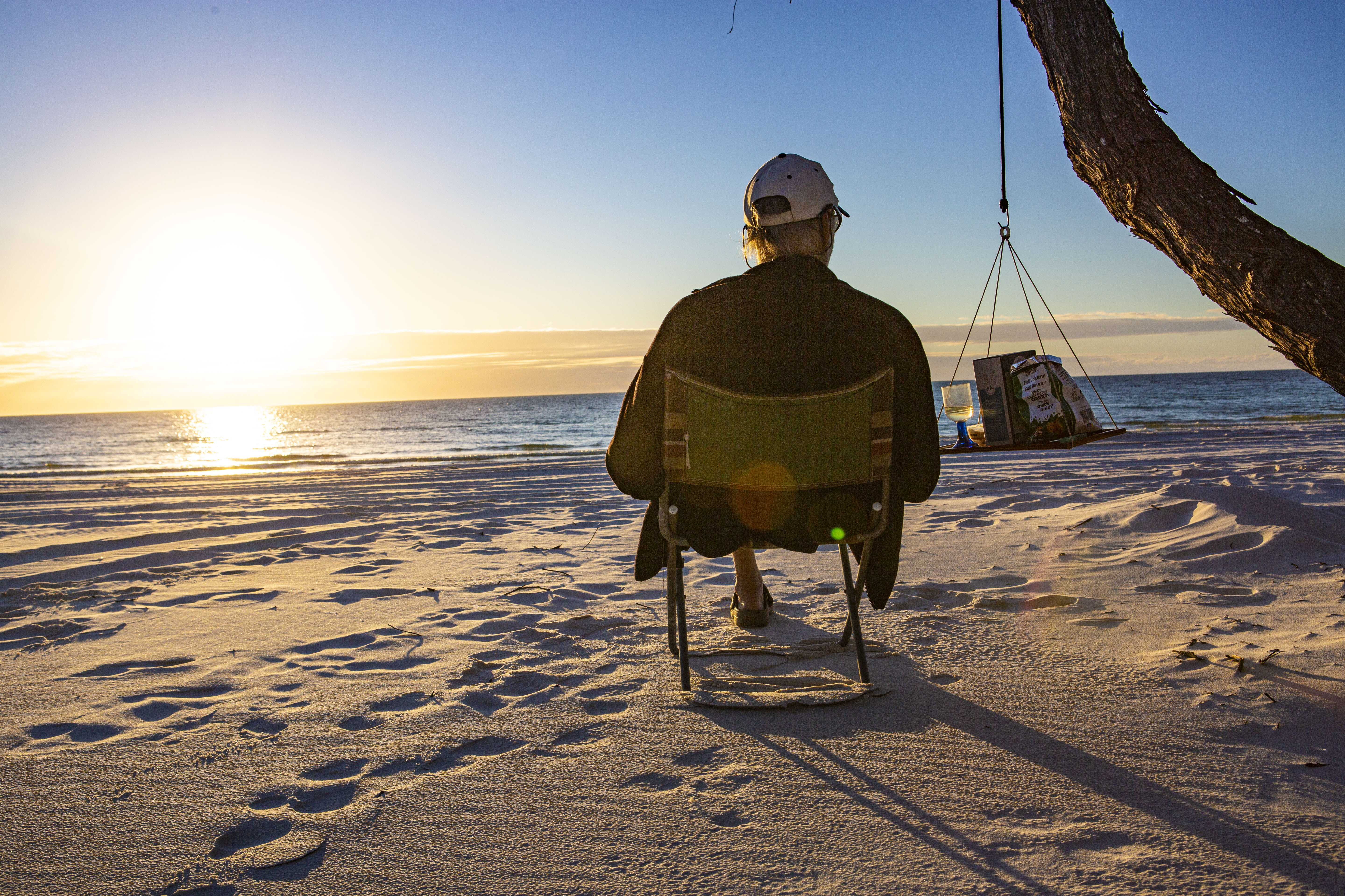
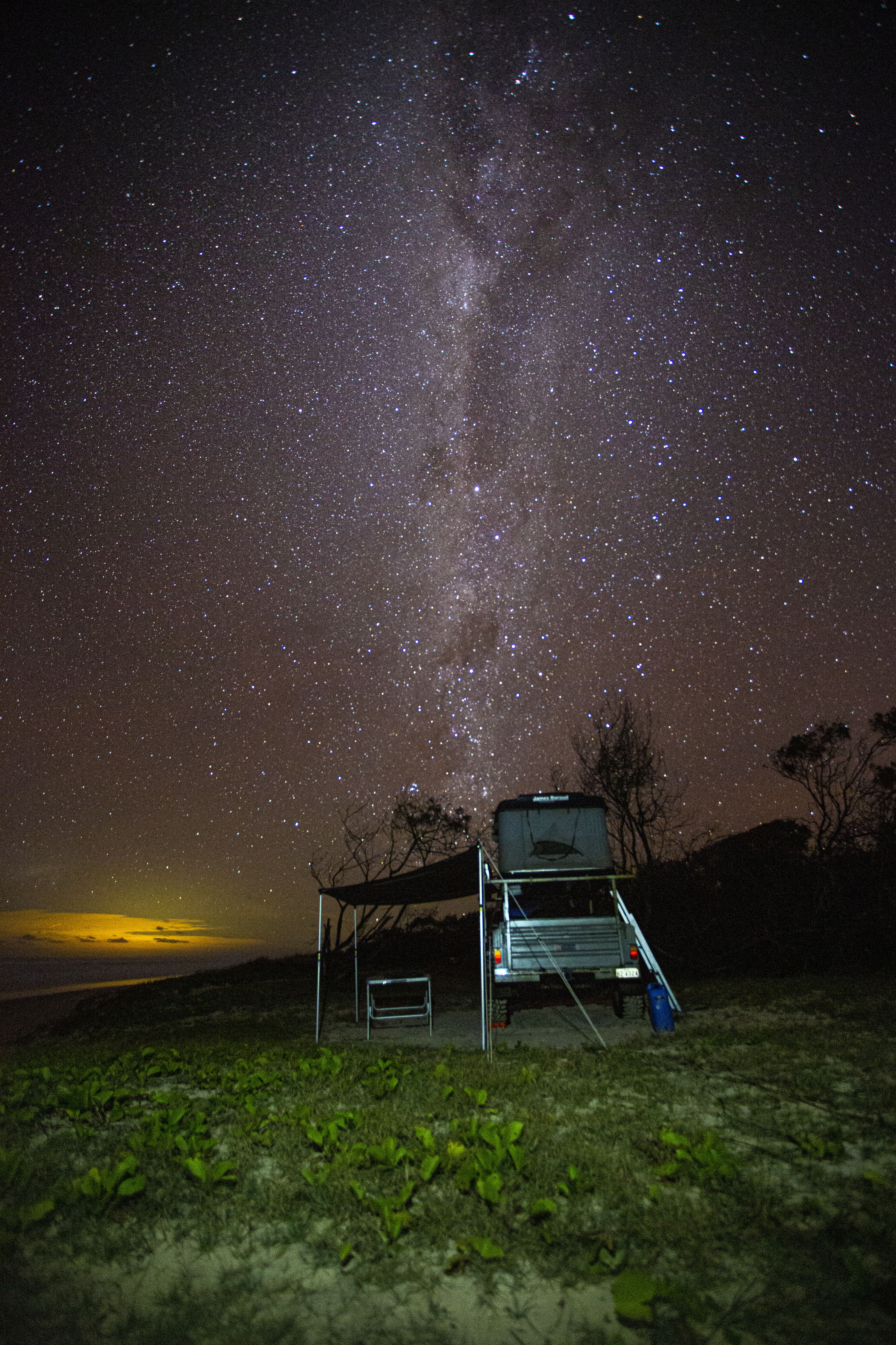
Sandy Cape is one of my favourite places on Fraser Island. I love the meeting of calm and turbulent waters, the sweeping tides, resting sea birds, and the clash of colliding currents and winds. Well before sunset, we pulled out the chairs and the ‘fivesies’ and watched this glorious day slowly end. Cameras down, we soaked in the last warm rays of the setting sun as it melted into the sea.
CAMPING SPOTS
While the remote, far northern campsites of Sandy Cape are a long-time favourite of mine, they’re fast becoming overused. This trip, I rediscovered the tranquillity of Fraser’s west-coast campsites, tucked in amongst the sheoaks, just metres from the high-water mark and atop the sandy shore.There are five fantastic west-coast bush campsites between Moon Point and Wathumba Creek including Coongul, Woralie, Bowarrady, Awinya and Bowal Creeks. You’ll need to be completely self-sufficient with your own water, food and fuel. No toilets or showers either, so bring a shovel and toilet tent, or even better a portaloo. There’s a small but deep freshwater swimming hole at Bowarrady Creek.
Being the most southern, Coogul Creek is closest to Moon Point and the popular fishing areas of Great Sandy Strait. Woralie Creek is the easiest to access for those with trailers, with some majestic but exposed campsites right near the track terminus. For a shady site beside a deep and fresh waterhole, it’s hard to go past Bowarrady Creek – but with only three main sites, it’s ‘first-in best-rested’.My pick is Awinya Creek, as the sites are spread out right along the beach and tucked in amongst the sheoaks for some welcome shade. But the access via Awinya Road gets rough and difficult for trailers and has a tidal creek crossing at the end, so this site is best suited for tent/vehicle-based camping.
If you really want to be alone, head farther north along the beach to Bowal Creek where you’ll likely have the place to yourself (well, at least until everyone else reads this article).
Numbers are well-managed, so be sure to book ahead. Small camper trailers are permitted at all sites but beware of the soft sand on the western beach, check the tides first and lower your tyres to less than 20psi. Summer months will likely bring mossies and sandflies, so winter and spring seasons are the best time here.The morning of my fiftieth birthday, I rose early to catch the sunrise and walked along the beach pondering the next decade of life. Scotty had made me a fresh, hand-ground coffee. We had the full length of the beach to drive, lunch at a mate’s place at Rainbow Beach and my own family celebration to head home to. My next chapter of life was looking good already!
FRASER’S BEST FOREST DRIVES
SOUTHERN LAKES DRIVE: Beyond the well-trodden central forest roads connecting Kingfisher and Eurong via Lake McKenzie and Central Station, there are several fantastic and lesser-used trails. An old favourite is the Southern Lakes Road (29km, three to four hours) which leaves the Eastern Beach near Dilli Village and twists its way through the southern heathlands, swamps and forests, kissing the peaceful shores of Lakes Boomanjin and Birrabeen and meandering on to Central Station amongst the giant satinays, brushbox and hoop pines of the central forests.WORALIE ROAD: Farther north, Woralie Road (21km, two to four hours) provides easy access from Maheno Beach through lush rainforest, swamps and ridgetop woodlands, and on to the gorgeous west-coast beaches overlooking Hervey Bay. For a full cross-section of this beautiful landscape, head north along the western beach to Awinya Creek and return via Awinya Road.
FIVE THINGS TO SEE
1. CENTRAL LAKES There are a mix of fantastic pristine freshwater lakes on K’gari that are perfect for a cooling dip. Boorangoora (Lake McKenzie) in particular, has crystal blue water fringed by brilliant white sand.2. THE MAHENO Driving the eastern ocean beach, the wreck of the SS Maheno is an interesting and popular tourist attraction. The former trans-Tasman liner was steaming north to a ship-breaker’s yard in Japan when a cyclone washed her ashore in 1935.3. CHAMPAGNE POOLS These volcanic rock outcrops create ocean-level pools that are best at mid-tide when breaking waves cascade champagne-like into the protected pools for a refreshing and safe dip. The Champagne Pools boardwalk is on the Eastern Beach scenic drive.4. VALLEY OF THE GIANTS For serious hikers, take the 90km one-way Fraser Island Great Walk. A highlight is the Valley of the Giants walkers’ campsite where you can set up camp and spend a night or two among the massive tallowwood and 1000-year-old towering satinay trees.5. WHALE WATCHING The calm waters of Platypus Bay, on the island’s western side, are a prime whale-watching spot. On their spring migration south, humpback whales stop to rest and tend to their calves in Hervey Bay.
Tidy 79 Series LandCruiser heralds in the latest batch of reader-submitted 4x4s. Get involved by posting a photo of your vehicle on our Facebook page – it could even end up in the mag.
2014 TOYOTA LANDCRUISER VDJ79
It has a factory tray with custom tool boxes and a home-made fridge slide. Other gear includes a two-inch Ultimate suspension lift; Superior Engineering U Bolt plates; LED spotties on an ARB bullbar; a light bar on the roof; Ironman winch; Rhino-Rack; Motop rooftop tent; and King alloy wheels to correct the wheel track. It’s stock as a rock inside, bar an amp, two eight-inch slimline subs and Black Duck seat covers – Todd Hore
2015 FORD EVEREST TREND
There’s not a whole lot to tell just yet. It has an Armax snorkel; double transmission cooler; Redarc Tow-Pro; Titan drawers; home-made platform; and some basic add-ons on the outside. It’s my dream car. This pic was taken at Point Quobba, Western Australia – David Lane
2018 VW AMAROK
Despite being the four-cylinder, it is great on the sand and my daughter loves it when I take her to Bribie Island on weekends. It has an Ironman bullbar; Pedders two-inch Trackrider shocks and springs (front and back); a catch can; Rhino roof rack with mounted LED light bars on the front and rear; Kings awning; front LED lighting; and eBay-bought side-steps – Jonathan Hropic
2014 FORD RANGER
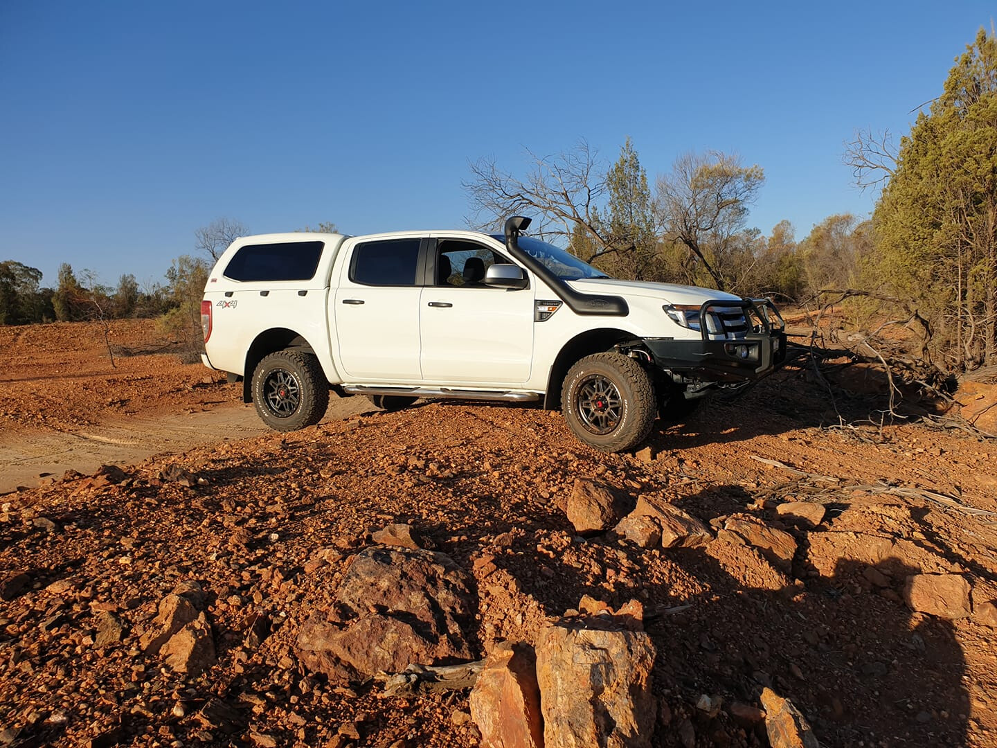
My Ranger is set up nicely for travelling around Australia. This pic was taken in Central West NSW. It has an ARB 120L long-range tank; OME two-inch lift; ARB diff breathers; Redarc electric brakes; an Engel fridge in the tub; GME UHF; Ironman bullbar with bash plates; Ironman four-inch spotlights; and monster 17-inch rims with 31×10.5 BFG KO2 ATs. The best place I have taken it so far is Hanging Rock, NSW – it has some awesome tracks – Wayne Gray
1999 RANGE ROVER HSE
It’s powered by the 4.6-litre petrol V8 and has a two-inch lift with air suspension; rear diff lock; triple battery set-up; MCC bullbar and TigerZ11 winch; Kaymar rear wheel-mount; and built-in tyre compressor. It has been a reliable, comfortable off-road tourer for us, and it still has many more years left in her – Andrew Kimmer
2019 FORD RANGER XLT
Two of the best spots I’ve taken my Ranger are the Pyrenees Ranges in Victoria, and Robe in SA. Gear fitted includes an ARB bullbar, rails and steps; Old Man Emu BP-51 suspension; Stedi driving lights; GME UHF; and 275/70R18 Maxxis RAZR tyres – Jono Hewitt
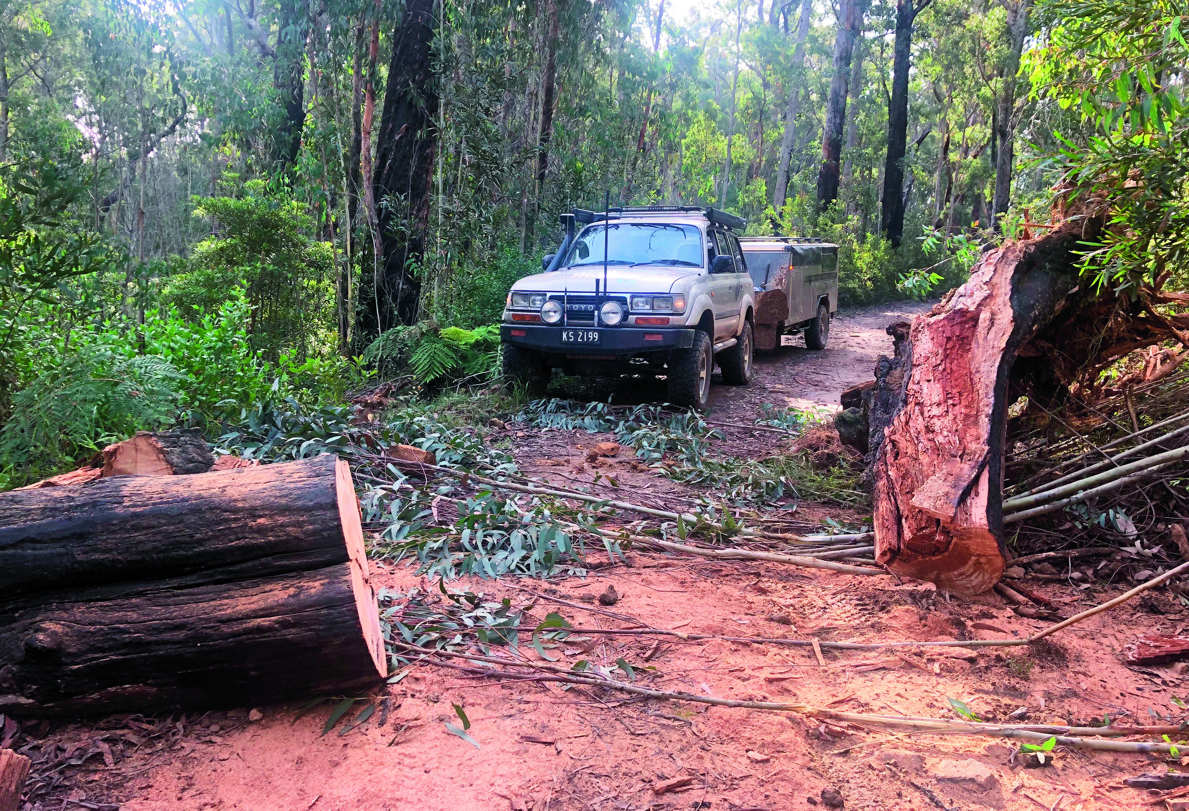
Kempsey, on the mid-north coast of NSW, lies at the base of some of the most spectacular 4WDing, camping and viewing points that you might ever come across.When earth had a mighty volcanic upheaval 35 million years ago, it left a host of mountains, peaks and plateaus standing. Weathered down, they point to the sky over 1200m high – and the best part is, most of it is still accessible for us to admire and enjoy.
On the banks of the Macleay River, Kempsey is halfway between Sydney and Brisbane and perfect for an overnight stay – or before heading to the hills for a culture lesson, exploring more of the area that timber-cutters and miners once called home.
There are several combined National Parks in this area that include Carrai, Willi Willi, Oxley Wild Rivers and Cottan-Bimbang, whose geology is from the Carboniferous period – some 400 million years ago – and composed of mudstones, sandstones and conglomerates, allowing for the rich growth that occurs here.
With a maze of nearly 200,000 hectares of valleys, cliffs and rivers, this place is home to the Thunggutti Aboriginal People who, in years gone by, used the rivers and ridges like roads, linking the coast to the higher plateaus towards the New England region.
MACLEAY RIVER
The Macleay River is at the heart of the Kempsey Shire, carving its way from the mountains of the New England Plateau to the sea at South West Rocks. It starts as the Guyra River and merges with a number of tributaries including the Apsley, Chandler and Styx Rivers 100km to the west. These days, Kempsey is a major hub for supplies and fuel, and you need to be self-sufficient on trips into the wilderness.
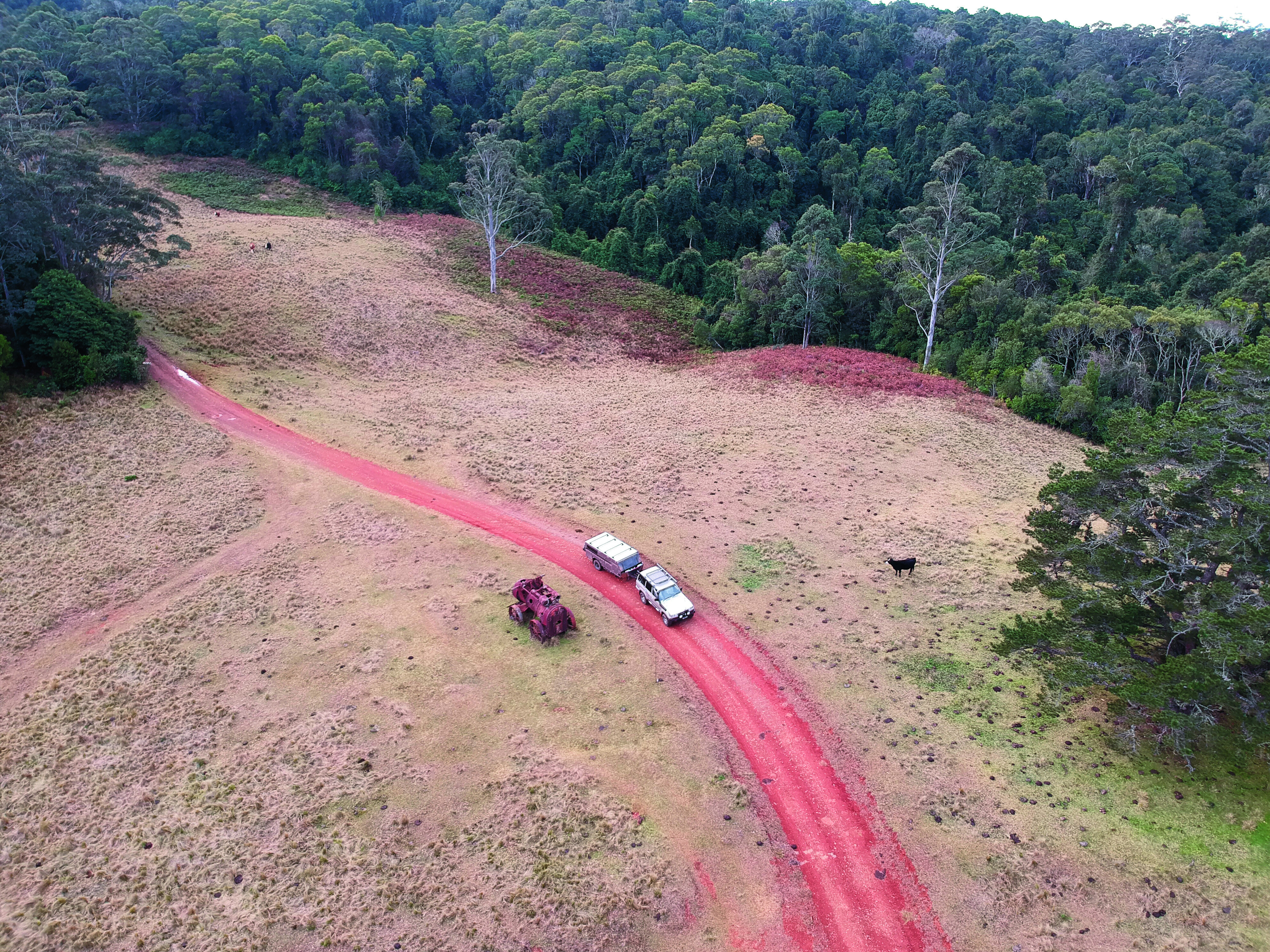
Heading out of town westward for 20km, turn left to Temagog, which is signposted with a locals’ info board at the corner where you can pick up local chit chat on current conditions in the area – bit like the bushman’s telegraph.When crossing the Macleay River on a fairly new bridge – remnants of the old one can still be seen poking up out of the water – one thing you may notice is just how low this new bridge is; the reason being is to let most debris flow over the top of it to avoid causing structural damage.A little side note for around here is that you’re only at 67m above sea level and it’s hard to imagine that you will soon be around the 1200m mark. It’s a good drive heading to the hills here, as it’s well signposted all the way. The roads that twist and wind their way around this steep country were put in at the turn of the century, when hardy men sought huge red cedar trees from the Macleay’s valleys and plateaus – it’s reported that some of these trees had a circumference of around 30 feet.
There are reports that if the men couldn’t get down into the valley to snig the logs out after being cut, they would winch them over cliffs. Some of the old dozers from the 1950s and ’60s had nearly two miles of steel cable on them for these jobs – try doing that now battling with OH&S.One of the bonuses of travelling on a track that rises so high and so fast are the views, and there are several stops along the way to pull over to admire them. A notable stop is Willi Willi Lookout, where you get a clear view of the rich farmlands below, towards the coast along the Macleay River. In all fairness, this trip does sound like another drive into the hills, but around every corner there is always the chance to see something new, from the shy eastern spotted quoll, Frypan Corner, and even lyre birds darting across the road ahead. Even the quality of the eco systems up here are something to be seen, from thick pockets of rainforest and cool-climate stands of coachwood trees, right down to fragile ferns that cover the ground under the last remaining tall gums.
Following Carrai Road for several kilometres, you come across the intersection with Coachwood Road – this is the old town of Kookaburra. Once an active sawmill, it was a tough life here as the men had to endure snow (we are 1000m above sea level), stifling hot summers and then the remoteness of the camp.
Kookaburra was established in 1946 for harvesting red cedar, rosewood and coachwood from the nearby forests. The mill closed in 1967 and the 30 men employed moved on along with their families. The old school house has been restored and free camping is allowed around the grounds.
‘HIGH COUNTRY’ HUTS
Heading back along Carrai Road, the forests change to thick timbered country with an undergrowth of cool-climate tree ferns. Another 20km along, look out for the old hut which resembles something from the Victorian High Country. This hut has some of the best views you will ever see across the deep gorges, remote peaks and valleys. Owned by the McMillian family for many generations, this area once had orchards and market gardens supplying locals and themselves.
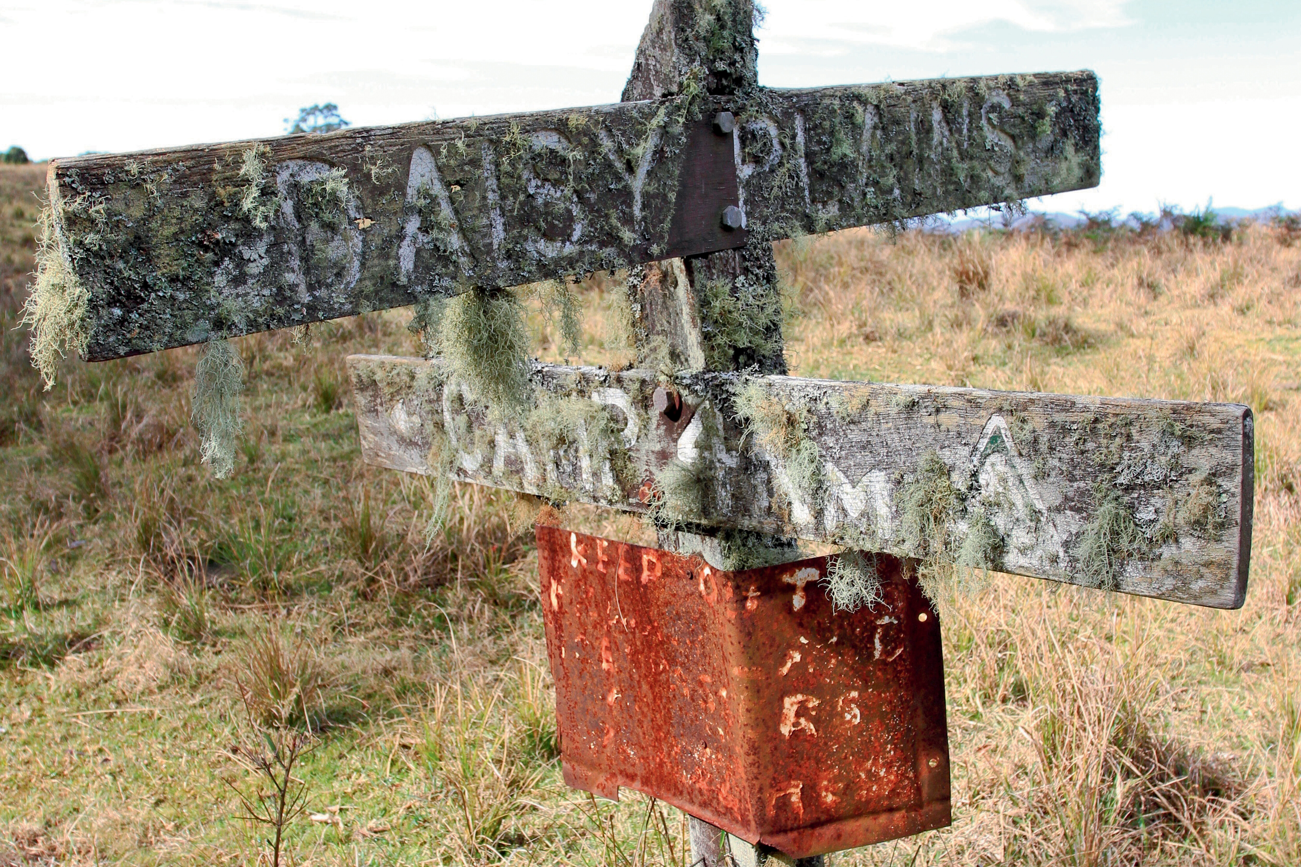
Farther down the road is the site of the Daisy Plains township where the only thing left is the moss-covered sign and a few mining relics. Daisy Plains was once a town where more than 200 residents called home, including miners, timber cutters and families looking for fortunes. A great reminder of the area’s past is the old Ruston Proctor steam engine that sits idle beside the track, as well as other relics including boilers, building foundations and old cattle yards – if it wasn’t for these last remaining pieces, no one would believe there was once a town here where tin and gold was mined.
By now, if you’re after a top camping spot, just 5km along you will encounter what is commonly known as the Daisy Plains Huts. These huts are owned and maintained by National Parks and surprisingly are available to the public to stay at free of charge for as long as a three-week stint. Several huts include a kitchen, sleeping quarters and even a bathroom hut. Access for travellers is on a first-in first-served basis, so don’t be disappointed if there are other groups here. A flushing toilet is a bonus.
The huts have been put in place for the NP workers that frequent the area for park maintenance, to save on the three-hour travel time back to town each day.
The huts have huge grassy areas where camper trailers or tents can be set up and left when exploring the nearby tracks.
MARY’S LOOKOUT
Farther along Carrai Road, a turn to the left will point you down Cochrane Road, where for 35km the trail follows remote farmlands and scrubby timber country towards Mary’s Lookout. At the ‘car park’ it’s a 100m walk to the spectacular viewing area. National Parks has done a great job here installing safety barriers away from the 1000m drop.
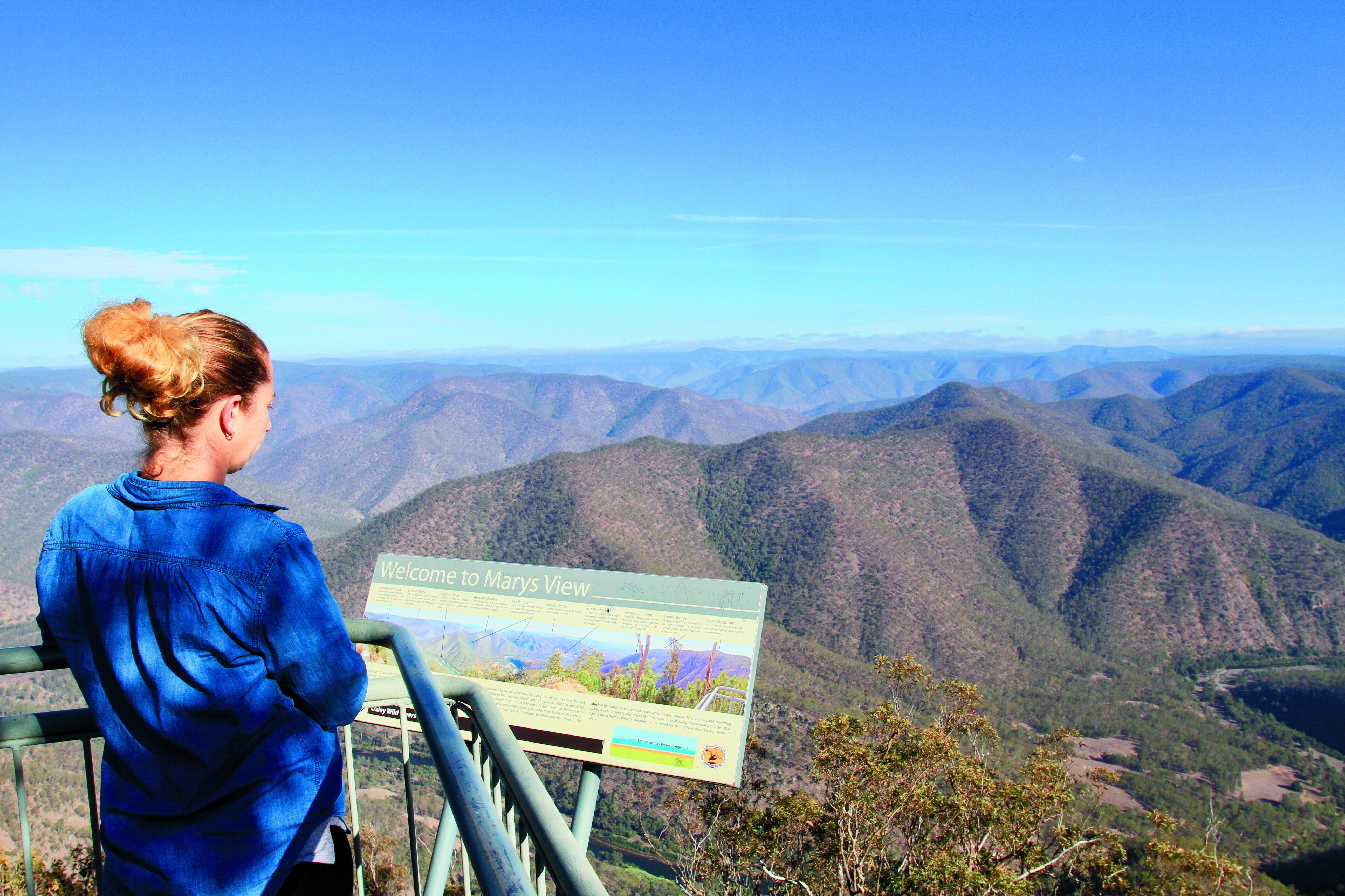
Looking into the wilderness below and the plateaus west, it’s hard to comprehend how the early settlers explored these areas with as little as a bellyful of determination and a handful of pack horses. Way back in 1818, explorer John Oxley passed through the New England Tablelands, opening it up for graziers and timber cutters. Mary’s View was named after Mary Cochrane, the wife of an early settler and logger on the Carrai Plateau.While not a hard drive or extreme area to explore, the Kempsey tablelands are rich in diversity, history and beauty. National Parks has opened up many of the area’s sections so we can explore them to our hearts’ content.
FIVE KEY PLACES:
1. PARKS UNITED A string of five National Parks – Carrai, Willi Willi, Oxley Wild Rivers, Kumbertine and Cottan-Bimbang – are grouped together, draping a massive area of the mountains, ranges and valleys just to the west of Kempsey.2. KEMPSEY Kempsey is the major town of the Macleay River Valley and worth a stay in its own right. Stock up here on supplies and fuel for the trip into the wilderness.3. WORKERS HUTS Reminiscent of the Vic High Country are the huts found in a couple of the parks, especially at Daisy Plains. Here, National Parks maintain several workers huts and, when not required, are available free-of-charge to the public on a first-in first-served basis.4. THE VIEWS For breathtaking mountain views, check out Willi Willi Lookout for a view of the farmlands heading to the coast along the Macleay River. Also, Mary’s Lookout for the wilderness and views to the ranges and plateaus west.5. KOOKABURRA The old timber town of Kookaburra is 1000m above sea level, and a place that’s stifling hot in summer and has snow in winter. Camping is free.
After yet another jaunt to Cape York, I’ve gotta say the Cape remains the premier long-distance destination for adventurous four-wheel drivers in Australia. Yep, places like the Simpson and the Kimberley are on many people’s bucket list, but the Cape remains a firm favourite, as it has for the last 30 to 40 years.
I say that after not only being to Cape York this year but also having wandered the Victorian High Country, crossed the Simpson, wandered many of the Beadell Roads of the western deserts, the Pilbara and goldfields regions of WA, and the Flinders Ranges in SA.
Thinking about that, I’ve been pretty lucky in what has been a hell of a COVID-disrupted year; but, anyway, back to the Cape. Nowhere, absolutely nowhere, excites the travel bug of four-wheelers more than the thought of heading to Cape York!And this year is going to go down as a big year for changes going on in the Cape. Some good … some possibly not so good!
Of course, the upgrading of the 600km-long Peninsula Developmental Road (PDR) between Lakeland and Weipa continues apace with less than 200km remaining to be sealed. Many four wheelers may lament that progress, but the locals and the long-distance truckies servicing the region are loving it. When we drove the route, even the unpaved sections were a breeze and well-maintained.
What also surprised me was the amount of bitumen north of where the Cape York road leaves the PDR and strikes north to the Jardine River ferry and the top.
There were a few corrugated sections along the ‘Bypass Roads’ but work along these sections is ongoing. And rumours of a bridge over the Jardine River are still just that, but there are a lot of tour operators and the like pushing for it. It’ll happen one day, but I’m not sure when!
As we reported a month or so back, Bramwell Station near the top of Cape York and the northernmost cattle station in Australia has been sold, or at least it seems to have been sold. Latest reports are that the current owners, who have owned the property for 20 years, are in discussion with the Queensland government about the purchase price. Rumour has it that even if National Parks take over the property, the tourist facility and campground at the homestead along with the Bramwell Roadhouse, situated at the junction of the OTL track and the Southern Bypass Road, will remain operating much as before. We can only hope so!
But the really great news for adventurous four-wheelers looking for an alternative to driving the main road north, the route through the old Running Creek Station property and now Lama Lama Aboriginal land north of the Lakefield-Musgrave Road is now open to travellers. In fact, the road which was once a track is now in pretty good shape, but the real icing on the cake is that the Traditional Owners who have now taken over the ownership and management of the country, are allowing camping along the nearby beach front.It’s a fabulous area and one which has been closed off for many years, so when you head north to the Cape, take the opportunity to experience this great part of the east coast of Cape York.
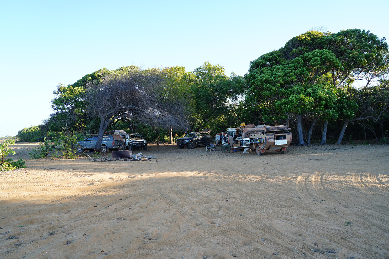
The sign inside the Visitor Centre at Purnululu National Park says it all: “How lucky are you to be sleeping under a million stars instead of five.”Even though we’re towing our off-road caravan, we’ve allowed ourselves the flexibility of going completely off-road with a swag packed on top of the D-MAX.Here at Purnululu, we’ve dropped the ’van off at the Bungle Bungle Caravan Park with plans to camp in the National Park for the next two nights.The Bungle Bungle Caravan Park is a great option for those travelling over the border from Kununurra who want to leave their vans, and tent or swag it for a night or two. Only single-axle trailers are allowed in the park. It’s here we meet up with Bernie, one of the off-road tour guides who drives visitors into the park a few times a week in 4×4 buses.
Bernie is someone I connected with on social media more than a year ago. He’s been working at Purnululu as a tour guide for the past three months and it feels like we’re old friends as we greet each other with a big hug.We enjoy a drink together at the Bungle BARavan, a great place to meet fellow travellers and enjoy a buffet dinner before hitting the tracks the next day.
BUNGLES BACKGROUND
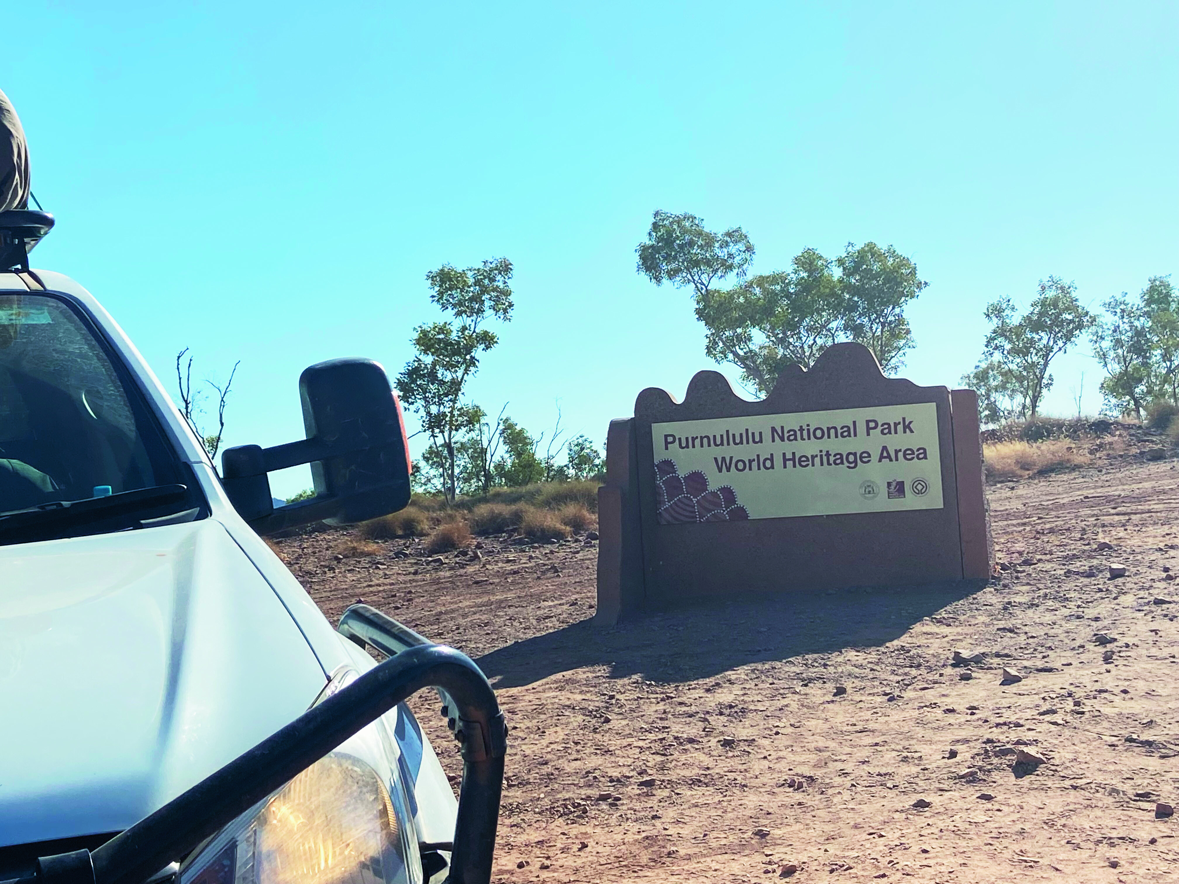
The Bungle Bungles is in Purnululu National Park, about 304km from Kununurra. The extraordinary, banded sandstone domes, created some 360 million years ago and which the park is best known for, are unrivalled in their scale, grandeur and diversity, and in 2003 Purnululu National Park was World-Heritage-listed for its beauty and geological value.
Erosion by creeks, rivers and weathering in the past 20 million years has carved out these stones, along with spectacular chasms and gorges, creating a surreal landscape.
GETTING INTO PURNULULU
It’s only 53km into the park from the highway, but it takes more than two hours to get there as the road is rough and four-wheel drive only. There’s no fuel within the park and you need to be completely self-sufficient, so make sure you have at least 200km worth of fuel in your tank.
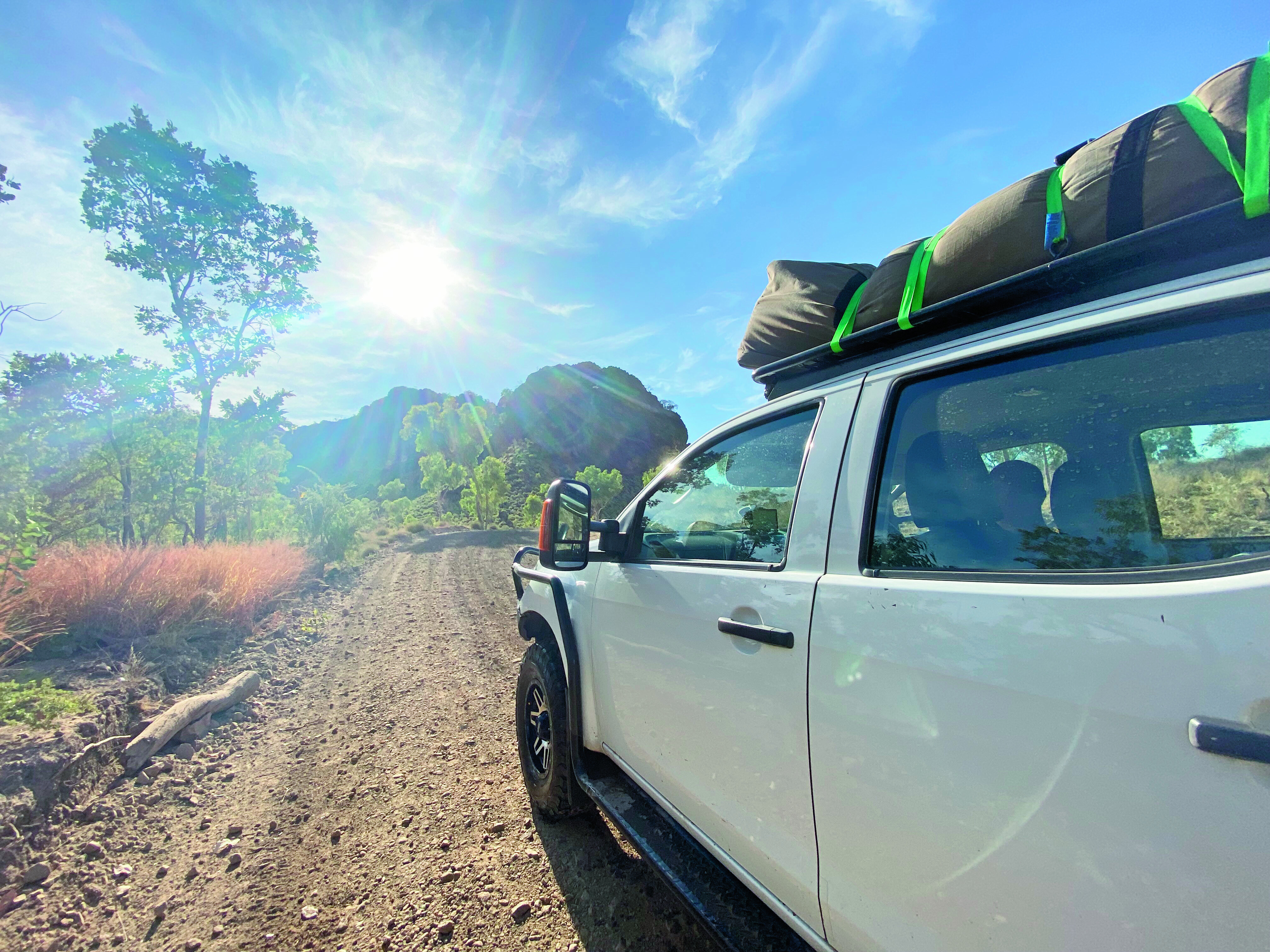
We were lucky that the first 17km of the track had recently been graded. Beyond that, however, the road is pretty rough. There are narrow sections, steep inclines and a number of creek crossings, but the D-Max handled the terrain well.
Our first stop is the Visitor Centre where everyone needs to register. We get our maps, camping permits for our two nights at Kurranjong and Willardi, and continue to the northern section of the park.
NORTHERN WALKS
The Bungle Bungles is all about walking. It’s the best way to explore the park, with a few important tips to keep in mind. Walk early in the day, carry lots of water, wear sturdy walking shoes and wear a hat. It’s common sense, but you’d be surprised at the number of people I saw wearing thongs. Imagine having a thong blowout on a rock and having to stagger back in bare feet! No fun.Our first walk is to Mini Palms, a trail that starts from the Bloodwoods car park. It’s a 4.4km moderately challenging walk with some steep slopes and some large rocks to negotiate. It features dramatic cliffs, Livistona palms, stairs that lead to two viewing platforms and a natural amphitheatre that is truly stunning.
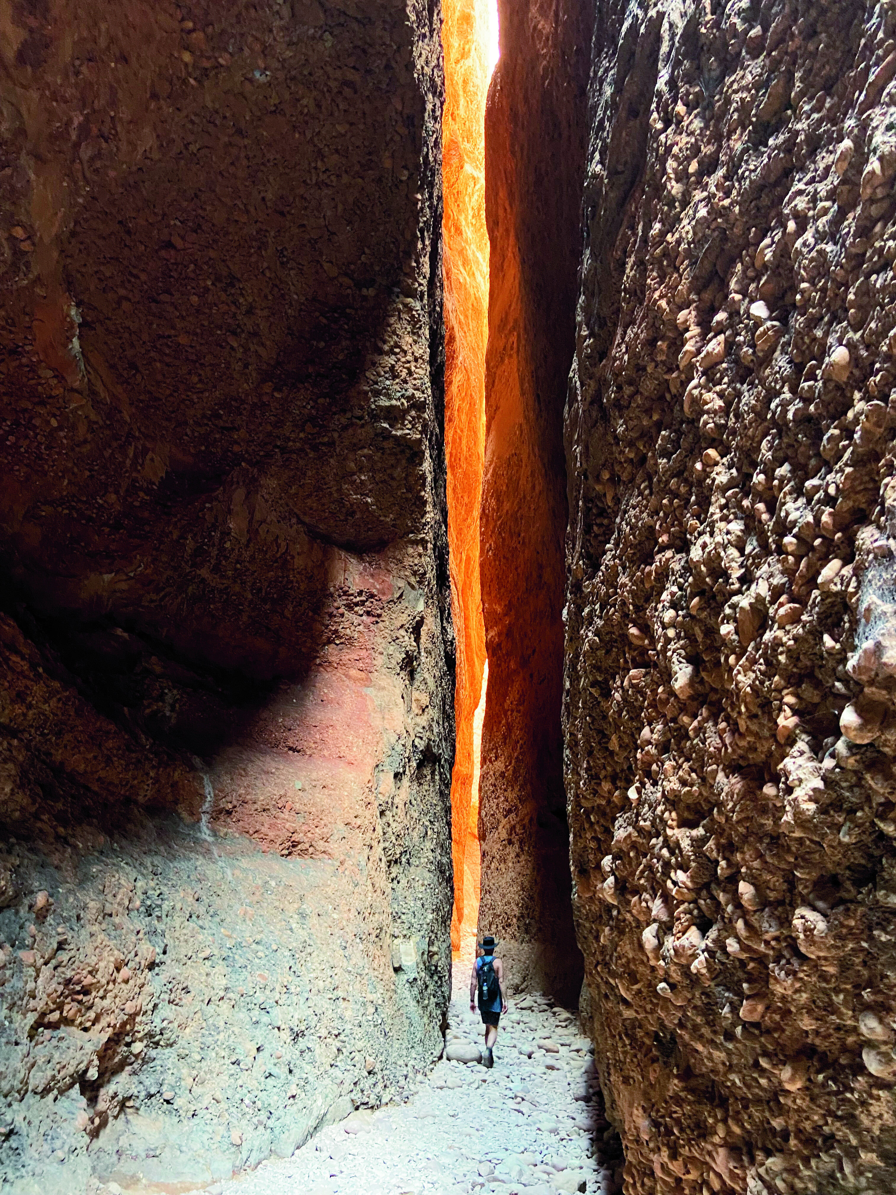
Our next walk to Echidna Chasm is one of the most popular in the park, and I can see why. It’s a beautiful walk, about 2km in length that leads to a spectacular chasm. If you get there between 11am and 11.30am, the sun shines directly through the chasm creating a shaft of light that’s truly striking. You can explore farther into the chasm where the shade in the middle of the day is particularly welcome.With temperatures soaring to 38˚C and feeling even hotter in the blazing sun, our walks were generally done and dusted by early afternoon. Then it was time to find a camp spot at Kurranjong and stay cool for the afternoon.It’s amazing how the little things become the big things: the shade of a tree, a bore water tap, a wash-up tub that doubles as a cool foot bath, and car-wash cloths turning into cool face washers when wrung out in water.
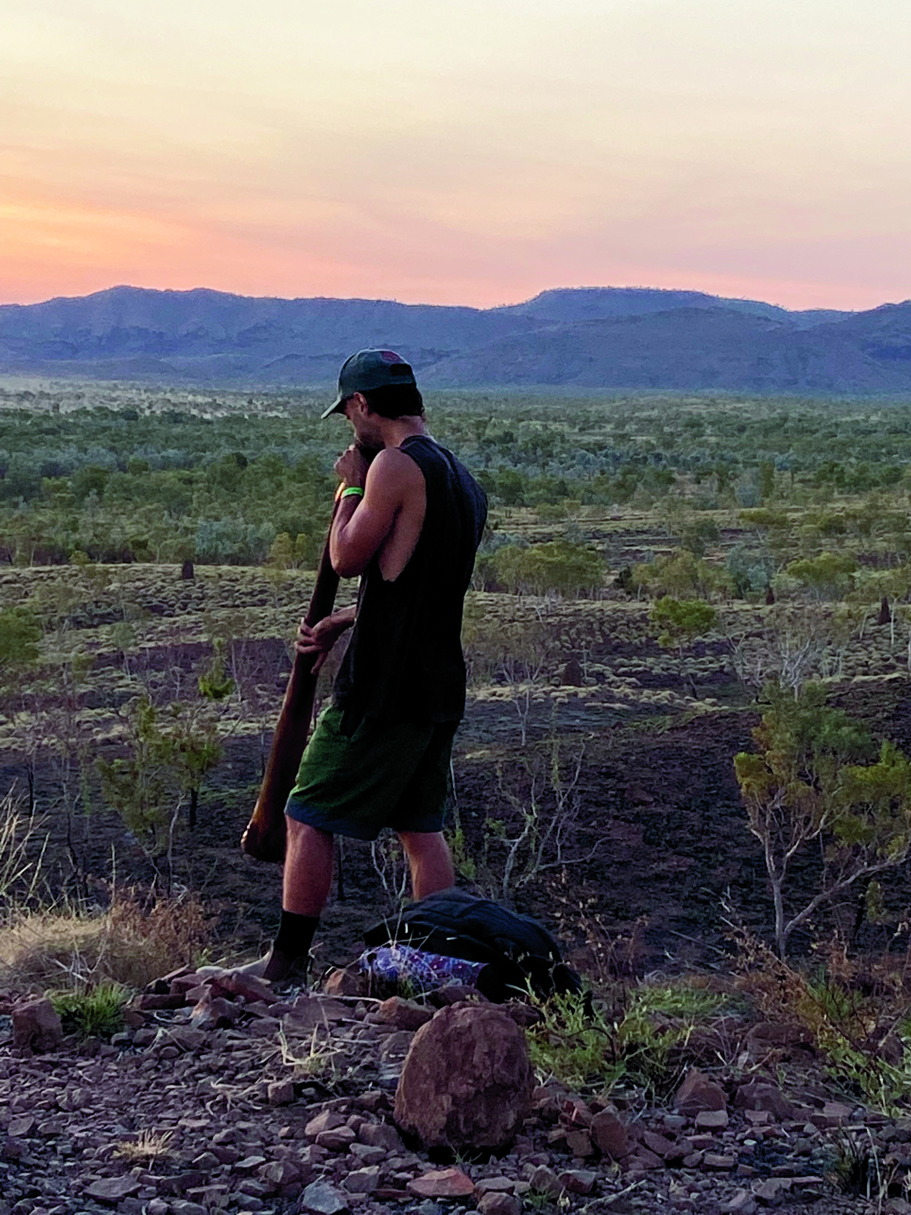
That night, just before sunset, we drive out to Kungkalanayi Lookout for 360-degree views over the ranges. It’s an awe-inspiring sight to watch the sky turn those outback hues of orange and pink – and then, out of nowhere, came the haunting sounds of a didgeridoo.On walking a bit farther we came across the person responsible, a young guy adding his own blend of magic to the setting. It reminded us of the sacred roots of the area.With darkness arriving early here in the west, we have dinner and hit the hay. And as I lay back in the swag and look up at a dazzling array of stars, I think again of the sign at the Visitor Centre. A shooting star flashes above me, and I silently wish that everyone can experience the freedom of travel again, as we are. This is truly camping.
SOUTHERN WALKS
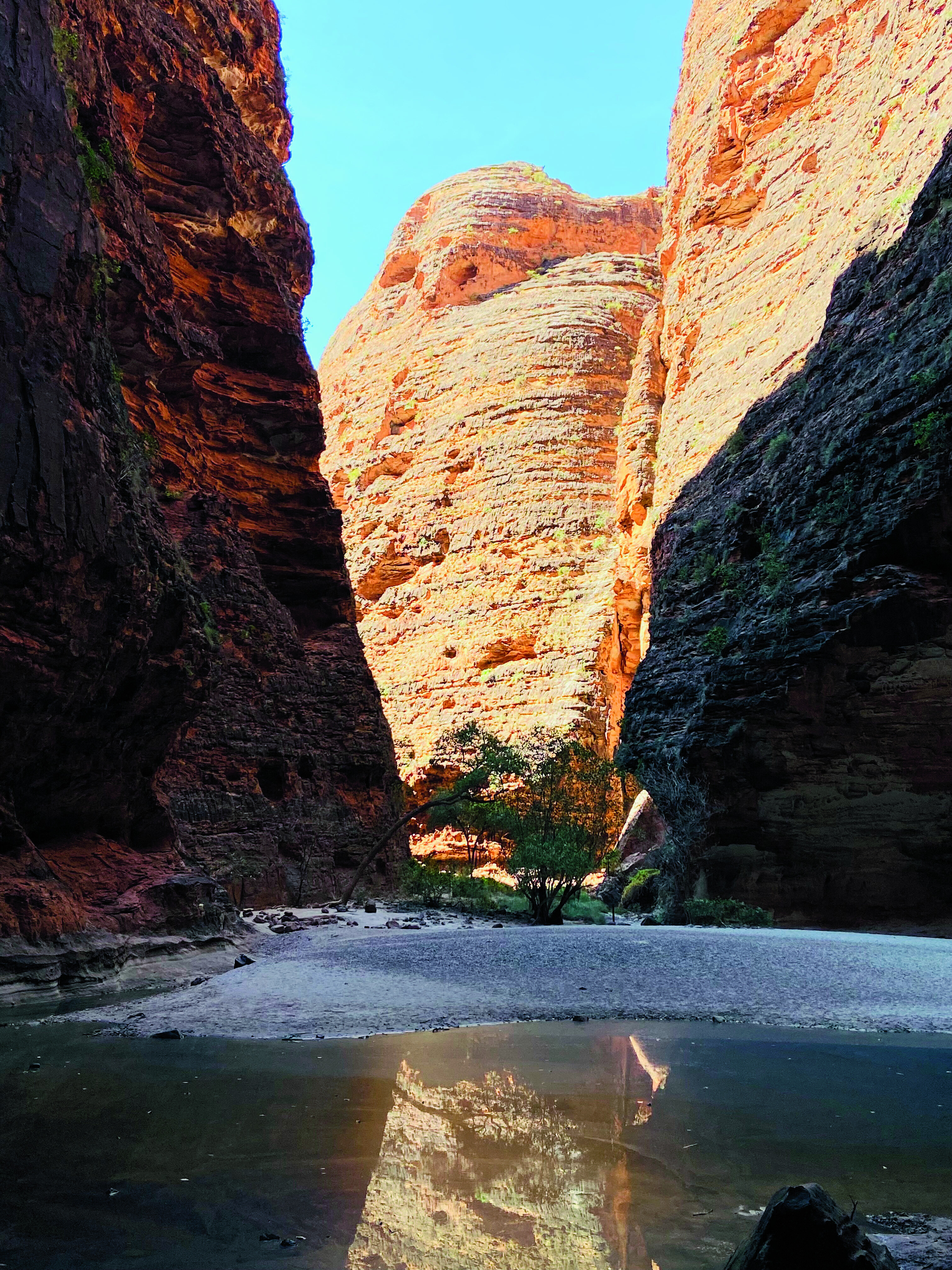
The next day, we pack up camp and continue through the park towards Piccaninny Creek Lookout, our first walk in the south. This lookout is a 2.8km trail that winds south through spinifex hummocks and the dry Ord River. Super-keen hikers can tackle the two-day trek to Piccaninny Gorge, but need to register at the visitor centre and carry a satellite phone or Personal Locator Beacon (PLB). We’re content with a walk along the dry riverbank and to the lookout.From Piccaninny Creek we backtrack and head towards Cathedral Gorge, undoubtedly the most popular and photographed spot in the park. When you reach the amphitheatre, the full scale unfolds before you. It’s magnificent, every sound is amplified and every moment in there feels almost sacred.We finish our Bungle walks with a loop walk around the Domes, the stripey beehive-like domes that tower majestically around you. In the heat, the 700m walk feels long and intense, and we’re happy to reach the shade of a cave to rest along the way.That night, we enjoy a simple dinner and another magnificent Kimberley sunset. It’s yet another night under the ultimate outdoor cinema.
THE BUNGLES TO WINDJANA
Back at the Bungle Bungle Caravan Park the next day, we unload the car, hitch up the caravan and continue our western adventure. We drive through Halls Creek, with a night pulled over on top of the spectacular Ngumban Cliffs, a designated 24-hour rest spot, before continuing towards Fitzroy Crossing.
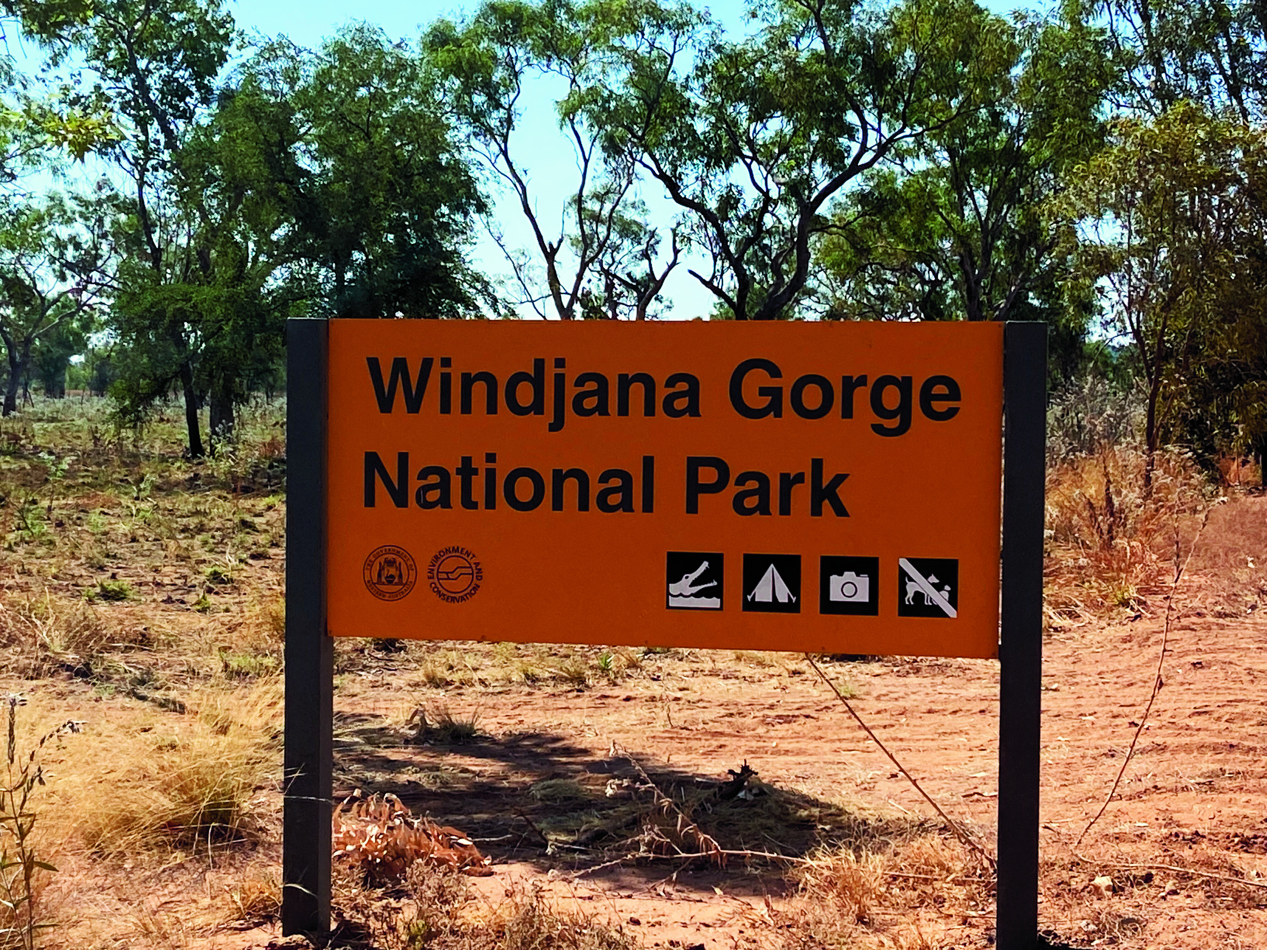
There, we restock, refuel and continue, before eventually turning on to Leopold Downs Road for another 92km of dirt-track driving. It’s an alternate way to Derby, four-wheel drive recommended and the last hundred kilometres of the Gibb River Road. With Tunnel Bend closed at the time, our destination for the night is Windjana Gorge National Park.The track is corrugated, and we reduce the pressure on both the car and ’van tyres accordingly. Still the track has its fair share of dips, creek crossings and grids from nearby stations, so we take it easy. There’s little traffic except for the occasional rogue cows that seem to have little concept of giving way.
Windjana is a great spot to spend a night or two. There are self-registration envelopes at the park entrance with fees of $17 per adult which includes facilities with flushing toilets, showers and tables, plus an incredible backdrop and some stunning walks.
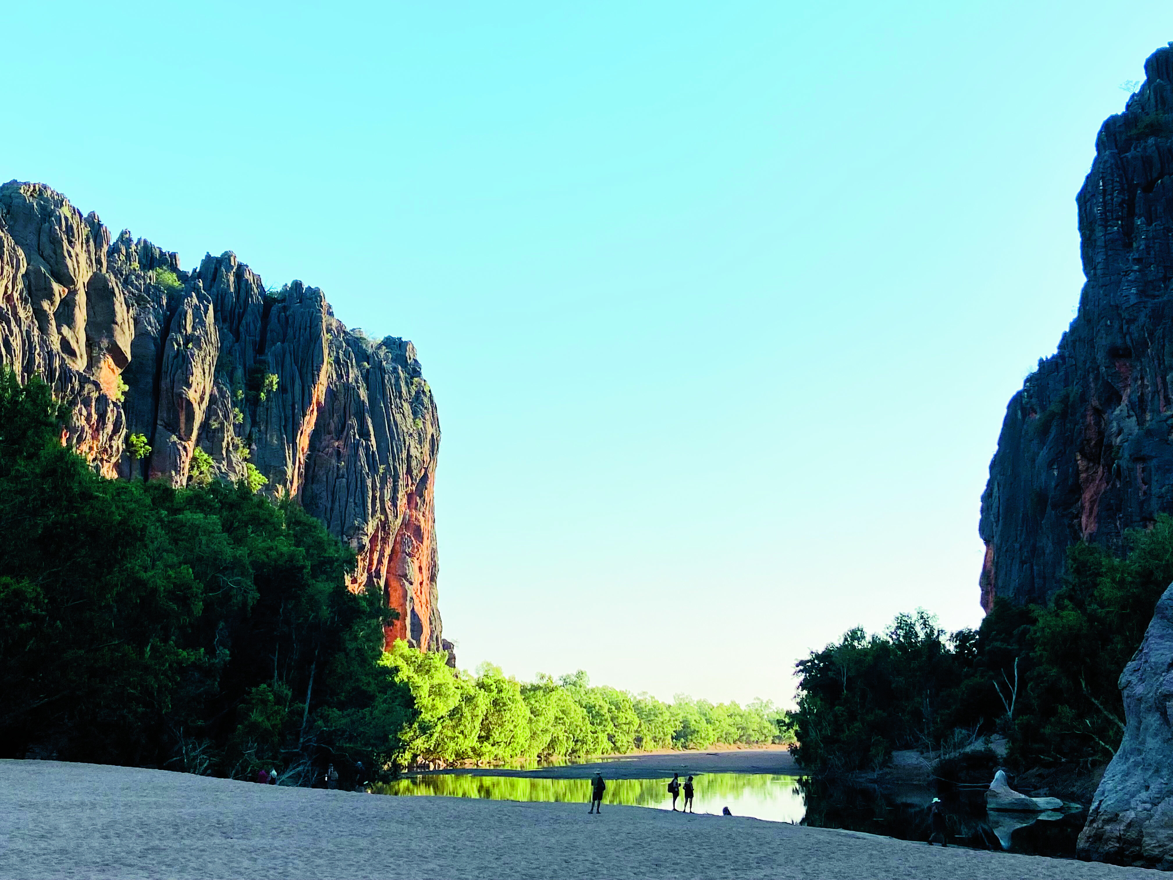
Bandilngan (Windjana Gorge) National Park is one of the Kimberley’s most stunning gorges, with water-streaked walls that rise majestically to heights of 100m – we can see them from our campsite. The Lennard River runs through Windjana Gorge in wet weather, but forms pools surrounded by trees and shrubs during the dry season. The 3.5km-long gorge cuts through Napier Range which is part of the ancient Devonian limestone reef.Walks include the Gorge Walk and begin at the camping area, winding through the gorge for 3.5km each way. There’s also the short Time Walk where you can try and find marine life forms fossilised within the limestone of the gorge walls.
Look out for freshwater crocodiles that bask in the pools. We saw many of them in the water and I nearly walked into one sunning itself on the shore, which the other half thought was hilarious. As beautiful as this park is, it’s advisable not to swim in these waters.Both the Bungle Bungles and Windjana are closed to vehicle traffic in the wet season which begins in December in the Top End, but a flight overhead is always possible. Or you can put them on your bucket list when all the borders are open again. You’ll get a warm welcome up here in the magnificent Kimberley region of Australia.
FIVE THINGS TO SEE
1. PURNULULU NATIONAL PARK The most famous of The Kimberley’s eight National Parks, Purnululu’s claim to fame is the other-worldly, eroded sedimentary domes of the Bungle Bungle Range that resemble skeps or wicker-type beehives.2. BUNGLE BUNGLE CARAVAN PARK Bungle Bungle Caravan Park offers storage for caravans and trailers; accommodation spanning cabins, safari tents and powered/unpowered sites; bus and helicopter tours; licensed restaurant; and more.3. BANDILNGAN (WINDJANA GORGE) NATIONAL PARK Regarded as the most stunning of Kimberley gorges, Windjana Gorge (north of Fitzroy Crossing) cuts through the Napier Range, a former ancient Devonian limestone reef.4. NGUMBAN CLIFFS Between Halls Creek and Fitzroy Crossing is the Ngumban Cliffs, a free overnight rest area and dump point with covered picnic tables, barbecue areas and toilets.5. OFF-ROADING Plenty of long, corrugated dirt-road driving to test your mettle and fourbie, getting to and from the two aforementioned national parks.