Explore NSW
Gallery 1
I’ve always wanted to explore the Walcha area and see what explorer John Oxley was so excited about when he saw flowing rivers cutting through gorges and the rich mix of good pastures on the New England Tablelands.
I started my trip in the town of Walcha, where the elevation is just over 1000m and the weather can change in a snap. I explored the town’s heritage walking trail, visiting some of the many old buildings dating back to the late 1860s and the open-air sculptures around the town limits.
On the north side of town there’s a pioneer village and museum where visitors can see a range of buildings and collections from different eras. Alongside a diverse collection of artefacts, it also houses a Tiger Moth aircraft that was used in the district and was originally built for pilot training in the 1940s.
In the heart of town there’s also the Big Black Shed to wander around in, which is jam-packed with antiques, relics and modern-day items for sale.
1
Waterfalls and dry rainforest
After a few hours around town, I headed 20km east to explore the waterfalls this area is known for, namely Apsley and Tia falls. Apsley Falls is where the Walcha plateau meets the rugged Apsley–Macleay gorge system, where the river continues east and finally meets the Macleay River.
There’s cheap camping at the falls, but it must be booked online through the NPWS website. Walking trails lead you around the top of the gorge to different viewing areas, and for the fit crew there’s a hike to the base of the falls. Just down the road is Tia Falls, where there’s also affordable NP camping, which is a great base to set off from if you want to complete the hiking trail loop to the base of the gorge and back.
An interesting fact is that the area below both these falls is considered dry rainforest, which survives in the deep gorges on the moisture provided by the waterfalls in the spray zone. The area below the falls is like a giant sponge, soaking up and slowly releasing the moisture. Oxley Wild Rivers NP protects the largest reserved area of dry rainforest in NSW, covering 10,500 hectares.
1
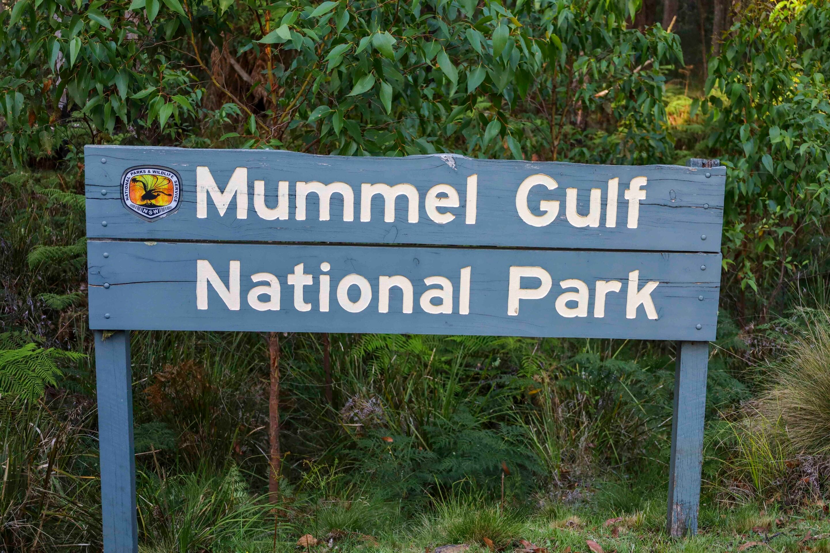
Camping and wilderness at Mummel Gulf
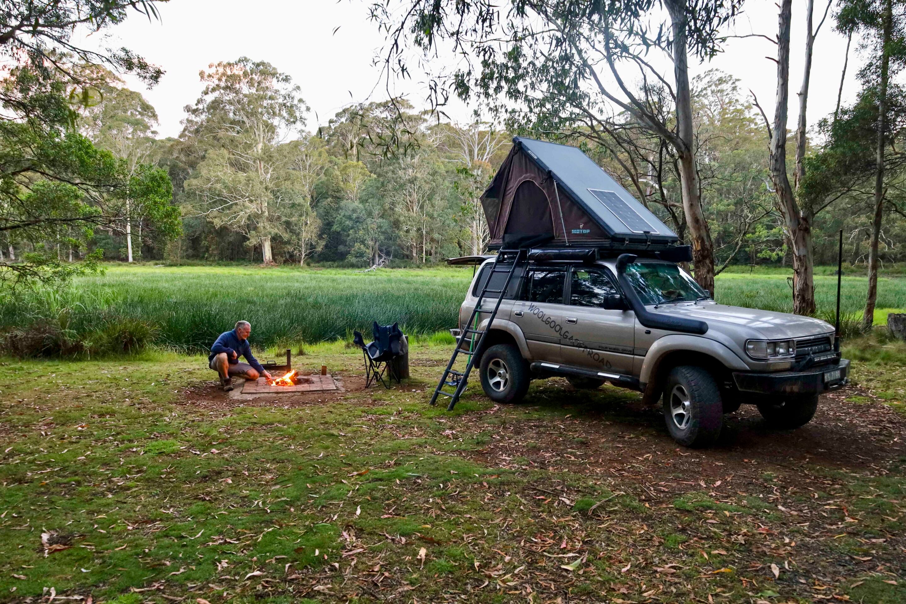
With the tourist trail out of the way, I headed across the Oxley Highway and into Mummel Gulf National Park for the first of my overnight camps at New Country Swamp.
There are five designated areas beside the swamp, which is a rare montane peatland flowing into Numble Creek. The swamp lies at 1200 metres elevation, and the forest includes snow gums, mountain ribbon gum and banksia. It’s a quiet place where you may see wildlife and many birds.
Cedar-getters found quality trees here and this country was heavily logged at the turn of the century. Small-scale mining also took place, and cattle were allowed to graze in the forest. Then in 1992 forest defenders set up camp nearby and protested against the destruction of old-growth forest and the loss of wildlife and biodiversity that normally follows. They were successful, and today this country is protected as Mummel Gulf National Park, with much of it declared wilderness.
From the campsite there’s a pleasant stroll through the forest past snow gums, with a view over the swamp towards the campsite. The track continues to Mummel Gulf lookout, overlooking the deep forested valley of the Mummel River, and on a clear day you can see the top of the Barrington Mountains.
1
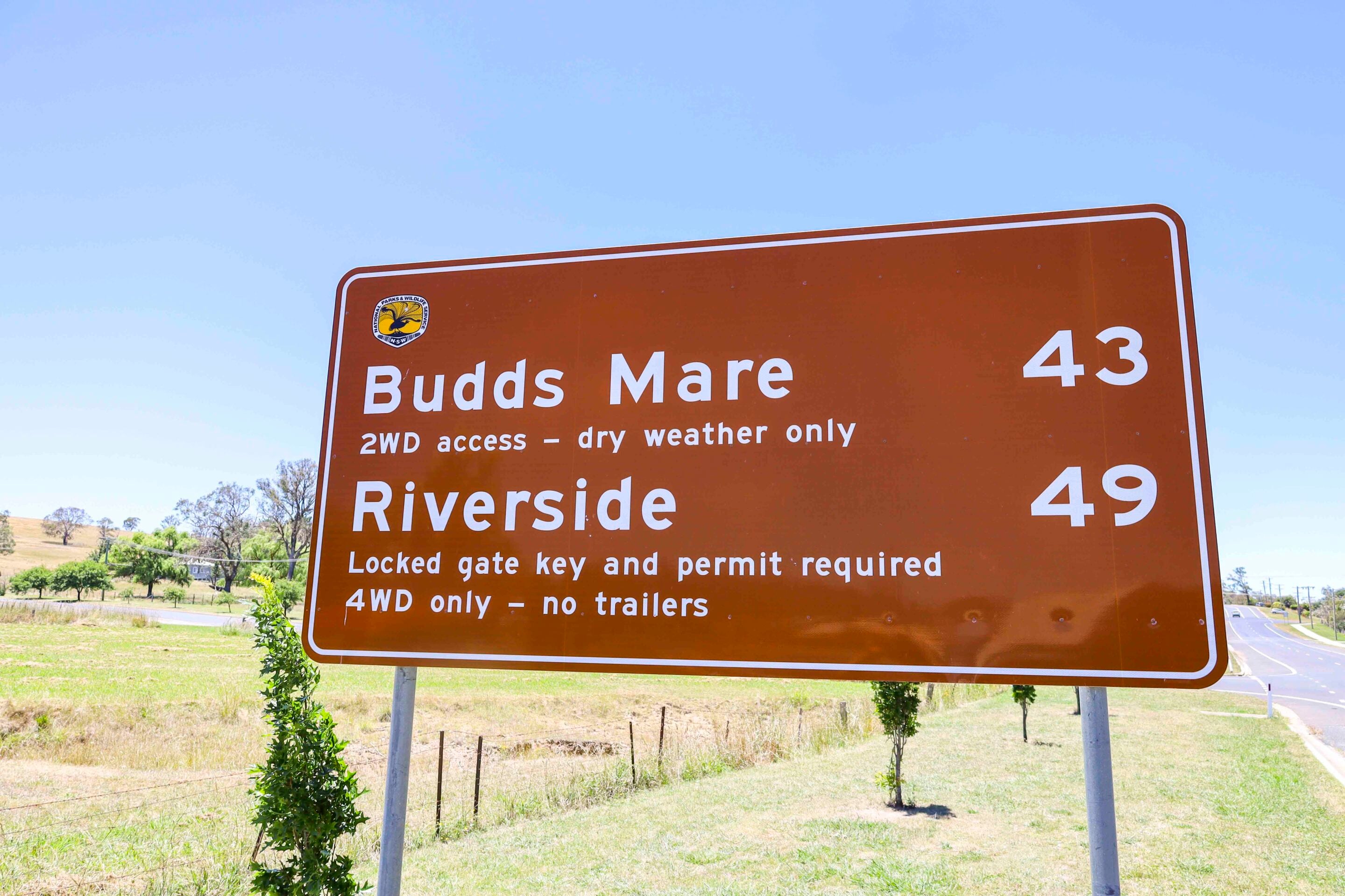
Budds Mare and access tips
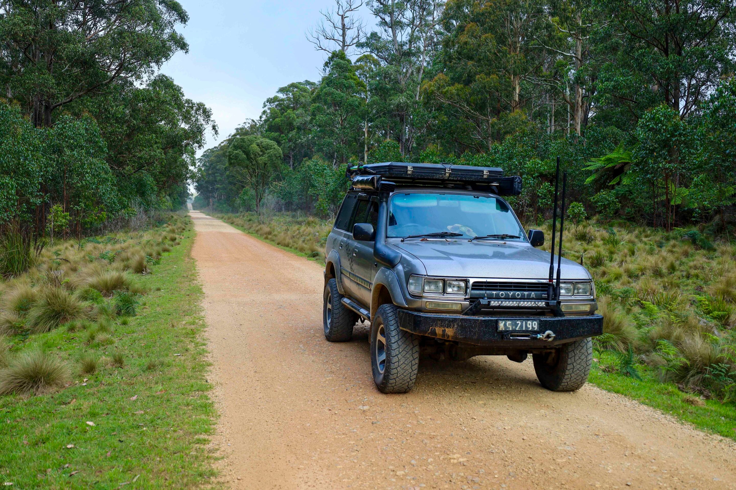
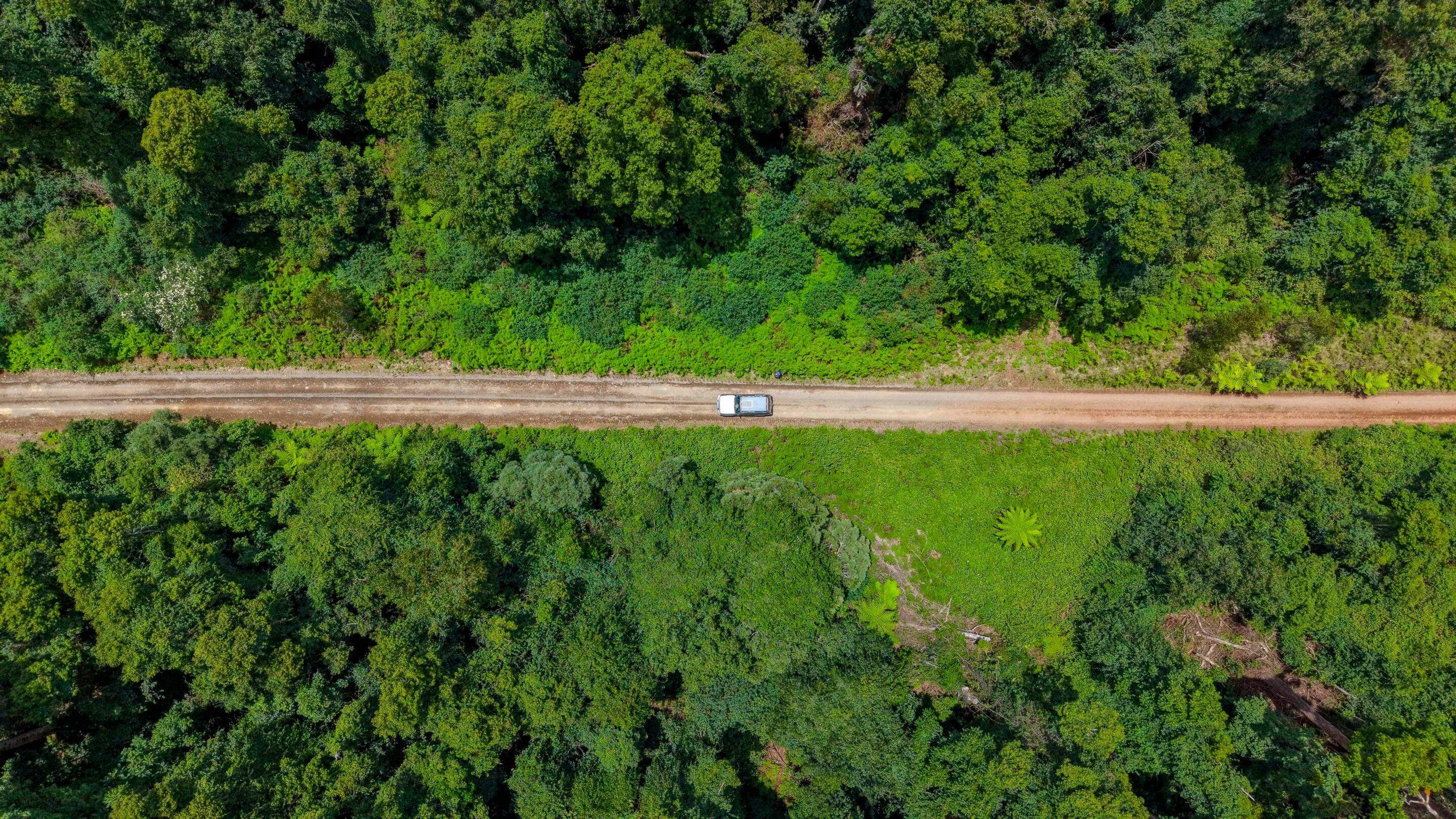
After exploring the waterfalls and Mummel Gulf I headed out to the western side of Oxley Wild Rivers National Park, travelling back through Walcha along Moona Plains Road and towards Budds Mare.
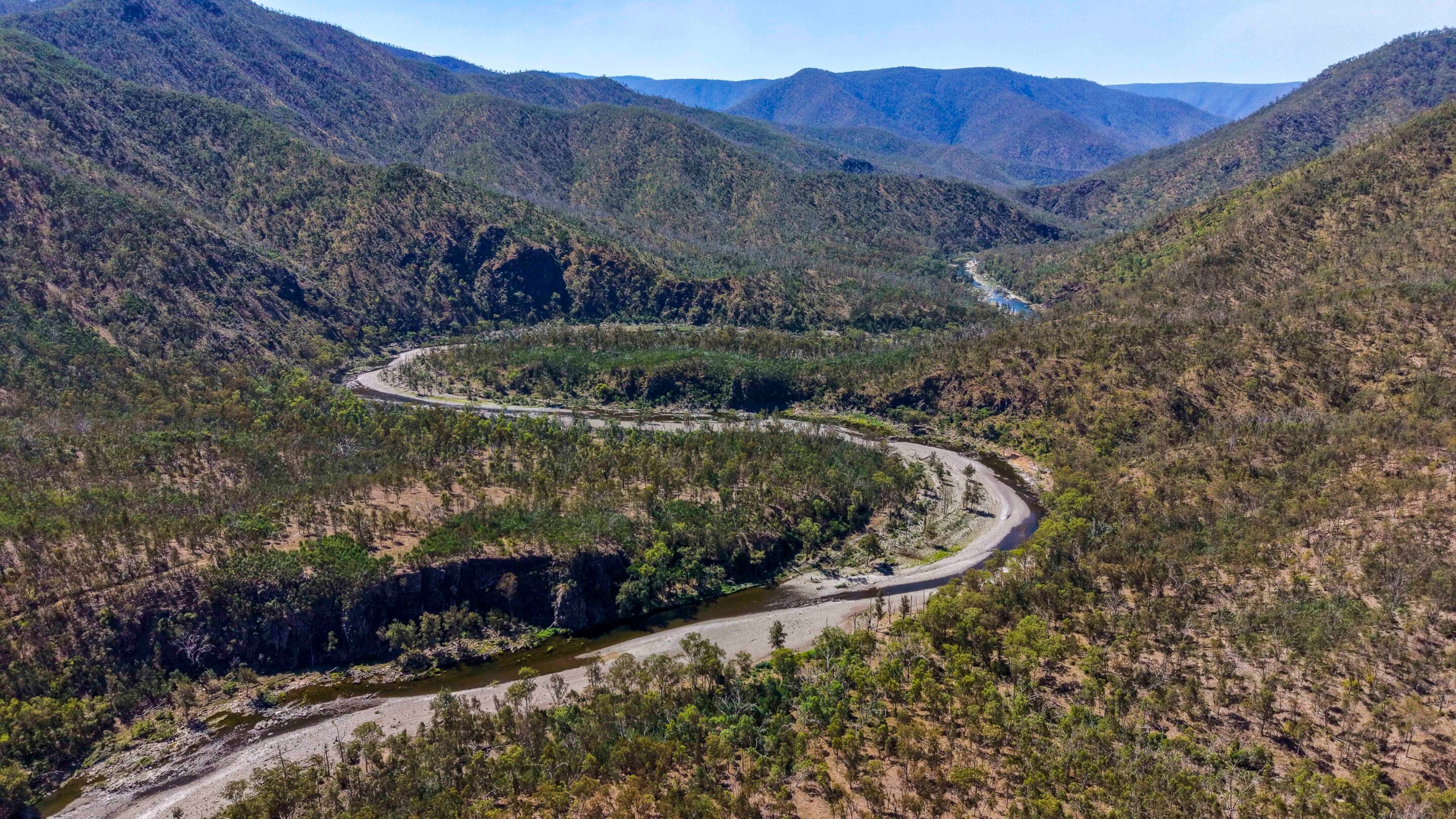
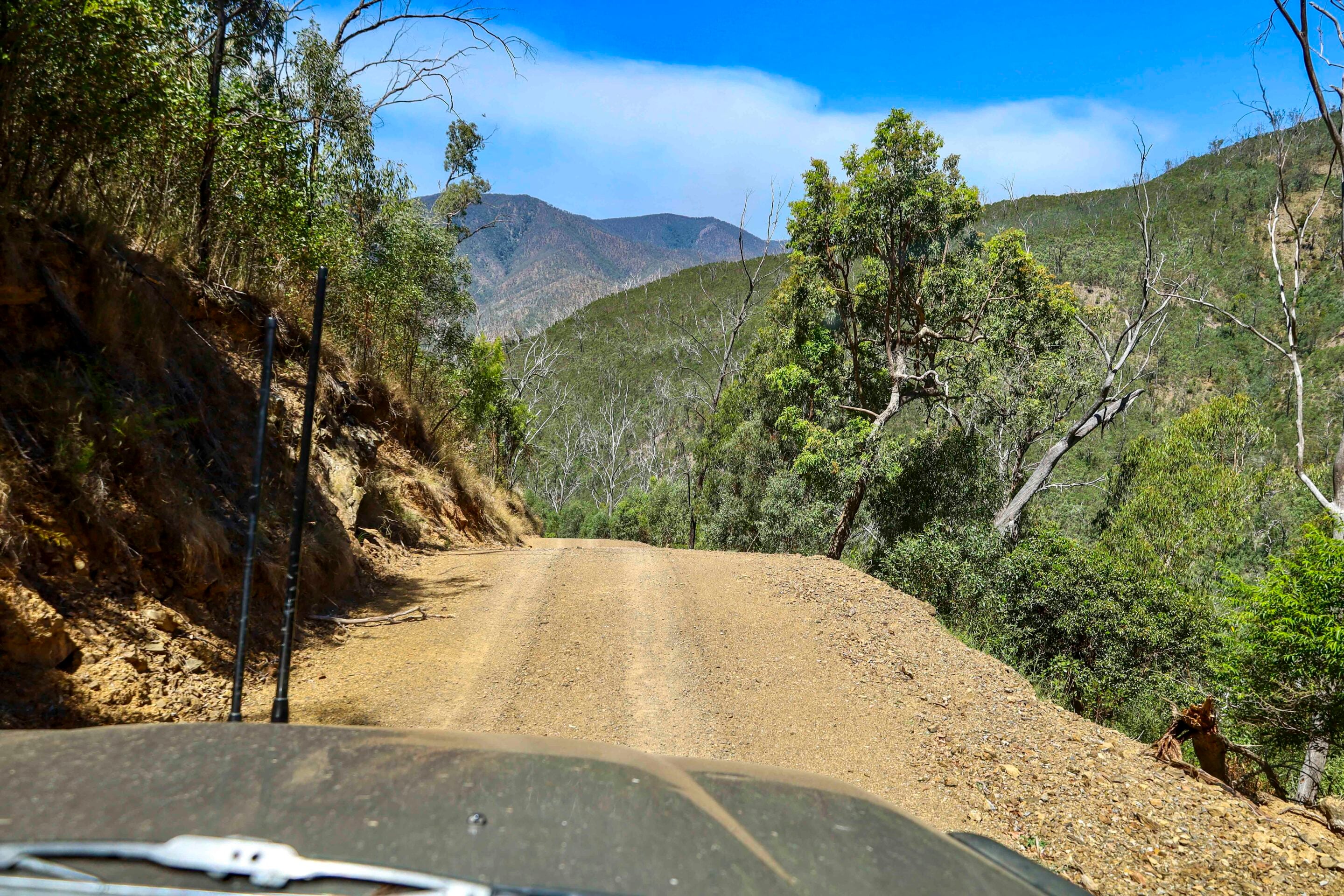
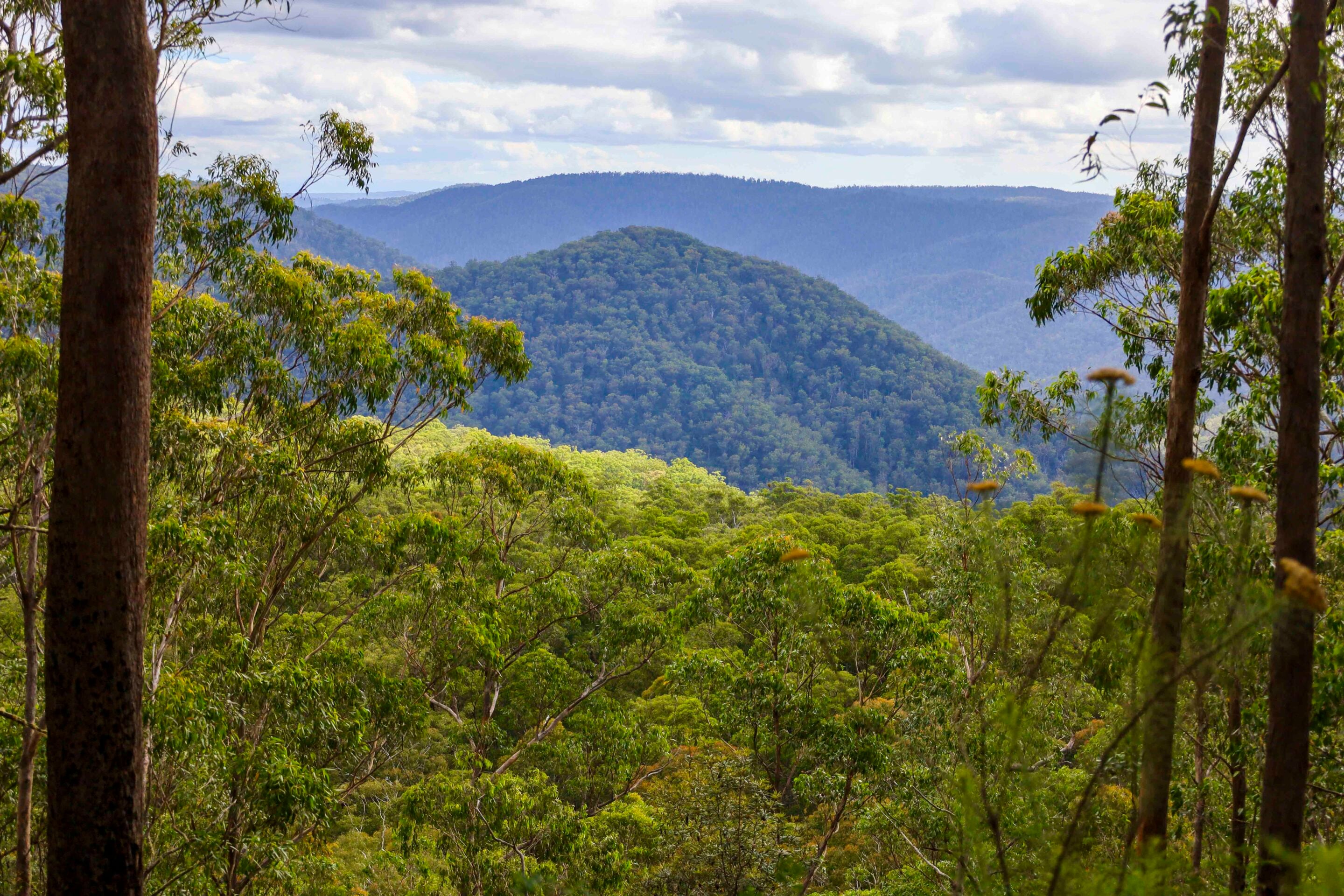
My goal was to stay in the remote gorge Riverside campground on the Apsley River, but before leaving phone service it’s necessary to book online via the NPWS website, as there are limited sites and a gate code is needed to access the last stretch of the 4×4 track into the gorge. Budds Mare is right on top of an escarpment with dramatic views into some seriously steep and rugged gorge country.
For those without a 4×4 or who don’t have the gate code, it’s possible to camp at Budds Mare. The added bonus is the new facilities, including a timber shelter with a fireplace for the cooler months, and there’s an easy walk to Paradise Rocks Lookout where you can view Riverside and the Apsley River cutting a path through the landscape.
It’s only six kilometres down to the Riverside camping area, but the atmosphere surrounding the landscape and the narrow track in is something I’d compare to driving through the Victorian High Country. There are some serious switchbacks on the narrow, steep track and it’s easy to see why trailers are banned.
1
Riverside Camp and history
National Parks has set up Riverside with some pretty amazing campsites and day areas. Explorer John Oxley camped down here on the river in September 1818, then headed east towards the Tia Valley, eventually arriving at Port Macquarie in early October of the same year.
The name Riverside comes from a house that was built in 1891 where today’s camp area is, which was part of Moona Plains Station. There were several slab-built, shingle-roofed dwellings made for the stockmen working down off the tableland. Unfortunately fires ripped through around 1930 and destroyed the huts, but old farm relics can be found alongside the remains of a stone chimney.
In the 1980s plans were underway to dam the Apsley River to supply a nearby hydroelectric plant, and the steep road into Riverside was constructed to install the river gauging station. Ironically the NSW minister at the time and his wife, Neville and Jill Wran, spent three days hiking the Apsley River and were so impressed that he included this gorge in the 127,000ha gazetted for the new Oxley Wild Rivers NP.
1
Campers can enjoy swimming in the nearby Apsley River and fish for wild bass that head downstream on an epic pilgrimage to spawn before returning each year. Once the sun goes down the nights are quiet and the nocturnal creatures venture out.
The park is included in the listing of the Gondwana Rainforests of Australia World Heritage area for landforms stretching back to when Australia was connected to Antarctica 40 million years ago.
The protection of this national park and its wild natural areas not only preserves the lives of countless unique lifeforms, but also ensures we can continue to enjoy opportunities to immerse ourselves in wild landscapes. After tens of millions of years without interference, where the river has clawed out deep valleys along the eastern flank of the Great Divide, the Apsley River whispers to us of something profoundly ancient and beautiful.
1
Who was John William Oxley?
Explorer and surveyor-general John William Oxley played a huge and important part in the exploration that opened up large areas of eastern Australia and also helped open up parts of Tasmania (known then as Van Diemen’s Land).
Born in England, he arrived on our shores in 1802 and was immediately set to work as a coastal surveyor for several years before sailing to Van Diemen’s Land, then back to Sydney where he was granted land. He was soon appointed surveyor-general of NSW and began his exploration travels across the eastern seaboard between Bathurst and up to Port Macquarie on the Mid North Coast.
In search of new farming lands beyond the Hunter Valley, he headed north and climbed the steep, rugged ranges, traversing from west to east over the southern end of the tablelands he had discovered – today known as the New England Tablelands. In September 1818, Oxley and his expedition camped by a waterhole on the Apsley River (named after Lord Apsley) south of the current township of Walcha. He was the first ‘official’ European in the district as far as anyone knew.
Oxley wrote of this newfound country in his journal: ‘the finest open country, or rather park, imaginable. A country of running waters; on every hill a spring and in every valley a rivulet.’
Prior to Oxley coming to the area the Dungutti people had lived on the tablelands for around 6000 years, using it as a meeting place and a centre for trade. In winter the Dungutti people headed east into the gorges where there was plenty to eat and the weather was warmer.
28
Essential information
Where is Walcha?
Walcha is 180km west of Port Macquarie and a little over 480km N-NW of Sydney in the New England High Country, at the intersection of the Oxley Highway and Thunderbolts Way. It is surrounded by national parks where waterfalls spill into wild rivers and thread through rugged gorges on a journey to the coast. Walcha is the oldest colonial settlement in the New England region, known for its natural beauty and rich history, with a town centre that retains genuine old-world charm.
What’s in the region?
There’s a multitude of areas to explore in the Walcha region, including camping on the Apsley River, a plethora of hiking trails into gorges and waterfalls, exploring the town’s heritage and museums, and 4×4 touring trails.
More info
The New England Tablelands is around 1000m above sea level and there are often several weather conditions in one day. The winters are cold with frost and sometimes a covering of snow, and in summer it can be stinking hot with cold nights, so be prepared for anything.
Walcha has a tourist information centre (29 Fitzroy St) that can help with what’s on in the district. To camp at Riverside in Oxley Wild Rivers NP you’ll need to book online through the NPWS website, and when you pay you’ll also receive a code for gate access. Other camping options in the area include Tia and Apsley falls and the New Country Swamp area at Mummel Gulf NP, which also need to be booked online. Walcha is a busy hub where you’ll find all services and facilities.
MORE
NSW travel yarns!
Follow 4X4 Australia on Google
Get more 4x4 news, reviews and gear stories from 4X4 Australia in your Google feeds.

We recommend
-
 Explore NSW
Crowdy Bay National Park is a hidden gem for 4x4ing
From headland lookouts and beachside camps to quiet forest tracks, Crowdy Bay National Park rewards those who slow down and explore
-
 Explore NSW
Following Sturt’s footsteps: A 4x4 journey from NSW to South Australia
Retrace Charles Sturt’s 1829-30 expedition along the Murrumbidgee and Murray rivers on a modern 4x4 adventure
-
 Explore NSW
Kwiambal National Park is an ideal destination for a weekend adventure
Waterfalls, hiking trails, caves and quiet campsites. Kwiambal National Park has all the ingredients for a weekend adventure off the beaten track


