Explore

Gallery 1
It’s a challenge to beat Queensland in the National Parks stakes with its desert country, rugged mountains, natural springs, and stunning flora and fauna, as well as its indigenous culture, pastoral history and threatened species.
Queensland national parks are diverse in what they offer, and it would certainly be a challenge to visit them all, so here are seven that we highly recommend you add to your bucket list.
1
Mariala National Park
The turn-off to Mariala National Park is 124km west of Charleville via Adavale Road.
The majority of this stretch is bitumen and on the way there’s an interesting cemetery up a side track to the right, just before crossing the Langlo River. A small sign points you in the right direction, and plaques reveal the interesting stories of how the people buried in the vicinity passed away. Once across the bridge there is also a good free camp on the banks of the river.
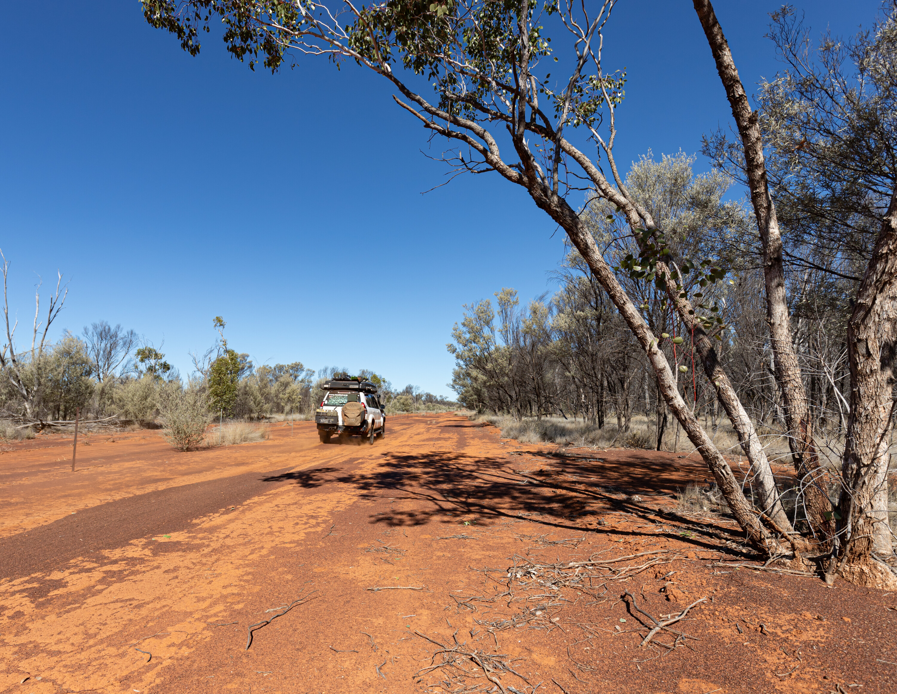
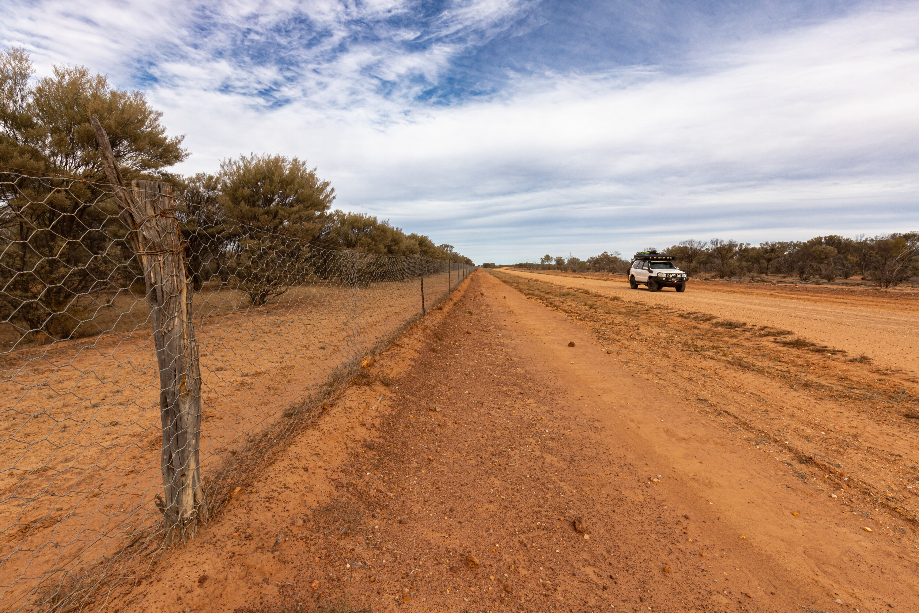
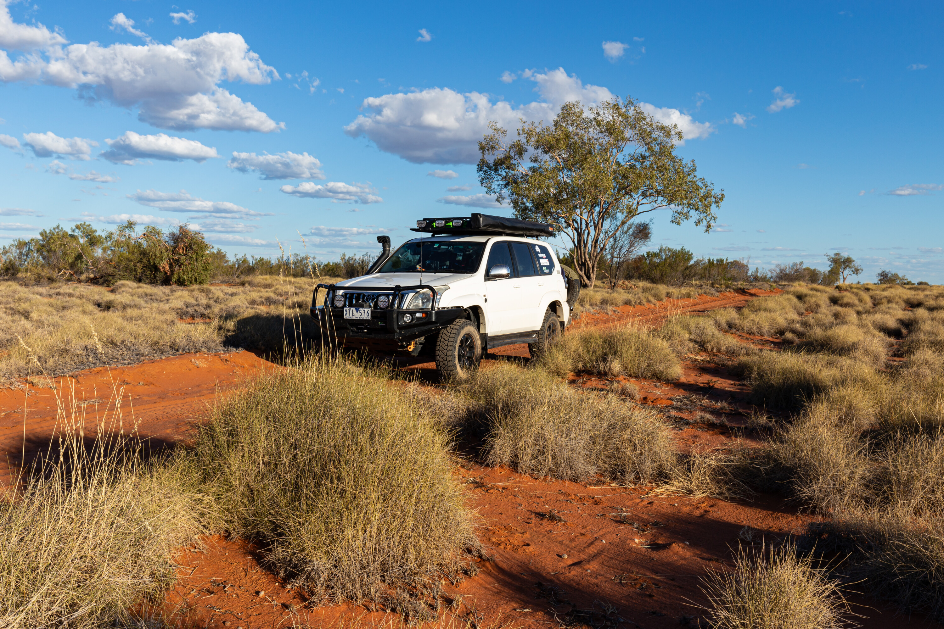
Upon reaching the entrance to Mariala National Park, dropping some air out of your tyres will make the going smoother. The track follows the fence line for the first few kilometres and there are plenty of speed humps and termite nests to keep your speed down.
1
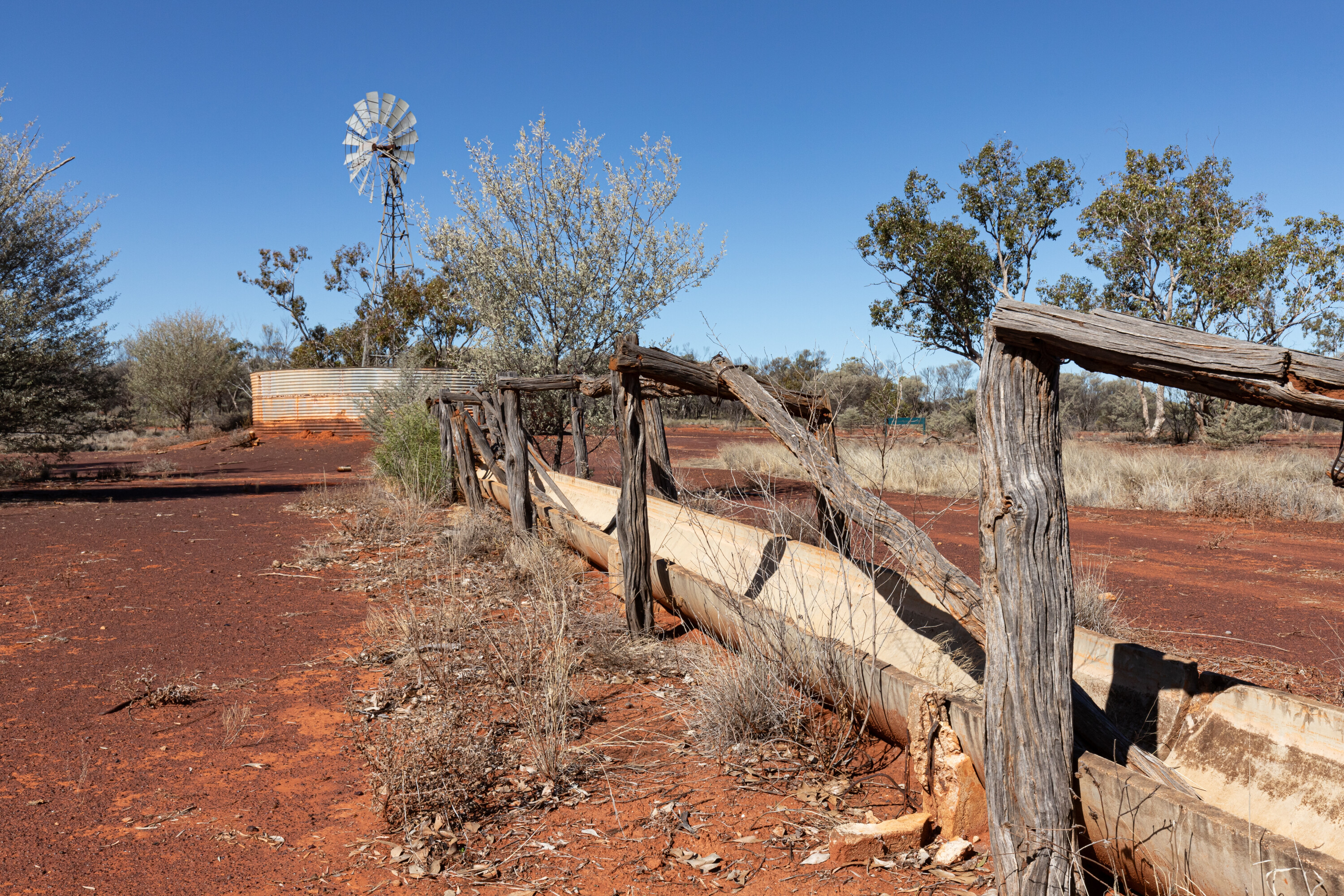
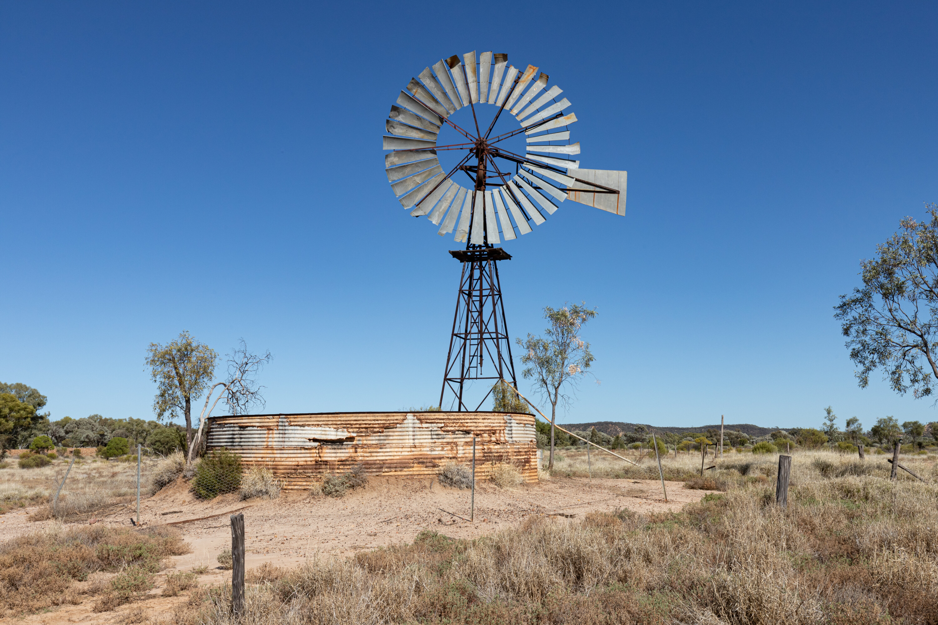
Once the track turns west, the first stop is at Bore No.3, which is also one of the three designated camping areas within Mariala.
Here you’ll find a rusting water tank, a dilapidated windmill and an old steam pump; there are no facilities at any of the campsites so take out what you bring in and leave the campsites better than you found them.
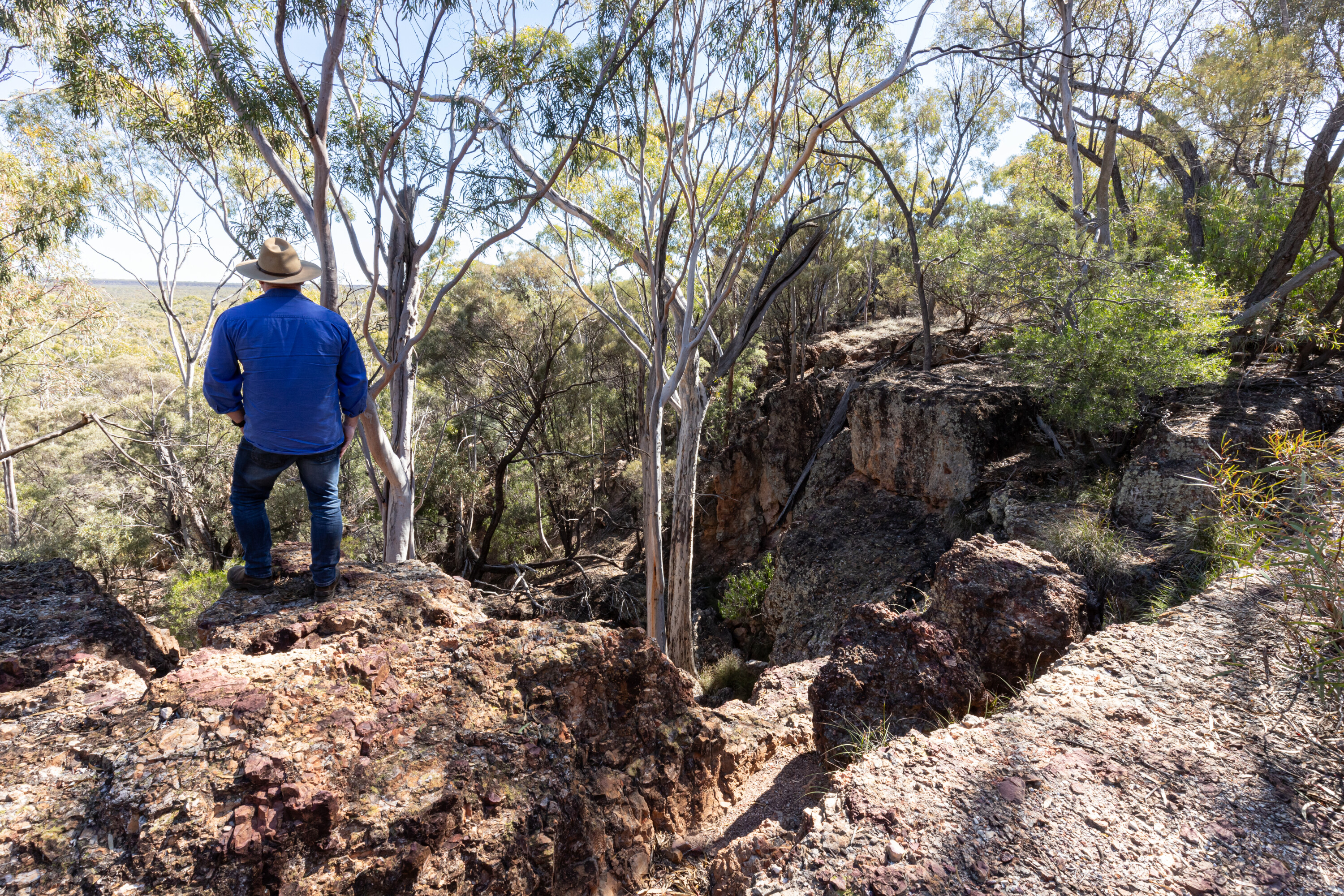
The track continues past Bore No.3 after which it changes from a solid orange sand base to stony and rocky as it runs up and down the escapements. Before dropping down the first steep section, there is a lookout and picnic spot on the right.
1
The views across the park from here are stunning and if you’re quiet you may spot a yellow-footed rock-wallaby that inhabits this remote park.
Mariala was one of the breeding parks for these wallabies that were once so close to becoming extinct. It was such a successful breeding program that the number of yellow-footed rock-wallabies now in Queensland means the marsupial is close to being off the threatened species list.
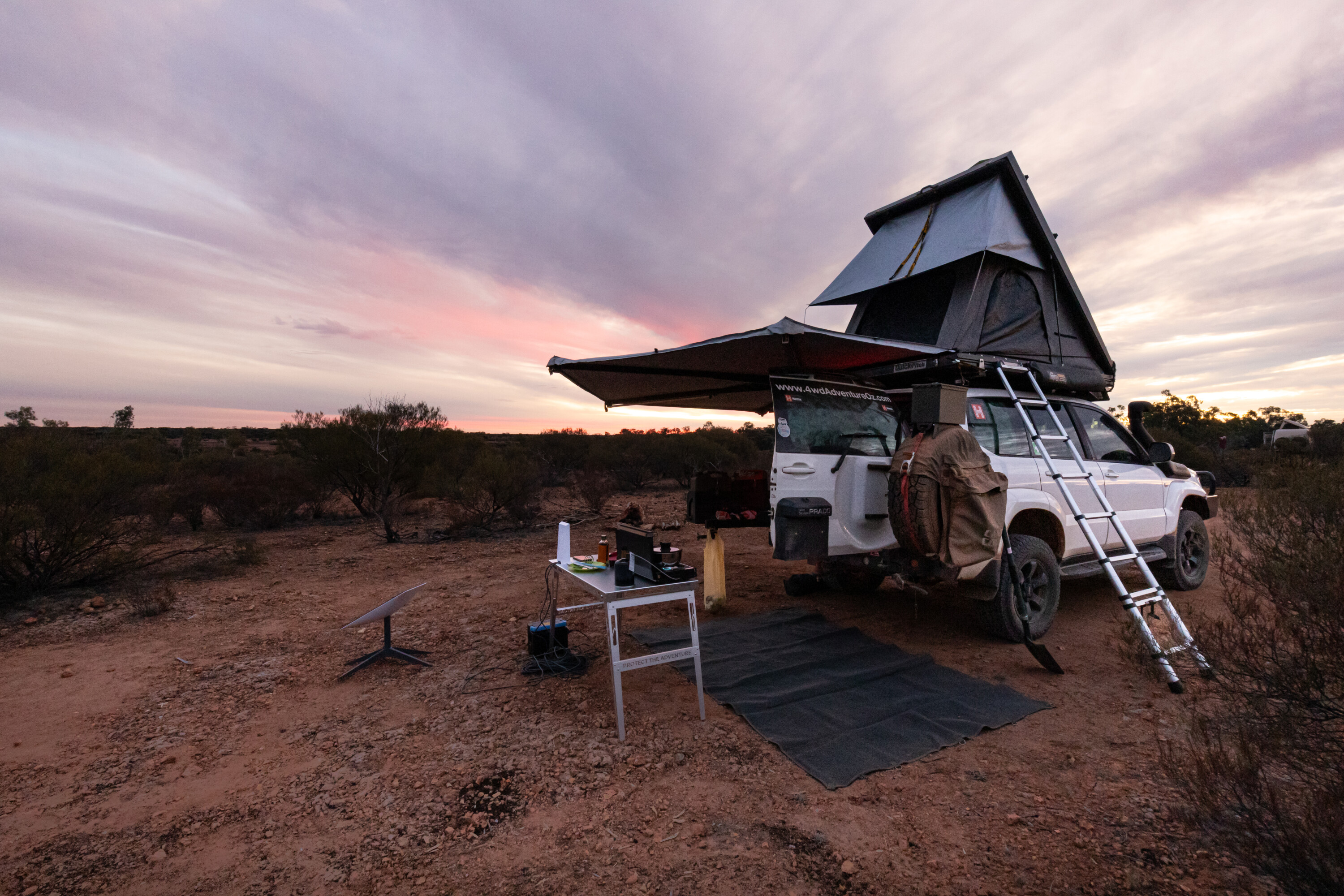
From the lookout, it is slow going as the testing track leads out to the Rockpools camping area. This is another great spot to keep an eye out for yellow-footed rock-wallabies, especially when there is water in the rockholes. The camping area here is small and well-shaded amongst the mulga.
4
Fires are permitted at all the campsites, but they must be fuelled by milled wood, as wood collection is not permitted within the park.
If you like a bit pf peace and quiet, you’ll love this park; there is so much silence, it is refreshing. Even in the morning, the most you’ll likely hear are a couple of small birds chatting with each other. It’s such a rare experience and very beautiful.
Essentials
Camping: Rockpools, Bore No.3 and Roadside camping areas have limited sites and bookings must be made online before arrival. Fires are permitted (except when bans apply) and wood is BYO.
Closest Town & Facilities: Charleville is 124km away, with caravan parks, fuel, shops and dump point.
Items: Food and drinking water, satellite phone or PLB, rubbish bags, portable toilet, insect repellent, sun protection, first-aid and snake bite kits.
1
Hell Hole Gorge National Park
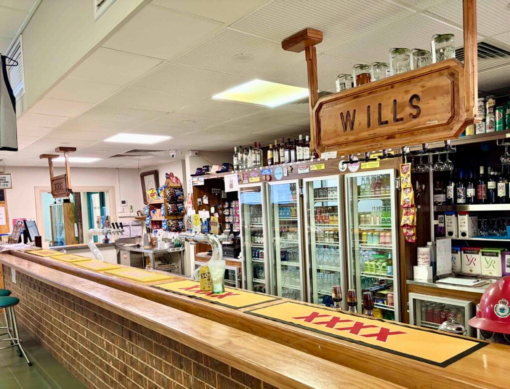
Access to Hell Hole Gorge National Park is from Adavale and it’s a good idea to have a chat with the publican before you head out as he can offer some great tips on what to see and do, as well as point you to a free camp on the way out if you can’t book a campsite in the national park.
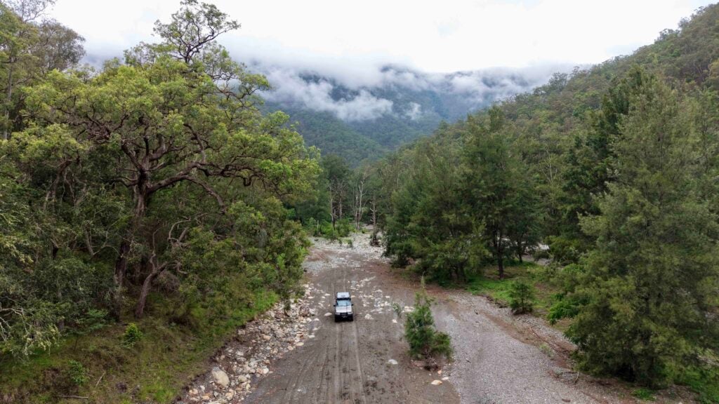
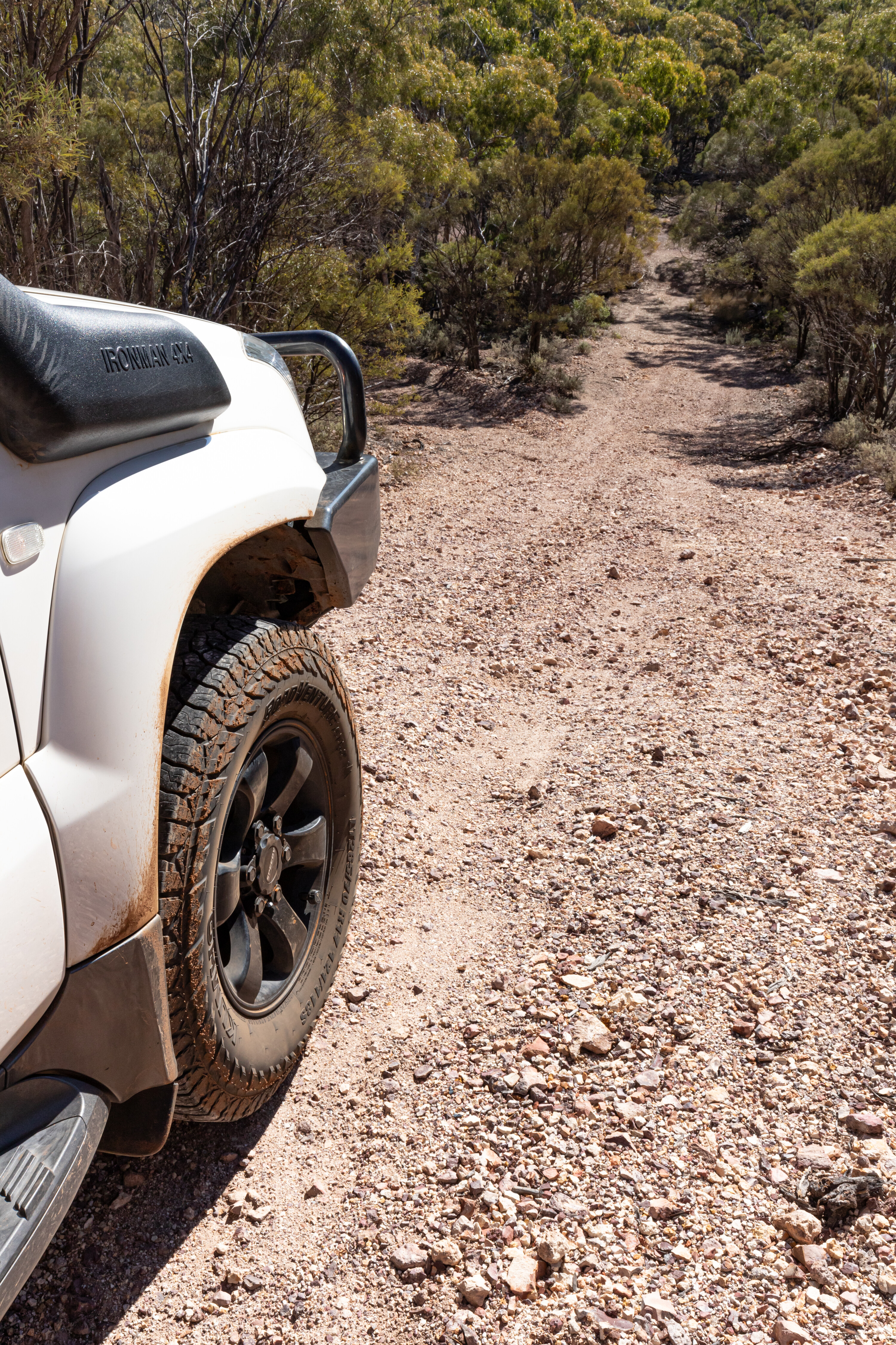
The 70km track out to Hell Hole Gorge NP was in great condition when we were last there and as you drive along the landscape changes from treeless plains to mulga trees and cane grass.
The track follows the Wild Dog Fence for a while before turning west towards the park. Entrance to the park is through a gate – please leave it as you find it – and an information board offers an insight into the assets of Hell Hole Gorge.

1
From here it is 7km to the Powell Creek camping area which has dispersed camping options on a stony plateau amongst low wattles and mulga trees, but with no facilities.
While the Queensland Parks camp booking site suggests there are only four campsites at Powell Creek, there is certainly space for more.
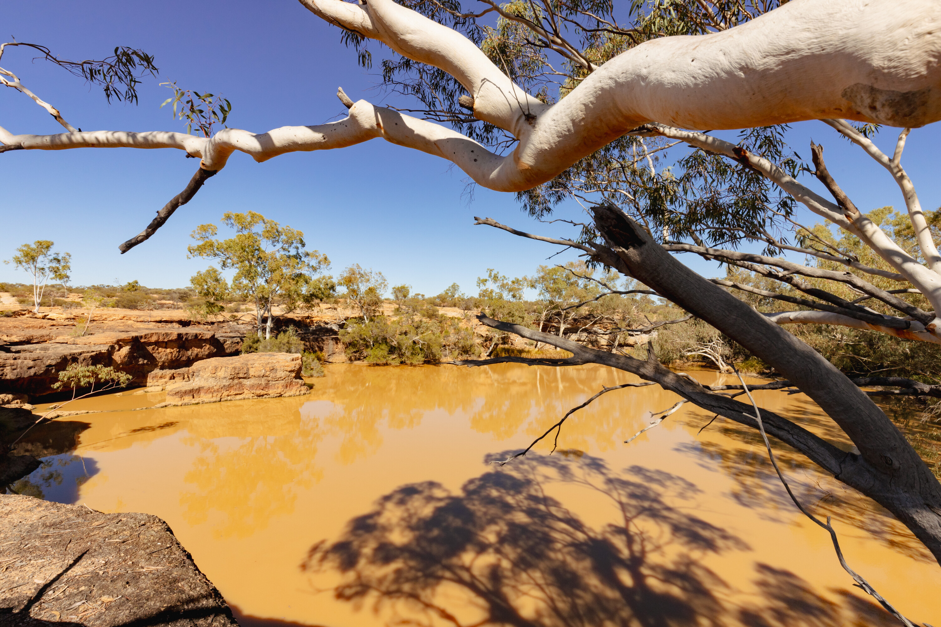
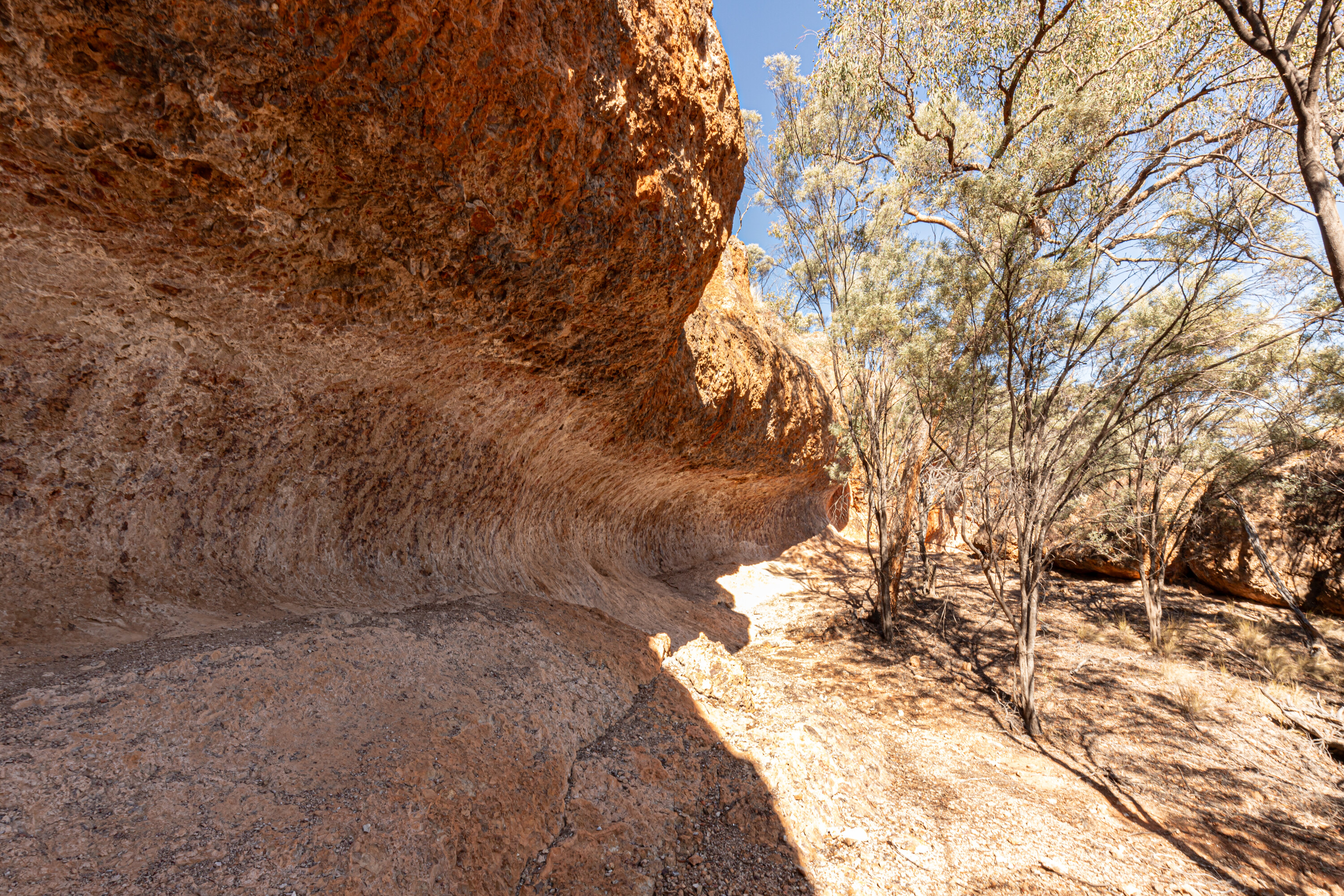
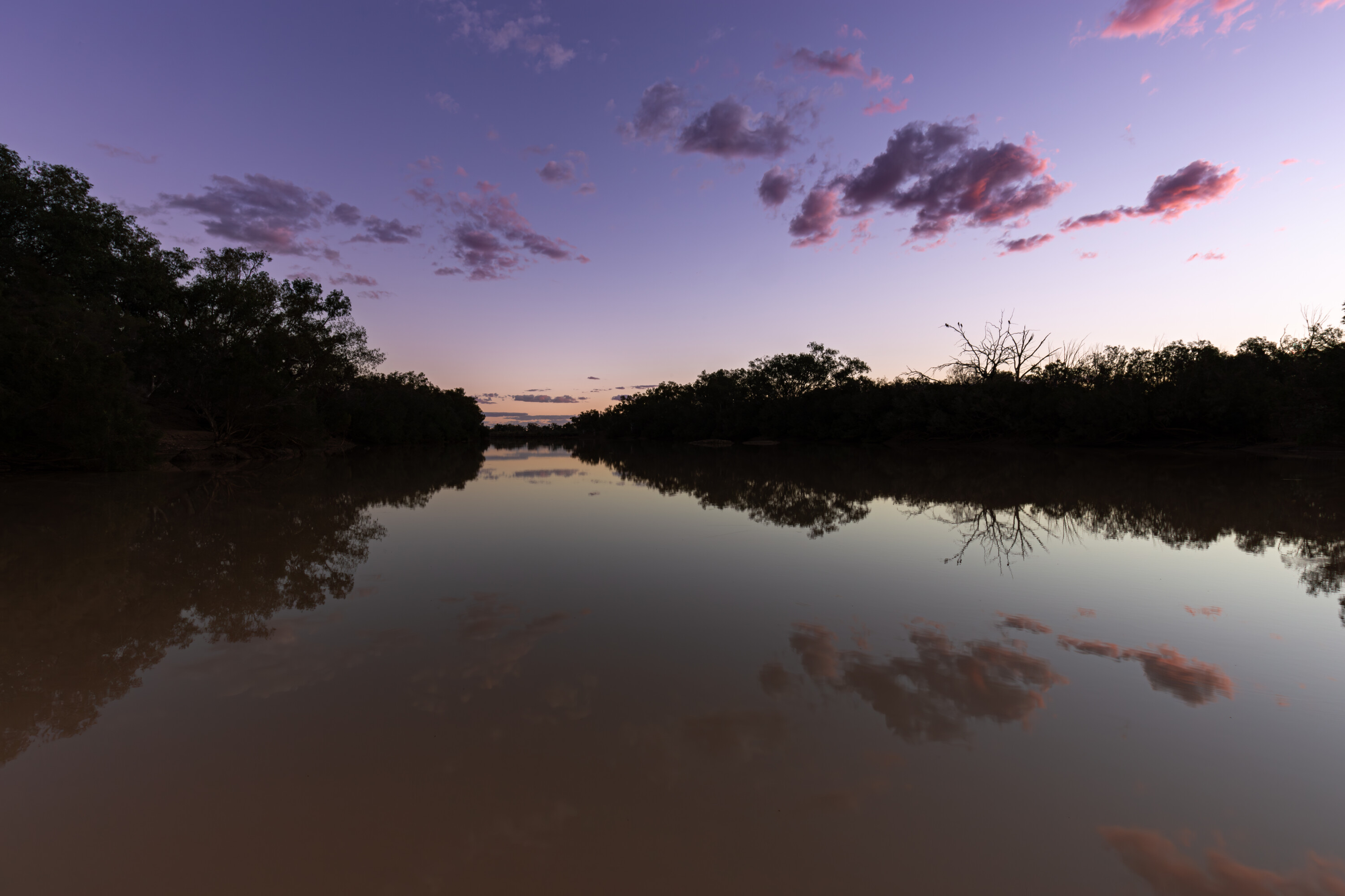
From the campground, it is a 1200m return walk out to Hell Hole Gorge. It isn’t a challenging walk across the rockshelf, and the views of the waterhole are special. Keep an eye out for Krefft’s river turtles swimming in the water or sunning themselves on the rocky banks.
1
The best time to view it is at sunset as the colours of the rock explode, but make sure you take a torch as walking back to camp in the dark can be dangerous.
There’s another nice walk further upstream; keep an eye out for yellow-footed rock-wallabies that live along the cliffs. Hell Hole Gorge was also part of the successful breeding program so the chances of spotting one or more of these critters is quite high.
Take care along the cliff face as the rock is prone to breaking off, and you can see that this has already happened in some places.
4
On the way to Powell Creek camping area, you’ll likely spot the track to Spencers Waterhole and this is another gem within the park.
It’s a short walk if you want to look over the stunning waterhole, but take the time to explore upstream and check out the seasonal waterfall – it would be spectacular to witness it flowing. The sandy riverbed sections of Spencer Creek are dotted with ghost gums along the bank while mulga trees thrive in the rockier sections.
Unfortunately we saw evidence of campfires and vehicle tracks past the ‘No Access’ sign; Hell Hole Gorge is such an epic destination that we’d hate to see it closed because of idiots who ruin it for everyone else. The same goes for toilet paper; please take out what you bring in, leave only footprints and take only photos so that more people can enjoy this amazing national park.
Essentials
Camping: Powell Creek has limited sites and bookings must be made online before arrival. Fires are permitted (except when bans apply) and wood is BYO.
Closest Town & Facilities: Quilpie is 260km away, with caravan park, fuel, shops and dump point.
Items: Food and drinking water, satellite phone or PLB, rubbish bags, portable toilet (or be prepared to bury human waste and toilet paper in the rocky ground at least 150m away from watercourses), insect repellent, sun protection, first-aid and snake bite kits, and a torch.
Website: https://parks.des.qld.gov.au/parks/hell-hole-gorge [↗]
1
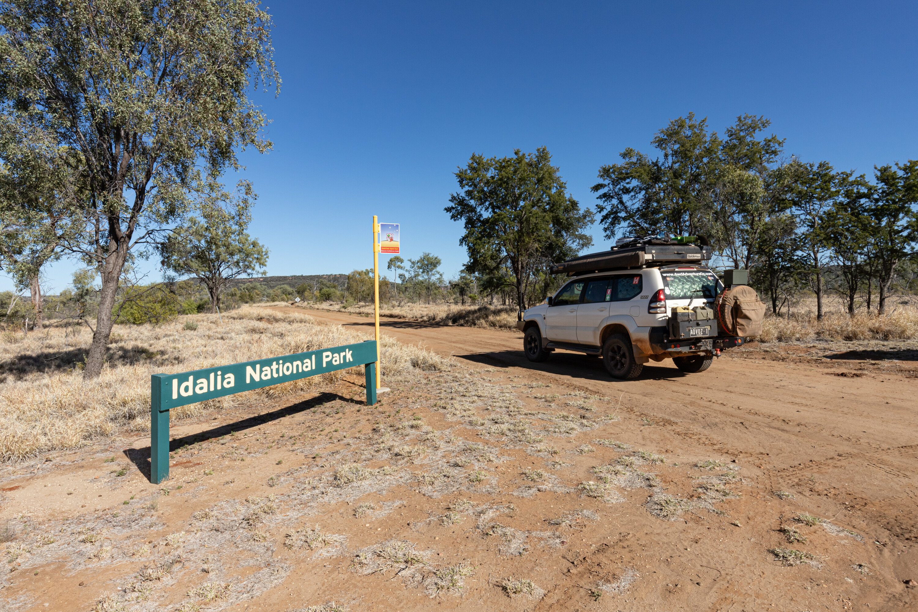
Idalia National Park
Of the 113km drive from Blackall, only the final 44km to Idalia National Park is on black soil, the rest is bitumen.
The information board near the entrance to the park provides a great explanation of what to expect, as well as a bit about the pastoral history of the region and the story of saving in-danger macropods, the yellow-footed rock-wallaby, and the bridled nail-tail wallaby.
Chucksters Bore is worth checking out, with its windmill squeaking in the breeze. Keep an eye out for the old stick stockyards made from tree branches and wire; this method was used throughout Idalia when it was a cattle station.
1
The Idalia ruins site is also worth exploring, with collapsed wooden walls and lots of old relics lying around.
The old home yards can be spotted amongst the scrub. There is also a walk to a scenic lookout that is well worth the effort, and this is well marked with arrows or white spots painted on trees. The reward is a wave rock that has been eroded over time so that it now looks like a surf break.
I spotted a couple of yellow-footed rock-wallabies, but they fled up the rock face and disappeared before I had a chance to raise my camera. The birds give you away, issuing a warning to the critters that humans are coming.
1
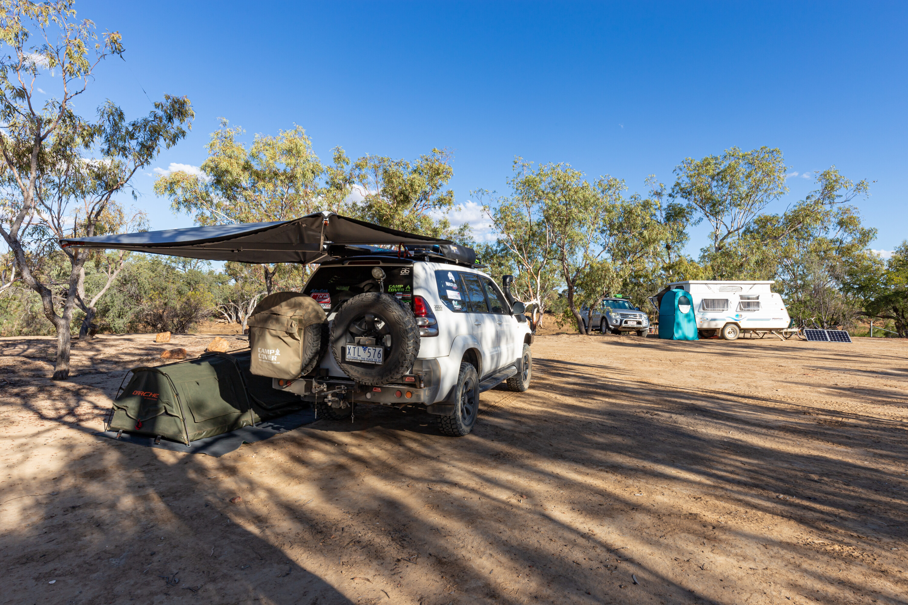
It’s a 33km drive to the Monks Tank campground from the park entrance. Spread out amongst the mulga woodlands, there is plenty of space for a few adventurers without it becoming crowded.
There were two off-road caravans and an Earth Cruiser there during my stay. The only facilities are a drop toilet that is serviced daily when the ranger is about and fire rings.
Please extinguish fires with water as there is plenty of grass and trees surrounding the campground that would go up very easily.
10
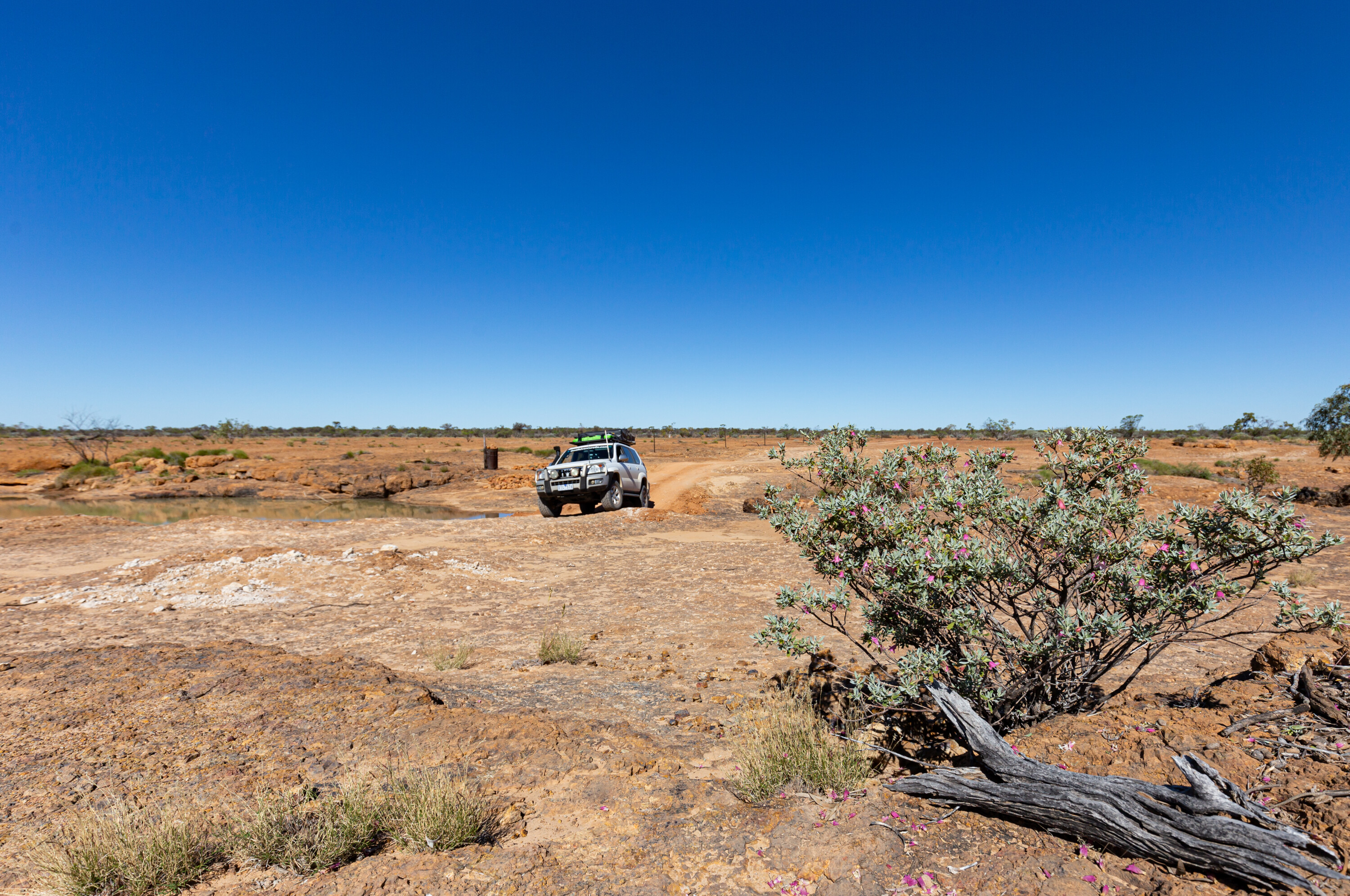
It’s a pleasant drive out to Murphys Rockhole – one of the largest rockholes you’ll ever see – but unfortunately it is seasonally dry, even if the region has had bucketloads of rain.
Emmet Pocket is the furthest point of interest, and it is worth visiting for the views across the valley from the lookout. There is a 4.4km return walk that leads into the gorge with a rating of difficult.
Nearby Bullock Gorge is the pick of the walks, consisting a 2.7km loop walk that offers many stunning outlooks across the plains; it was here that I spotted another couple of yellow-footed rock-wallabies.
Essentials
Camping: Monks Tank has limited sites and bookings must be made online before arrival. There is a drop toilet and fires are permitted (except when bans apply) and wood is BYO clean-cut and weed-free.
Closest Town & Facilities: Blackall is 113km away, with caravan parks, fuel, shops, and dump point.
Items: Food and drinking water, satellite phone or PLB, rubbish bags, insect repellent, sun protection, first-aid and snake bite kits, torch.
1
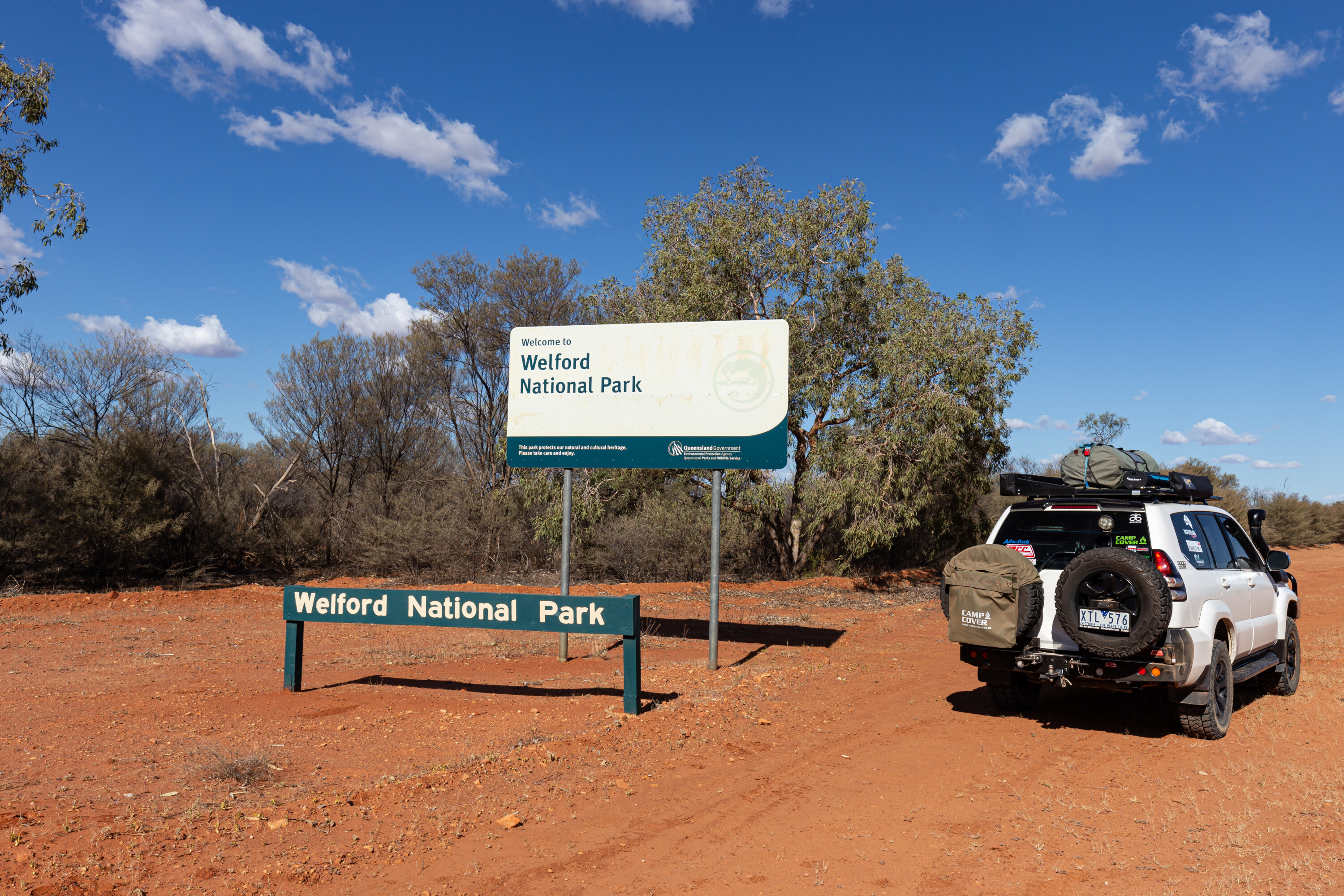
Welford National Park
Welford National Park is a favourite amongst landscape photographers.
Bordered by the Barcoo River, when it floods, the park can be cut off for weeks, however when open it provides a great place to set up camp and explore the self-drive tracks over a couple of days. Or just throw in a line, a yabby net or cruise the river in a kayak or a canoe.
Access to the only camping option within Welford NP, Little Boomerang, is via the Jundah Quilpie Road, a maintained gravel road that is situated on the steep banks of the Barcoo River.
1
Jundah to the northwest and Windorah to the southwest are the closest towns with fuel and pubs at both.
The Bullo River meets Cooper Creek just outside the park and there are free camping options at the bridge over the Cooper east of Windorah if Little Boomerang is booked out.
Welford has three exceptional self-drive routes you can experience, and you’ll get to see a lot of the park. The 12km River Drive takes you upstream following the Barcoo River lined by river red gums in some sections.
1
The Mulga Drive is a 71km return journey and is 4WD only onceyou venture past the old homestead (no public access) and the stockyards.
Make sure you visit Frances and Trafalgar Waterholes, with the latter being the best spot to launch a canoe or catch a fish. Across Mitchell grass plains and into the rugged mulga country, you’re led to Sawyers Lookout and then Sawyers Creek before returning to the homestead via a dusty loop track.
The 22km loop Desert Track is best left until the late afternoon so that you can capture the desert colours from atop a large orange dune, the most photographed feature within Welford NP. With golden-green spinifex thrown in, you will think you’re in the Simpson Desert.
6
Essentials
Camping: Little Boomerang Campground, Barcoo River, limited sites, drop toilet, fire pits.
Closest Town & Facilities: Jundah is 45km away, with caravan park, fuel, shop, hotel, free camping nearby, and dump point.
Items: Food and drinking water, satellite phone or PLB, rubbish bags, insect repellent, sun protection, first-aid and snake bite kits, and torch.
1
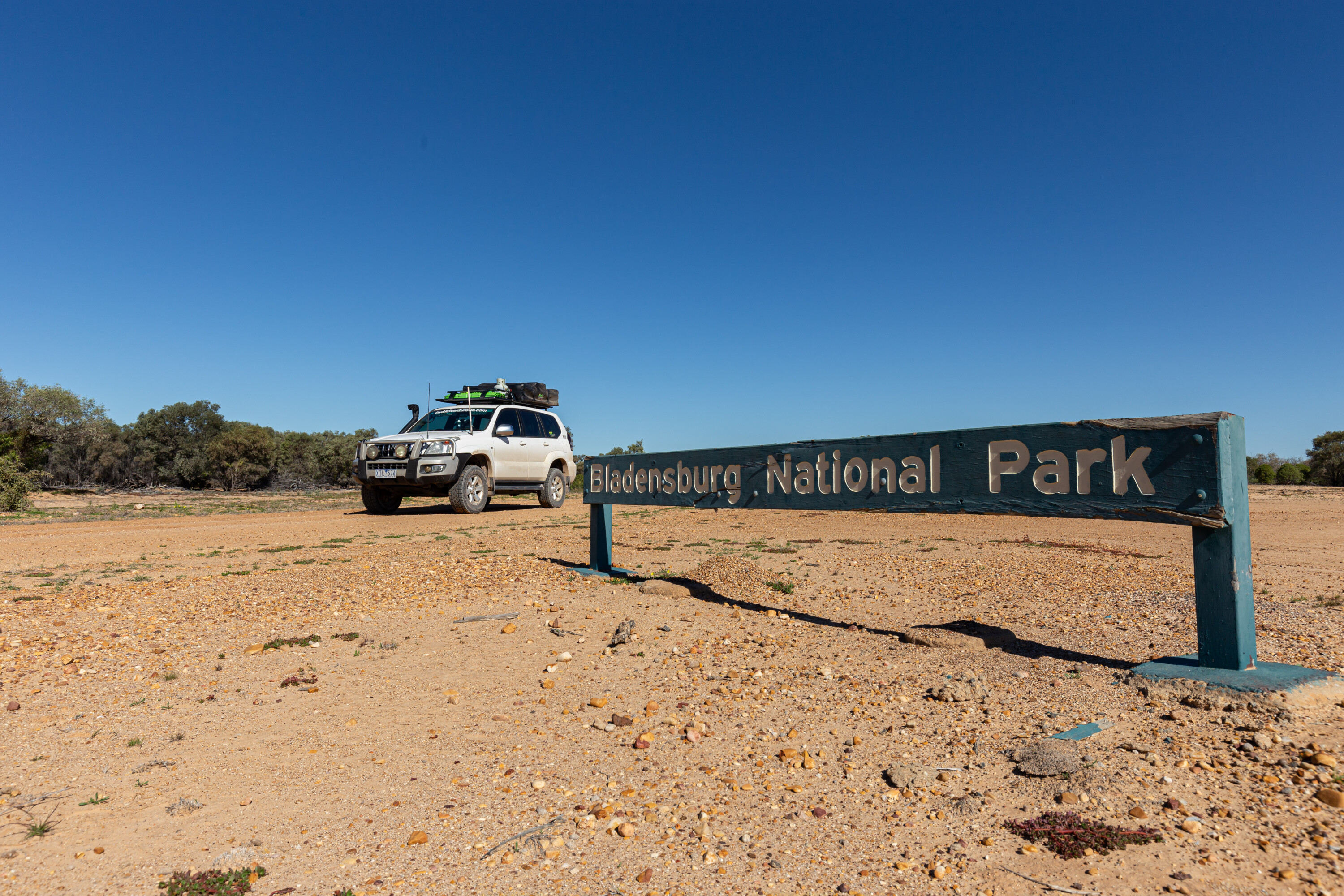
Bladensburg National Park
Bladensburg National Park was once a thriving sheep station but is now a beautiful park ready to be explored by four-wheel drive adventurers.
The old homestead is now the Information Centre and Rangers Station, and you have easy access to the display boards that show the history of the property, while you can also explore most of the outbuildings.
The nearby Shearing Shed still smells of lanolin from long-gone sheep. The yards are off limits though due to the risk of arsenic poisoning.
1
To access the park from Winton, take the Jundah Winton Road, or Lark Quarry Road as some people call it, and then follow the signs for the Route of the Rivergum Road to the camping area at Bough Shed Hole.
If booked out, Long Waterhole is a popular free camp on the Western River, also accessed via the Jundah Winton Road.
The Route of the River Gum will take you to Engine Hole, a great place to picnic or take a dip. It also leads to Skull Hole, reputed to be the site of a tragic Aboriginal massacre in the late 1800s.
6
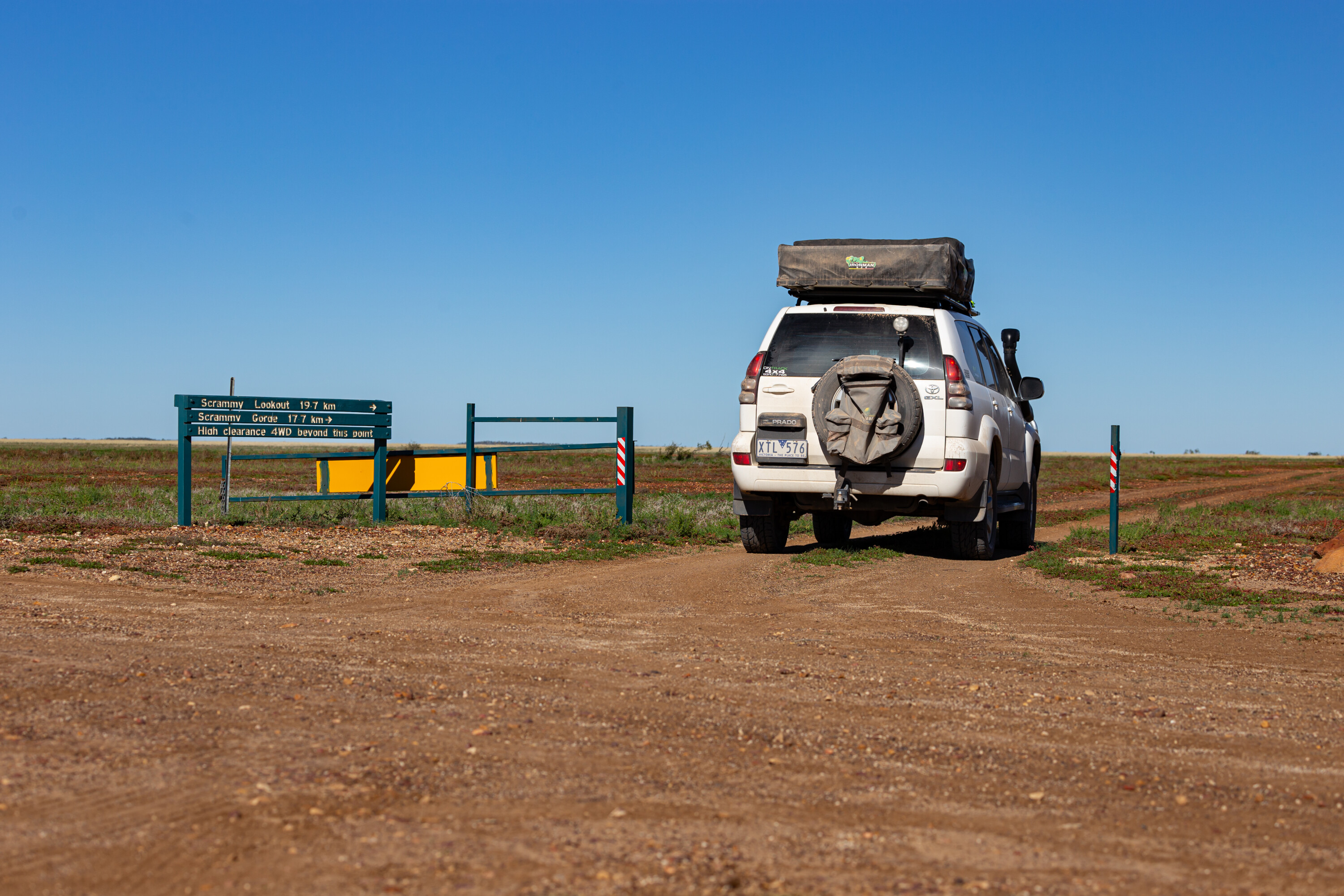
One of the best 4WD tracks in the outback is the 40km return Scrammy Drive. Scrammy was a roustabout on the property who sadly drowned while camped on the jump-up.
This circuit takes you across the flood plains, past the old racecourse and the lonely grave of a young child before you climb up the jump-up to see the waterhole where Scrammy lost his life.
The gorge named after him, and the lookout across the plains, will leave you breathless.
Essentials
Camping: Bough Shed Hole and Surprise Creek have limited sites, drop toilets and fire pits. Bookings must be made online before arrival.
Closest Town & Facilities: Winton is 17km away, with caravan parks, fuel, shops, and dump point.
Essential items: Food and drinking water, satellite phone or PLB, rubbish bags, insect repellent, sun protection, first-aid and snake bite kits, and torch.
Follow 4X4 Australia on Google
Get more 4x4 news, reviews and gear stories from 4X4 Australia in your Google feeds.

We recommend
-
 Explore QLD
The Burke Developmental Road, Queensland
Tracking the mining routes along the Burke Developmental Road.
-
 Explore
Drive North Queensland: Part 1
Sponsored: Cape York, the Outback, Townsville, The Whitsundays and more
-
 Explore
Drive North Queensland: Part 2
Sponsored: A journey through North Queensland's stunning and diverse attractions