The 2022 Jeep Wrangler and the closely-related Gladiator ute have been updated in the US for the new year, along with the Grand Cherokee L which has yet to be launched in Australia.
While the Wrangler and Gladiator updates mainly bring entry-level variants into line with specifications already offered in Australia, Jeep has introduced a 100:1 crawl ratio for the five-door Wrangler Rubicon – up from an already-impressive 77.2:1 offered across the range.
The change is thanks to a shorter 4.88 axle ratio, helping to improve the model’s off-road capability. The change will be applied to vehicles fitted with manual transmissions initially, with automatic cars to follow.
Both the Wrangler and Gladiator have also received a new cabin filter for the US market, which is said to remove 95 per cent of particulates in the air.

There’s no word yet on when the Grand Cherokee L will be arriving, with the all-new model originally slated for an Australian launch in late 2021 – but the SUV has already received an update in North America, with a passenger-side touchscreen being added to its options list, while second-row passengers will now enjoy dual 10.1-inch displays.
In late December, leaked information showed Jeep is preparing to drop both the 3.6-litre Pentastar V6 and 5.4-litre Hemi V8 in favour of a new 3.0-litre twin-turbo inline-six engine, though the carmaker hasn’t officially announced anything at this stage.
Jeep has made some changes to the exterior colour palettes across its range, but no timeline has been given for Australian-delivered cars to receive the minor updates.
Back in 2020, a team of photojournalists released a book simply titled, The Mallee, which beautifully captured the people and places within this region of north-west Victoria. We were so impressed by the book we shared excerpts of it in our Summer 2020 edition of 4X4 Australia magazine.That same team has shifted its focus south of the Mallee for its latest hardcover book, The Wimmera, and the photographers have raised the bar even higher with this stunning publication.The Wimmera lies south of the Mallee to the central western regions in the south, and it runs between the Goldfields in the east to the South Australian border in the west. Primarily farming country, the Wimmera is a haven for travellers who will be enchanted by its rich history.The book whets your appetite for travel, visiting towns long forgotten since their heyday yet still offering plenty for the visitor. The photographers beautifully capture the places and people that call the Wimmera home; the ageing architecture, welcoming country pubs, friendly faces, and natural scenery.
Travelling from town to town, the book often follows old railway routes, revealing what made the places what they once were and what’s changed in modern times. In some cases, a return to the bush, as people leave the cities to create a better life.While not a real four-wheel drive destination or off-road trek on its own, the Wimmera is still worthy of a visit and stay, either as your destination or on your way to more epic adventures.“The Wimmera is a land full of contrasts,” said author Adam McNicol. “From dryland scrub in the north to stately trees and rolling green hills in the south.
“On our travels we learned about the region’s indigenous history, including the celebrated cricket team that toured England in the 1860s. We met fifth and sixth generation farmers and so many people who are proud to call the Wimmera home.”The book has us wanting to get out to explore the Wimmera and western Victoria again, and we’re sure it will have the same effect on you.The Wimmera – A journey through western Victoria is a 243-page hardcover book selling for $59.99 from Ten Bag Press, where you’ll also find The Mallee book. The two books are also available as a boxed set and will make an awesome Christmas gift for anyone who enjoys travel, photography and great yarns.
AVAILABLE FROM: www.tenbagpress.com.au RRP: $59.99 WHAT WE SAY: A beautifully curated book that urges you to get out and explore the region.
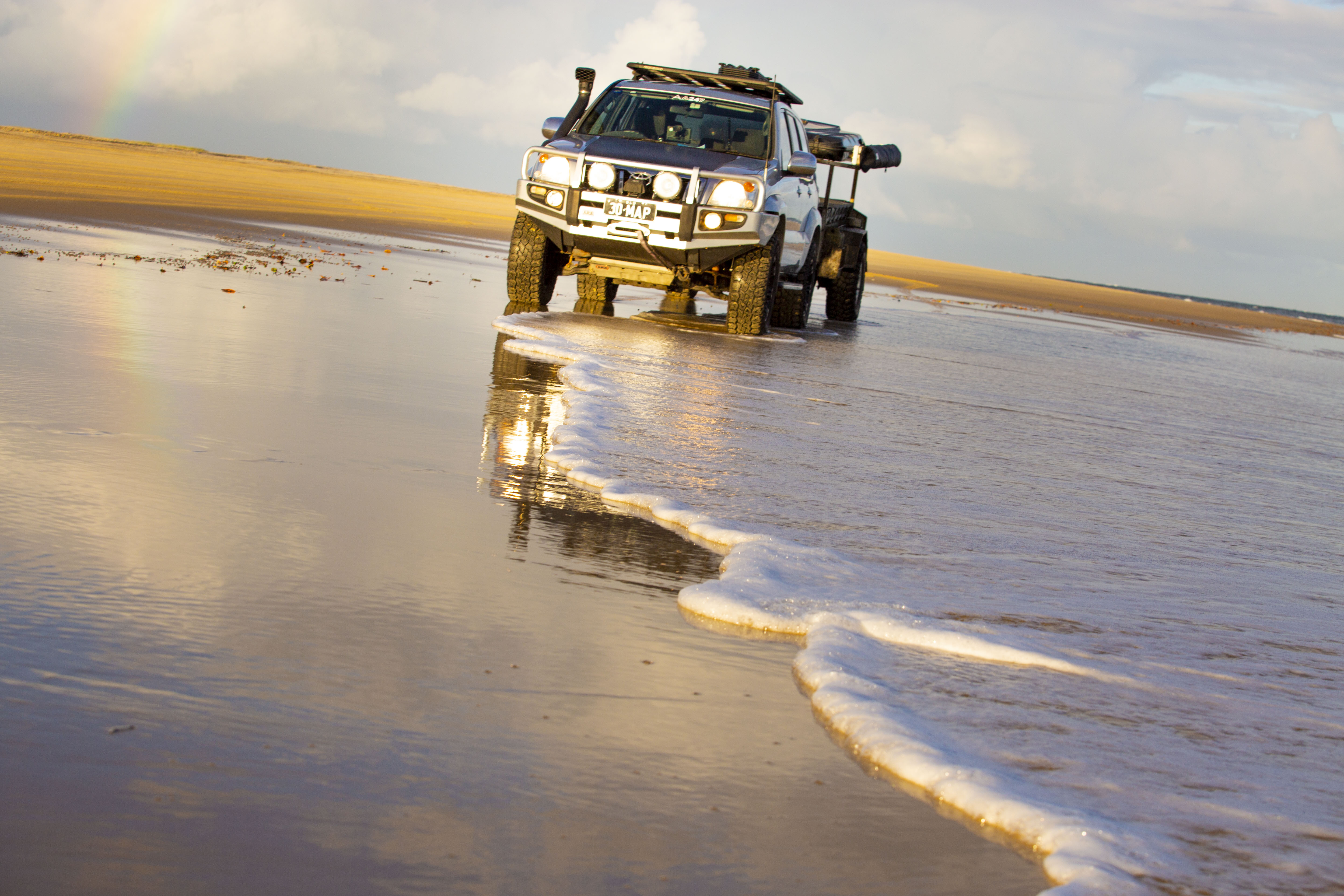
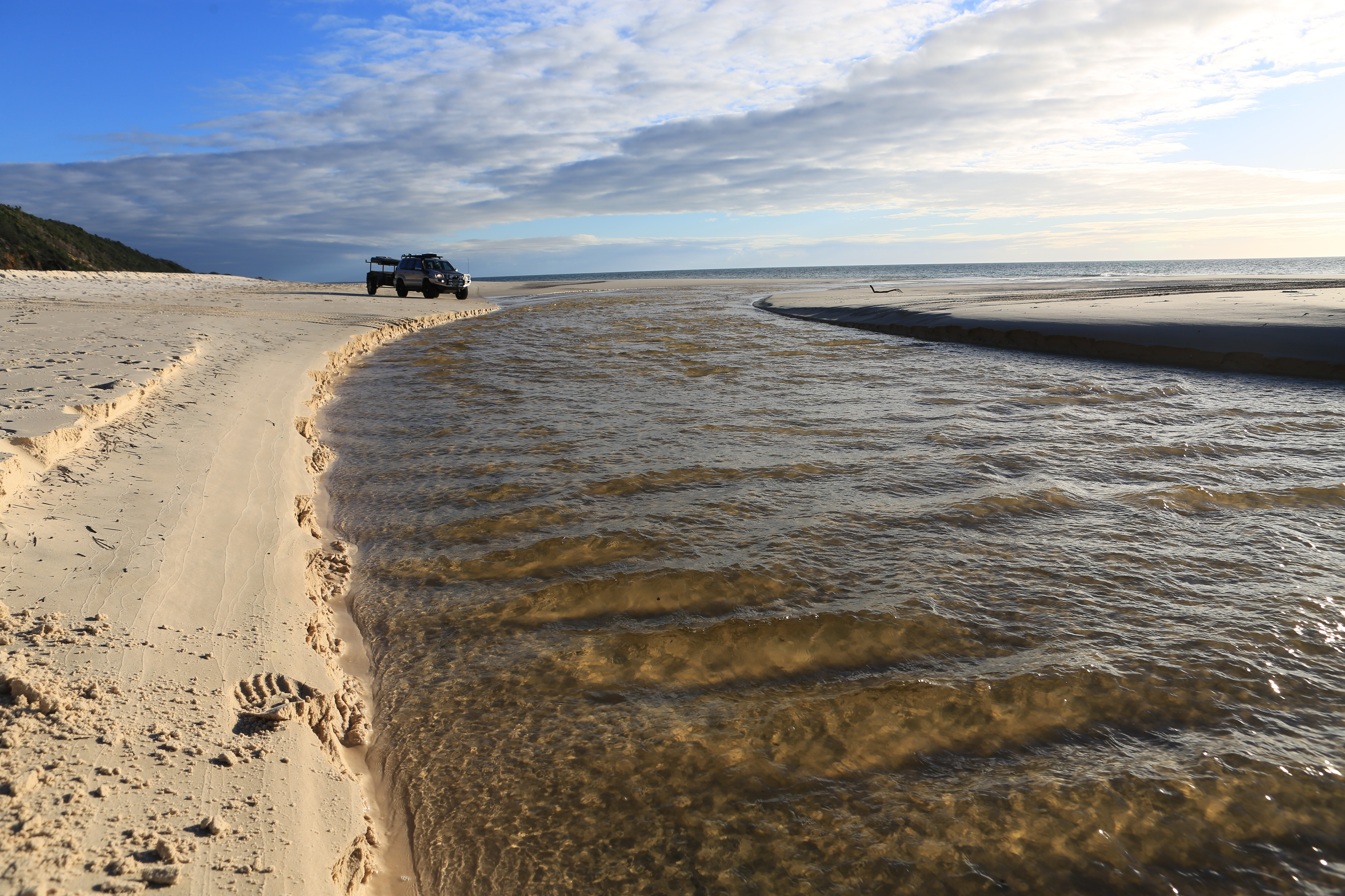
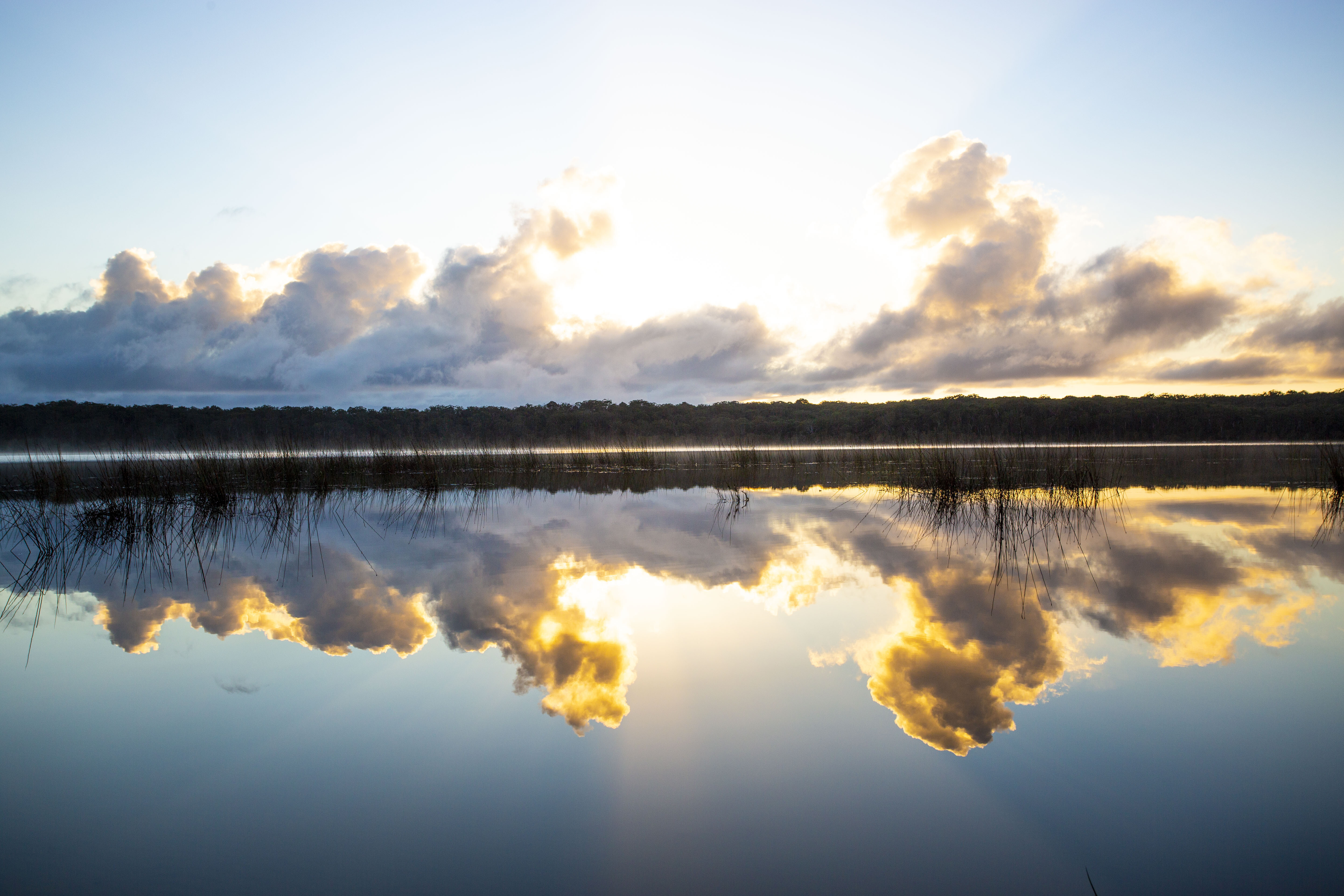
It was the week of my fiftieth birthday. Like me, our crude but simple camping set-up had been sitting idle and collecting dust for too long. The Prado was running a little rough and it, too, needed some fresh air and an escape from all the mask-wearing and talk of lockdowns. A week at Fraser Island (K’gari) was the ticket for us both.Quite literally, K’gari means ‘paradise’ to the Butchulla people, but given all I’d seen and heard on the news last year, would it now be a ‘paradise lost’? Would the lush rainforest, majestic trees and clean and vibrant landscapes be a scorched and distant memory? There was only one way to find out.
CAMPFIRE CHAOS
On October 14, 2020, four beachside campers north of Orchid Beach failed to extinguish their sand-covered but still-smouldering campfire, triggering an 870km² bushfire that ravaged over half the World Heritage-listed island.
It kept airborne and ground-based fire crews busy defending forest and homes for more than six weeks, before several rain events in early December finally extinguished the blaze. Both Kingfisher and Happy Valley communities were evacuated as the fires threatened beach houses and resort communities.
In many eastern beach areas, the fires burned to the shoreline, and most of the northern and western heathlands, swamps and forests were completely burned.
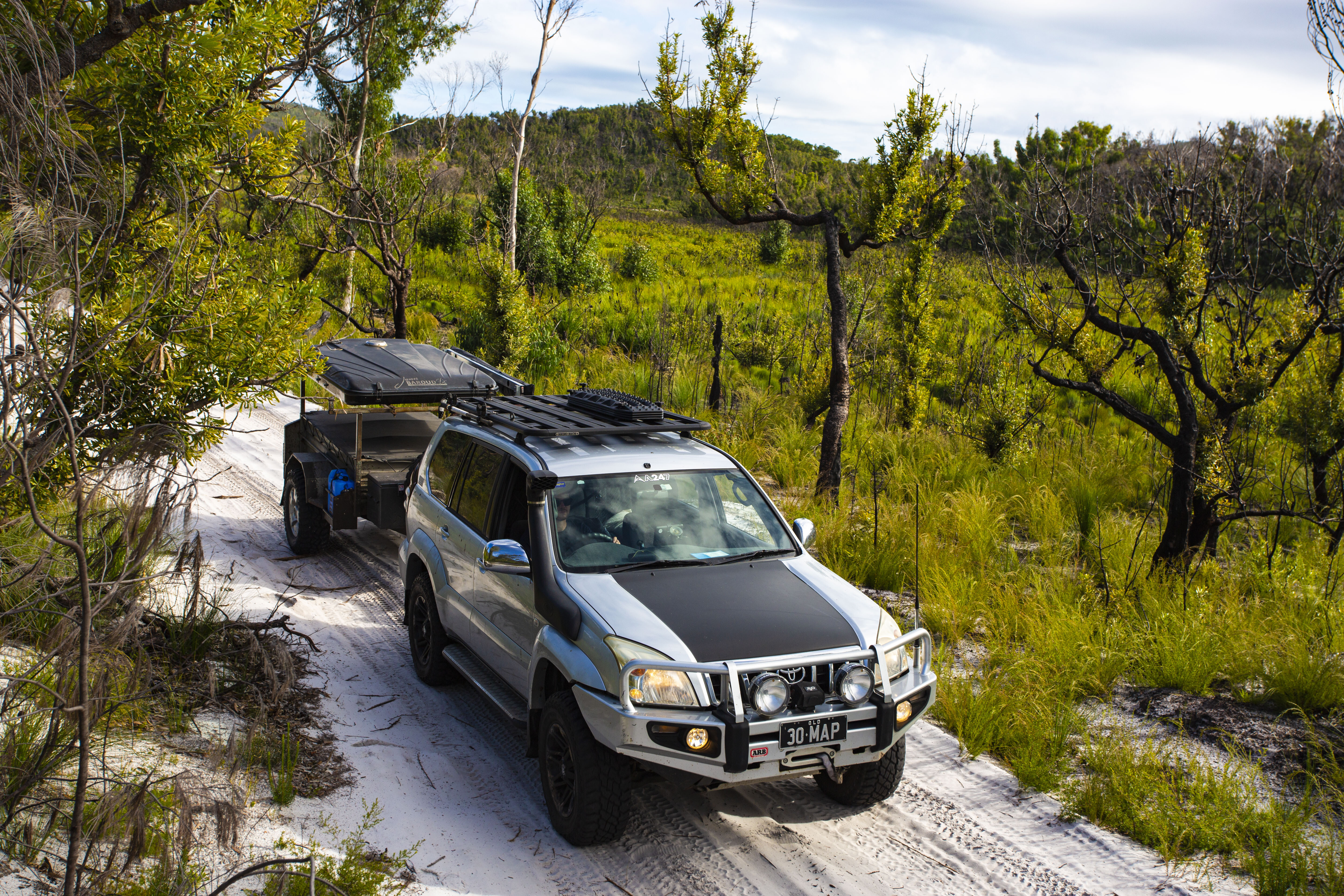
I caught a late afternoon ferry via Inskip Point and camped at Lake Boomanjin. After watching the sunrise across the lake’s tranquil waters, I explored its forested shoreline looking for evidence of the fires.
There were occasional blackened buttresses beneath the lush green, but it seemed the fire had been more cleansing than damaging here, burning slowly and only through the undergrowth. I headed north along the Southern Lakes Drive, one of my favourite forested drives, unsure what devastation may lie ahead.
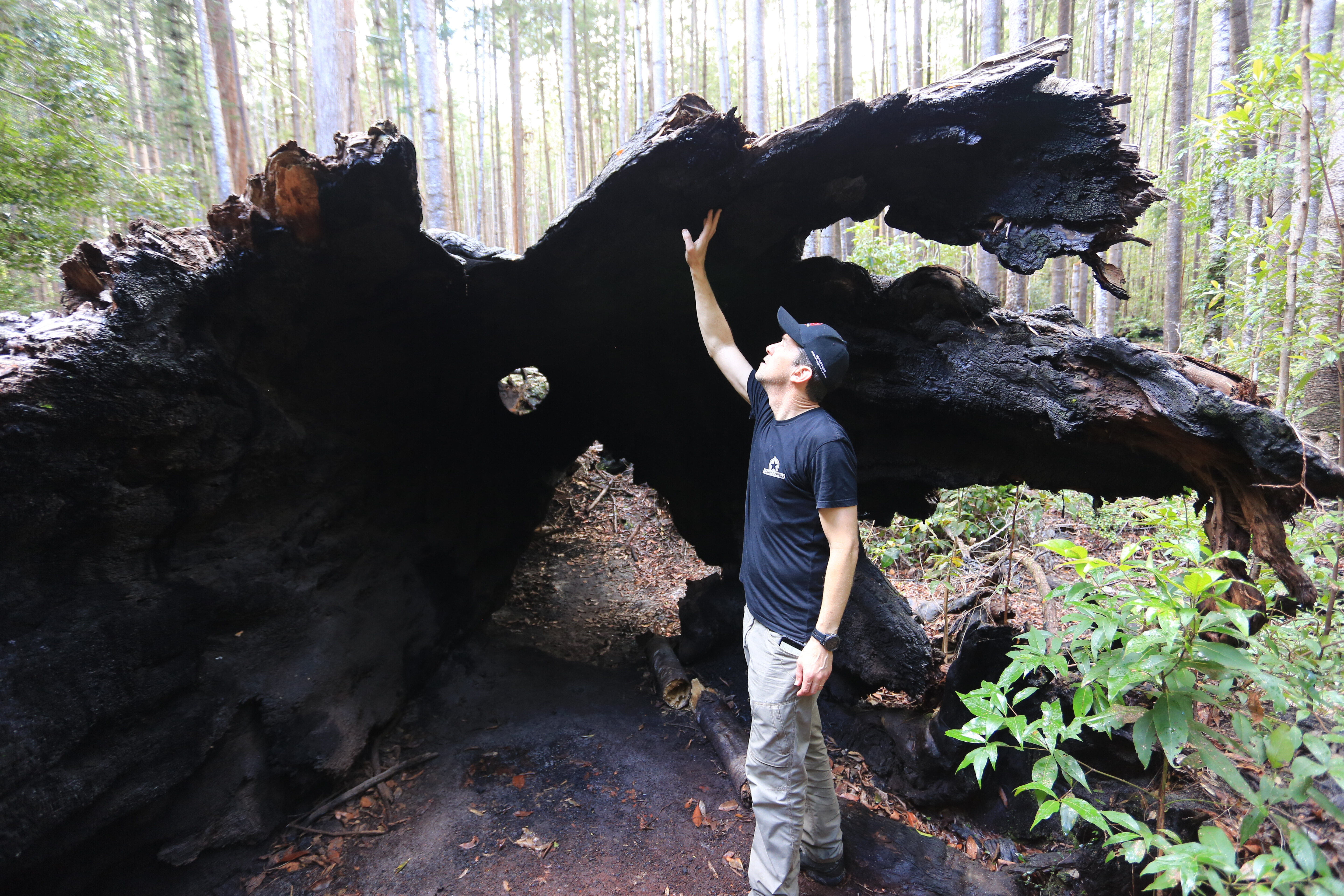
Just a few kilometres south of Central Station, I rounded the bend and stopped suddenly – my worst fears realised. I could still hear the echo of the thunderous crash as this once majestic forest giant was murderously slain by the licking flames.
Its death had been torturously slow, its innards were burnt to a hollow core and the melting roots could no longer point it skywards. After days of torturous smouldering, it had finally submitted to its fate. The now decaying body will feed a new generation of giants, and the freshly punctured canopy will flood in light for the new life.
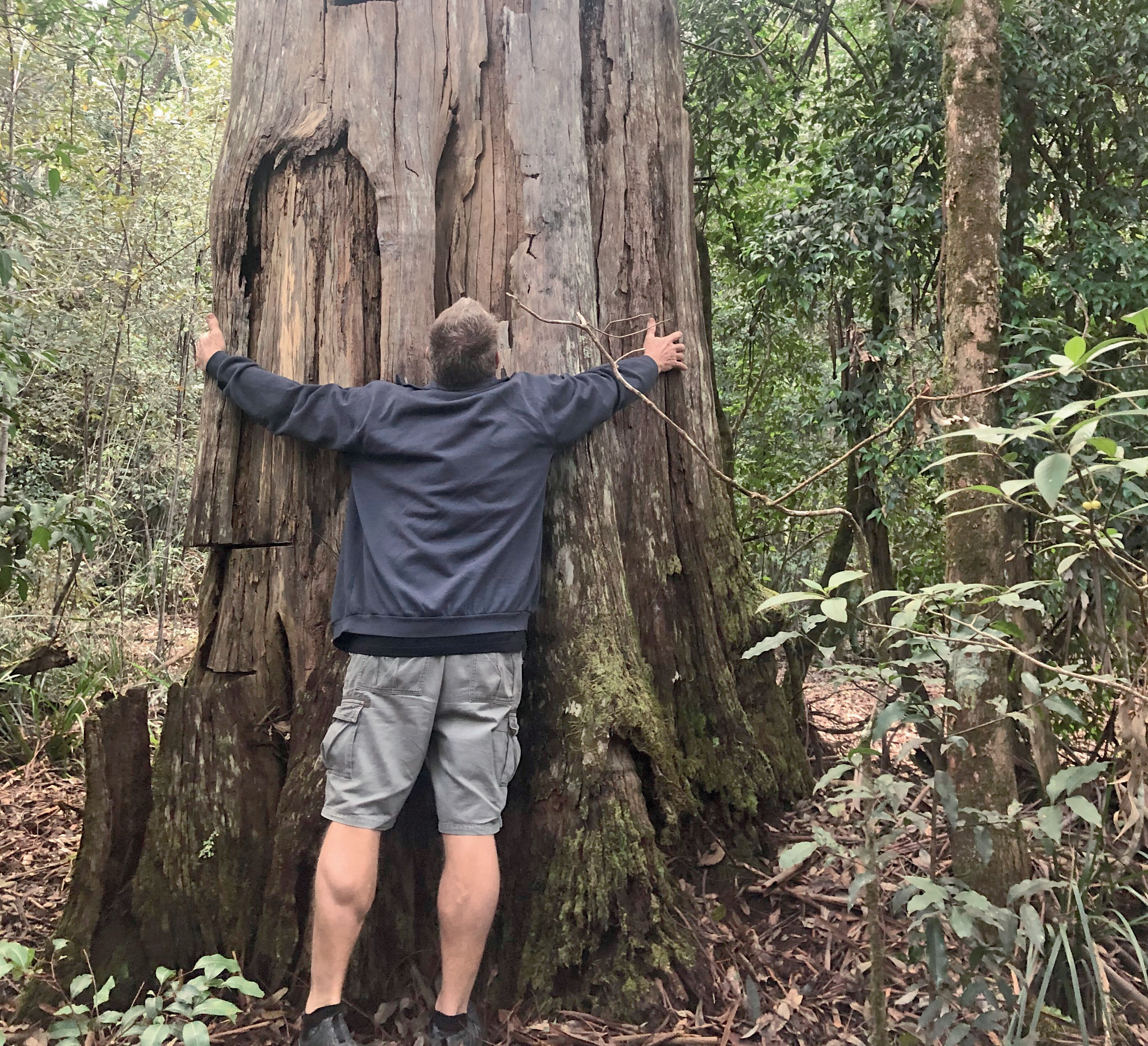
The fire had cleared out the surrounding undergrowth, revealing the thousands of hoop pines planted back in the 1930s. Most had lay hidden for decades beyond the trackside rainforest understorey. Many were snapped like matchsticks and crumpled by the falling giant. With a laid-down diameter of 2.5 metres, it would have taken a whole family to hug the near eight-metre girth.I stood deep inside the buttress and walked a good 30 metres along the hollowed and lifeless trunk. My ‘moment’s silence’ complete and thankful that only the frailest and near-dead trees had been felled by the fire, I pushed on anxiously, still worried for the mass-destruction ahead.
GETTING THERE
Vehicle ferry access is via Inskip Point (mantarayfraserislandbarge.com.au) or River Heads (fraserislandferry.com.au). Cost is around $200 return for a 4WD and trailer.Before you go, be sure to book your vehicle and camping permits online through the Queensland DES website: parks.des.qld.gov.au/parks/kgari-fraser/camping.
See the Great Sandy Marine Park Visitor Guide for info on recreational fishing regulations and Green Zones: parks.des.qld.gov.auBest Map: Hema’s Fraser Island printed map is the best for outlining all the beach camping zones; as is the older Hema Maps or Hema Explorer app, which still include this map.
VERDANT OASIS
I cautiously turned in to the Central Station campsite. It was still green, lush and mossy with an assortment of quality, vacant sites. This shady haven had escaped the flames, as had most of the central rainforest.’
The relentless work of the fire crews had held back the pressing destruction, using the tracks as a fire break and sacrificially backburning as needed. Central Station, the Wanggoolba Creek boardwalk and Lake McKenzie were all kept safe.Much relieved and knowing the dropping tide would mean an easy afternoon run along Seventy-Five Mile beach, I swung east towards Eurong, grabbed a tasty pie and coffee and headed north to find a scenic beach campsite.
My good mate, Scotty, was flying in the next day, touching down on the beach at dawn. I’d have to wait until morning to venture deeper north and farther through the forest. Sadly, the real destruction was still to come.North of Cornwells Road, the fires had been much hotter and burned relentlessly throughout most of the central and northern parts of the island. The taller and wetter parts had fared better, but the fires had ripped through the open hillsides, consuming everything in their destructive path.
The ‘road closed’ sign at The Valley of the Giants turnoff was an ominous indicator of what lay beyond. We navigated 60km north along the maze of inland trails, following Northern Road for the most part, and criss-crossing Postans, Bogimbah, Moon Point, Bullock and Woralie Roads.
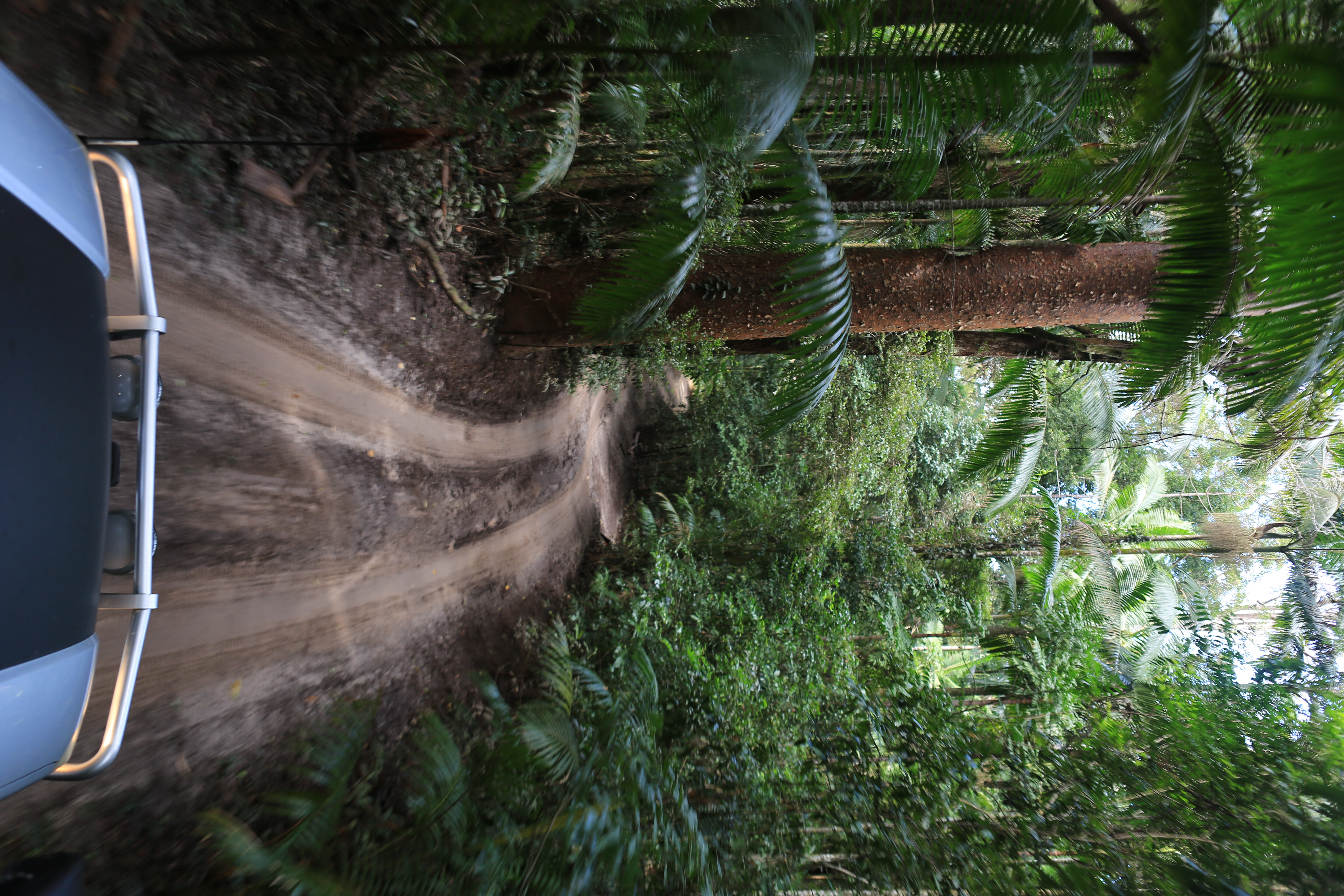
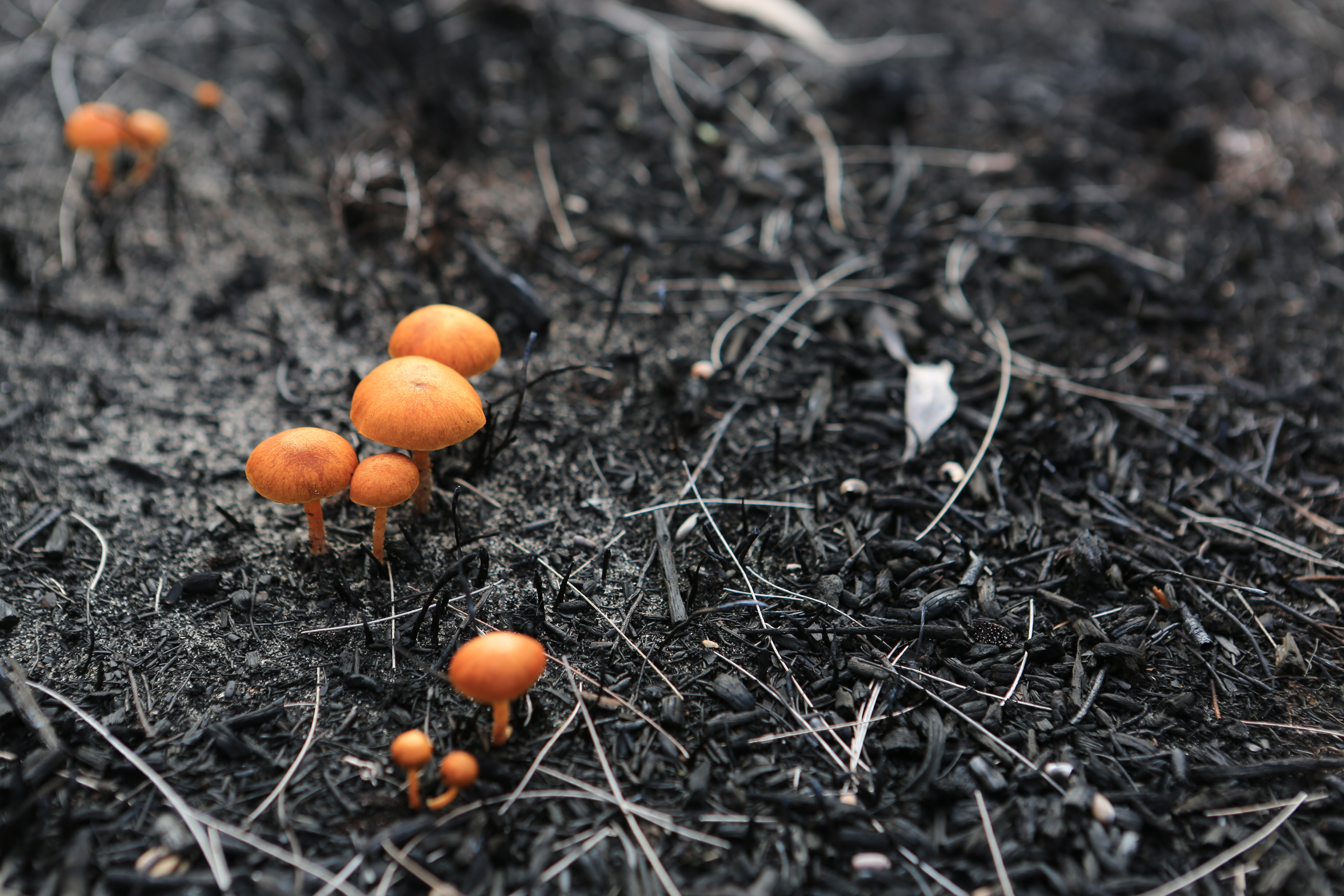
The farther north we went, the blacker the trunks became – even the swamps and grasslands had not escaped the inferno. The December rains had done more than just extinguish the flames. Every blackened branch was now awash with fluorescent, new life. Hellfire had tried to rob K’gari of her paradise beauty, but her radiance was returning in dramatic fashion. The contrast of vibrant green on charcoal black was truly remarkable.I’m amazed at the way Australia’s native vegetation naturally recovers after a devastating bushfire, and the variety of ways it does so. The still-golden scribbly gums seemed immune to the heat, but a closer looked revealed their bases were surrounded by layers of shed, burnt bark.
The woody banksia fruits had burst open with seed, relying on the heat to trigger their germination. The black, ash-laden swamp floor was now littered with tiny, flame-orange mushrooms, releasing rich essential nutrients back into the soil. The once-burnt bracken and grasstrees now exploded with a celebration of fresh green.
Confident that K’gari was on the road to recovery, we pushed on to the beautiful west coast beaches and set up the swags right on the beach.
Well-protected from the south-easterlies, K’gari’s west coast is the perfect place to turn off your phone, take off your watch and take in every second of the sunset as it melts into the sky-blue water. Watch for whales in the winter months or just silently explore the pure white beach and intimate tidal creeks for endless hours or even days.
FIRE BAN
Be sure to bring a gas stove, as for now, and likely permanently, no more fires are permitted on K’gari. She may not recover so easily next time.
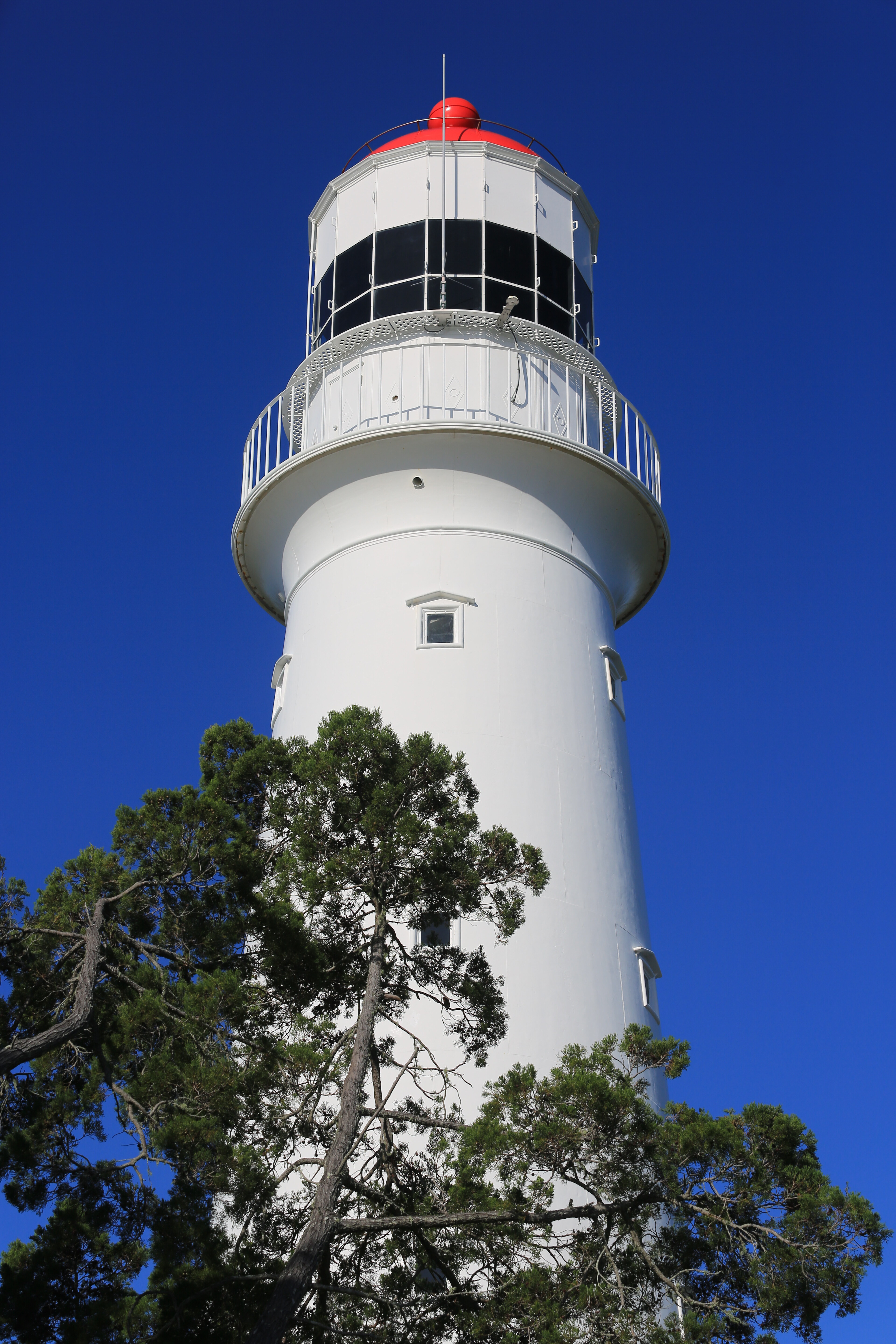
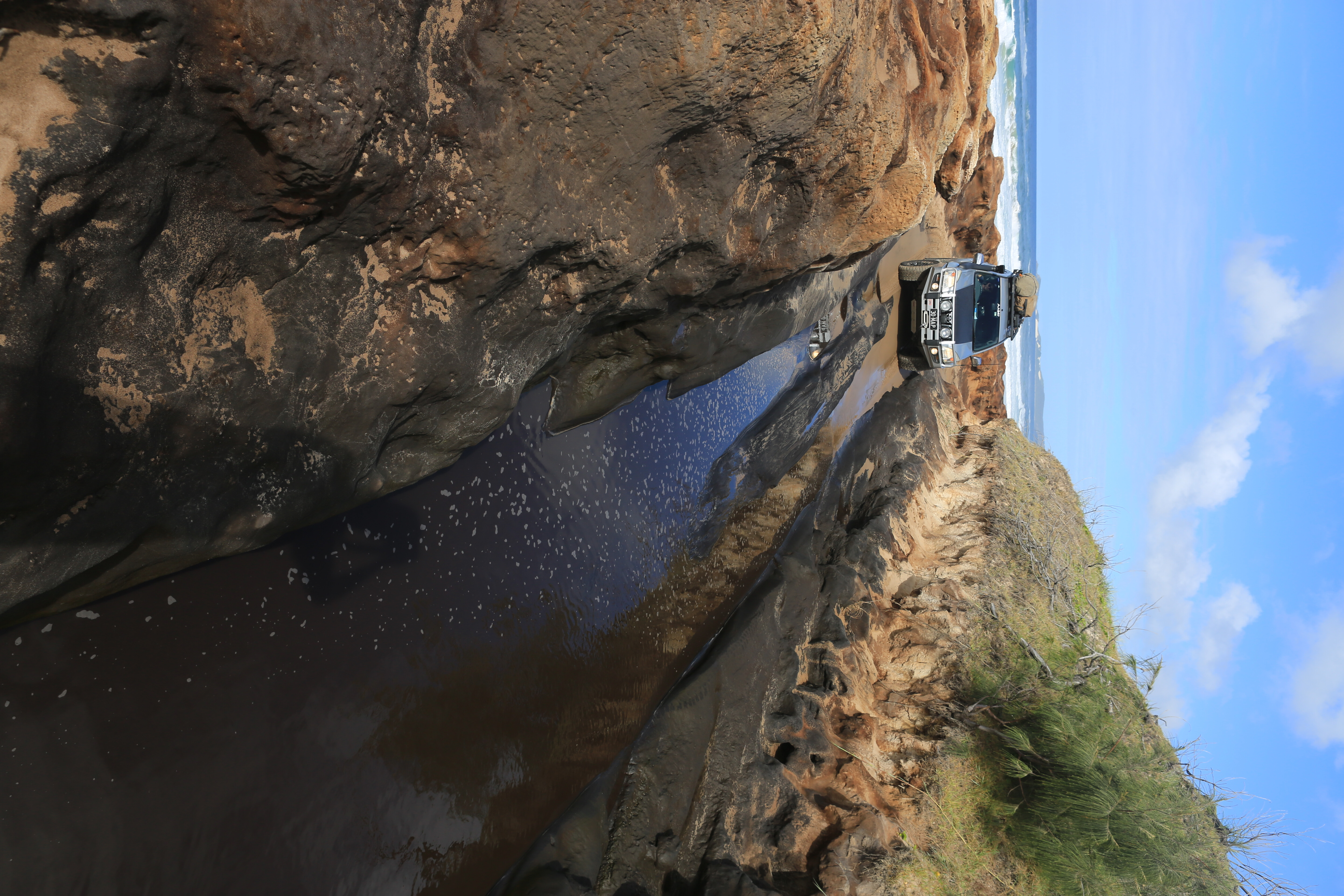
With an early start on our fourth day, we were soon past Indian Head and watching the humpback whales from the Champagne Pools boardwalk, before navigating the northern gateway of Ngkala Rocks. We made short work of the cavern through the coffee rock and the soft sandy bypass, before rounding Sandy Cape and heading west towards the lighthouse.Sandy Cape Lighthouse has long intrigued me. Built in 1870, this 33-metre tall lighthouse is mounted on a 130-metre hill but set kilometres back from the shoreline. The rocky outcrops of Indian Head and Waddy Point always seem more obvious dangers for passing ships.
But the near and present danger in these seemingly sublime waters is the submerged and sandy isthmus of Breaksea Spit, stretching 35km north from Sandy Cape and now the buried graveyard of several century-old ships.
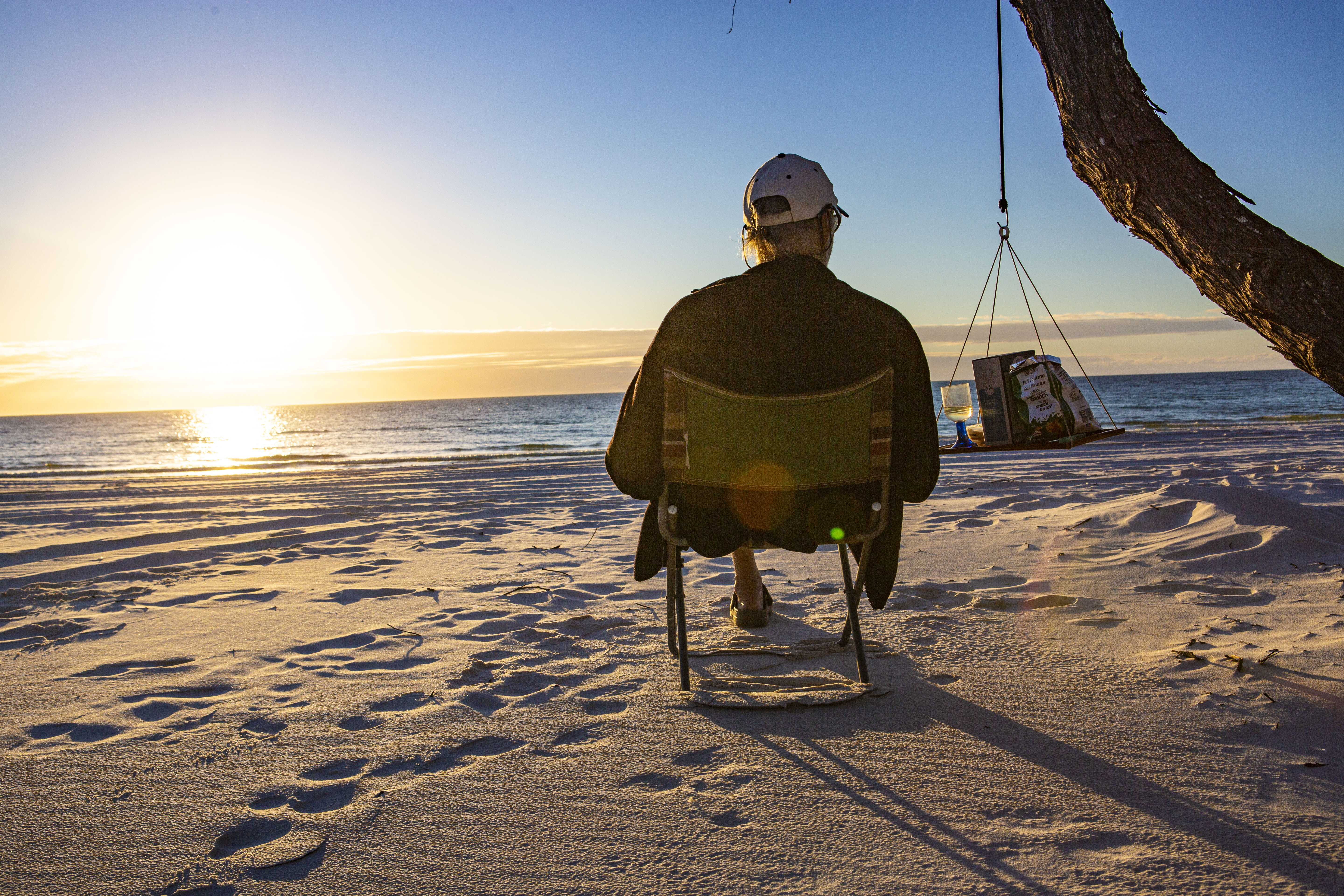
Sandy Cape is one of my favourite places on Fraser Island. I love the meeting of calm and turbulent waters, the sweeping tides, resting sea birds, and the clash of colliding currents and winds. Well before sunset, we pulled out the chairs and the ‘fivesies’ and watched this glorious day slowly end. Cameras down, we soaked in the last warm rays of the setting sun as it melted into the sea.
CAMPING SPOTS
While the remote, far northern campsites of Sandy Cape are a long-time favourite of mine, they’re fast becoming overused. This trip, I rediscovered the tranquillity of Fraser’s west-coast campsites, tucked in amongst the sheoaks, just metres from the high-water mark and atop the sandy shore.There are five fantastic west-coast bush campsites between Moon Point and Wathumba Creek including Coongul, Woralie, Bowarrady, Awinya and Bowal Creeks. You’ll need to be completely self-sufficient with your own water, food and fuel. No toilets or showers either, so bring a shovel and toilet tent, or even better a portaloo. There’s a small but deep freshwater swimming hole at Bowarrady Creek.
Being the most southern, Coogul Creek is closest to Moon Point and the popular fishing areas of Great Sandy Strait. Woralie Creek is the easiest to access for those with trailers, with some majestic but exposed campsites right near the track terminus. For a shady site beside a deep and fresh waterhole, it’s hard to go past Bowarrady Creek – but with only three main sites, it’s ‘first-in best-rested’.My pick is Awinya Creek, as the sites are spread out right along the beach and tucked in amongst the sheoaks for some welcome shade. But the access via Awinya Road gets rough and difficult for trailers and has a tidal creek crossing at the end, so this site is best suited for tent/vehicle-based camping.
If you really want to be alone, head farther north along the beach to Bowal Creek where you’ll likely have the place to yourself (well, at least until everyone else reads this article).
Numbers are well-managed, so be sure to book ahead. Small camper trailers are permitted at all sites but beware of the soft sand on the western beach, check the tides first and lower your tyres to less than 20psi. Summer months will likely bring mossies and sandflies, so winter and spring seasons are the best time here.The morning of my fiftieth birthday, I rose early to catch the sunrise and walked along the beach pondering the next decade of life. Scotty had made me a fresh, hand-ground coffee. We had the full length of the beach to drive, lunch at a mate’s place at Rainbow Beach and my own family celebration to head home to. My next chapter of life was looking good already!
FRASER’S BEST FOREST DRIVES
SOUTHERN LAKES DRIVE: Beyond the well-trodden central forest roads connecting Kingfisher and Eurong via Lake McKenzie and Central Station, there are several fantastic and lesser-used trails. An old favourite is the Southern Lakes Road (29km, three to four hours) which leaves the Eastern Beach near Dilli Village and twists its way through the southern heathlands, swamps and forests, kissing the peaceful shores of Lakes Boomanjin and Birrabeen and meandering on to Central Station amongst the giant satinays, brushbox and hoop pines of the central forests.WORALIE ROAD: Farther north, Woralie Road (21km, two to four hours) provides easy access from Maheno Beach through lush rainforest, swamps and ridgetop woodlands, and on to the gorgeous west-coast beaches overlooking Hervey Bay. For a full cross-section of this beautiful landscape, head north along the western beach to Awinya Creek and return via Awinya Road.
FIVE THINGS TO SEE
1. CENTRAL LAKES There are a mix of fantastic pristine freshwater lakes on K’gari that are perfect for a cooling dip. Boorangoora (Lake McKenzie) in particular, has crystal blue water fringed by brilliant white sand.2. THE MAHENO Driving the eastern ocean beach, the wreck of the SS Maheno is an interesting and popular tourist attraction. The former trans-Tasman liner was steaming north to a ship-breaker’s yard in Japan when a cyclone washed her ashore in 1935.3. CHAMPAGNE POOLS These volcanic rock outcrops create ocean-level pools that are best at mid-tide when breaking waves cascade champagne-like into the protected pools for a refreshing and safe dip. The Champagne Pools boardwalk is on the Eastern Beach scenic drive.4. VALLEY OF THE GIANTS For serious hikers, take the 90km one-way Fraser Island Great Walk. A highlight is the Valley of the Giants walkers’ campsite where you can set up camp and spend a night or two among the massive tallowwood and 1000-year-old towering satinay trees.5. WHALE WATCHING The calm waters of Platypus Bay, on the island’s western side, are a prime whale-watching spot. On their spring migration south, humpback whales stop to rest and tend to their calves in Hervey Bay.
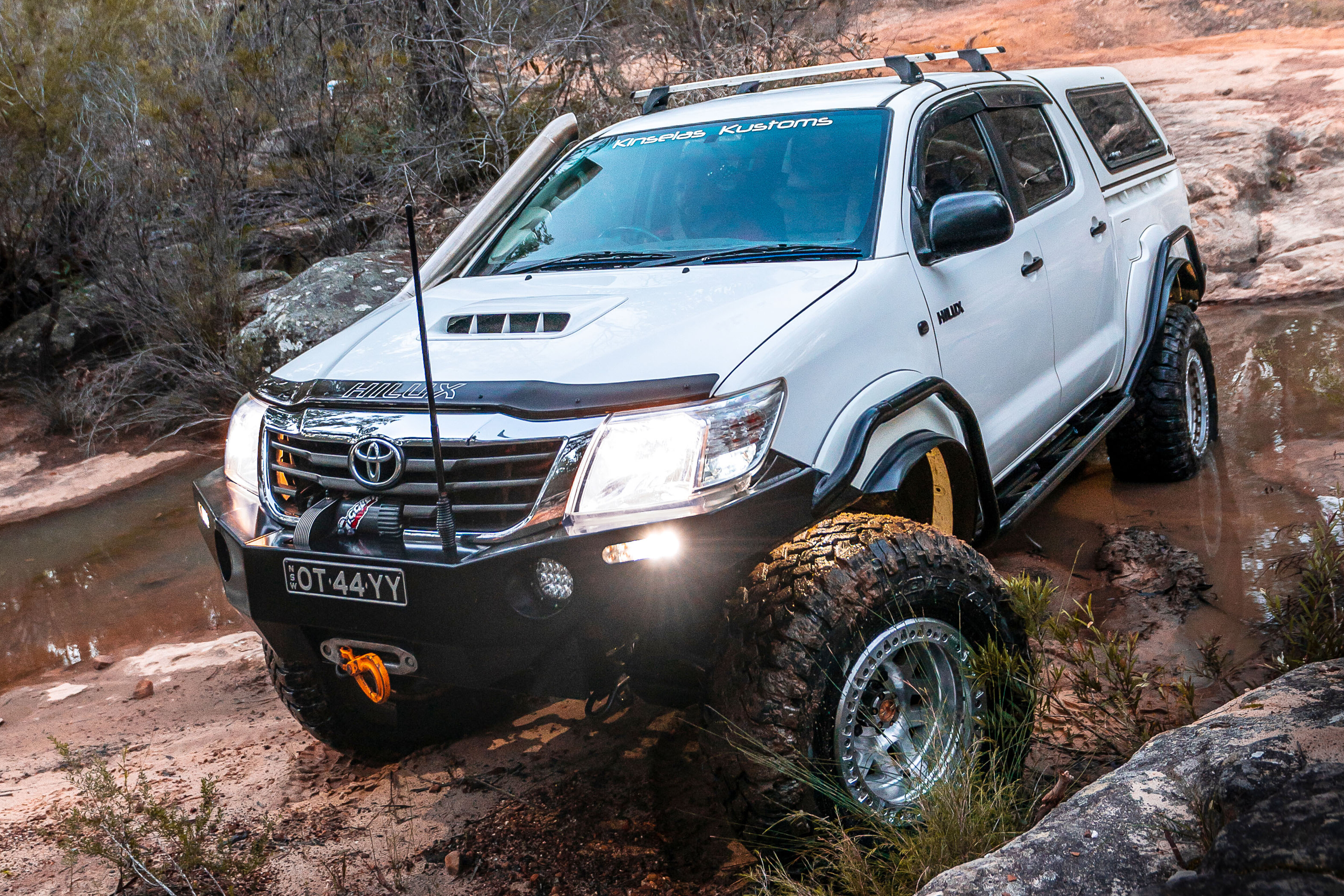
Tidy 79 Series LandCruiser heralds in the latest batch of reader-submitted 4x4s. Get involved by posting a photo of your vehicle on our Facebook page – it could even end up in the mag.
2014 TOYOTA LANDCRUISER VDJ79
It has a factory tray with custom tool boxes and a home-made fridge slide. Other gear includes a two-inch Ultimate suspension lift; Superior Engineering U Bolt plates; LED spotties on an ARB bullbar; a light bar on the roof; Ironman winch; Rhino-Rack; Motop rooftop tent; and King alloy wheels to correct the wheel track. It’s stock as a rock inside, bar an amp, two eight-inch slimline subs and Black Duck seat covers – Todd Hore
2015 FORD EVEREST TREND
There’s not a whole lot to tell just yet. It has an Armax snorkel; double transmission cooler; Redarc Tow-Pro; Titan drawers; home-made platform; and some basic add-ons on the outside. It’s my dream car. This pic was taken at Point Quobba, Western Australia – David Lane
2018 VW AMAROK
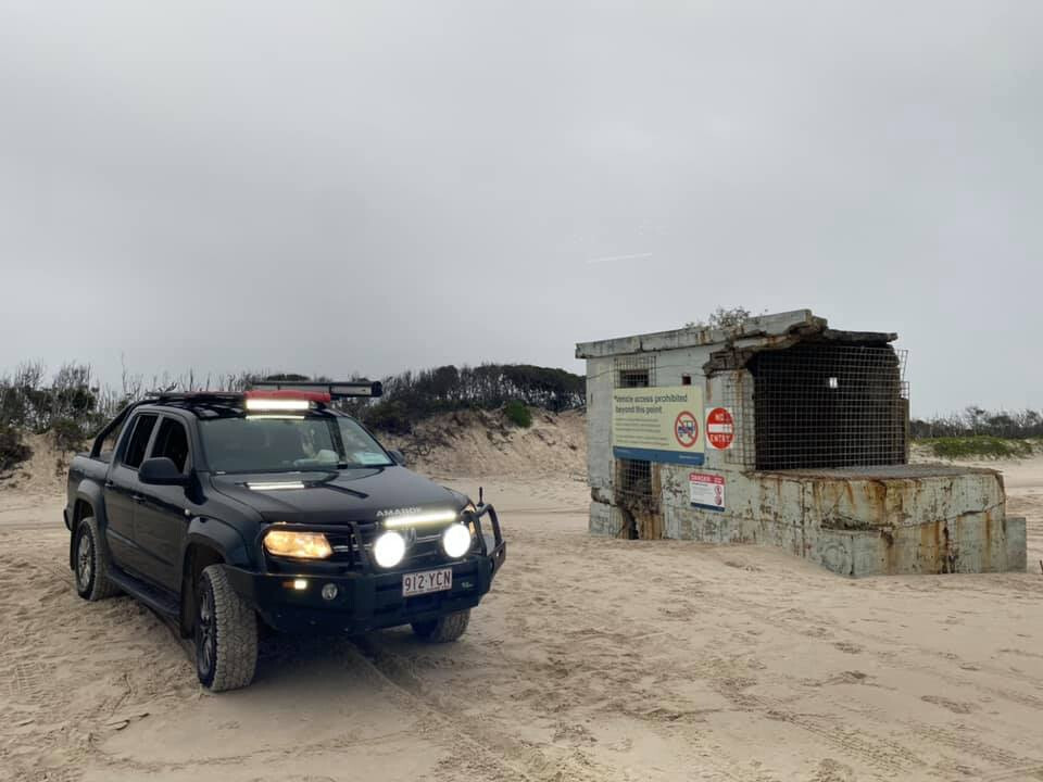
Despite being the four-cylinder, it is great on the sand and my daughter loves it when I take her to Bribie Island on weekends. It has an Ironman bullbar; Pedders two-inch Trackrider shocks and springs (front and back); a catch can; Rhino roof rack with mounted LED light bars on the front and rear; Kings awning; front LED lighting; and eBay-bought side-steps – Jonathan Hropic
2014 FORD RANGER
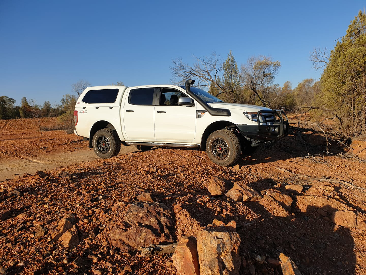
My Ranger is set up nicely for travelling around Australia. This pic was taken in Central West NSW. It has an ARB 120L long-range tank; OME two-inch lift; ARB diff breathers; Redarc electric brakes; an Engel fridge in the tub; GME UHF; Ironman bullbar with bash plates; Ironman four-inch spotlights; and monster 17-inch rims with 31×10.5 BFG KO2 ATs. The best place I have taken it so far is Hanging Rock, NSW – it has some awesome tracks – Wayne Gray
1999 RANGE ROVER HSE
It’s powered by the 4.6-litre petrol V8 and has a two-inch lift with air suspension; rear diff lock; triple battery set-up; MCC bullbar and TigerZ11 winch; Kaymar rear wheel-mount; and built-in tyre compressor. It has been a reliable, comfortable off-road tourer for us, and it still has many more years left in her – Andrew Kimmer
2019 FORD RANGER XLT
Two of the best spots I’ve taken my Ranger are the Pyrenees Ranges in Victoria, and Robe in SA. Gear fitted includes an ARB bullbar, rails and steps; Old Man Emu BP-51 suspension; Stedi driving lights; GME UHF; and 275/70R18 Maxxis RAZR tyres – Jono Hewitt
Kempsey, on the mid-north coast of NSW, lies at the base of some of the most spectacular 4WDing, camping and viewing points that you might ever come across.When earth had a mighty volcanic upheaval 35 million years ago, it left a host of mountains, peaks and plateaus standing. Weathered down, they point to the sky over 1200m high – and the best part is, most of it is still accessible for us to admire and enjoy.
On the banks of the Macleay River, Kempsey is halfway between Sydney and Brisbane and perfect for an overnight stay – or before heading to the hills for a culture lesson, exploring more of the area that timber-cutters and miners once called home.
There are several combined National Parks in this area that include Carrai, Willi Willi, Oxley Wild Rivers and Cottan-Bimbang, whose geology is from the Carboniferous period – some 400 million years ago – and composed of mudstones, sandstones and conglomerates, allowing for the rich growth that occurs here.
With a maze of nearly 200,000 hectares of valleys, cliffs and rivers, this place is home to the Thunggutti Aboriginal People who, in years gone by, used the rivers and ridges like roads, linking the coast to the higher plateaus towards the New England region.
MACLEAY RIVER
The Macleay River is at the heart of the Kempsey Shire, carving its way from the mountains of the New England Plateau to the sea at South West Rocks. It starts as the Guyra River and merges with a number of tributaries including the Apsley, Chandler and Styx Rivers 100km to the west. These days, Kempsey is a major hub for supplies and fuel, and you need to be self-sufficient on trips into the wilderness.
Heading out of town westward for 20km, turn left to Temagog, which is signposted with a locals’ info board at the corner where you can pick up local chit chat on current conditions in the area – bit like the bushman’s telegraph.When crossing the Macleay River on a fairly new bridge – remnants of the old one can still be seen poking up out of the water – one thing you may notice is just how low this new bridge is; the reason being is to let most debris flow over the top of it to avoid causing structural damage.A little side note for around here is that you’re only at 67m above sea level and it’s hard to imagine that you will soon be around the 1200m mark. It’s a good drive heading to the hills here, as it’s well signposted all the way. The roads that twist and wind their way around this steep country were put in at the turn of the century, when hardy men sought huge red cedar trees from the Macleay’s valleys and plateaus – it’s reported that some of these trees had a circumference of around 30 feet.
There are reports that if the men couldn’t get down into the valley to snig the logs out after being cut, they would winch them over cliffs. Some of the old dozers from the 1950s and ’60s had nearly two miles of steel cable on them for these jobs – try doing that now battling with OH&S.One of the bonuses of travelling on a track that rises so high and so fast are the views, and there are several stops along the way to pull over to admire them. A notable stop is Willi Willi Lookout, where you get a clear view of the rich farmlands below, towards the coast along the Macleay River. In all fairness, this trip does sound like another drive into the hills, but around every corner there is always the chance to see something new, from the shy eastern spotted quoll, Frypan Corner, and even lyre birds darting across the road ahead. Even the quality of the eco systems up here are something to be seen, from thick pockets of rainforest and cool-climate stands of coachwood trees, right down to fragile ferns that cover the ground under the last remaining tall gums.
Following Carrai Road for several kilometres, you come across the intersection with Coachwood Road – this is the old town of Kookaburra. Once an active sawmill, it was a tough life here as the men had to endure snow (we are 1000m above sea level), stifling hot summers and then the remoteness of the camp.
Kookaburra was established in 1946 for harvesting red cedar, rosewood and coachwood from the nearby forests. The mill closed in 1967 and the 30 men employed moved on along with their families. The old school house has been restored and free camping is allowed around the grounds.
‘HIGH COUNTRY’ HUTS
Heading back along Carrai Road, the forests change to thick timbered country with an undergrowth of cool-climate tree ferns. Another 20km along, look out for the old hut which resembles something from the Victorian High Country. This hut has some of the best views you will ever see across the deep gorges, remote peaks and valleys. Owned by the McMillian family for many generations, this area once had orchards and market gardens supplying locals and themselves.
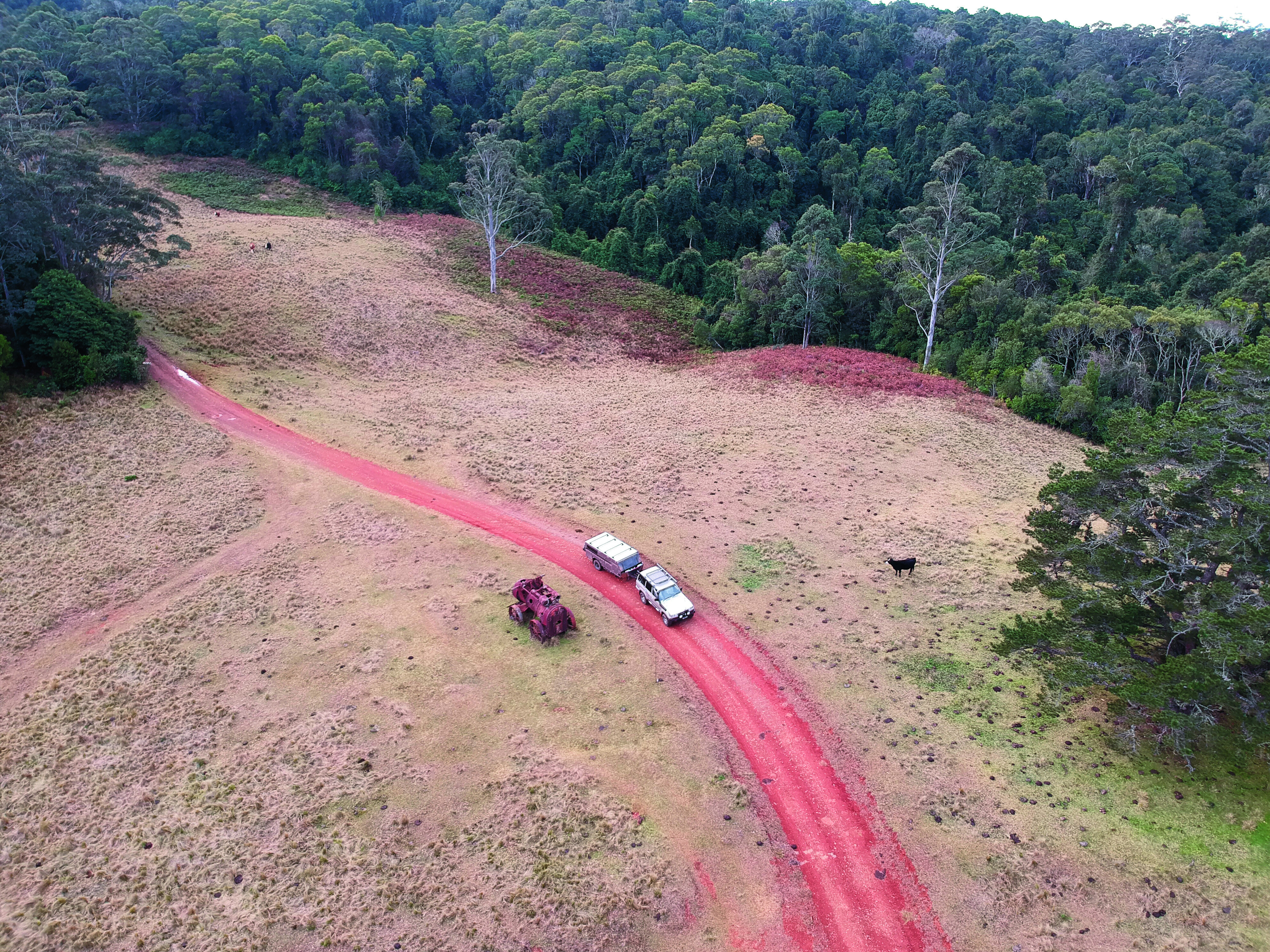
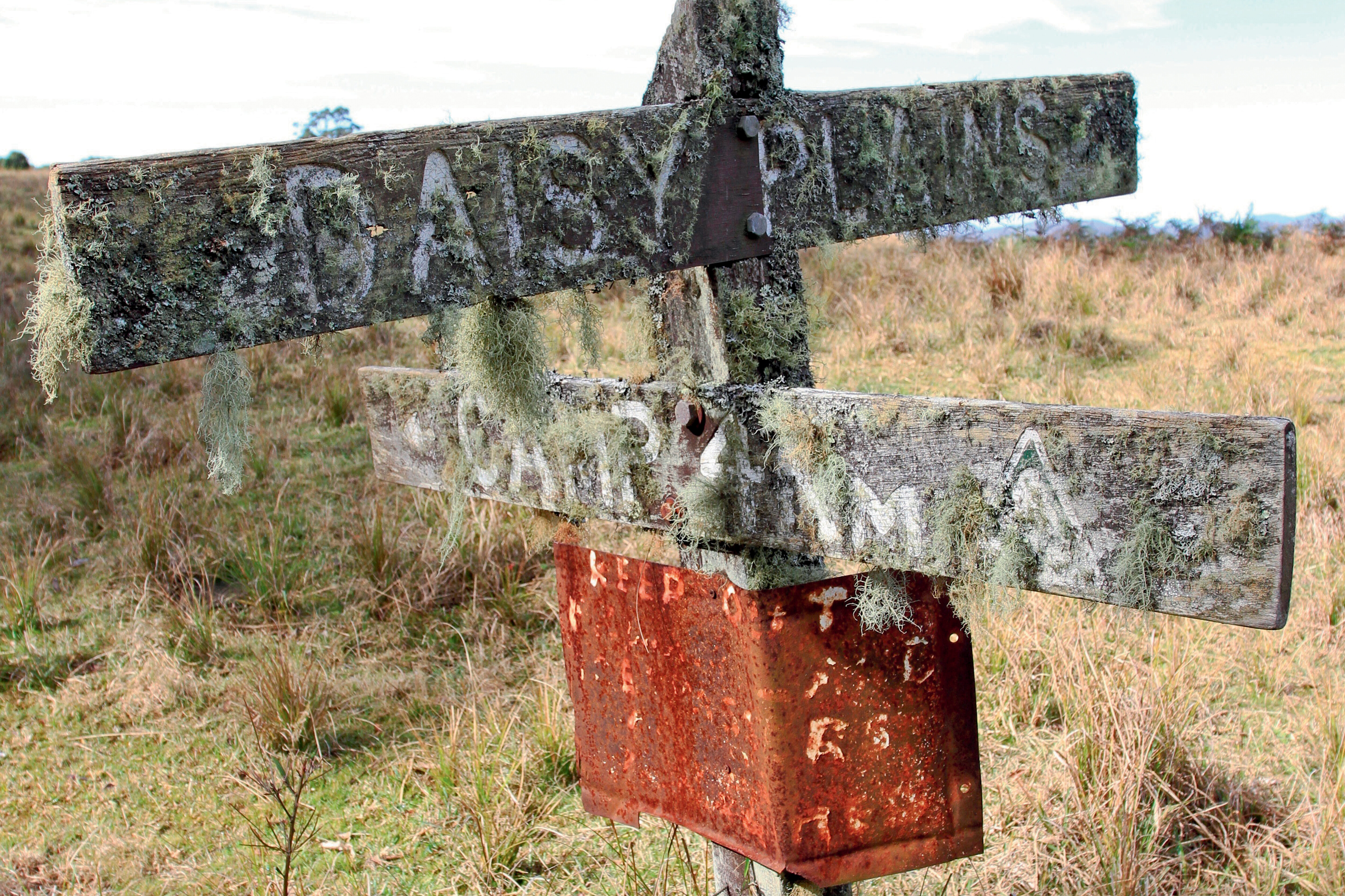
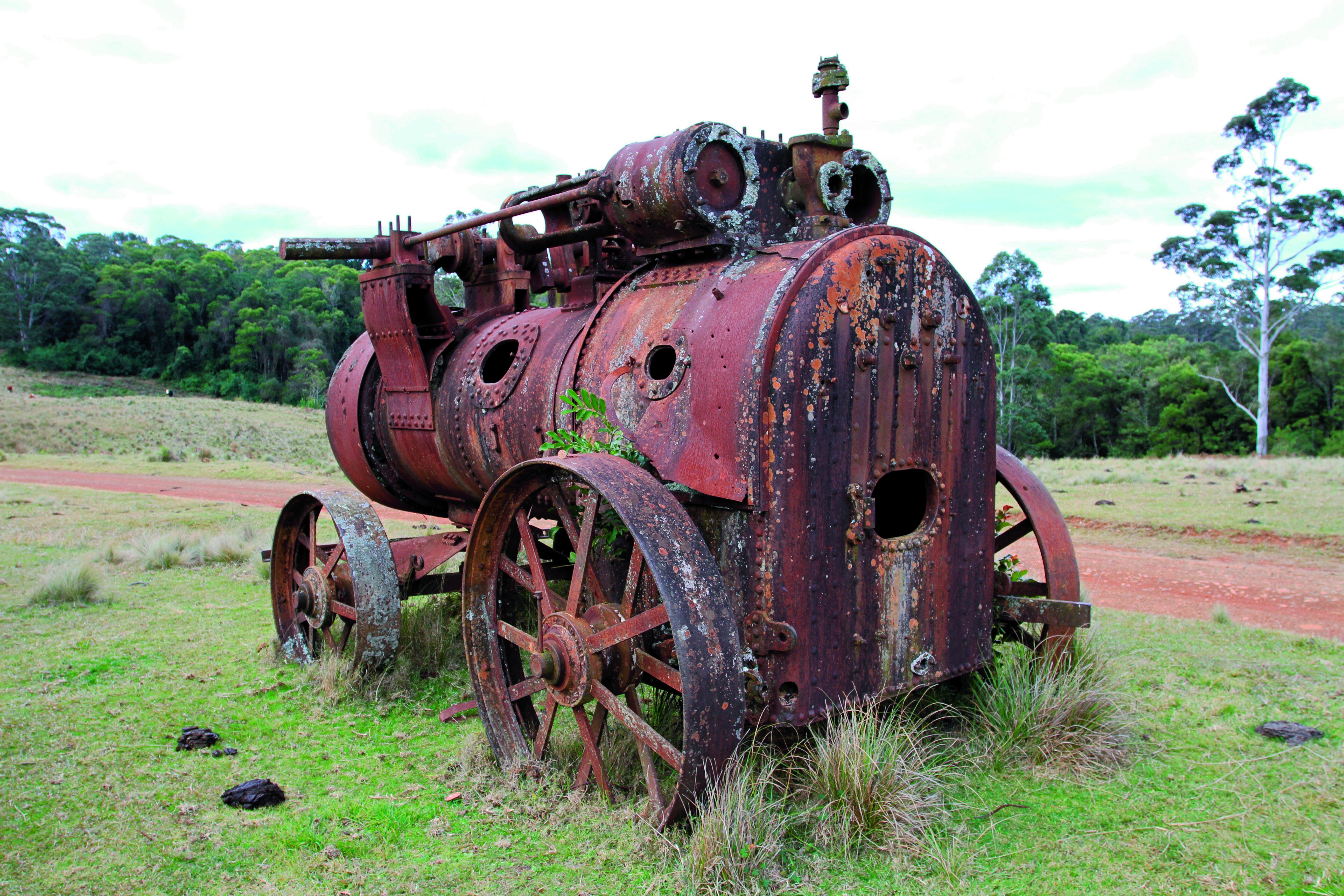
Farther down the road is the site of the Daisy Plains township where the only thing left is the moss-covered sign and a few mining relics. Daisy Plains was once a town where more than 200 residents called home, including miners, timber cutters and families looking for fortunes. A great reminder of the area’s past is the old Ruston Proctor steam engine that sits idle beside the track, as well as other relics including boilers, building foundations and old cattle yards – if it wasn’t for these last remaining pieces, no one would believe there was once a town here where tin and gold was mined.
By now, if you’re after a top camping spot, just 5km along you will encounter what is commonly known as the Daisy Plains Huts. These huts are owned and maintained by National Parks and surprisingly are available to the public to stay at free of charge for as long as a three-week stint. Several huts include a kitchen, sleeping quarters and even a bathroom hut. Access for travellers is on a first-in first-served basis, so don’t be disappointed if there are other groups here. A flushing toilet is a bonus.
The huts have been put in place for the NP workers that frequent the area for park maintenance, to save on the three-hour travel time back to town each day.
The huts have huge grassy areas where camper trailers or tents can be set up and left when exploring the nearby tracks.
MARY’S LOOKOUT
Farther along Carrai Road, a turn to the left will point you down Cochrane Road, where for 35km the trail follows remote farmlands and scrubby timber country towards Mary’s Lookout. At the ‘car park’ it’s a 100m walk to the spectacular viewing area. National Parks has done a great job here installing safety barriers away from the 1000m drop.
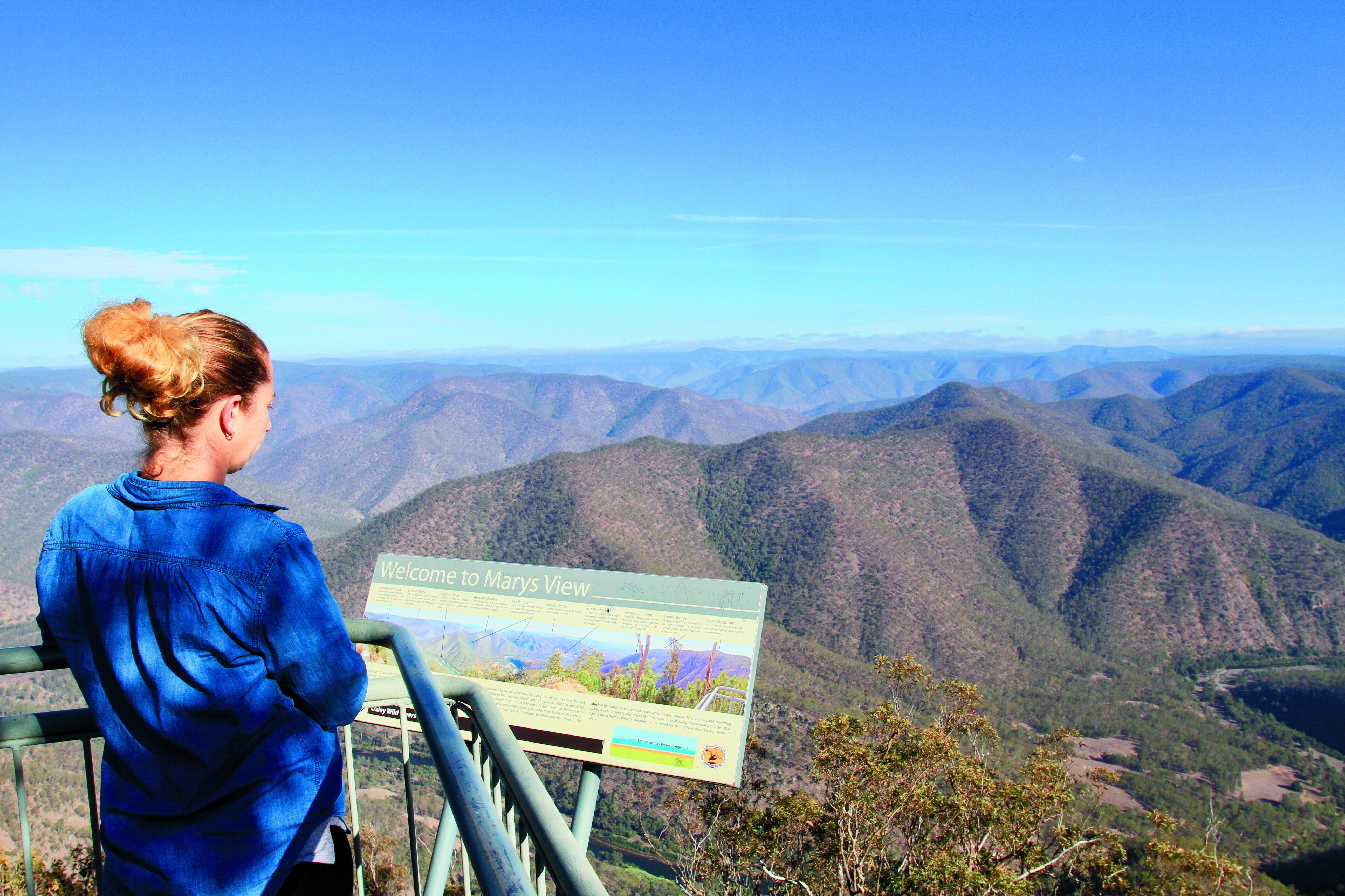
Looking into the wilderness below and the plateaus west, it’s hard to comprehend how the early settlers explored these areas with as little as a bellyful of determination and a handful of pack horses. Way back in 1818, explorer John Oxley passed through the New England Tablelands, opening it up for graziers and timber cutters. Mary’s View was named after Mary Cochrane, the wife of an early settler and logger on the Carrai Plateau.While not a hard drive or extreme area to explore, the Kempsey tablelands are rich in diversity, history and beauty. National Parks has opened up many of the area’s sections so we can explore them to our hearts’ content.
FIVE KEY PLACES:
1. PARKS UNITED A string of five National Parks – Carrai, Willi Willi, Oxley Wild Rivers, Kumbertine and Cottan-Bimbang – are grouped together, draping a massive area of the mountains, ranges and valleys just to the west of Kempsey.2. KEMPSEY Kempsey is the major town of the Macleay River Valley and worth a stay in its own right. Stock up here on supplies and fuel for the trip into the wilderness.3. WORKERS HUTS Reminiscent of the Vic High Country are the huts found in a couple of the parks, especially at Daisy Plains. Here, National Parks maintain several workers huts and, when not required, are available free-of-charge to the public on a first-in first-served basis.4. THE VIEWS For breathtaking mountain views, check out Willi Willi Lookout for a view of the farmlands heading to the coast along the Macleay River. Also, Mary’s Lookout for the wilderness and views to the ranges and plateaus west.5. KOOKABURRA The old timber town of Kookaburra is 1000m above sea level, and a place that’s stifling hot in summer and has snow in winter. Camping is free.
After yet another jaunt to Cape York, I’ve gotta say the Cape remains the premier long-distance destination for adventurous four-wheel drivers in Australia. Yep, places like the Simpson and the Kimberley are on many people’s bucket list, but the Cape remains a firm favourite, as it has for the last 30 to 40 years.
I say that after not only being to Cape York this year but also having wandered the Victorian High Country, crossed the Simpson, wandered many of the Beadell Roads of the western deserts, the Pilbara and goldfields regions of WA, and the Flinders Ranges in SA.
Thinking about that, I’ve been pretty lucky in what has been a hell of a COVID-disrupted year; but, anyway, back to the Cape. Nowhere, absolutely nowhere, excites the travel bug of four-wheelers more than the thought of heading to Cape York!And this year is going to go down as a big year for changes going on in the Cape. Some good … some possibly not so good!
Of course, the upgrading of the 600km-long Peninsula Developmental Road (PDR) between Lakeland and Weipa continues apace with less than 200km remaining to be sealed. Many four wheelers may lament that progress, but the locals and the long-distance truckies servicing the region are loving it. When we drove the route, even the unpaved sections were a breeze and well-maintained.
What also surprised me was the amount of bitumen north of where the Cape York road leaves the PDR and strikes north to the Jardine River ferry and the top.
There were a few corrugated sections along the ‘Bypass Roads’ but work along these sections is ongoing. And rumours of a bridge over the Jardine River are still just that, but there are a lot of tour operators and the like pushing for it. It’ll happen one day, but I’m not sure when!
As we reported a month or so back, Bramwell Station near the top of Cape York and the northernmost cattle station in Australia has been sold, or at least it seems to have been sold. Latest reports are that the current owners, who have owned the property for 20 years, are in discussion with the Queensland government about the purchase price. Rumour has it that even if National Parks take over the property, the tourist facility and campground at the homestead along with the Bramwell Roadhouse, situated at the junction of the OTL track and the Southern Bypass Road, will remain operating much as before. We can only hope so!
But the really great news for adventurous four-wheelers looking for an alternative to driving the main road north, the route through the old Running Creek Station property and now Lama Lama Aboriginal land north of the Lakefield-Musgrave Road is now open to travellers. In fact, the road which was once a track is now in pretty good shape, but the real icing on the cake is that the Traditional Owners who have now taken over the ownership and management of the country, are allowing camping along the nearby beach front.It’s a fabulous area and one which has been closed off for many years, so when you head north to the Cape, take the opportunity to experience this great part of the east coast of Cape York.
The sign inside the Visitor Centre at Purnululu National Park says it all: “How lucky are you to be sleeping under a million stars instead of five.”Even though we’re towing our off-road caravan, we’ve allowed ourselves the flexibility of going completely off-road with a swag packed on top of the D-MAX.Here at Purnululu, we’ve dropped the ’van off at the Bungle Bungle Caravan Park with plans to camp in the National Park for the next two nights.The Bungle Bungle Caravan Park is a great option for those travelling over the border from Kununurra who want to leave their vans, and tent or swag it for a night or two. Only single-axle trailers are allowed in the park. It’s here we meet up with Bernie, one of the off-road tour guides who drives visitors into the park a few times a week in 4×4 buses.
Bernie is someone I connected with on social media more than a year ago. He’s been working at Purnululu as a tour guide for the past three months and it feels like we’re old friends as we greet each other with a big hug.We enjoy a drink together at the Bungle BARavan, a great place to meet fellow travellers and enjoy a buffet dinner before hitting the tracks the next day.
BUNGLES BACKGROUND
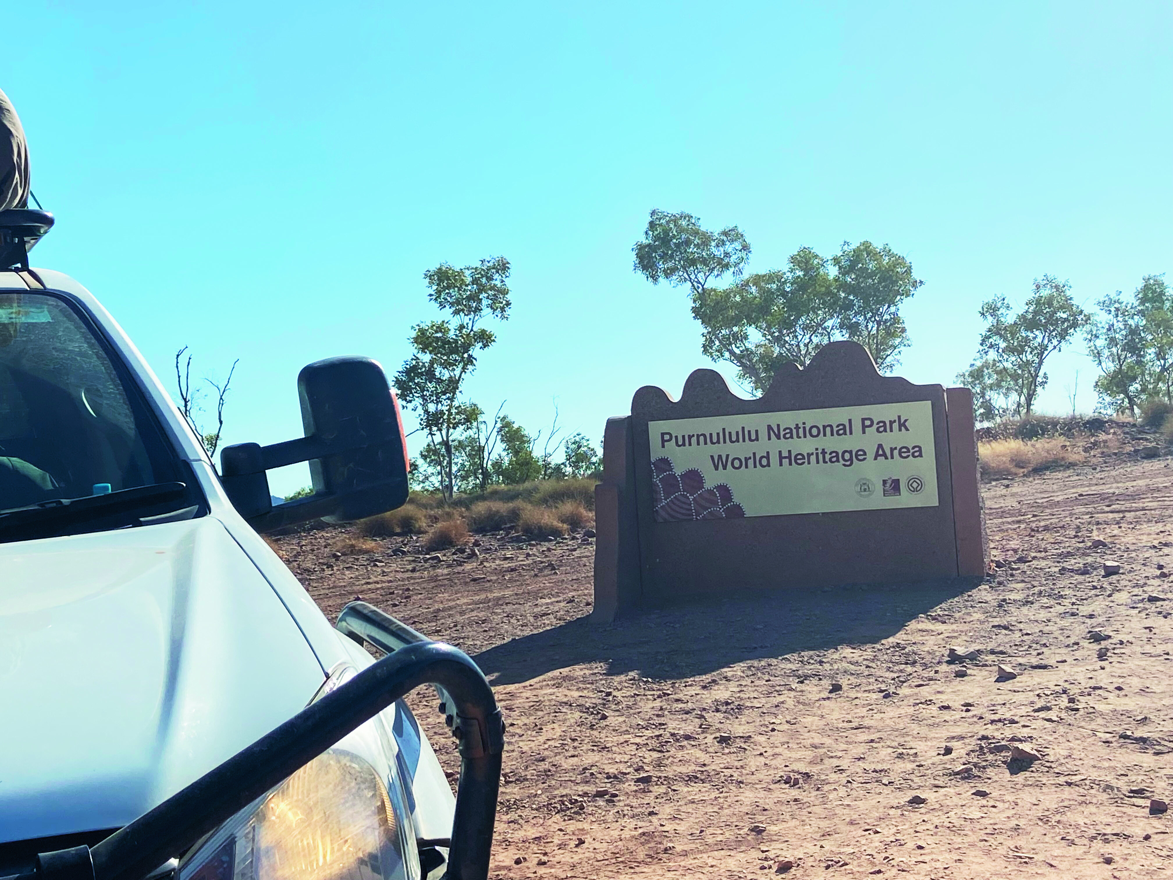
The Bungle Bungles is in Purnululu National Park, about 304km from Kununurra. The extraordinary, banded sandstone domes, created some 360 million years ago and which the park is best known for, are unrivalled in their scale, grandeur and diversity, and in 2003 Purnululu National Park was World-Heritage-listed for its beauty and geological value.
Erosion by creeks, rivers and weathering in the past 20 million years has carved out these stones, along with spectacular chasms and gorges, creating a surreal landscape.
GETTING INTO PURNULULU
It’s only 53km into the park from the highway, but it takes more than two hours to get there as the road is rough and four-wheel drive only. There’s no fuel within the park and you need to be completely self-sufficient, so make sure you have at least 200km worth of fuel in your tank.
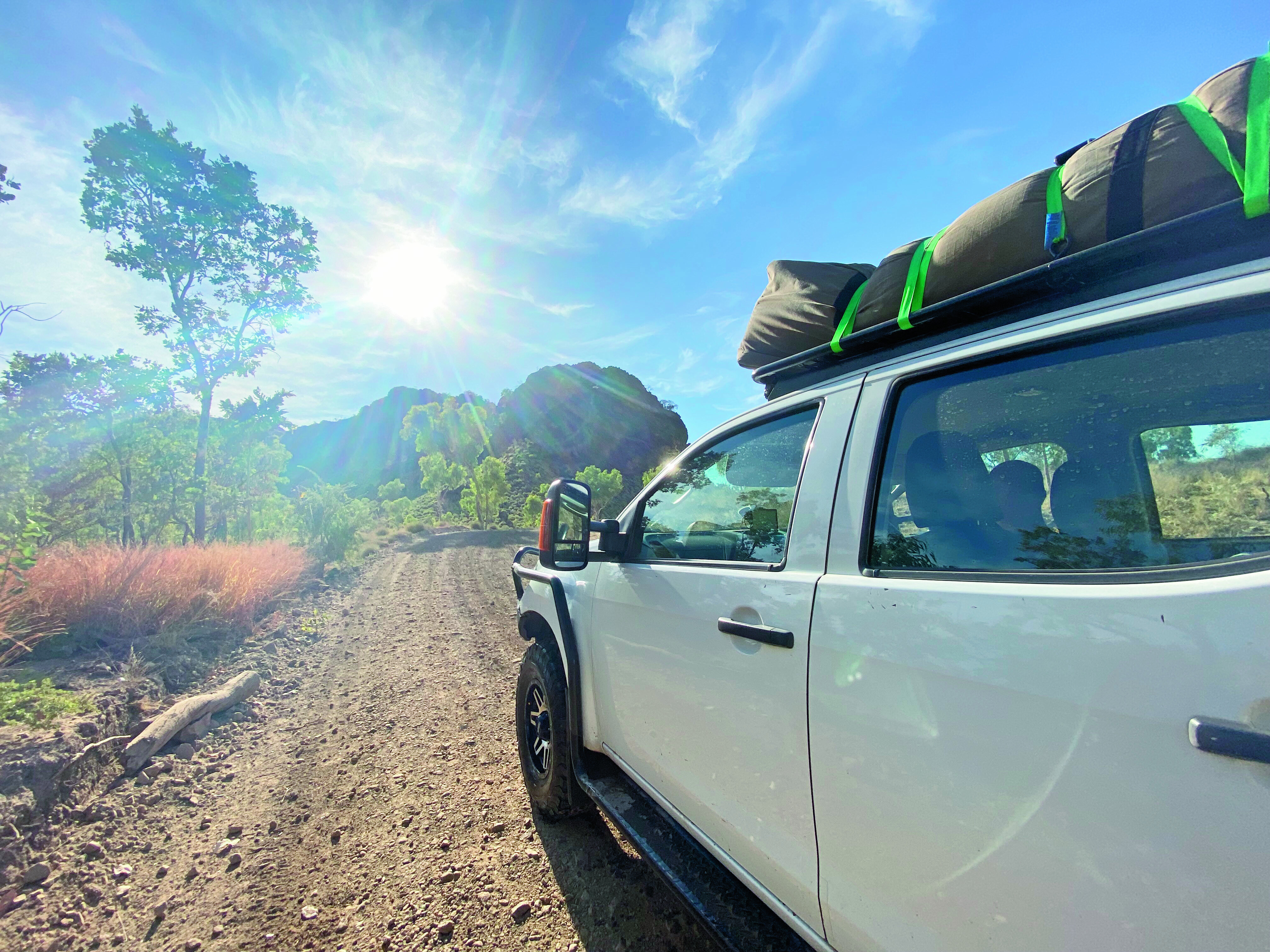
We were lucky that the first 17km of the track had recently been graded. Beyond that, however, the road is pretty rough. There are narrow sections, steep inclines and a number of creek crossings, but the D-Max handled the terrain well.
Our first stop is the Visitor Centre where everyone needs to register. We get our maps, camping permits for our two nights at Kurranjong and Willardi, and continue to the northern section of the park.
NORTHERN WALKS
The Bungle Bungles is all about walking. It’s the best way to explore the park, with a few important tips to keep in mind. Walk early in the day, carry lots of water, wear sturdy walking shoes and wear a hat. It’s common sense, but you’d be surprised at the number of people I saw wearing thongs. Imagine having a thong blowout on a rock and having to stagger back in bare feet! No fun.Our first walk is to Mini Palms, a trail that starts from the Bloodwoods car park. It’s a 4.4km moderately challenging walk with some steep slopes and some large rocks to negotiate. It features dramatic cliffs, Livistona palms, stairs that lead to two viewing platforms and a natural amphitheatre that is truly stunning.
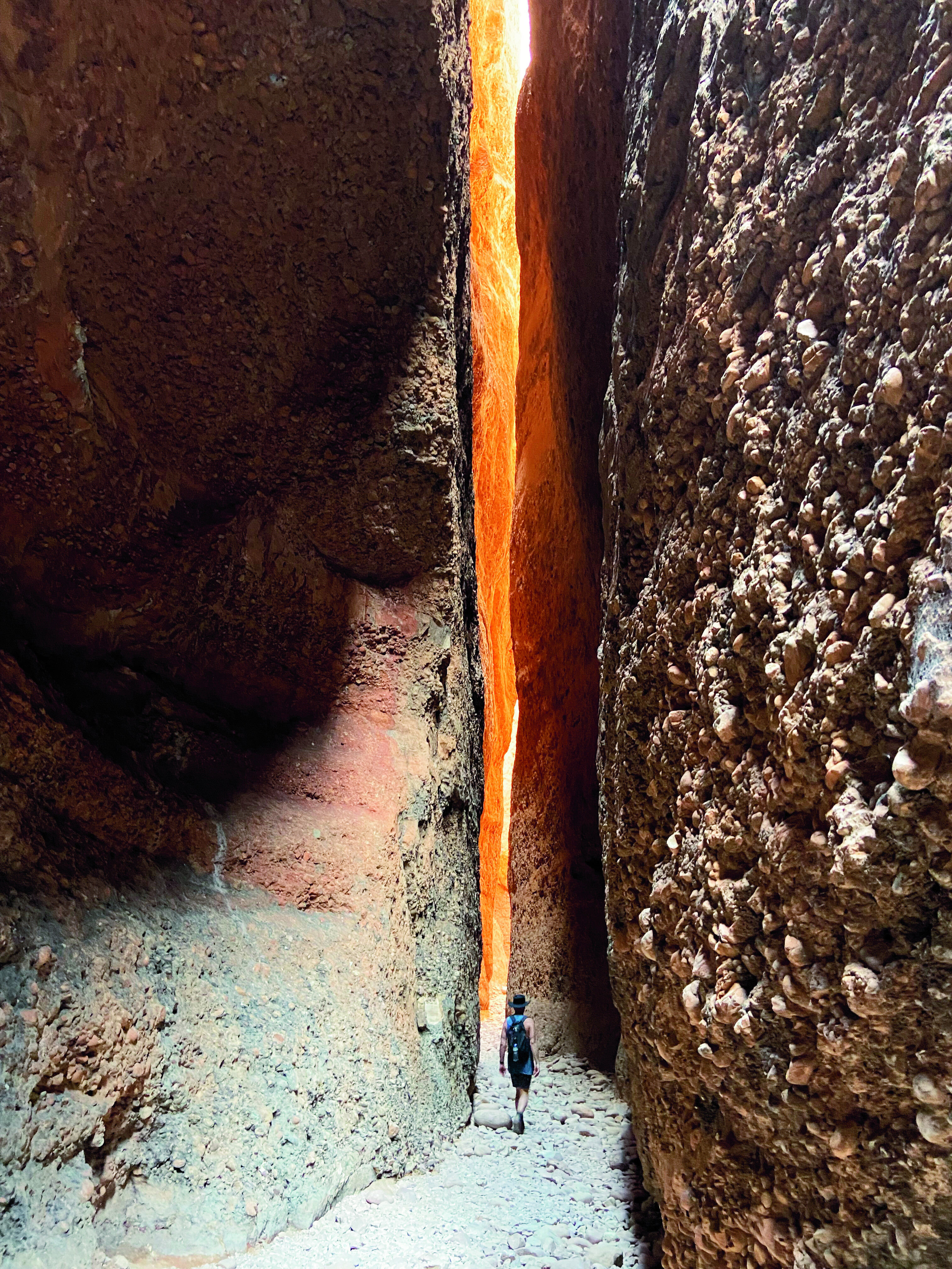
Our next walk to Echidna Chasm is one of the most popular in the park, and I can see why. It’s a beautiful walk, about 2km in length that leads to a spectacular chasm. If you get there between 11am and 11.30am, the sun shines directly through the chasm creating a shaft of light that’s truly striking. You can explore farther into the chasm where the shade in the middle of the day is particularly welcome.With temperatures soaring to 38˚C and feeling even hotter in the blazing sun, our walks were generally done and dusted by early afternoon. Then it was time to find a camp spot at Kurranjong and stay cool for the afternoon.It’s amazing how the little things become the big things: the shade of a tree, a bore water tap, a wash-up tub that doubles as a cool foot bath, and car-wash cloths turning into cool face washers when wrung out in water.
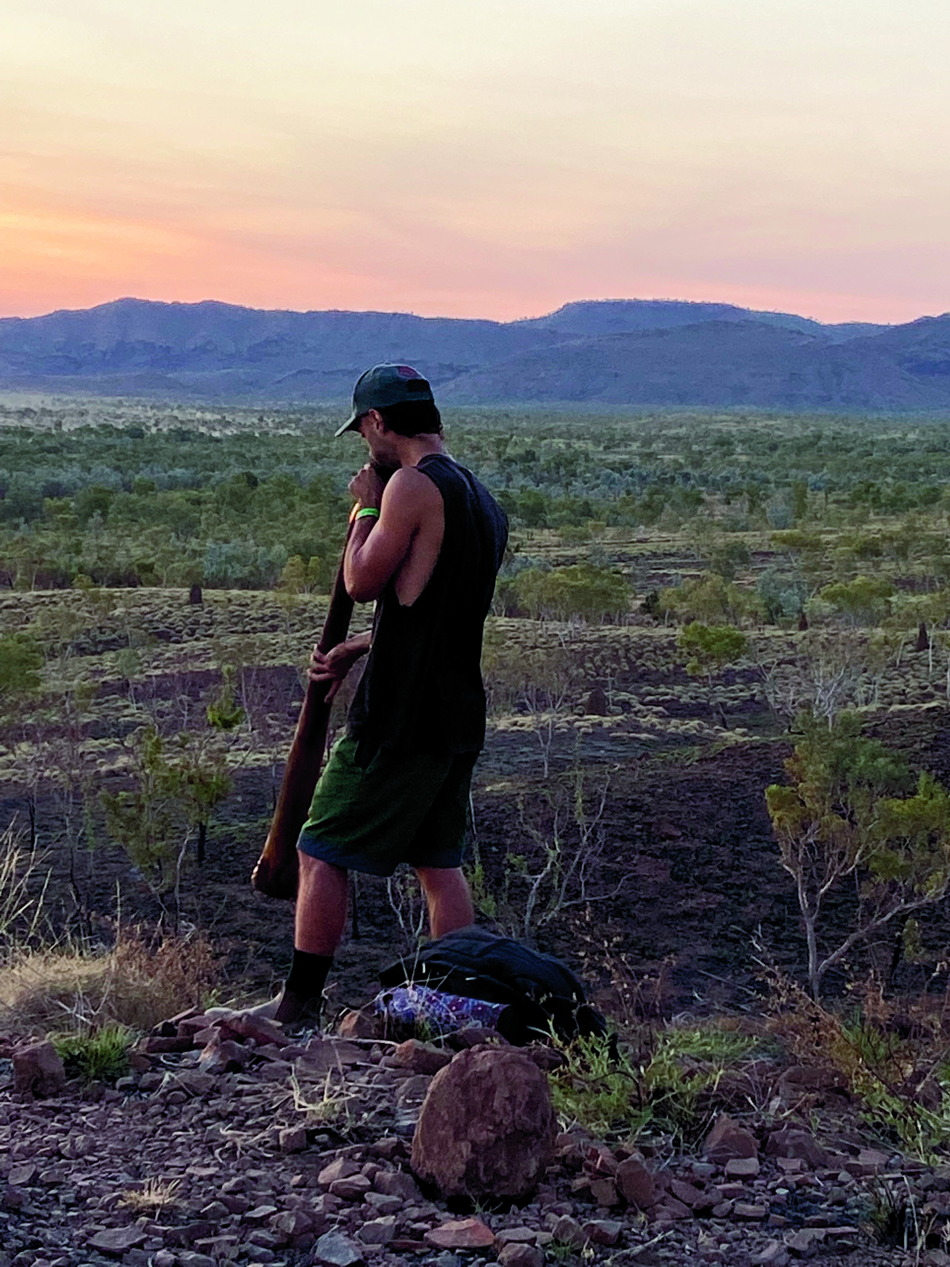
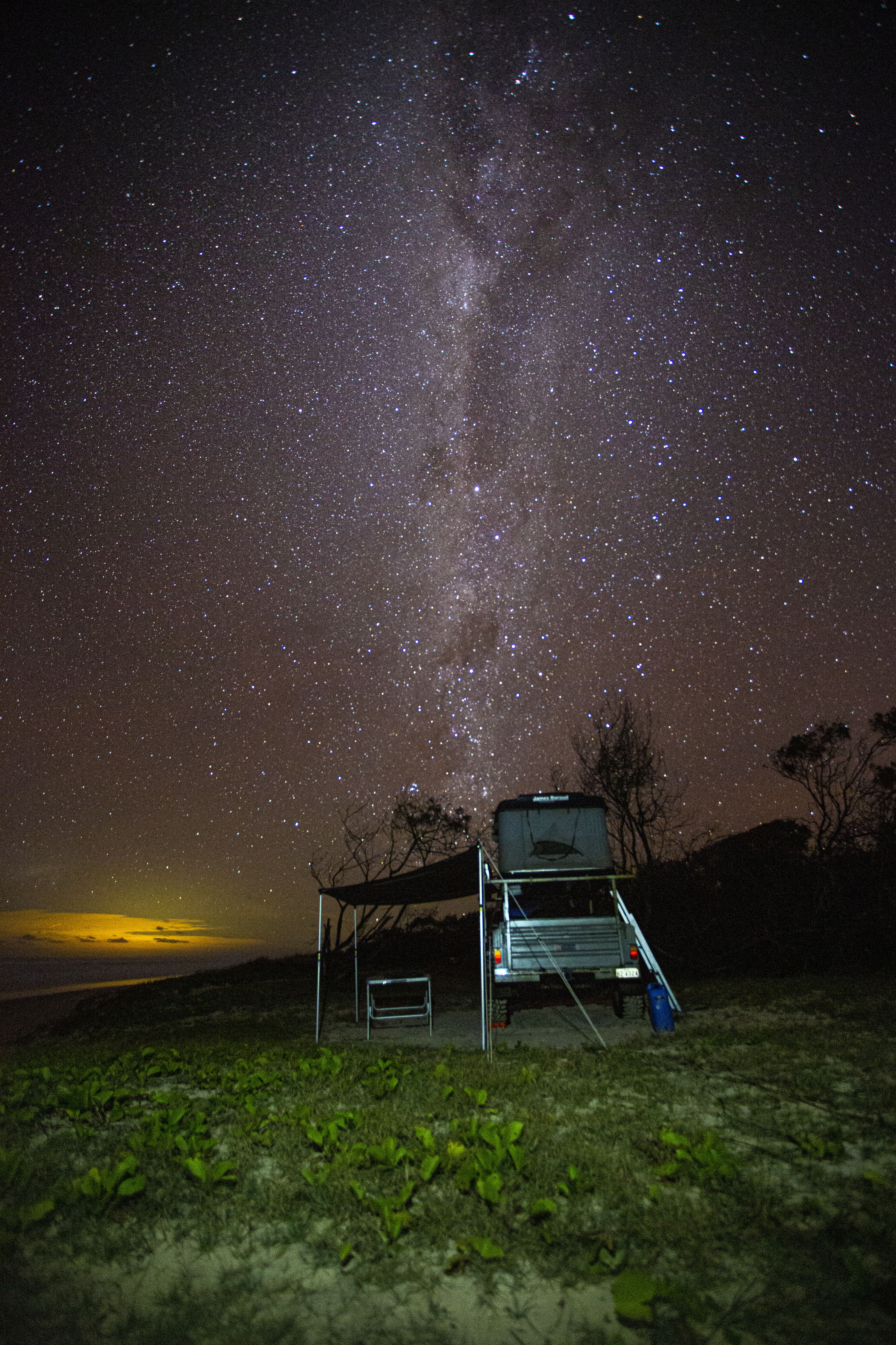
That night, just before sunset, we drive out to Kungkalanayi Lookout for 360-degree views over the ranges. It’s an awe-inspiring sight to watch the sky turn those outback hues of orange and pink – and then, out of nowhere, came the haunting sounds of a didgeridoo.On walking a bit farther we came across the person responsible, a young guy adding his own blend of magic to the setting. It reminded us of the sacred roots of the area.With darkness arriving early here in the west, we have dinner and hit the hay. And as I lay back in the swag and look up at a dazzling array of stars, I think again of the sign at the Visitor Centre. A shooting star flashes above me, and I silently wish that everyone can experience the freedom of travel again, as we are. This is truly camping.
SOUTHERN WALKS
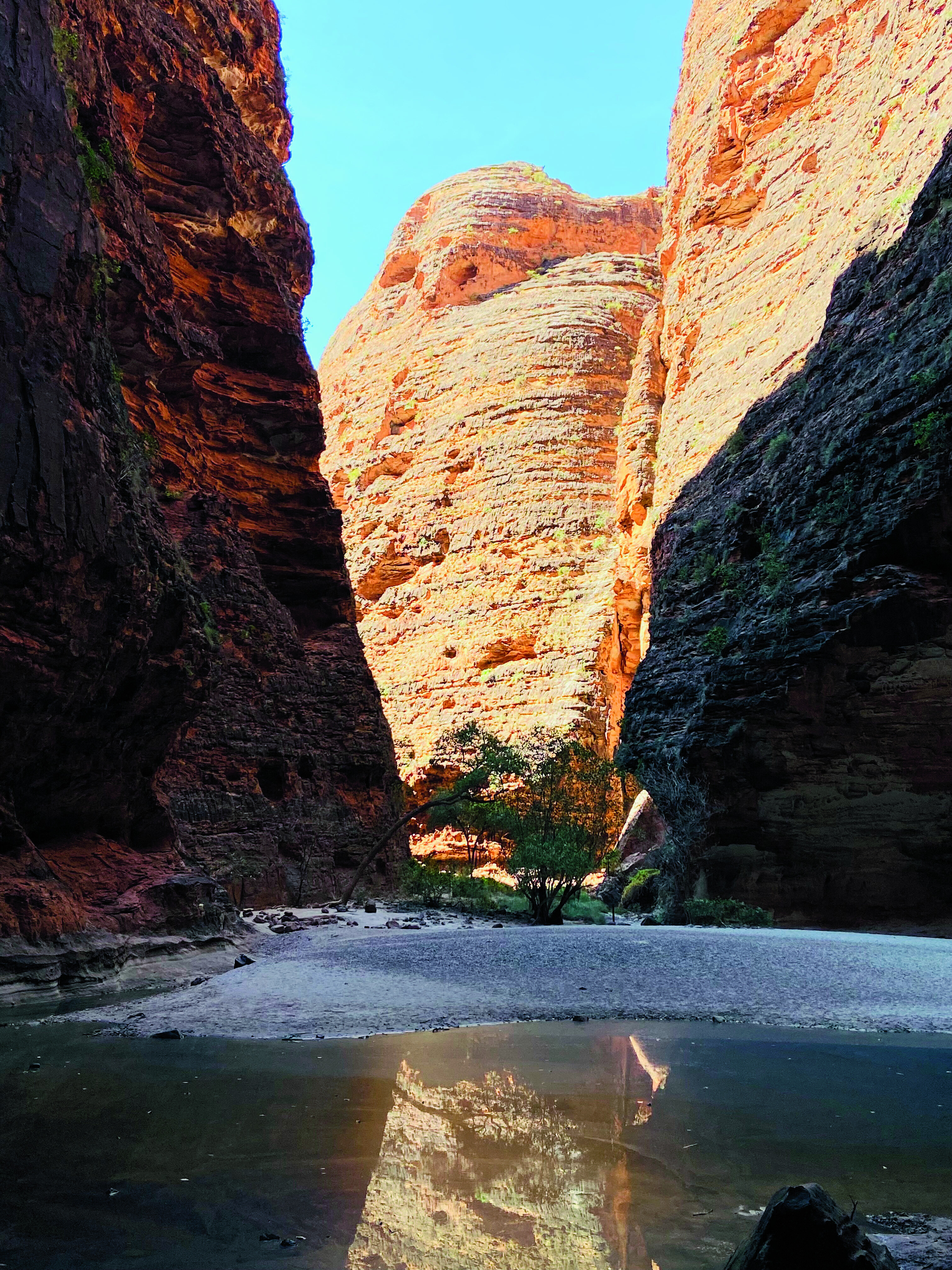
The next day, we pack up camp and continue through the park towards Piccaninny Creek Lookout, our first walk in the south. This lookout is a 2.8km trail that winds south through spinifex hummocks and the dry Ord River. Super-keen hikers can tackle the two-day trek to Piccaninny Gorge, but need to register at the visitor centre and carry a satellite phone or Personal Locator Beacon (PLB). We’re content with a walk along the dry riverbank and to the lookout.From Piccaninny Creek we backtrack and head towards Cathedral Gorge, undoubtedly the most popular and photographed spot in the park. When you reach the amphitheatre, the full scale unfolds before you. It’s magnificent, every sound is amplified and every moment in there feels almost sacred.We finish our Bungle walks with a loop walk around the Domes, the stripey beehive-like domes that tower majestically around you. In the heat, the 700m walk feels long and intense, and we’re happy to reach the shade of a cave to rest along the way.That night, we enjoy a simple dinner and another magnificent Kimberley sunset. It’s yet another night under the ultimate outdoor cinema.
THE BUNGLES TO WINDJANA
Back at the Bungle Bungle Caravan Park the next day, we unload the car, hitch up the caravan and continue our western adventure. We drive through Halls Creek, with a night pulled over on top of the spectacular Ngumban Cliffs, a designated 24-hour rest spot, before continuing towards Fitzroy Crossing.
There, we restock, refuel and continue, before eventually turning on to Leopold Downs Road for another 92km of dirt-track driving. It’s an alternate way to Derby, four-wheel drive recommended and the last hundred kilometres of the Gibb River Road. With Tunnel Bend closed at the time, our destination for the night is Windjana Gorge National Park.The track is corrugated, and we reduce the pressure on both the car and ’van tyres accordingly. Still the track has its fair share of dips, creek crossings and grids from nearby stations, so we take it easy. There’s little traffic except for the occasional rogue cows that seem to have little concept of giving way.
Windjana is a great spot to spend a night or two. There are self-registration envelopes at the park entrance with fees of $17 per adult which includes facilities with flushing toilets, showers and tables, plus an incredible backdrop and some stunning walks.
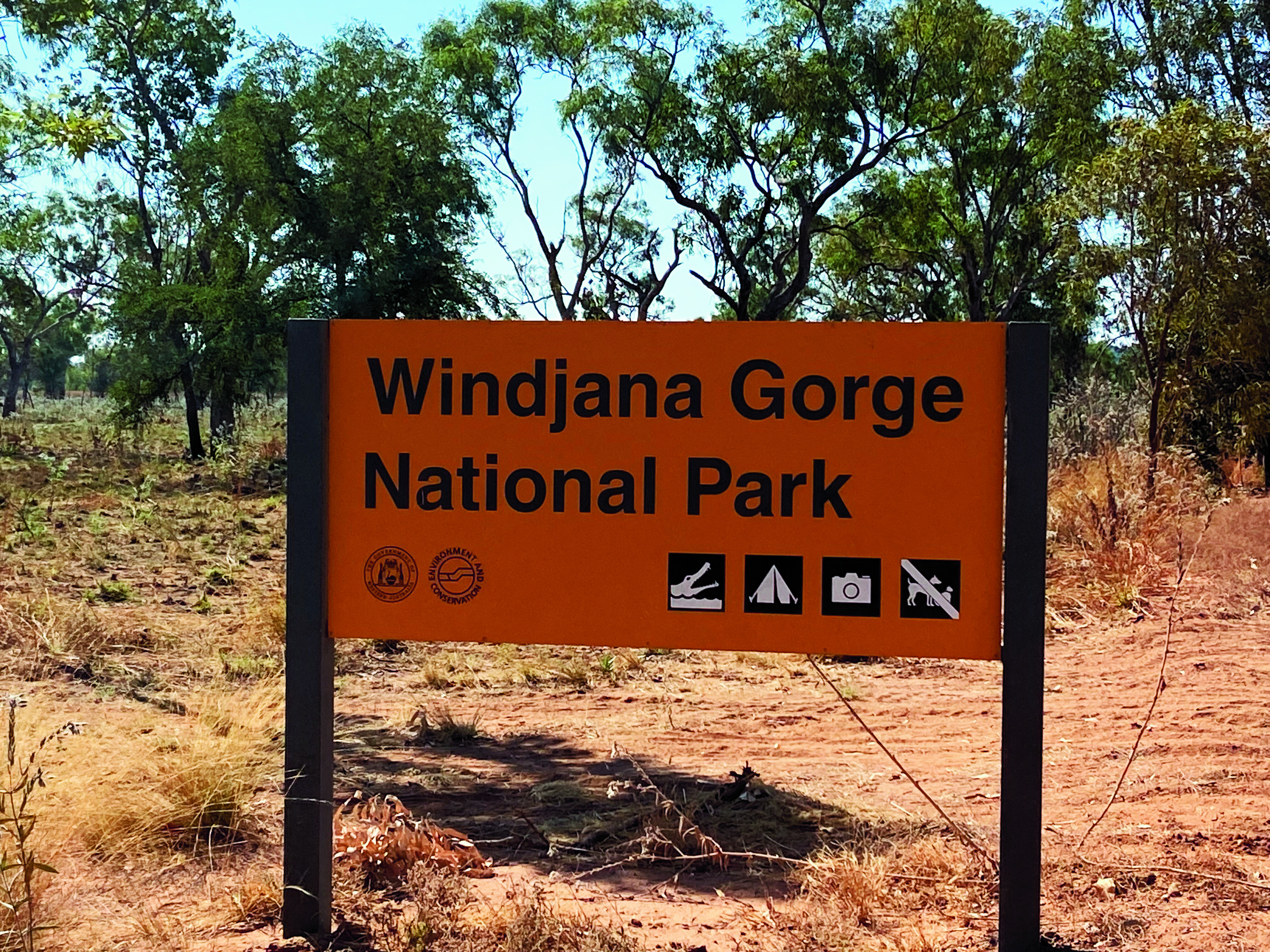
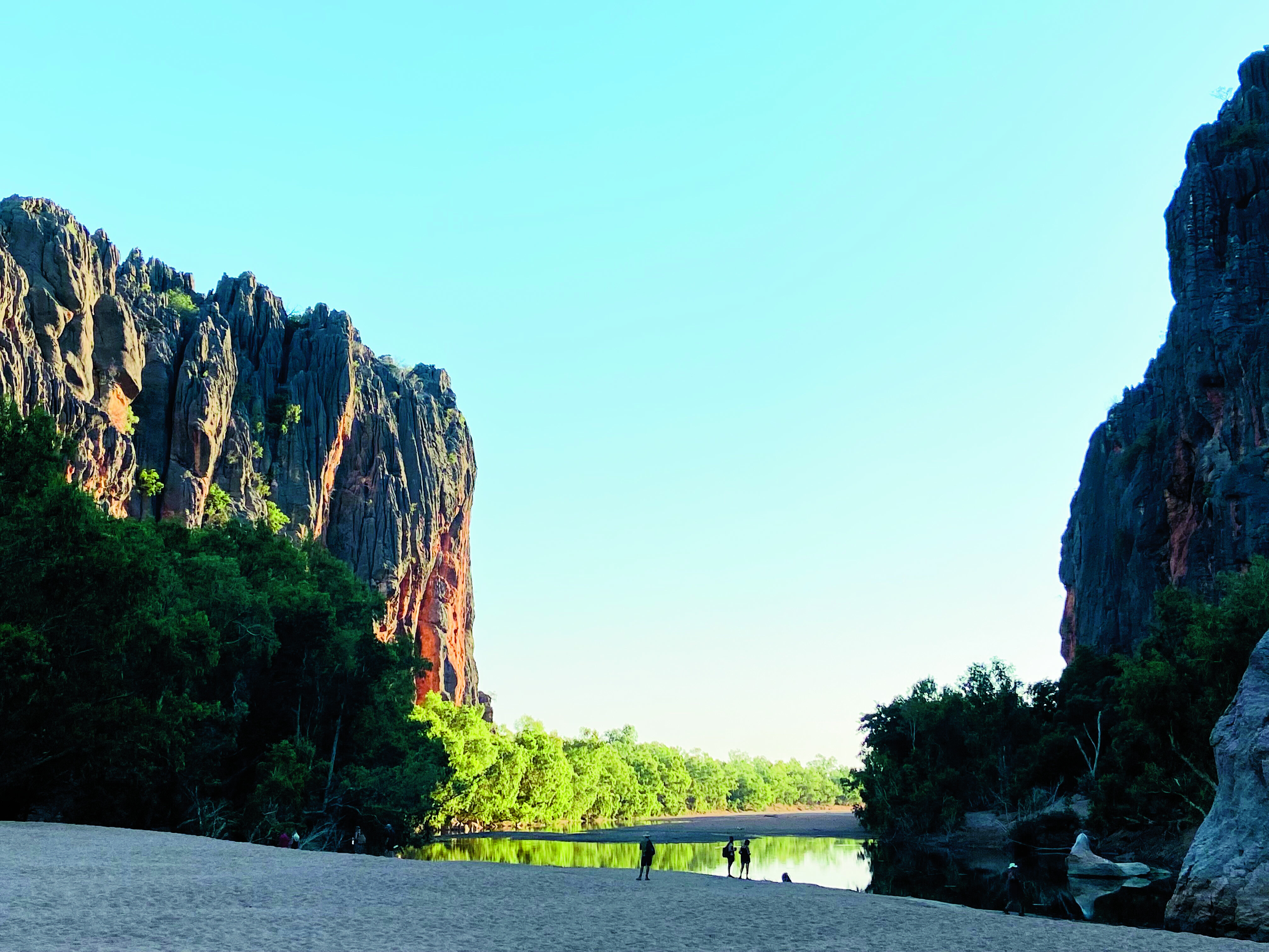
Bandilngan (Windjana Gorge) National Park is one of the Kimberley’s most stunning gorges, with water-streaked walls that rise majestically to heights of 100m – we can see them from our campsite. The Lennard River runs through Windjana Gorge in wet weather, but forms pools surrounded by trees and shrubs during the dry season. The 3.5km-long gorge cuts through Napier Range which is part of the ancient Devonian limestone reef.Walks include the Gorge Walk and begin at the camping area, winding through the gorge for 3.5km each way. There’s also the short Time Walk where you can try and find marine life forms fossilised within the limestone of the gorge walls.
Look out for freshwater crocodiles that bask in the pools. We saw many of them in the water and I nearly walked into one sunning itself on the shore, which the other half thought was hilarious. As beautiful as this park is, it’s advisable not to swim in these waters.Both the Bungle Bungles and Windjana are closed to vehicle traffic in the wet season which begins in December in the Top End, but a flight overhead is always possible. Or you can put them on your bucket list when all the borders are open again. You’ll get a warm welcome up here in the magnificent Kimberley region of Australia.
FIVE THINGS TO SEE
1. PURNULULU NATIONAL PARK The most famous of The Kimberley’s eight National Parks, Purnululu’s claim to fame is the other-worldly, eroded sedimentary domes of the Bungle Bungle Range that resemble skeps or wicker-type beehives.2. BUNGLE BUNGLE CARAVAN PARK Bungle Bungle Caravan Park offers storage for caravans and trailers; accommodation spanning cabins, safari tents and powered/unpowered sites; bus and helicopter tours; licensed restaurant; and more.3. BANDILNGAN (WINDJANA GORGE) NATIONAL PARK Regarded as the most stunning of Kimberley gorges, Windjana Gorge (north of Fitzroy Crossing) cuts through the Napier Range, a former ancient Devonian limestone reef.4. NGUMBAN CLIFFS Between Halls Creek and Fitzroy Crossing is the Ngumban Cliffs, a free overnight rest area and dump point with covered picnic tables, barbecue areas and toilets.5. OFF-ROADING Plenty of long, corrugated dirt-road driving to test your mettle and fourbie, getting to and from the two aforementioned national parks.
Imagine being a billionaire for a minute. Not even a go-to-bloody-outer-space kind of billionaire like Elon Musk or the bald fella who looks suspiciously like the bad guy from the Superman movies.
I’m talking your run of the mill billionaire. The hedge fund managers and bitcoin nerds. There’s about 2700 of them at the moment and they’re all capable of spending dumb amounts of money on whatever their hearts’ desire.
What would you park in your garage? I reckon I’d have an F150 Raptor for a daily runabout, parked next to a big Ram 3500 with a canopy for a tourer, and a soft-top FJ40 on coil-overs and 37s as a weekend toy.
Hell, if I was a billionaire I reckon I’d have an aeroplane hanger full of every kind of 4×4 imaginable from wild to mild – rock crawlers, racers, big comfy tourers.
Sadly, the last time I checked my bank account I had a few less zeros than Jim Walton’s $60,000,000,000. About 10 less now, if I think about it. That means I have just the one 4×4, and it means I have to choose my modifications carefully – I can’t afford to be redoing things, and I sure as hell can’t buy a second 4×4 to suit my whims.
We’re taking a wild stab in the dark here and figuring you’re probably not a billionaire either, so a handy guide on how to build a 4×4 once and build it right should help keep your hard-earned in your pocket.
Here, we’re talking everything from the material your roof racks are made from to how many pillows you stuff inside your swag. Thousands of dollars of hard-earned lessons from 4WDing in just about every region of the country. It’s not going to be pretty, and there’s going to be some uncomfortable truths, but you’ll be one step closer to that billionaire list after our advice.
What’s the game plan?
In the age of FOMO (fear of missing out), people are more and more frequently building a 4×4 based on something they’ve seen rather than their own specific needs. It’s not really an issue we saw before everyone was glued to their phones 24/7.
Back in the day you’d go camping with your mates, it’d inevitably rain, and you’d get wet. The next time your mates saw you, you’d either have an awning bolted to the side of your roof rack, or a tarp and a couple of poles shoved in the back. The need would present itself, and you’d modify your 4×4 to suit.
These days people will see a rig with a big, slinky suspension and decide they need the same. Forgetting they’ve spent the last 12 months decking out a big camping canopy and rooftop tent that all raise their centre of gravity.
By trying to make their tourer a rock crawler, they’ve made it worse at both and spent a fortune in the process. The result is more money wasted. Buying a new suspension again, or selling the canopy at a massive loss second-hand because they’ve decided they want to rock crawl now.
It might sound a little basic, but there’s a reason we’ve put this one front and centre. Before you buy a single accessory for your 4×4, or even the 4×4 itself, decide what your goals are and if the modifications you’re doing will actually help you towards the end goal.
That comp-spec low-profile bar will look a million bucks, but if you’re building a tourer you’ll probably find yourself selling it at a loss to buy another bar at retail with headlight hoops for ’roo country.
Best foot forward
No, the 4×4 you like isn’t the best option for everything. A Prado doesn’t go “everywhere the big boys go”, and a GQ isn’t the most comfortable tourer around just because it’s got coil springs and expensive shocks. Different 4x4s have different pros and cons, and starting with the right platform can save you an absolute fortune in the long run.
Let’s throw out an example here. Dave wants a tourer he can drive from one side of the country to the other in comfort, then punt it up the hard tracks on the weekends. An IFS dual-cab ute ticks both boxes, they’re outstanding for noise, vibration and harshness (NVH). They’ll make a dual-cab Cruiser look like a dinosaur by comparison, and are around $20K cheaper. Throw in a locker and some mud tyres and they’re pretty damn capable too.
Want to go to the extreme and do a solid-axle swap on your dual cab? You’re looking at $30K to do that mod, making you $10,000 more expensive than the Cruiser. And $10K buys a lot of sound deadening and a very fancy stereo to nice up the Cruiser. Our mate Dave would have saved money and had a more reliable rig out of the gates by buying the platform suited to his needs.
It’s not that one is better or worse than the other; it’s that one is more suited to the job you’re asking of it and will achieve it easier with bolt-on parts. That solid-axle Hilux may get two inches more articulation, but it’s gotta be engineered, will be off the road for months for the work, and is full of custom parts you won’t find at Oodnadatta. It’ll be cool as hell, but is cool worth $30,000 to you when a near stock TJ Wrangler would be just as capable for $15,000?
Ask yourself seriously if the 4×4 you like is the right 4×4 for your needs. The opposite is true as well. As cool as a decked-out Cruiser looks, a mildly modified dual-cab ute will be far nicer to live with every day, especially when your focus is beach runs and weekend camping trips.
Write down the pros and cons of the different options. Factor in parts availability, capability, what future modifications will look like if you get out of hand, and how much you’re financially willing to sink in to the project to achieve your goal. For some, a five-inch lifted GQ on 37s will be the right choice. For others, a Rav4 could be perfect.
Building on a solid foundation
You’ve chosen the 4×4 right for your project, begrudgingly accepted that you’ll probably spend more time driving it to work than wheeling double black diamond trails, and now you’re rolling out the spanners ready to start modifying it. Your 4×4’s suspension system isn’t just the part that dictates how high from the ground it’ll be. It affects how it’ll perform on- and off-road, how well it’ll deal with loads and towing, and how fatigued you’ll be after driving corrugations for 10 hours.
The first thing you’ll need to consider is how high your 4×4 needs to be. As a general rule of thumb (yes, there’s always exceptions) the higher your 4×4 the less stable it’ll be and the more you’ll have to spend to make it work right.
In most rigs, around a 50mm lift will let you step up a size or two in tyres, which is where the real capability comes from off-road. Live-axle rigs can typically be lifted to three or even four inches over stock with easy bolt-in kits, while independent rigs will typically require body lifts or goofy bracket lifts to go above two inches without maxxing out the stock suspension design.
A two-inch lifted vehicle on 35s with modifications to the guards will outdrive a comparable four-inch lifted vehicle with 33s, and all with a simpler suspension system and less concerns with legalities.When it comes to choosing the shock absorbers for your 4×4, it’s typically a case of the more you spend, the better the result. A spring’s job is to keep your 4×4 in the air and handle the weight, the shock absorber’s job is to smooth out the bumps. The better the shock is at smoothing out the bumps, the better the ride quality and the less you’ll have to fight the steering wheel to keep you pointing down the track.
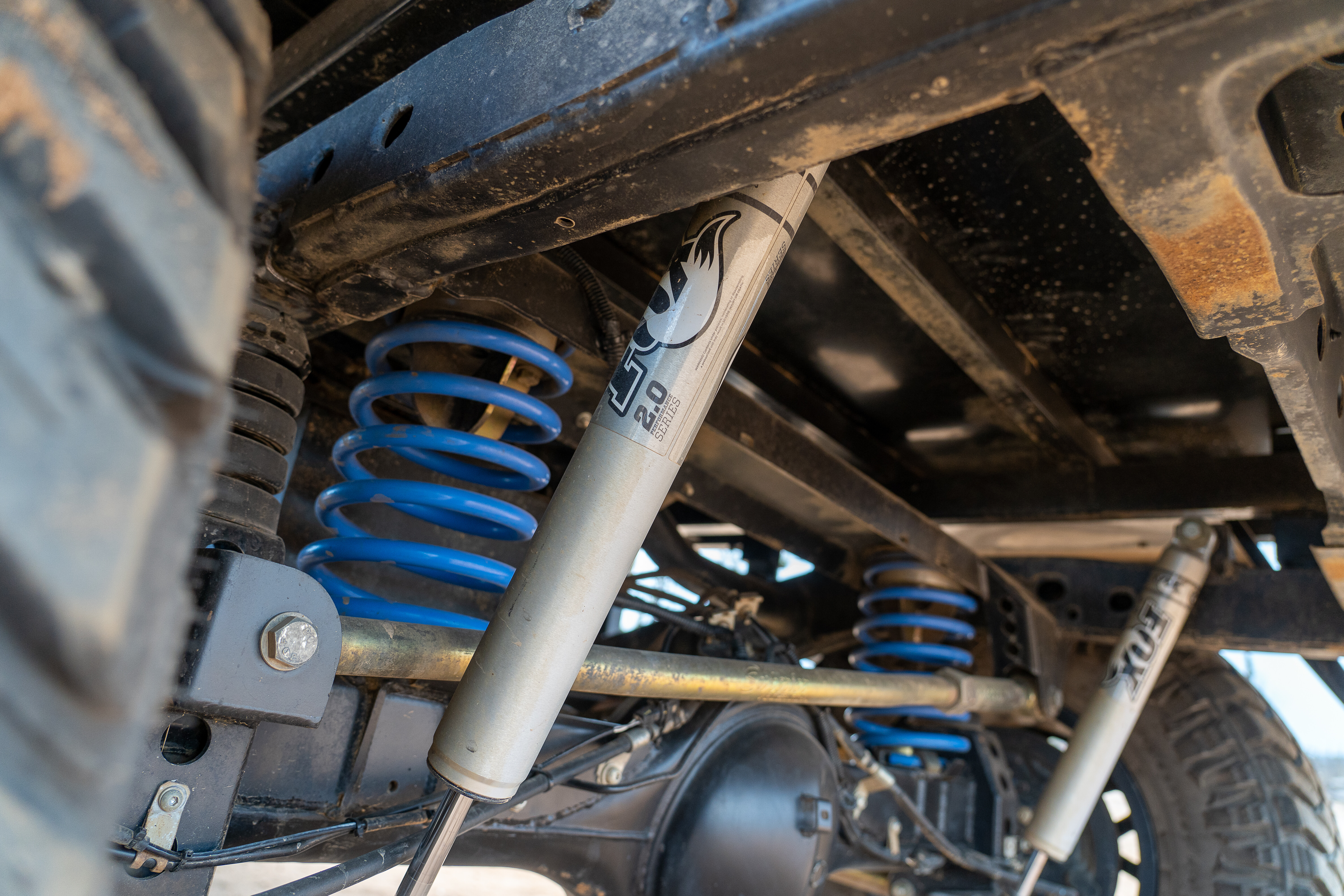
Typically, shock absorbers can be looked at in three tiers. The entry-level set-ups will cost around the $1000 to $1500 mark for shocks alone and can offer a slight improvement in ride quality and a boost in reliability.
From here, the $1500 to $3000 range starts introducing rebuildable shocks and increased oil capacity through external or piggyback reservoirs. The additional oil capacity helps stave off shock fade in corrugations and undulating terrain, and the higher quality valving will give a smoother ride.
From here you’re in to the high-end shocks where the sky is the limit. They’ll offer similar features on paper as the second-tier offerings, but will typically be fully rebuildable and tunable by a quality shop to get them dialled in exactly to your needs – more oil capacity, better valving, huge increases in strength. Big, fancy shocks predominantly benefit tourers rather than hard-core weekend wheeling, but both benefit from as low a ride height as you can get away with.
The final piece to the puzzle is your load-carrying ability. You can imagine how bad your 4×4 would ride if you put springs from a Mack truck in it; getting the spring rate wrong is no different. If your 4×4 is always loaded up the same, then constant-rate springs will be the simplest option. If you’re constantly changing what’s in there, or occasionally towing, an adjustable air-bag helper set-up can dial in your spring rates to suit the day.
All barred up
Short of the wheels and tyres, your 4×4’s bar work is one of the biggest deciding components for what your 4×4 excels at. You could have two identical GQ Patrols. Both three-inch lifted on 35s. Both with big angry turbos hanging off the side of a TD42.
One is sporting an ARB plate and post front bar, matching scrub bars and a Kaymar rear bar. The other has a custom tube bar tucked high and tight going in to custom rails and sliders from front to back with a one-off rear bar. It’s immediately obvious just from looking at the two side by side which spends its weekends wheels up and winching, and which one has seen more of Australia than the kangaroos.
The two biggest choices you’ll have with your bar work is steel versus alloy, and low profile versus full hoops. Steel versus alloy is a question you’ll need to seriously ask yourself between your uses and desires.
Steel is a must if you’re doing remote touring and animal strikes are a real concern, but it will eat into your GVM, potentially tipping you over the scales into illegal territory. It’s also preferable if you’re punting your rig into rocks 300 times a weekend.
On the opposite end of the spectrum, alloy bar work can still give much needed protection to the radiator but won’t hold up to sustained strikes. Alloy bars can still mount driving lights, recovery points and winches with a fraction of the weight, so still have their place.
Ditching the factory side-steps is another common upgrade people tick the box for without considering their options. Heavy-duty rock sliders will give you the peace of mind you can tip your sill panels in to a rock or tree without serious damage, but there are not too many rock ledges in the Simpson Desert to give you grief, and you’d save yourself $1000-plus and 50kg out of your GVM running factory side-steps.
Likewise, the need-vs-want ratio needs to be considered when eyeing off a rear bar. They’re fantastic bits of kit if you need them, giving you a sturdier mounting point for your heavier spare tyre, mounting points for jerry cans and much needed rear-quarter protection. But if you don’t need those features, you’re spending thousands and eating considerably into your GVM purely for aesthetics. What you need is more important than what you want.
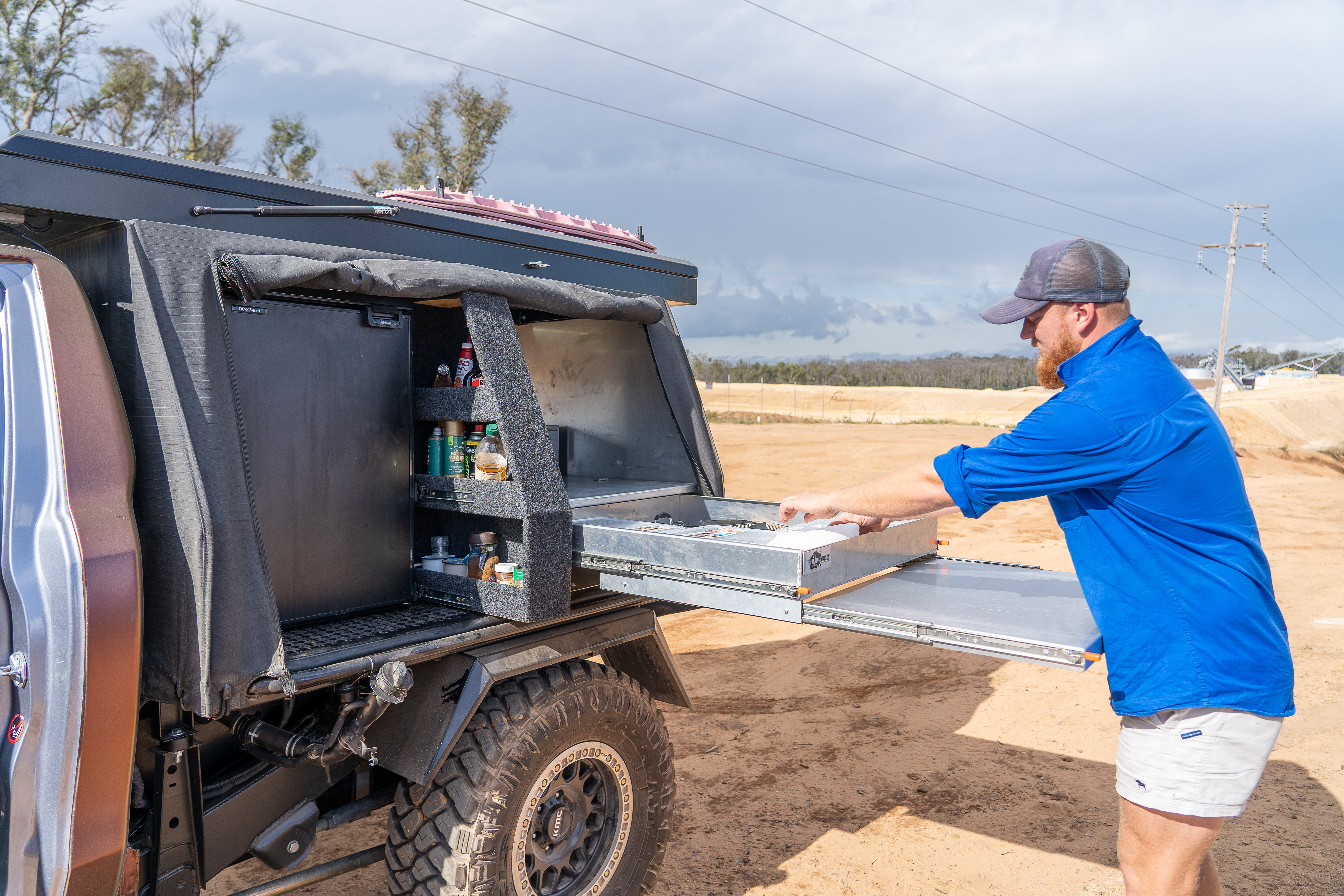
The final piece to the puzzle with bar work considerations is your roof rack. In years gone by they were all steel, all huge and all heavy. These days the prices have risen, but so have your options. Alloy flat racks promise huge versatility for bulky items without adding too much weight to the roof, while baskets provide a handy place to stash small items like camp chairs and firewood. There are few downsides to either option, so personal taste holds as much weight as practicality.
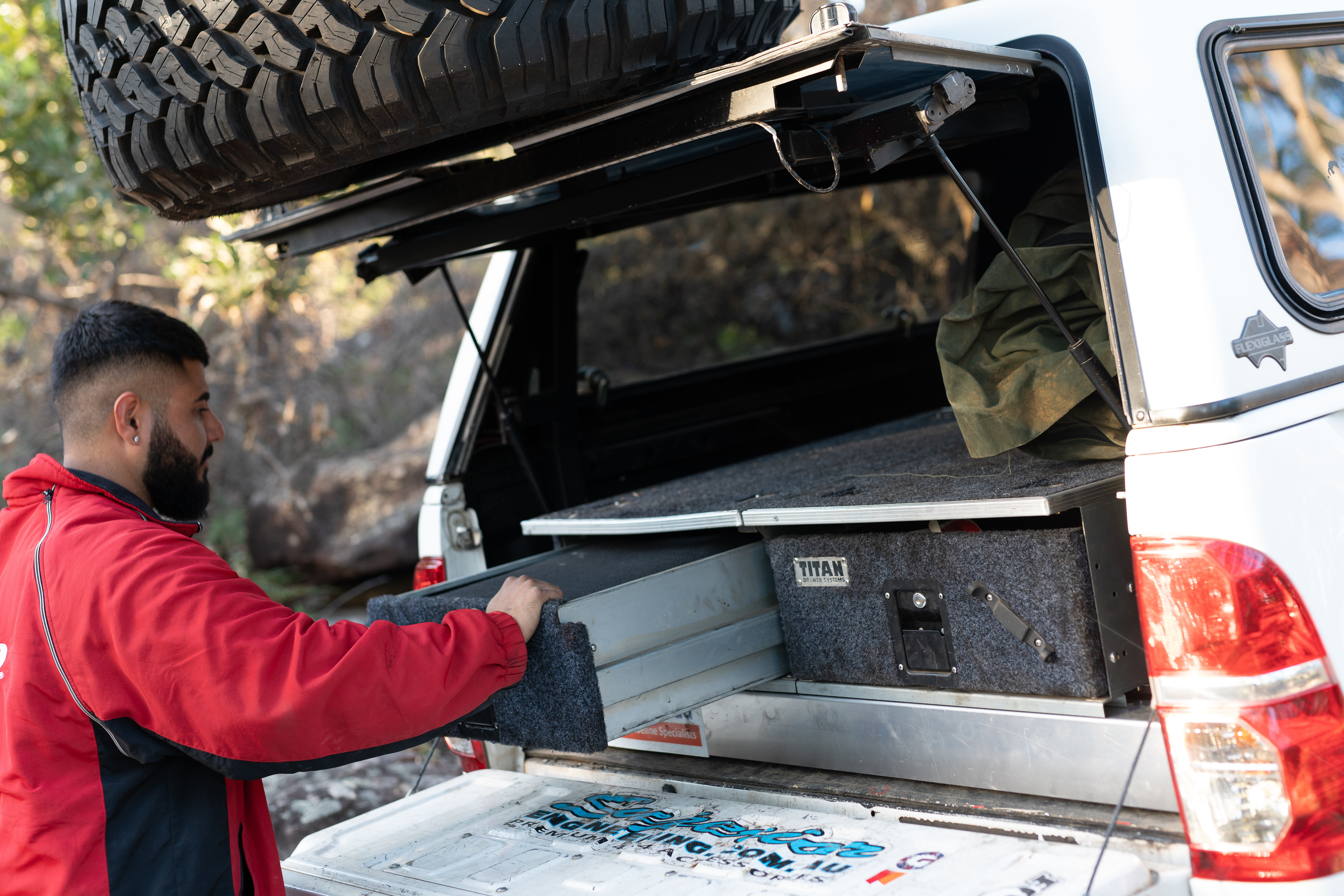
Pitching tents
When it comes to camping, more gear normally makes for an easier camp. Expensive lithium battery set-ups, 12V coffee machines, electric-opening tents and even inflatable swags are all the hottest trends of the day. But it all costs money and adds weight.
Take for example the latest trend of hard-shell rooftop tents. They’re one of the easiest camping systems on the market, being able to stash your bedding and full sleeping set-up in one box that takes 30 seconds to erect. The downside, and there’s always downsides, is that convenience will take up your entire roof rack, massively eating in to your storage space and practicality.
And with many of the hard-shell rooftop tents tipping the scales at 60kg, even if you’ve got a garage you can fit in and a winch to lift it on and off, odds are it’ll live on your roof until the day you sell it.
Once it’s up there, your roof is dedicated to sleeping. If you’re camping every second weekend the comfort and convenience can’t be rivalled; but if it’s your only vehicle, a single swag with a thin sleeping bag and inflatable pillow will cost roughly 1/8th of the price and can be thrown in the back seat.
It’s just one analogy, but it rings true for every component you can think of when it comes to camping comfort. Convenience adds complexity, cost, weight, and limits how practical your 4×4 is when you’re not camping. From drawers to ute canopies, to fancy electrical systems. Decide where the balance point for you lies and don’t let yourself get carried away. It’s an expensive lesson to learn you’ve tilted your 4×4 too far in one direction.
The other factor to consider is that an extensive camping set-up won’t just affect your GVM and storage space, but it’ll directly affect how capable your 4×4 is in every situation on and off the road. Heavier 4x4s are more likely to get bogged, work harder to drive through sand, and are more tippy when doing technical wheels-up 4x4ing.
You might be happy to spend the $4000 on that fancy rooftop tent, but are you happy with the instability it’ll introduce to your weekend wheeling set-up?
Under the bonnet
If ever there was one invention responsible for the ongoing keeping up with the Joneses’ syndrome it’d have to be the dyno. While numbers on a sheet of paper are always fun to look at, it’s transformed the goal of engine modifications away from how capable your rig is, to how impressed everyone will be by it.
Let’s get one thing straight, with very few exceptions reliability and engine modifications are at opposite ends of a straight line. The closer you get to one, the further you get from the other.
Of course, there are exceptions with upgrades like intercoolers, hard pipe kits, and transmission coolers that, while adding some level of complexity, far outweigh it with their benefits. But if you’ve got dreams of having a 4×4 that’s an absolute animal with the loud pedal, you’ll give up a little peace of mind in touring conditions.
As a result, mild performance upgrades are the most common seen as they can have reasonable boosts in performance and driveability without drastically affecting reliability, as long as the work is done to a high standard. ECU re-mapping and turbo-back exhausts can be had for a few thousand dollars with 20 per cent increases in power and torque.
From here you’re looking at bigger injectors, bigger pumps and bigger turbos. Reputable shops can guide you towards reliable set-ups and advise on how far you can push your engine before you start running in to reliability issues. The budget you allocate won’t just dictate how much power you can expect to find under your right foot, but how reliable it’ll be.
Off-brand turbos, second-hand intercoolers, and suspect heavy-duty transmission valve bodies from AliExpress can all push out big numbers on the day of installation but aren’t something most people would feel comfortable crossing deserts with.

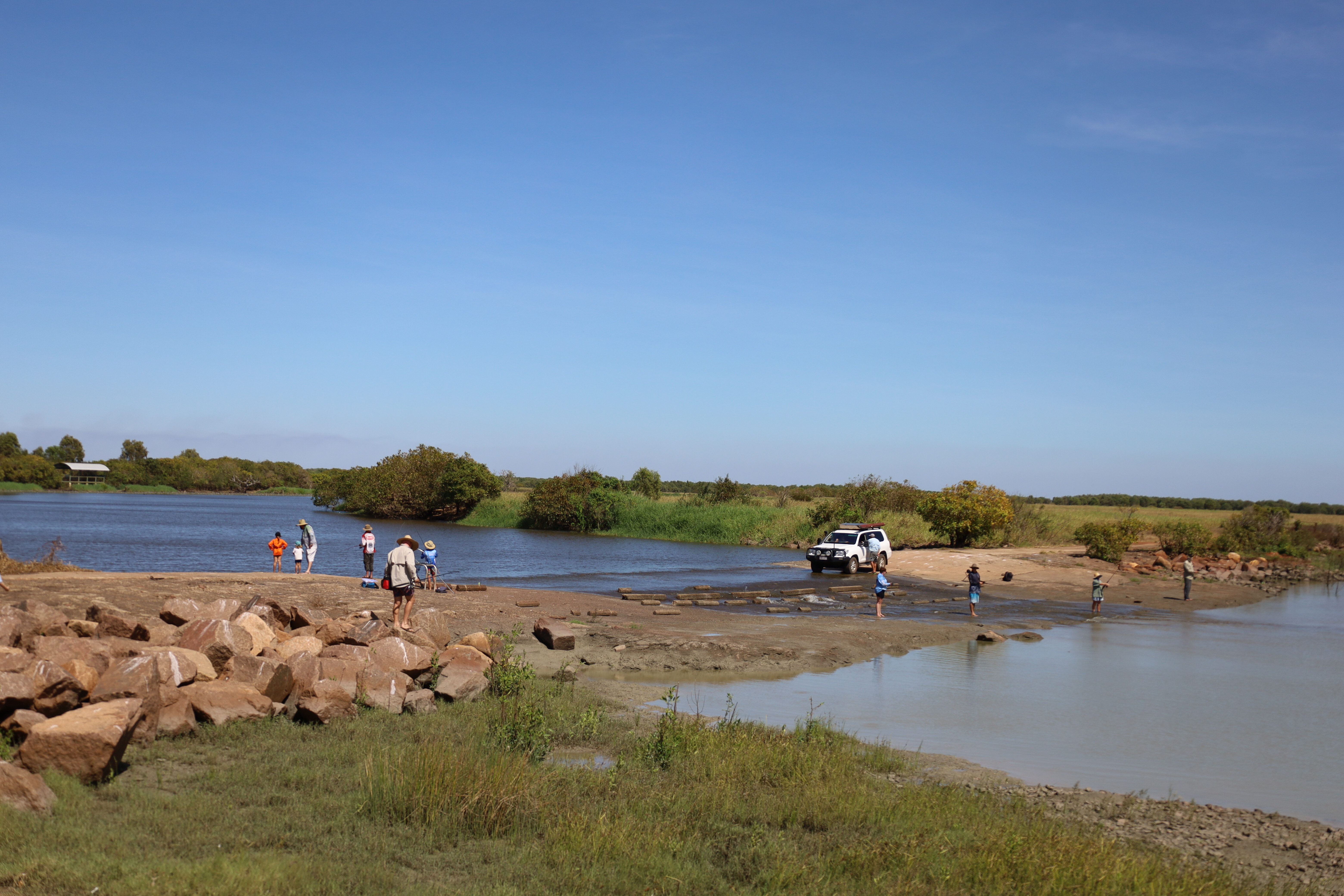
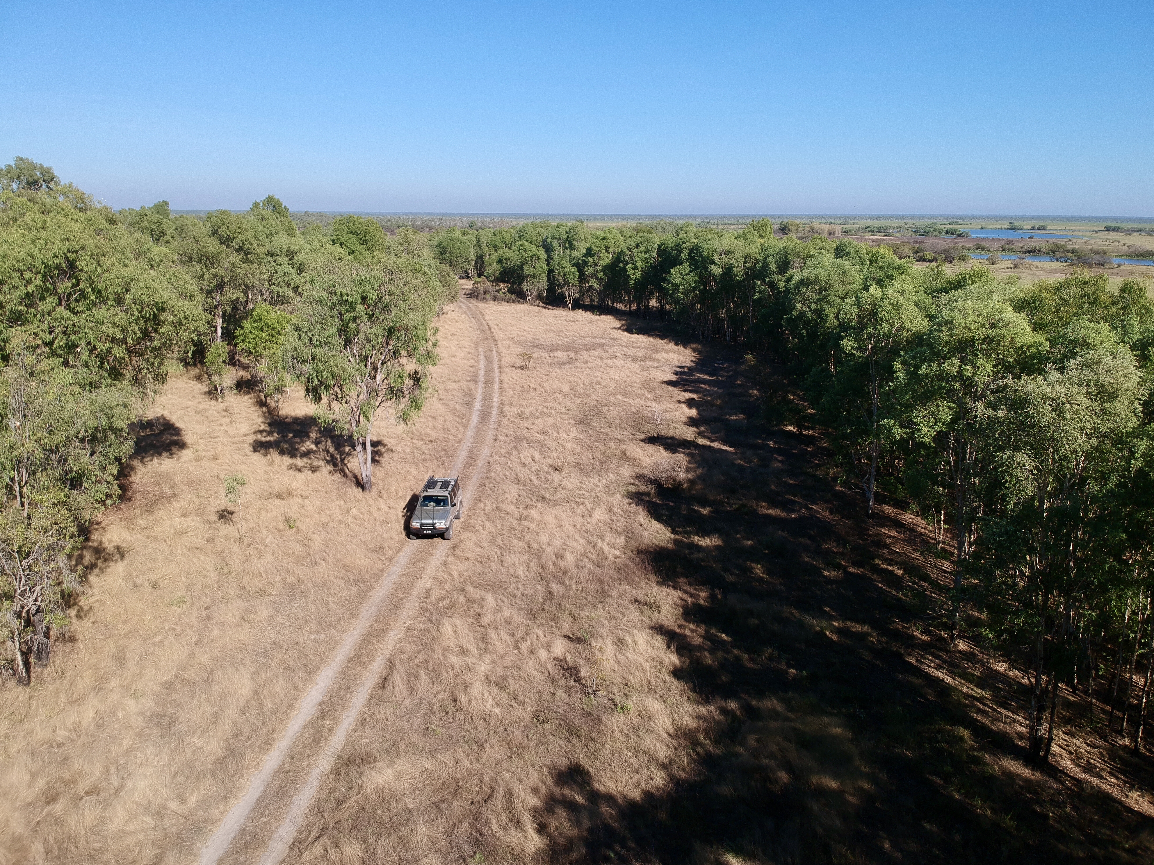
The Top End of Australia is so unique, with animals and plants that can only be found here, a wet season that can leave hundreds of billabongs and rivers full, while seasonal cyclones can destroy huge amounts of land, yet the balance in all this has to be seen to be believed.One of these delicate and often under-rated sections is the Mary River NP just 150km out of Darwin and very much shadowed by nearby Kakadu. Mary River consists of a handful of small reserve areas which protect part of the huge Mary River catchment area covering a staggering 8000km² and is one of eight rivers in the Top End with huge water systems.
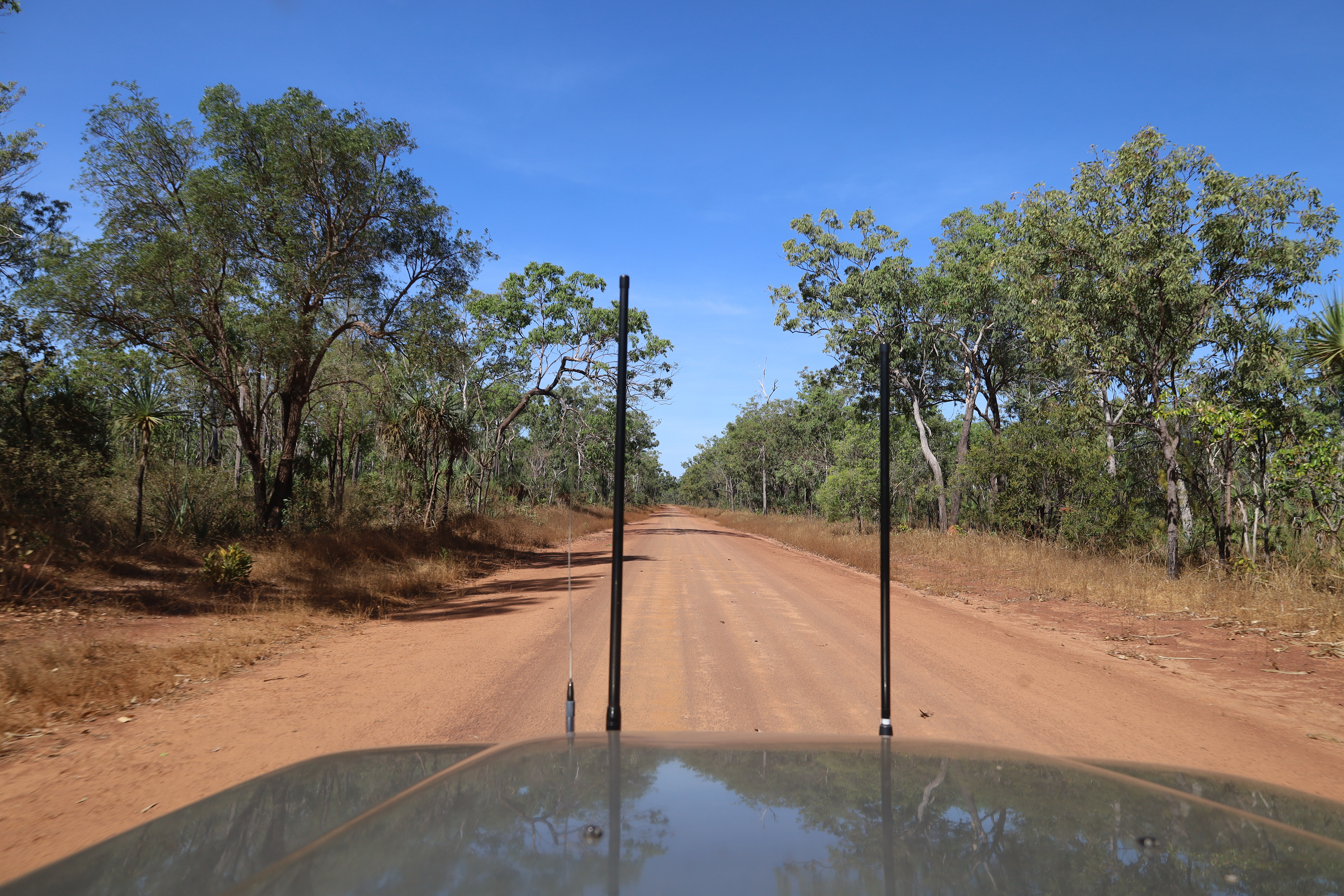
In the dry season from May to September, most areas are accessible to all vehicles, however many roads are unsealed. During the wet season from October to April, flooding can cause seasonal road closures. It has huge areas where monsoon forests, floodplains, savannah grasslands, paperbark and bamboo forests meet, and the best thing is it’s open to exploring − fishing, driving the 4WD tracks, getting back to nature and some of the best camping around.
SHADY CAMP
Getting to Mary River is pretty simple along the Arnhem Highway towards Kakadu for 135km, then turning north towards Mary River NP for another 55km. The road to the park is sealed for nearly 30km then turns in to a good, solid dirt road.
During the wet season, the road may be closed due to flooding, but huge signs at the start will say whether open or closed. My first target point was the well-known Shady Camp area that’s an iconic spot for fishos chasing big barra.Unfortunately, my effort was pretty dismal, but there’s always next time.
Camping out here is pretty good where the NP’s only charge is $3.30 per person for unpowered sites, but there are bins and compost toilets. At the boat launching ramps, a barrage has been installed to protect the wetlands.
Much of the Mary River catchment is below sea level and up until the 1940s, this area was totally landlocked. For the past 80 years, huge sea levels, cyclones and wildlife have carved an opening out to sea allowing for the area to drain and allowing saltwater to destroy parts of the area. Due to this, a barrage (or low-level wall) was built to hold back the freshwater so it can regenerate through the estimated 250km² that has been destroyed.
The Shady Camp barrage is nearly 30km from the ocean to the north and at low tide, the saltwater drains away to nothing leaving just thick mud until the next tide. Yet at high tide, the water often flows over the barrage into the fresh side. If the barrage wasn’t built, huge amounts of saltwater would penetrate the upstream area causing devastation to the fragile environment.If fishing isn’t your thing and you need a day away from camp, go back out to Point Stuart Road and head north to the Point Stuart Coastal Reserve. The road soon turns to a single-lane track where the NP is only a thin sliver of land with private stations on either side.
Honestly, there’s nothing hard about this long dirt road but it does follow the trek that explorer John Stuart took on his last epic trip to the north of Australia back in 1862 looking for pastoral land and to be the first person to reach the Gulf. Back in the day, the government offered £2000 to the first person to do so and with this, Stuart and his party made the successful trip there and back.
I was hoping to reach the rock monument right at the tip of the coastal reserve but was met with a locked gate, just a few kilometres short of the coast due to a seasonal closure – yet on the park’s website it was marked as open. Stuart’s mapping skills and records were so great that when others followed his trail, they found everything to be spot on.
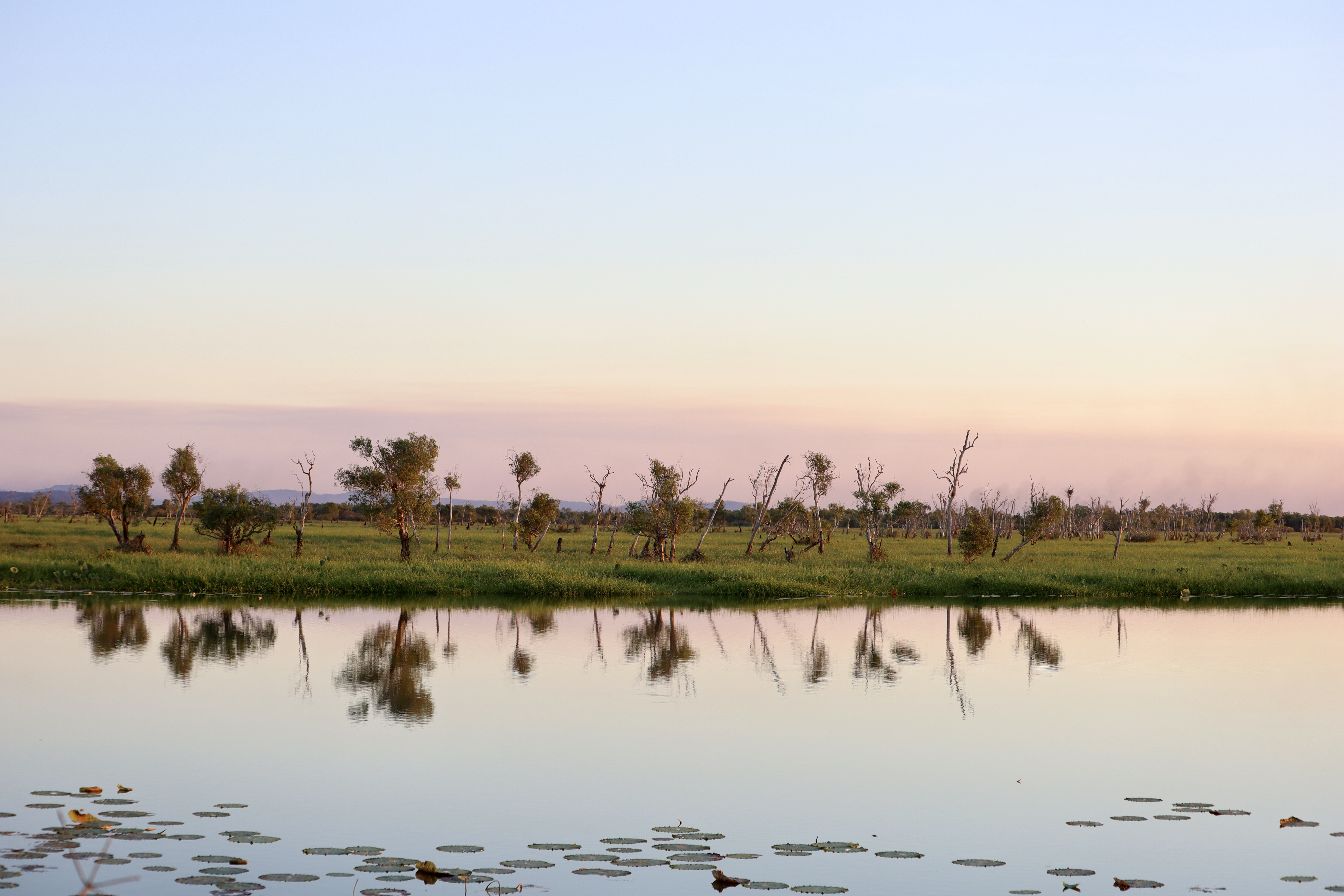
Another significant area to explore relating to explorer Stuart is Mistake Billabong just south of Shady Camp. It is believed that his party camped here on his way north and the return journey for its water and possibly fresh food. A bird hide has been built overlooking the lagoon so visitors can view the birdlife, colourful lillies and crocs.
COUZENS LOOKOUT
Within the centre of the Mary River NP is another popular spot, Couzens Lookout campground that overlooks the stunning and huge river system of the Mary River.It’s located off the tar section of the Point Stuart Road, with a 19km dirt section that again may be closed in the wet season. The camping fees here are cheap too, but you’ll need to be self-sufficient.
A popular activity is to stroll up to the lookout at sunset to see the light change as the sun sets, plus with the high viewpoint you can see big crocs often cruise past stalking their next meal. Masses of lotus lily line the banks and in the distance, vast wetlands cover the area. During the night, the bellows of wild buffalo can be heard as well as wild dogs howling in the distance.
Nearby at the Rockhole, river cruises operate from here and it’s also great to fish for barra in the deep holes safely from the shore. It’s said that the Mary River system has the highest number of crocs per km than anywhere else in Australia, and here at the Rockhole I counted dozens with a mix between salties and freshwater crocs.
WILDMAN TRACK
Starting at the Rockhole, the Wildman 4WD Track takes you from here 32km north to Wildman Road. Again it has seasonal closures, recommended for high-clearance 4WDs and definitely no trailers. The track meanders past huge billabongs full of birds, fish and crocs, plus you’ll see an array of different vegetation including massive native bamboo stands, stunning pandanus forests and tea tree-lined waterways.
The nearby Wildman River was named in 1866 and today is a protected waterway. Across the floodplains, don’t be surprised to see jabiru, magpie geese, masses of white herons right down to herds of feral buffalo who have made a mess of the swampy areas on the edge of the waterholes.
While not a hard track, allow several hours to enjoy the serenity and what the area offers. The Wildman Track joins back to the Wildman Road to the north, where it’s only a short drive back to the main road.
HARDIES 4WD TRACK
If you’re after something a little more diverse and even a little harder, Hardies 4WD Track is a must-do. An entry point is to the south near the Corroboree Tavern and Bark Hut Inn, and the track is around a 100km loop. It dives deep into the fertile and harsh area that Mary has to offer.
Only open during the dry season, the track sees extensive flooding across the plains with several deep river crossings that often close the track for months at a time when it’s been wet. Prior to the loop, the track used to cross at Clarkes Crossing before heading north through Annaburroo Station to nearby Couzens Lookout, but access is now blocked through the station.
At the start of the track, Bird Billabong is a pleasant walk to see large numbers of birds, even in the dry ground where water used to be. From the moment you pass through the gate, the track narrows and winds its way through stands of tea tree towards a viewing point of the Mary River.
Along the way, keep an eye out across the other side for the massive Bambusa arnhemica stands, one of three bamboo species endemic to Australia. It lives for about 30 years, flowers, then dies.Soon the track heads westward towards the hills of Mount Bundey, these rock formations and lumps were important to the Limilngan-Wulna people of this land. The track follows the hills for some way before branching off through savannah grass which, before it’s burnt, can be as high as a 4WD’s bonnet.
There are a couple of river crossings to negotiate, but dependent on the water level and the time of the year. The water at Hardies Crossing flows for most of the year and it’s a narrow, rocky track through the water at the flowing end of the lagoon. Even though the water is flowing, be croc wise, as it’s a permanent waterhole and they are there … as I found out, lying in the pools of water on the track.
The loop follows the wet plains and heads to its farthest point at Corroboree Billabong where there’s a boat ramp but also a high point up the bank to have a break and croc spotting. Parts of the road were extremely rough, not from lack of maintenance but from the feral pigs and buffalo who use the road as their highway going from waterhole to waterhole.
At times, with tyres right down, driving it was only at a slow walking pace. Following the track was pretty easy though, with a stack of blue and red arrows along the way but really, there is only one main track. To fully enjoy and discover the Hardie loop track, allow a full day out with the many spots to enjoy and discover, you never know what you’ll see. My other advice is to get on to the track early in the morning as sections of it were that dusty, it was hard to see out the window.The Mary River NP is a must-do if you’re in the area, as it combines some good 4WDing, has a hint of the gulf country plus the attractions of nearby Kakadu.
FIVE PLACES TO VISIT
1. SHADY CAMP A popular barra-fishing departure point and campsite, with boat ramps either side of the barrage for fishing saltwater downstream or freshwater upriver.2. COUZENS LOOKOUT Enjoy secluded camping beside the Mary River, with only a short walk to the lookout for magic sunset views.3. WILDMAN 4WD TRACK This 32km track is limited to trailer-less and high-clearance 4WDs for exploring the wetlands, monsoonal forests and the wildlife within.4. HARDIES 4WD TRACK This dry-season only route is just off the Arnhem Highway and is one of a limited number of tracks with access to the floodplains.5. POINT STUART COASTAL RESERVE Only accessible during the dry, the drive to the reserve takes you through a variety of environments to Finke Bay. The track also takes you past Stuart’s Memorial Cairn.
Hands up anyone who thought that traditionally conservative Toyota would ever equip its iconic LandCruiser, the even more conservative bedrock upon which the company is built, with a leading-edge-technology 10-speed automatic transmission?
Or indeed equip it with an ultra-sophisticated sequential-parallel bi-turbo system, also at the pointy end of current diesel-engine tech? I certainly didn’t see any of this coming.Oh to be a fly on the wall in the numerous planning meetings that no doubt took place at Toyota HQ as engineers, marketers, bean counters and who knows whom else, nutted out the details of all this at the most difficult and uncertain time in the history of fossil-fuel burning cars. The end decision on this powertrain can’t be seen as anything but bold.
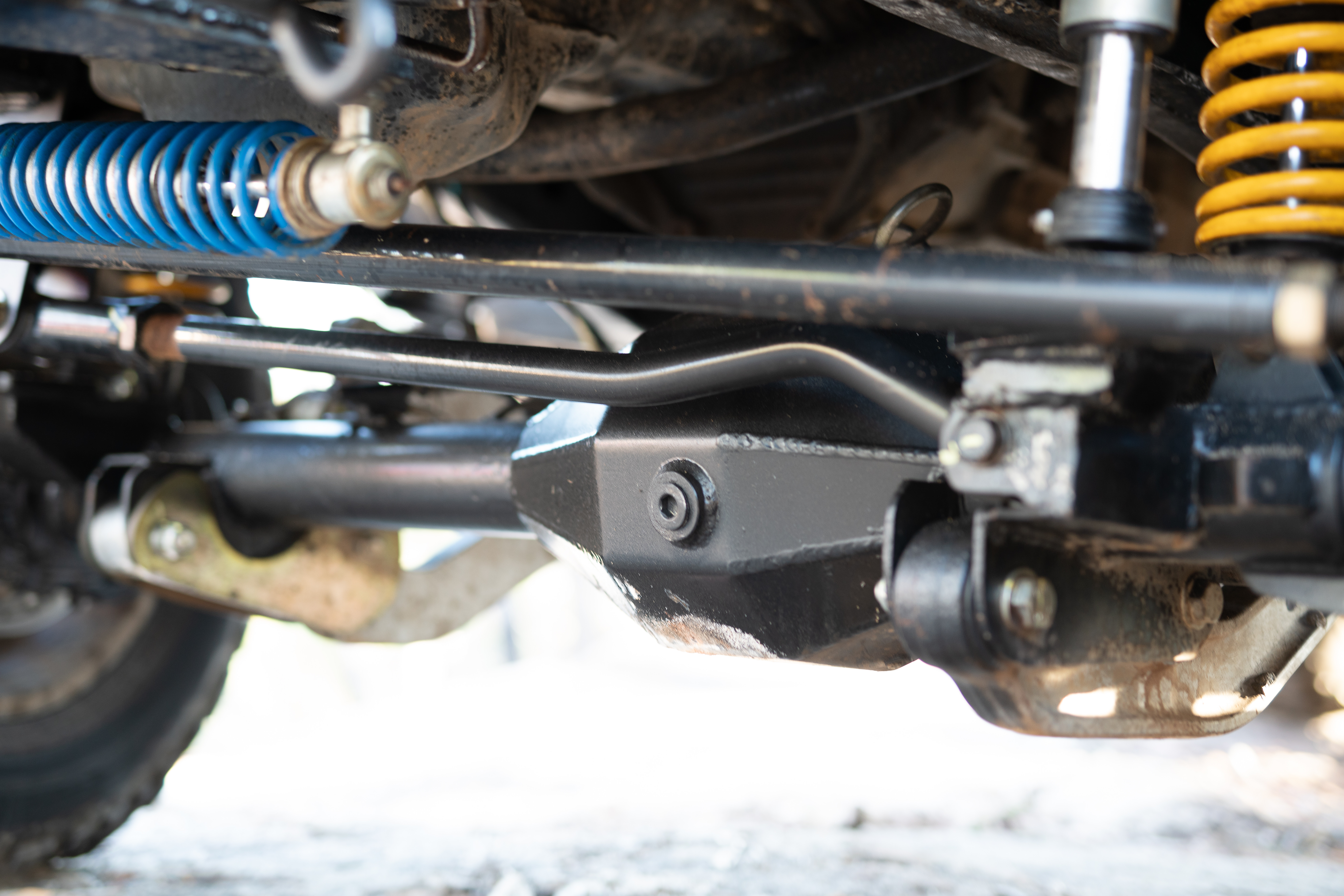
Toyota did, however, stay in its comfort zone with the general layout of the rest of the 300. Not only does it have a body mounted on top of a ladder frame, popularly known as separate-chassis construction, but it has a coil-sprung live axle at the rear and independent double-wishbone front suspension, also with coil springs. This is essentially the same arrangement as used by both the 200 and 100 Series LandCruisers, although the 300 does bring second-generation KDSS which is substantially different from the 200 Series’ KDSS.
It could have even been different, of course. Toyota could have adopted monocoque construction or fully independent suspension, or both. And if it had of been as bold with the chassis as it was with the powertrain, that may have been the path chosen.Ironically, 300 Series prototypes were extensively benchmarked here in Australia as long ago as 2015 against both a Range Rover and the closely related Range Rover Sport, both monocoque 4x4s with fully independent suspension.
Toyota’s choice of separate-chassis rather than monocoque construction comes with good reason. Separating the body from the chassis isolates what’s happening with the tyres, wheel and suspension – all the noise and vibration – and limits its intrusion in to the cabin.
This is especially the case on high-speed gravel and other unsealed roads, which typically present noise and running refinement problems for monocoque vehicles. And while you may see the LandCruiser as just a tough and capable 4×4, Toyota also wants it to be a quiet and refined off-road limousine. The 300 wasn’t benchmarked against the Range Rover and RR Sport for nothing.A ladder frame, which accounts for most of the structural strength of a separate-chassis vehicle, also means this critical weight is placed low, which improves – among other things – the off-road side-sloping stability. With the 300, while the body shell is fabricated from various-grade steels, the exterior body panels are made from lighter aluminium alloy.
The pros and cons of the 300’s suspension versus a fully independent arrangement as per the aforementioned RR and RR S comes down to what’s happening at the rear, as the front is essentially the same.The major benefit of a rear live axle over an independent set-up is that there’s no change in ground clearance under the differential regardless of what the wheels are doing. Changeable ground clearance is, however, a problem with independent suspension.
The live axle’s exterior casting also protects the drive axles from damage, and there’s no need for CV or universal joints. So both simpler and more robust, both attributes that Toyota values.The downside of a live axle compared to independent suspension is more unsprung weight, while a road disturbance to either wheel effects the wheel on the other side of the axle. There’s also some bump-steer as the axle (located by a Panhard rod, as it is with the 300) moves slightly sideways back and forth as it moves up and down in response to road irregularities.A vehicle with rear independent suspension isn’t afflicted by any of this. Drive any of Land Rover’s serious 4x4s – from the Defender up – on a bumpy road, especially at higher speeds, and you can’t help but notice the difference. Ironically, Toyota has experience with a fully independent suspension on a serious 4×4. It’s called the Mega Cruiser. Perhaps next time …