Advice


Gallery 1
The right apps can make a big difference to a 4WD trip, whether you’re exploring local tracks for the weekend or planning a multi-week trek through remote Australia.
From finding new routes and navigating off-road to locating campsites and comparing fuel prices, they can help you plan ahead and make the most of your time away. Weather forecasts, track reports and emergency-warning apps are also worth having on hand, particularly when travelling through unfamiliar country where conditions can change quickly.
Having the right information can help you adjust your plans, avoid trouble spots and make better decisions along the way. These digital tools won’t replace proper preparation, reliable maps or dedicated safety equipment, but used together, they can make trips easier to organise and less stressful when plans change.
1. ExplorOz Traveller
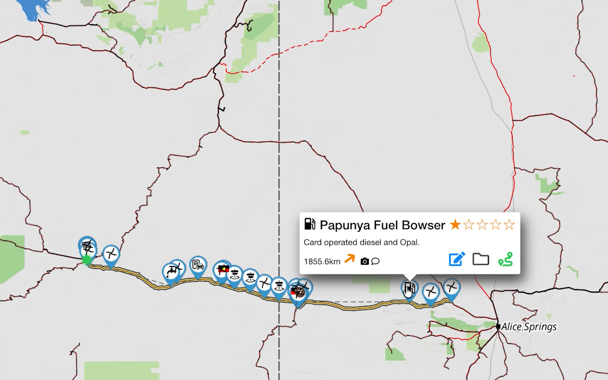
ExplorOz Traveller (↗) is built around Australian touring, with detailed mapping, trip planning and a database of campsites, fuel stops and other points of interest. It lets you plan routes, record trips and view tracks, terrain and remote infrastructure that can be difficult to make sense of using a standard road-navigation app.
The app includes Australia-wide overview maps for offline use, along with GPS tracking and trip planning. For more detailed offline topographic mapping, you’ll need to purchase access to the relevant EOTopo map edition or subscription. Download the required maps before heading out of range.
For anyone planning a long-distance outback trip, ExplorOz Traveller combines mapping and trip-planning tools in one place, with information geared towards travelling around Australia.
1
2. Newtracs
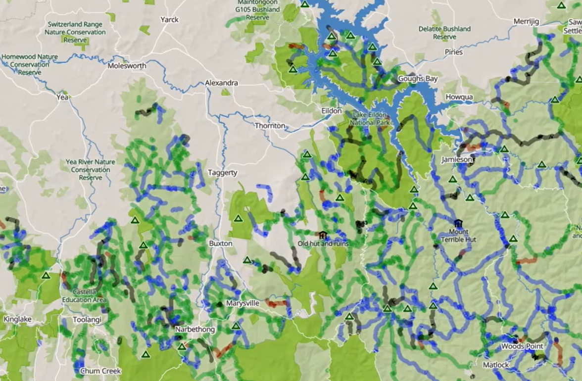
Newtracs (↗) is focused on tracks, with community-sourced information to help drivers assess routes before setting off. Its features include track difficulty ratings, warnings, route information and reports from other users, helping you make a more informed decision about where to go and what your vehicle may encounter.
The app supports offline maps, while paid features provide access to additional mapping and information. Check the current plan details and download the areas you need before leaving mobile coverage.
Track information and closures can change, so check current access conditions before travelling. A track that suits one vehicle or driver might not be appropriate for another, particularly after rain or when conditions deteriorate.
1
3. Hema 4×4 Explorer
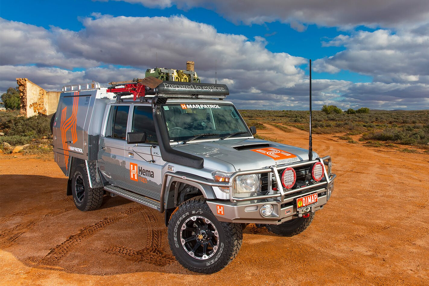
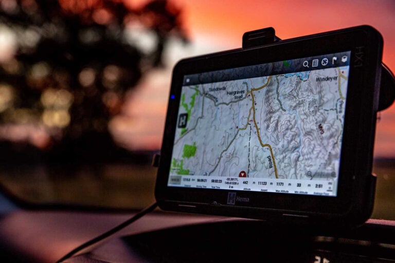
Hema 4×4 Explorer (↗) provides mapping and trip-planning tools aimed at four-wheel drivers and touring travellers. Features include GPS positioning, waypoints, track recording and different map styles, with specialist mapping available for planning trips away from sealed roads.
There are important offline limitations to understand. Some map styles require a paid subscription and must be downloaded before departure, while other layers and features require a data connection. Check which maps are available offline for your intended route, and test them on your device before relying on the app in remote country.
Hema 4×4 Explorer is worth considering if you want specialist mapping, but don’t assume every map layer or feature will work without reception.
1
4. WikiCamps Australia
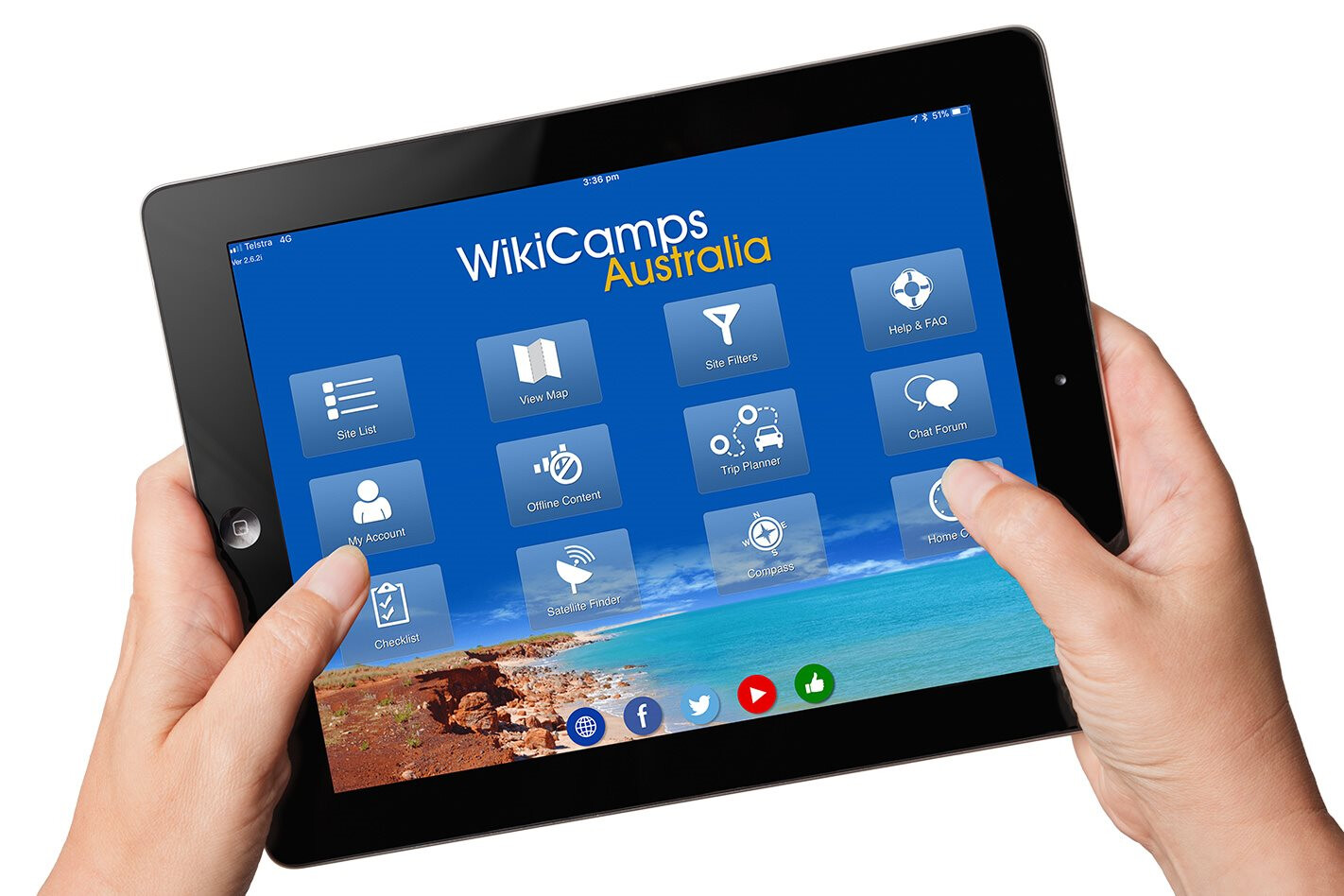
WikiCamps Australia (↗) is a handy companion for finding places to stay and facilities along the way. Its listings cover campgrounds, caravan parks, free camping areas, toilets, showers, dump points and other points of interest, with photos and reviews contributed by travellers.
Filters help narrow down options based on your needs, whether you’re looking for a free campsite, a pet-friendly stop or a place with particular facilities. You can also build itineraries, save favourite locations and access downloaded information offline.
As with any community-driven directory, listings and reviews are only as useful as the information available. Check recent feedback and confirm important details before committing to a remote campsite or relying on a facility being available.
1
5. Fuel Map Australia
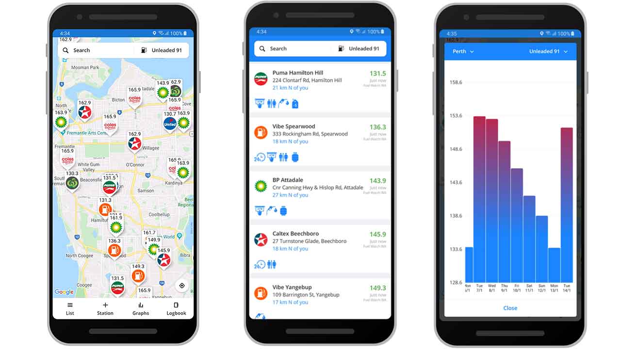
Fuel Map Australia (↗) helps drivers locate service stations and compare fuel prices across the country. It combines a crowdsourced database of stations and prices with government-sourced price information in some states, making it useful when planning fuel stops on a long drive.
The app also includes a fuel log, allowing you to record purchases and keep track of fuel economy. That can be handy when monitoring consumption in a loaded touring vehicle or working out how far you can travel between stops.
Prices and station information can become outdated, particularly in remote areas where there may be limited reporting. Treat the displayed price as a guide, check when it was last updated and confirm that a station is operating and has the fuel you need before relying on it.
1
6. CamperMate
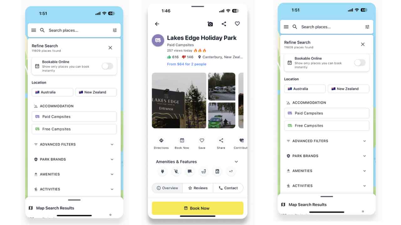
CamperMate (↗) is another useful tool for finding campsites, holiday parks and facilities while travelling around Australia and New Zealand. Its map includes free and paid camping options, public toilets, showers, dump stations, attractions and other useful stops.
You can filter listings, read traveller reviews, save favourite places and plan a road trip. The app supports offline maps and information, but download the relevant content while connected to the internet.
CamperMate overlaps with WikiCamps, so you may not need both. However, comparing the two can be worthwhile when researching a campsite, checking facilities or looking for alternatives along your route. Confirm critical details before arrival.
1
7. Google Maps
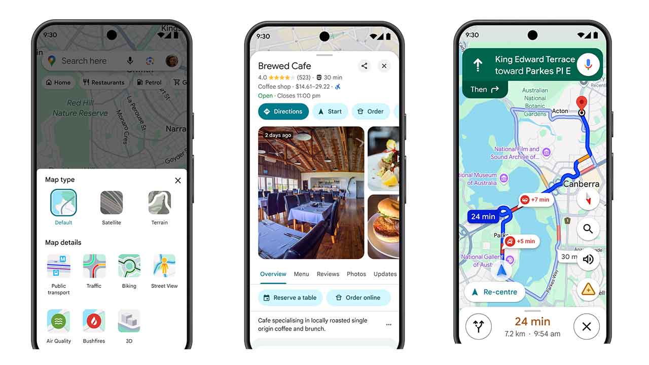
Google Maps (↗) might not be designed specifically for four-wheel driving, but it remains useful for getting to the start of a trip, navigating towns and finding shops, fuel stops and other services.
You can download selected areas for offline use, which helps when travelling through regions with patchy reception. However, offline maps have limitations, and some information and navigation features won’t be available without a connection.
Google Maps should not be your only navigation tool when heading onto remote tracks. It isn’t a substitute for dedicated off-road mapping, and it may not provide the track detail, access information or terrain context needed to make safe decisions away from formed roads.
1
8. BOM Weather
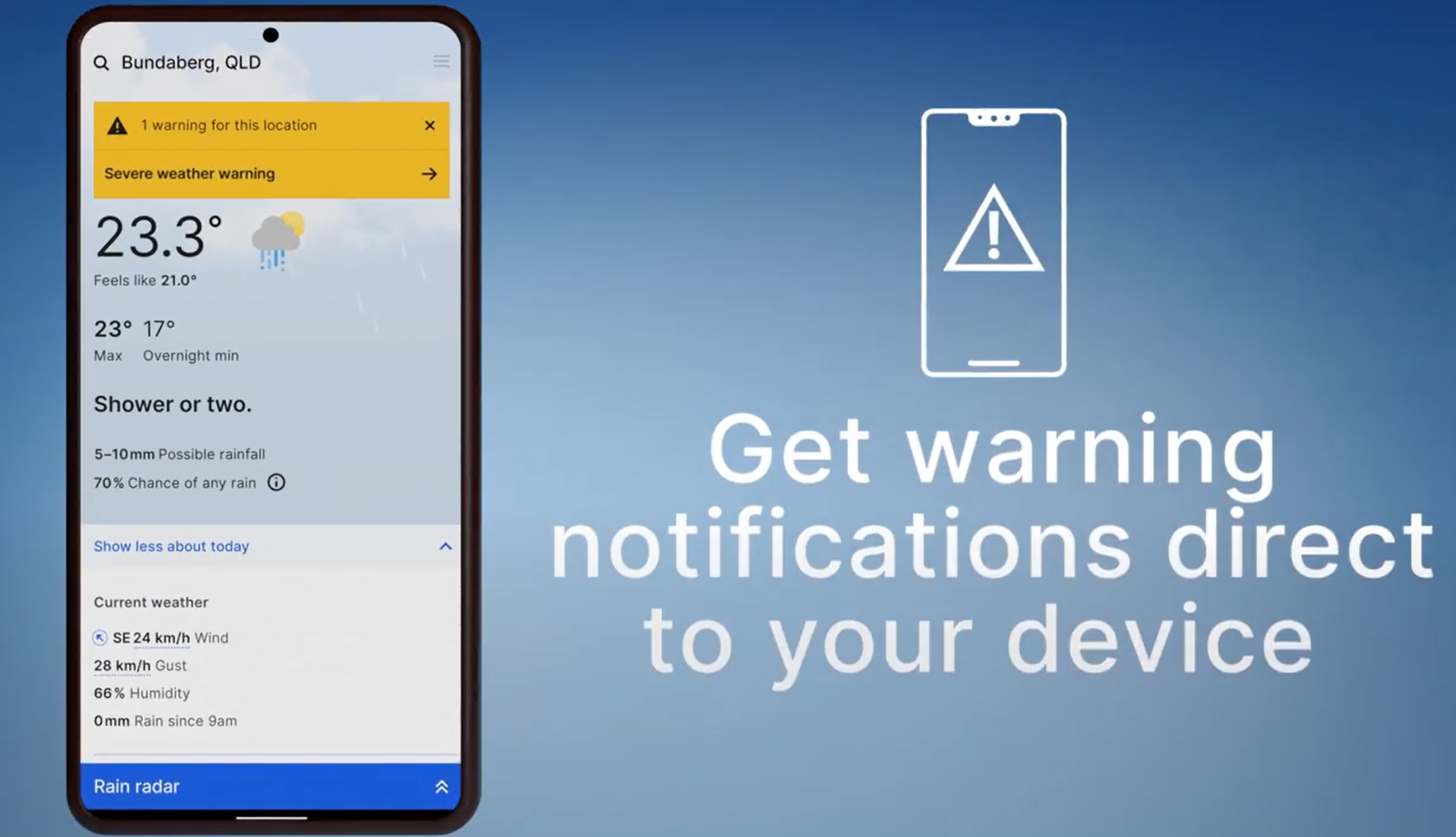
The Bureau of Meteorology’s BOM Weather app (↗) provides forecasts, radar imagery, warnings and other weather information to help you plan a trip and monitor changing conditions.
Checking the forecast before leaving is particularly important when travelling through flood-prone areas, alpine country, deserts or regions affected by bushfires and severe storms. Conditions can change quickly, and rain can turn an easy track into a difficult or impassable route.
The app relies on an internet connection to refresh live forecasts, radar and warnings. Check conditions before leaving coverage and update your information whenever you regain reception. A forecast is only one part of trip planning, so be prepared to change your route or postpone travel if conditions deteriorate.
1
9. Emergency+
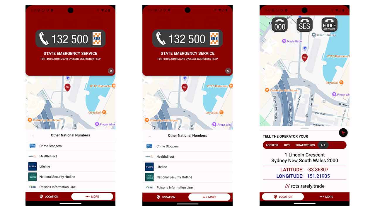
Emergency+ (↗) is a free Australian app developed with emergency services and their government and industry partners. It uses your phone’s location services to help you provide emergency call-takers with your location when contacting Triple Zero (000). It also provides access to other relevant emergency and assistance numbers.
In an emergency, being able to communicate your location accurately can make a real difference, especially if you are unfamiliar with the area or don’t know the nearest road or landmark.
Emergency+ is not a satellite communicator and cannot create mobile coverage where there is none. You still need a working connection to place a call. If you’re travelling beyond mobile coverage, consider carrying a personal locator beacon (PLB) or satellite communicator and make sure someone knows your planned route and expected return time.
1
10. Gaia GPS
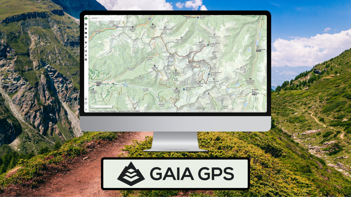
Gaia GPS (↗) is a mapping and navigation app designed for outdoor activities, including off-roading and overlanding. It lets you view your location, mark waypoints, record tracks and plan routes, with a selection of topographic maps and overlays for understanding terrain.
The free version provides basic mapping and GPS features, but downloading maps for offline use requires a Premium subscription. Once the required maps have been downloaded, you can use them to navigate without mobile reception.
Gaia GPS is a flexible option for drivers who want to work with different map layers and terrain information. Before heading off-grid, check that the maps cover your destination, download the areas you need and test offline access on your device.
1
Special mentions
- VicEmergency and other state and territory warning apps: Check the official emergency-warning service for the state or territory you’re travelling through. VicEmergency (↗) provides Victorian warnings and incident information, while other jurisdictions have their own services. These are particularly useful for monitoring bushfires, floods, severe weather and other incidents that could affect your route. Live alerts and updates generally require an internet connection.
- Memory-Map: Memory-Map (↗) is another mapping option for people who prefer working with specialist topographic maps. Check the maps available for your destination, licensing requirements and offline functionality before relying on it for a trip.
- Goin’ Bush: Goin’ Bush (↗) is an Australian 4WD app focused on track discovery, vehicle-specific difficulty ratings, trip planning and navigation. Its paid Off-Grid tier adds downloadable regional maps and offline navigation. Download the required maps before leaving mobile coverage.
Will these apps work without the internet?
Not every app works fully offline, and even those that do may lose important features without an internet connection. That’s a crucial consideration when travelling through remote Australia, where mobile reception can disappear for hours or days.
Dedicated navigation and camping apps may let you download maps and other information before departure. However, offline access varies by app, map product, subscription and device. Features that depend on live data, including updated fuel prices, recent track reports, weather forecasts and emergency notifications, generally need a connection to refresh.
GPS positioning is different from mobile reception. A compatible phone can determine its location using GPS satellites without mobile coverage, but it still needs suitable maps stored on the device to show where it is. GPS alone does not provide internet access or allow you to make a phone call.
Before leaving mobile coverage:
- Download the maps and offline information you’ll need for your entire route.
- Check whether the map style you intend to use is available offline, and whether it requires a paid subscription.
- Test your downloaded maps with your phone in flight mode, rather than assuming they’re available offline.
- Save important addresses, route details and emergency contacts somewhere accessible without the internet.
- Check weather forecasts, road closures, fire warnings and track access before departure, then refresh your information whenever you regain coverage.
- Keep your phone charged and carry suitable backup power.
Most importantly, don’t rely on a smartphone as your only navigation or emergency device when travelling beyond mobile coverage. Emergency+ cannot create mobile reception, and ordinary mobile calls and messages may not work outside network coverage. Carry suitable backup navigation and safety equipment, consider a PLB or satellite communicator, and make sure someone knows where you’re going and when you expect to return.
Quickfire FAQs
What is the best app for 4WD navigation in Australia?
ExplorOz Traveller, Newtracs, Hema 4×4 Explorer and Gaia GPS offer mapping and navigation features suited to different types of off-road travel.
Can you use 4WD navigation apps without mobile reception?
Yes, many support offline navigation, but you must download compatible maps in advance and some features require a paid subscription.
What is the best app for finding campsites in Australia?
WikiCamps Australia and CamperMate both help locate campsites, caravan parks and facilities, with listings and reviews from travellers.
Which app helps find the cheapest fuel in Australia?
Fuel Map Australia lists service stations and reported fuel prices, although prices and availability should be verified before travelling.
Can Emergency+ work without mobile reception?
Emergency+ can use GPS to identify your location, but you still need a working connection to contact emergency services.
Follow 4X4 Australia on Google
Get more 4x4 news, reviews and gear stories from 4X4 Australia in your Google feeds.


We recommend
-
 Gear
GearLost and found: A guide to satellite navigation
A purpose-built sat-nav system for 4x4 use guarantees continent-wide coverage.
-
 Gear
GearWhy every 4x4er needs a satellite phone
It’s a big country out there, and a satellite phone gets the coverage you won’t get from a mobile phone when you’re away from the city lights.