Explore NSW

Gallery 1
A gorge is a narrow valley carved between hills or mountains, typically with steep, rocky walls and a river or stream running through it. Warrabah National Park is a picture-perfect example.
It’s remote, you need to be self-sufficient, there are plenty of activities and it helps if you have a 4×4 to get there. Located on the western slopes of Australia’s Great Dividing Range, the park was declared in 1984 and covers nearly 5000 hectares along 20km of the Namoi River.
My trip started at the small town of Manilla, 80km north of Tamworth. Manilla has basic facilities, including a mechanical workshop and supermarket, and is the last stop to fuel up.
1
Getting into Warrabah
Head north from Manilla across the Namoi River, then turn onto Fossickers Way.
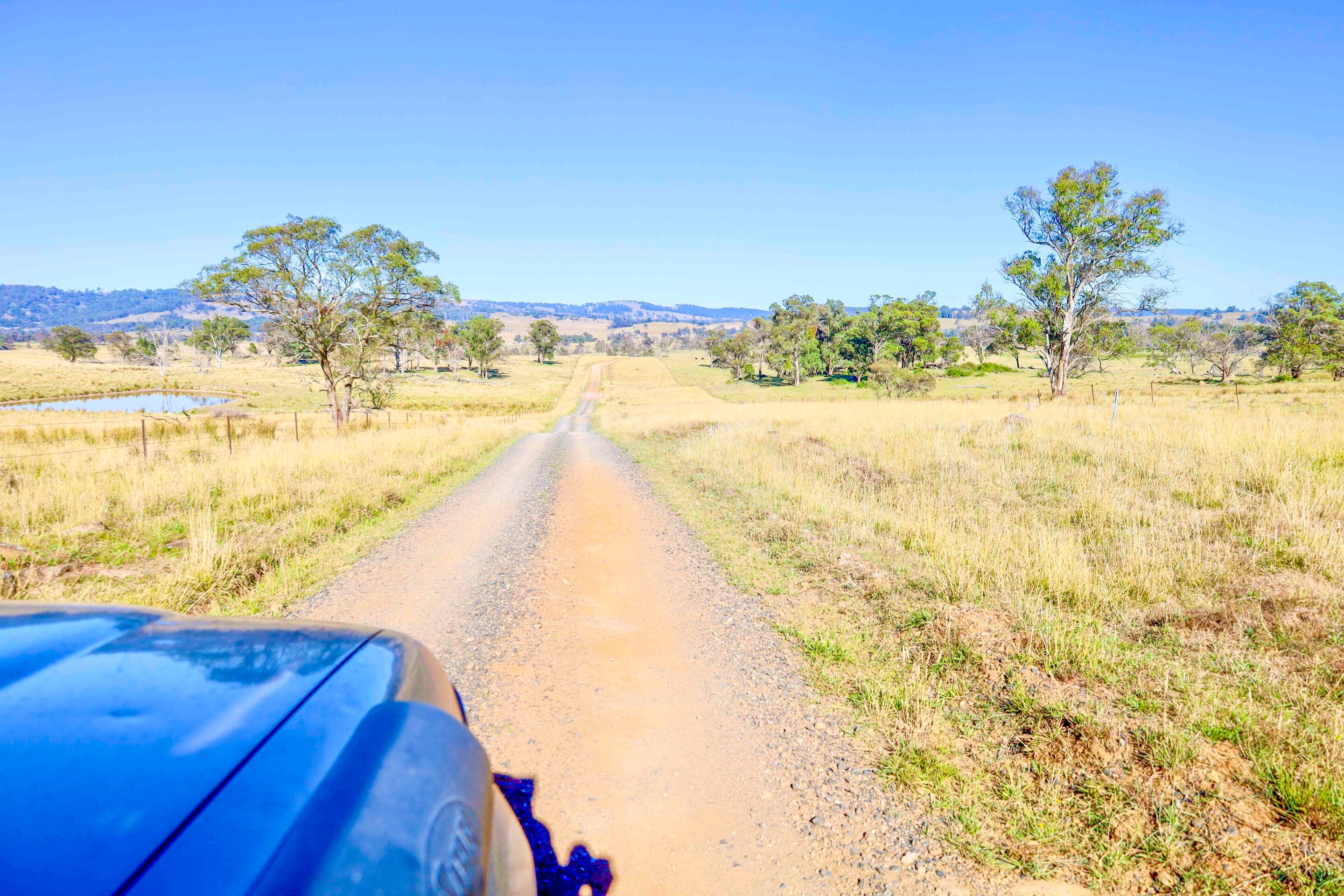
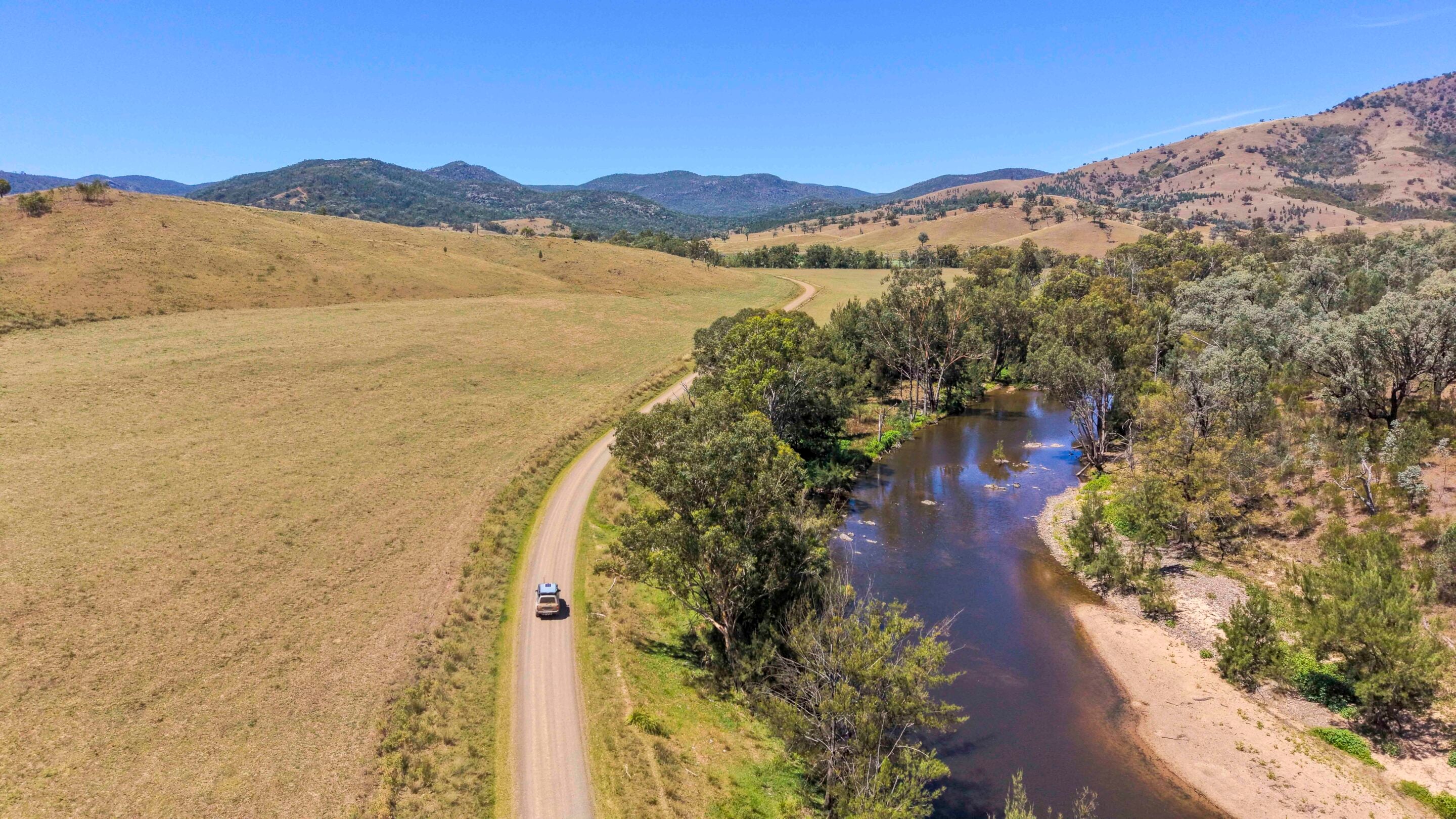
The first 15km follows a narrow sealed road winding past hobby farms and old buildings. Once you hit the dirt, the farms give way to huge pastoral stations and cropping areas beside the Namoi River. You’ll soon cross the Nandewar Ranges, which explorer John Oxley first recorded in 1818. There are several turns towards Warrabah, but these are well signposted.
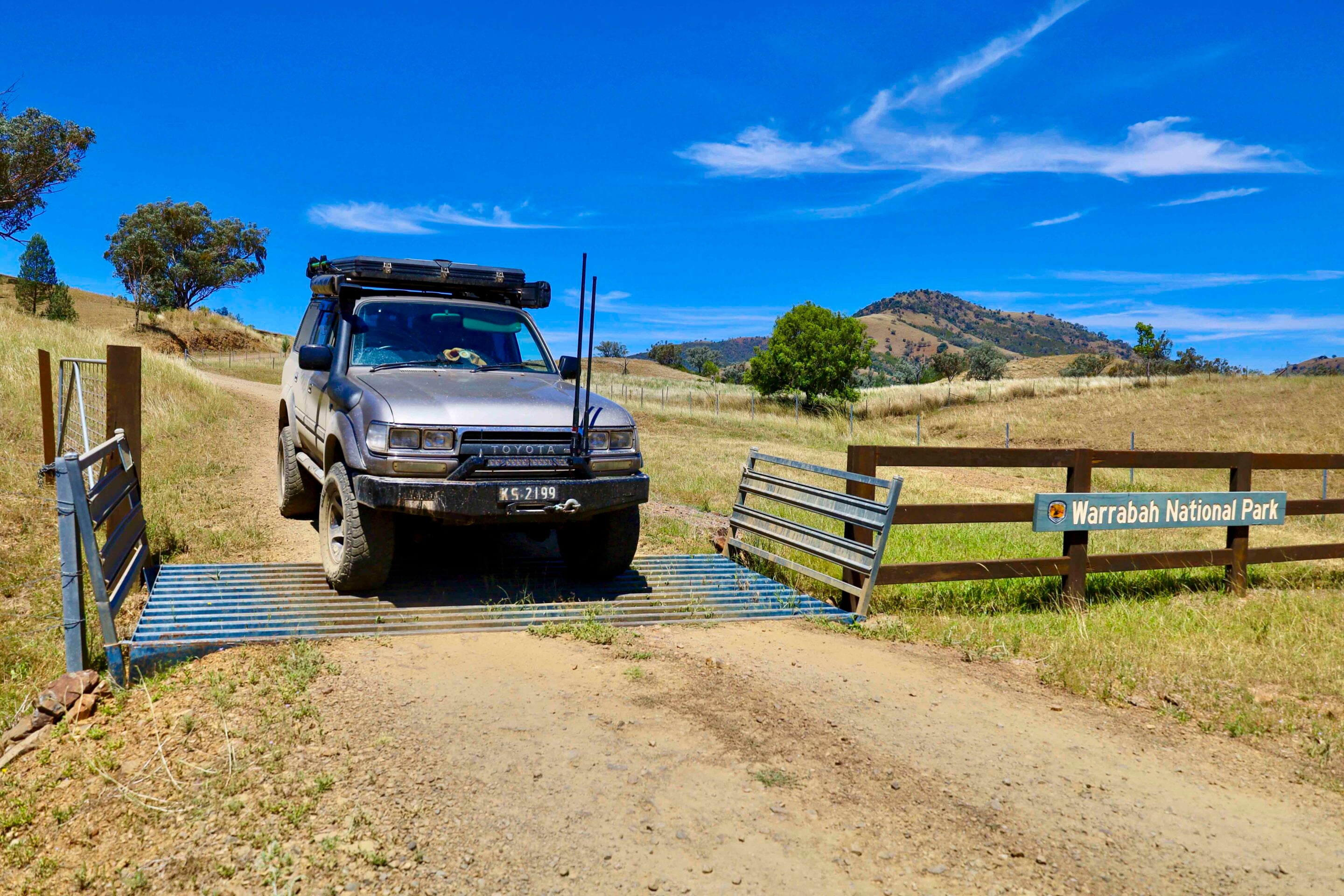
Entering the park, you’re greeted by information boards covering the ecology, camping locations and other important park details. If you haven’t booked online, you may need to return to an area with phone service, as reception is patchy around the campgrounds.
1
Camping beside the Namoi River
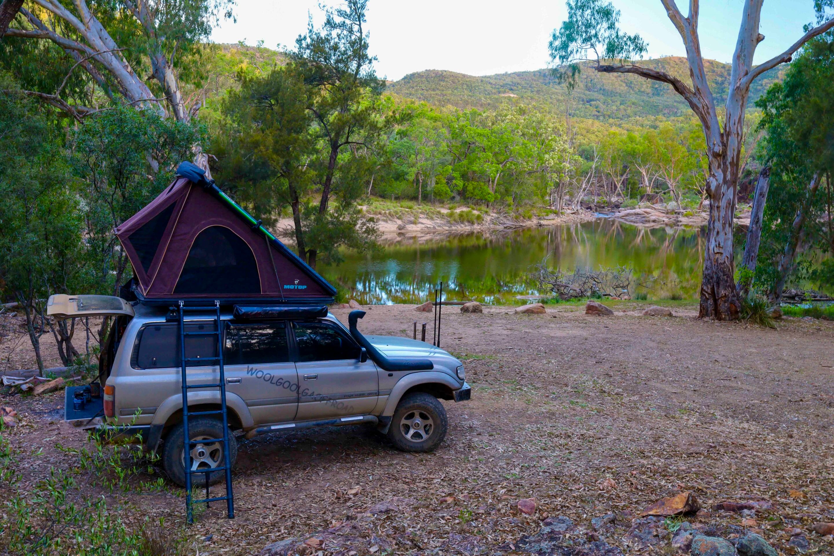
The main campground sits right on the Namoi River, with plenty of sites for tents and camper trailers, along with composting toilets, firewood bins and barbecues.
The river has carved an impressive gorge through the Nandewar Range. Huge granite boulders line the water as it burbles along, creating pools where you can fish for yellowbelly, Murray cod, redfin and carp. A wide variety of wildlife frequents the river, from little willy wagtails and shags to lizards and snakes. If you’re a morning person, you might spot a platypus in the deeper pools.
The park lies on the rugged Nandewar Range, part of a belt of granite that extends 200km towards Queensland. Its woodlands form an important corridor for wildlife, with large areas of grassy white box woodland. This habitat is threatened in many other parts of northern NSW by land clearing and bushfires. Out here, you need to come prepared for any season. Stinking hot days and chilly nights down around zero are common, even in summer. Winter days are cold and the nights bitter.
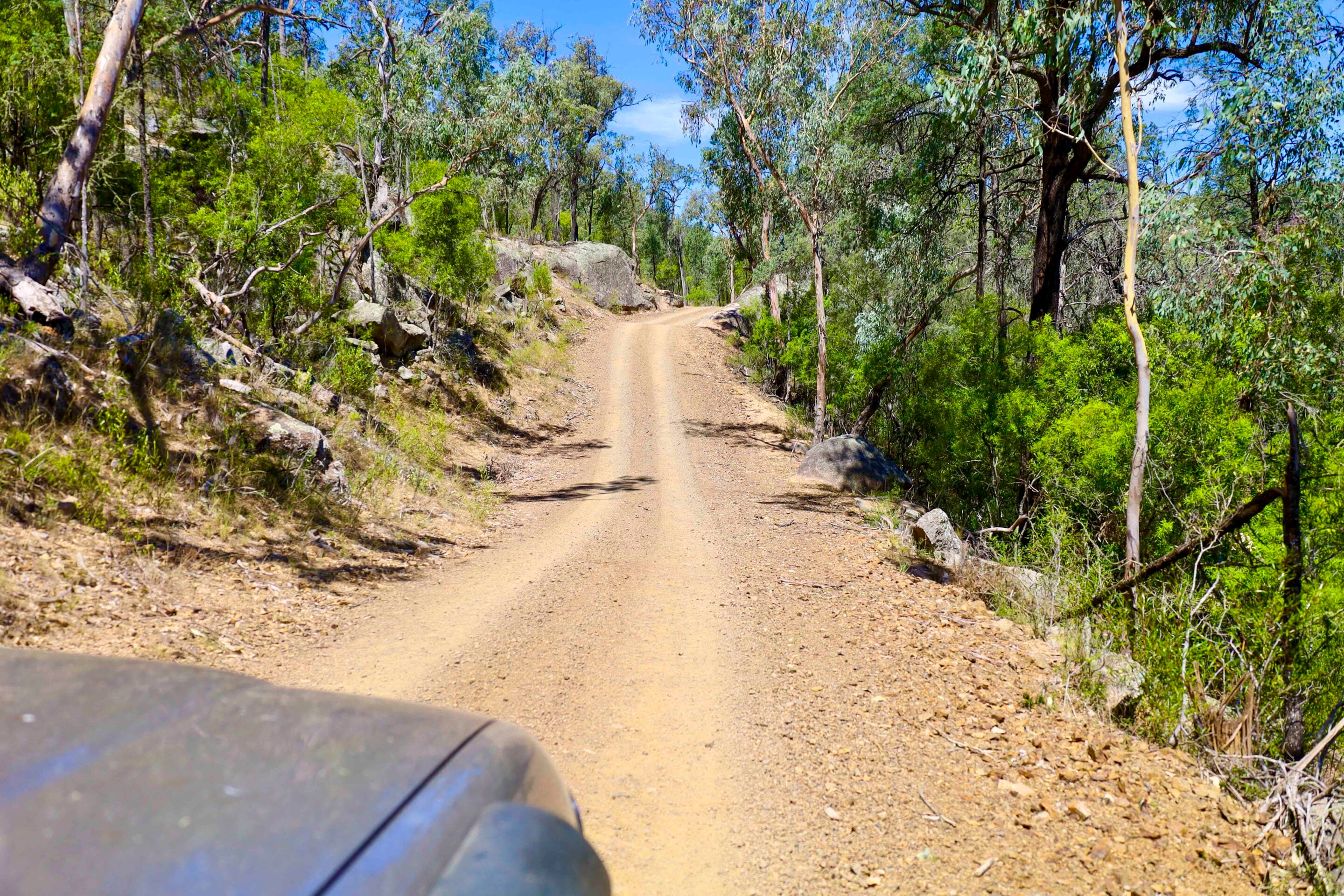
Another option for those with a capable 4×4 and an off-road trailer is the remote Gum Hole camping area, just 3km from the main campground. Access is by 4×4 only. The track is steep and narrow, passing between huge granite boulders and along the ridgeline before dropping down to Gum Hole.
The campground at Gum Hole is great, with some sites offering their own barbecue fire pit and table. At the southern end, there’s a composting toilet. There are no bins, so take your rubbish with you to help keep vermin away and the park clean. Camping at Gum Hole gives you privacy away from the main campground and lets you explore more of this rugged area.
1
Exploring the Namoi River gorge
There are several walks from the campground along the riverbank into the gorge in both directions, but the best heads downstream. This takes you along the steep-sided gorge, where 20m-high rock formations frame fantastic views.
Keep an eye out for signs of just how high the Namoi River can rise during floods, with debris caught in trees and piles of driftwood left high and dry. This is a great area to cast a few lures and try your luck in the deep pools or, in summer, try riding the rapids. Most walkers with a moderate level of fitness can follow the river, combining rock hopping with swimming. If you’re willing to climb to some of the higher peaks, you’ll be rewarded with views into more of Warrabah’s rugged country and along the Namoi.
After kicking back for several days, breathing the clear mountain air and just chilling out, you can take an alternative route out of the park. Head east to explore more of the tablelands surrounding the Nandewar Range.
1
The scenic drive to Uralla
Head back past the main campground and continue out of the park for 10km, then turn left onto Glenbarra Trail near the big old shearing shed. Keep an eye out for two graves, including that of Sarah Abbott, who died in 1898 aged just four. Other family members are buried here too.
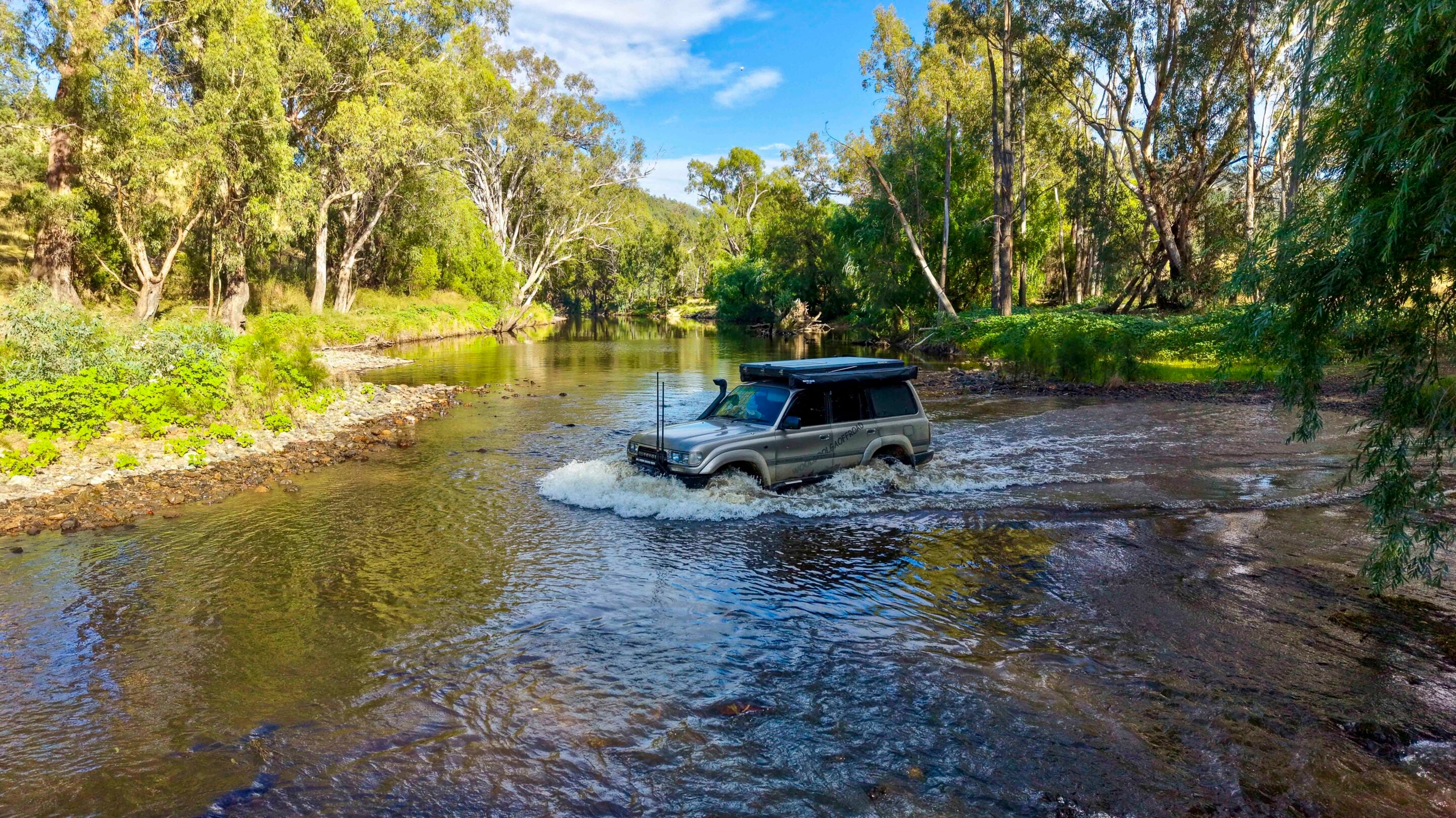
Nearby, old buildings and yards overlook the Namoi River. Squatters reportedly moved to the area in the mid-1800s, beyond the limits of settlement, to start a new life. They were attracted by prime sheep-grazing land, while the discovery of gold in nearby Rocky River swelled the area’s population. The Glenbarra Trail heads down to a much larger crossing of the Namoi River, where you’ll need to check the water flow and depth. After rain, the river can be around 30m wide. The trail forks beyond the crossing, so keep left.
As you travel through the localities of Balala, Retreat and Kingston, you’ll pass a number of old buildings in the paddocks that have been listed on the Register of the National Estate. The Glenbarra Trail becomes Balala Retreat Trail, and you know civilisation isn’t too far away as sheep stations give way to boutique horse studs, wineries and cropping areas. Brushgrove is where the dirt ends, but there’s little more here than a quaint, restored school building that operated from 1954 to 1964.
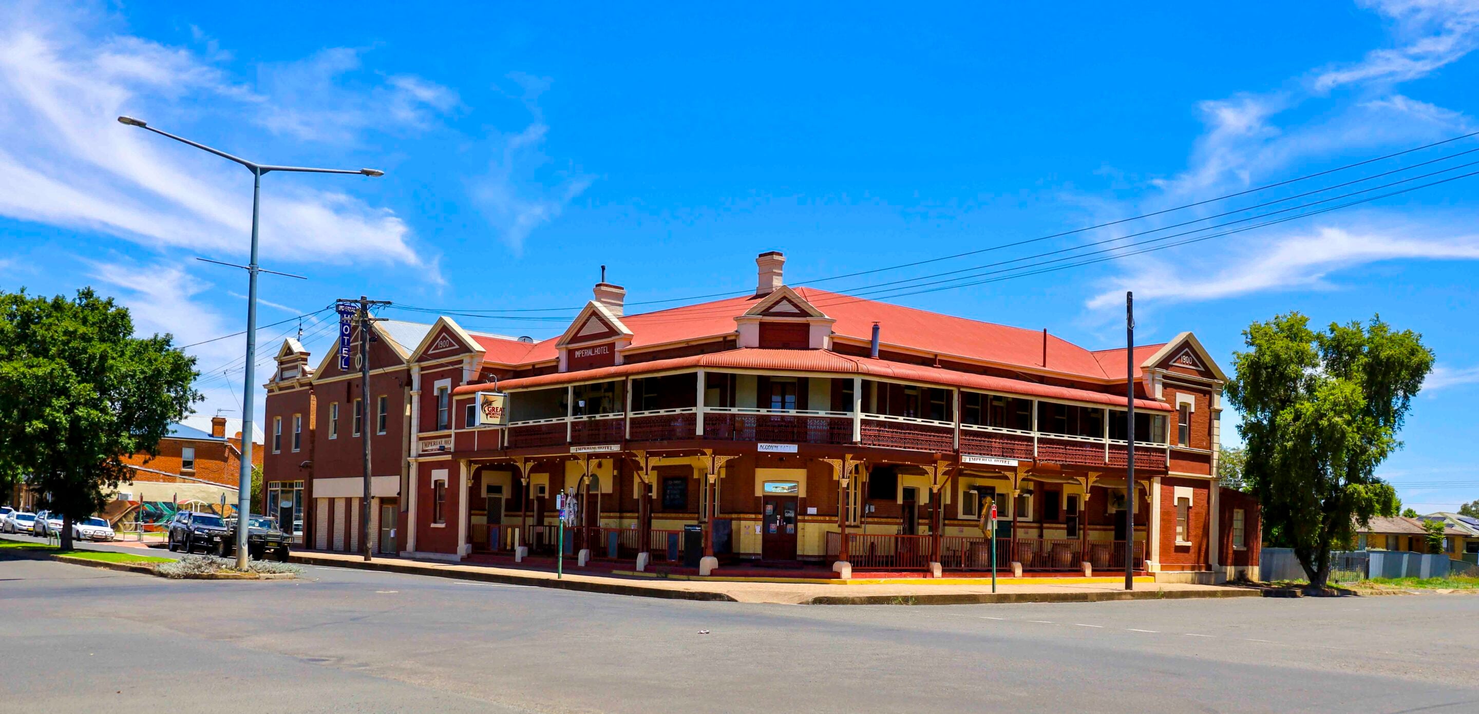
At Uralla, you’ll be pleasantly surprised by the cafés, pie shops and microbreweries. It’s a beautiful historic town lined with old-style streetlights, and a heritage walk takes in more than 50 buildings dating back to the mid-1880s.
1
Discovering Uralla’s bushranger history
Bushranger Captain Thunderbolt (aka Frederick Ward), who roamed the Uralla area in the 1860s, is buried in the old Uralla Cemetery, and there are many references to him around town.
To the south is a rock from which Thunderbolt ambushed travellers. Today, it’s more of a graffiti rock than a historic landmark. In town, roads bear his name and an exhibition at McCrossin’s Mill Museum highlights his time in the area, including his death on 25 May 1870, when he was shot and killed by Constable Alexander Walker during a highway robbery. However, local accounts claimed it was his uncle, William Ward, posing as Thunderbolt, who was killed rather than Frederick.
Another must-do in Uralla is a visit to Gostwyck Church, along Gostwyck Road, a 10-minute drive out of town. The chapel was dedicated to the memory of Major Clive Collingwood Dangar MC, who died in World War I. He was the grandson of Henry Dangar, who emigrated in 1821 and worked as an assistant surveyor to explorer John Oxley, surveying land and exploring river systems across the New England region.
The Gothic-style chapel is a stunning example of English architecture, with an oak interior and roof shingles. Massive oak trees surround the ivy-covered chapel, making it popular with photographers all year round.
The New England region has so much to offer, with its distinct seasons and many national parks. Warrabah is a great example: visitors can relax beside the Namoi River, explore the nearby rugged Nandewar Range, then head to Uralla for its unique charm and bushranger history.
1
Warrabah National Park quickfire FAQs
Where is Warrabah National Park?
Warrabah National Park lies between Uralla and Manilla on the New England Tableland in NSW. The Namoi River runs through the park, which features dramatic gorges and granite boulders. Once bushranger country, it’s now a peaceful destination for nature lovers.
How do you get to Warrabah National Park?
From Manilla, 80km north of Tamworth, head north across the Namoi River and turn onto Fossickers Way. Follow the sealed road for around 15km before continuing along the unsealed roads towards the park. The route is well signposted, with several turns leading to Warrabah.
What can you see and do at Warrabah National Park?
Visitors can explore hiking trails, spot native wildlife, fish in the Namoi River or enjoy time on the water during the warmer months. The park has two camping areas with basic facilities, suitable for off-road campers and 4x4s.
Can you camp at Warrabah National Park?
Yes, there are two camping areas with basic facilities. Campsites must be booked online through the NSW National Parks and Wildlife Service website.
Do you need a 4×4 to visit Warrabah National Park?
A 4×4 is recommended for accessing the park, particularly the remote Gum Hole camping area, which is only accessible via a steep, narrow 4×4 track.
Can you swim and fish at Warrabah National Park?
Yes. The Namoi River offers opportunities for swimming, fishing and exploring natural pools. Fish species include yellowbelly, Murray cod, redfin and carp. Swimming and riding the rapids are popular options during summer.
Is there mobile phone reception at Warrabah National Park?
Phone reception is limited around the park’s campgrounds, so visitors should plan ahead and book campsites online before arriving.
What is there to do around Uralla?
Located between Tamworth and Armidale, Uralla offers breweries, a heritage walking trail and plenty of historic shops to browse.
What is Uralla famous for?
Uralla is closely associated with bushranger Captain Thunderbolt, who roamed the area during the 1860s. Visitors can explore his history through museum exhibits, his rock hideout, gravesite and local monuments.
MORE
NSW travel yarns!
Follow 4X4 Australia on Google
Get more 4x4 news, reviews and gear stories from 4X4 Australia in your Google feeds.


We recommend
-
 Explore NSW
Oxley Wild Rivers National Park: One of NSW's greatest 4WD escapes
Basalt peaks, misty escarpments and remote river camps make Oxley Wild NP a standout escape in NSW’s New England region
-
 Explore NSW
A 4x4 guide to Walcha in the New England High Country
Hit the 4x4 tracks, chase waterfalls, and lose yourself in Walcha’s wild High Country
-
 Explore NSW
Crowdy Bay National Park is a hidden gem for 4x4ing
From headland lookouts and beachside camps to quiet forest tracks, Crowdy Bay National Park rewards those who slow down and explore