Explore NSW
Gallery 1
CHAELUNDI National Park is located in a remote area, 60km north of Dorrigo.
To gain access, you need a New South Wales Parks and Wildlife Services (NPWS) key, and once you’re down into the guts of the park, it’s prehistoric-like. Entering Chaelundi from the Nymbodia side, 24km south-west from Grafton, is relatively easy to find thanks to the Boundary Creek Road sign post, as well as the directional sign to Chaelundi.
The roads here are irregularly maintained and pass through several working cattle properties, so care must be taken.
Boundary Creek Road follows the terrain for many kilometres before it starts to wind down into deep gullies, providing views of the hills ahead as you travel at 700 metres above sea level. Logging is still performed in these areas, so be aware of any warning signs, trucks or machinery, and be sure to drive with your lights on.
A short drive down will bring you to an intersection, which will direct you to Chaelundi National Park. From here, you will need to veer right down onto the Shannon Creek Trail.
This trail wanders deeper into the forest where, if you keep an eye out, you may be lucky enough to spot lyrebirds, goannas, or even wallabies. Shannon Creek has a quaint little stop area with a pit toilet, barbecue, table and an info board which outlines a detailed history and geological data of the area.
Raising sharply from here, the trail passes huge white gums and massive tree ferns that line the road until the top of the ridge. To the left, you’ll find the beginning of the Chandlers Creek fire trail, and it’s here that you will need the NPWS key. Be sure to check the key box for spiders before reaching in.
From the top of this trail you’ll notice the track is all downhill and you’ll need a low-range 4WD as it gets pretty steep. Good ground clearance would also be an advantage to avoid the washaway mounds, which can get a little high and tricky at times.
As you wander down this trail, check out the prehistoric spiky and fibrous Cycad and Burrawang plants, which date back to the dinosaur period some 200 million years ago.
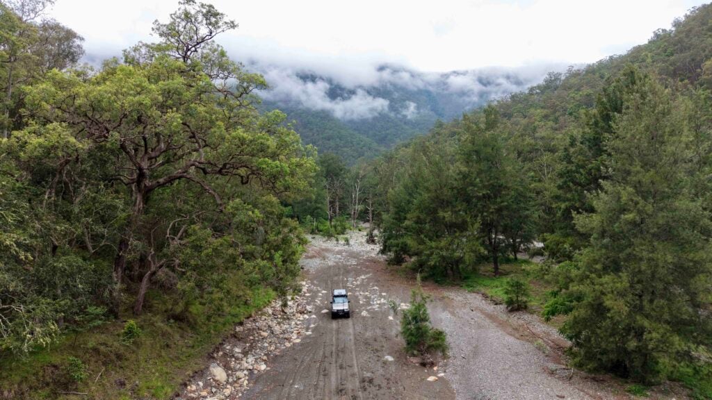
The trail wanders down the mountain for kilometres, dropping several hundred metres to the bottom, but you’ll be rewarded with impressive views of the valley through the trees. At the bottom are several creek crossings, which have a firm, rocky base, but it’s still worth checking them out, especially if there has been rainfall.
Following the trail across several open valleys, you’ll be pleasantly surprised upon arriving at the Doon Goonge campground. Camping here is superb, with grassy sites overlooking the river below – a backdrop of the seriously steep terrain, swimming holes just a minutes’ walk down the bank, clean drop toilets, fire pits and solitude.
NPWS control the number of campers visiting this area at any one time, with a maximum of six camping spots allowed. You’ll need to take your rubbish with you to keep the area pristine for others to enjoy, as there are no bins to keep vermin away. You’ll also need to bring your own firewood.
This area is great for kids as it’s flat, grassy and relatively safe. Swimming is possible in the nearby Chandlers Creek, which gets waters that have filtered down through the valleys and are always refreshing – plus, the running water is always a pleasant sound to fall asleep to as it trickles through the night.
The drive out isn’t hard, but you’ll need low range as you head out from Doon Goonge because there are several creek crossings.
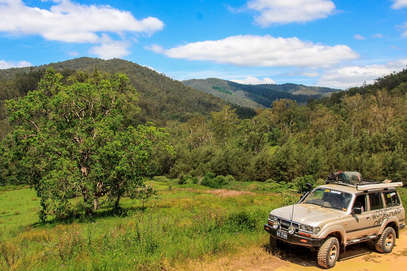
Putting it in low range will also minimise track damage. Heading out of Doon Goonge will put you on Quartz Road, which will eventually lead to a gate that can be unlocked using the NPWS key. The sights from here are quite spectacular, offering views across to gorge walls and the tracks you’ve just driven across.
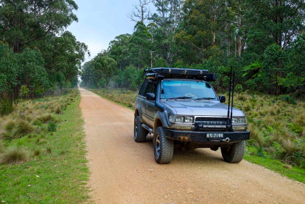
Quartz Road is a section where you’ll need to find your own pace depending on its condition, as it’s irregularly maintained and can get very rough.
The track continues for a further 10km uphill towards the outskirts of Chaelundi National Park, where you’ll arrive at a T–intersection on the Chaelundi Trail.
The option here is to turn left for a 90km drive back to Dorrigo, or turn right and head towards Boyd River and the Old Glen Innes Road.
By turning right and following the Chaelundi Trail down through several valleys for a further 15km, you’ll soon arrive at the old settlement of Dalmorton. This area was part of the Cobb and Co route at the turn of the century, and it was once alive with gold mines and a bustling settlement.
Now a ghost town, the NPWS is going to lengths to preserve the area and its remaining buildings. Several info boards provide a brief history from the past 100 years and give you plenty of room to imagine what it would have been like out here in its heyday.
Heading east from beside the river, Grafton is only 90 minutes’ drive away. This area is remote and definitely worth the visit for those looking to explore, escape the crowds and enjoy a secluded weekend away.LOCATION Chaelundi NP is located 60km north of Dorrigo on the NSW north coast. With prehistoric plants and 4WD access within a locked valley, this rugged and remote park holds plenty of natural beauty within. A NPWS key is needed to access the area and is available from the Dorrigo Rainforest Centre. Vehicle numbers entering the park are controlled.
CAMPING The main camping area is Doon Goonge, which has large, grassy open sites beside Chandlers Creek. There are pit toilets, fire places and tables. Be sure to pack your bathers as the creek is safe for swimming (best to boil before drinking). Plenty of room for off–road campers, tents and swags.
WHAT TO TAKE You’ll need to take everything from food, water, firewood and plenty of fuel. As soon as you leave Dorrigo there are no towns or stops along the way and, when travelling out the other side, the nearest town, Grafton, is 100km away. There is no phone service, little traffic and no farms to offer help, so ensure you’re very self-sufficient.
CONTACTS, MAPS AND INFORMATION Most relevant and up-to-date information can be found on the NPWS website (search for Chaelundi National Park). The key to access the park must be booked prior through NPWS and can be picked up at the Dorrigo Rainforest Centre; they can be called on (02) 6657 2309. There is a deposit for the key, but this will be refunded once the key is back in their hands. Hema apps and navigators show all roads into and out of the park.
Follow 4X4 Australia on Google
Get more 4x4 news, reviews and gear stories from 4X4 Australia in your Google feeds.