Conditions apply, see www.whichcar.com.au/terms-and-conditions. Commences 5 October 2024. Ends 23:59 AEDST on 8 November 2024. Open to AU residents 18+. Only one entry per person. Drawn at 4×4 Media, Sydney at 11:00 AEDST on November 1, 2024. Prizes: Maxxis Tyre Voucher for winning Vehicle – $2000 + Maxxis Tyre Voucher for winning online entrant – $1000 (including GST).
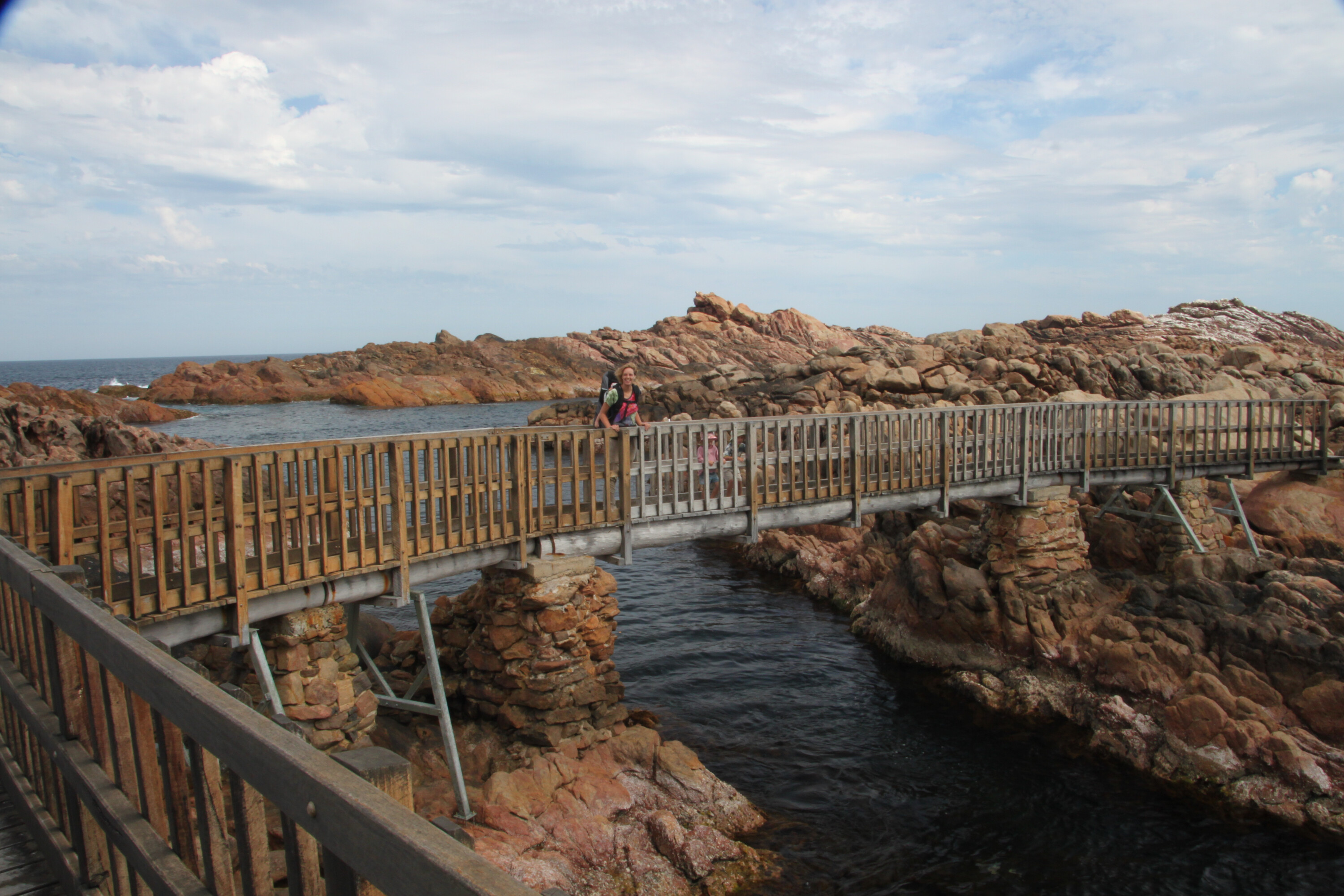
This national park, around five hours’ drive from Perth in the lower south-west of WA, is part of the larger Walpole Wilderness Area and sprawls across the Shannon River basin.
The park is relatively new, having been gazetted as a national park in 1988. Before this, ‘The Shannon’, as it is colloquially known, was a former logging area, but even that was only recent in terms of European history in Australia – with a severe timber shortage to address following World War II, the WA state government was desperate to find new sources.
The Shannon area’s rugged terrain (a mix of wetlands, heathlands and steep hills) meant it was deemed inaccessible – or, only at great time and cost – but the desperate need for timber soon saw that change and, by the late 1940s, timber cutting had begun, with a mill built in what is the northern section of the park. A town farther south was also built to house the workers and their families.
Again, it is the mighty karri tree that dominates the park, but visitors will also find stands of jarrah, paperbark and blackbutt scattered around the area. The park is a definite must-visit for those keen on checking out the various tall timbers, but there’s plenty more to do here as well including a number of bushwalks, canoeing in the Shannon River, and the 50km Great Forest Trees Drive.
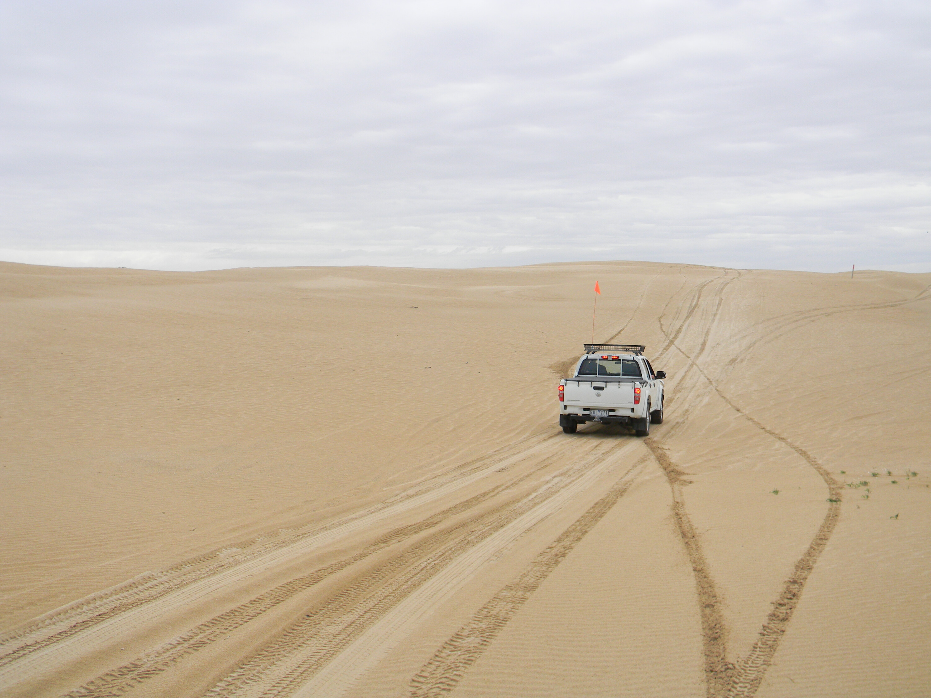
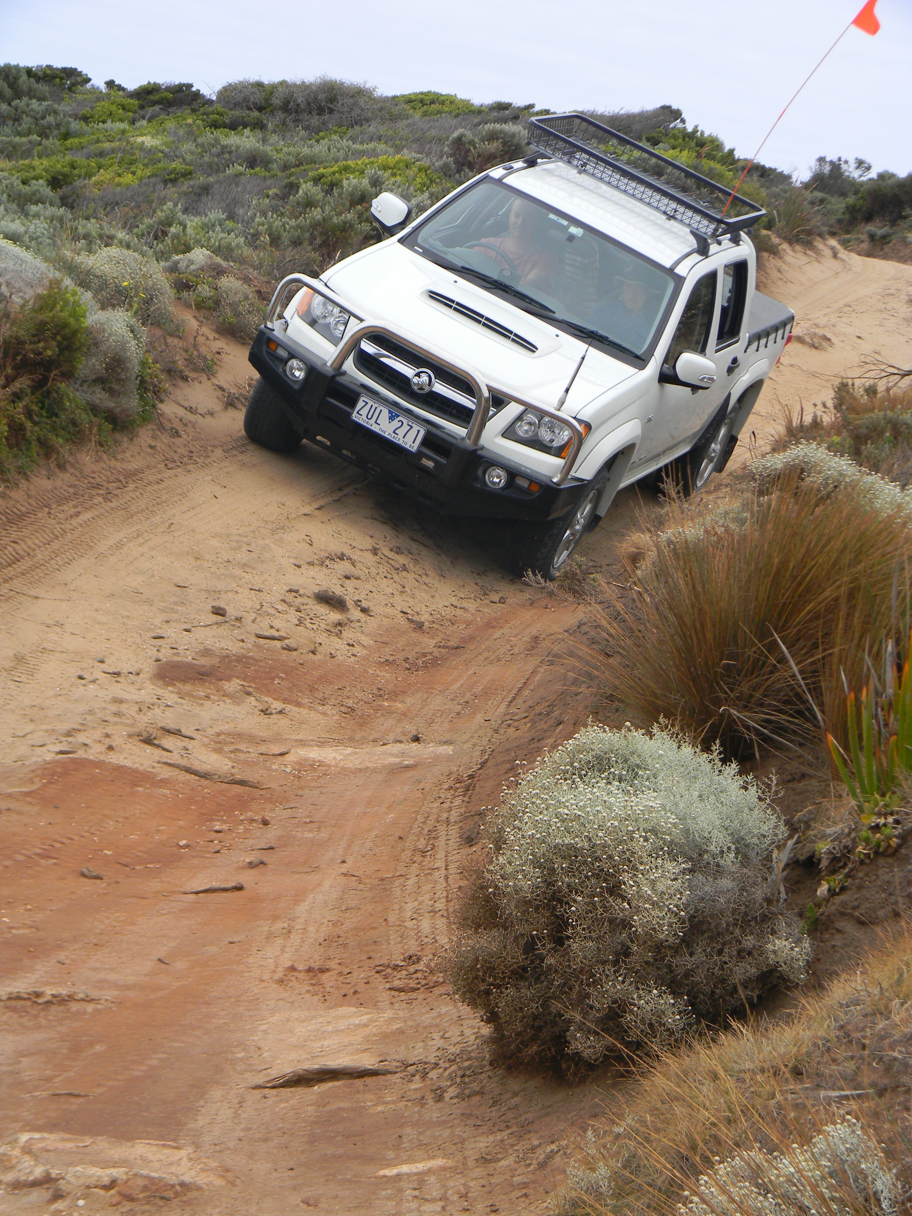
This dirt-road route kicks off just north of the South Western Highway from the park’s day-use area and takes visitors on a winding journey through the wildly varied landscape that is contained within the park, before it reaches Shannon campground (the location of the former township).
From old- and new-growth karri and jarrah, the track traverses heathland, vast sedgelands and areas dotted with rugged granite outcrops. WA National Parks has installed a number of signposted information stops along the drive, and there are plenty of stopping points to access views of the park.
1
Highlights in the northern part of the drive include Shannon Dam and Shannon River, both great locations for canoeing and bird-spotting. The dam was originally built to service the mill and town of Shannon and as assurance of water supply in times of drought. The dam is also the start-point for some of the park’s bushwalks (more later).
From Shannon Dam, the drive continues south taking you to the excellent Snake Gully Lookout and then on to Big Tree Grove where – you guessed it – you can gawk at the amazing height of the karri trees. Then, it is on to the campground.
Shannon NP’s campground has just been upgraded and now has more than 60 campsites, suitable for everything from tents through to big caravans. Amenities are impressive with hot showers, gas barbecues and upgraded walking tracks nearby.
1
It’s a far cry from the 90-house township that was once here; the houses circled a communal area and the town included a butcher, baker, post office, school and church, among other amenities and services.
Running water was non-existent back then, as was electricity after midnight, but the township trundled along happily until the mill’s closure in 1968. The surrounding forests were logged for a further 15 years, until 1983, after the town’s houses were sold off and removed from the area, before the eventual gazetting (as mentioned) of the park (there are still some remnants – introduced trees, house footings – dotted around the campground).
1
Besides paddling the dam, the other popular outdoor activity in this park is bushwalking. The Rocks Walk Trail, at 5.5km, is a cracker, with the undulating path taking you through the ubiquitous stands of karri, as well as across small creeks and onto the track’s highest point, the boardwalked Mokares Rock, a granite outcrop that supplies expansive over-forest views. Other tracks include sections of the Bibbulmun Track (WA’s long-distance trail), the Shannon Dam Trail (3.5km) and the aptly-named Great Forest Trees Walk (are you sensing a theme yet?).
It’s a lesser-known park, but for those keen to check out some of WA’s more recent history, as well as the still-wild landscape, Shannon NP is well worth a weekend.
Park location
- 53km South-East of Manjimup
Park activities
- Canoeing and kayaking
- Bushwalking
Park facilities
- Info shelter
- Toilet
- Barbecue
Big trees and big adventure await those who visit Warren National Park, located 15km from Pemberton, inland from the southwest coastline of WA and around three hours’ drive from Perth.
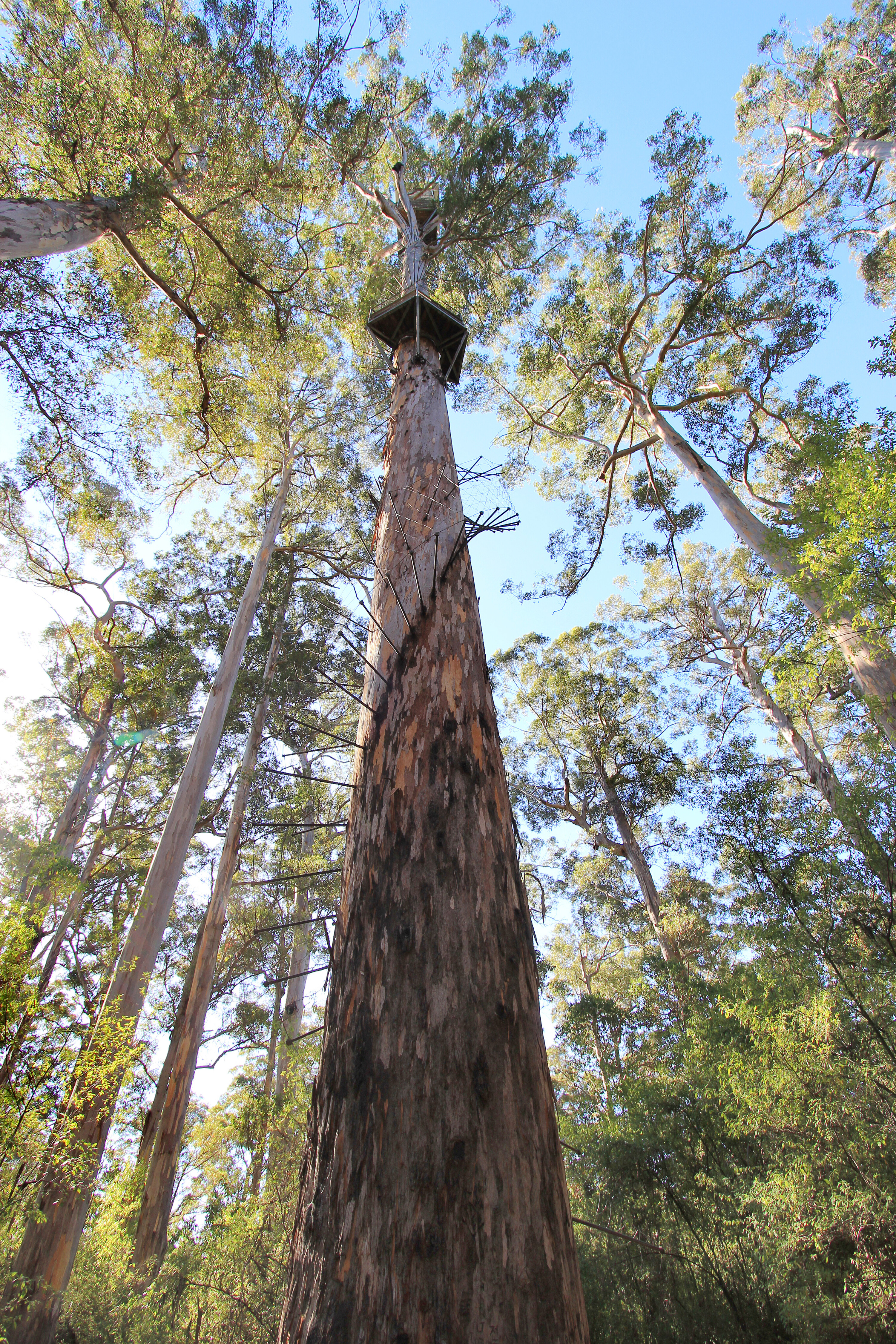
The ‘big trees’ are, of course, WA’s famous karri trees. These massive eucalypts grow straight, tall and true up to a height of 90m. Interestingly, early settlers used some of these tall trees as lookout points for spotting bushfires.
Visitors to the park can actually climb up three of them, following a route via metal pegs that were hammered into the trees, before reaching the top and being rewarded with all-encompassing views over the surrounding national park landscape. It’s not for those adverse to heights, but it’s an amazing experience if you’re up for a bit of a challenge.
The most popular touring route through the 3130-hectare national park is the Heartbreak Trail, so named due to the hardship experienced by those who cut the track into the rugged, rocky terrain (created to aid in bushfire fighting).
Visitors get the benefit of all that toil, as the one-way 12km drive is steep (and can be slippery in wet conditions), but is a cracker, dropping down to the Warren River (some great stopovers along this section are beside the rapids of Heartbreak Crossing) before ascending the other side through more karri-dense forests. You can also link into a longer journey, dubbed the Karri Forest Explorer, an 86km route that winds its way through other areas of karri forest outside the park.
1
Camping in the park revolves around two sites (fees apply), both of which are located off Maidens Bush Trail. Draftys Campground has 22 sites and a cool camp kitchen that houses gas barbecues and other cooking facilities, as well as excellent lookout decks from which you can check out the Warren River.
Warren Campground, a smaller six-site location (some sites are riverside, others are a bit farther back in the bush), has wood barbecues (you have to supply your own firewood) and is slightly more isolated and remote. For keen paddlers (canoe or kayak) Warren Campground also offers a put-in point to the river of the same name, with more lookout platforms above the launch site.
1
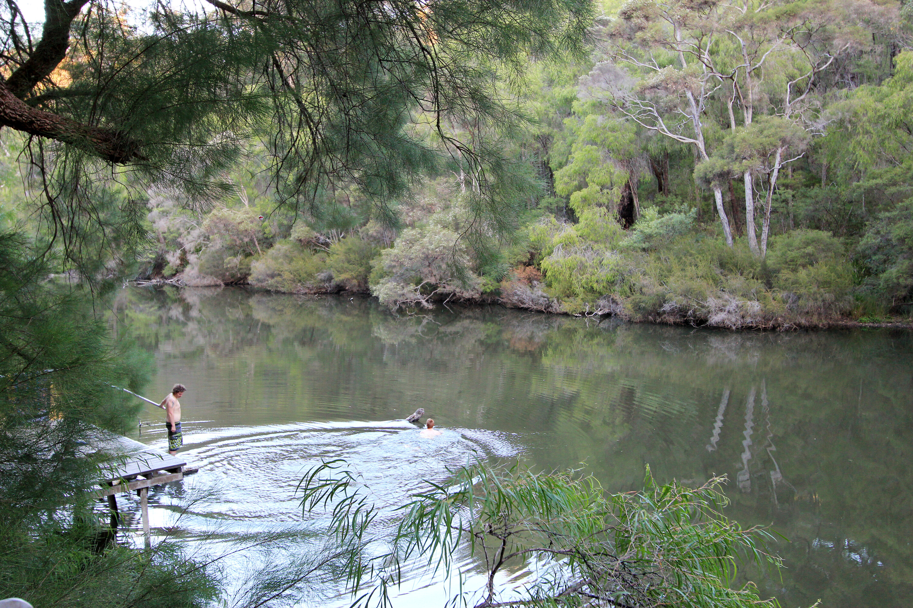
The national park is a fantastic destination for waterborne adventures, with three canoe put-in points dotted along the Warren River. Along with the aforementioned Warren Campground (and its stairs right down to the water), you can access the river at Maiden Bush and Blackbutt and then get down to the fun task of exploring the park via the river. The Warren River is a Grade 2 waterway, meaning it has some small rapids dotted along its length, so you will need some previous paddling experience.
Bushwalkers are also well catered for at Warren NP. The 10.5km Warren River Loop includes plenty of hills as you pass dense karri forest on your way through the Warren River Valley, and the rapids at Heartbreak Crossing make a nice food stop, as does Warren Lookout.
1
Mountain bikers can ride the vehicular tracks in the park or, if you’re a bit keener, the nearby (free) Pemberton Forest MTB tracks will keep you entertained for a day, with its mix of beginner through to more testing tracks. For anglers, the park is a bit of a goldmine, with trout the catch of choice – or you may get lucky and snare a marron (freshwater crayfish or yabbie).
Warren National Park is a park with plenty of big stuff in it, from the huge karri trees to the many opportunities for outdoor activities and off-road touring. Even though packing all that gear – bikes, canoe, fishing gear and camping equipment – can be a painful task, the effort here would be well worth your while.
Park location
- 15km SW of Pemberton
Park activities
- Canoeing and kayaking
- Bushwalking
- Fishing
Park facilities
- Picnic table
- Entry station
- Toilet
- Lookout/deck
Claimed to be the most popular national park in Western Australia, this 19,092-hectare giant lays its claim to that crown thanks to the gigantic shed-load of activities available.
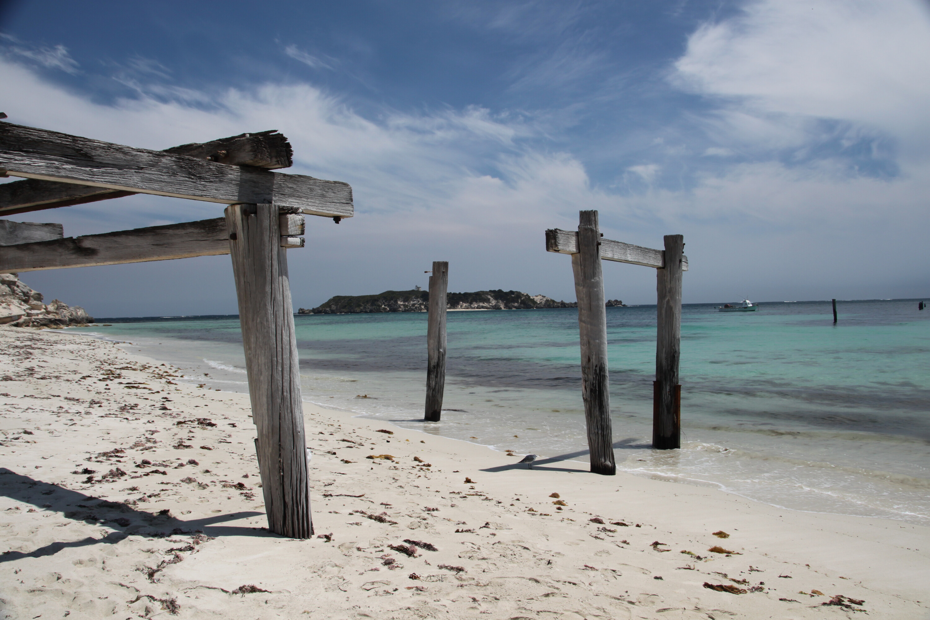
There’s surfing, swimming, diving, hiking, cycling, touring, camping, fishing and more. Plus, there’s the epic landscape combination of pristine coastline abutting the often-ferocious swells of the Indian Ocean meshed with heavily timbered forest behind the dunes. Throw in the added bonus of historical homesteads and lighthouses, as well as some amazing caves (thanks to the Leeuwin-Naturaliste ridgeline), and it fills that cliché of something for everyone.
To that effect, the park is a long-weekend destination at a minimum, but, thanks to its manageable distance from Perth, that just gives you the excuse to return more than once… and you’ll definitely want to.
The park has four campgrounds – Boranup, Point Road, Conto and the recently-completed Jarrahdene – with all of these being of the first-arrive, best-score type. Point Road has probably the most appeal to off-roaders as it is accessed via a 4×4-only track and is a small campground (it has space for roughly seven tents) sheltered from winds on the edge of the Boranup karri forest, with access to the nearby coastline via Point Road itself.
Conto, with 116 campsites, is ideal for larger groups and those after a bit more space along with some ‘luxuries’, such as a campers’ kitchen, tables, toilets and barbecues. Plus, it’s right next to Conto Springs Beach. Boranup is another small campground (only seven sites) located in the middle of Boranup karri forest, so if you want a bit of solitude (here or at Point Road) you’ll need to be quick, especially in summer and school holiday periods.
1
Jarrahdene campground is a schmick new addition to the bush accommodation options in the park, with the first stage of what is a $2.7 million investment opened in late January this year. The campground is south of the Margaret River and nestled beside the historic site of the Heritage-listed Jarrahdene Mill, which was built in 1896. The campground has 24 campsites, each with its own table and firepit, with five toilet blocks and four sheltered barbecue areas scattered throughout.
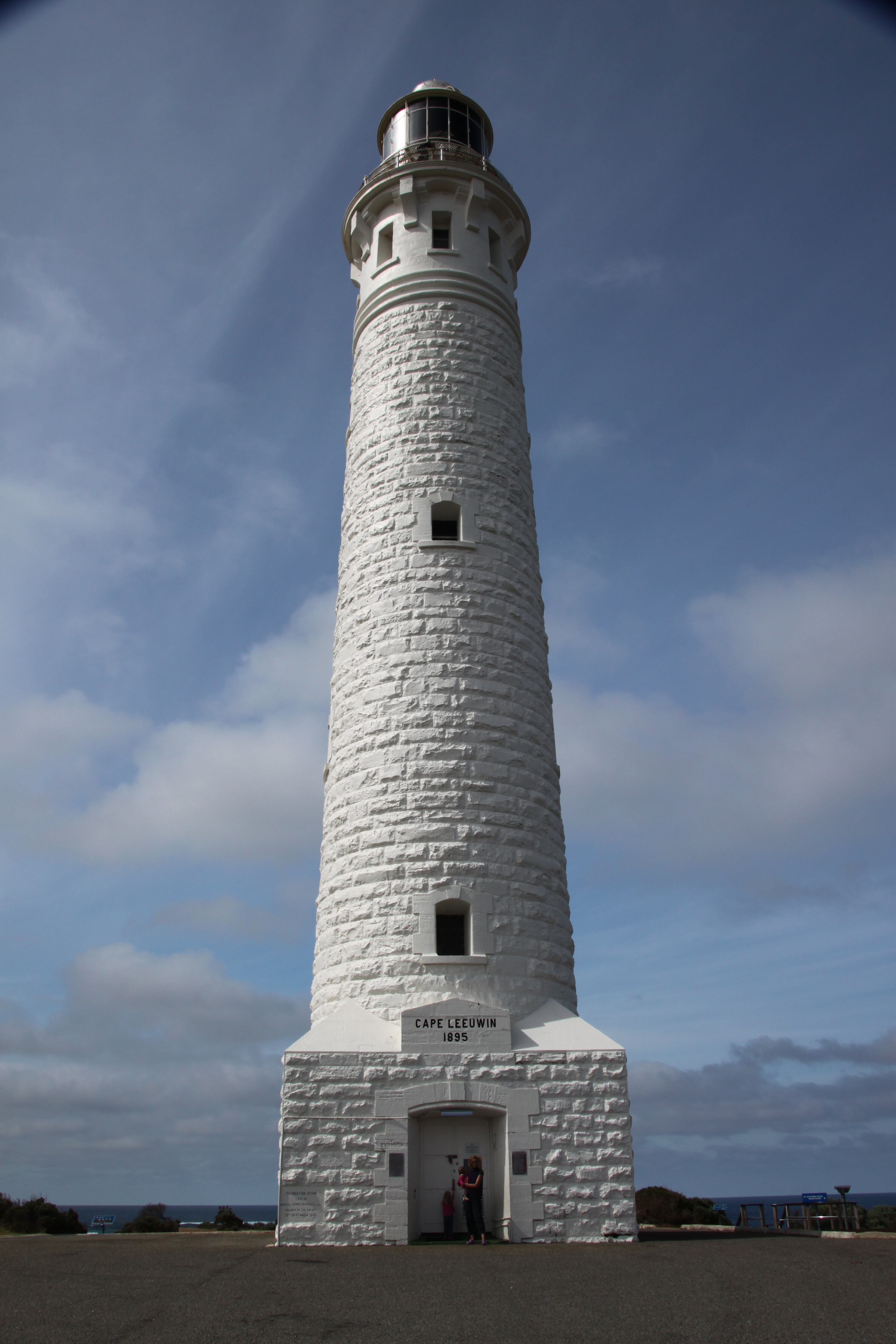
The Cape-to-Cape walking track is rated one of Australia’s best multi-day hiking experiences and, as its name suggests, it travels between Cape Naturaliste Lighthouse in the north and its Cape Leeuwin counterpart in the south (both these open to visitors). The full distance is 135km, but you can walk a number of the track’s sections as day-walks or even shorter ambles if you wish.
1
There are numerous beaches for swimming or diving. The more sheltered Cape Naturaliste and Shelley Cove in the north offer ideal swim spots for families; as does Bunker Bay, located on the northern side of Cape Naturaliste. Anglers can fish all along the coastline and offshore (in your own boat or with a fishing charter). Expect to catch salmon, snapper, tailor and dhufish, but be aware of bag limits.
Surfing is super-popular with the Indian Ocean swells regarded as top-notch by wax-heads worldwide. Margaret River, Guillotines, South Point and Gallows are just some of the surf spots, and there are myriad others.
1
Away from the coast and it’s time to head underground. The park contains numerous caves, with visitors able to explore any number of them, including Calgardup and Giants Cave. For those not up to an independent caving experience, you can opt for guided tours of Mammoth Cave and Lake Cave.
Leeuwin-Naturaliste National Park is packed with stuff to do. Our best advice is to tackle a long weekend first in the north, then return a few more times to spend weekends in the south, before exploring the park hinterland. And then do it all again.
Park location
- 36km west of Busselton
Park activities
- Abseiling
- Diving
- Canoeing and kayaking
- Caving
- Surfing
- Snorkelling
- Swimming
- Fishing
- Bushwalking
Park facilities
- Picnic Table
- Toilet
- Lookout/Deck
- Boat Ramp
- Entry Station
- Barbecue
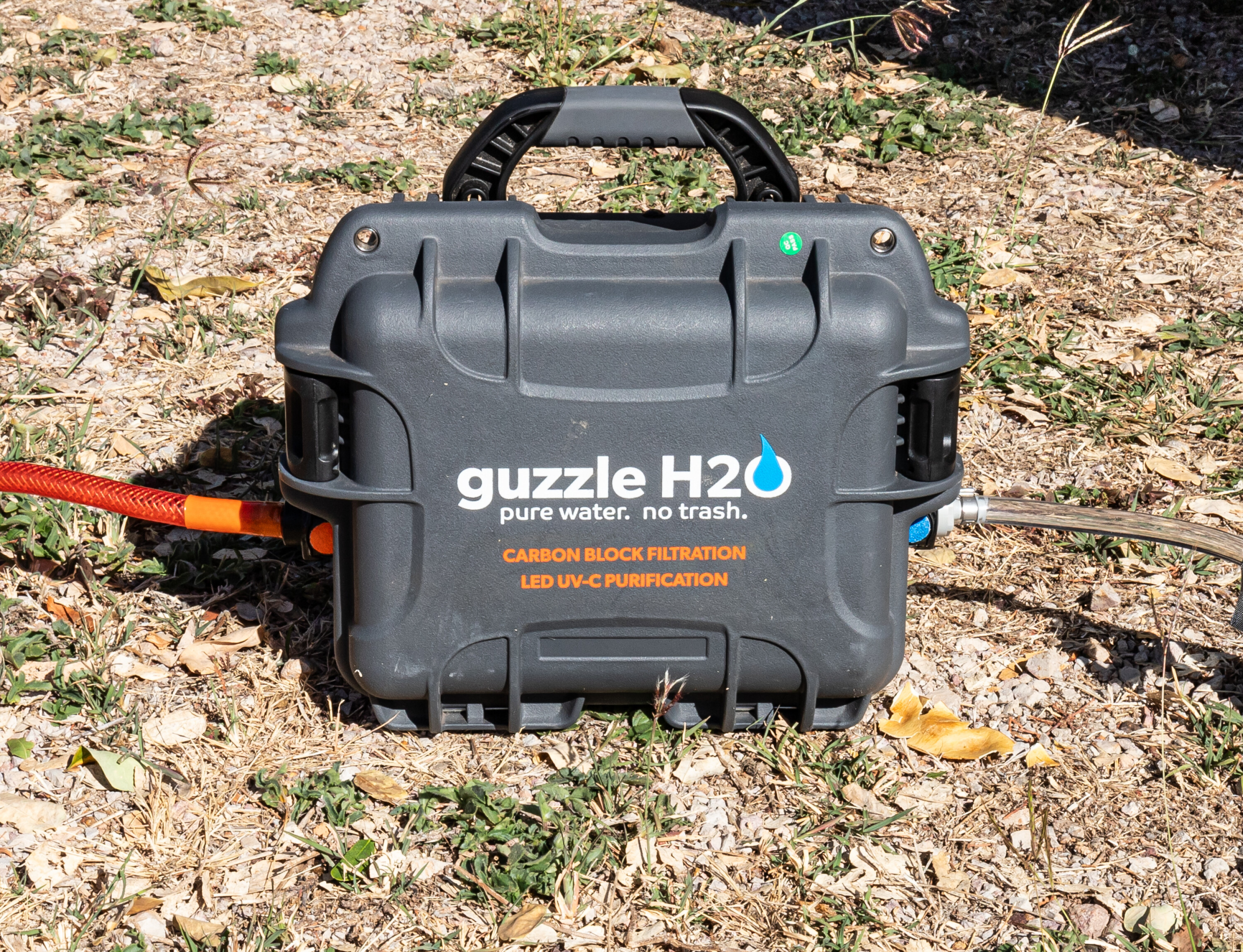
When you’re hitting the outback or setting up camp at a bush site, clean water is imperative.
That’s where the Guzzle H2O Stream comes in. This top-notch water purification system is perfect for Aussie adventurers, campers, and anyone needing a reliable source of clean drinking water while off the grid.
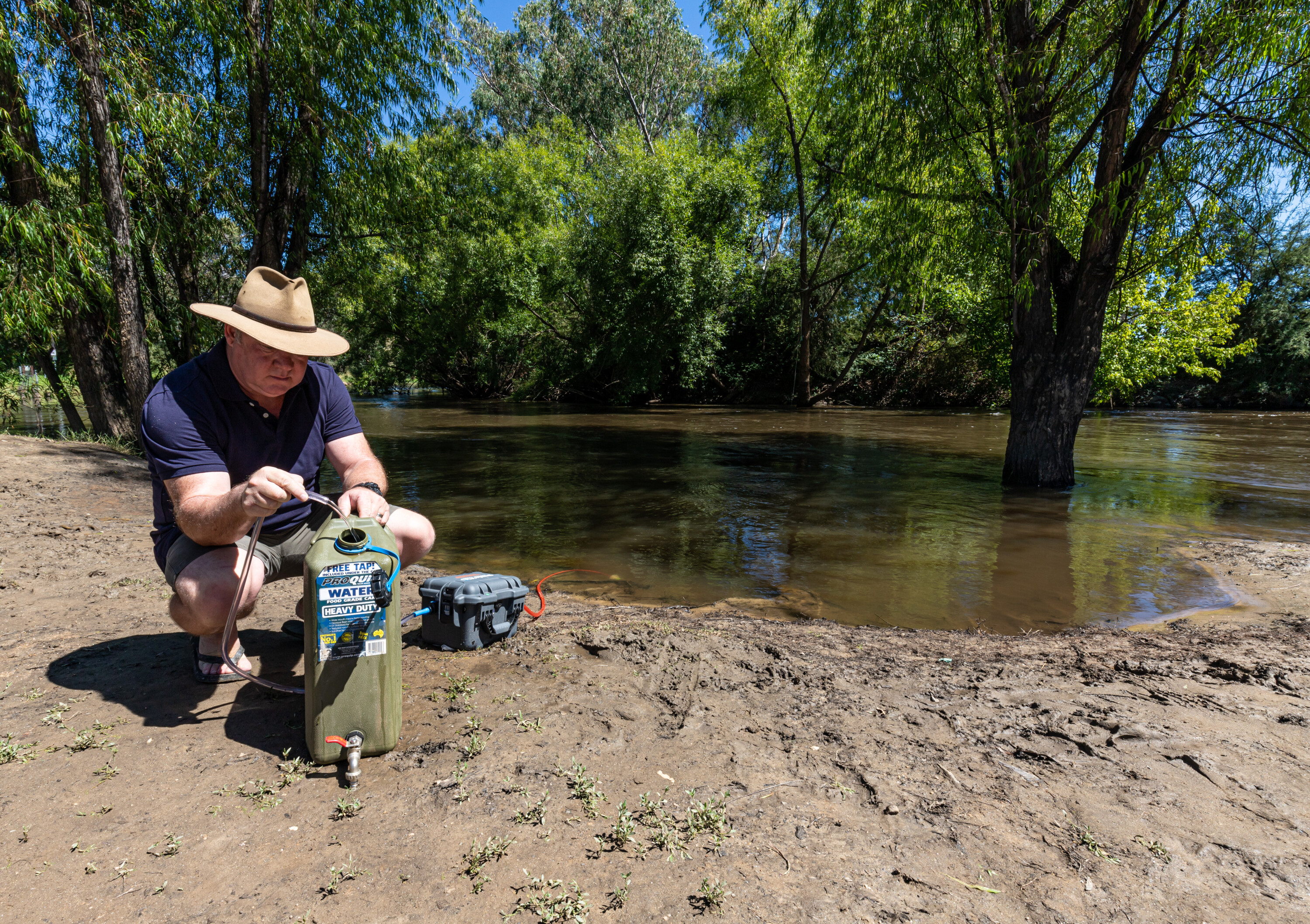
I’ve been running the Guzzle H2O Stream for the past couple of years and this portable UV water purification system has been a game-changer. Whether setting up camp beside a river or exploring the rugged terrain of outback Queensland, this device has ensured that I’ve always had a dependable supply of clean drinking water.
1
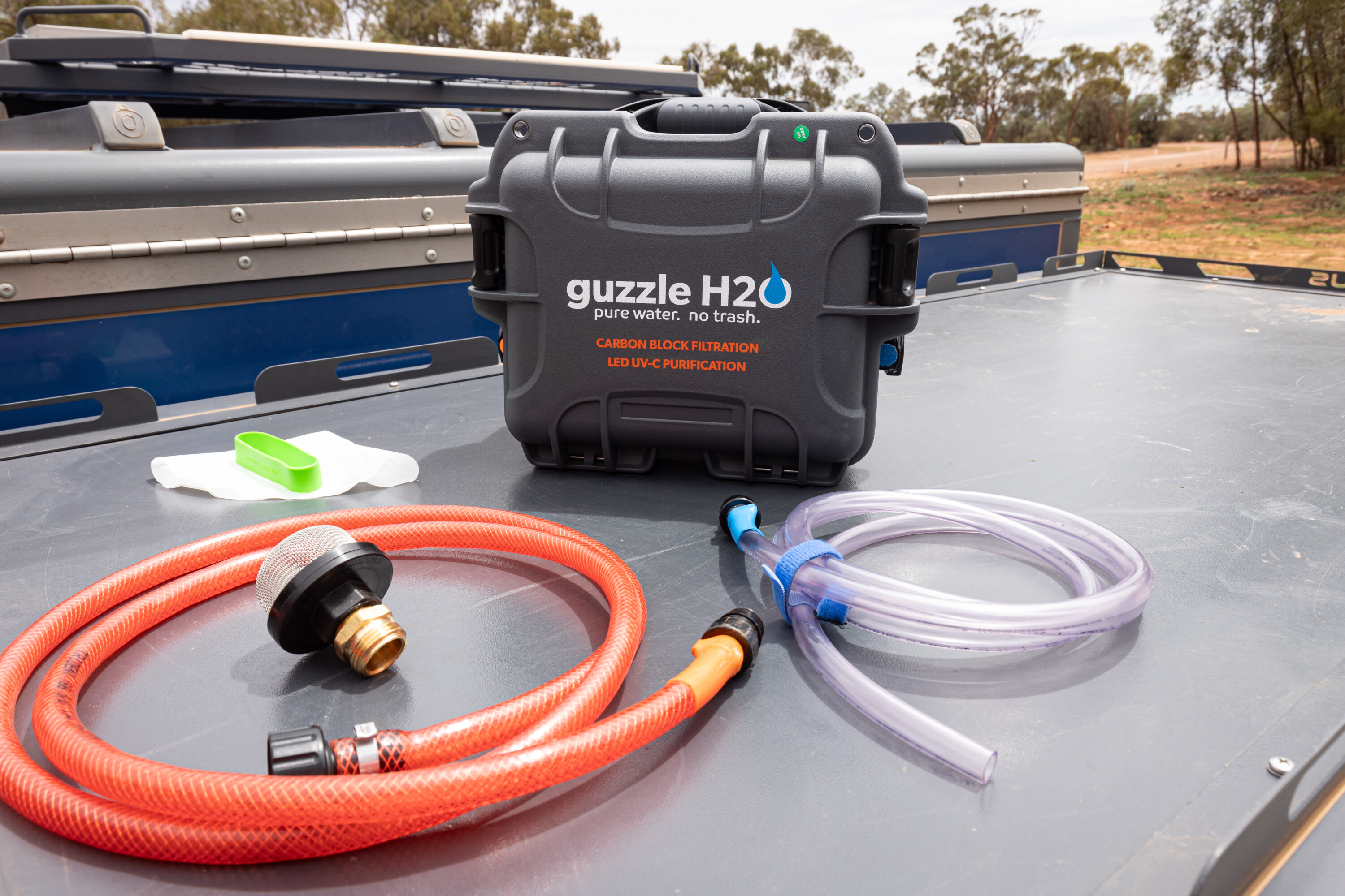
The self-contained unit doesn’t need any extra gizmos to function; with just the push of a button, the system pumps, filters and purifies water from virtually any fresh water source, so there’s no need to carry a lot of water with you, or to worry about where your next drink will come from.
One of the standout features of the Guzzle H2O Stream is its water-processing efficiency. It can pump and filter water at a maximum rate of 2.7 litres per minute (lpm). Furthermore, the device can purify up to 120 litres of water on a single battery charge, making it ideal for longer expeditions where access to clean water is limited. This means you can fill up your water tank or jerry can without breaking a sweat, making it suited to solo adventurers and families alike.
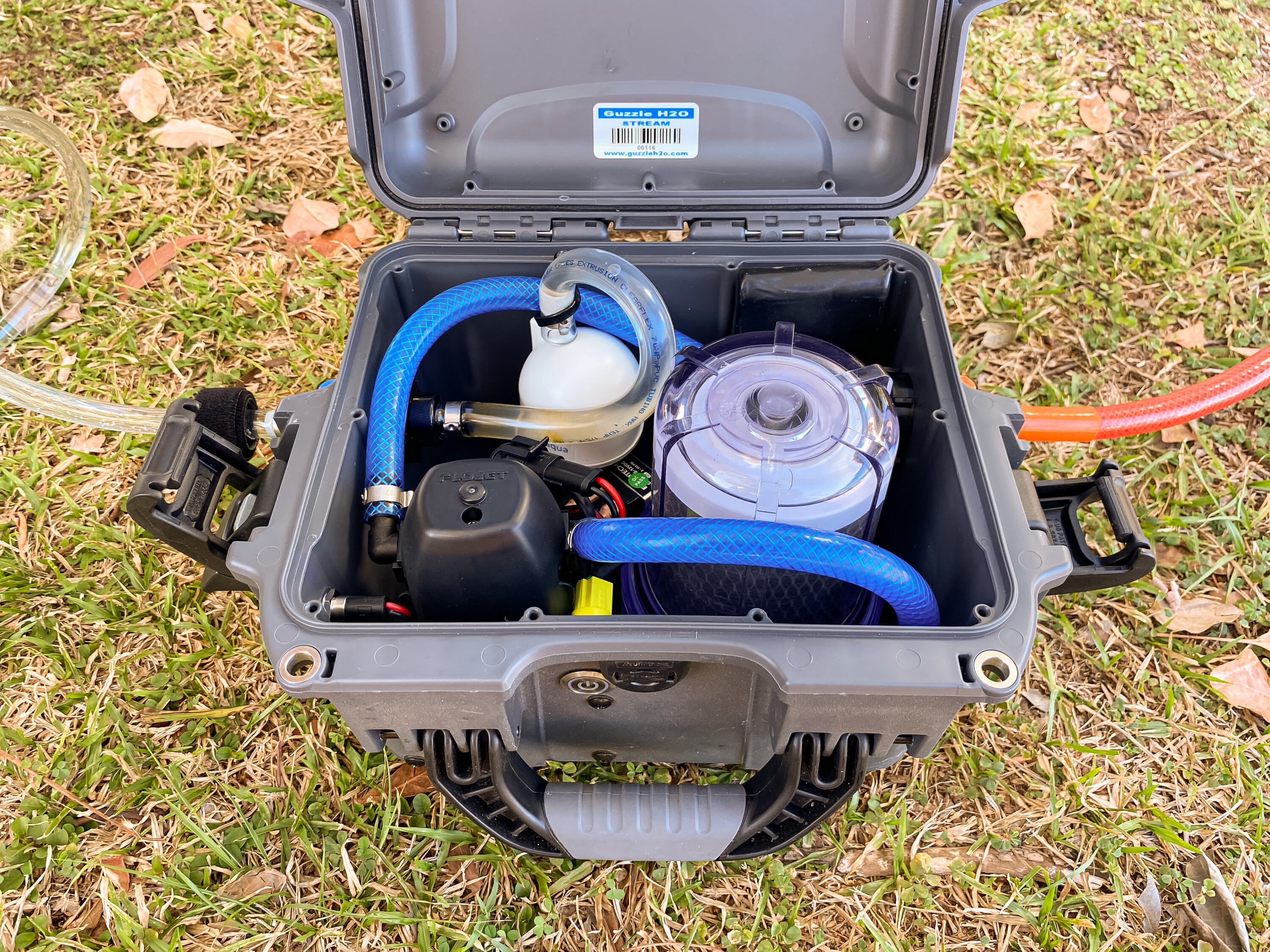
At the heart of the Guzzle H2O Stream’s effectiveness is its advanced LED UV-C purification, which has been third-party tested to inactivate 99.99 per cent of bacteria, protozoa and viruses. And the purification system is NSF 55 listed, so you can be sure it’s providing clean water whether your source is crystal-clear creek or a murky billabong.
1
In addition to its UV-C purification capabilities, the Guzzle H2O Stream features a 0.5-micron activated carbon block filter. This filter plays a crucial role in reducing sediment, chlorine taste and odour, volatile organic compounds (VOCs), and other chemical contaminants that may be present in water. The carbon block filter is particularly effective at improving the taste and quality of water, which is especially important when sourcing water from natural bodies.
The carbon block filter can handle up to 3785 litres per cartridge before it needs replacement. This long lifespan not only makes the Guzzle H2O Stream cost-effective to maintain but also ensures that you won’t have to worry about frequent filter changes, even on extended trips. When the time does come to replace the filter, the process is straightforward, requiring minimal effort.
1
The system also includes a pre-filter to remove larger particles and sediment before the water reaches the UV-C purification stage. The pre-filter ensures that the main filtration system isn’t overwhelmed by debris, allowing the device to work effectively even in challenging conditions. I’ve recently been sent an upgraded pre-filter that contains a heavier weight to keep the filter below the waterline; the filter is larger and finer, significantly reducing sediment and particulates from reaching the next purification stage.
For those who frequent established campgrounds, the Guzzle H2O Stream’s ability to connect to standard hoses is a significant benefit. This feature allows you to use the device with campground water supplies, filtering and purifying the water to remove any residual chemicals or contaminants that might affect taste or safety.
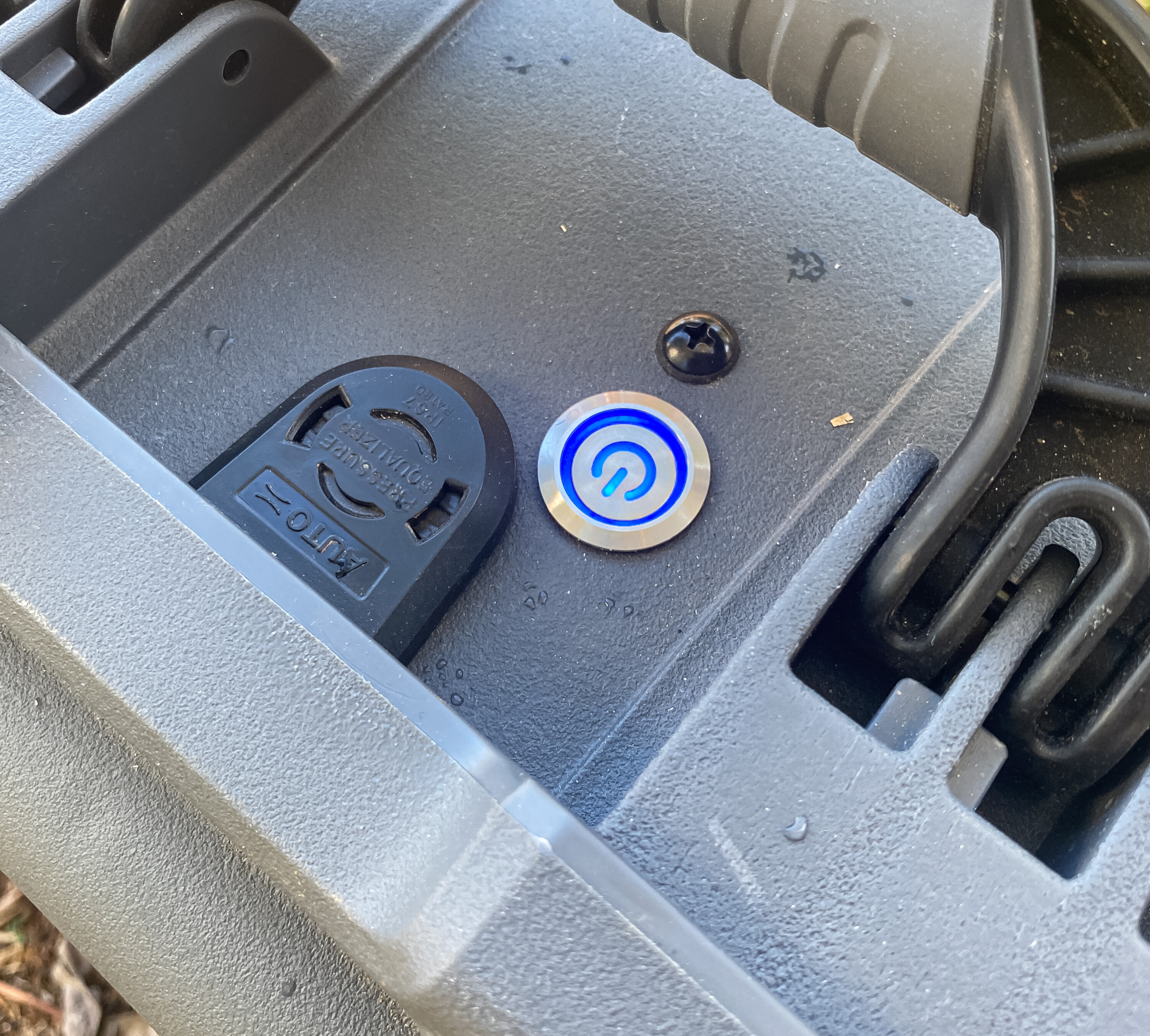
The Guzzle H2O Stream is built tough and designed to withstand harsh conditions, with an IP67 waterproof rating that protects it from dust and water ingress. All components are NSF-listed or made from FDA-approved materials, so you know it’s built to last.
1
The Guzzle H2O Stream is powered by a rechargeable 3000mAh LiFePO4 battery that is capable of filtering and purifying up to 340 litres of water on a single charge, depending on the mode used. The device offers two modes: Pumping Mode, which supports 120 litres of water at a 2.83 lpm flow rate; and Pressurised Mode, which supports 340 litres at a 4.16 lpm flow rate.
These options provide flexibility, allowing you to choose the mode that best suits your needs at any given time. I’ve used the Guzzle H2O Stream in caravan parks, service stations, and roadside stops to refill my drinking water tank using the Pressurised Mode, and it is a faster filling method by far.
The Guzzle H2O Stream can be recharged using a 240v charger or a 12v plug, making it compatible with various power sources, and ensuring reliability no matter where your adventures take you.
1
The Guzzle H2O Stream weighs 6kg, so it’s light enough to pack without weighing you down. Its dimensions are 330 x 255 x 215mm, so it doesn’t take up much space either. And an intuitive interface means that even those with little experience in water purification can operate it without difficulty.
Cleaning and storage is straightforward. After treating silty water, the Guzzle H2O Stream should be flushed with clean fresh water. Steve from Off-Grid Adventure Co suggests, “For long-term storage, it’s a good idea to remove the carbon filter and run the system dry; it will pump the water out of itself. It wouldn’t be a bad idea to flush (the unit) with clean water if your source was particularly nasty. Then store the system with the carbon filter housing removed so that the insides can air dry as much as possible.”
The Guzzle H2O Stream is a cracker of a product that will meet the needs of anyone who requires a dependable source of drinking water while off the grid.
RRP: $2350
We’ve shortlisted 15 of the boldest and most capable 4x4s roaming Australia, to compete for the 2024 Custom 4×4 of the Year title.
We’ve featured dozens of custom creations online and in 4X4 Australia magazine this year, and we’ve finished the tricky task of narrowing the massive field down to just 15 contenders that will compete for the crown.
Now the task of picking the best Custom 4X4OTY of 2024 is in your hands.
Simply by voting for a winner, you’ll go into the draw to win our voter prize: A Maxxis Tyres voucher valued at $1000. The owner of the winning custom 4×4 not only claims the 2024 silverware, but also wins a Maxxis Tyre voucher valued at $2000.
Voting is now closed.
Terms & Conditions
Right from the get-go I knew my trip through the Herberton area in Far North Queensland would reveal some unbelievable history and hidden gems across an area I’ve never previously explored.
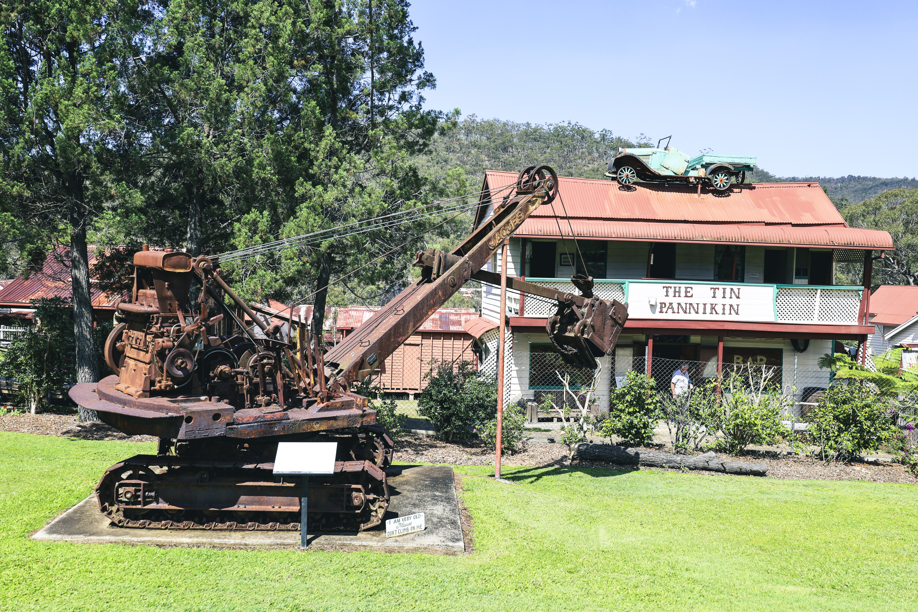
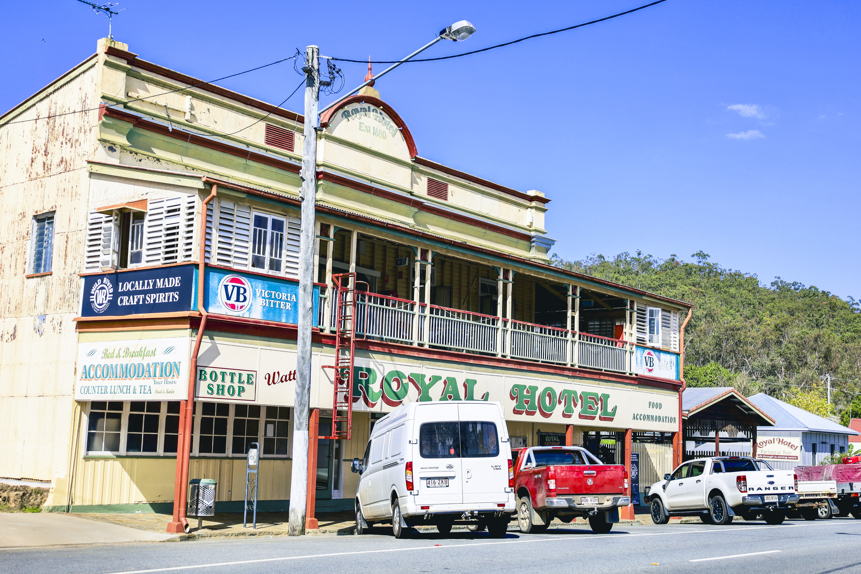
Starting off at Herberton, 90 minutes southwest of Cairns, I was immediately drawn to the Historic Village Herberton, a place that has to be seen to be believed. There is 6.5ha to explore, covering historical buildings, working machinery, antique cars and trucks, a huge array of mining gear plus a main street where buildings are period correct with live demonstrations. My advice: be prepared to spend the whole day here.
The village opened in 1973 but closed in 2003 due to rising costs. A few years later a couple drove past and made enquiries on the failing village, and ended up buying it. It re-opened in 2009 with restoration starting on the 30 buildings already on site, and since then another 20 period-style buildings have been added.
1
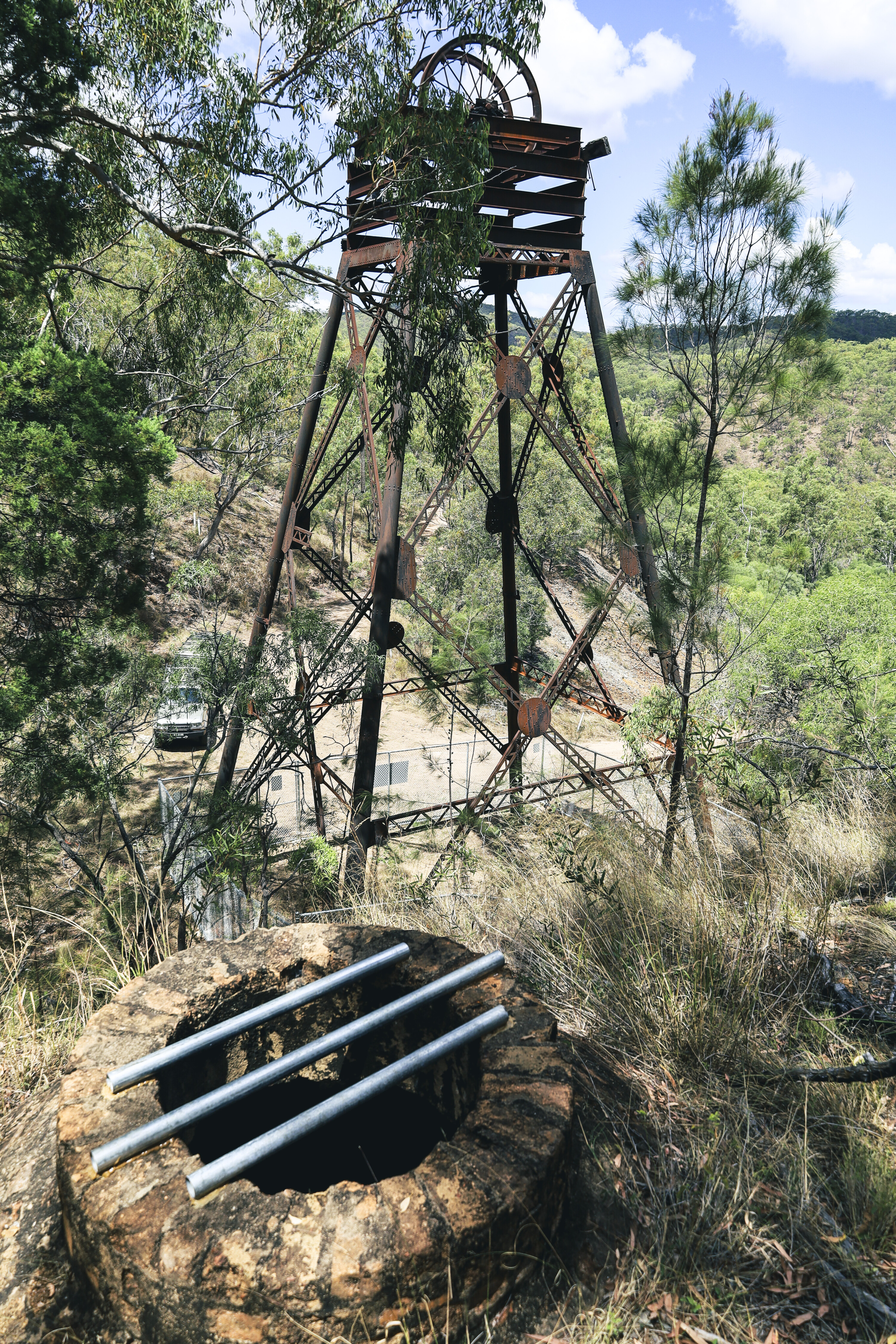
There is an old tin mine on the property and some of the sheds and huts near here date back to 1880. The original mine head over the shaft remains in situ to this day.
Wandering around the property offers the opportunity to examine more than 150,000 exhibits, both inside and outside of the buildings, including toys, chemist potions, machines, garages, shop paraphernalia, tractors and a huge working saw mill that was relocated here from the bush.
The centrepiece of the village is Elderslie House, which used to overlook a huge tin mining operation in Herberton, and has now been moved into the village and been meticulously restored. Originally built by Queensland miner and entrepreneur Mr John Newell in 1881 for his wife, it stood atop a hill in the heart of town back when Herberton was regarded as the centre of the Atherton Tablelands.
1
Herberton was known as the village in the hills when tin was found here in 1880 by John Newell and Willie Jack. A few years later they opened up a merchant store in town, and later opened another 12 stores on the tablelands and on the coast.
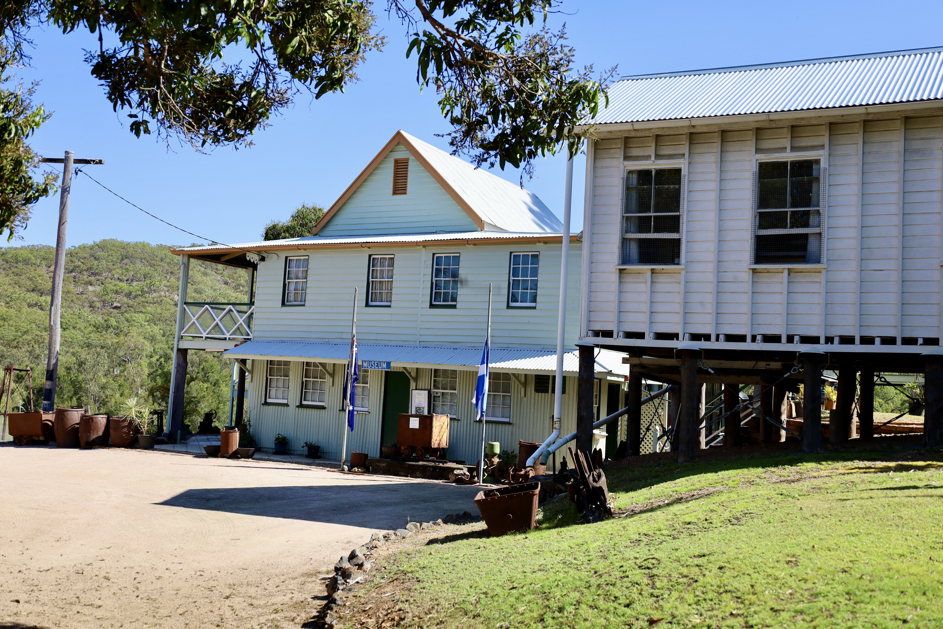
Up town, the Herberton mining museum has been built where the first payable tin was found in Herberton, and you can walk several mining trails here and view the old mine shafts – namely the Gully Shaft, Eastern Shaft and No. 3 Shaft. Take a wander around the old machinery and check out the old camps, while inside the building is a massive collection of mining memorabilia and minerals.
Even the main street of Herberton is like a step back in time with the verandahs of century old buildings built right to the street’s edge. There are 60 buildings that can be visited on a self-guided tour, including a spy museum with rare cameras on display.
1
I found it difficult to drag myself away from Herberton but the push was on to head 30km further west towards Irvinebank, a fascinating and historic tin-mining town that remains largely untouched.
I headed straight for Loudoun House which is now the local museum. It was built by John Moffat when he discovered tin here in 1882. He built the house to overlook his mining operations which included a smelter, a mill and a dozen stampers, all within earshot.
Moffat was a religious man and was well respected within the area, and when he realised that the mine was no longer viable he refunded £20,000 pounds back to investors in good faith.
1
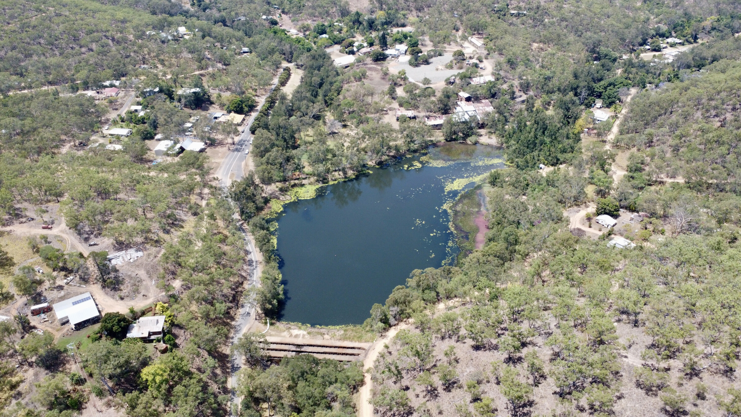
Today Loudoun House is packed with mining information, photos and town memorabilia, and from its verandah you can see the massive tailings dam of the original tin mine.
This was drained back in 2010 and more than $20 million dollars of tin was recovered, according to the museum’s curator. Irvinebank has other handsome buildings built at the turn of the century including the National Bank, the School of Arts and the Treatment Works (originally the Loudoun Mill), and all are heritage listed and well preserved.
To the north of town the Vulcan Mine and mill are well worth exploring. The mine was once regarded as the deepest tin mine in Australia and the most successful one time during its 40 year lifespan. The massive mine head can still be found, and by following a track up the hill I found the deep shafts and could spot the tunnels heading off the main shaft.
1
Irvinebank also had a small-gauge tramway that was built in 1907 and it carried passengers and tin ingots north towards Chillagoe. At the time Queensland Railways had built 3ft 6in lines, but the privately owned Irvinebank line was a 2ft gauge.
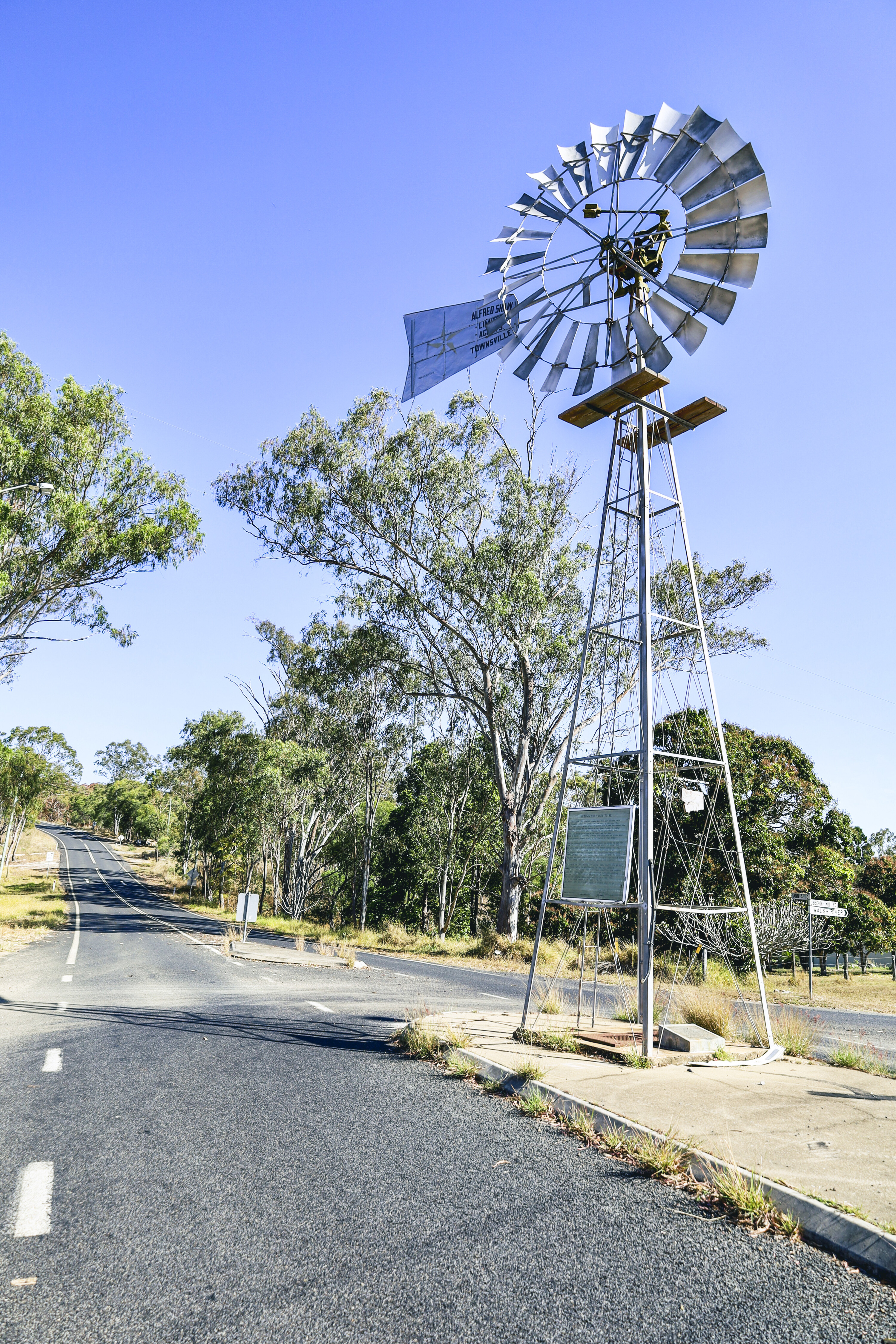
Leaving Irvinebank along the Petford Road the next stop was the old township site of Montalbion, where a huge amount of silver was found in 1885, as well as copper and gold. A small town grew here over time but eventually the primitive lifestyle and remoteness resulted in the closure of both town and mine. All that remains these days is a sign and a dam that was used for the town’s water supply.
At Emuford, a further 30km west, legendary explorer and prospector James Mulligan was on a hunt for food when he stumbled across an emu’s nest with four eggs in it, and so he named Emu Creek. Tin was found here in 1881 but it wasn’t until 1911 that a commercial operation was built, and this was an ongoing operation up until 1985.
1
The town site is situated beside Emu Creek, but there’s nothing left of it bar concrete slabs and a few crumbling bricks.
The main mine site is on the western side of the creek and the sheds and stamper are still intact; it is regarded as Queensland’s most intact example of a historical tin mine battery site. The landscape out here is harsh yet beautiful, and the Petford Road follows the Atherton Ranges all the way to Petford.
Just a locality now, Petford was once an important siding on the original rail line from Chillagoe to Cairns that was built in 1900. Today, other than a little siding shack, there’s nothing left of the original town.
34
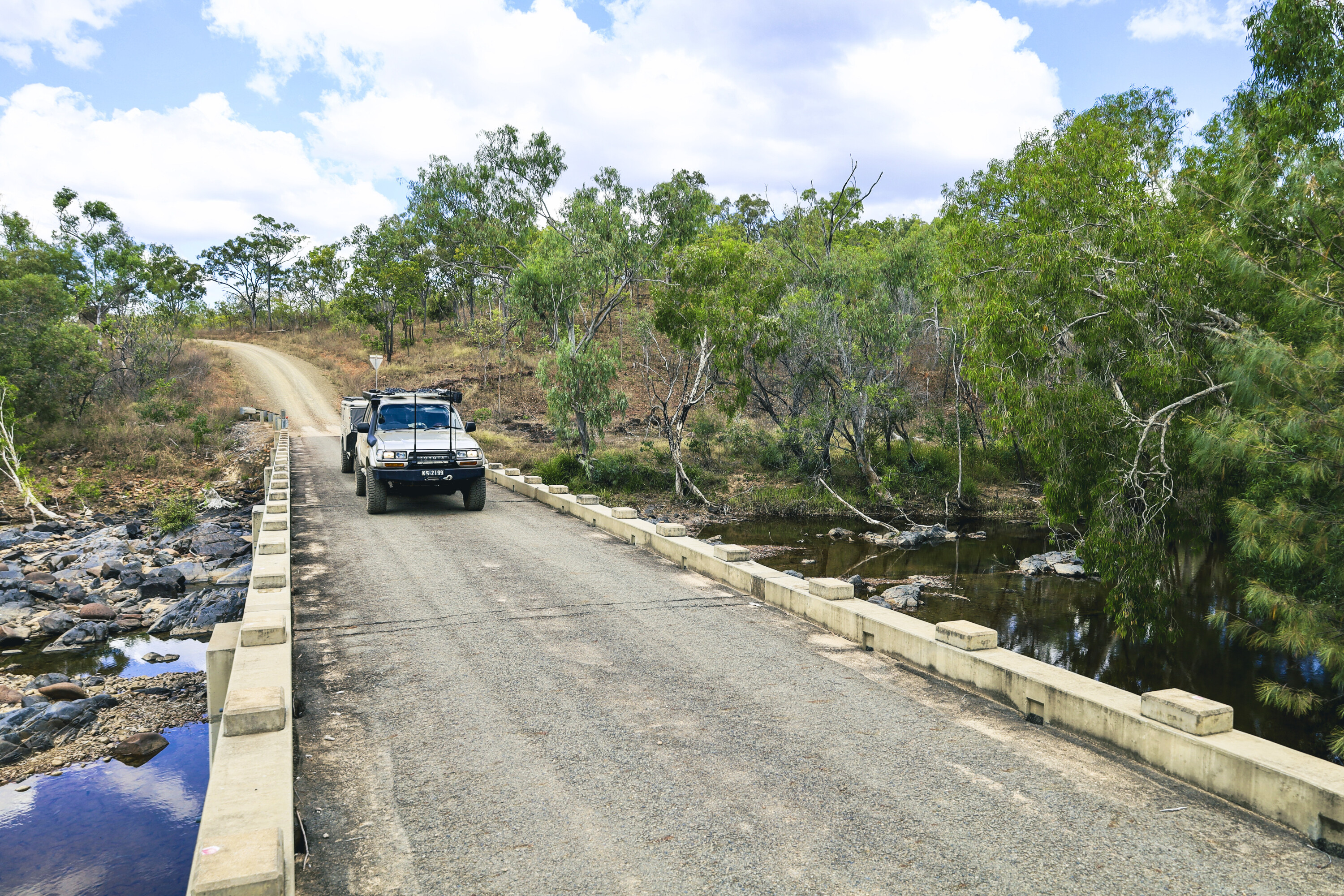
The track from Herberton to Petford was the original Cobb & Co route between 1888 and 1904.
A connection to the outside world, when the driver would sound his bugle to announce the coach’s arrival, it would generate great interest by the town folk. This was mail service number 201, and it carried nearly anything to everyone, covering all the small communities along the way on its weekly 270km run.
This Herberton adventure is one of the most amazing history trails I have covered anywhere in Queensland. If you have a few days up your sleeve while exploring FNQ, I highly recommend the Herberton to Petford drive.
Fast facts
Where:
The Herberton history trail starts at Herberton, 100km southwest of Cairns in Far North Queensland, and ends at Petford a further 70km to the west. This area is rich in both mining and pioneering history dating back to the mid 1800s.
What to see:
There’s plenty to see and do here including self-guided mine tours, a day at the Historic Village Herberton, a visit to the mining museum, a wander around the old tin mining operations at Irvinebank, and exploring the dirt trails through to Petford.
More information
The main office at the Historic Village Herberton (Ph: (07) 4096 2002) has plenty of information on the town and what to see there.
Up the road is the Herberton Mining Museum (Ph: (07) 4096 3474) which is the local information centre.
At Irvinebank, the local museum is in Loudoun House (Ph: (07) 4096 4020) in O’Callaghan Street, and here you’ll find all the relevant information from the past to the present, along with a huge array of memorabilia from the area’s mining days.
Adelaide may be known as the City of Churches, but you don’t have to venture too far from the city lights to find pockets of touring gold.
Within a few hundred clicks you can be in the outback proper, with Ngarkat Conservation Park about a 300km drive to the east and Alpana Station about 500km to the north. If you have a spare few days and you need a break from civilisation, here are a few 4WD tracks ‘close’ to Adelaide. Have we missed any? Let us know in the comments section below.
Five of the best 4×4 tracks within 500km of Adelaide
Explore by state


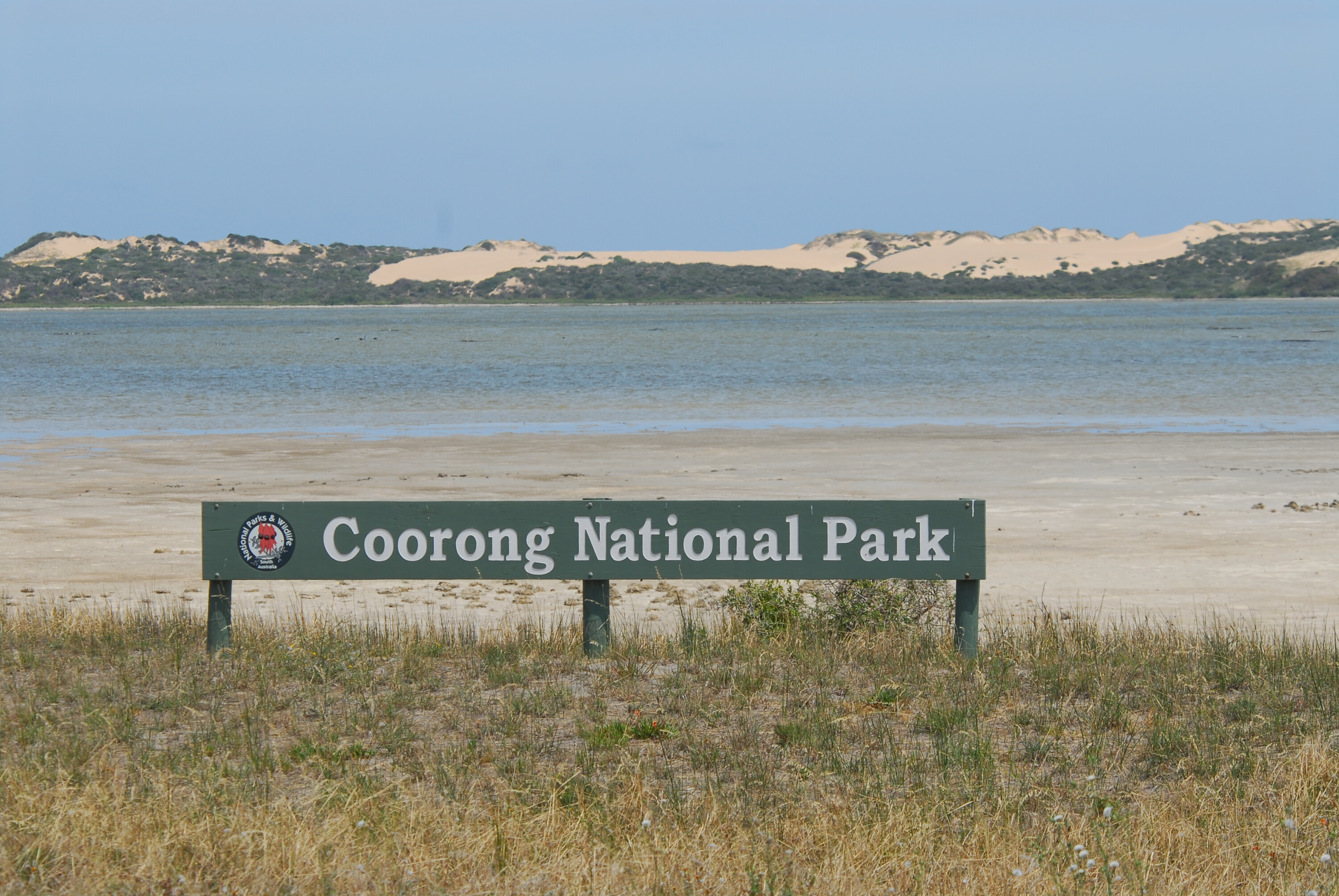
A relatively short 200km jaunt southeast of Adelaide, the Coorong, as it’s colloquially known, offers plenty for the off-road tourer.
The fantastic beach driving (the best access point is from Tailem Bend, off the Princes Highway) is an obvious highlight, but there’s also plenty of opportunity to throw a line in, with both beach-based and lagoon-focused fishing on offer (Coorong NP encompasses a lagoon ecosystem; the waters of the Coorong are protected from the Southern Ocean’s swells by the sand dunes of the Younghusband Peninsula). Salmon and shark are common catches offshore, while flathead and bream are just two species you have the chance to hook in the Coorong’s calm waters.
The ocean-beach drive (speed restrictions apply here, so be aware) is brilliant, but be sure to only tackle it at low tide and to stick to the section of beach between the low and high water marks. You can camp anywhere along the beach in this zone.
Alternatively, you can keep an eye out for post markers that signal a sidetrack that will take you to designated campgrounds on the other side of the dunes, offering a modicum of protection from the coastal winds.
The driving is relatively straightforward (don’t forget to drop tyre pressures), with the sand only becoming particularly treacherous after heavy rain. Don’t forget the ocean beach is a gazetted road, so speed limits apply – and use common sense, as people fishing, swimming and sunning on the beach means slow speeds are a no-brainer.
The beach is also shut down for a short period during spring to assist in the protection of hooded plover nests. This shutdown covers the section of beach running from the mouth of the Murray River to Tea Tree Crossing. Finally, don’t forget some of the water crossings are also tide-dependent, so check the charts first before driving in those areas.
1
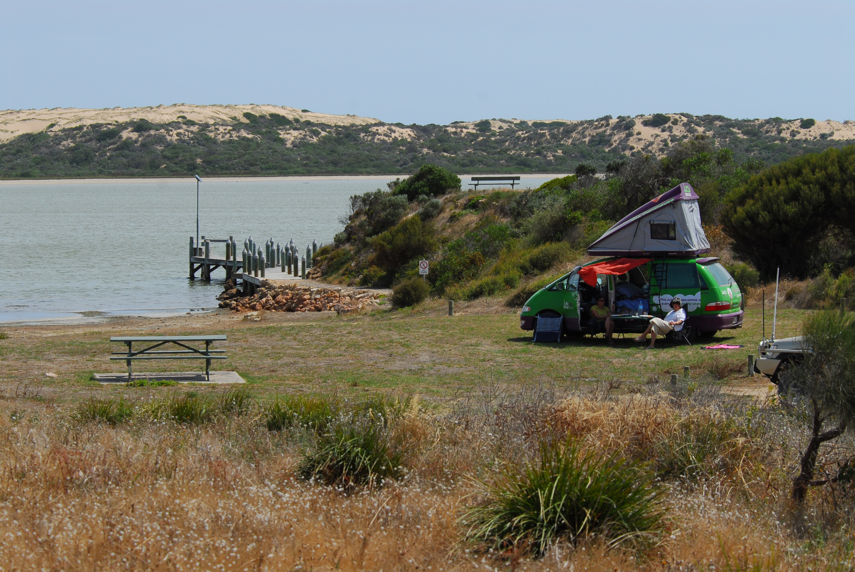
The Coorong’s popularity with visitors is reflected in the number of campgrounds in the park. With 14 to choose from (some are also 2WD-accessible, and there are a few that are boat-access only), spread from Barker Knoll and Godfreys Landing in the north and dotted toward the south along the curve of the Younghusband Peninusla right down to the southernmost, 28 Mile Crossing, there are plenty of options for two nights in this coastal wonderland.
Facilities are varied from campground to campground, with a number of these campgrounds offering access to bushwalks and the park’s many waterways for boating and paddling enthusiasts.
Boaters and kayakers will have a ball here thanks to the 150km of lagoon (the Northern Lagoon and Southern Lagoon are ‘split’ by Parnka Point that nearly touches the peninsula’s Hells Gate, linking up small beaches and the lagoon’s islands, such as Seagull and Wild Dog).
1
One bushwalk – Godfreys Landing, which is about a 3km hike of around an hour’s length – is boat-access only. There are numerous other short walks that are accessible to everyone, the majority of which are ideal for families as they usually entail only an hour at most and take you past a number of historic and natural sites within the park.
A great family-oriented short wildlife walk is the Jack Point Observatory Walk, a short 20-minute journey through sand dunes to a lookout positioned over the park’s pelican-breeding islands. Another nice one is the Lakes Nature Walk Trail, an hour loop that mixes in lakes, dunes and the ubiquitous mallee scrub.
For the more adventurous hikers, the two-day, 25km (one-way) Nukan Kungun Hike is brilliant. Located in the park’s southern section and running from its northern start point of Salt Creek (accessed via the Princes Highway) to 42 Mile Crossing down south, this trek passes by a chain of lakes that include Chinaman Well Lake (don’t forget to check out the short diversion of Chinaman Historic Walk) and has a number of bush campgrounds just off it.
1
You can even stretch the hike out another one kilometre and traverse the sand dunes near the 42 Mile Crossing campground, to reach the ocean beach. Fishing is very popular in the Coorong, and with good reason: the same-named ocean beach provides easy access to deep channels near shore, while the lagoon contains Coorong mullet and mulloway. Note: fishing is not allowed in the marine park sanctuary zones near here, so check access and maps first.
Add the fishing and bushwalking to the fact the Coorong is a haven for birds – more than 200 species, including numerous water birds, have been recorded here – and pile all this on top of the beach driving and sublime campgrounds and you’ve got an epic weekend (or longer) in the Coorong.
The quaint coastal township of Robe, 335km southeast of Adelaide, belies its underwhelming appearance by acting as a gateway to the Limestone Coast, one of Australia’s most spectacular environments.
As the Limestone Coast name suggests, the coastline here is dramatic; craggy rocky cliffs, sea caves and more dot this part of the coast, linked together by sweeping beaches abutting the waters of the Upper South East Marine Park. The beaches around Robe are also renowned as top-notch surfing destinations.
This part of South Australia offers not only said spectacle in terms of the coastal/hinterland landscape, but truckloads of outdoor activities – fishing, 4×4 touring, hiking, kayaking, swimming, surfing and camping – with most of these located within the boundaries of Little Dip Conservation Park, around two kilometres south of Robe (if accessing the park through its northern boundary).
For those keen on checking out the park’s southern section, you can follow Nora Creina Road southeast out of Robe and enter the park near Long Gully Campground. The conservation park is named after one of its beaches – Little Dip Beach – and contains four campgrounds.
For those lugging a camper trailer, the Long Gully campground offers the best access as it (unlike its moniker) is a wide, flat area of ground with plenty of site space. This area also provides more protection from coastal winds as it’s about one kilometre from the beach. You can drive the sand tracks from here through sand dunes to the beach, but don’t forget to drop tyre pressures accordingly.
The other three campgrounds – The Gums, Old Man Lake and Stony Rise – are more compact but closer to the surf and offer the bonus of more shaded sites (The Gums and Stony Rise are found in the park’s northern section; Old Man Lake and Long Gully are in the south).
1
All four campgrounds have minimal facilities, so remember to bring water and all supplies. Also be aware that solid-fuel fires are banned year-round; a portable gas barbecue/stove is the go (usage of this will be subject to fire bans within the park).
Little Dip Conservation Park contains numerous small lakes including Fresh Water Lake, which is also the start-point for a nice bushwalk that leads along a melaleuca-shrouded path (with intermittent coastal views) and is ideal for those with young kids (just remember to cover them with insect spray, as the midges in the park have a fearsome reputation).
Other lakes worth checking out include Lake Robe, Lake Eliza (check for aboriginal middens along its shores) and Big Dip Lake. The longer hike between these two bodies of water is worth the effort as well, thanks to the mix of vegetation and the resultant birdlife inhabiting it (and the lakes themselves; waterbirds are prolific), along with some speccy views to the Woakwine Range farther inland.
1
Along with bushwalking in the park’s hinterland there are the obvious beach walks on offer, with the added bonus of the kids being able to do some beachcombing for lost treasures, as well as have a crack at some beach fishing.
In terms of fishing, this park is brilliant; depending on the season and the conditions at the time, you may catch salmon, flathead and snapper from the beach. Rock fishing also yields similar species and (hopefully) potential for success.
Driving here is challenging as the sand’s very coarse nature promotes a soft texture that offers zero support for a two-tonne 4×4 (or even when walking on it, for that matter). Drop tyre pressures to around 18psi and, if you do cop an early bogging, don’t hesitate to drop further.
3
It’s also essential to bring recovery gear (MaxTrax, snatch strap, shovel, etc.). It sounds daunting, but the fear of a potential bogging shouldn’t put you off exploring the beaches in your vehicle. Just remember to keep your speed low and an eye out for people on the beach, and be aware of tide times.
For a relatively small park, at 21.5km², Little Dip Conservation Park does a sterling job of proving size doesn’t matter when it comes to offering an awesome outdoor/camping experience not that far from Adelaide.
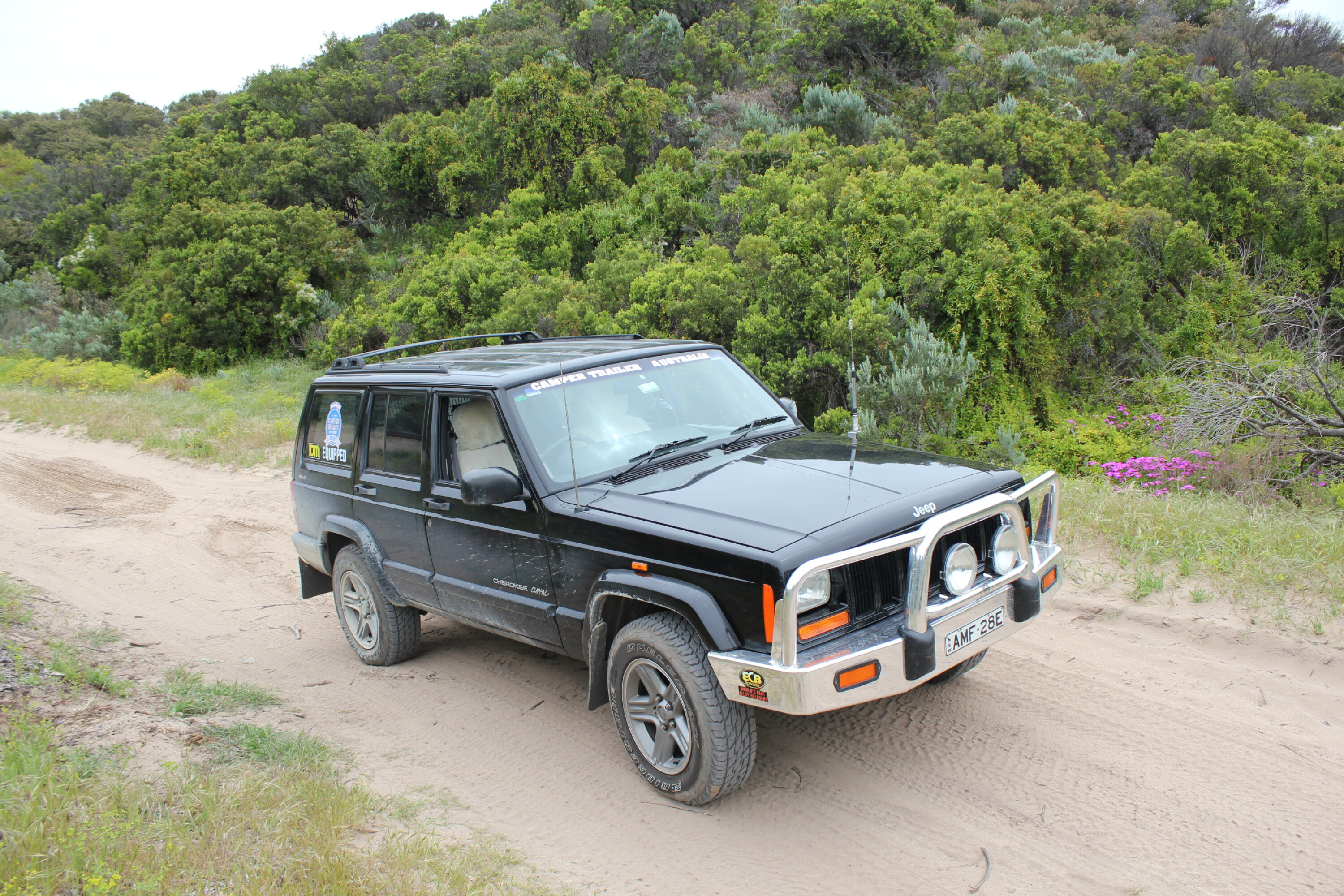
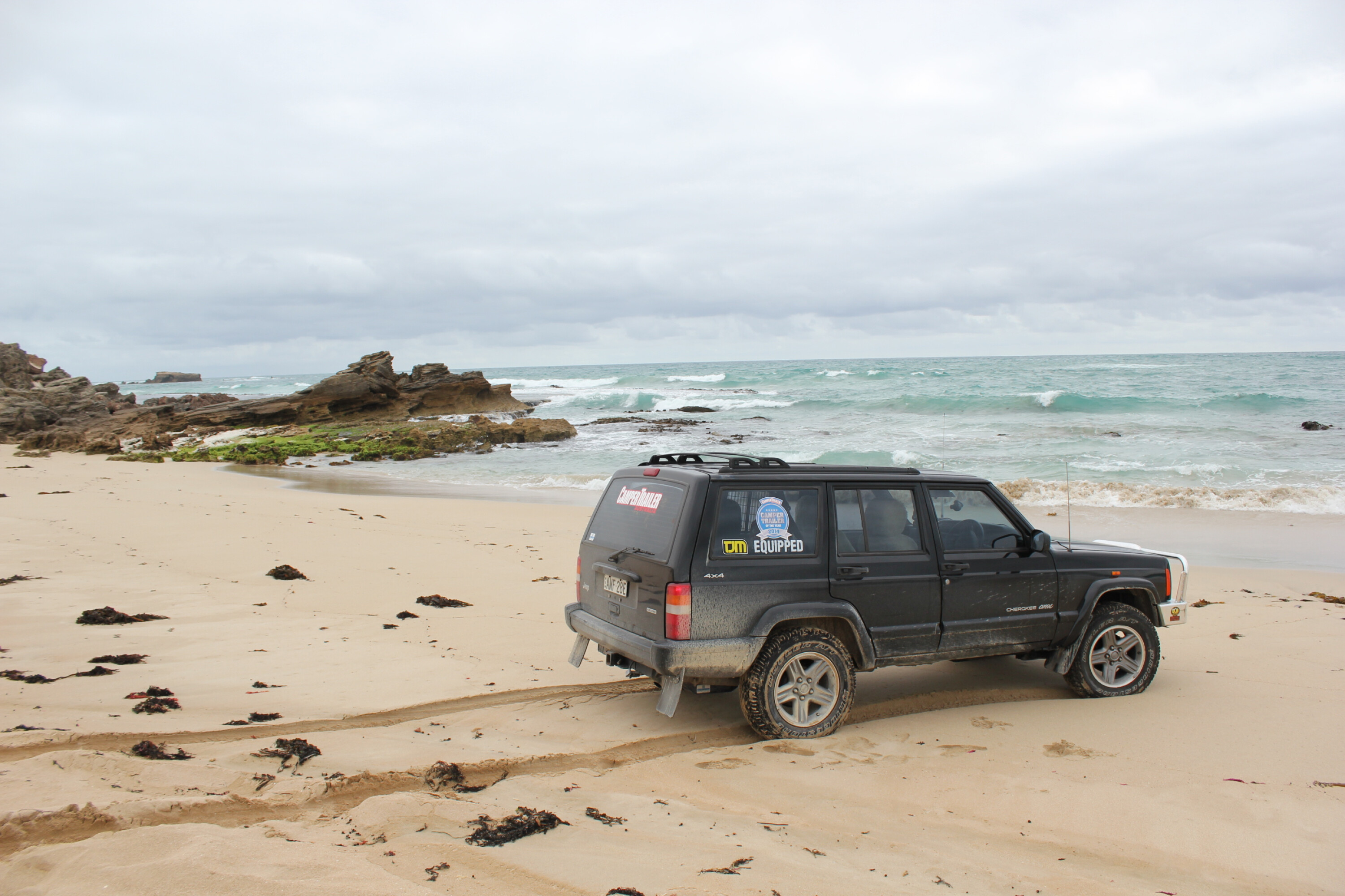
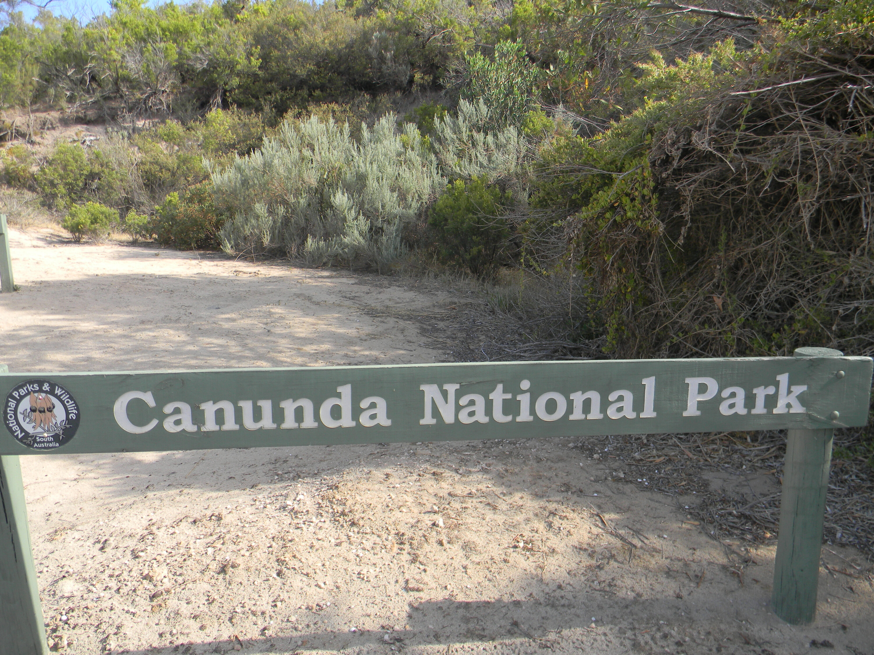
Another Limestone Coast destination, albeit a better kept secret, Canunda National Park is around five hours’ drive south of Adelaide, so it’s probably at the outer limit of a weekend away.
However, tackle that drive and you’ll be rewarded with a coastal park that allows you to pack in a couple of days full of fishing, beach driving, camping, surfing, diving, bushwalking and exploring.
The Canunda NP landscape differs from its northern neighbour (Little Dip CP) by offering a totally different experience in the northern section of the park, where rugged limestone cliffs dominate, along with spectacular rock stacks off the coastline and rugged, thick bushland to explore.
The southern section contrasts with its more open terrain dominated by sand dunes that stretch to the park border, and low dunes just back from the beach. Driving in Canunda NP you can cover the full length of the park, with the northernmost entry point accessed via the township of Southend.
You can also enter the park via Carpenter Rocks in the south, or the township of Millicent, which has an access road that leads to the park’s centre section, just above the expanse of Lake Bonney. The town of Southend is worth spending some time in, even if it is just to pick up some mega-fresh seafood (lobster, anyone?) on your way to camp.
Upon entering the park’s northern section you have the option of two campgrounds: Kotgee and Nal-a-wort. These are two of the six campgrounds you’ll find in the park; Oil Rig Square and Geltwood campgrounds are located in the centre of the park, while No 2 Rocks Campground south of these two, and Cape Banks Campground at the southern border, just north of Carpenter Rocks.
1
Most of these campgrounds are small and the majority have six sites; Kotgee has seven, with limited facilities. The pick of the campgrounds would be Number 2 Rocks. This is the most remote campground with limited sites and a pit toilet (be fully self-sufficient if camping here), but the reward is the beach is only 200 metres away, plus there are beaches to the north and south of the campground, separated by a lagoon that offers great swimming for young kids (the beaches are considerably rougher).
This campground also allows access to two beautiful limestone headlands. Having said that, Cape Banks, right down south, is also worth a final night stay; the historic Cape Banks Lighthouse is near here, too, so check it out before the long drive back home.
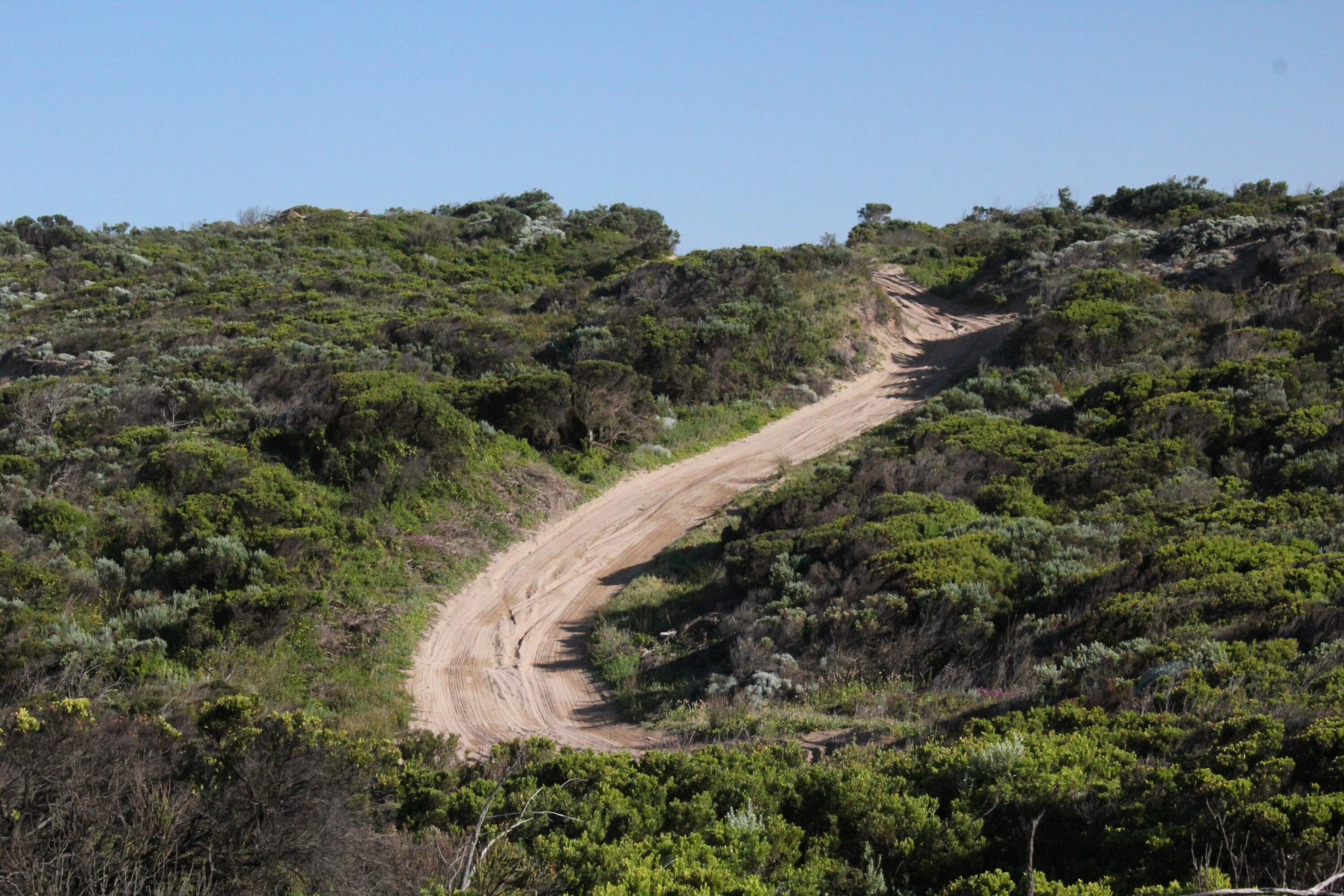
The off-road driving here is sublime – and surprisingly uncrowded – with a nice mix of challenging and straightforward coastal terrain to experience. As with any beach driving, check and double-check tide times before heading out onto the soft sand of Geltwood Beach. If it looks sketchy, there are numerous alternative tracks to explore behind the beach among the sand dunes, but, again, be well-prepared and deflate tyres accordingly.
1
Some of the tracks in the dunes behind the beach are dotted with marker posts that will guide you through these sections, with a number of tracks looping back to Geltwood Beach. Before you do delve into the park’s tracks, though, one drive that should be on your list is the short poodle up to Cape Buffon, just outside the park’s northern boundary.
The cliffs, sea stacks and roaring ocean below make for a speccy intro to your weekend. Along with the expected beach driving, the park’s tracks will throw up other challenges including rocky sections and soft sand behind the beach dunes. Follow some of these and you’ll pass through small clusters of coastal wattle and other coastal tree species as you move east/southeast away from the beach itself.
Another great track is Bevilaqua Ford, with its undulating dune sections, that acts as a great link track to park highlights such as Khyber Pass, a collection of large sand dunes that are ‘solid’ on top, being capped by sandstone and petrified tree roots.
2
For keen bushwalkers the Seaview Hike is a must. This 12km trek takes you along the steep cliffs in the park’s north. You’ll spot plenty of wildlife here; sea birds are commonplace, plus dolphins, seals and – during migration – whales.
On land there’s every chance you’ll surprise a grazing wallaby or wandering echidna. For those looking to catch their own seafood meal, the beach fishing is excellent; mulloway and salmon are commonly caught off the beach here, while rock fishing may reward with sweep. For divers – noting the bag limits – crayfish and abalone can be found along the many reefs offshore.
For a small, relatively out-of-the-way national park, Canunda packs a mighty big punch. As we mentioned earlier, it’s a longish haul for a weekend, but, snare yourself an extra day and it’s the perfect long weekend away.