Explore NT
Gallery 1
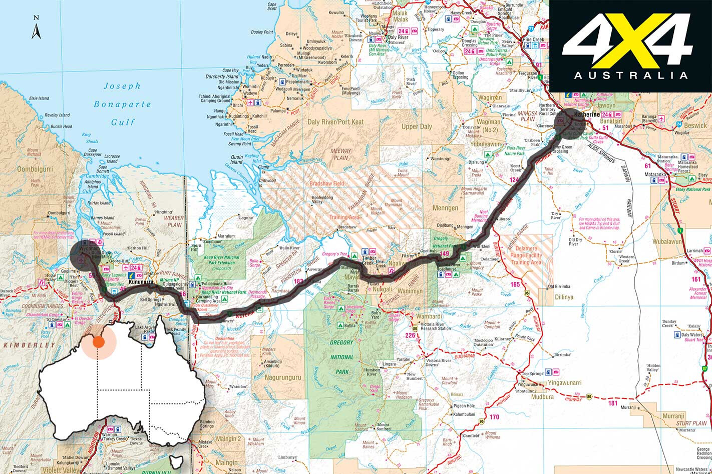
While the Victoria Highway is fully sealed, there are several sidetracks that lead to cattle stations, Indigenous communities and national parks along its length, and there are plenty of rest areas and campsites in strategic places to ensure travellers can pull-up and unwind when tired.
Despite being blacktop, the Victoria Highway is still subject to seasonal closures in the wet season. Some 86km west of Katherine is the turnoff to Flora River Nature Park, a 46km dusty drive to running springs and tufa dams that keep stunning crystal-emerald pools full to the brim.
1
Camping is permitted here and tinnies with no more than a 15hp motor are allowed on the pool, allowing access to a spectacular waterfall. The fishing is also outstanding, with barramundi and sooty grunter present in decent numbers. No swimming, though, as crocodiles live here.
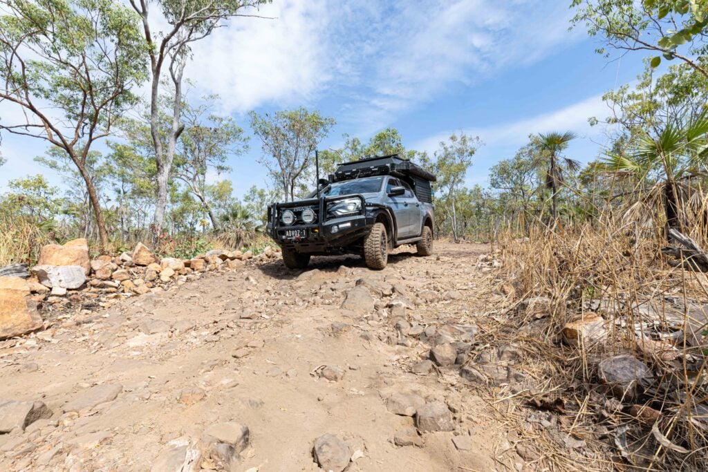
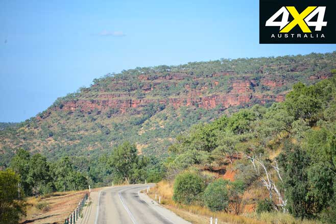
Farther west, the timbered country subtly changes to plains before hilly country abruptly encounters escarpments and cliffs, where the Moray Range rears up from the woodlands. Beyond here are the massive Stokes and Fitzroy Ranges. This is where the highway cuts through the Eastern Section of the Judbarra/Gregory National Park, and the Sullivan Creek campground is the first encountered when entering the park.
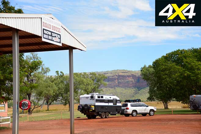
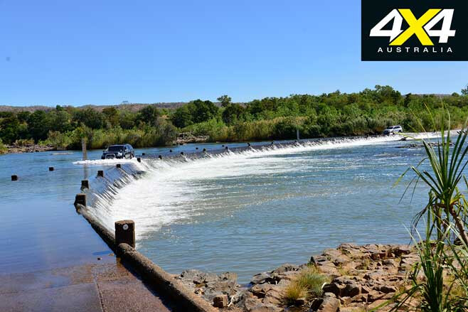
Another 17km on you’ll find the Victoria River Roadhouse situated on the banks of the freshwater reach of the mighty Victoria, the largest tidal stream in Australia. The river is 26km wide at the mouth and has a tidal influence of some 130km as it races upriver twice every 24 hours in a massive display of movement and power.
1
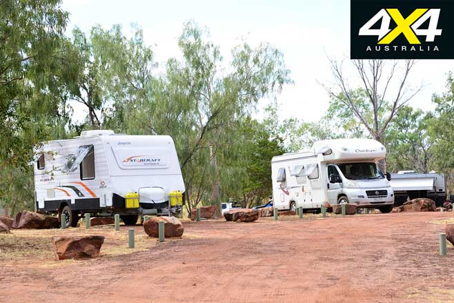
The roadhouse is a favoured stopover for those who prefer comforts like hot showers and hot meals. It’s close to park walks, Aboriginal rock-art sites and scenic attractions, and it has a campground, motel rooms, meals and fuel; plus, boat tours run from here.
A Northern Territory Parks and Wildlife Commission ranger station is west of the roadhouse, while the Park Visitors Centre has plenty of information on what you can do and what you’ll need during your stay.
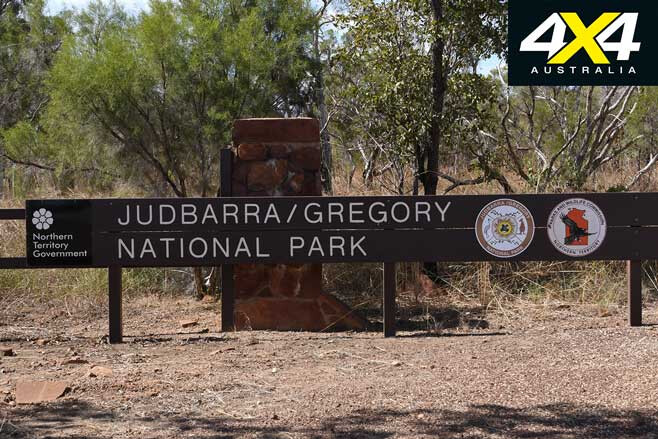
At 13,000km², Judbarra/Gregory NP is the second largest park in the NT, a total wilderness regime that’s best seen via bush tracks with a reliable 4×4 and a good pair of hiking boots. Much of the park consists of spectacular escarpments, mountain ranges and deep gorges where no tracks go. In years past, much of it was part of a cattle-grazing empire that has left a legacy of tracks, old yards and stock dams.
1
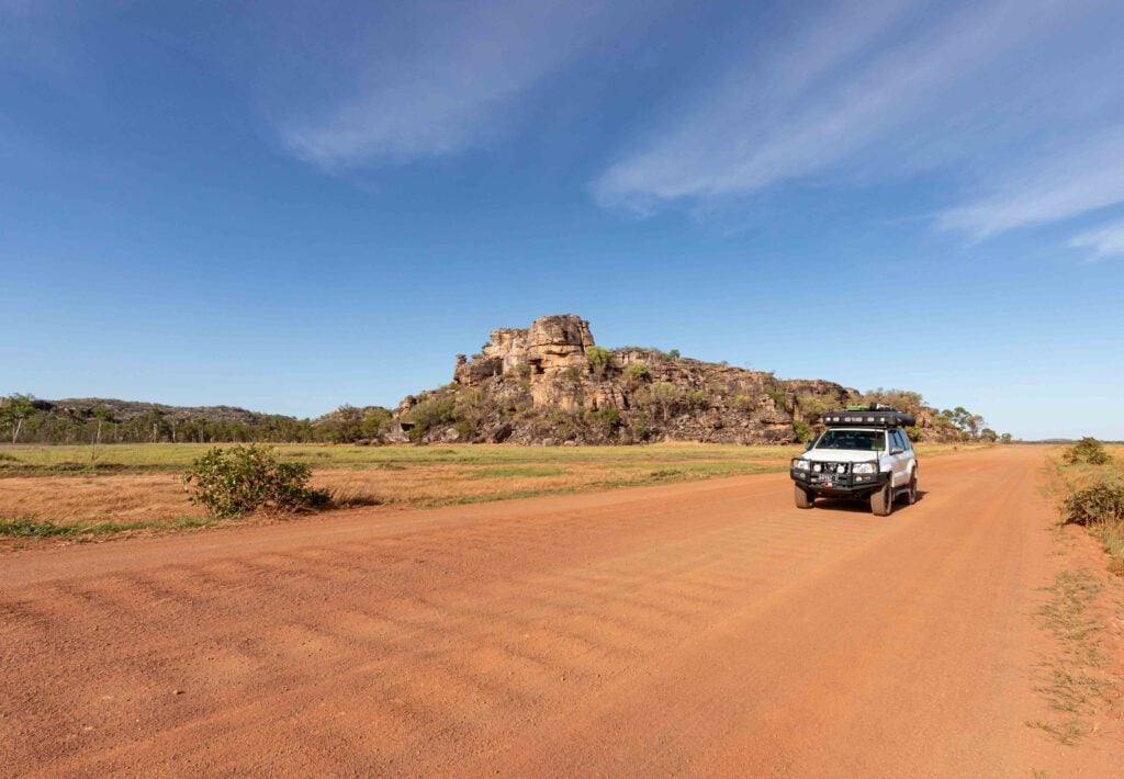
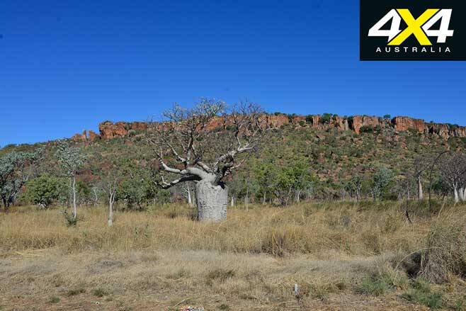
Another feature of the park is its boab trees, which grow regally along the highway and on the steep, scree-covered slopes under the ochre-red scarps that dominate the high ranges. Only nine species of boab (or baobab) trees exist in the world; eight are on the African continent, including two on the Arabian Peninsula, with our own endemic boab, Adansonia Gregorri, only occurring in the Kimberley and the Victoria River district. They are believed to date back to when Australia was connected to Africa during the Gondwana period.
To start your Judbarra/Gregory adventure, take the Escarpment Walk track that commences 2km west from the roadhouse along the highway. It’s a bit of a slog so it’s only for the fit, and remember to take plenty of drinking water when hiking in the region.
Another wonderful spot is Joe Creek Picnic Area and the Nawulbinbin Walk, 10km west of the roadhouse. Just 2km from the highway, the walk is steep and difficult in spots, so, again, only the fit should consider attempting it. And remember to always let someone know when you explore remote places.
1
The Old Victoria River Crossing is just up the road, where the old Coolibah and Bradshaw Stations track crosses the river. Bradshaw Station is now owned by the Department of Defense and is used as a training base.
A bridge has been built across the tidal section of the river west of Timber Creek and it’s open to the public, but only to walkers. The old crossing has rapids running over rocks that offer safe knee-deep swimming to cool off, but never swim in deep pools … that’s where the crocodiles live.
Judbarra/Gregory NP is divided into eastern and western sections, and the highway follows the river for some distance before heading out of the eastern section and entering Indigenous lands. The park’s network of 4×4 tracks can also be accessed from the Buchanan and Buntine Highways. Some 17km before Timber Creek, you can head south on the Bullita Access Road to the Jasper Gorge Campground, where permanent waterholes and high cliffs make for a great wilderness camp.
1
Back on the highway, turn off 10km before Timber Creek for the 42km drive to old Bullita Station. There is also a track north of the Jasper Gorge campground that connects with the Bullita track. There are several campgrounds in the park including a favourite on the East Baines River, where you can catch a barra for dinner if you’re a keen angler.
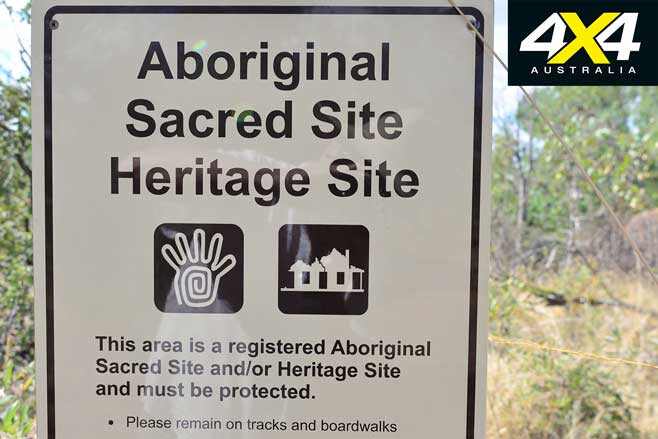
The historic Bullita Homestead features a display that highlights the history of the region before it became a park and was handed over to the traditional owners, who rate it as an important cultural and heritage region. It is divided into the traditional lands of several language groups, and the park is still used for traditional and cultural events that date back thousands of years.
Some of the largest art sites in Australia are in the park, with caves and shelters housing huge rock-art galleries adorned with friezes of stencils, printing, packing, pounding and animal and human motifs, which are the most common. Several galleries and art sites are open to the public.
1
A number of old station tracks also remain open to the public, and the park is well signposted with attractions highlighted. Exploring the western section of Judpurra/Gregory is best done with the help of another vehicle, as the region is very dry, hilly and isolated. It will take days to see much of it, but it’s the best wilderness park in the NT for those who really want to get away from other people.
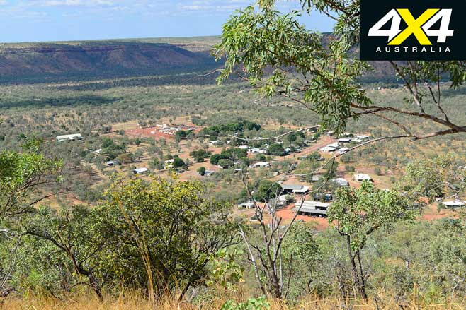
Timber Creek, with a population of about 300, has a roadhouse, camping and motel accommodation, police station, police museum and a medical centre. It’s a popular venue for barramundi fishers who fish the tidal stretch that commences behind the village.
For something different, take the very steep and narrow sealed road about 3km west of the village on your right, and drive right up onto the top of the forbidden Newcastle Range. Here, sweeping views of the river and Timber Creek unfold to far horizons. It’s one of the best lookouts in the tropics and a total surprise that sees little public attention from passing tourists.
1
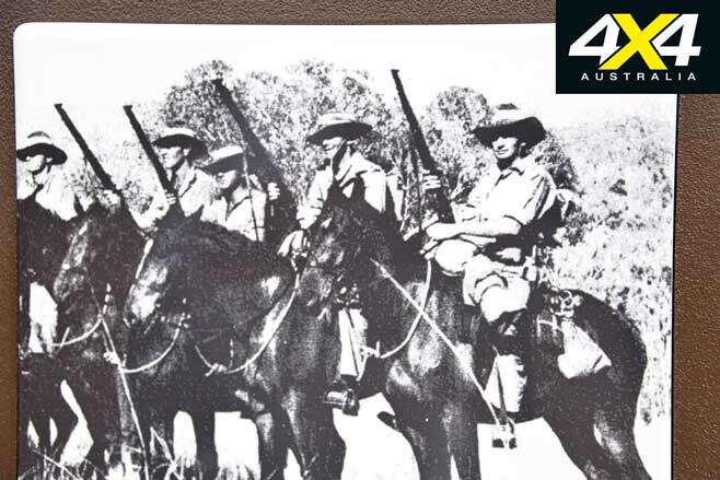
There are picnic tables and a very informative memorial to the North Australian Observation Unit (NAOU), better known as the “Knackaroos”. The NAOU was formed by anthropologist Major W.E.H. Stanner on May 11, 1942, after the Japanese bombing of Darwin on February 19, 1942.
The Knackaroos were all volunteer bush commandos; their headquarters were in Katherine and three companies, comprising 550 soldiers and 59 Aboriginal people, including trackers, donkey and horse-tailers, were stationed on the Gregory, Roper and Ord Rivers.
They patrolled the unpopulated coastal regions on horseback, in vehicles and in eight boats. Most carried their own personal firearms, or captured enemy weapons scoured from the army. Some even had their own personal mounts. They endured isolation, crocodile attacks, malaria, hunger, thirst and the knowledge that they were expendable as far as the army was concerned. Had it not been for the skills of the Aboriginal trackers and the NT Mounted Police, more would have perished.
1
West of Timber Creek is the Big Horse Creek campground and boat ramp, which is a great spot to pull-up stumps, launch the tinnie and catch a barra. Down the highway a little farther on, park and take the walk across the Bradshaw Bridge and experience how big and wide the Victoria River truly is – 100km from the mouth.
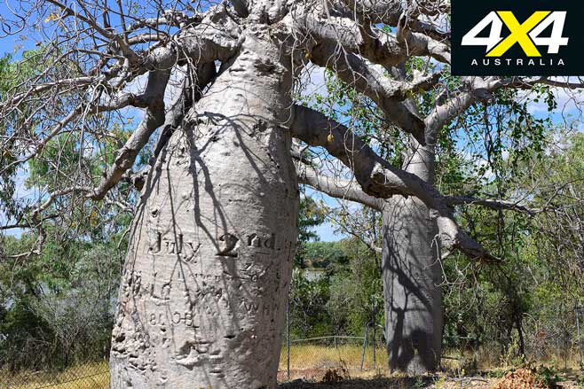
About 9km from Big Horse Creek Campground take the marked bush track to Gregory’s Tree, a massive boab. This is where explorer Augustus Charles Gregory landed his expedition in 1855 and established “The Depot”. From here he set out to explore the region to the south.
After several successful forays to the south, Gregory left an inscription carved into a huge boab tree explaining that a letter of the expedition’s intentions had been buried nearby just in case they became lost en route to Brisbane.
1
The date was July 2 ,1856, when the Gregory party headed east exploring the Elsey, Roper and McArthur Rivers before entering Queensland and turning south, crossing the Flinders, Burdekin, Fitzroy and Burnett Rivers on the hitherto largely unexplored western side of the Great Dividing Range.
He rode triumphantly into Brisbane on December 16, 1857, marking one of the most successful expeditions of exploration ever; yet it remains relatively unknown. Gregory’s name is a fitting tribute to the boab tree and the park.
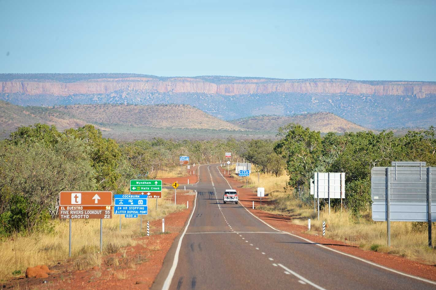
Farther west on the highway, the East and West Baines Rivers are crossed, and beyond here the landscape opens into woodland, scrub and plains. The different boab trees and groves will keep you enthralled, as not one tree looks the same as the next. Many have names carved into them, but thankfully these unsightly vandalistic habits that started with Gregory appear to be a passing trend. Distant ranges on the horizon promise much, but it’s not until one nears the Western Australian border that ochre-red escarpments and spinifex-grassed ranges make for a welcome change.
The East Kimberley Region
1
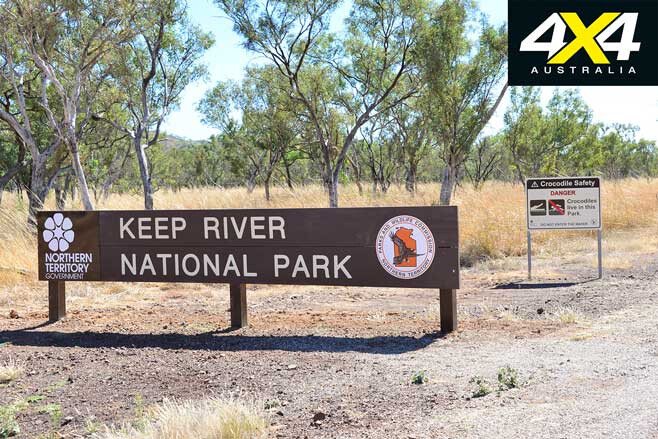
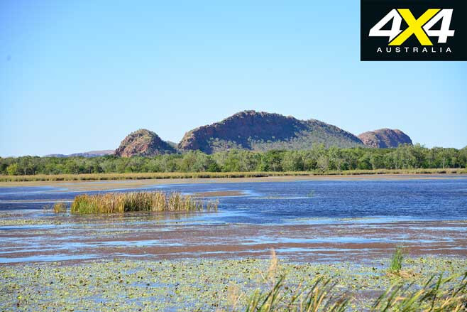
The Keep River NP entrance is only 3km from the WA/NT border. While only a small park it’s high on natural attractions, geological wonders and cultural values. There is an abundance of Aboriginal rock art, a “city” of striped sandstone structures reminiscent of the Bungle Bungle Range, and lots of waterholes fringed by gallery forest. There are two campsites within the park called Gurrandalng and Jarmen, and both offer great walks to several attractions and escarpment climbs.
The park is close enough for people staying in Kununarra to do several of the walks on day trips. The road at the park entrance continues north before turning west into WA, where it connects with the sealed Weaber Plain Rd to Kununurra.
On the Victoria Highway there is a quarantine station on the border where travellers are required to pull-up and dispose of fruit and vegies in the bins provided – quarantine officers search all vehicles and fridges. From the border it’s an attractive scenic drive to Kununurra, where every turn on the road reveals more photogenic views.
1
Kununurra is on the junction of the Victoria and the Great Northern Highways. It’s a progressive farming town situated on the banks of the Ord River and the gateway to the East Kimberley. There are many attractions and things to do including a visit to Hidden Valley NP, Kelly’s Knob Lookout, river and fishing cruises on the Ord River, nearby Lake Argyle and Lake Kununurra, day trips to Wyndham and Parry Creek, and more.
Wyndham is about 100km to the north of Kununarra. Visit the Grotto en route and marvel at the panoramic views of the Terr, Erskine and Cockburn Ranges. There are two parts to the town: Old Wyndham (The Port – established in 1886 when gold was discovered at Halls Creek); and New Wyndham, or The 3-Mile, which is now the residential and shopping centre for the 800-strong population.
MORE
The East Kimberley
1
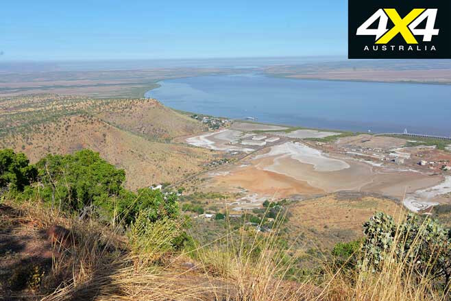
The 3-Mile is where you can head several kilometres up the steep Bastion Range to the famous Five Rivers Lookout. If you strike a clear day you can see far up into the Cambridge Gulf, but I have yet to strike one on several visits, as either sea haze or bushfire smoke obscured much of the view. Still, the lookout with its picnic facilities and views of The Port make for an amazing detour.
The Port is where much of the ABC TV series Mystery Road is filmed. It underwent a massive makeover to make it look like a lively township. In reality, the pub is closed and few people live there nowadays, preferring the facilities of “new” Wyndham. Only the Police Station remains…
Parry Creek
1
Old Halls Creek Rd takes you to Parry Creek Station and back to Kununurra, via Ivanhoe Crossing, or the alternate Valentine Rockhole Track when the crossing is running high.
From the Wyndham Rd take the track on the left to Telegraph Hill, where defense personnel were stationed during our disagreement with the Japanese forces that bombed Wyndham. The hill has great views, including Parry Lagoon below on the flood plains.
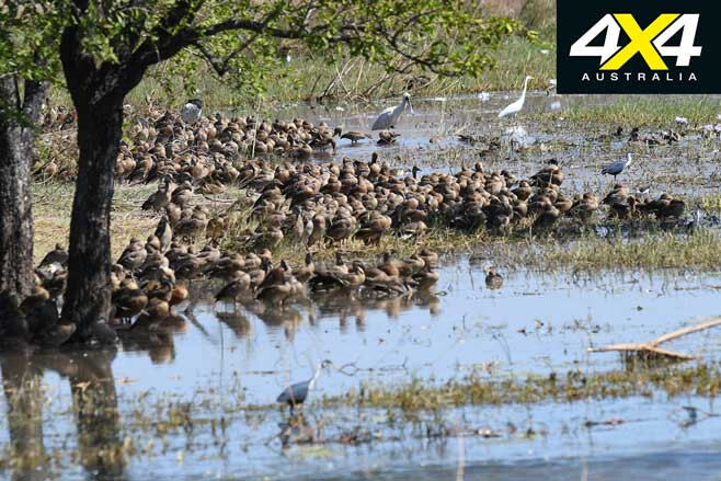
The billabong is home to myriad waterfowl and plains birds; take a pair of field glasses and enjoy the birds from the comfortable bird hide that extends over the water.
1
Nearby Parry Creek Farm has comfortable accommodation with cabins built over the water amongst shady tropical trees. A fully licensed restaurant, campgrounds and a crocodile-free swimming pool makes it a welcome interlude away from the crowds.
The farm is surrounded by the Parry Creek wetlands, which are rated as “Wetlands of International Importance” under the Ramsar Convention. From the farm it’s only 13km to Ivanhoe Crossing, with boab stands and billabongs to enjoy en route, plus wonderful panoramas over the plains, the ranges and hills beyond. Try and lure a barra for tea, but beware of the Ord River crocs which are the fattest saurians anywhere … they didn’t get like that for being slow.
Take care and enjoy what the Victoria Highway has to offer; it’s well worth the drive, but only if you get off the blacktop.
MORE
4×4 Explore
The Victoria Highway Travel Planner
1
Flora River Nature Park – (08) 8973 8888; nt.gov.au Victoria River Roadhouse – (08) 8975 0744; Judbarra (Gregory) National Park – (08) 8975 0888; nt.gov.au Timber Creek Hotel & Caravan Park – (08) 8975 0722; timbercreektr.com.au Wirib Store & Tourism Park, Timber Creek – (08) 8975 0602; Keep River National Park – (08) 9167 8827; nt.gov.au Ivanhoe Village Caravan Resort, Kununurra – (08) 9169 1995; ivanhoevillageresort.com Parry Creek Farm – (08) 9161 1139; parrycreekfarm.com.au NT Road Conditions – 1800 246 199; roadreport.nt.gov.au Katherine Visitors Information Centre – (08) 8972 2650; www.visitkatherine.com.au
Note: Camping fees apply in all NT National Parks, as do entry fees in WA National Parks. All park tracks may be impassible in the wet season from November to April. The best time to visit is from May to August.
Author’s note: I visited in mid-May and most park tracks in the NT were still closed.
Follow 4X4 Australia on Google
Get more 4x4 news, reviews and gear stories from 4X4 Australia in your Google feeds.