“Stay in your tent … the lion will visit tonight…”
This feature was originally published in 4×4 Australia’s November 2011 issue
His ivory-white eyes appeared like two searchlights on a stormy South Atlantic coast, and his skin, dark as obsidian, was absorbed by the moonless Kalahari night like the featureless miles of bush surrounding our camp. Climbing into an old LandCruiser trayback, he disappeared into the night.
As the taillights vanished, his last words of advice, “Stay in your tent…” trampled through my subconscious like a stampede of elephants, awakening every childhood nightmare of the boogieman in my closet. I’d spent weeks camping in the wilds of Namibia, South Africa, Lesotho and Zimbabwe.
I’d had elephants walk through my camp, baboons steal my food, and caught hyenas patrolling the perimeter of my fire light. But with the park ranger’s final nine words, things instantly changed. What we’d thought would be another tranquil night in the depths of Kalahari, suddenly became one of internal mind games, strange and foreboding noises, and fear.
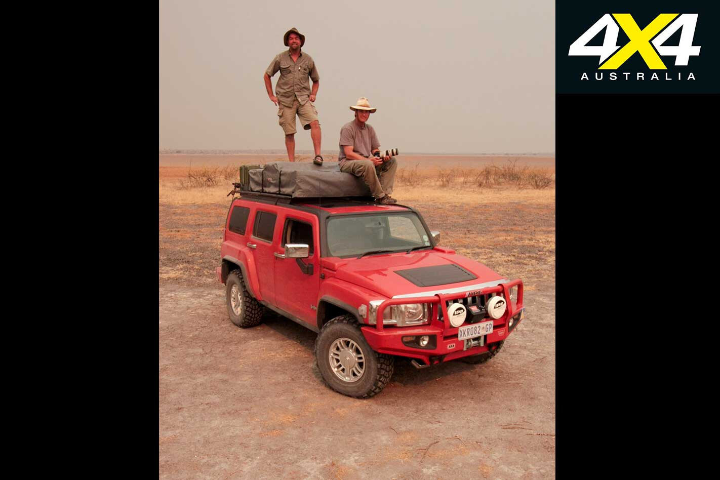
Four days earlier, we’d crossed into Botswana from South Africa. The other half of ‘we’ was old college buddy, Allen Andrews. We were a week into the adventure of a lifetime. General Motors had offered me a deal I couldn’t pass up – an H3 Hummer … and no time limit.
As a kid, only a few could draw my attention from my dirtbike and endless tracks of the California desert. The first was 4X4 trucks, and the second, oddly enough, was a TV show.
Each Sunday my dad would turn on Mutual of Omaha’s Wild Kingdom. Sporting safari garb and trekking through a distant land called Africa, Marlin Perkins, would authoritatively describe the deadly prowess of a python or lion, as his sidekick, Jim Fowler, wrestled it into submission. I dreamed of one day pitching my tent on the African savanna and falling asleep to the sound of elephants trumpeting in the bush, lions making a kill and hyenas scavenging for carrion.
As an adult, I never let go of those childhood ambitions. This was my chance to follow in Marlin’s footsteps, to live the dream.
DARWINISM AND THE FOOD CHAIN
I’d chiselled two months out of my schedule and planned to cross eight countries and cover approximately 10,000 kilometres. Allen would join me for three weeks. After that, I’d be on my own.
Kalahari, which means ‘waterless place’ in the Setswana language, may be one of the most diverse semi-deserts on the planet. And while services are more frequent to the north, the southern Kalahari, from Letlhakeng to Rakops – about 750km of deep Kalahari sand tracks – you are on your own.
A trek through the Kalahari is like stepping into another dimension. One of centuries past, where common sense and preparedness are prerequisites, and Darwin’s theory of evolution rules the bush. It is the realm of the Big Five (lion, leopard, rhino, elephant and cape buffalo), survival of the fittest, and a place where, if you put yourself in the wrong situation, you may become part of the food chain.
I’d hooked up with the guys at 4×4 Megaworld, southern Africa’s largest suppliers of off-road gear, to help with kitting the vehicle. Waiting for us were a Warn 9.5ti winch, high-lift jack, two Optima batteries, IPF lights and a slew of gear from ARB (bullbars, roof rack and tent, compressor, etc.)
The Megaworld crew fitted the gear and even gave me an open-ended shopping spree through their racks of camping gear: chairs, stove, etc. – everything I needed for two months in the bush.
BORDER CROSSING, LAST GAS AND GIRAFFES
The sun burned a searing orange hole in the morning sky as we passed through the border post at Ramatlabama, Botswana.
Unlike many African border crossings, this one was seamless. Insurance, registration, passports and carnet were in order, the guard issued our visas, stamped everything in duplicate, lifted the gate and we motored through.
Barring any major issues, we’d cover approximately 2500km before reaching the Kazengula ferry to Zambia. The last fuel before entering the Central Kalahari Game Reserves was in Letlhakeng. Ahead lay 750km of soft sandy two-tracks. Topping-up the H3’s 87-litre tank and four jerry cans, about 167 litres in total, we’d need to conserve fuel and avoid costly detours. Running low on fuel would mean a 200km detour to Namibia.
The Khutse Game Reserve, at 2600km2, is but a speck on the map compared with the Central Kalahari (52,000km2). But within its boundaries, the arid landscape stretches into oblivion and feels as though you are entering the burning gates of hell.
The sun was setting and we’d knocked off 150 kilometres by the time we pulled into the Molose Camp waterhole. Our first night in the Kalahari, we sat and watched in awe as the fiery orb settled into a distant acacia forest. A giraffe stepped into scene along with a few jackals and a variety of birds.
We stoked up a good fire, listened to the sounds of Africa, and witnessed the passing of a billion stars across the austral sky.
THE ROAD FROM HELL AND T’D OFF RANGERS
The thin red line on the map didn’t seem so long, but the trek from Molose to Xade Camp, at 266km, would be a brutal day. The sand of the Kalahari, which is exceptionally dry and fine-grained, made for a gruelling pace.
Fire had swept through the area a few days earlier, and smoke and the smell of charred wood hung heavy in the air. A pair of headlights poking through the haze at dusk, the first traffic of the day. Two couples in hired Toyotas who had spent the day digging out of the sand. They said there was a big military camp ahead set up to fight the fire. With 90km to go, we flipped on the headlights as darkness fell. Suddenly, the guidebook’s suggestion, “don’t travel alone” was gaining credence.
Park rules prohibit driving at night, but also bush camping. At the military camp, the soldiers rerouted us to the XaXa camp just a few minutes away. A few minutes turned into 25km and precious litres of fuel, something we could not afford.
It was quite late when we found the waterhole, but there were no signs for the camp and it is illegal to camp close to a water source. We were dog-beat tired and said the hell with it – camp here. About this time another ranger appeared, and an angry one at that. We got our arses royally chewed for not using the official camp.
“It is illegal to camp here, you could be arrested,” he proclaimed, and “I’ll take you there if you can not find it – it is well marked.”
There was the sign, and in perfect English, but it was lying on the ground to the side of the track and in the bushes. TIA (This Is Africa).
LIONS, JACKALS AND SCARES… OH MY!
As the sound of the ranger’s LandCruiser faded into the darkness, our first thoughts were, ‘we need to get a fire started.’ Allen volunteered to manage spotlight duties, while I scrounged the edge of the bush for dry grass.
My heart raced, eyes trained intensely into the darkness, the words “stay in your tent” swept through my mind. Allen panned the brush with the torch and shadows seemed to grow, dart to one side, and disappear with each pass…it was the boogieman, I knew it! And as tough as you think you might be, when you are tossed into the food chain, and you’re no longer at the top, you become a lily-livered weak-kneed chicken.
I collected a few handfuls of grass and quickly scrambled back to the safety of the camp. Lions have a distinct roar, and they did come to visit. Through the camel thorn acacia and scrub brush, we could hear the unmistakable call of a pride of lion on their nightly hunt. Even with a campfire blazing, the ARB camp light on and strobe in hand, we didn’t stray far.
The fuel light came on as we reached Xade military Camp. The fire had grown to 20,000km2 and was moving fast across the Kalahari. “It could be dangerous, be very careful,” we were told.
Though we had 80 litres of fuel on our ARB roof rack, the extra 50km to Xaxa Camp had pushed our previous range estimates over the limit. The decision was made to head to Ghanzi for fuel (250km return). Two nights later we’d set foot on the edge of Deception Pan.
DECEPTION PAN, WILDFIRES AND T4A
Deception Pan was launched into the global limelight in the ’80s by a pair of young zoologists, Mark and Delia Owens. Living in tents on the edge of the pan for seven years, they studied the wild dog, hyena and lion, and published a book, Cry of the Kalahari. Allen had a copy of the book and had been reading me excerpts.
Driving around the pan, we identified the Tree Island on which they lived and envisioned life in this truly remote and wild place. Smoke rolled in like a fog bank as we headed back to camp – by dusk we could see the faint orange glow to the southeast. Fire! Strong hot winds blew from the south and the faint glow was growing and moving.
By 2300hrs, we were getting concerned. We packed everything for a possible quick departure and set our alarm for three hours. We were awakened by the smell of smoke. Peering out window of our ARB tent, the entire horizon was fiery red, flames whipping into the air like a crimson geyser. “We need to get the hell out of here.”
On my first trip to Africa, my only navigation aids were a set of maps and compass. But, with today’s technology and software, I had sourced a Garmin GPS and Tracks-4-Africa (T4A) software. T4A is by far the coolest thing since the invention of four-wheel drive. It details almost every highway, dirt road and two-track on the African continent, and was literally a lifesaver at this point.
Our planned escape route was north, around Deception and to the Mangana park gate, and that put us on a collision course with the rapidly moving fire. If we couldn’t get in front of it, we’d have to retreat to the west.
By the time we reached Deception Pan, the fire had encircled its southern end and was running north up both sides. Smoke and ash swirled through the cab and across our headlights as the road zigzagged east towards the fire, then north, then east again. We were certain that the fire had already crossed the road behind us, so turning back was not an option.
Option two was to park in the middle of the pan, let the fire burn around us, and wait it out. We didn’t like that one either.
With maps and a compass we would have been toast… Well, maybe barbecued. But the T4A map detailed the track precisely, and the decision was, “Drive … fast!” The flames ran like the wind and were within a few hundred metres of us by the time we got in front of them.
When we reached the park gate at 0400, a ranger and a few Brits greeted us and said, “We didn’t know if you mates were going to make it. All we could see were the flames, and two headlights coming out of the red fire.”
The trip meter clicked 3339km as we rolled through the Mangana gate and headed for Rakops for fuel. We’d covered 1097km through the Kalahari’s deepest sand tracks, been visited by lions and hyenas, walked in the footsteps of a childhood hero, and survived the biggest fire in recent history. By 0600 the winds had shifted and all seemed calm.
As the sun prepared for the daily arrival, it cast a golden pallet of orange, crimson and ginger over the scorched landscape.
MAKGADIKGADI, BAOBABS AND THE OKAVANGO
The searing austral winter heat was pressing against the windshield, whipping through my open window like a glassblower’s furnace. My legs, now a crimson tone, are reeling from the previous seven days of exposure to the intense sun and forty-plus-degree temperatures.
I could have reached down, hit the aircon and slid the power windows to the up position. But no, I was following the tracks of one of my childhood heroes and the explorers of centuries past, Marlin Perkins, Henry Stanley and Dr Livingstone, and had vowed not to cave in to modern conveniences; save the Hummer H3.
We’re heading towards the Boteti River, the Makgadikgadi and Nxai Pans, and the aqueous reaches of the Okavango Delta. Rakops is no more than a few dozen rondavels and a dirt main street. But it possesses all the necessities for an African road trip – two garage-sized markets and a fuel pump. With full tanks and a few sundries into our fridge, we went in search of the decade-dry Boteti River.
Rumours were drifting through the bush that floodwaters from the Angolan highlands were pushing south, and that the historically dry web of channels, including the Boteti, may have water.
Locating a faint track from the tar road, we headed east to its terminus at an abandoned camp. A game trail led us a few hundred metres through thick bush to the steep banks of the Boteti. Void of water, we shoehorned the H3 down through a maze of acacia, and were greeted by a very surprised herdsman and a few dozen cattle. It appeared that he’d been living with his cattle for months, maybe years, pumping (and drinking) water from a hand-dug well and sleeping under a tree.
The language barrier was broken with a smile, a bottle of clean water and a small piece of quickly melting chocolate. Bewildered, he attempted to put it in his pocket for later. We assured him he should eat the chocolate immediately.
From treetop perches, black-breasted snake eagles kept a curious eye on us as we followed the riverbed upstream in search of the oncoming flow. Reaching the boundary of the Makgadikgadi Game Reserve, and unsuccessful in our quest in the Boteti, we climbed the east embankment into Makgadikgadi and would continue our search in a few days.
Herds of zebra and wildebeest greeted us within 200 metres of the park gate. We’d transitioned from agricultural Botswana to the realm of the wild. Outside the gate, people hunt for subsistence and commerce, and the remaining wildlife competes with cattle for limited resources. But within the reserve’s four-metre-high game fence, the bush appears in a constant state of motion.
Springbok and gemsbok peer from camouflaged veils of mopani, and vervet monkeys play their mischief while keeping a vigilant eye out for predators. The Makgadikgadi lies on the footprint of ancient Lake Ngami.
Most of our maps showed the region as a large blue form and, based on its endorheic disposition, this most assuredly meant a lake surrounded by savanna. Wrong! The blue only indicated where a lake would be if Noah were preparing his ark for departure. And rather than one massive dry lakebed, or pan, Makgadikgadi is a compilation of dozens of small pans, broken by islands of yellow prickly salt grass, acacia and scrub.
It was just before sunset when we arrived at Nxai Pan. Matusi, a young park ranger, pointed us to our camp on the map, laid down the park rules, and urged us to get out to the South Waterhole to view the wildlife.
As the sun dissolved into a fiery orb in the western sky, we blasted across the ancient lake bottom towards the Baines baobabs. Perched on an island, this mini forest of baobabs gained notoriety via the late 18th-century painter Thomas Baines, who set their macabre forms to canvas.
Pulling the H3 to the edge of the saltpan, we deployed the ARB tent, quickly scrounged some grass to start our nightly fire and, after picking out the bones, dined on gourmet cuisine of canned chicken curry. A cool breeze softened the relentless heat of the day, and we’d share camp this night with a few black-backed jackals beneath the ghostly moon shadow of these prehistoric giants.
Unlike me, Allen is not the kind of guy who can wear the same pair of underwear for a week (the trick is to go commando, or turn them inside-out on day four, then wash or burn them on day seven).
It was time for another shower, and rather than surrendering to the tar road to Planet Baobab – a funky retreat to the east – we attempted to locate a thin dotted line on our map, the traditional Maun-to-Gweta route.
Although we eventually found the long-abandoned track, it had been closed by the government and the better part of the day was lost in the effort. But cold beers, a hot meal of game stew and a double bunk rondavels awaited. So we swallowed our pride, endured a few dozen kilometres of pavement, and an hour later were tossing back coldies.
MOREMI, CHOBE AND THE JEWEL OF AFRICA
We’d been in-country for thirteen days, set up our transient camp each night, and spun almost two thousand kilometres on the odometer.
The following morning would find us in Maun (Ma-oon), gateway to the Okavango Delta—The Jewel of Africa. One of the world’s largest inland water systems, the Okavango receives an annual 18 billion cubic metres of floodwater from the Angola Highlands. It is a world of rivulets, palm-lined channels and forested islands, and home to thousands of species of African flora and fauna.
Due to perennial flooding in much of the delta, there isn’t a direct route from Maun to Chobe and Moremi, and the tar road is a 280km detour.
There are two Botswanas – that which lies outside the game fence, and that which is inside. The outside is void of indigenous species, and all you see are cattle and agriculture.
Inside, however, elephants and giraffe walk across your path, leopards nap lazily from limbs of sausage trees waiting for an unsuspecting baboon, and if you stray to into the bush on foot, you might find your place somewhere in the food chain.
The next four days in Moremi and Chobe Game Reserves would be just that: Elephants, giraffe, kudu, eland, vervet monkeys and baboons. It was like driving through Wild Country Safari, but with no fences, caution signs or traffic.
North of Maun, the track came to an abrupt end at the edge of the Khwai River. It continued on the other side, and the local villagers said the government was working on a bridge, but hadn’t done anything in several years.
New plan: head up-river to a spot shallow enough to cross (and not congested with elephants, hippos or crocs), and enter the Moremi at the north gate. After navigating a web of tracks we found a crossing, located a suitable winch anchor in case we got stuck, scanned the banks for crocs, and forged across.
Camps in Moremi are named after the log bridges they are near, and our destination was Third Bridge Camp on the remote finger of the delta. The area is a massive floodplain, and in the dry, water is usually low enough to pass safely. Ninety kilometres and a dozen water crossings later, we wandered into camp at dusk.
We made a quick bush-forage for firewood. And, upon returning, the ranger informed us “A leopard made a kill where you just were last night; stay near camp.” Knowing that Zambian fuel was three-fold the cost in Botswana (US$12 vs US$4), we topped the tank and jerry cans and headed for the Kazengula Ferry.
It had been 18 days since we entered the Kalahari. I’d be dropping Allen at the airport the next day, and be on my own for the next month. I slipped a well-worn Botswana map in the glove box, pulled out Zambia, and unfolded the next chapter of my childhood dreams of following the footsteps of Marlin Perkins and exploring the Dark Continent.
THE crew at 4X4 have been out in the bush for the last two weeks, and along the way we came across an unattended campfire still burning. We put it out and continued, later passing through areas of private land that had prominent signs up warning that trespasses would be prosecuted for leaving the public road.
It only goes to reinforce an email I received the other week from a frustrated mate who runs a sheep and cattle property in far-west NSW. He has been having more than his fair share of people doing the wrong thing – either unknowingly or, sadly, intentionally – while they pass through his place, resulting in busted gates, shot-up water tanks, spooked cattle and thirsty sheep. As a keen 4WDer and tourer, he appreciates why we want to come to the outback and visit the remote parts of Australia; but along with the privilege of touring our vast country comes some responsibility.
Here’s what he said: “When travelling in station country (designated by stock, fences, gates and watering points) you’re travelling on a working station where stock is our livelihood. Please make the effort to contact/visit the homestead if you would like to do anything other than pass directly through, or if you have queries on road conditions. It is when travellers are found camping, exploring or travelling on station tracks or closed roads without permission that landowners and managers can become grumpy.
“Leave gates as you find them. If it doesn’t look right, call in to see the station staff or attempt to track down someone on the UHF radio. If travelling in a group use convoy procedures and make sure the last through closes the gate properly. We often see latches that are not put back securely. Children need close supervision if taking on the gate-opening task. We cannot stress this enough: a box-up of stock by leaving a gate open can incur very significant mustering and handling costs to resolve; while a closed gate (that should be open) can deprive stock of access to water, resulting in many costly deaths.
“On outback properties there are often activities in progress that can have a major safety implication if people are camping without permission. For example, many stations have ’roo shooters that operate at night, there may be hunters looking for feral animals, and there may be mustering activities in progress. Do not camp without making an attempt to gain permission from the property, and don’t camp close to water points as that will deprive stock of access to water.
“Dogs must be on a lead at all times. Many properties regularly bait, trap and/or use other methods for the management of wild dogs and there can be a very real risk to any dog that is allowed off a lead.
“Take out any rubbish with you and rake out fires to ensure no cans or other debris is left behind. When you need to go to the toilet, dig a hole and burn the paper before filling the hole in, while ensuring you are well away from watering points and the side of the road.
“Shooting and exploring are not allowed under any circumstances without specific permission.
“If it happens to rain and you’re leaving defined wheel marks, stop and access the damage. In most areas roads are closed whenever there is any amount of rain and in many cases it may just mean camping overnight to let sun and wind do some drying before proceeding. Again, make every attempt to contact the station to find out what conditions are doing. We have, on occasions, put people up in our shearers’ quarters for several days rather than make a mess of the road. Remember, we have to travel on these roads every day.
“And you can help us by doing a big favour and report anything that doesn’t look right. If you suspect there is stock in strife or a watering point has stopped working, please try to call in or make contact via the UHF. Given the distances involved in station country we often only find out about issues after it’s too late.
“As landowners we’re happy to provide advice where we can to those who travel through our ‘backyard’, thus improving the outcomes and experience for us all.”What more can I say? Be a good outback traveller and we’ll all be better for it.
In 1832 ferocious dogs guarded the Eaglehawk Neck isthmus that joins the Tasman and Forestier peninsulas in an attempt by colonial authorities to keep Port Arthur convicts from escaping.
This article was originally published in 4×4 Australia’s November 2011 issue.
The infamous dog line proved quite effective, but it wasn’t enough to prevent the escape of Martin Cash who went on to become one of Tasmania’s best-known bushrangers.
Other escapees hatched quite bizarre plans to breach the vicious canine barrier – such as convict Billy Hunt’s attempt to hop across the neck in a kangaroo hide. His plan was brought to a sudden halt when one of the soldiers decided to shoot the unusually large (and probably rather ungainly) roo.
The Tasman Peninsula is no longer a place to flee; instead it offers a perfect mix of fascinating Tassie history, set alongside dramatic coastal scenery, including the highest vertical cliffs in Australia. There is a beautiful campground right on the beach at Fortescue Bay, with fantastic swimming and a boat ramp, where you could easily spend the entire weekend – but you wouldn’t want to miss out on everything else there is to see.
The Tasman’s Arch, Devil’s Kitchen, the Blowhole and the Tessellated Pavement are awe-inspiring sites of natural grandeur. To lose the crowds, follow Waterfall Bay Road (turn off Blowhole Road) and absorb the views at Morley’s Lookout without having to wait your turn. The last couple of kilometres are dirt, but it is a perfectly good road.
On a clear day there are beautiful views over Waterfall Bay, with the cliff walls rising straight out of the water. Rainfall gives the bay its namesake. Time permitting, visit the Port Arthur Historic Site – but allow at least a full day to do the place justice.
Different ‘experience’ passes are available, including a Port Arthur After Dark Pass, which includes the popular historic ghost tour. The Coal Mines Historic Site provides an interesting insight into Tasmania’s first operational mine, and the site also served as a place for punishment of the worst class of convict.
Tasman NP is a bushwalking mecca. The famous Tasman Coastal Track follows the sea cliffs from Waterfall Bay through to Fortescue Beach, out to Cape Hauy and on to Cape Pillar. Walks range from a couple of hours to extended four-day hikes.
For a more leisurely stroll, or something more suited to young families, follow the track at the northern end of Fortescue Beach to the rocky shore at Canoe Bay. Fairy Penguin burrows can be found along the way and, with a bit of luck, you may even spy the occupants.
Of course, there are plenty of 4X4 tracks to explore, just be sure to have a detailed map handy and be careful on forestry roads. In a nutshell, Tasman NP has something for everyone and, happily, nowadays you don’t have to concern yourself with snarling dogs or trigger-happy policemen if you do decide to hop across Eaglehawk Neck.
Travel Planner
WHERE Tasman National Park is 80km south-east of Hobart, on the Tasman Peninsula.
GETTING THERE Access from Hobart is via the A9.
CAMPING There are bush-camping facilities at Fortescue Bay, 22km south-east of Port Arthur (12km dirt road). For enquiries, ring the Parks and Wildlife office on 03 6250 2433 or email [email protected]. Cost is $13 per couple, per night (creek water, drop toilets and $2 hot showers). Bookings are advisable. There is no power, but generators are allowed in one part of the campground. There are limited sites suitable for caravans.
WHAT TO BRING Bring your own drinking water as well as supplies. There is a small supermarket in Port Arthur. Note restrictions on what foods can be brought from mainland Australia.
MAPS Tasman National Park: Map and Notes, TASMAP, 1:75,000, $9.95. Available from the Fortescue Bay Parks and Wildlife Office, or tasmap.tas.gov.au.
PERMITS You need a National Parks Pass, available at Fortescue Bay (day pass, $24).
Lexus has added to its luxury off-road LX range by launching the twin-turbo V8 diesel-powered LX 450d.
The 450d, with a 4.5-litre twin-turbo direct-injection V8 diesel engine, delivers 200kW at 3600rpm and a whopping 650Nm from 1600-2800rpm – meaning it can tow 3500kg without much fuss. The engine is mated to a six-speed automatic transmission and full-time all-wheel drive. A pressure discharge valve and low-inertia turbochargers with electric motors enhance performance and responsiveness.
Off-road tech extends to multi-terrain anti-skid brakes, crawl control, and a four-camera multi-terrain monitor, while 285/50R tyres wrap around 20-inch alloys.
The premium off-roader also features five drive modes, variable gear-ratio steering, adaptive variable suspension and active height control.
“We have had consistent demand for the LX with a turbo-diesel and Lexus has responded by developing an extremely well-specified vehicle that we are able to offer at a remarkable price,” Lexus Australia’s chief executive Scott Thompson said. “The turbo-diesel engine is smooth, quiet and powerful and will suit a wide variety of applications.”
In-cabin, the diesel-powered LX houses a 12.3-inch high-definition screen, satellite navigation, four-zone climate control air-con, a premium audio system, heated front seats with leather-accented trim, a wireless phone charger, a cool box and rear-door sunshades.
The LX 450d has retails for $134,500.
Located some 30km south of Omeo in the heart of Victoria’s scenic High Country, the Haunted Stream Track reopened late in 2017 after being closed for two years as a result of damage caused by irresponsible drivers.
While the eastern end of the Haunted Stream Track runs off the Great Alpine Road near Ensay – 60km down the bitumen from Omeo – the scenic route is via Cassilis through the bush to the track’s western end.
When checking conditions with the local office of DELWP (Department of Environment, Land, Water and Planning) before making this trip, their recommended option was to enter from the western (Dawson City) end of the track.
Part of the repairs DELWP had undertaken involved rebuilding a short uphill section comprising principally yellow clay. With a forecast for thunderstorms, the rangers suggested that, if it became wet, this section would probably only be conquered with the use of a winch, and so tobogganing downhill from the west was perhaps a better option than trying to climb that slippery slope from the east.
From Omeo the journey to the Haunted Stream passes the Cassilis Historical Area, 20km south of Omeo. A busy goldmining centre in the late 1800s, little remains today of that activity, and Cassilis is just a scattering of farms and small rural lifestyle allotments.
When passing through Cassilis it’s worth checking out the King Cassilis Mine ruins, with its scattering of relics, including old vehicle bodies and remnants of ore-processing machinery.
From Cassilis, the well-made gravel Mt Delusion Road winds through the forest before picking up Brookvale Road and then Angora Road, from where Dawson City Track descends steeply to the Haunted Stream in the valley below. The tracks through are generally in excellent condition, being well-maintained to support the significant logging activity undertaken in the area.
Dawson City Track was bulldozed prior to its re-opening, making what had been a rough and rocky descent much less so. Undoubtedly, with its large sections of yellow clay, once it has seen some use and copped some rain it is likely to revert to its former self. Even as it is, this track would make for an ‘interesting’ drive after rainfall.
The Dawson City Campground is a grassy area large enough to accommodate three or four vehicles. It’s arguably better than the other couple of camping areas along the Haunted Stream, so anyone planning to use it for an overnight stay should get there early or risk missing out. The thick forest and steep hillsides that surround Dawson City make it hard to envisage that this was once the site of a township with a population of 3000.
The Haunted Stream Track takes about two-and-a-half hours to complete and has 54 river crossings, where small trout can regularly be seen skittering through the shallow, crystal-clear water.
Many of the water crossings have steep entry and exit points, with clearance-challenging rocks thrown in for good measure. Potholes and deep wheel ruts also contribute to the slow going. Anyone with a shiny, new 4×4 should expect a few scratches by the end of the journey, given thick bush encroaches on the narrow track in places.
Other mining towns sprang up along the river, but, like Dawson City, apart from the rusting remains of an old ore crusher alongside the track at Dogtown and a dry stone wall at Stirling, there is little obvious evidence of the area’s history.
However, walk into the surrounding bush (with care given to the numerous unmarked diggings throughout the area) and the remnants of water races and other mining activity can readily be seen. Down a short side track near Stirling, the site of the Victoria Mine makes for an interesting stop.
The last leg of the journey from Stirling to the highway sees the narrow track cut into the steep hillside, high above the river below. With limited opportunity for approaching vehicles to pass, this would be a manoeuvre best avoided if at all possible. The track eventually leaves the State Forest and passes through private farmland, before exiting onto the highway.
DELWP’s warning about the clay section near Stirling proved to be unnecessary, as the storms stayed away. However, it and another nearby steep, slippery approach to the river would certainly present challenges after significant rain.
That said, the Haunted Stream is probably not a place to be in the wet. A significant black earth section near Dogtown was already deeply rutted, even though the track had only been open for a couple of weeks. It would seem quite likely that, without due care and responsibility exhibited by users of the track, it may soon become, once again, impassable and closed to the public – perhaps permanently next time.
A few years ago we took a Tvan Camper on this very same trip, so it’s possible (but not necessarily recommended) to tow a camper along the Haunted Stream. The track is narrow with limited opportunities for overtaking, but, in the company of others, with an appropriate 4×4 and an experienced driver, in dry conditions, towing a small off-road camper would not be an impossible task.
The quickest route from Melbourne to the Haunted Stream is via the A1 to Bairnsdale and then north on the Great Alpine Road.
The more scenic route is via Mt Hotham, where stunning panoramic views of blue mountain ranges stretching into the distance make it easy to understand why this part of Victoria is called the High Country. The Haunted Stream offers a mildly challenging 4×4 drive, great scenery and secluded camping along a trout-filled stream.
It’s a great destination for the entire family and, being in the State Forest, the furry, four-footed family members of the canine persuasion can come along as well.
Park Stay
Anyone planning to drive the Haunted Stream Track who doesn’t want to bush camp should certainly consider the Omeo Caravan Park and campground as a base. The Park offers numerous powered and unpowered grassy sites scattered along the Livingstone Creek in the shade of tall poplar trees.
Old Haunt
The Haunted Stream was given its name following the suspected murder of a local identity, Sir Roger Tichborne, better known as ‘Ballarat Harry’. Ballarat Harry disappeared on a trip to Omeo with a mate, who subsequently returned to the diggings at Stirling with a large amount of money and some of Harry’s possessions.
While nothing was proven and a body never found, locals began to report strange sounds in the night and ghostly apparitions which ultimately led to many considering the area haunted. In reality, the strange noises were probably the calls of the powerful owl which sounds not unlike someone screaming, and the ghostly apparitions were most likely due to the alcohol-fuelled, overactive imagination of superstitious miners.
Travel Planner
- WHERE: The Haunted Stream is near Ensay, 350km north-east of Melbourne.
- WHEN TO TRAVEL: Oct to April are the best months to travel, with summer temperatures rarely exceeding the mid-20s. Winter is cold and harsh, with many tracks seasonally closed between June and Oct.
- CAMPING / ACCOMMODATION: Bush camping is available at Stirling, Dogtown and Dawson City on the Haunted Stream. Omeo Caravan Park offers good camping facilities, while a full range of services are available in the township.
- ROAD CONDITIONS: The Haunted Stream Track is a 4×4 track of medium difficulty. Very popular on weekends and holidays, extreme caution is required on blind corners. In dry conditions, with an appropriate 4×4, an experienced driver would find it possible (but challenging) to tow a small off-road camper.
- PETS: Dogs are permitted in Victoria’s State forests provided they are ‘under effective control’, something DELWP rangers interpret as being on a lead. With large areas of State Forest baited with 1080 poison, your much-loved pet should never be allowed to roam.
- CONTACTS: For more info phone the Department of Environment, Land, Water and Planning (DELWP) at Omeo on 13 61 86.
THE April issue of 4X4 Australia will land in stores just in time for the Easter break.
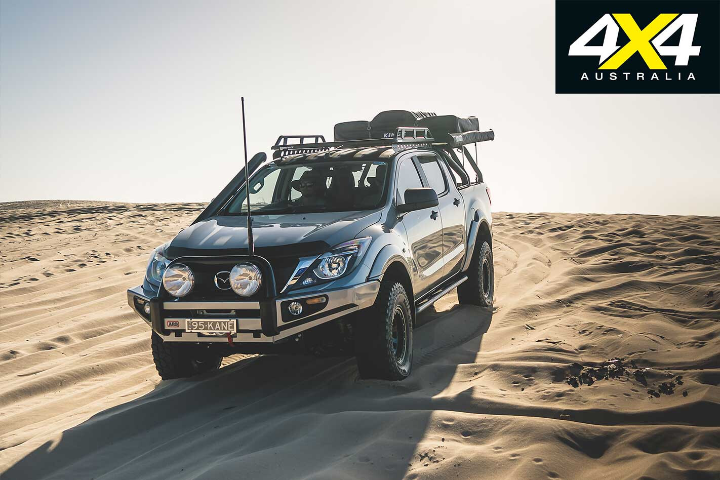
Headlined by a crazy, chopped Y62 Patrol dual-cab ute we reckon Nissan should build, the April issue is packing an arsenal of customised metal in the form of a bonkers BT-50 and an LSA-powered Range Rover.
We also share our thoughts from our first experience behind the wheel of Mahindra’s second-gen Pik-Up and Toyota’s MY18 Prado GXL.
The Toyota Hilux celebrates its 50th anniversary in Australia, so this month we pay tribute to the iconic and successful stalwart of the ute market.
Also in this issue, Ron and Viv Moon took off in search of the graves of the men lost during the famous Burke & Wills expedition, and we also list the best weekend escapes from Adelaide – perfect for the upcoming four-day weekend.
WHAT ELSE IS THERE?
- Holden 1 Tonner – the strip show begins
- Patrol Ti-L shed update
- Water sports at NSW’s Wave Hill Station
- Radiators explained
- Time for an alternator upgrade?
- Gear tests, and monthly rants by Ron and Fraser.
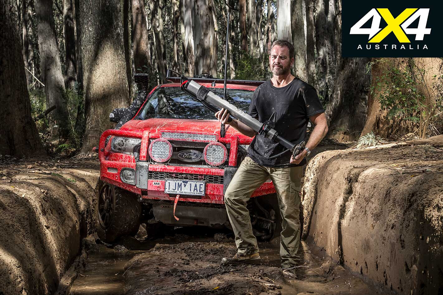
FORGET reinventing the wheel, ARB has decided to reinvent the high-lift jack, with the release of its long-travel hydraulic jack.
Simply called Jack, it retains all the functionality of a mechanical jack while significantly lifting safety levels and load capacity (Jack is rated to 2000kg). It also adds overload protection (through implementation of a blow-off valve), features an additional safety stop on the lowering lever (when compared to a bottle/trolley jack), and offers the ability to quickly lower the jack in situations where the vehicle being recovered may move.
Jack also has a wider lifting range when compared to a 48-inch mechanical high-lift: 160mm to 1230mm versus 115mm to 946mm. The unit weighs 10.5kg, is constructed from 6061 aluminium for strength, has a cast alloy base (also shaped to help break a tyre bead if necessary) and is hard-anodised for durability and protection against corrosion.
For additional protection and ease of storage, ARB includes a heavy-duty carry bag. Jack can be used in tight spaces thanks to its 890mm compressed height, which is considerably lower than equivalent mechanical high-lift jacks.
Smart thinking is behind the rotatable base (or foot, as ARB dubs it), as it ensures as much load weight as possible is transferred directly to the ground (and base), making for a safer and more effective recovery.
A big selling point of Jack is how straightforward it is to use. You don’t need to go through a full stroke of the lever and it can be engaged in any position which, as anyone who has completed a tricky recovery can tell you, is bloody handy for fine control of the jacking and recovery process.
The two-stage lowering lever also aids recoveries and the aftermath by ensuring the jack doesn’t ‘drop down’ suddenly, with the first two-thirds of lowering completed at a lower speed than the last third. This minimises the chance of the vehicle moving unexpectedly if the jack is dropped away too quickly.
The strong cast handle and its four-bar slide linkage combine very effectively to lessen the effort required (read: your arm/shoulder strength) when under load and lifting a 4×4.
Speaking of strength, ARB is claiming Jack’s teardrop body shape increases overall strength of the unit, while the inbuilt body bumper ensures you aren’t going to lose any paint if/when Jack bangs or slides up against your vehicle.
Even things like the handle-retaining clip are well thought-out – there’s nothing worse than a handle banging about in the back of your rig, not to mention the potential for the thing to break and then you’re left with, potentially, no recovery capabilities.
The ARB Jack isn’t cheap at $995.00 (RRP Australian East Coast Metro pricing). But having said that, with the additional safety features, robust build quality, top-notch engineering, higher load capacity and overall ease of use, Jack still makes for a great investment. Look for an extensive product review in a future issue.
EASTER is just around the corner, and so is the 30th Anniversary Condo 750 navigational rally.
Condobolin is just 450km west of Sydney and is regarded as the centre of off-road racing. With 34 vehicles already signed up for this iconic race, there’ll be plenty of action, so why not plan an Easter break in the Australia bush?
Friday morning (March 30) will kick off with scrutineering taking place at the showgrounds from 9am till 12pm. This is your opportunity to get a close look at all the machinery and talk to the competitors.
A 34km prologue will start at 12:30pm, with each competitor getting the chance to shake down their vehicle and settle the nerves while sorting out who is quickest for the Saturday race start.
Racing gets underway early Saturday, with the first competitor hitting the track at 6:30am. Autos race one course, while bikes/quads race a separate course. These are then reversed for Sunday’s race.
Racing will be tough, with competitors racking up more than 1000km in two days, including 778km of competitive racing! On Sunday evening it’s time to kick back with the presentation dinner and a few drinks.
Camping and admission are free for spectators, so bring the family, bring your friends and enjoy some country hospitality.
The sense of remoteness is tangible as you travel north-west from Marree, a small, isolated outpost on the edge of the driest and harshest country you’ll find in Australia, 380km north of Port Augusta in the bleached outback of South Australia.
This article was originally published in 4×4 Australia’s February 2011 issue.
But for a fluke of geology, few people would come this way and history as we know it would not have been written.
Dotting this country in a great arc from near Lake Callabonna, north-east of present day Arkaroola in the Flinders Ranges, through Marree to north of Oodnadatta, is a series of so-called mound springs.
These springs, where ancient water (some say over a million years old) bubbles up to a parched land and transforms it, were the basis for the ancient Aboriginal trade routes that crisscrossed the dry heart of Australia. When Europeans started exploring this country, those same mound springs were the key to the centre and beyond.
The mounds were first discovered by Major Peter Warburton in 1858. John McDouall Stuart, arguably Australia’s greatest explorer, used the springs as stepping stones to the interior and for his successful crossing of the continent in 1862. Pioneer pastoralists followed, quickly taking up the land around each and every spring.
Stuart’s route was so practical that 10 years later, when the Overland Telegraph Line (OTL) was pushed through from Darwin to Adelaide, it followed virtually the same track across the continent. With the OTL as a safe and known line on an otherwise blank map, other explorers set out from its repeater stations into the vast western interior.
Then, as the railway was pushed north from Port Augusta, it too followed Stuart’s route, reaching Marree, originally known as Hergott Springs, in 1884. Oodnadatta was then connected to the railway in 1890, but there the railhead stayed until it was finally pushed through to Alice Springs in 1928.
The track that sprang up beside the OTL was tramped by budding explorers, pioneer pastoralists (my great grandfather among them), Afghan cameleers, itinerant workers, missionaries and early adventurers. The steam trains that followed the route were almost entirely dependent on the waters of the mound springs and the occasional artesian bore dug along the way.
Today when you travel the route you are rarely out of sight of the old Ghan Railway Line, and often you come to the scattered ruins of the OTL. Here and there are other iconic features of our arid inland; an ephemeral water-covered Lake Eyre, the oasis of Algebuckina Waterhole and the nearby historic bridge of the same name that spans the sometimes mighty Neales River.
The Oodnadatta Track is more like a good dirt road these days, its only challenge being a wayward rock that can easily tear the sidewall out of a tyre, or after heavy rain when the creeks wash across the road and the track becomes, for a short time at least, a set of wheel marks vanishing into the distance.
The rewards for travelling are many. The sense of history is palpable, the vastness succour for the soul, while the characters you meet, like the commodore of the Lake Eyre Yacht Club, are more than memorable.
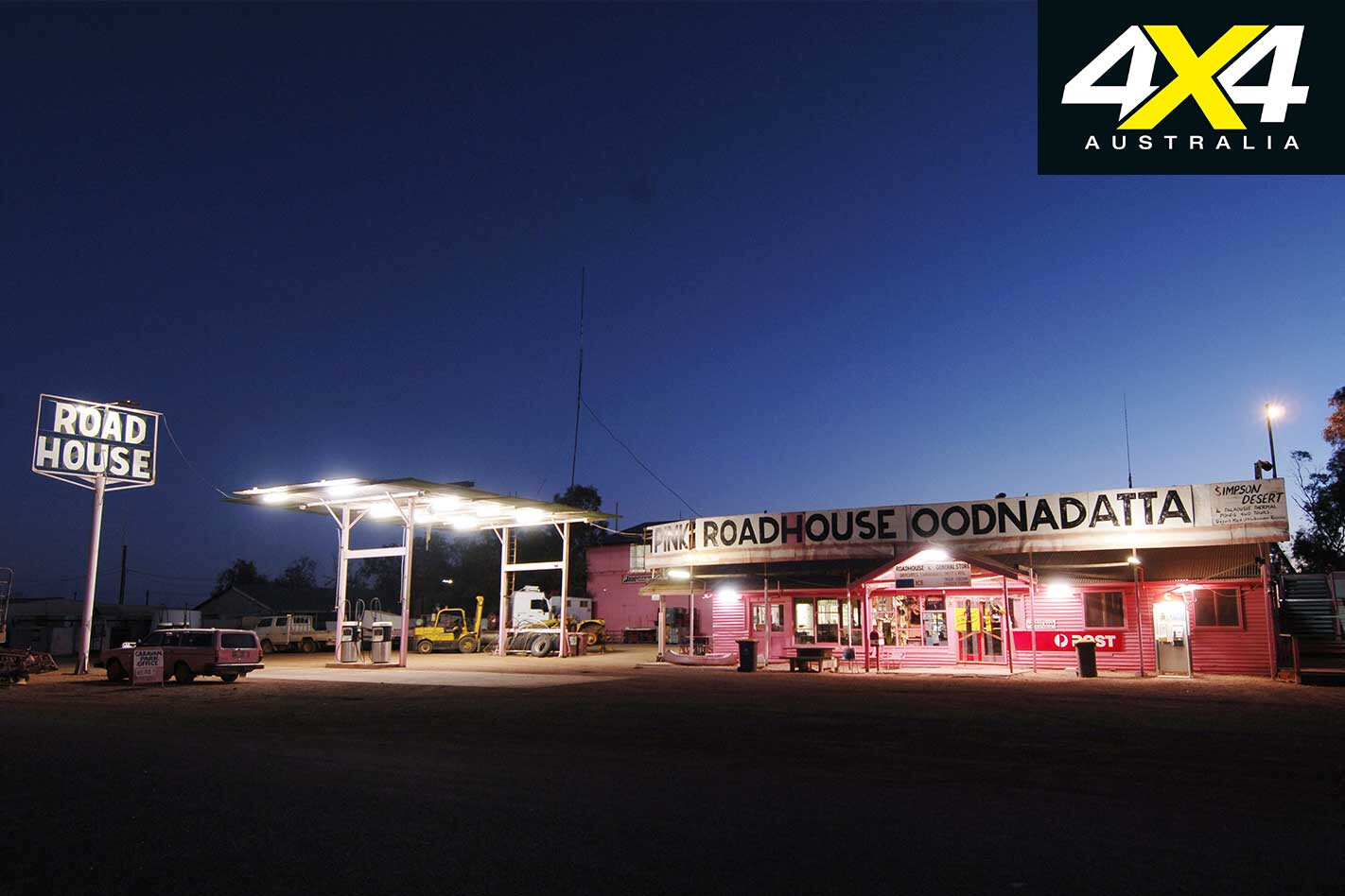
Then there are the harsh natural wonders of the region, the mound springs and Lake Eyre among them, while the quirky places along the route, such as the ‘artistic’ sculptures just north of Marree, the rustic interior of the William Creek Hotel, or the gaudy exterior of the Pink Roadhouse, say more about the Australian psyche than any encyclopaedia on the subject!
Travel Planner
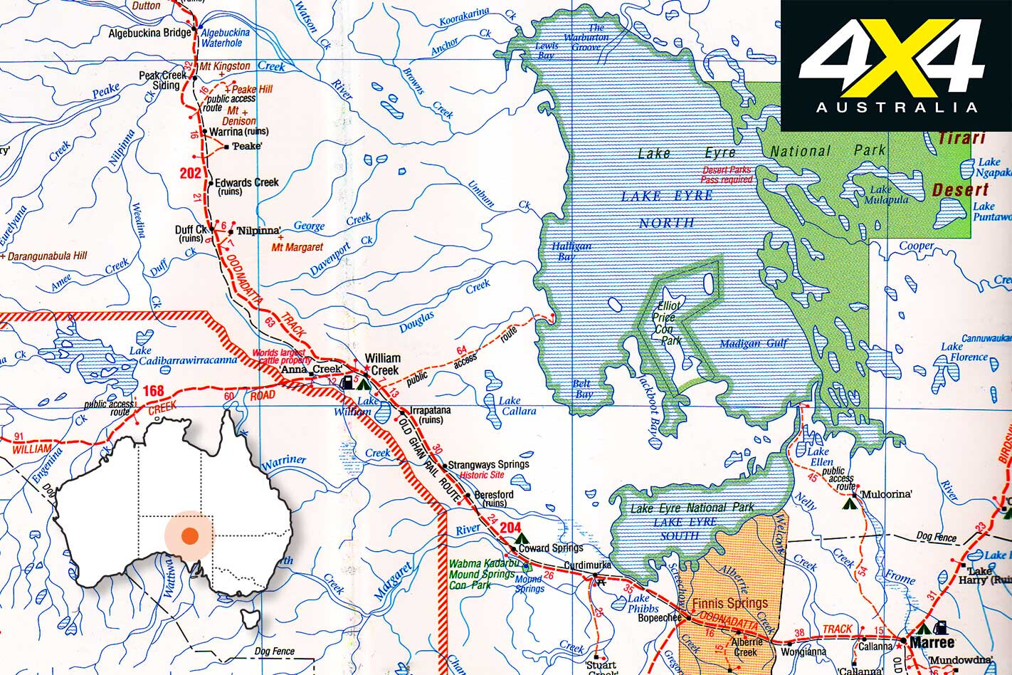
START Marree
FINISH Oodnadatta
LENGTH 405km
LONGEST DISTANCE WITHOUT FUEL 204km between Marree and William Creek
BEST TIME TO TRAVEL March to September
More info marree.com.au williamcreekhotel.net.au pinkroadhouse.com.au lakeeyreyc.com www.wrightsair.com.au environment.sa.gov.au
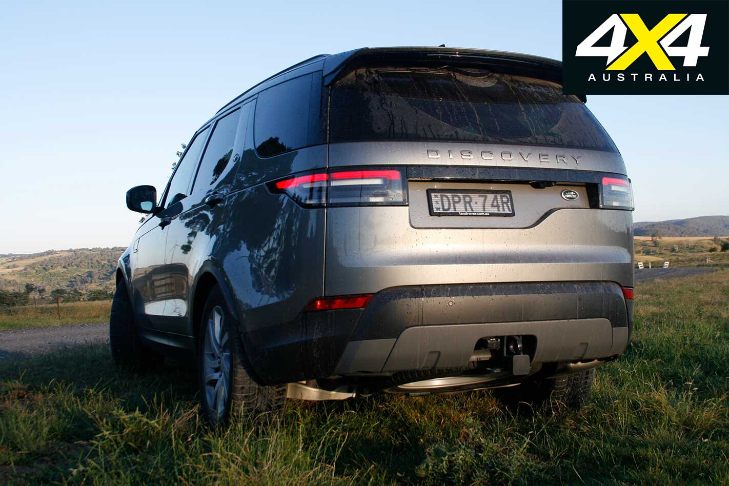
A recall has been issued for specific MY18 Land Rover Discovery, Discovery Sport, Range Rover, Range Rover Sport, Evoque and Velar models due to incorrectly manufactured engine-mounted fuel rails.
VIN ranges of affected vehicles:
– SALGA3BY1JA343646 to SALGA2AY5JA387693 – SALWA2BY2JA146054 to SALWA2BY6JA185973 – SALVR2RX4JH226559 to SALVP2RX3JH296852 – SALYA2AX9JA700000 to SALYA2BX5JA746759 – SALCA2AX0JH685128 to SALCR2SX4JH748920 – SALRA2BX3JA014201 to SALRA2AX6JA039854
The recall report indicates that “some engine-mounted fuel rails installed on Ingenium I4 2.0L petrol engines have not been manufactured correctly”. This fault increases the risk of fuel vapour and liquid leaks occurring in the engine bay, which could create a fire hazard.
Owners of affected vehicles may notice an excessive fuel odour, and liquid fuel may be seen in the engine bay.
Owners of affected vehicles will be advised by JLR “to contact their preferred authorised repairer who will inspect the vehicle’s fuel pipes and replace them where required. Two additional clips to ensure correct design clearance will also be fitted”.
The affected vehicles were sold nationally.