Explore VIC

Gallery 1
It’s one of those iconic destinations that overlanders talk about in camp chairs across the country. The historic McKillops Bridge sits high above the Snowy River in a remote corner of Snowy River National Park, and reaching it is half the story.
I began at Marlo with a stiff coastal wind trying its best to tear the awning from the Prado. After breaking camp at Marlo Ocean View Caravan and Camping Park, I rolled out towards Cape Conran, where a wild ocean swell hammered the headlands. From there, it was inland via Cabbage Tree Creek and back to the Princes Highway, before a final supply stop in Orbost. Fuel, food and a quick vehicle check are wise here, because once you turn north onto the Snowy River Country Trail, services disappear quickly.
Taming McKillops Road
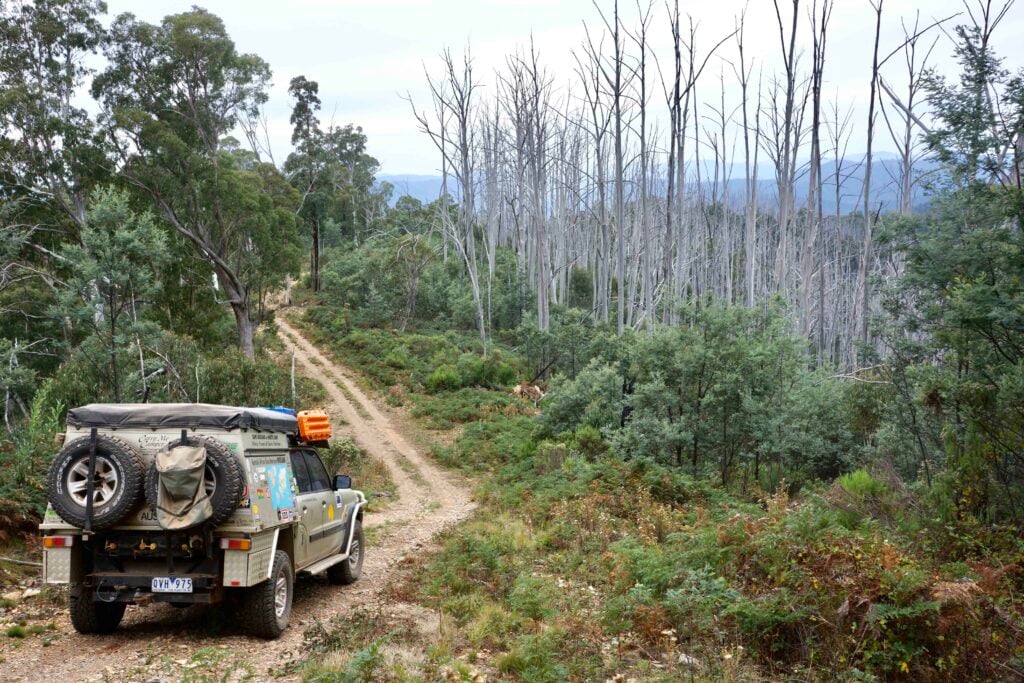
Within minutes of leaving Orbost, the tone changes. Wind the window down and the forest announces itself. Ironbark and mountain ash tower above the track, cicadas scream from the canopy, and tree ferns mark the creeks below the road line. It feels remote, even though you are only a short distance from town.
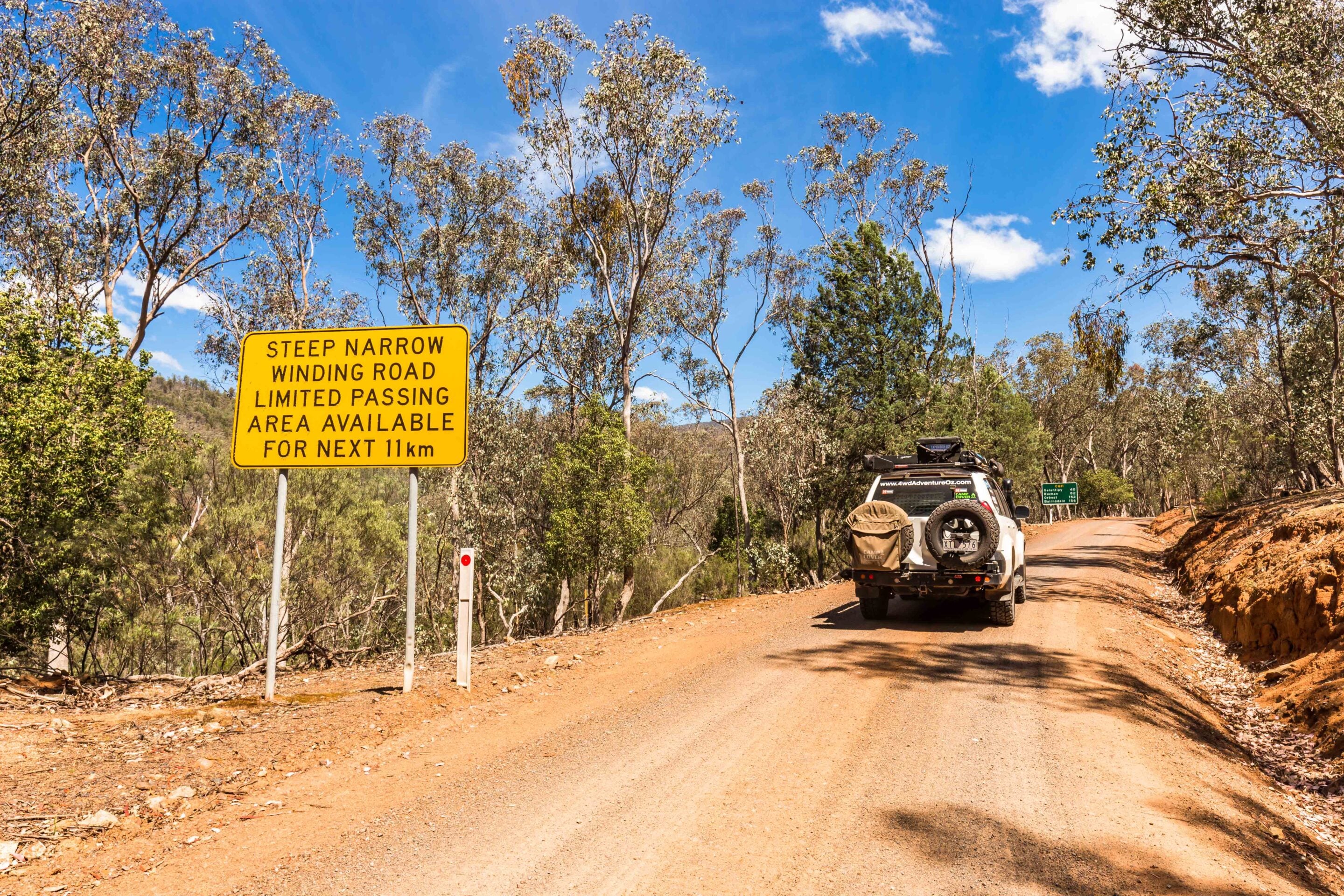
The road is signposted at 80km/h, but that figure is optimistic at best. Blind corners, cambered sections and logging activity demand respect. This is active forestry country, so switch the UHF to channel 40 and keep it there. Log trucks are frequent, and they move with purpose. If you hear one call up, answer back and confirm your position. It makes life easier for everyone, especially on tighter bends.
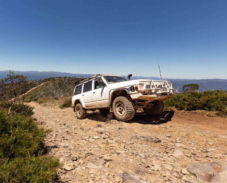
There are patches of bitumen before Bonang, but they do not last. Beyond the tiny settlement, the surface turns properly to dirt and the road narrows as it begins to follow the Deddick River along McKillops Road. Conditions vary with the weather. In the dry, it is generally firm with loose gravel on top. After rain, it can become slick and confidence-sapping on the steeper sections. Low range is not always required, but it is reassuring to have it ready for the descents.
1
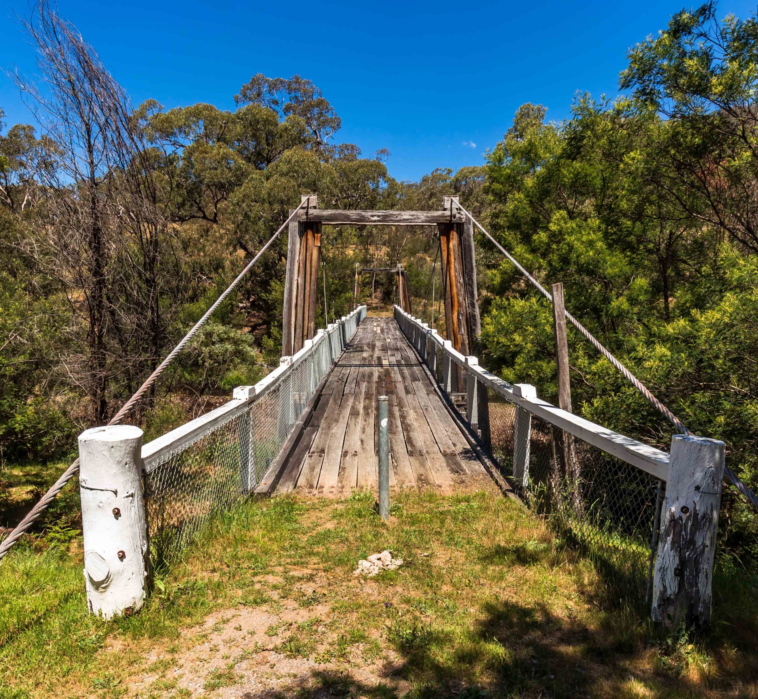
A worthwhile detour is the historic Ambyne Suspension Bridge. Built by the Victorian Country Roads Board, it carried vehicles from 1935 until 1970 before closing and eventually being restored. Standing on it today gives a real sense of the isolation faced by early travellers and road crews in this region.
Further along, Mount Deddick rises above what was once the small township of Deddick. Little remains now beyond subtle hints in the landscape. Then the road tips and twists towards the main attraction.
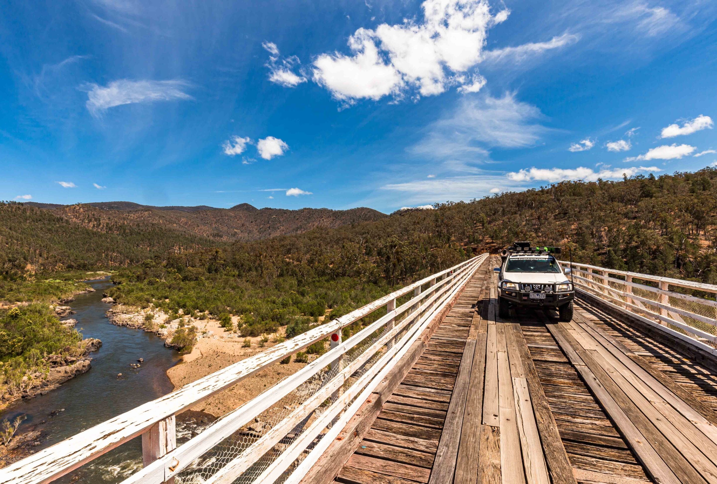
McKillops Bridge appears almost suddenly, an elegant steel truss spanning the Snowy River far below. The current bridge was built between 1931 and 1936 after earlier flood damage, replacing a ferry crossing used by stockman George McKillops as early as 1835. It was once claimed to be the longest arc-welded steel truss road bridge in the world and remains one of Victoria’s most impressive remote structures.
1
Allow around four hours from Orbost, depending on conditions and stops. It is not a drive to rush. Canoeists launch here to explore the gorges downstream, and there are walking options, including the Silver Mine Trail, for those keen to stretch their legs.
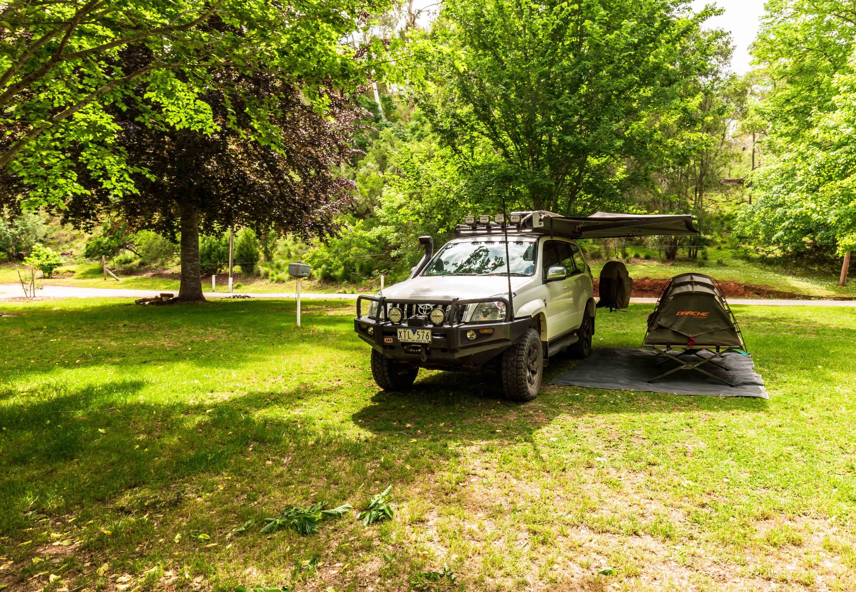
The nearby campground is basic but well spaced, with drop toilets, fireplaces and picnic tables. Sites are not perfectly flat, so take levelling gear and choose your position carefully. On one visit, I had a sizeable limb fall metres from the Prado overnight – a reminder that camping in tall timber demands awareness.
The climb out from the campground side is where the track really earns its reputation. The ascent is steep and exposed, with long drop-offs towards the Snowy River. There are limited pull-over points, and meeting oncoming traffic requires patience and clear communication. Engage low range early, take your time and enjoy the views when it is safe to do so. They are some of the best in Victoria.
Gorges, ghost towns and High Country history
Not far from McKillops Road are two standout natural features.
A short side trip leads to the lookout over Little River Gorge, carved over millions of years and plunging around 500m to the valley floor – the deepest gorge in the state. In wet conditions, Wulgulmerang Creek can be seen cascading dramatically into the chasm opposite the viewing platform. Nearby, Little River Falls offers a contrast. The upper section near the car park looks modest, but cross the bridge and follow the walking track down to the main drop and you will find water spilling 30m down a rock face into the gorge below.
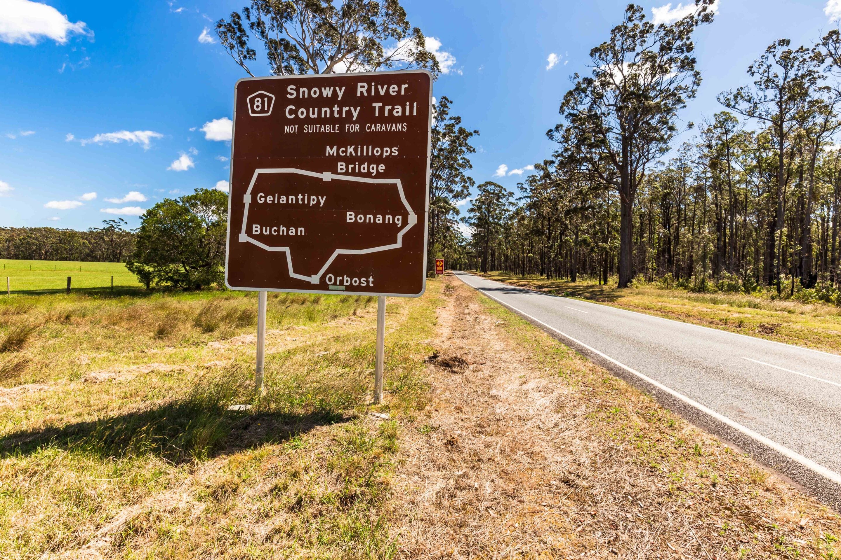
Eventually, you cross a cattle grid and leave Snowy River National Park behind. Rolling grazing country replaces dense forest as you approach the T-junction, which presents two very different choices. Turn right and the Barry Way leads towards Jindabyne and the New South Wales high country. Turn left and you drop towards Buchan.
1
Before committing to either direction, there is another worthwhile detour. Follow the Barry Way north for a short run and you will reach the tiny settlement of Suggan Buggan, one of Victoria’s most remote communities. With only a handful of permanent residents, it feels like a step back into a quieter era of High Country life.
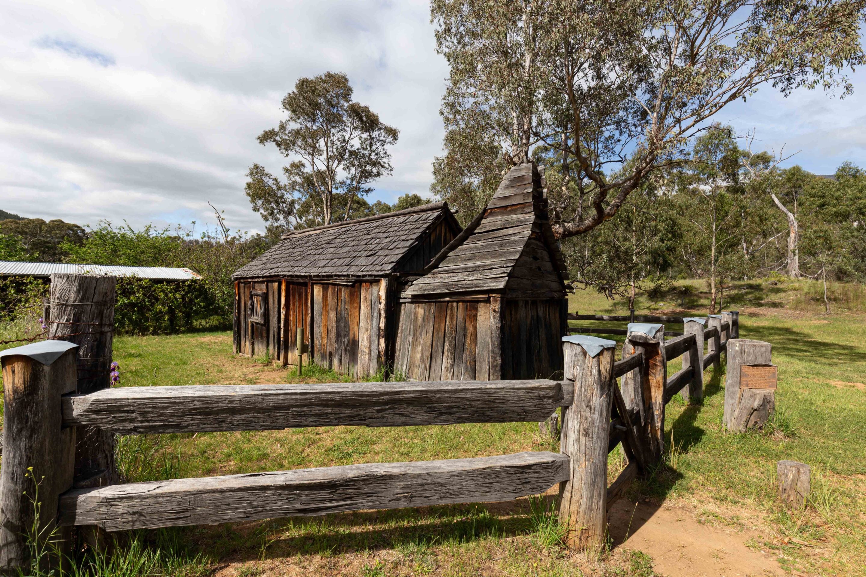
Perched on a rise above the Snowy River sits the beautifully restored Suggan Buggan Schoolhouse. Built in 1922, the timber building once educated children from surrounding cattle properties who arrived on horseback or foot. Today it operates as a small museum, preserving photographs, classroom furniture and stories from a time when isolation was simply part of daily life. The building’s neat weatherboards and corrugated iron roof stand in stark contrast to the vast landscape that surrounds it.
Standing on the schoolhouse verandah and looking out across the rolling hills towards the river flats, it is easy to imagine the resilience required to live here year-round. The road in remains narrow and winding and, during wet weather, can become challenging. It’s a fitting reminder that the Snowy River Country has always demanded determination from those who call it home, whether they arrived by horse, Holden or fully loaded 4×4.
1
Buchan is built on limestone formed nearly 400 million years ago, when this region lay beneath a shallow sea. Over time, uplift and water movement created one of Australia’s most impressive cave systems – the Buchan Caves. Discovered in 1907 by Frank Moon, who enlarged a small opening and lowered himself into the darkness on a rope, the Fairy Cave revealed extraordinary formations. Frederick Wilson, previously of the Jenolan Caves, developed pathways, ladders and handrails that still guide visitors today. Tours began in 1917 and continue daily through the Fairy and Royal caves.
The reserve is jointly managed by Parks Victoria and the Gunaikurnai Traditional Owners, recognising Buchan as an important meeting place between sea and mountains. Guided tours are the only way to access the caves, and they regularly book out during peak periods, so advance tickets are recommended.
No visit to Buchan feels complete without a stop at the Buchan Caves Hotel. Originally trading as the Buchan Inn in 1882, the pub was destroyed by fire in 2014. The local community rallied, raising more than $600,000 to rebuild. The new hotel opened in 2016 and remains a testament to small-town resilience. After days on steep gravel and narrow mountain roads, a cold drink here feels well earned.
The Snowy River Country Trail is not extreme in a technical sense, but it demands attention, planning and respect for conditions. It delivers isolation, history and scenery in equal measure. For those prepared to take the long way around, it remains one of Victoria’s most rewarding 4×4 journeys.
15
Essential information
- Region: Southeast Victoria
- Getting there: The Snowy River Country Trail is a 290 km loop starting and ending at Orbost.
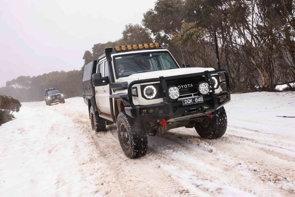
- Best time to visit: Warmer months are ideal. Winter can bring cold, wet conditions that make the trail more challenging.
- What to take: Be self-reliant. Bring fuel, food, water, and firewood, and carry out everything you bring in. Fuel is available at Orbost and Buchan.
- Accommodation:
- Marlo Ocean View Caravan and Camping Park
- McKillops Bridge Campground: free camping, basic facilities
- Buchan Caves Reserve
- Difficulty:
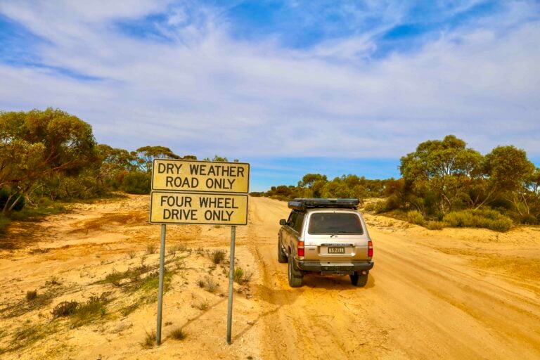
- In dry conditions, most of the trail is accessible to 2WD vehicles.
- Access to McKillops Bridge via Bonang Road is suitable for caravans, if returning the same way.
- Access from Buchan Road involves a steep, narrow gravel descent – not suitable for caravans and requires a 4×4 when wet.
- Towing a camper trailer is possible and offers good practice with brake overrides.
Follow 4X4 Australia on Google
Get more 4x4 news, reviews and gear stories from 4X4 Australia in your Google feeds.

We recommend
-
 Explore VIC
Five of the best Victorian High Country tracks
These Vic High Country tracks represent four-wheel driving at its most demanding and rewarding
-
 Explore VIC
An epic snow trip with 4X4 Australia's supporters and suppliers
An alpine convoy over Mt Skene, a brewery stop in Mansfield and plenty of snow driving brought our supporters and mates together for a memorable weekend
-
 Explore VIC
Wyperfeld National Park: A 4WD and camping paradise in Victoria’s outback
A remote outback escape in Victoria’s northwest, Wyperfeld offers epic 4WD tracks, rich history and stunning mallee camping