Explore NT
Gallery 1
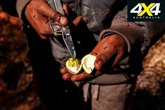
Sherwin sliced open the green seedpod with a deft flick of the Leatherman’s blade.
“You can eat this,” he said as he handed the opened fruit to me. “You white fellas call it bush banana, but I reckon you’ll prefer the banana you get in the supermarket,” he continued with a wry smile.
1
The taste wasn’t unpleasant and has been likened by some to peas, but I couldn’t taste that. Still, it did help dispel that famous Crocodile Dundee quote about bush tucker which went something like, “You can eat this, but it tastes like shit!”
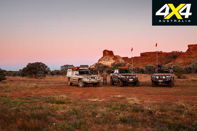
We were on a ‘Bush Tucker Tour’ with a couple of young Aboriginal fellas at Batton Hill Camp in the very north of the Simpson Desert, and the stepping off point (or end point, depending on which way you are heading) for a trip along the Hay River.
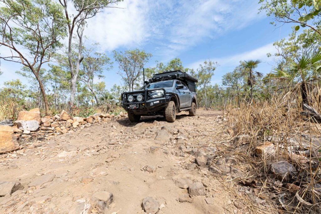
For the previous week or so we had wandered through the Eastern MacDonnell Ranges and along the back roads north of the Plenty Highway before refuelling at the Jervois Homestead, the closest fuel to the Batton Hill and a good spot to camp, if the timing is right.
MORE
Plenty Highway, NT
1
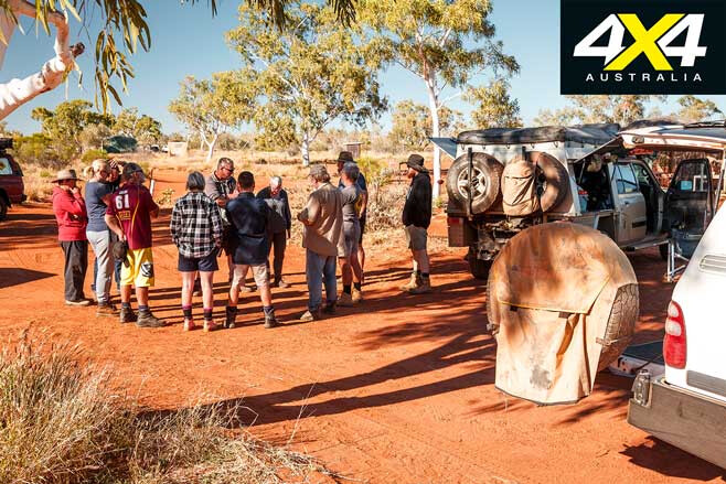
Being midday we pushed on, passing a group who had been camped for a couple of days waiting for a tow truck to come from Alice Springs to recover one of the party with a busted rear spring. They were in luck; the truck was following us.
The late Lindsay Bookie, the traditional owner of this area of the northern Simpson Desert, set up Batton Hill Camp, which is set back a little from the main channel on the banks of the Hay River.
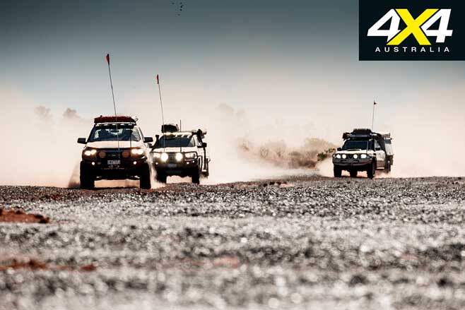
With the help of Jol Fleming from Direct 4WD Awareness based in Alice Springs, the route along the Hay River was recce’d and established in 2000, and I had joined Jol in 2002 for the first commercial trip which he had led from Birdsville north to the camp. Now I was back with the crew from 4X4 Australia, heading south on what has become one of the favoured routes through the Simpson Desert, even though only around 500 vehicles travelled the route in 2018.
1
We arrived at Batton Hill in the early evening and settled in for the night at a pretty good basic campground with hot showers (once you get the woodfired ‘donkey’ going), flushing toilets and designated roomy campsites, with fire pits and supplied timber. The camping area even sports a few white gums for shade.
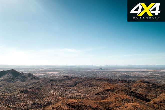
The next morning, after a leisurely start, we went and found our guides and set off on our bush tucker tour, which took us around Mt Tietkens and Mt Smith. Tietkens, who the peak was named after, was an accomplished explorer in the late 1800s and acted as 2IC to Ernest Giles on his incredible crossing of the western half of Australia, but I have no idea who Smith was.
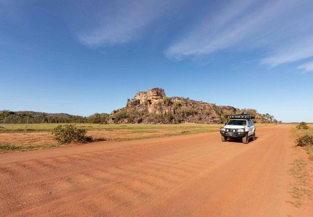
Farther south, and passed as you head along the Hay, is the singular peak of Mt Winnecke, all three peaks as well as the river being named by Charles Winnecke during his explorations in 1880 and 1882 – he also named Goyders Pillar, which is a little farther north.
1
While the sunset tours run by the family at Batton Hill take you to a spectacular pillar of rock they all call Goyders Pillar, it doesn’t seem to gel with the peak marked on the maps of the area. Still, I think the Aboriginal owners are right – it is a pillar, it is obvious, it is quite spectacular, especially in the light of the setting sun, and there is nothing quite like it in the immediate vicinity. It’s the mapmakers, I reckon, who have got it wrong.
This area along the northern margins of the Simpson Desert had first been explored by HV Barclay in 1879, but it was Winnecke, with a small party of men on camels, who in 1883 pushed deep into the desert and traversed the whole length of the Hay River from near Batton Hill, south to the Eyre Creek Police Barracks, which were then, for a short time, north of current day Birdsville.
1
Pastoral settlement of this area was slow, with Jervois station only being taken up in 1960. Little happened deeper in the desert, apart from in 1939 when CT Madigan crossed the northern Simpson, meeting the wide shallow channels of the Hay at what was his Camp 16. It’s now a well-visited spot for Hay River and Madigan Line travellers.
Aerial-based survey teams were out along the Hay in 1968, having a base camp somewhere in the north and a fuel dump farther south along the river. A team from the Division of National Mapping traversed the Hay in 1974 as part of the mapping of the continent in 1:250,000 scale, and the keen-eyed will occasionally see their star pickets (used as benchmarks) along the route.
Oil and gas exploration took place farther south from the late-1960s, but it never extended north of Beachcomber Well (farther south again), which was drilled in 1988 and was one of the last exploratory wells drilled in the Simpson.
1
By then the recreational boom was underway and travellers were crossing the desert via the old seismic lines, with the French Line being the most famous. Around that time, South Australia and Queensland established parks and reserves in their respective sections of the Simpson, and in 1994 all of the northern Simpson Desert in the NT was handed back to the Aboriginal Traditional Owners, the Eastern Arernte people.
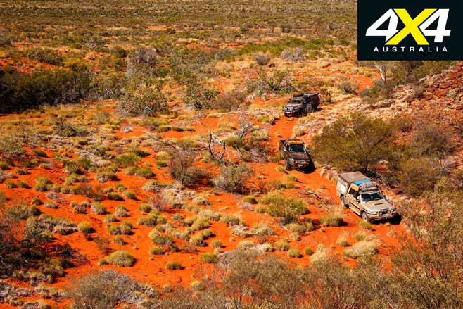
The next day we left our pleasant camp and headed south, passing the aforementioned Mt Winnecke, the main distinct channel of the Hay off to our west. The track soon started to twist and turn in an effort to dodge around the washouts and erosion gullies left by the most recent flood down the river back in March of this year, when Cyclone Trevor thundered in from the coast.
1
It penetrated deep into the Territory and brought heavy rain and floods to areas north of the MacDonnell Ranges and along the Plenty Highway, before heading back into Queensland. The track showed signs of these floods, while the bush and trees were green and lush with a prolific covering of grass among them.
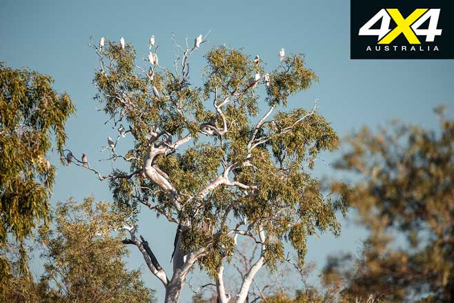
Birds flitted among the trees, with small flocks of budgerigars bursting from cover and winging their way through the scattered greenery that dotted the riverbed. Galahs, willy wagtails and wood swallows were common as well, while the occasional brown falcon circled overhead or waited patiently on a branch for a feed to appear.
1
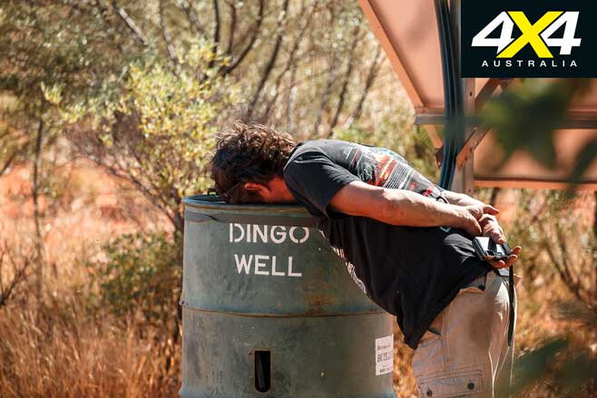
We crossed the Tropic of Capricorn into the temperate zone of Australia – its imaginary line marked by a rough metal sign – but the weather didn’t change a bit. Not much farther south we came to Dingo Well, which had been sunk in the 1970s to test where the outer edge of the Great Artesian Basin was. It’s a boon for travellers as the water is good and the local birds love it, with budgies and zebra finches flitting through the nearby verdant bushes.
The well is also the base camp area for the rather obscure ‘Dingo for Biodiversity’ project, led by a couple of researchers who have some seemingly off-the-planet ideas about dingoes which may well be true for remote areas such as this but would be unworkable in pastoral and (especially) sheep-grazing settings. We met up with the couple and, while they initially seemed to want to talk, they bolted without even saying goodbye once a video camera and an interview was mentioned.
1
While the wild dog is apparently common around here (even Winnecke mentioned it more than a 100 years ago) we never saw a dingo for the entire trip, or a kangaroo for that matter; nothing other than birds. We did see tracks of camels fairly often, and we also spied the telltale prints of wild cattle that would come this far into the desert when the seasons were good, like they were now.
We then passed the obscure Yurracurracoo Native Well, with Winnecke reporting it was the most productive water source he found in the desert; although, years of disuse has seen it silt up and vanish, and we certainly never saw it.
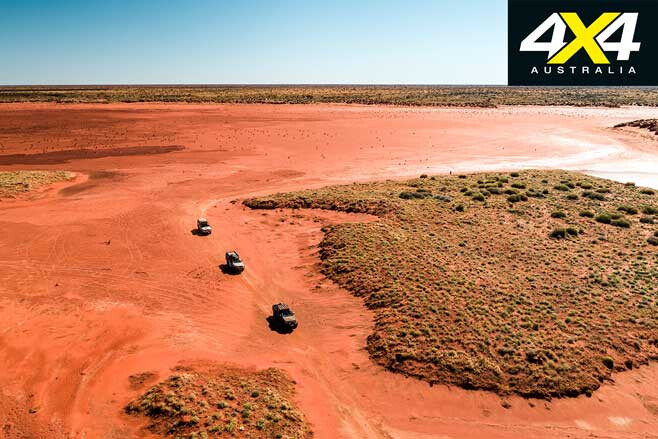
A short time later we crossed the wide, sandy bed of the Hay and headed out on the diversion to Lake Caroline. This large lake is a claypan and not a salt lake and, while water had flowed down the Hay to a point south of the lake earlier in the year, no water had flowed from the Hay into the pan. This (sort of) confirms the point of view that the lake is fed from a source other than the Hay.
1
Sadly we didn’t have enough time to explore the area around the lake, but we retraced our steps and continued down the riverbed, the track evermore windy as it dodged around erosion gullies and downed trees.
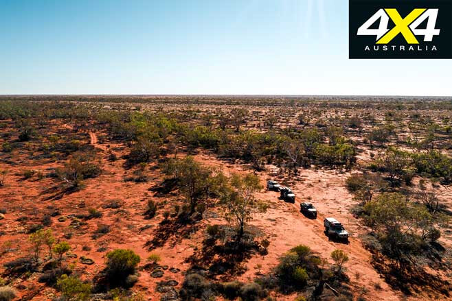
Slowly the distinct river channel gave way to just a sliver of a stream oozing between the dunes, the trees sparser and spindlier. Once we were south of where the flood had reached, the country dried out rapidly and the trees were nearly devoid of leaves; what grass we saw was dry and brittle.
1
However, the track and our speed improved. That evening we pulled up in a naturally cleared area away, just off the track, and set up camp among some spindly gums that dotted the widish main channel of what remained of the river.
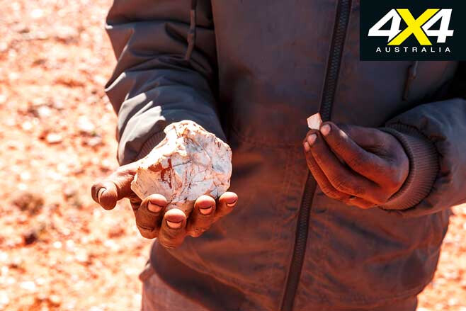
An Aboriginal midden can be discovered farther south, just west of the main road, while a walk around the area will unearth scatterings of rock and stone where craftsmen from another age chipped stone into workable tools.
Not much farther on, the now obvious east-west route of the Madigan Line across the Simpson is reached at what was Madigan’s Camp 15, while a short distance south is the tree blazed by Madigan at his Camp 16.
1
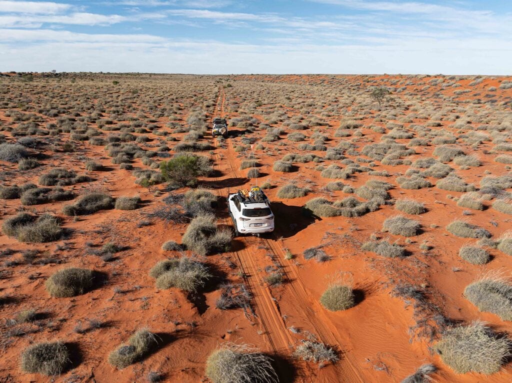
We cruised on, the track remaining pretty good as we loped along at 30km/h or so, the last vestiges of the river and any water that makes it this far south vanishing into the dry, thirsty sands of the desert.
The route swung west and we crossed a few steep dunes, the first real dunes we had to cross since leaving the Batton Hill camp. At ‘The Glove’, where the Hay River track meets an old east-west shot line, we turned west and then set up camp for the evening on a wide gidgee flat.
The following morning we stopped briefly at the cleared and stamped flat of Beachcomber Well, before heading south on what was initially a well-formed road that soon degenerated into an eroded track. The Poeppel Corner well site (drilled in 1984) was passed, and a short time later we were at the junction of the QAA Line where it crosses a large unnamed salt lake.
1
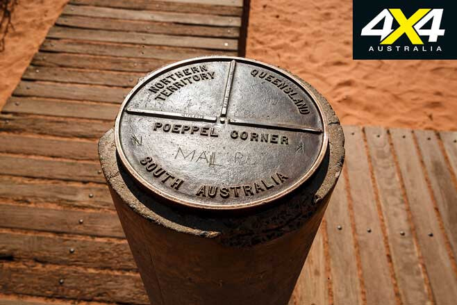
Our journey along the Hay River Track was officially at an end, but we diverted and headed to the historic border post of Poeppel Corner, where South Australia, the Northern Territory and Queensland meet. We then turned east along the QAA line towards Birdsville.
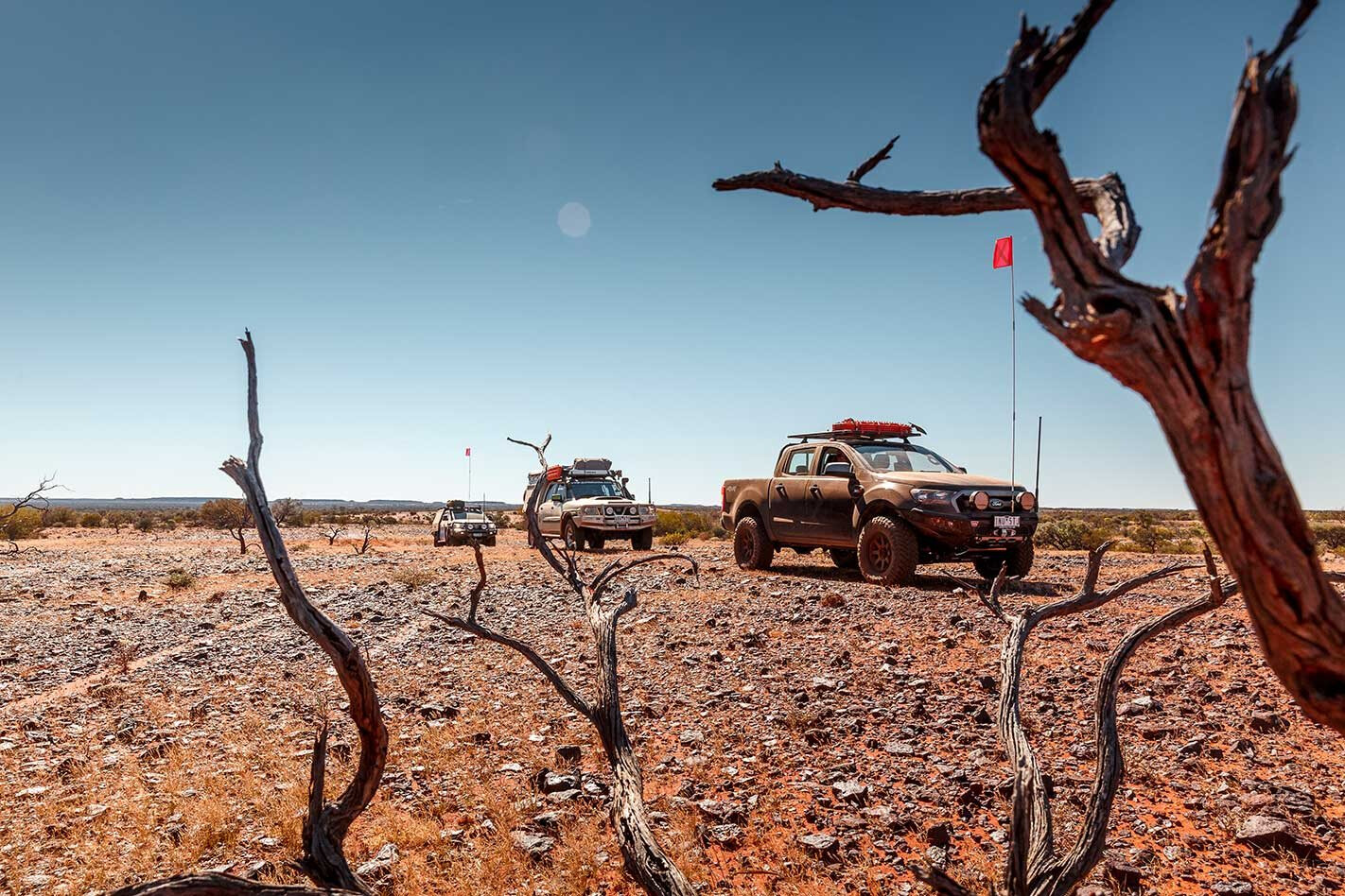
Pulling up for the evening on a flat just north of the main east-west crossing track of the Simpson, we had already passed two vehicles waiting to be recovered by Birdsville Auto; they were to wait a fair while.
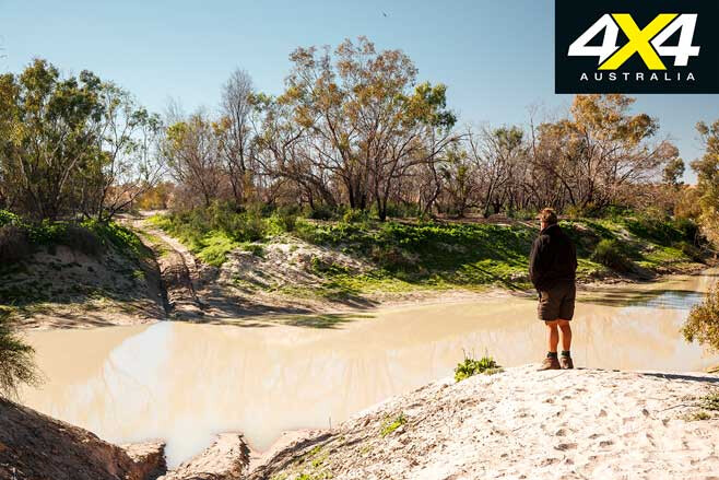
But our adventure wasn’t over; the Eyre Creek was in flood, so we took the diversion north for 30 odd kilometres, crossed the greenery bordering the stream and splashed across the rock bar that marks this northern crossing point. I would have liked to stop and enjoy this rare scene, but time was short so we pushed on.
1
Back on the main route we reached Big Red, which of course we had to climb and take a few photos; although, using the drone was out of the question as two soaring kites took umbrage at its presence.
A few hours later we rolled into Birdsville, the place still recovering from the multitudes who had attended the Big Red Bash. Our adventure was over, but little did I know I was to turn around and follow my son across the Madigan Line just a few days later. But that, as they say, is another story.
MORE
4×4 explore
Travel Planner
1
This is remote country, so you must be experienced in desert travel and have a reliable and well set-up vehicle. Make sure you carry enough water and fuel. Fuel usage will be heavier than normal as the sand can be soft. Have an emergency plan and a satphone, HF radio or satellite messenger.
To travel the Hay River Track it is approximately 700km from Jervois Station to Birdsville, depending on any tours you take at Batton Hill, or if you take the diversion to Lake Caroline. Permits and camping: To travel the Hay River you require a permit from the Central Land Council. The easiest way of to obtain one is to contact Jol Fleming from Direct 4WD based in Alice Springs. See www.direct4wd.com.au Permit cost is $220/vehicle. Camping is $20/person at Batton Hill
Bush Tucker Tour is $50/person. Most people, once they are at the QAA Line or Poeppel Corner, turn east towards Birdsville where you require a camping permit for the Munga-Thirri (Simpson Desert) NP. See https://parks.des.qld.gov.au/parks/munga-thirri/about.html Fuel is available at Jervois Station (cash only); phone (08) 8956 6307. Good facilities are available at Birdsville.
Follow 4X4 Australia on Google
Get more 4x4 news, reviews and gear stories from 4X4 Australia in your Google feeds.