They are Australia’s 20 best-selling dual-range 4X4s – but are they all worth your hard-earned dollar?
# 20
LAND ROVER DISCOVERY 4
The Discovery 4 looks a lot like its predecessor because when it arrived in late 2009 it carried over the body, chassis and much of the suspension and interior from the 2005 Discovery 3. So this quasi-new Discovery 4 has a smoother nose treatment and changes to suspension and steering, larger brakes, improved traction control and Terrain Response system, among myriad other detail changes. The Discovery 4 has an entry-level 2.7-litre turbo-diesel V6, a 3.0-litre bi-turbo-diesel and a 5.0-litre V8 petrol; the best of this bunch is the superb 3.0-litre diesel.
The plush-riding height-adjustable air suspension combined with flat cornering attitude and direct steering make the Disco an easy vehicle to steer around quickly. There are few vehicles that also make off-roading seem so easy – with its strong underbody and excellent ground clearance and off-road angles overlaid by excellent traction systems, even the steepest, slipperiest climbs are no big deal.
Only the use of 19-inch wheels – and a distinct lack of options for off-road rubber to match – tarnishes its off-road ability. The saving grace is the 2.7 which can be fitted with 17s.
# 19
MERCEDES-BENZ M-CLASS
With us since 2005, the second-generation ML is in its final months on the market with a third-generation model due mid-year. The ML only makes this list because of its optional Off-Road Pro Engineering package (which adds, among other things, a dual-range transmission) – an option few buyers tick. The engines available in conjunction with the dual-range option pack include two versions of the 3.0-litre turbo-diesel, a 3.5-litre V6 and a 5.5-litre petrol V8, all with a standard seven-speed auto. The pick is the ML 350 CDI: an absolute pearl of an engine, with ladles of torque piled on from low in the rev range, combined with eagerness to sweep the tacho across to maximum revs. This superb engine is matched by the excellent seven-speed auto.
The M-Class cabin is all class – although its column-shift gear wand and foot-operated park brake seem very last century. The ML handles well and, while it lacks the BMW X5’s sharpness on-road, with the off-road package it’ll leave the X5 for dead when the going gets tough. The only downside with the ML’s height-adjustable air suspension is that it can give a too-firm ride, especially when raised for off-road work.
… For the rest, pick up the latest issue of 4X4 Australia magazine. Out now!
Snowy River National Park in Victoria’s East Gippsland boasts much more than some of the state’s best off-roading, and it’s just four hours from Melbourne.
Over the course of 18 days in October 2011 – in a collaborative effort between the New South Wales, Victorian and federal governments – the spill gates of Jindabyne dam opened to release the majority of its 84 billion-litre capacity into the Snowy River’s parched upper reaches. The monumental release was made in an attempt to restore life to the iconic river, which has been flowing at a wretched one-percent rate since the completion of the historic Snowy Hydro Scheme in 1974.
The Snowy River headwaters begin on the slopes of Mount Kosciuszko, merging near the NSW alpine town of Jindabyne, then meandering a further 352km before emptying into the Bass Strait in a wide, picturesque estuary at the Victorian coastal village of Marlo.
And that’s where our journey, modest in comparison, begins: sitting on the deck of the Marlo Hotel, sipping cold beers and watching the sun set over the tannin-stained brackish water; enormous pelicans adorning lights and pylons, accompanied by fisherman, their hushed concentration broken only by the occasional whoosh and plonk of a line cast into the river mouth.
Paul and I had driven the four hours from Melbourne airport that morning to the newly-built Bullant Brewery in Bruthen for a late lunch, followed by another hour to Marlo on the coast, where we would spend our first evening in East Gippsland.
DAY ONE: CAVES AND BUSHWALKS
We rose early the next morning to drive to the nearby Buchan Caves Reserve, where we toured the prettily named Fairy Cave.
Named for the sparkling limestone formations within, Fairy Cave was discovered by Frank Moon – on an official exploration mission to find tourist-attracting caves of the likes of Jenolan – in 1907. Frank must have been inspired, because he also named his daughter Fairy (who remained Fairy Moon until her marriage, which was held, incidentally, inside Fairy Cave). When Fairy had a son, she named him Cave.
That afternoon, we continued on to Gelantipy via the unsealed Tulloch Ard Road – a scenic off-road route running parallel to the all-bitumen Gelantipy Road. Our busy weekend getaway had been arranged by tourism organisation Destination Gippsland (DGL), which was keen for a journo from 4X4 to experience one of their six newly marketed ‘iconic’ 4X4 tracks – this one, the Snowy River Drive.
The vehicle hired for us was a softroader Nissan X-Trail and, while it was great on-road and its better-than-a-car clearance and lockable centre-diff made the unsealed roads easily manageable, it meant we missed some of the seasonal 4X4 tracks which beckoned us along the way.
Not to worry, though. DGL had also arranged for a Parks Victoria ranger to chaperone us across the rougher second half of the Snowy River Trail in his official 4X4 – an experience we happily anticipated.
For those not equipped or game (don’t scoff) to take on the more difficult tracks branching off Tulloch Ard Road, there is a 3.2km (return) walking track at the Gelantipy end, which leads to a lookout over the Snowy River National Park, providing an expansive view of the harsh, mountainous landscape the river has carved on its ancient route towards the sea.
Emerging from the narrow, tree-lined Tulloch Ard Road in the late afternoon, we pulled onto the bitumen and soon arrived at our accommodation for the evening at Kooranda Park, just outside Gelantipy.
Equipped with a rockclimbing wall, tennis courts, a concrete swimming pool and high ropes course, Kooranda is popular with school camps and has that familiar unadorned feel – an ideal budget accommodation option close to some of the region’s best four-wheel driving (for those choosing not to camp).
With the recent environmental flows into the Snowy, business was also booming for Kooranda Park’s whitewater rafting tours – for the first time in several years.
DAY TWO: HIT THE TRACKS
We awoke the next morning eager to meet with ‘our’ Parks Victoria ranger, David Butterworth, who would collect us in his Prado while his colleague drove our X-Trail back to Orbost where it would wait for us to finish our day exploring the Snowy.
David at the wheel, we snaked along the tight and narrow unsealed road (which is well maintained, but unsuitable for towing a caravan), eventually arriving at the heritage-listed, 255 metre-long McKillops Bridge. Leaning over the impressive structure, it’s difficult to imagine water lapping at its timber deck during the region’s infamous 1971 storms. Now, even with an additional 84 gigalitres, the Snowy flowed at a gentle pace, calm enough to swim in – and not as cold as the name suggests.
From this point, David took us off the main Snowy River Drive and onto the dry-weather only Deddick Track, where steep roll-overs and slippery, rocky inclines necessitate a low-range equipped 4X4. David informed us that we were taking the track in its easiest direction (starting at McKillops Bridge), descending rather than climbing most of the steeper sections. He also warned how quickly the conditions could change in wet weather – always check the forecast before off-roading in the area.
We eventually crawled our way to the top of Mount Tower, disturbing four majestic wedge-tailed eagles off the side of the track, which we watched soar away into the distance before settling in for lunch. We looked out over the expanse of surrounding national park while David filled us in on fire management in the area since the 2003 wildfires burnt around 1.12 million hectares. Dead, white alpine ash trees line sections of the tracks as a ghostly reminder.
After Deddick, we connected onto Bowen, Bowen Link and Monkey Top tracks – the latter home to the aptly named Big Tree, and a good rest stop – before joining the AWD-friendly Yalma Road, which would lead us back to civilisation in Orbost. Time constraints meant we passed the trailhead to a 40-minute return hike to Raymond Creek Falls (and its freshwater swimming hole), as well as several other side tracks – all of which combine to make a great reason to return. Next time we’d probably camp, and spend longer soaking up the mysterious and ancient history of the Snowy River, which includes intriguing evidence of aboriginal inhabitancy, such as the impression of a canoe cut out of a long-dead tree that David pointed out to us.
It had been a very long weekend and we were exhausted, yet felt we’d barely touched the surface of all this spectacular region has to offer.
Our final night’s accommodation was at a bed and breakfast in Newmerella – the Snowy Mountain Lodge – to which we arrived just in time for the cumulonimbi to gather and erupt in a powerful spring storm; the first of the year, our hosts Glen and Sue informed us.
We finished our home-cooked meal and spent our last night in Gippsland flicking through a book of Banjo Patterson poetry and watching lightning illuminate the low-hanging clouds in the distance.
TRAVEL PLANNER
- GETTING THERE: Allow four hours or so to get to East Gippsland from Melbourne (360km), travelling the M1 and then the A1.
- WHEN TO GO: November to May (most Vic High Country tracks are closed during winter).
- WHERE TO STAY: There are several accommodation options throughout East Gippsland, and in the vicinity of Snowy River NP. Camping grounds at McKillops Bridge, Waratah Flat and Balley Hooley have pit toilets, picnic facilities and fire pits.
- CONTACT: Visit Parks Victoria or call 131 963
Toyota’s FJ Cruiser has taken out the title of 4X4 Australia’s 4X4 of the Year 2012.
At the start of the week, most of the judges didn’t give the FJ much hope of winning 4X4OTY. But as the days progressed, the FJ’s fun factor, the simplicity of design, and the way it works so well came to the fore.
Three judges scored it first, two scored it second and another third against tough competition.
The FJ Cruiser puts enjoyment into driving on- and off-road thanks to its individual styling, ease of use, affordability and no-fuss ability. Whichever way you look at it, the FJ Cruiser is a great 4X4 and a worthy 4X4 of the Year winner.
To read the full story grab a copy of February’s issue of 4X4 Australia magazine, on sale now!
Having driven and relished the pure technology of the Defender and Defender Sport concepts…
“The sky is falling,” say purists! Having driven and relished the pure technology of the Defender and Defender Sport concepts, we’re donning hard hats; with a smile.
Visit any sheep market and you’ll see farmers driving Land Rover Defenders; flanks muddy, panels dinged.
In the back there’ll be a long piece of wood kept to wedge between the lowered tailgate and the rest of the load bay. Without it, the sheep the Defender is supposed to safely transport could slip between the gap and, as one farmer we know has it, “snap their legs like carrots”.
The Defender is a versatile workhorse, but it’s also flawed: the driver’s seat feels like it should slide back further; the steering wheel doesn’t adjust and has no airbag; the handbrake is an awkward reach away; the turning circle is dreadful; it’s loud and unrefined and the whole body shimmies and floats when you pass over bad surfaces at speed.
None of this has killed or will kill the Defender, which remains remarkably similar to the Land Rover Series I of 1948.
And with its flaws comes character often lacking in modern cars; that’s why almost two million have been sold, and why it’s one of the most iconic vehicles in history, with a fiercely loyal fan base and thriving businesses and enthusiast magazines.
But the end is nigh. In 2015, EU6 emissions regulations will force the current diesel engine into retirement. This, of course, is surmountable, but it’d be like keeping a brain-dead patient on life-support.
“We didn’t intend to make the Defender EU5 compliant, but we did,” says Land Rover PR manager Richard Agnew.
“So, yes, EU6 is possible, but in 2018 it really is game over with crash-testing legislation and pedestrian protection compliance in the US.”
Hence Land Rover is readying an all-new model for 2015, and the DC100 concepts — Defender Concept, 100-inch wheelbase — are design studies to prepare us for what comes next.
Design studies that happen to move, that is, and today we’re first to drive them, before the blue, more production-viable DC100 gets shipped to the LA show along with the yellow, further flung DC100 Sport.
As they roll off the delivery trucks at Land Rover’s Gaydon test track — sans finishing details — it’s hard not to be struck by the parallels with BMW’s ‘new’ Mini of over a decade ago.
Here’s another replacement for a British icon that’s evolved glacially over the decades, yet is suddenly being fast-forwarded while diehards froth at the mouth and rage incandescently on internet forums.
Mitsubishi celebrated 30 years of its diamond logo in Australia with a trip full of desert sparkle.
The scrub out here disappears in a gentle arch, extending horizon to horizon, overwhelmed by a washed-out blue sky. The giant sky fills the landscape; it isn’t called big-sky country for nothing.
This is South Australia’s desert heart, the geographic centre of the state and the playground for Mitsubishi’s 30th anniversary celebrations in Australia.
Our four-day exploration of the South Australian desert with a fleet of Mitsubishi 4X4s started at Balcanoona, just west of Lake Frome.
Flying in from Adelaide on a charter plane, we watched the coast’s blonde soil gradually deepen to rich ochre and the spine of the Flinders Ranges rise from the plains below.
This area was an inland sea millions of years ago, and with forces shifting the earth’s crust the mountain ranges formed, much if it enduring almost unaltered with its tough quartzite outcrops.
This harsh dry region has been the home of Aboriginal tribes of the Adnyamathanha (meaning ‘rock people’) for at least 15,000 years, although archaeological evidence shows a more consistent population in the last 5000 years.
European exploration started in 1802 under the instigation of a Matthew Flinders survey and exploration party.
From the 1850s pastoral leases were taken, and copper mining and — for a while in the 1870s — agriculture was successful (though it subsequently collapsed, thanks to the easing of unseasonal rainfall). Today mining and pastoral land are key industries in the Flinders.
With the charter flight bumping to a stop on the airstrip at Balcanoona, we eased into our fleet of Mitsubishi Tritons, Challengers and Pajeros for the 18km drive up the road to Wooltana Homestead.
The homestead is nestled into the side of the range and looks out onto the gibber plains. We pulled up for lunch alongside the remains of the old shearing shed, thought to have been built in the early 1900s.
With time to explore around the ruins and the scattered remains under a baking sun, you began to get a sense of the harsh life early settlers had here.
From Wooltana we headed south then west through the Vulkathunha–Gammon Ranges National Park, heading for Leigh Creek, around 120km away. As we turned off the Arkaroola Road the smooth wide dirt road of the gibber plain quickly turned into single track threading its way across the undulating terrain.
To read the full story grab a copy of February’s issue of 4X4 Australia magazine, on sale now!
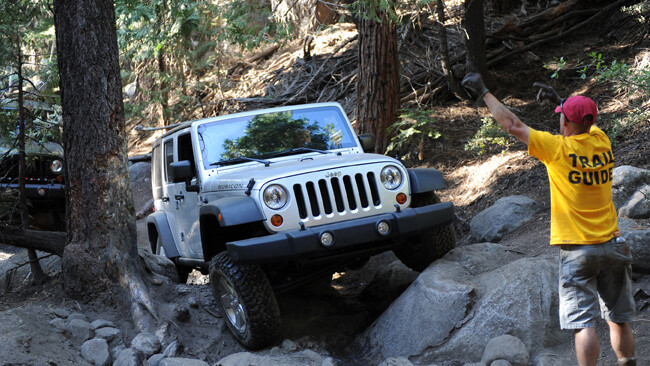
Jeep Wrangler Rubicons take on their namesake 4X4 track in the USA.
Candle light flickers across gaunt faces. Eyes are sunken, exhaustion is obvious. Conversation is muted because everyone is too busy eating. We know the fight begins again in the morning so it’s important to re-stock energy. Sleep awaits in our tents not far away.
This is not a bivouac behind some battlefield and we are not soldiers. We’re at Rubicon Springs campground deep in the Sierra Nevada Mountains as guests of Jeep, about two-thirds of the way through a crossing of the legendary Rubicon Trail.
Incongruously, there’s a grand piano tinkling in the background, helicoptered in especially for this occasion. There’s an open bar and fresh-cooked steaks. There are all the makings of a pretty decent party.
Except we’re too knackered to think about festivities. The day began at 7am at our digs down near Squaw Valley and it took three hours just to get to the trailhead. It’s taken us another 11 hours 30 minutes to make it here, just 13 kilometres further on. Yep, that’s an average of just over one kilometre per hour.
That should give you a hint of just how tough this place is and why it has become globally famous as the ultimate 4X4 trail.
BEGINNINGS
The Rubicon’s origin can be traced back to a time when it was an Indian walking trail. But for four-wheel drivers its history began in 1953 when a group of 155 friends took their Jeeps across the rough granite path through the Sierra Nevada Mountains on their way to Lake Tahoe, California.
This trek, originally conceived as a way to support the economy of the local community, was to become the first official Jeep crossing of the Rubicon Trail and the first-ever Jeep Jamboree.
The trek was led by Mark A Smith, who is still deeply involved with the Jeep brand and the Rubicon Trail. Since then, tens of thousands of 4X4 enthusiasts and their vehicles have traversed the famous trail.
The Rubicon is a 35km route – part road and part 4X4 track – located west of Lake Tahoe. The maintained portion of the route is called the McKinney-Rubicon Springs Road, and it begins in Georgetown, California, a hamlet in the state’s Gold Country.
The McKinney-Rubicon Springs Road was originally established for stagecoaches to access resort hotels at Wentworth Springs and Rubicon Springs from the 1890s until the 1920s. The trail saw the first motorised travel in 1908. From the 1950s through today, the Rubicon Trail has largely been used by off-road enthusiasts for recreation.
The trailhead for the unmaintained section of the route begins in a location adjacent to Loon Lake. The 4X4 trail portion is about 19km long and passes in part through the El Dorado National Forest.
The trail crosses a river at one point close to Lake Tahoe. Early settlers named the river Rubicon after its counterpart in Italy – a small river north of Rome that Julius Caesar fatefully crossed in 49BC.
Drawing on that history, the term Rubicon now means ‘a limit that, when passed or exceeded, permits no return and typically results in irrevocable commitment.’ To ‘cross the Rubicon’ means ‘to irrevocably commit to a course of action, or make a fateful and final decision’. Appropriate really.
WRANGLING WITH THE RUBICONS
The Rubicon Trail has also been used for over four decades by Jeep engineering teams to improve the off-road capability of Jeep brand vehicles and to aid in the development of new models and technologies.
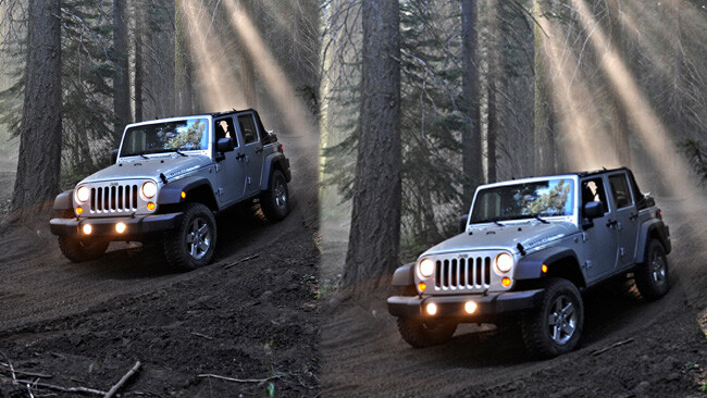
This time round, Jeep had invited us here to try out the model year 2012 Wrangler, which most significantly swaps its outdated overhead valve 3.8-litre V6 for the sophisticated new Pentastar DOHC 3.6-litre V6. It does all the things a new generation engine should, bringing with it more power and torque and better fuel efficiency.
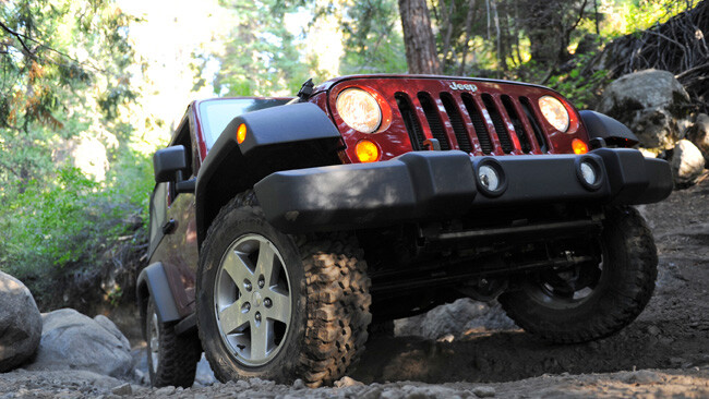
Naturally, being the Rubicon Trail, we were driving the Rubicon edition of the Wrangler, which adds even more off-road capability compared to the Sport. Considering all Wranglers are decent off-road, that is saying something! It achieves that distinction via such features as Dana 44 front and rear live axles, Rock-Trac two-speed transfer case, electronic front and rear locking differentials, disconnecting front swaybar and 32-inch rock tyres.
Having cruised up from Squaw Creek in a 17-strong convoy of Wrangler Sports, the collection of four Aussie media and two Jeep staffers, as well as a big group of Chinese journos and one Filipino, transferred into Rubicons at Loon Lake.
Co-driver, and fellow freelancer Josh Dowling and I agreed we wanted the security and protection of a fixed roof. We ended up in a long-wheelbase Ultimate with a manual gearbox. An hour later we had travelled 300 metres, been stuck several times and already overcome 4X4 challenges exceeding anything we’d seen before.
Already we were wondering where they got the idea the Rubicon was, in fact, a trail. All we’d encountered so far was a bunch of rocks and boulders, over which we had crashed, banged, graunched and grinded. It sounded like icebergs dragging on the Titanic. Thankfully, the Rubicon’s features include substantial underbody protection.
And when we inevitably did get hung up – turtling it’s called – the guides would rebuild the trail literally on the run, making ramps and grip points so the Wranglers could at least get one wheel pushing forward once more.
AVERAGE SPEED: 1KM/H
Ah, the guides. In their yellow T-shirts, these 4X4 enthusiasts were our lifeline as we inched forward over one obstacle after another. They ran forward and back, never riding along. Instructions were detailed and minute. It’s definitely a case of slow and steady rather than bull at a gate.
“Stay left, back up, stop, turn wheels to the right, good, turn wheels back to left, that’s where I want you, straighten wheels a little, c’mon come forward, straighten a little, keep coming right, keep it straight, go straight down there all the way over the obstacle. Very nice.” That’s another two metres conquered. “We do this for a hobby,” explained guide, Brian. “I’m just a member of a local group. It’s an awesome place to live.”
Indeed it is. When we could tear our eyes from the fascinating sight of the Jeep in front of us teetering and slithering over piles of rocks the size of haybales, bouncing up and down granite steps and assuming attitudes more extreme than a drunken teenager at 4am, the Sierra Nevadas were a truly spectacular place to be.
We were at 2000m and beyond, yet the mountain tops still reared over us, covered in pines, snow still dappling their peaks. When we broke out into open territory on what’s called Granite Bowl we could see for miles. No wonder people ask to have their ashes scattered up here. More than once we saw white crosses on hillsides marking such a spot.
Mind you, it wasn’t hard to wonder if any of these crosses belong to people who actually died driving up here. It really is that extreme. In one rocky sluice, I had two wheels in a ditch, two on a granite side wall and then turned hard left up a sheer bank, executed a two point right turn around a boulder with al-o-n-g drop-off to the left, then went straight up another wall. Repeat several hundred times and you’re getting the idea.
My confidence level peaked and troughed from obstacle to obstacle. One moment I was punching the air after clambering up or down an impossible rock garden without a mistake, the next red-faced and embarrassed after getting hung up on something that looked straightforward. Then the yellow-shirted guides would descend like worker ants, bouncing front and rear, rearranging rocks and issuing their explicit advice.
Everyone went through it, often watched by locals pulled to the side of the trail, sucking on a beer and enjoying their Sunday afternoon fun. They were universally friendly and happy, watching on almost incredulously as this convoy of stock Wranglers fought its way forward.
We saw not one other standard production vehicle out there in two days. All were heavily modified with massive suspension travel and tyres giving them huge clearance. Toyota 4Runners were the most popular choice, many of them with external rollcages. Turns out the track was hosting a 4Runner convention, with about 180 vehicles involved.
Considering what they were up against the Wrangler Rubicons were doing brilliantly. In low-first they could clamber over almost anything. With the diff locks engaged and swaybar disconnected, erase the ‘almost’. Sure, sometimes it required more than one go and a little trail modification, but damn they were impressive.
But the ‘monster trucks’ could go just about anywhere on the trail, kicking big rocks into the centre where our convoy was being delayed or having to stop while the worst moveable obstacles were rolled or winched out of the way.
“We also had a late winter, and during the winter those snowbanks tend to choose the trail as their run-off,” explained Sean, a 20-year veteran of trail guiding. “With each winter you get more and more erosion, not just from the vehicles, but from mother nature too. So every year it gets that little bit harder.”
The verdict from the guides was we were negotiating the toughest conditions seen on the track in 10 years. Which explained why we arrived at the top of Big Sluice – a mile-long, 1000-foot drop – as night fell. This was our last major obstacle before Rubicon Springs. In darkness, it also proved to be the most difficult.
Nine hours of inching progress had exhausted everyone, including the trail guides. Now, lit only by headlights and head torches, the drop-offs, rocks, boulders and obstacles were harder than ever to negotiate. Standing and watching as Wranglers crunched, banged and scraped their way toward the night’s camp was a wincing experience. It was a shock when a sturdy bridge loomed out of the dark. This was the Rubicon Bridge, and I was happy to cross it.
BATTLE WON
“It was a long day, probably an hour or two longer than normal,” conceded expedition logistics manager Gregg Kitchmark, after we had arrived at the campground, piano surreally tinkling in the background. “This is the longest day we’ve had in 10 years.
“The trail was a bit beat up so it was a bit hairy,” he admitted, in what seemed a gross understatement. “It’s usually hairy, but it was just one of those things.
“The good news is, the worst and longest day is day one. We should be out of the trail and on pavement in four hours tomorrow.”
Twenty minutes into day two and we were cursing Kitchmark and his forecast. We could still see the campground, having hit gnarly track the moment we’d exited the property, dropping into our now traditional 1km/h pace as we headed for the rutted switchbacks of the Cadillac Hill climb.
This used to be a county road, providing access to Rubicon Springs when it was a plush resort. Well. The springs are no longer plush and nor is the road. Bang, crash, grind, smash. By now Josh and I were immune to the sounds of tortured metal. Our Ultimate looked awful. A wheel was buckled, a door scraped, a mirror housing smashed and the front bumpers stoved in.
Our Wrangler was one of the worst abused, but plenty of others had copped it too. No problems, we were assured; some new bumper skins, wheels and some smash repairs and they would all be pristine and ready for the next group.
The magnificent views of Observation Point signalled we had conquered Cadillac Hill and much of the Rubicon. There were still some hard sections to go, but the most severe challenges were done.
If we had champagne we would have popped it like racing drivers atop the Grand Prix podium. Instead, it was time for a happy snap or two, a drink of water and time to get back onboard.
The battle had ended and we’d survived the fight. Yesterday we had been rookies, now we felt like grizzled vets. It was time go home, or at least to the hotel for a hot shower. And a cold beer. Or three.
The dust has settled and the five judges have tallied their scores…
When the dust had settled and the five judges had tallied their scores, it was Volkswagen’s brilliant Amarok that had its nose in front.
Four of the five judges scored it above the other four aspirants to the crown of the 2011 4X4 Australia’s Ute of the Year. That’s not quite a clean sweep but very convincing nevertheless.
The Amarok is ahead of the game in so many ways. It’s powered by the quietest, most refined and most economical engine that gives little or nothing away to the others – Navara aside – in terms of real-world performance. Inside the Amarok’s cabin you’ll find the best finish, the most comfortable seats and the most room.
Likewise the tray is as big and useable as any here. On-road, the chassis offers a level of ride and handling well above all of the others, yet the Amarok is still as good as it gets for off-road ability. Whatever way you look at it, the Amarok is the complete package… and the 2011 Ute of the Year.
To read the judge’s full review of each of our five Ute of the Year contenders, pick up the latest copy of4X4 Australia, out now.
Toyota’s new Land Cruiser 200 Series variant is badged a GX, but the compliance plate tags it as a ‘Commercial’, the handbook a ‘Station Wagon’.
Whatever the name, this new Cruiser lowers the entry point into the rarefied world of the 200 Series diesel by near-on $10,000, offering a back-to basics vehicle that will appeal to the commercial/rural sector and the recreational 4X4 buyer alike.
For the $79,990 (plus on-roads) asking price you still get the full-strength twin-turbo 4.5-litre V8 diesel complete with its sweet six-speed auto, and the full raft of electronic chassis systems (stability, traction and crawl control) from the GXL. The GX also has front, side and curtain airbags. But gone from the GXL grade are the third-row seats, carpet floors, proximity ignition key, alloy wheels, and horizontally split rear tailgate, to name the key differences.
In their place, the GX has five seats, vinyl floor coverings, a conventional ignition key, steel wheels and rear ‘barn’ doors. It also comes standard with a snorkel. Not surprisingly, it is lighter than the GXL (and higher grades) and therefore has a slightly higher 710kg payload.
When a late wet season threatens to destroy all your meticulous travel plans, the only option is to adapt and enjoy the ride.
After a challenging hike in the early dry-season heat, you reach the famous waterfalls cascading over tiers of red sandstone, sending whirlwinds of spray into the air. Hot and sweaty, you plunge into the deep sapphire waterhole and emerge breathless from the chill, utterly rejuvenated.
Or so I’ve read.
That is, while I was researching the imminent trip I was supposed to be taking to Mitchell Falls in the far north-west Kimberley, WA, in early June this year.
But as the Australian Geographic Expedition I was attending in El Questro [4X4 October 2011] drew to a close – with my partner, Paul, due to arrive in Kununurra in just a few days – the bush telegraph was in full swing, and the news wasn’t good. A record-breaking wet season meant the Kalumburu Road, which turns north-west off the Gibb River Road, was weeks away from opening.
After a year at 4X4, the boss had finally released me from my desk and into the wilderness. I’d spent weeks imagining sleeping under the stars, deep water crossings, red dust, big, blue skies…
So, I got out the maps and learnt my first lesson in outback travel: Flexibility is vital.
I knew we had to be in Darwin to fly home exactly one week after Paul arrived, which left us six days to travel what is a nine-hour drive on the highway. The first 24 hours were set: there was no way I was letting Paul fly all the way here without seeing the spectacular gorges at El Questro – not to mention sampling the four-wheel driving on the privately owned, near-million-acre station property.
However, I knew that sunsets at Saddle Back Ridge lookout, swimming in fresh waterholes and (don’t tell the boss) dinner at the El Questro steakhouse weren’t the true objectives of the trip, so we packed up the Pajero and headed east.
First stop: Purnululu National Park, home of the Bungle Bungles.
BUNGLED
Purnululu NP is located 304km south of Kununurra, the last 53 of which follow the 4X4-only Spring Creek Track through Mabel Downs cattle station before reaching Purnululu.
Closed to caravans (but not off-road camper trailers), the track winds through spectacular country – even before reaching the national park itself – and comes complete with teeth-chattering corrugations and plenty of fun water crossings to splash through along the way. Your vehicle will need plenty of clearance, but we got by happily without a snorkel. The crossings can, however, become chopped up and muddy after rain or with increased traffic, so you may need to engage low-range, depending on conditions. Off-road tyres are a must.
We were amazed to find a Subaru Liberty a quarter of the way along the track with its bonnet up (how did it even get that far?!) and later discovered it had been stranded there for days, and even started to compete with the Bungles as the local tourist attraction.
Still, with an able 4X4, the track is quite accessible (but conditions vary) and you’ll only need to engage low-range once or twice. Allow at least three hours to complete the track once you turn off the Great Northern Highway. There’s no point rushing through those views over the red rock escarpments, particularly at sunset.
The region that now includes Purnululu NP and the Bungle Bungles existed well out of the spotlight as largely pastoralist land up until 1983, when an internationally screened television documentary called Wonders of WA lent the spectacular geological formations fame. By 1987, the Western Australian government had gazetted Purnululu NP and, in 2003, it became World Heritage Listed. It now ranks in popularity with the likes of Uluru.
There are two public campgrounds in Purnululu NP and, after filling out the relevant paperwork and parting with some cash at the visitors’ centre (this can be done after hours), we set up at the southern Walardi campsite just before dark. We chose it over the northern Kurrajong site because it’s closer to Cathedral Gorge, which we planned on reaching first thing the next morning – hopefully well before the tour groups arrived.
The campgrounds are grassy and pleasant, with a communal fire pit, untreated tap water and a drop toilet. We certainly weren’t alone – the site was almost full, and we even ran into a couple of 4X4 subscribers who offered us a much-needed shower out of their impressive camper trailer set up (thanks Wolfe and Esther!). Despite the numbers, we slept peacefully through the night having chosen the quiet camping area over the generator/group section.
The good thing about coming from the east to the west half of the country is that, if you don’t let your body clock shift, getting up early is relatively painless. So just after 5am, before brekky – or even a cuppa – we got back on the track towards Cathedral Gorge, determined to experience the marketed serenity of this ancient site on our own.
Unfortunately, navigation isn’t my strong point. But I swear the sign along the walking track that signals the turn off to Cathedral Gorge was hidden behind some scrub. You see, Cathedral Gorge is about two kays along the 30km-long Piccaninny Gorge track. We were thoroughly enjoying the walk along the open river bed, but, as the sun rose higher in the sky and more and more hikers materialised around us, I thought I’d better double check we were headed in the right direction. I wasn’t quite sensing ‘cathedral’ yet.
Having asked and received the predictable answer, we turned around and joined the no doubt well-slept and breakfasted throngs to Cathedral Gorge.
The enormous sandstone amphitheatre is truly something to behold – and we even had it to ourselves for long enough to test out the acoustics and take a couple of snapshots. Not to mention, we can now say we’ve experienced at least part of the epic Piccaninny Gorge track – something I’d love to complete one day.
The afternoon’s itinerary was to visit the Echidna Chasm, named simply after an echidna once found there (we didn’t find any, but did come across a stunning bottle-green magnificent tree frog).
Echidna Chasm is best visited around midday when the sun shines directly into the towering, narrow incision that constitutes the walking track through the rock (at places just a couple of metres wide), lighting up the red sandstone walls within. The walk in is over flat, pebbly ground, with a short scramble over a few boulders before you reach the end – arriving at which was like stumbling in on some sort of group therapy session.
We found at least half a dozen tourists lying on the ground and watching the wisps of cloud pass over the small gap in the rock above. Not wanting to miss out, we joined them and lay quietly for a few minutes, enjoying the silence and the chance to escape the midday heat outside the chasm walls.
Had we had longer, I could have stayed at least another day in Purnululu and tried out more of the Piccaninny Gorge track (intentionally this time), and more closely explored the Bungle Bungles. But the road ahead beckoned.
PUB WITH NO BEER
It’s not a big deal (I swear), but there’s really nothing like a cold beer after a day of dust, heat and corrugations. Unfortunately, as it turned out, I’d botched that part of the grocery shopping in Kununurra, passing through before 5pm when, under the liquor restrictions imposed there – and in many other communities throughout the region – alcohol isn’t sold. Luckily, we were also travelling through Halls Creek before turning on to the Duncan Road, so we could pick up a few cold ones there. Or so I thought.
Turns out, Halls Creek is a ‘light town’, meaning the Halls Creek Liquor Store doesn’t sell liquor, wine, or full-strength beer. Still, a couple of light beers in the fridge are better than nothing, so we bought them and continued on our way.
The little-used, unsealed Duncan Road (or Duncan Highway, as it is also known) heads east across the NT/WA border from the Great Northern Highway for 170km, then turns north where it meets Buntine Highway, and continues for 270km until it reaches Victoria Highway, which intersects the Stuart Highway at Katherine.
This is red dirt and spinifex country, with plenty of isolation – rewarding enough in itself, but there were also a couple of real gems along the way.
The first point of call along the Duncan Road is just 16km in at Old Halls Creek, a town that flourished during the gold rush in the late 19th century and clung to life until as late as the 1950s before relocating to its current site. Now all that remains are crumbling ruins, which are fascinating to roam through.
Another 40 kays along the road, Palm Springs appears like a mirage at the roadside. An idyllic spring-fed waterhole surrounded by date palms, it offers an inviting contrast to the sparse country travelled through to get to that point. We hadn’t travelled far along the Duncan Road yet, but had to stop for a dip – although not for long. We already had our camping spot for that night lined up, and wanted to reach it before sunset.
The plan was to set up camp at Marella Gorge, located on Nicholson station, just 20km before the Duncan Highway makes its turn north. The turn-off to Marella Gorge is unmarked, and we would have surely missed it, had we not been studying closely Ron and Viv Moon’s Kimberley guidebook, which provides the precise GPS location (18’08’39.6”S 128’42’19.9”E). The track to the small camping spot (call for permission to use, 08 9168 7393) is rough at places, with a steep, rutted section at the end – which was a novelty after hundreds of kilometres of long, straight, corrugated dirt road.
We couldn’t quite believe our eyes when the coordinates on the Pajero’s built-in GPS finally correlated with those in the guidebook. We imagined we’d be pitching our tent among spinifex by the road; instead here was a sandy spot by the water, surrounded by towering eucalypts – and we had it entirely to ourselves. The stars must have aligned, because there was even a small neat pile of chopped firewood (and, thankfully, no rubbish) left by a previous camper.
Sure enough, the 4X4 then decided to inexplicably blow a fuse – threatening a fridge full of sour milk and warm beer – but that was quickly fixed with a replacement (fuse, not 4X4). We soon had the tent up, chairs out, a fire crackling away and were sipping the best tasting light beers imaginable.
CLOSED ENCOUNTERS
The next day, rather than take the Duncan Road north, we decided to continue east along the Buntine Highway, which would take us to Top Springs and eventually back to the Victoria Highway towards Katherine.
In keeping with the unintended theme of the trip, we had enquired in Halls Creek about the state of the tracks in Gregory NP – accessed by four-wheel-drive tracks off the Buntine Highway. Again, we were too early in the dry season (particularly one that followed a wet season courtesy of a moody La Nina) and all of the tracks were closed. So, we fuelled up and passed through the Aboriginal community of Kalkarindji on the Buntine Highway – which should have been our entry point to a spectacular national park – and continued on to the Top Springs Roadhouse.
There is a campsite at Top Springs, but we forewent the $20 fee and headed a short distance away for a bush camp, removed from the pub and the thrum of the roadhouse generator.
I resolved not to dwell on missed opportunities, and instead embraced camping out under the stars in outback NT. I was also looking forward to our last night’s camp the following evening in Nitmiluk National Park (Katherine Gorge) east of Katherine and south of Kakadu NP, before returning to Darwin.
The stretch between Top Springs and Nitmiluk NP is all bitumen, so we pumped up the tyres – ready for the NT’s generous 130km/h speed limit – and finally bade the dust farewell. Katherine Gorge would be our last stop, and I happily anticipated one more day of bushwalking and a final swim before our trip drew to a close.
There would be no bush camping or unmarked turn-offs here, but we weren’t really all that against the idea of an amenities block, or the poolside bar.
That night, the shampoo suds were red with dust and resembled something out of Psycho as they spiralled down the drain. We fell asleep to a local strumming John Williamson covers at the bar.
The next day, we weren’t surprised to discover that swimming was closed to most of the waterholes around Katherine Gorge, waiting for water levels to subside and an official croc survey to be conducted. All bar one, that is. So, we paid our $14 ferry fee and crossed the Katherine River, then hiked for an hour in the early dry season heat to the Northern Rockhole.
A cascading waterfall sent whirlwinds of cool spray into the air, over enormous, prehistoric boulders and water-logged pandanis. Hot and sweaty, we plunged into the deep sapphire waterhole and emerged breathless from the chill, utterly rejuvenated.TRAVEL PLANNER
WHEN TO GO
Dry season, from May to September. Some roads open later in the season than others, although expect the company of plenty of other travellers during the peak of the dry.
SUPPLIES AND FACILITIES
Kununurra and Halls Creek are the two main service towns in the vicinity of the Great Northern Highway, and offer all facilities including groceries, fuel and camping supplies. Fill up at Halls Creek before turning on to the Duncan Road. The Doon Doon Roadhouse (08 9167 8004) is a good place to top up fuel if travelling south on the Great Northern Highway towards Purnululu NP. Top Springs Roadhouse (08 8975 0767), at the junction of the Buntine and Buchanan highways, offers fuel and accommodation.
TRIP STANDARD
A high-clearance 4X4 is essential for the Spring Creek Track into Purnululu NP. Caravans are prohibited on this track (off-road camper trailers are fine).
The Duncan and Buntine highways are unsealed and corrugated. Reduce tyre pressures and always give way to road trains.
VISITORS’ CENTRES
Kununurra, 08 9168 1177
Halls Creek, 08 9168 6262
Katherine, 08 8972 2650
RESTRICTIONS AND PERMITS
A permit is required to enter and camp at Purnululu NP, available for purchase on arrival. The Buntine Highway passes through Aboriginal land, but as long as you are only passing through, you won’t need a permit.
MAPS AND GUIDES
HEMA’sNorthern Territory State Map. HEMA also has maps specifically covering Purnululu NP and the Kimberley region.
Ron and Viv Moon’s The Kimberley: An Adventurer’s Guide and Hema’s The Kimberley Atlas & Guide both proved valuable resources on this trip.
The judges have taken five competent 4X4 utes through their paces, and a winner has been decided.
For the full story and the final result, you’ll have to wait for the January issue of 4X4 Australia, on sale in December. For now, check out these preview shots (contenders shown in alphabetical order) and vote to tell us who you think should win.
Check out our gallery featuring the 4×4 Ute finalists here .