Victoria’s free camping scheme will come to an end on July 1, 2025.
Introduced in late 2024 to help ease cost-of-living pressures and boost regional tourism, the initiative offered free access to a range of public campgrounds across the state. However, it was quickly inundated by ghost bookings, overcrowding, and increased rubbish and site damage.
“From 1 July 2025, the Victorian Government is investing $10.5 million to keep camping fees at half price at Parks Victoria campgrounds across the state for another two years” – Parks Victoria
A main issue for its closure has been a rise in campsite bookings that were never used, leading to empty sites despite full reservation lists. This problem, referred to as “ghost camping,” has meant 4x4ers and campers have been turned away despite many sites being empty. This lack of accountability in the booking system has drawn criticism from users and highlighted the need for better management practices.
The scheme also created pressure on local tourism infrastructure. It was designed to encourage travel to regional areas, but it placed strain on nearby services and businesses competing with government-funded options. Additionally, maintaining the campgrounds and managing the increased usage required significant public funding.
The Victorian Government allocated $9 million to support the scheme, including funds for site maintenance and operations. Despite the investment, the long-term sustainability of free access has come into question, particularly as demand increased without adequate systems in place to manage bookings and usage.
Reports indicate the government is considering new measures to address these concerns, including introducing refundable booking deposits, applying peak season fees, and penalising no-shows. These steps aim to make the system more efficient while still supporting accessible camping.
For 4×4 adventurers who rely on public campsites as staging points for off-road travel, the end of the free camping trial means a return to paid bookings and more structured trip planning. Updates to booking policies and site fees will be available through Parks Victoria.
Let’s get a few of my personal bones to pick with the Prado out of the way first. One: It’s effectively useless as a seven-seater. Two: The 48V hybrid system is essentially a waste of GVM. Three: It is spendy for what you get. Four: Bring back the twin fuel tanks!
Now, with that out of the way I will say it’s still a fantastic vehicle that can be turned into an Australia-wide tourer with little issue. It’s comfy both on and off-road (seriously, a four-hour drive feels like a quick trip to the shops), and the electric steering is nothing short of excellent, making traversing tight tracks a breeze.
I’d go for the twenty-grand-more-expensive (over the base model GX) Altitude, which has a rear diff locker and more ground clearance than the other options. I’d opt for the five-seater for the reason stated above. In fact, I’d tick none of the optional upgrades boxes. Anything I want I can add myself, probably for less money.
I’d buy a Prado not for hardcore wheeling or heavy-duty towing (not to say it couldn’t do those things, just not without a lot of work), but more as a daily and family wagon that doubles up as the school-holidays adventure bus – roles that it’s pretty much perfect for.
The usual barwork (front bar and sliders, call it $5000) would be the first additions, though I wouldn’t bother with a winch. Partly because mud-plugging and rock-crawling aren’t on the cards for this steed, and partly because if I get bogged on the sand, that’s why I brought the kids and long-handled shovel along.
The Altitude already comes with Toyo Open Country rubber, so I’d leave those things alone, but I would get a decent lithium set-up with as big a battery I could afford, overseen by a quality BMS, like the Redarc or Victron products (roughly $4500). I’d also add an Evakool 110L dual-zone fridge-freezer ($2000), which should just be enough to keep any omnivorous teenagers fed.
From there I’d turn my attention to the engine and get it breathing with a Safari snorkel and a three-inch DPF-back exhaust (call it $2000), plus an ECU Tune ($1500) that’ll get us roughly 550Nm to the ground (stock power figures are measured at the flywheel in case you’re wondering why it’s not a massive improvement over the standard 500Nm). From there I’d probably throw on some roof bars and a 270-degree awning ($1600-ish for both) and call it good.
Is it going to set the world on fire with its capability and never-seen-before power? No, not even close, but that’s not really what owning a Prado is about. It’s about owning a capable and comfortable rig without the ostentation of an Ineos Grenadier or decked-out dual-cab 79, but with 95 per cent of the off-road ability.
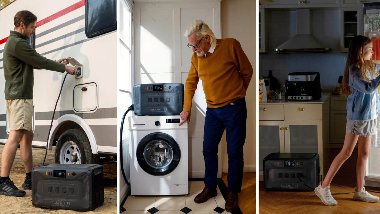
BLUETTI, a global leader in portable power and clean energy, has officially launched its most versatile portable power station to date – the Apex 300 – on Indiegogo.
Tailored for modern Australian lifestyles, it bridges the gap between emergency home backup, off-grid living, and mobile power for vans, campers, and remote work setups.
All-in-one power that grows with you
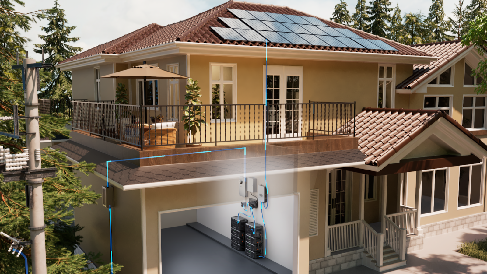
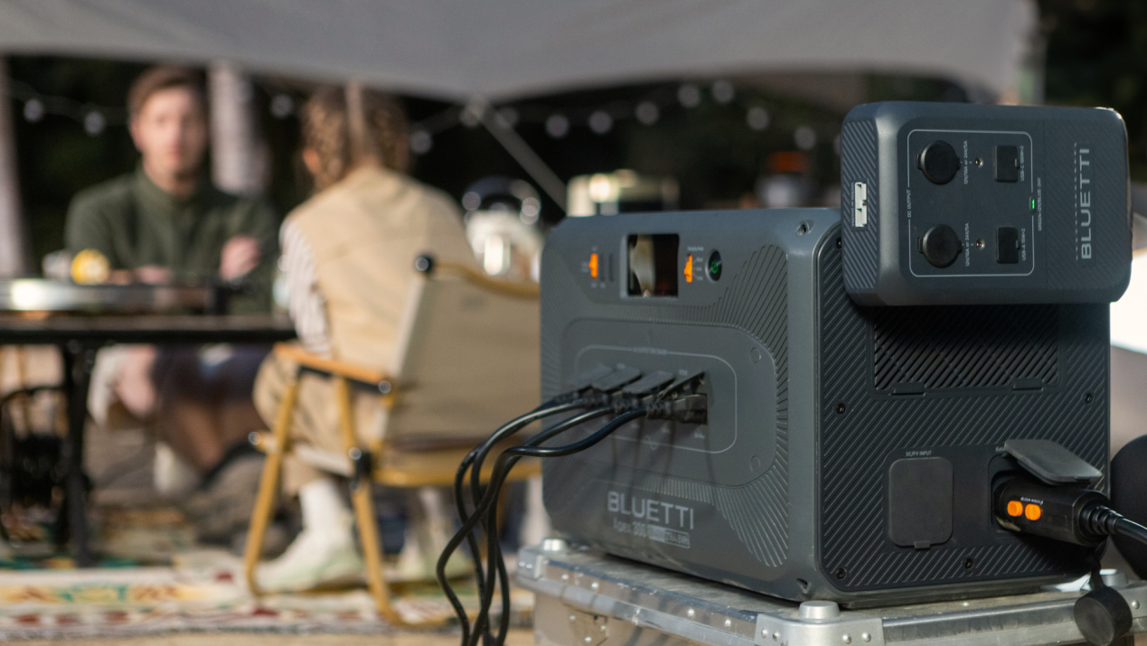
At the heart of the Apex 300 is a massive 2764.8Wh capacity and 3840W output, enough to run power-hungry appliances like air conditioners, microwaves or fridges with ease. Need more juice? Link up to three units in parallel and expand capacity to a staggering 58,000Wh with 18 B300K batteries, perfect for extended blackouts or full-time off-grid setups.
Whether you’re braving power outages, heading off-grid, or living the van life, the Apex 300 grows and adapts to meet your energy needs.
Built for efficiency: Save smarter, live freer
The Apex 300 leads the class in power efficiency, sipping just 20W in idle mode – ideal for stretching backup runtime. It can power a refrigerator up to 24 extra hours, run CPAP machines longer, and extend air conditioner standby time significantly.
Even better, it works with SolarX 4K, the world’s first 500V/4000W solar charge controller, slashing payback time to just two years. In a market like Australia, where power bills spike during winter, the Apex 300 offers a high ROI for families looking to reduce electricity costs.
Add BLUETTI’s Peak Load Shifting via the app, and the system automatically charges with cheap off-peak power or solar, then powers your home during peak-rate periods. It’s like having a smart energy assistant that quietly cuts your power bill.
Solar superpower: Up to 19.2kW solar input
Australians love solar, and the Apex 300 doesn’t disappoint. Connect three units via the Hub A1 Parallel Box with three SolarX 4K chargers, and enjoy a combined 19.2kW solar input – ideal for full off-grid solar setups. Each unit features dual MPPT solar inputs and TurboBoost tech, enabling up to 2400W solar input and an 80-per-cent charge in just 40 minutes.
You’ve also got options: up to seven charging methods, including wall outlets, solar panels, car alternators, gas generators and more. Indoors, a 3450W AC charge takes it from flat to full in about 70 minutes, perfect for quick turnarounds.
DIY-ready for vanlifers and tiny homeowners
With the Hub D1, BLUETTI caters to DIY power setups. This accessory includes a rugged 12V/50A Anderson port, letting you connect 12V appliances like camping fridges, Starlink, Wi-Fi routers, and lights, ideal for van builds, tiny homes, or outback cabins.
For long-haul adventures or remote travel, the Car DC to DC Alternator Charger 1 reclaims power from your vehicle while driving, delivering up to 560W for charging on the move.
Compact and transportable – with hot-swap freedom
Thanks to BLUETTI’s UltraCell tech, the Apex 300 boasts 40-per-cent more energy density, giving you more power in less space. Need to take part of the system outdoors? Hot-Swap Technology 2.0 lets you pull out a battery module for camping while the system keeps running.
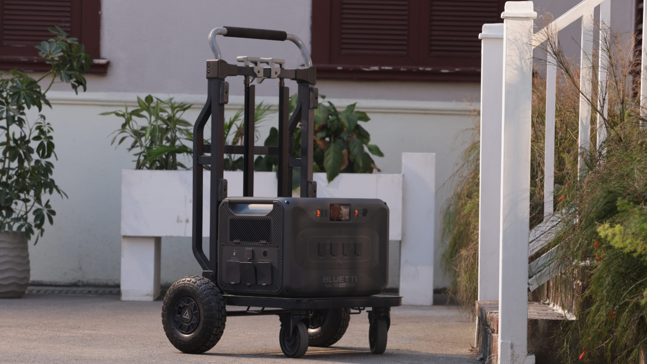
A foldable trolley makes transporting the unit from your home to your caravan or tent simple and stress-free. maximising the value of a backup power system.
Last for over 17 years with safer cells
Durability is a standout feature. With 6,000+ charge cycles, the Apex 300 promises up to 17 years of daily use, retaining 80-per-cent capacity even after long-term operation. Built with second-gen automotive-grade LiFePO₄ cells and passing 33 CNAS-certified safety tests, it’s one of the safest energy storage units on the market.
That long lifespan means less battery waste and more peace of mind, aligning with BLUETTI’s focus on sustainability and long-term value.
Pricing and availability
The BLUETTI Apex 300 is now available for early backers on Indiegogo. It will soon be available via Amazon Australia and the official BLUETTI website.
About BLUETTI
As a technology pioneer in clean energy, BLUETTI provides affordable clean energy storage solutions for both indoor and outdoor use. Through initiatives like the LAAF (Lighting An African Family) program, BLUETTI aims to power 1 million African families in off-grid areas. Focusing on innovation and customer needs, BLUETTI has become a trusted industry leader in over 110 countries and regions.
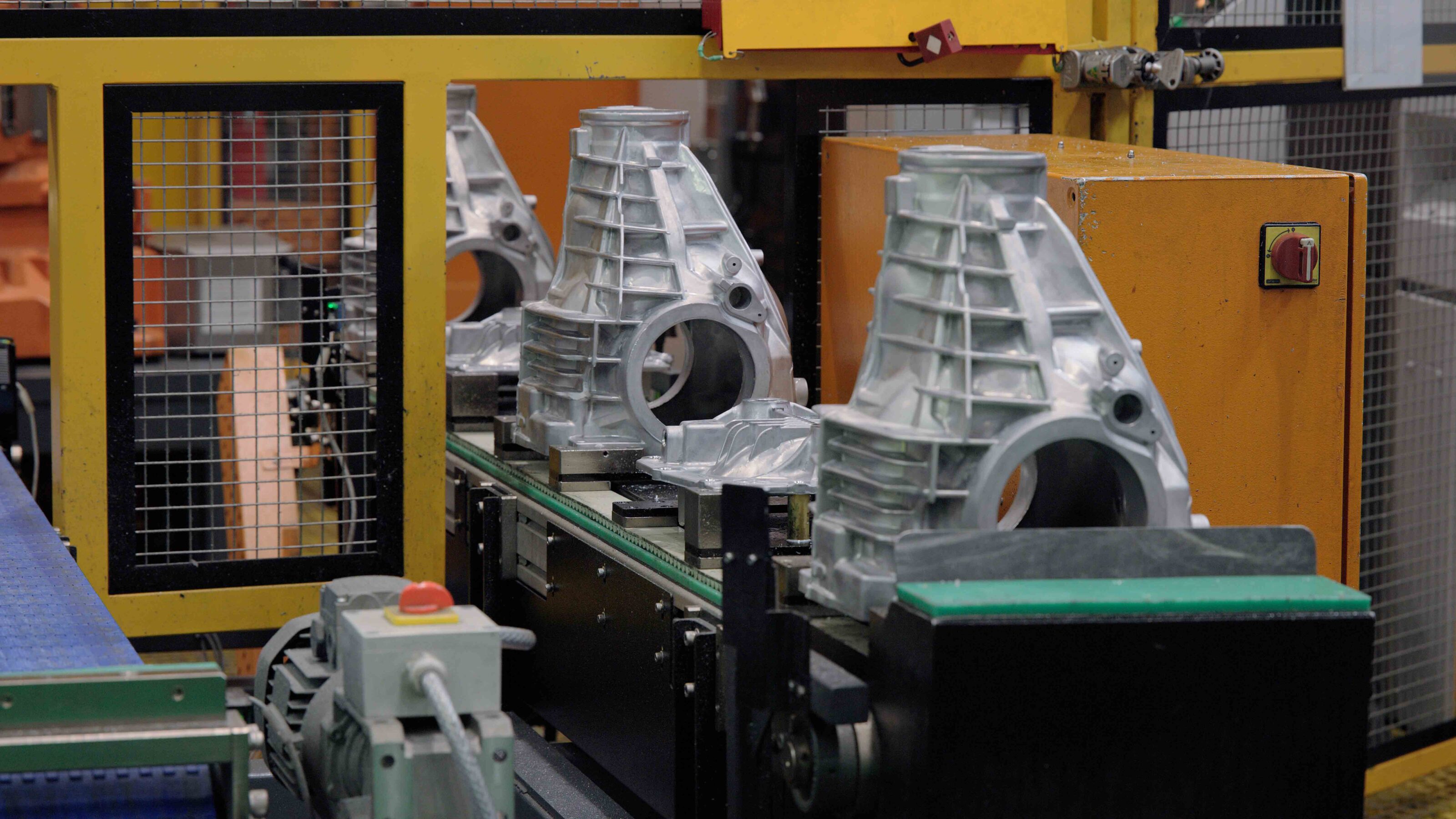
An important piece of equipment for the upcoming Nissan Y63 Patrol will be built in Australia at the brand’s Nissan Casting Australia Plant.
The Australian factory based in Dandenong South, Victoria, will manufacture the final drive differential housing that will feature in every single Y63 Patrol produced.
A key component of a vehicle’s drivetrain, the housing is a metal casing that protects the gears responsible for transferring power from the driveshaft to the wheels. This housing plays a vital role in ensuring smooth power delivery and protecting internal components from damage.
The housing holds the final drive and differential gears that reduce speed and allow the wheels to turn at different rates – crucial when crawling over rocks or cornering off-road. Found in both front and rear axles of 4WD setups, it’s key to smooth, reliable power delivery.
“We are proud to announce that the Nissan Casting Australia Plant is producing crucial parts for the brand’s 4WD flagship, the Y63 Nissan Patrol, which is currently sold in left-hand drive global markets and will be available to order in Australia in 2026” said Andrew Humberstone, Managing Director of Nissan Oceania.
“It means that the Y63 Nissan Patrol isn’t just made for Australia, but partly made in Australia as well.”
The Nissan Casting Australia Plant currently employs around 200 staff, who work to produce 1.2 million examples of 25 different components for Nissan markets around the world every year.
“Nissan Casting Australia Plant is a success story for the Australian automotive manufacturing space,” said Markus Spindler, the Plant Manager for Nissan Casting Australia Plant. “But it’s not all about global output. The Nissan Casting Australia Plant team is also responsible for producing some 16,000 Nissan Genuine Accessory tow bars for Australia and New Zealand.”
The Y63 Nissan Patrol will be powered by a V6 twin-turbo engine paired to a nine-speed automatic transmission, and it will feature customisable adaptive air suspension.
Order books for the Y63 Patrol are expected to open in Australia late in 2026.
Lazer’s Grille Integration Kits pack serious lighting power ready for any outback adventure, whilst achieving a clean aesthetic that looks right at home on any 4×4. Designed for a quick and easy, flush-mounted install, they perfectly blend with the vehicle’s original styling to deliver a true OE-grade finish.
Since its founding in 2010, Lazer Lamps has been a leader in LED lighting technology, ensuring incredible quality by designing, engineering and manufacturing all of its high-performance lighting solutions in-house in the UK. Although their heritage lies in the high-octane world of motorsports, where performance and reliability is everything, the same standard has earned them the trust and confidence of everyday 4×4 drivers.
With its standout lighting performance, rock-solid build, and ability to handle everything from the intense heat and dust of the Australian Outback to the sub-zero temperatures of Scandinavia, Lazer’s products have earned their place on a growing number of 4x4s in Australia and across the world.
Recognising that when you’re upgrading your driving lights, the quality of the install can be just as important as the quality of the driving lights themselves, Lazer puts just as much thought into its Grille Integration Kits as they do its high-performance light bars. These kits are built tough and made to fit seamlessly into the front grille of the most popular 4WDs and light commercial vehicles; no dodgy mounting brackets or messy installs.
While plenty of ‘grille kits’ are popping up these days, Lazer pioneered the innovation behind flush-mount LED Grille Integration Kits, launching its first kit back in 2015. The idea to make lighting more accessible and integrated was driven by company Director, Ben Russell-Smith, who has been working at the forefront of vehicle lighting design since 2002, managing exterior lighting projects at Nissan and Ford of Europe. Lazer have since continually grown the range into the biggest line-up of custom-fit grille solutions available on the market today.
With more than 100 kits available, Lazer offers solutions for a wide range of manufacturers, including Chevrolet, Ford, Isuzu, Land Rover, Mercedes, Mitsubishi, Nissan, Ram, Toyota, VW and more. Lazer is constantly developing new kits for not only the latest trending vehicles but also solutions for older models that have high popularity.
Mark Gelo, Market Manager at Hamer 4×4, has seen first-hand how well Lazer’s Grille Kits hold up against the elements, and as an official Australian distributor, they’ve fitted plenty and know what sets them apart.
“At Hamer 4×4, we’re committed to providing our customers with accessories that blend superior protection with stunning aesthetics, Lazer’s integration kits do exactly that,” Gelo said. “The build quality is exceptional, but what truly sets them apart is their attention to detail, which is clear throughout. The installation process is remarkably straightforward, the kits include detailed cutting guides and comprehensive wiring harnesses that make fitting efficient and professional.
When paired with our premium bull bars, they don’t just deliver an exceptional lighting upgrade, they elevate the overall aesthetics of the vehicle for a true statement look. Lazer continues to set the benchmark in the industry with overall build quality and technology that other products just simply can’t match,” he said.
Lazer’s success comes down to precision engineering and in-house manufacturing. Using advanced software, it designs bespoke mounting brackets that not only ensure a seamless install but also place the lights for optimal output and beam spread – crucial for visibility and safety in even the toughest Aussie conditions.
The brackets are made from a high-strength composite known for its UV stability and resistance to chemicals and weather, making them built to last in harsh environments. Each kit includes detailed cutting guides, so there’s no need to remove the grille or bumper, just a clean, rock-solid install that looks great and performs even better.
“Each grille integration kit begins with using our cutting edge software to scan the vehicle’s original grille, capturing every contour and detail with true precision. From there, our engineers spend time choosing the perfect light for the kit and are able to design the custom brackets for exact fitment and structural integrity,” said Graham Bailey, Engineering Director at Lazer Lamps.
“Nowadays we apply advanced manufacturing techniques to mirror every detail down to the original grille textures and grain patterns, achieving a finish that blends flawlessly. This level of craftsmanship and engineering rigour is a testament to the expertise of our team, and it ensures our kits deliver the true OE-quality finish Lazer is renowned for,” he added.
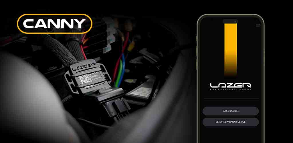
That same focus on smart design also translates into Lazer’s electronics development and another recent innovation comes in the form of Lazers new Canny module, a CAN interface device that simplifies the activation of auxiliary lights in vehicles with advanced electronic systems.
As many modern vehicles and 4x4s now use LED headlights controlled via CAN signals rather than traditional 12V triggers, the Canny device bridges this gap and ensures reliable integration. For more electronically complex modern vehicles, Lazer’s Canny interface is a truly ground-breaking solution.
Whether you’re building a rig for weekend escapes or need a set up for serious off-road touring, Lazer’s Grille Integration Kits offer a no-compromise solution for 4×4 lighting, delivering performance, style, and durability. Engineered for a quick and easy flush-mounted install, they blend seamlessly with your 4×4’s original design to deliver a clean, OE-grade finish.
Proven in the toughest environments and backed by industry-leading warranties, they’re the smart choice for anyone looking to upgrade their lighting setup to get true high performance output in the most simple, fast and most efficient way.
Here’s a selection of Lazer’s top featured Grille kits for some of Australia’s most popular 4x4s
Lazer Lamps Ford Ranger Raptor / Ford Ranger Grille Kits
- Ford Ranger Raptor (2023+) Grille Kit – x2 Triple-R 850
- Ford Ranger Raptor (2023+) Grille Kit – x1 Triple-R 16 Elite
- Ford Ranger Raptor (2018-2022) Grille Kit x1 Linear-24 Elite
- Ford F-150 Raptor (2017-2020) Grille Kit x2 Carbon-6
- Ford Ranger Wildtrak (2023+) Grille Kit – x2 Triple-R 850
- Ford Ranger Wildtrak (2023+) Grille Kit – x2 Triple-R 1250
- Ford Ranger Platinum (2023-2024) Grille Kit – x2 Triple-R 750
- Ford Ranger XLT (2023+) Grille Kit – x2 Triple-R 850
- Ford Ranger XL/XLS (2023+) Grille Kit – x2 Triple-R 750
- Ford Ranger (2019-2022) Grille Kit – x2 Triple-R 750
- Ford Ranger (2016-2018) Grille Kit – x2 Triple-R 750
Lazer Lamps Ineos Grenadier Grille Kits
- Ineos Grenadier (2023-Present) Grille Kit – x2 Triple-R 750
- Ineos Grenadier (2023-Present) Grille Kit – x2 Sentinel 7″ (Coming Soon)
Lazer Lamps Toyota Hilux Grille Kits
- Toyota Hilux (2021+) Grille Kit – x2 Triple-R 750
- Toyota Hilux (2021+) Grille Kit – x2 Linear-6
- Toyota Hilux Rogue (2021+) Grille Kit – x2 Triple-R 750
- Toyota Hilux Invincible-X (2017-2020) Grille Kit – x2 ST4
- Toyota Hilux (2017-2020) Grille Kit – x2 Triple-R 750
Lazer Lamps Toyota Rav4 Grille Kits
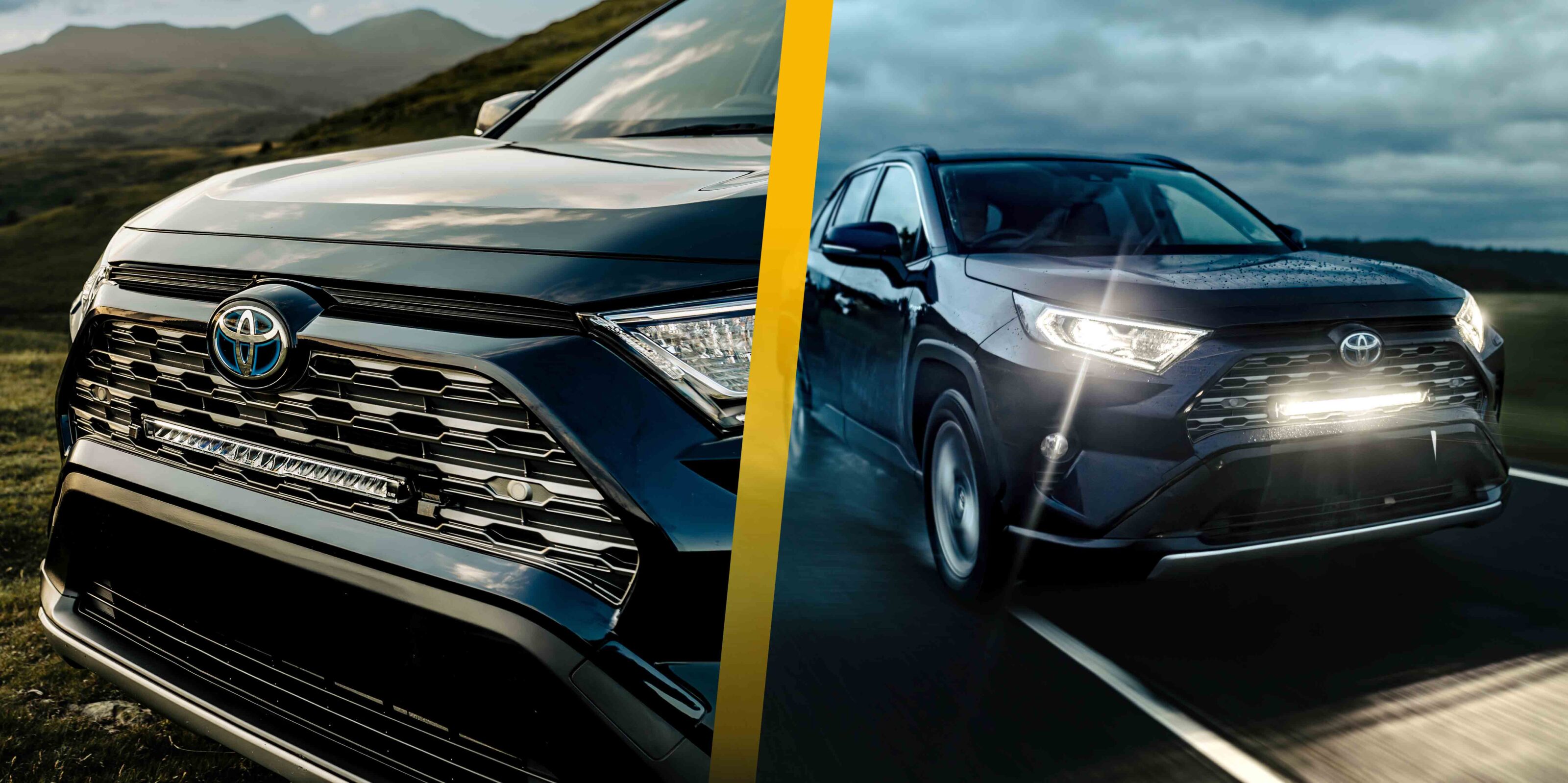
- Toyota RAV4 Hybrid (2019+) Grille Kit – x1 Linear-18 / x1 Glide
Lazer Toyota Land Cruiser Grille Kits
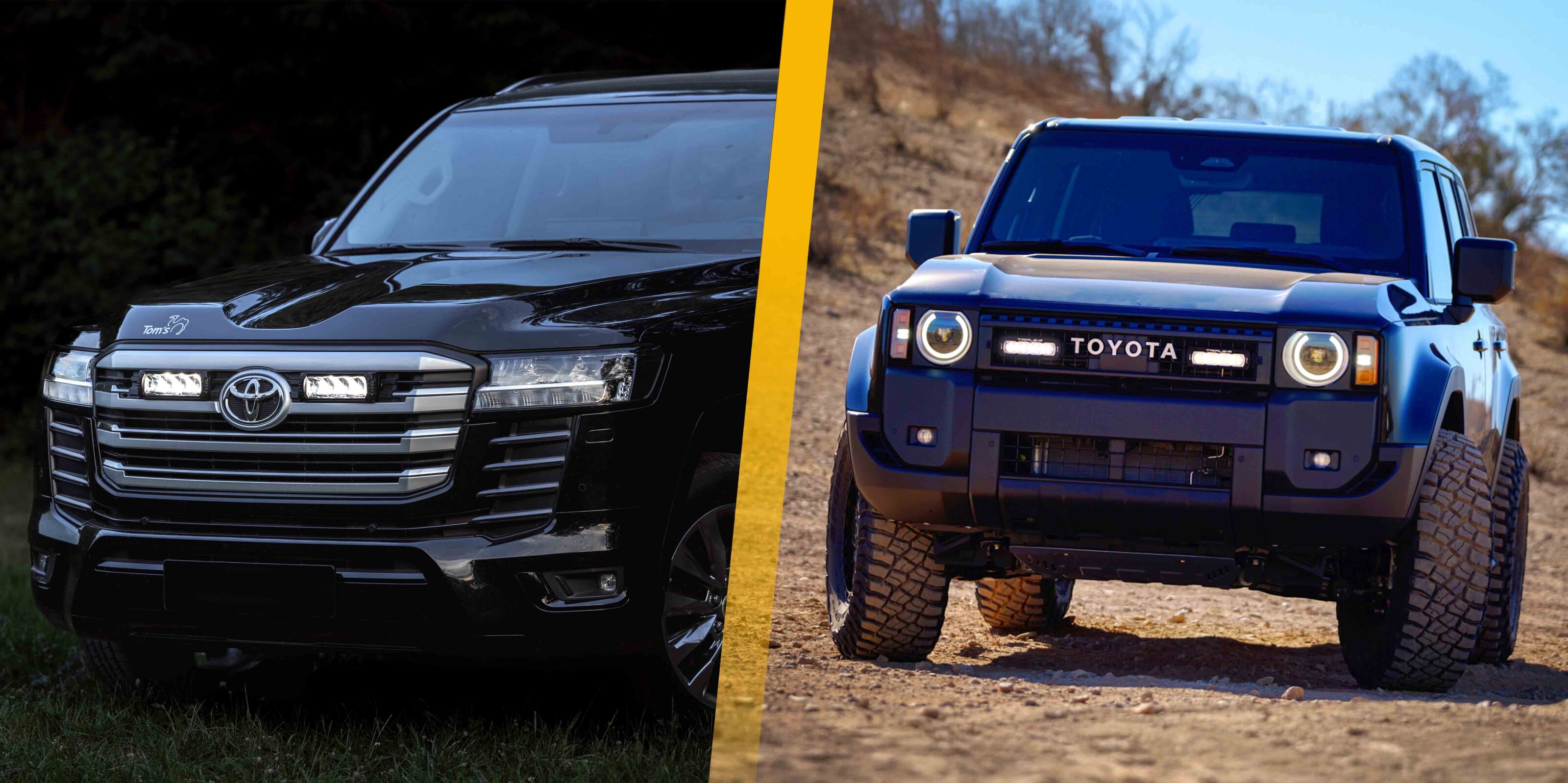
- Toyota Land Cruiser 250 (2024+) Grille Kit – x2 ST4
- Toyota Land Cruiser 300 Series (2022+) Grille Kit – x2 Triple-R 750
- Toyota Land Cruiser 200 Series (2015-2021) Grille Kit – x2 Triple-R 750
- Toyota Land Cruiser 70 Series (2007-2023) Grille Kit – x2 ST4
Lazer VW – T6 / T5 / Crafter Grille Kits
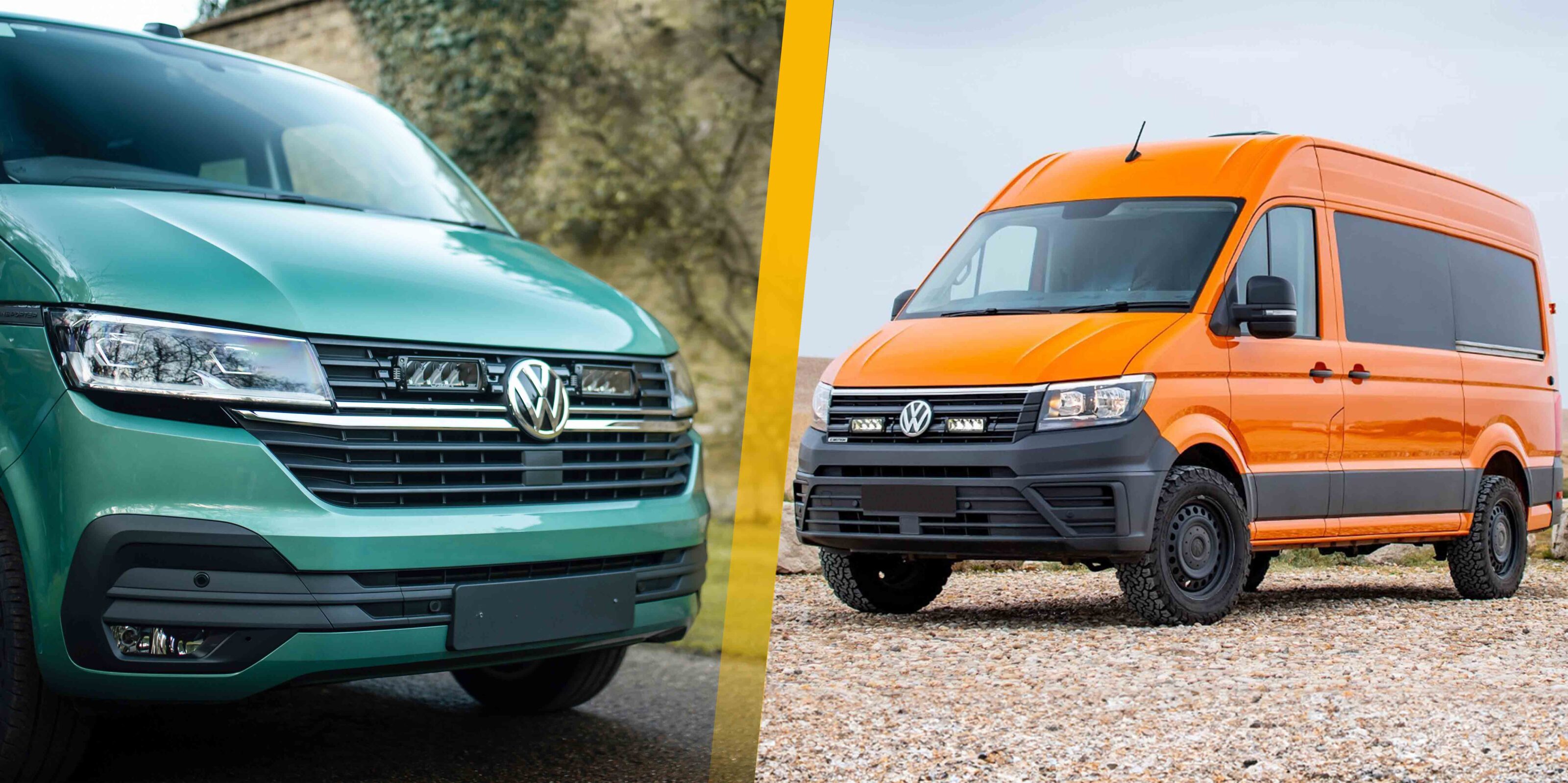
- VW T6.1 Grille Kit – x2 Triple-R 750
- VW T6 Highline Grille Kit – x2 Triple-R 750
- VW T6 Startline Grille Kit – x2 Triple-R 750
- VW T6.1 Grille Kit – x2 ST4 Evolution
- VW T6 Highline Grille Kit – x2 ST4 Evolution
- VW Crafter (2017+) Grille Kit – x2 Triple-R 750
- VW T5.1 Grille Kit – x2 Triple-R 750
Lazer VW Amarok Grille Kits
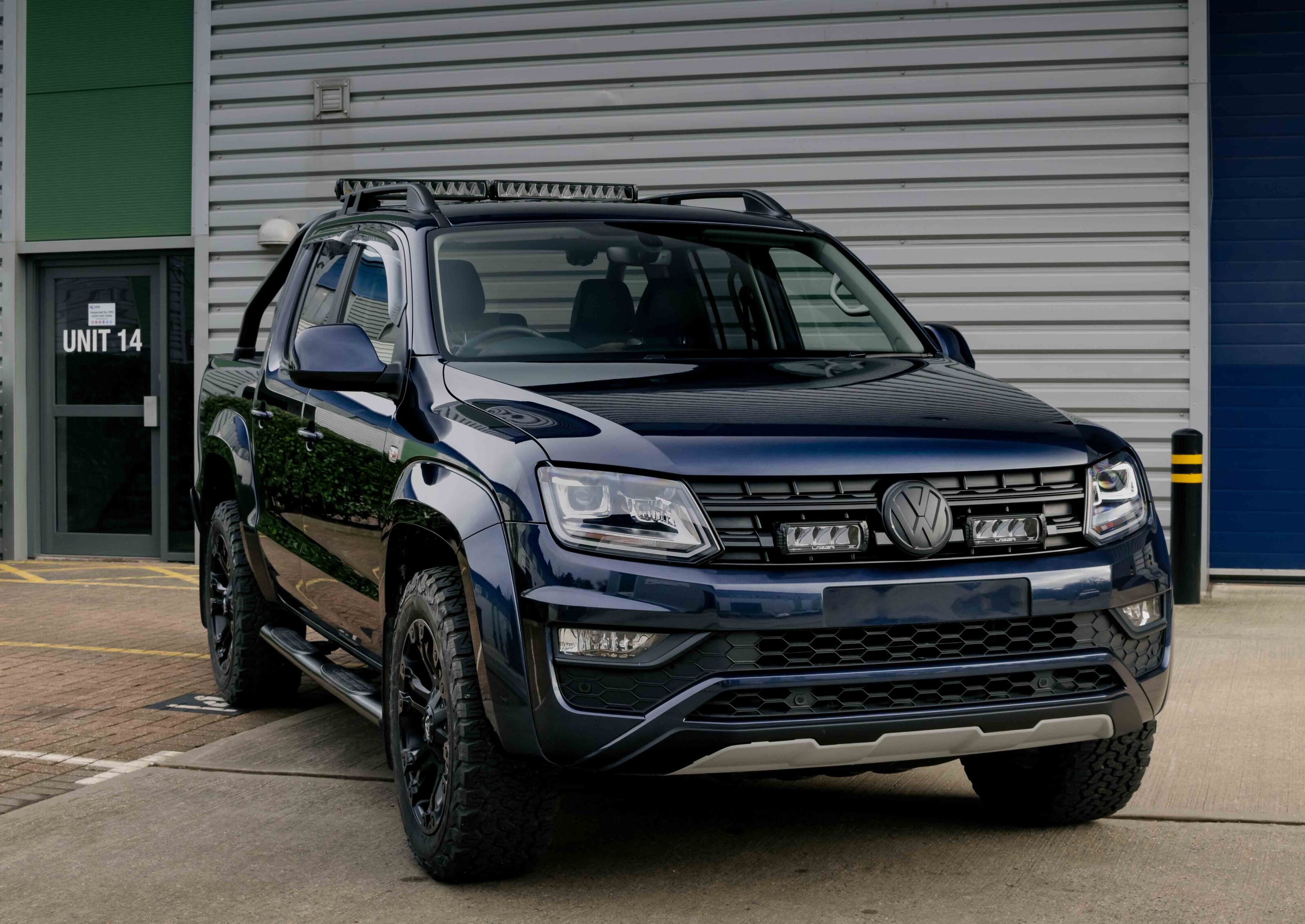
- VW Amarok (2023+) Grille Kit – x2 Triple-R 750
- VW Amarok V6 (2016-2022) Grille Kit – x2 Triple-R 750
- VW Amarok (2011-2015) Grille Kit – x2 Triple-R 750
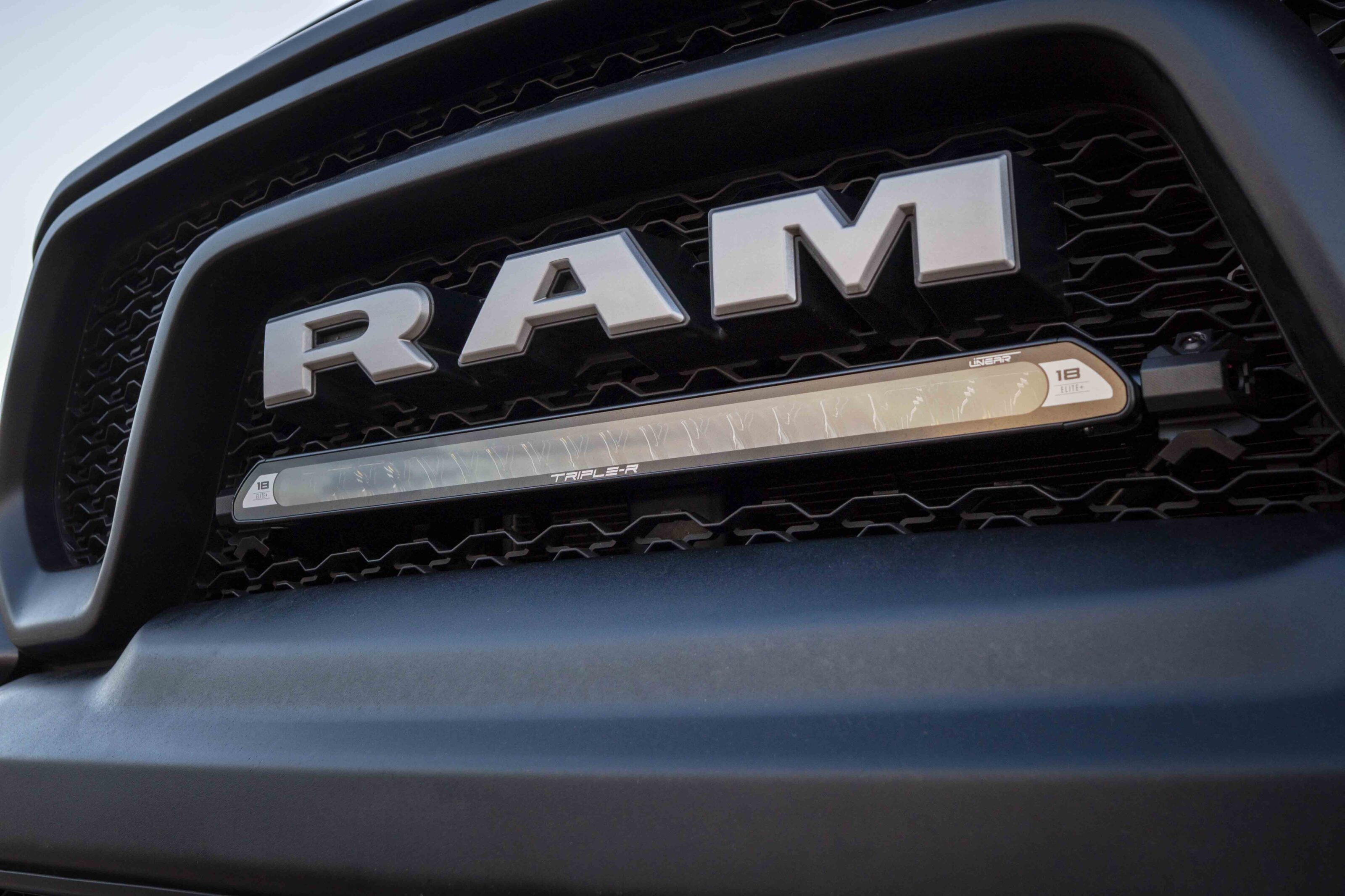
Lazer Lamps RAM Grille Kits
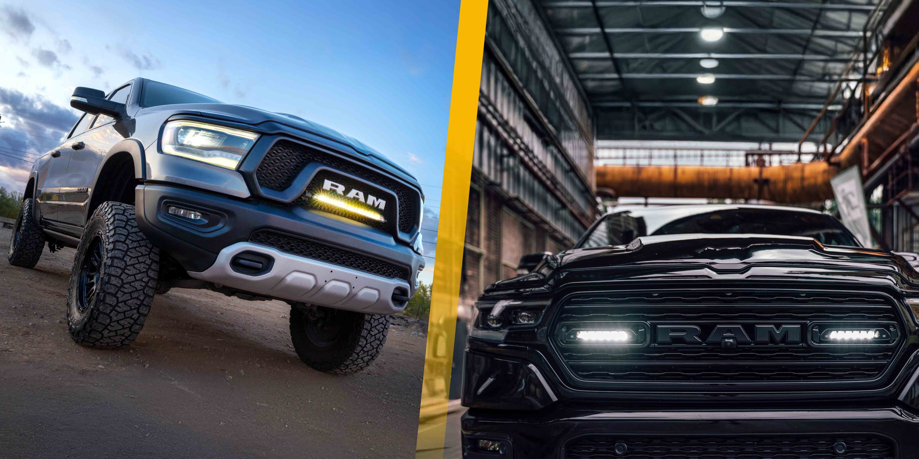
- RAM 1500 DT Series – Limited (2019-2023) Grille Kit – x2 Linear-6
- RAM 1500 DS Series – Classic (2013+) Grille Kit – x2 Triple-R 750
- RAM 1500 Rebel (2019 – 2024) Grille Kit – x1 Linear-18 (Coming Soon)
Lazer Lamps Chevrolet Grille Kits
- Chevrolet Silverado 1500 LTZ Premium (2022-2024) Grille Kit – x2 Triple-R 1000
- More on the way soon…
To view Lazers full range of kits, please visit: Lazer Lamps Integration Kits or get in touch with the Adelaide based sales office via [email protected]
However please note, if there is not a specific kit for your vehicle, it does not mean an install is not possible. Lazer has a large network of dealers and approved fitters across Australia to help: https://www.lazerlamps.com.au/dealer-locator
Both the GWM Cannon Alpha plug-in hybrid (PHEV) and the diesel-powered Tank 300 have been awarded five-star ANCAP safety ratings, following updated assessments released by the independent vehicle safety authority.
The five-star ratings come after a review process in which GWM submitted extra technical data to ANCAP to demonstrate its new variants matched the safety performance of previously tested models.
ANCAP confirmed the new scores are extensions of existing ratings, based on supplementary analysis and engineering data. It’s a common step when manufacturers introduce new drivetrain variants or trim levels after an initial safety assessment.
“These latest safety ratings build on GWM’s consistent record of strong ANCAP results and underscore the brand’s commitment to the highest safety standards – delivering confidence and peace of mind to our customers,” said Steve Maciver, GWM’s Head of Marketing and Communications.
The Cannon Alpha PHEV scored:
- 84% for adult occupant protection
- 93% for child occupant protection
- 82% for vulnerable road user protection
- 81% for safety assist technologies
The Tank 300 diesel variant recorded similar results:
- 88% for adult occupant protection
- 89% for child occupant protection
- 81% for vulnerable road user protection
- 85% for safety assist
The Cannon Alpha PHEV – positioned as a direct rival to the BYD Shark – was introduced to the Australian market in April 2025, with prices starting from $63,990 drive-away.
The diesel-powered Tank 300 diesel officially debuted in March 2025, with pricing starting at $47,990 drive-away for the Lux variant and $51,990 for the Ultra. The diesel variant is powered by a 145kW/480Nm 2.4-litre four-cylinder turbocharged engine, paired with a nine-speed automatic transmission and part-time 4WD system.
Just last week GWM updated the Tank for 2025, increasing the towing and payload capacities of both its petrol and hybrid variants. The Chinese marque also axed the Tank 300 Lux grade, in both petrol and hybrid configurations.
This culling streamlined the Tank 300’s Australian line-up to just four variants: the Lux (diesel); and the Ultra (petrol, diesel and hybrid).
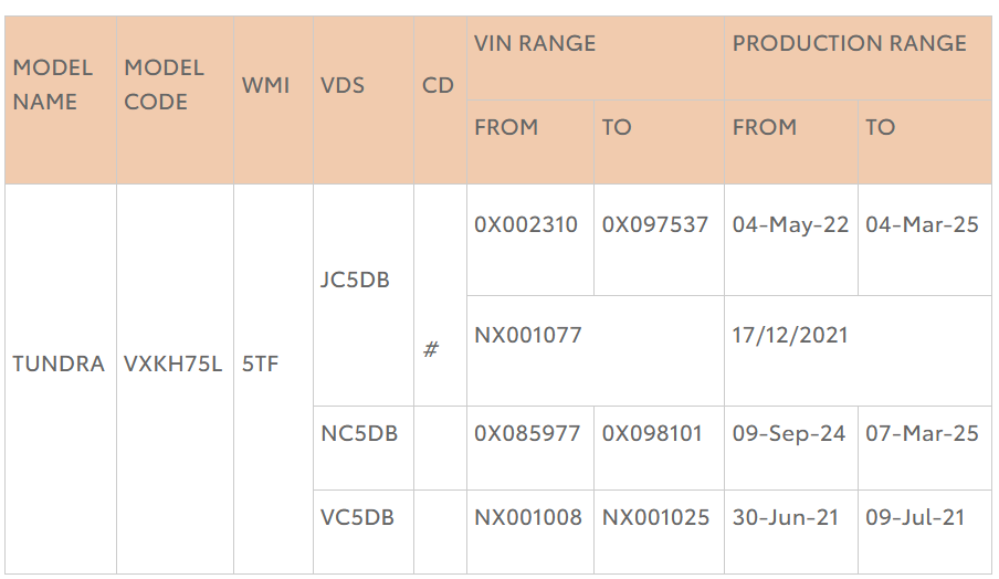
A safety recall has been issued for a total of 1532 Toyota Tundra vehicles produced between 30 June 2021 and 7 March 2025.
The recall addresses a potential fault in the factory reversing lamp assemblies that could compromise rear visibility and increase the risk of collisions.
The affected vehicles are equipped with two reversing lamp assemblies, each containing a multi-layer vent patch designed to protect against water intrusion. Over time, thermal cycling may cause the vent patch to separate, allowing moisture to enter the assembly.
This intrusion can lead to corrosion of internal components, potentially causing the reversing lamps to fail. If both reversing lamps are non-functional, drivers may experience reduced visibility when reversing, particularly in low-light conditions, and other road users may not be aware the vehicle is reversing.
To rectify the issue, Toyota dealers will replace both reversing lamp assemblies free of charge. The repair is expected to take approximately two hours, though service times may vary.
Toyota Australia will contact all affected vehicle owners directly with details of the recall. Owners are encouraged to ensure their contact information is up to date to receive timely notifications.
It’s no longer easy to find Aussie-made products that are built to handle our harsh conditions, which can be a challenge for a bloke like me who wants to know the products I buy for my year-round travels won’t expire before I do.
While travelling through the Kimberley region I recently discovered the brand Downunderlust Canvas and its range of handmade bags and accessories.
Downunderlust Canvas founders Kimm and Matt have an extensive four-wheel driving and camping background, and they saw the need for custom products while travelling on the road many years ago. Starting with a little sewing machine to make their own bags in Broome, their friends soon saw how great the products were and began asking for their own. Roll onto today and they are now sending custom orders all over Australia.
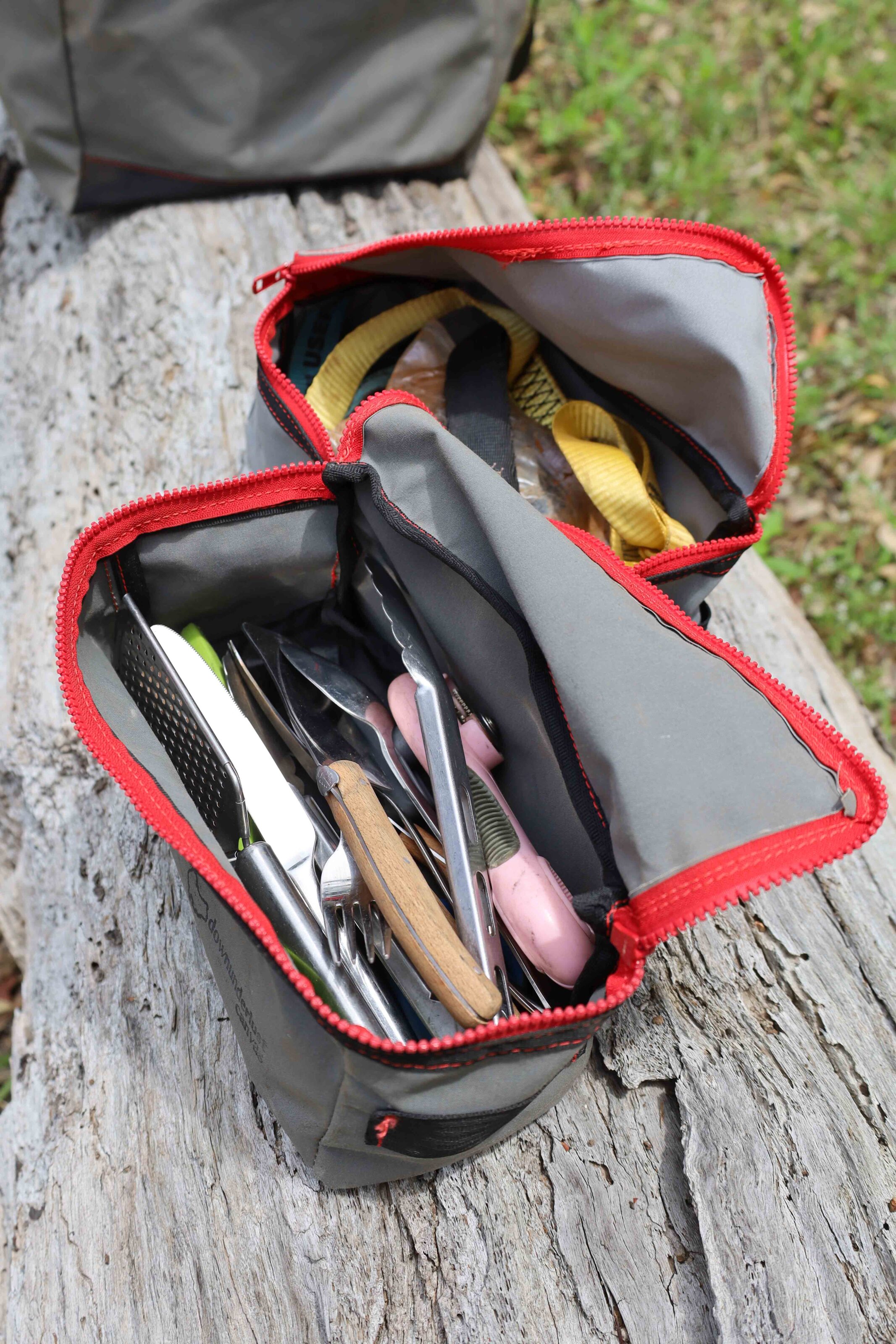
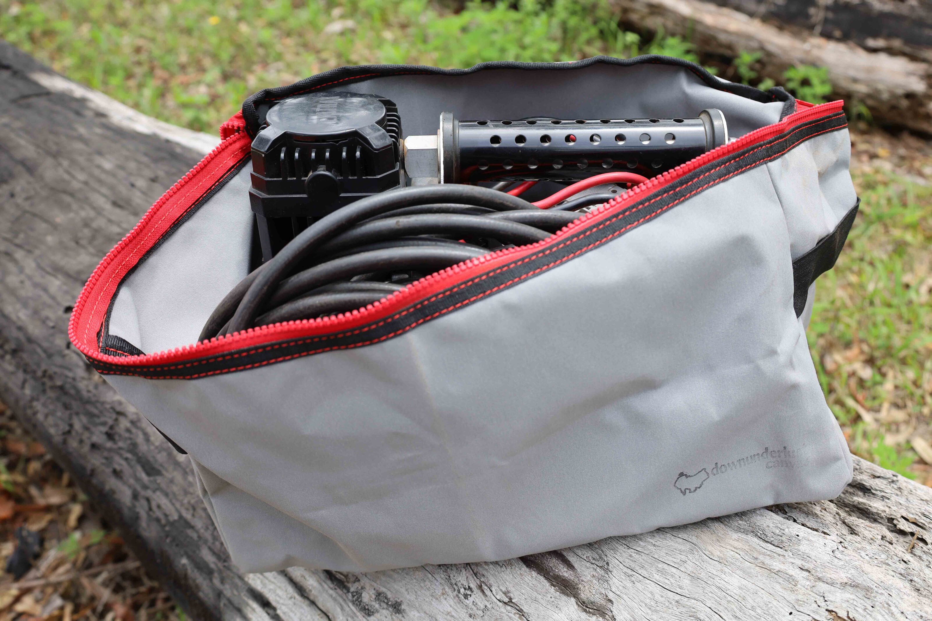
Based in the remote Kimberley region, Downunderlust Canvas is a small Australian-owned and operated company that specialises in recycling old canvas products into useful bags, pouches and more. Kimm and Matt source old swags and canvas material offcuts either online or locally to make their range of products. As well as the gear available on their online shop they accept custom orders. Kimm sewed up a large duffel bag for me, as well as some smaller bags to use while touring, and I can definitely say these things are as tough as nails.
The secondhand canvas is washed and dried prior to being used and while some of it may retain some marks and blemishes from its previous life, I reckon that gives it a fascinating backstory.
The straps are made from new seat-belt-style webbing material as these components can be the first to degrade in Australia’s harsh climate. The larger duffel bags have flaps that fold over the zips for added protection and so far I have had no water or dust get into any of my bags while travelling.
As they are not mass produced, every product is unique; when ordering a custom made bag you can request contrast stitching, a zip upgrade or even a custom colour depending on what canvas is on hand at the time of manufacture.
I discovered Downunderlust Canvas at Mount Barnett Roadhouse on the Gibb River Road, where Matt and Kimm are managing the operation. Here you’ll find a range of bags in different configurations for sale, or you can order custom made bags.
Pricing
- Small Storage Bag: $35
- Regular Storage Bag: $50
- Firewood Carrier: $65
- Duffel Bag: $165
We’ve always said that the Jeep Wrangler Rubicon is the most off-road capable 4×4 vehicle that you can get off the showroom floor and the addition of a new turbocharged petrol engine hasn’t changed our opinion.
Our recent time in a short wheelbase 2025 Rubicon gave us the chance to tackle some tracks we wouldn’t usually attempt in bone-stock press vehicles but the Jeep reminded us that it’s still the off road champion.
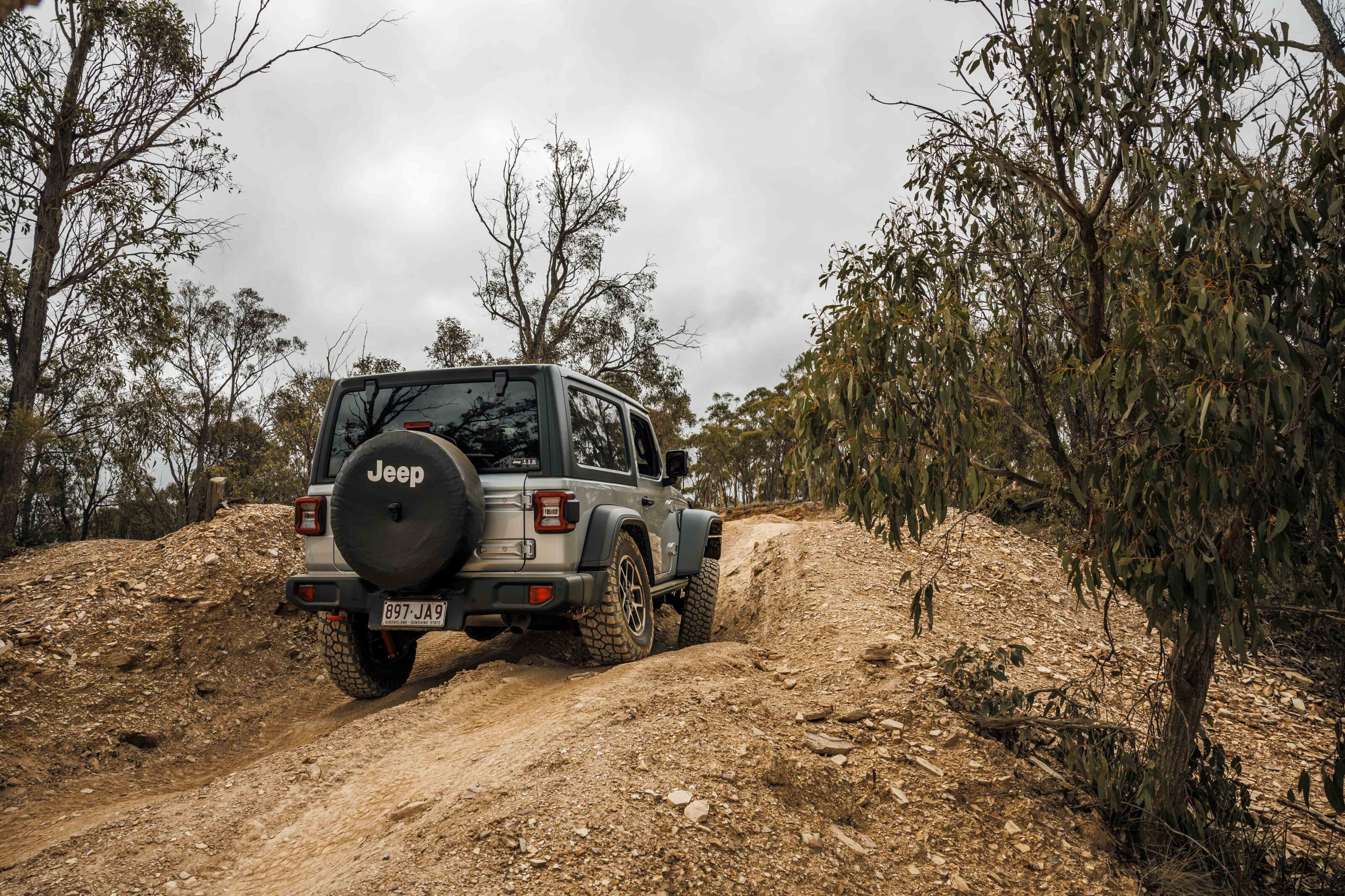
Triple locking diffs, a disconnecting sway bar and factory fitted BFG muddies are all you could really ask any vehicle manufacturer for, but only one company delivers – the Godfather of the recreational 4×4 – Jeep! The Wrangler always has been and remains the one new vehicle that stays true to the off-road ethos and gives users what they want in a vehicle to take them anywhere, while having fun all the way.
Add in a removable roof, fold-down windscreen and cool retro styling and the Jeep Wrangler is the ultimate off-road fun truck. Yes, Jeep could give is the bigger tyres as fitted to this model in the USA instead of the puny 255/75R17s that come on Aussie-delivered Rubicons, and we’re sure there’s something it could do about the near-$85k price tag, but aside from these gripes the iconic Jeep remains a favourite.
JUMP AHEAD
What’s new?
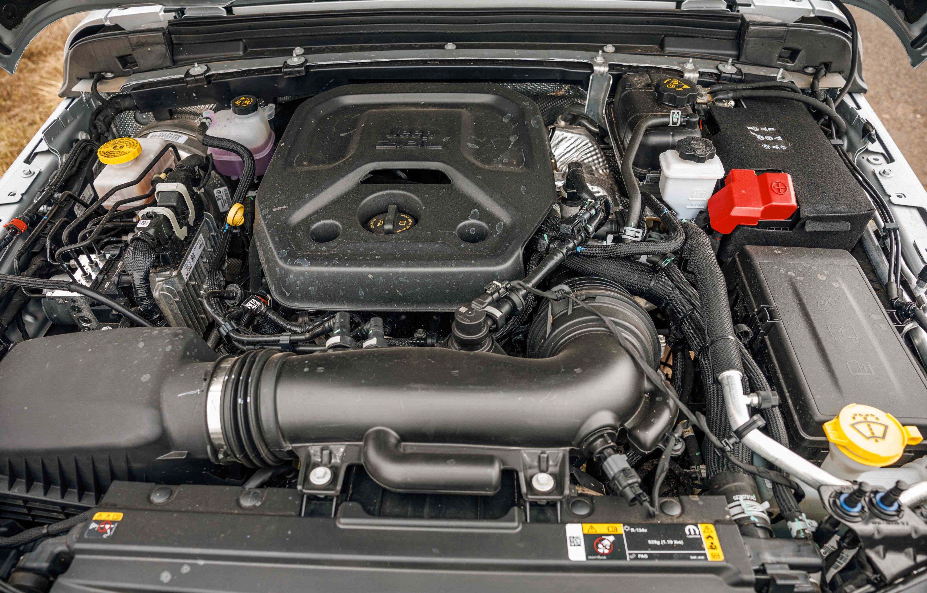
The latest updates to the Wrangler Rubicon saw the end of the Pentastar V6 engine and in its place sits a turbocharged four-cylinder petrol mill that outperforms the old V6 in every way.
The Wrangler’s new 2.0L four-cylinder turbo-petrol engine produces a claimed 200kW of power and 400Nm of torque compared with the previous V6’s claimed peaks of 209kW and 347Nm, and it’s that extra torque of the turbo four that makes all the difference in the way the latest Wranglers drive. It’s not the peak torque that makes the difference but the broader spread of torque from down low and through the midrange that makes it better to drive both on and off road.
Making life easier for the little-engine-that-could is a superb eight-speed automatic transmission that never seems to put a cog wrong.
When we say that the Rubicon is the off-road champion we’re talking about low-range crawling and rock hopping over gnarly terrain. It’s far from an ideal off-road tourer as it’s very limited for space and carrying capacity (especially in SWB form), and it’s not great for towing a large trailer. The Rubicon is a focused off roader but it is also heavily loaded with features and premium touches.
Inside the new dash pad has a soft-touch black material, while a new 12.3-inch panoramic multimedia touchscreen fills the centre of the dash. As well as being bigger than before it includes the latest U-Connect 5 system with wireless Apple and Android phone mirroring.
The Rubicon now gets 12-way power adjustable (driver’s only) and heated front leather seats. The rear seat is small but usable and thankfully folds forward to give some semblance of cargo space; when it is in position there is very little space for gear.
Off-road performance
With its old-school off-road design and construction, the Wrangler still only achieves a three-star safety rating despite the addition of new side curtain airbags for both front and rear passengers. Other standard safety kit includes rear cross traffic alert, front and rear cameras, forward collision warning, six airbags and a TPMS.
The interior of the Wrangler has never been quiet but the hardtop helps. To further quieten the cabin, acoustic laminated glass is now used in the front doors of Rubicon models. Speaking of glass, the Wrangler’s front windscreen is now made of Gorilla glass; this is the same heavy-duty glass that’s used on Apple iPhones and it’s said to be tougher than regular glass, so much so that Jeep warrants the windscreen against damage for two years.
As much as the high level of luxury and tech in the Rubicon is appreciated, and goes some way to justifying the price tag, I wonder if a more affordable model with all of the Rubicon’s off-road hardware, but a lower-spec interior and deleted rear seat, would be more popular with 4×4 enthusiasts.
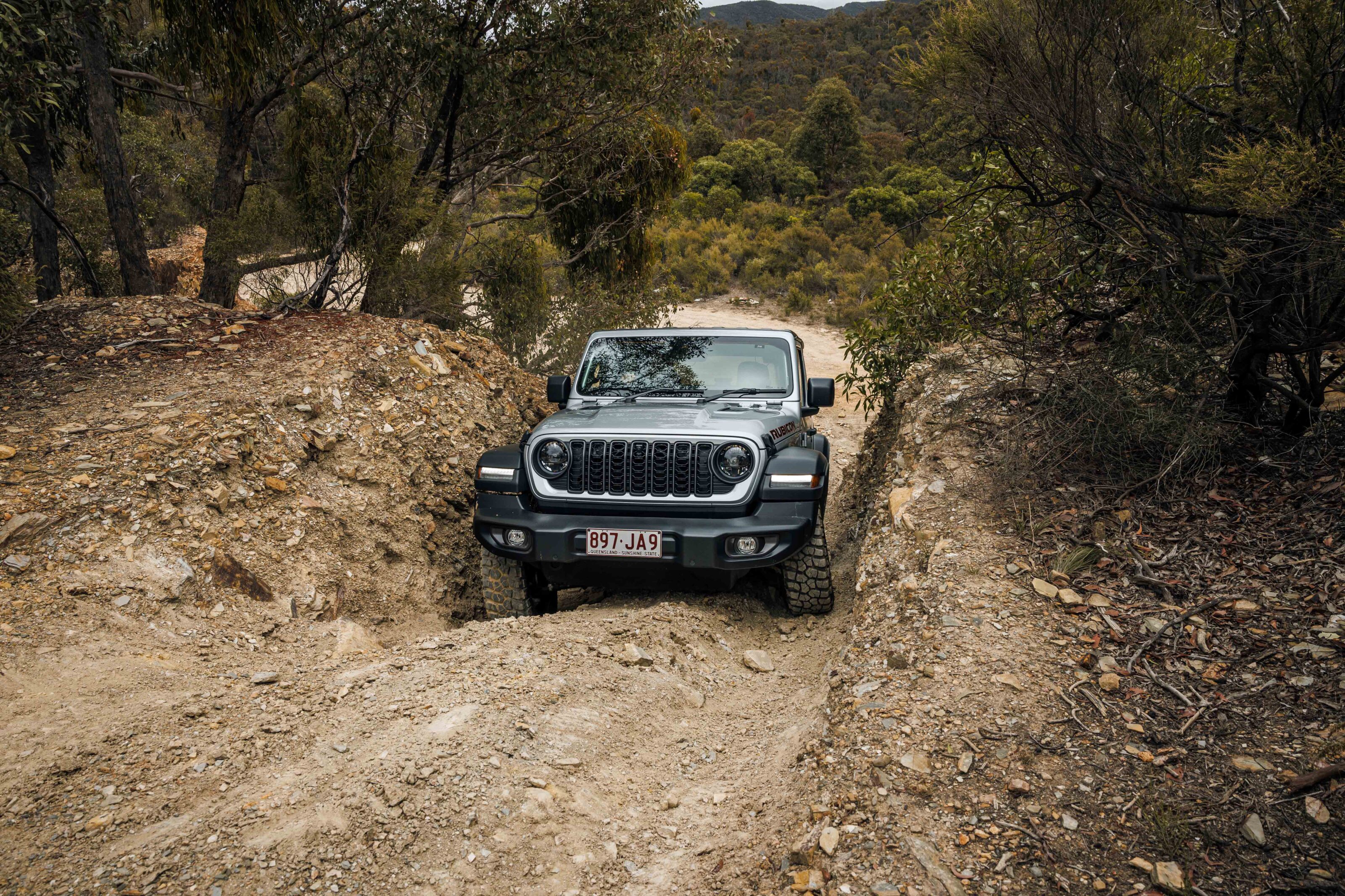
Along with its iconic looks, it’s the off-road capability that sets the Rubicon apart from all other new 4x4s. Point it up any piece of challenging track and employ the diff locks and swaybar disconnect, and the Rubicon feels unstoppable. The rear axle flexes nicely to give plenty of drive through the BFGs, and the swaybar disconnect allows the front axle to match it for articulation.
The short wheelbase makes it easy to poke the little Jeep in between rocks and trees as you negotiate tight trails but the feeling that you are sitting over the back axle can be a bit uneasy when climbing rock steps on already steep hills. There’s an unfounded feeling that with the weight on the rear axle the Wrangler might flip backwards… but it’s a feeling you get used to with time which allows you to fully appreciate the vehicle’s abilities.
Verdict
On-road performance is what you might expect of a vehicle with such great off road chops.
The mud-terrain tyres hum and vibrate on sealed roads, the soft suspension allows for plenty of body roll and the short wheelbase makes it super easy to park, but highway driving is not the Rubicon’s forte.
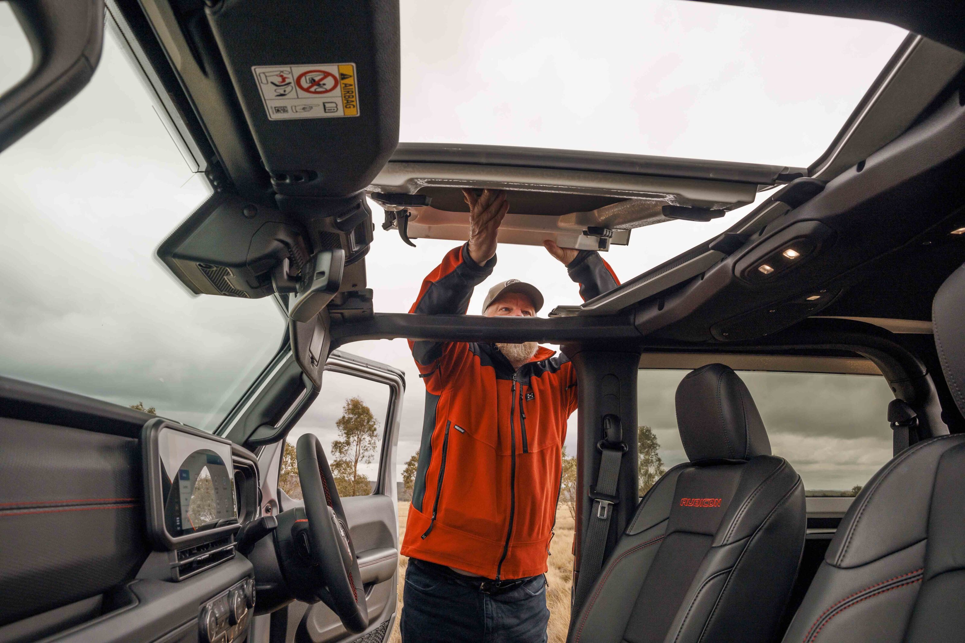
On or off road the Wrangler is best appreciated with the roof off. This can be as simple as removing the two panels over the front-seat occupants which only takes a minute and lets the sun shine in, or you can remove the entire roof section and drop the windscreen down onto the bonnet, but this takes considerably longer. The first option is quick and easy, and is great for those sunny days in the bush or on the beach.
The Wrangler Rubicon is not the vehicle for everyone but use it for what it was made for and you will be truly rewarded. The off-road ability is unmatched but comes at the expense of on-road comfort and practicality. Keep that in mind when you buy one of these and you won’t be disappointed.
Specs
| Price | $83,950 + ORC |
|---|---|
| Engine | I4 Turbocharged Petrol |
| Capacity | 2.0L |
| Max Power | 200 kW @ 5250rpm |
| Max Torque | 400 Nm @ 3000-4500rpm |
| Transmission | 8-speed automatic |
| 4×4 System | Rock-Trac selectable full-time 4×4 dual range, front and rear diff locks |
| Crawl Ratio | 77.24:1 |
| Construction | 3-door body on ladder frame chassis |
| Front Suspension | Live axle, links, coil springs, disconnecting stabiliser bar |
| Rear Suspension | Live axle, links, coil springs, stabiliser bar |
| Tyres | 255/75R17 |
| Kerb Weight | 2219kg |
| Payload | 620kg |
| GVM (Gross Vehicle Mass) | 2574kg |
| GCM (Gross Combined Mass) | 4819kg |
| Towing Capacity | 2495kg |
| Seats | 4 |
| Fuel Tank | 81 L |
| ADR Fuel Consumption | 9.2 L/100km |
| Departure Angle | 37.0 |
| Rampover Angle | 22.6 |
| Approach Angle | 43.9 |
| Wading Depth | 760mm |
| Ground Clearance | 255mm |
The GWM Tank 300 has been updated for 2025, with the Chinese marque increasing the towing and payload capacities of both its petrol and hybrid variants.
This towing capacity bump from 2500kg to 3000kg now brings the petrol and hybrid models in line with the Tank 300 diesel, which launched in Australia earlier this year. Payload capacities have increased by a minimum of 600kg across the range.
These improvements have been made possible by the implementation of more than 20 engineering enhancements, including larger front brakes and calipers; strengthened front knuckles; upgraded wheel bearings; and a reinforced prop shaft.
“These important updates reflect our global team’s growing understanding of the Australian market, where towing capability and payload remains a key consideration for buyers in this segment”, said Steve Maciver, GWM’s Head of Marketing & Communications.
GWM has also streamlined its local line-up, axing the Tank 300 Lux grade, in both petrol and hybrid configurations. GWM says they have been discontinued to “align with a shift of customer preference towards diesel”, with the Tank 300 diesel now accounting for 60 per cent of monthly sales.
The culling of these two models has cut the Tank 300’s Australian line-up to four variants: the Tank 300 Lux (diesel); and the Tank 300 Ultra (petrol, diesel and hybrid).
Despite these updates, GWM has left the pricing for its Tank 300 unchanged.
Specs: 2025 GWM Tank 300
| Specification | Tank 300 Lux Diesel | Tank 300 Ultra Petrol | Tank 300 Ultra Diesel | Tank 300 Ultra Hybrid |
|---|---|---|---|---|
| Driveaway price | $47,990 | $49,990 | $51,990 | $56,990 |
| Max Braked Towing Capacity – kg | 3,000 | 3,000 | 3,000 | 3,000 |
| Unbraked Towing Capacity – kg | 750 | 750 | 750 | 750 |
| Kerb weight – kg | 2,280 | 2,155 | 2,280 | 2,335 |
| Front & rear kerb weight – kg | 1,270 / 1,010 | 1,173 / 982 | 1,270 / 1,011 | 1,250 / 1,085 |
| Max front axle load – kg | 1,365 | 1,275 | 1,365 | 1,350 |
| Max rear axle load – kg | 1,515 | 1,490 | 1,515 | 1,585 |
| Gross vehicle mass (GWM) – kg | 2,880 | 2,765 | 2,880 | 2,935 |
| Payload – kg | 600 | 610 | 600 | 600 |