Explore QLD
Gallery 1
Tambo in central Queensland is one of those towns many travellers breeze through without a second thought.
I’d been guilty of it myself, thinking it was just another quiet country outpost. But Tambo is, in fact, the oldest town in Central Western Queensland, settled in 1863 as an important stopover for drovers seeking new pastoral country. Before explorer Sir Thomas Mitchell passed through in 1846, following local river systems, the Dharawala people roamed the area.
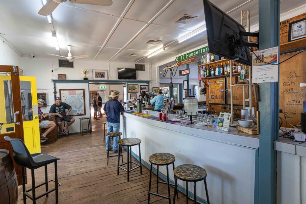
Originally called Carrangarra, the town’s name was changed to Tambo in 1868. The pub – still bearing the original name – was first built in 1865, has burned down three times, and once served as the post office. For the next 50 years, Tambo thrived as a service hub for the surrounding region. Today, it still has a strong pastoral industry alongside a growing tourism trade.
Tambo sits on the Barcoo River, 860km north-west of Brisbane in central Queensland, and it’s well worth a few hours to explore. You can wander its historic buildings, stroll the Coolibah Walk, check out the transport museum or drop into Tambo Teddies. The Visitor Information Centre has a brochure outlining 17 heritage sites, each with its own story. On the edge of town, the dam – built in 1880 as Tambo’s water supply until bores tapped the Great Artesian Basin in 1895 – now teems with native birds, fish and insects.
1
Local highlights
These days, Tambo is best known for Tambo Teddies – a local brainwave from 1992, when wool prices crashed and the town needed a new source of income. Thirty-three years on, more than 50,000 handcrafted bears have been sold around the world.
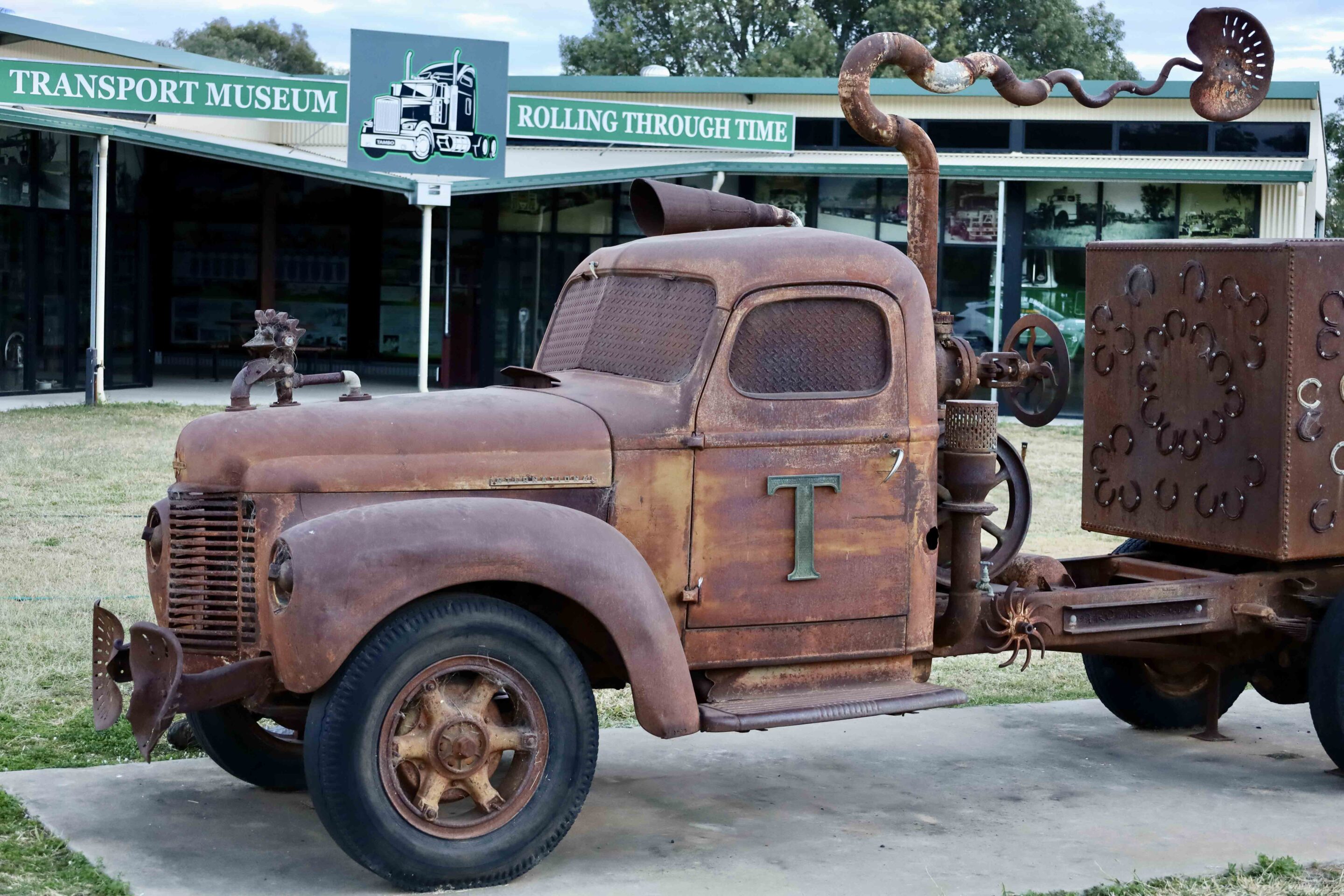
Just down the road, the Wild and Woolly Tambo Truck and Transport Museum was created in 2012 to celebrate the days when wool was king. Built around a 1944 Johnson Brothers freight truck, the display uses reclaimed materials from the district and is packed with memorabilia from the town’s long transport history. It charts the evolution of freight in the outback – from horse-drawn carriers of the 1860s, to the first motorised trucks of the 1920s, to today’s modern fleets.
1
The Wilderness Way
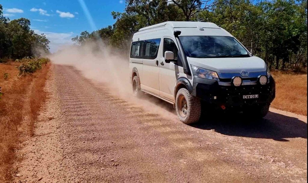
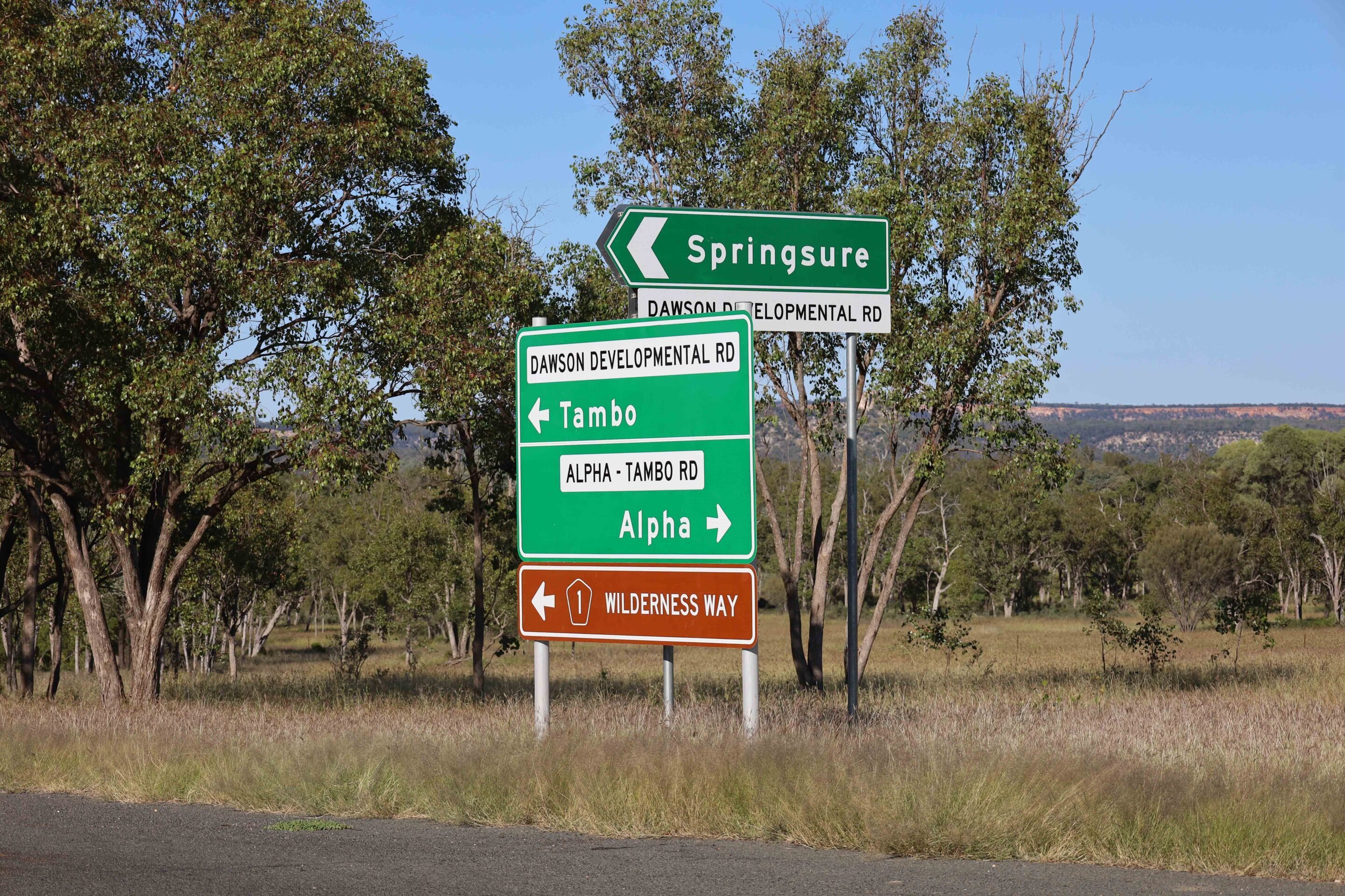
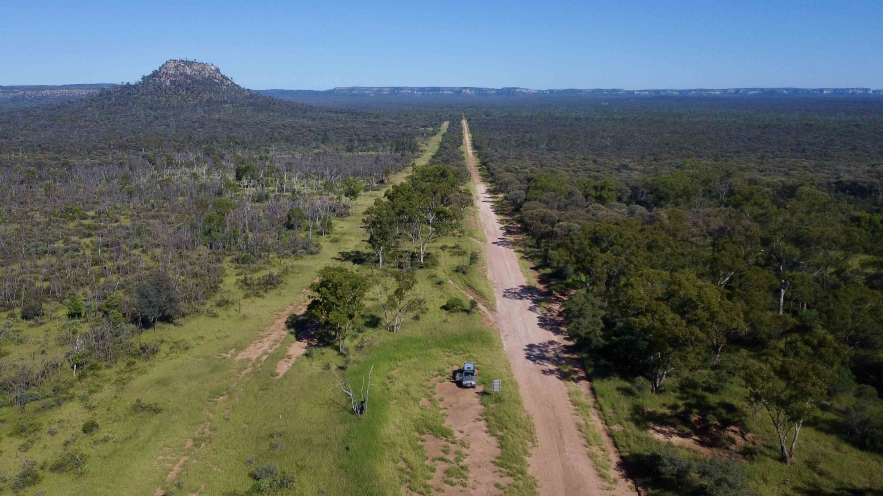
After a few hours in town, I set out on a scenic 4×4 run called the Wilderness Way, linking Tambo to Springsure 250km to the north. My starting point was Windeyer, 40km out of Tambo, where the Dawson Development Road turns right and the bitumen gives way to dirt.
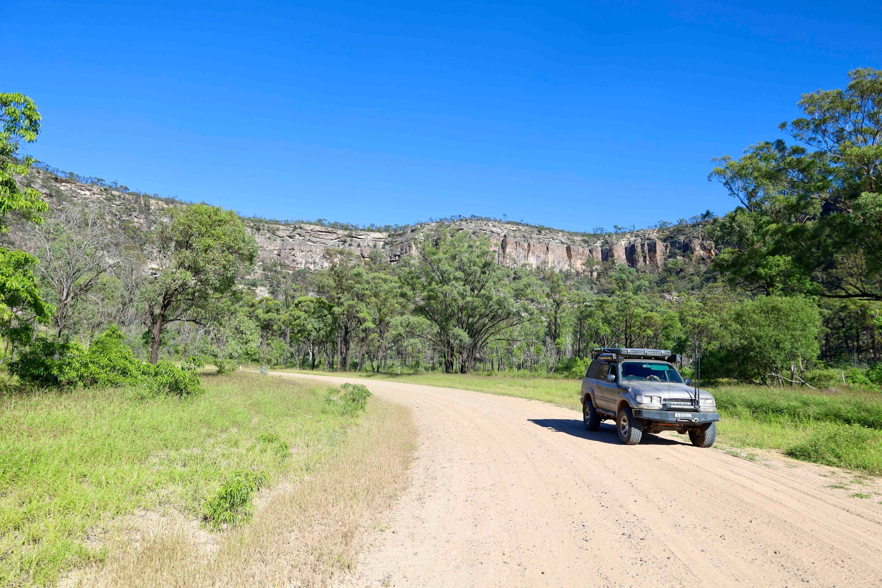
The route is often described as suitable only for high-clearance 4x4s – but on my run, the road was in top shape and barely a challenge. This self-drive tour skirts the western side of Carnarvon Gorge and Salvator Rosa National Park, offering spectacular views of sheer cliff lines, striking rock formations and rugged mountain country. Midway along, Bull Creek Vista is a great spot to stretch the legs, with views east to the sandstone outcrops of Autograph and Stool Rock, and a solitary pillar known as The Monument.
An hour further on, at the intersection of Cungelella Road, a monument marks where Major Thomas Mitchell passed through in 1846 while trying to unravel the mystery of Australia’s river system – and whether an inland sea existed. Mitchell named the nearby Salvator Rosa valley after a famous Italian painter, christened the Claude River, and identified the rich Mantuan Downs pastoral plains. Crossing those plains, he discovered entire petrified trees. His explorations also took him east, where he charted the Belyando and the entire Barcoo River system.
1
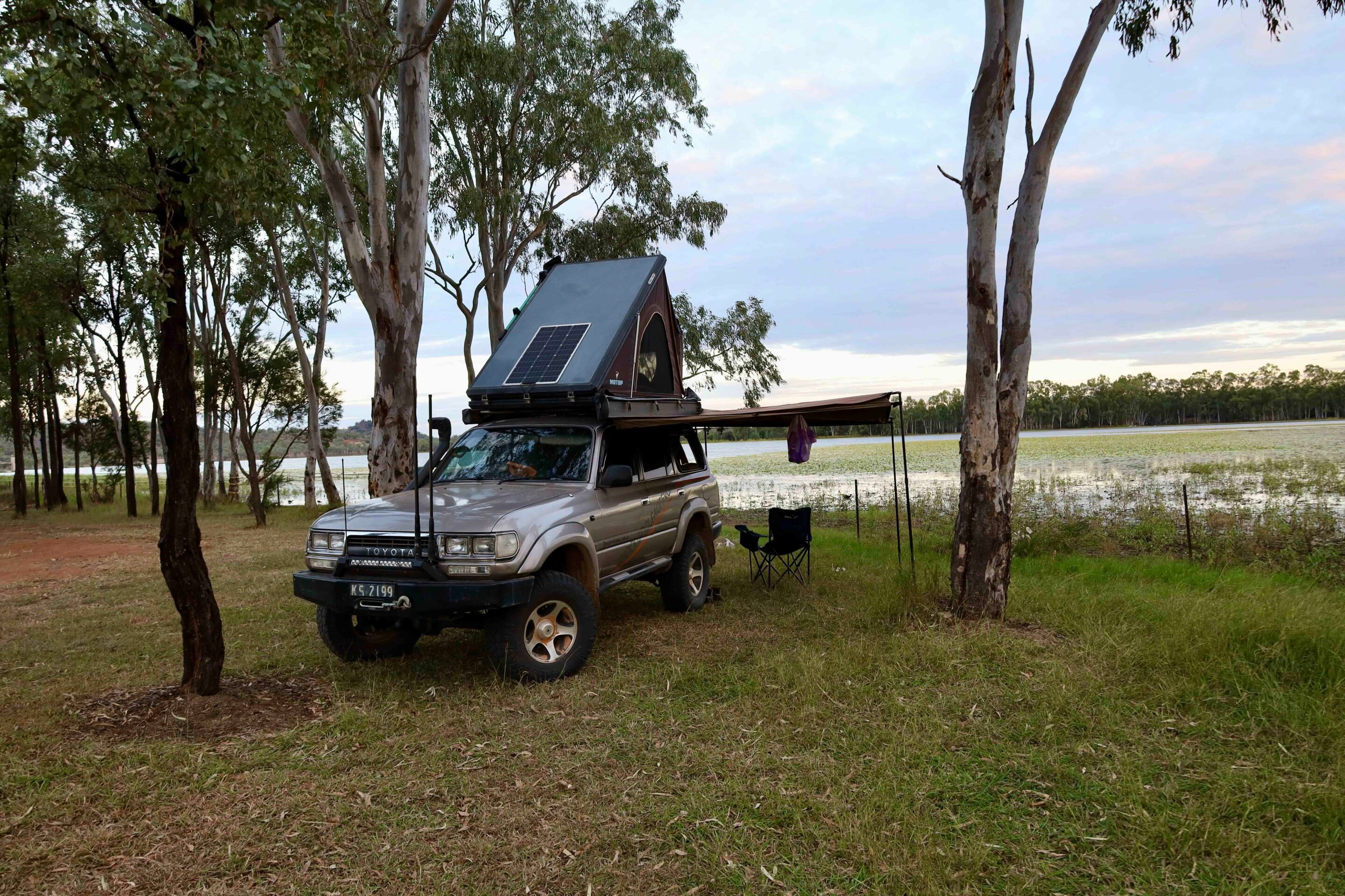
Cungelella Road leads into the remote Salvator Rosa National Park, where you can camp in solitude, tackle remote hikes and spot a wide variety of wildlife. For those heading off on foot, Queensland Parks asks hikers to complete a Remote Bushwalking Advice form and leave it with a responsible contact – the park’s rugged terrain and inhospitable country demand respect. One of its most remarkable features is the network of clear springs that feed more than 10 million litres of water a day into nearby creeks, seeping under the Central Queensland Sandstone Belt to form the headwaters of local rivers.
Heading back along the Dawson Development Road towards Springsure, the landscape opens into rolling pastoral country dotted with majestic bottle trees. Before long, the township comes into view, with plenty to see and do. Minerva Hills National Park offers sweeping views and the chance to see ancient volcanic plugs, while the Springsure Museum is crammed with 150 years of local memorabilia. You can even camp beneath the towering Virgin Rock and watch it dramatically lit at night.
I’ve only scratched the surface of this stunning stretch between Tambo and Springsure – there’s far more to uncover, from natural wonders and living museums of cultural history to some of the best remote driving roads central Queensland has to offer.
12
Essential information
Where
Tambo’s Wilderness Way is a remote self-drive route that can be tackled as a 270km loop or as an adventure drive between Tambo and Springsure in central Queensland. It can be done in a SUV in dry conditions, but a 4×4 is recommended – especially after rain, when sections may become impassable. Settled in 1863, Tambo is the oldest town in Western Queensland and a living museum of pastoral history. It’s located 580km west of Bundaberg on the Landsborough Highway.
Things to see
Tambo’s main street is lined with historic buildings, a transport museum and the oldest pub in Western Queensland. The Wilderness Way – known as the ‘Rooftop of Queensland’ – delivers sweeping views of deep gorges and towering cliff lines, with sharp sandstone ranges the highlight through Salvator Rosa National Park. Depending on your plans, you can camp in the park, push on to Springsure or loop back to Tambo. And while you’re in town, don’t miss the famous Tambo Teddies – handcrafted here since 1993.
More information
Tambo’s main street is rich in history, with information boards at nearly every heritage building. The Outback Queensland website has basic self-drive details for the Wilderness Way, or you can drop into the Tambo Museum at 10 Arthur Street for a deeper dive into the region’s past.
Follow 4X4 Australia on Google
Get more 4x4 news, reviews and gear stories from 4X4 Australia in your Google feeds.

We recommend
-
 Explore QLD
Paradise found: A 4x4 trip to K’gari (Fraser Island)
Exploring K’gari – the world’s largest sand island – proves every bit as rewarding as its reputation suggests
-
 Explore QLD
Discover Facing Island: Queensland’s coastal escape for campers, 4x4 enthusiasts and fishing lovers
Experience the perfect blend of camping, 4x4 trails, and fishing adventures
-
 Explore QLD
Moreton Island or K'gari (Fraser Island): Which one should you visit first?
Both are breath-taking, but which island paradise is right for you?