Opinion
Gallery 1
DO YOU remember what it was like navigating in the bush prior to the advent of global positioning systems?
As I recall it, using a topographic map, a compass and a ruler was sometimes a bit of a hit-and-miss affair, especially when trying to navigate in heavy scrub.
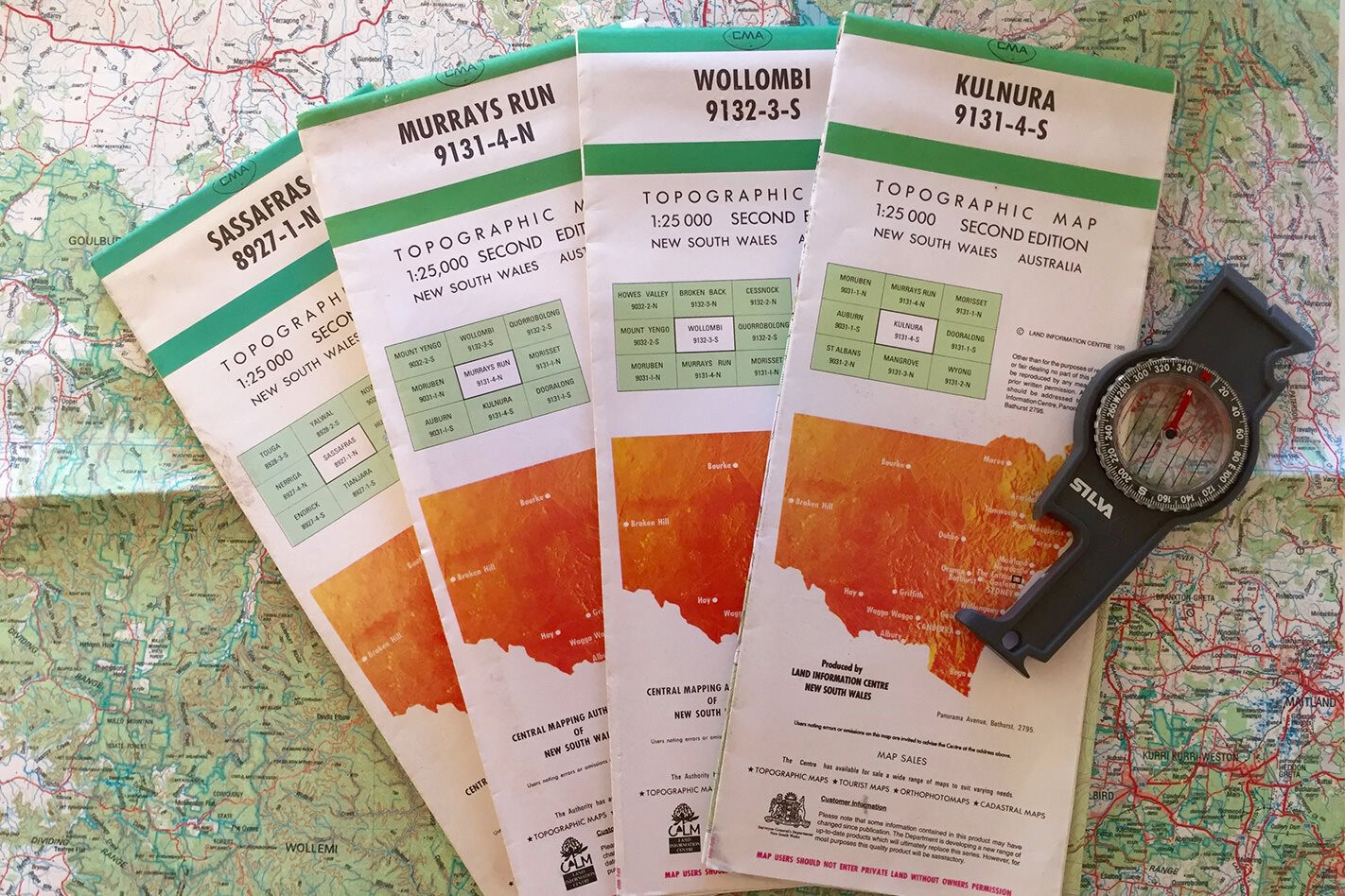
It could also be very expensive. Before heading off on a four-wheel drive adventure – even a short weekend away – you’d have to rifle through the filing cabinet to make sure you had all the topo maps covering the areas you intended to travel through.
If you were missing any maps, you’d then have to head off to your nearest map store and stock up, usually at a cost of around 10 bucks a map. Depending on where you were going you might need a couple of 1:100,000 topos and half a dozen 1:25,000 topos to even cover a relatively small area – so $80 or so later you could be on your way.
But hang on a tick. First you’d have to navigate your way to your intended off-road destination, which would involve using a series of road maps or a road atlas. Of course, due to their expense, you’d hang on to these for as long as possible, so they were usually out of date, meaning you’d often have to rely on your nous to get you through.
On top of these – and the topos – you might also have to throw in a few local visitors’ maps, some state forest maps and some Hema or Westprint Maps, as these would include additional useful information covering the area you were driving through.
With so many maps to carry you’d need a folder, folio or briefcase to store them, and it was always a good idea to put them in some sort of order prior to departure so you weren’t muddling through them once underway.
Once you finally made it to the off-road part of your trip, you could unfurl your brand new topo map on the bonnet of your 4×4 (assuming it wasn’t raining, dark or windy) to see exactly where you were. Unfortunately, even your brand new topo was likely out of date.
These maps were only revised occasionally and it could be more than a decade since they were last updated, so chances were that other than the topographic lines depicting the natural terrain, a lot of the other information might be incorrect, with missing tracks and various other features absent.
I don’t know about you, but I was always very particular with the way I handled my topo maps. But even taking extra care to make sure I folded them away correctly, they’d often start to wear on the folds – I still have a bunch of maps in my filing cabinet with holes worn through them from regular use.
These holes would, without fail, start to develop right at a critical junction of two tracks, ensuring the decision-making process would be as hard as possible when considering whether to turn left or right at the end of a long day of forging through the scrub.
I always considered myself to be reasonably competent when navigating with topo maps, a compass and a ruler. But I also recall the feeling of self-doubt creeping in on a regular basis when driving up an unfamiliar track that didn’t seem quite right – especially when leading a convoy towards the end of the day when everyone was hoping for a hot meal and somewhere warm and dry to spend the night.
These days we’ve got it easy – you don’t even need a dedicated GPS device. There are any number of apps you can download on your smartphone or tablet that will give you access to the latest topographic map, and they include various features so you always know exactly where you are and how to easily navigate to where you want to be. You don’t even need a compass or a ruler!
Just make sure you don’t drop your phone or tablet in a puddle of water, or the only place you’ll find yourself is up the proverbial creek.
Follow 4X4 Australia on Google
Get more 4x4 news, reviews and gear stories from 4X4 Australia in your Google feeds.