Explore VIC
Gallery 1
Unlike many other iconic Aussie 4×4 treks, this one straddles the Great Dividing Range almost mid-way between Sydney and Melbourne.
So for many people, getting there takes less than a day. The drive there is on bitumen roads, so there’s no punishment over thousands of kays of outback dust and corrugations just to get there.
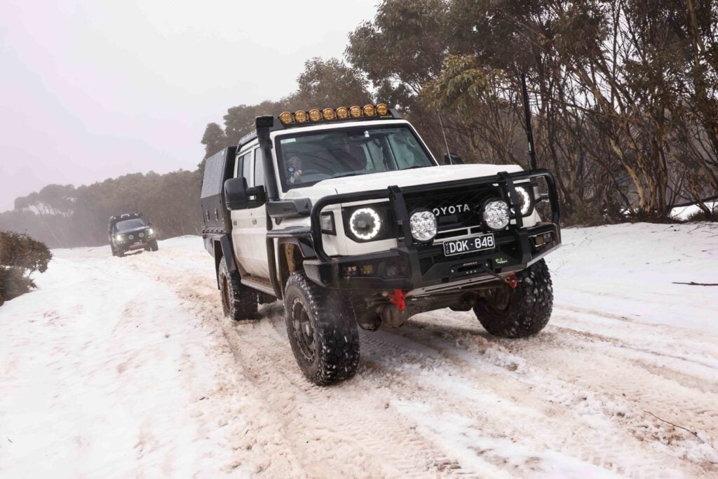
But make no mistake, as with any travel into arduous terrain, trip preparation should be thorough and with consideration of the conditions. In this part of the country it can snow any day of the year – yes, really – and being clay country, more than a few minutes of rain can turn tracks to soap, meaning you’re going nowhere for a day or three.
SNOWY’S ORIGIN Our Snowy River trek begins with a visit to Thredbo. Established in the 1950s as a ski resort within the Kosciuszko National Park, Thredbo is a crackin’ little year-round holiday village; it’s certainly not a ghost town in summer. It offers plenty of accommodation and – more our style – has campgrounds within an easy 10-minute drive.
Thredbo’s Kosciuszko Express Chairlift provides quick access from the village to the Snowy’s Main Range, where you can climb Mount Kosciuszko and begin your summit-to-sea adventure.
This relatively easy walk from the chairlift is around 10km return through some hardy alpine country – some years it’s snowbound for up to nine months – and allows you the opportunity to see the high altitude meadows, sphagnum soaks and trickles of water that are the origins of the Snowy.
From Thredbo, it’s a 40-minute drive along the Alpine Way to Jindabyne, but a worthwhile extra loop is to explore the area between Jindabyne and Charlotte Pass. Also a ski resort and another kick-off point for hiking to Mount Kosciuszko (a 16km round trek up the old section of Kosciuszko Road now closed to vehicles) the lookout at Charlotte Pass gives a spectacular view of the Main Range and is a terrific place to watch the sun go down.
From the back of the Smiggin Holes resort carpark, a 5km dirt road takes you toward Mount Blue Cow and Guthega, two snow-ski areas linked to Perisher and close to Guthega (also known as Munyang) power station. Completed in 1955, this is the first, highest and smallest of the Snowy Scheme’s power stations. It’s fed water from a dam on the Snowy River just below Guthega Ski Resort (a short drive from the power station) and with views of the pipes that feed it, is an easily visible example of the incredible engineering – dams, tunnels, pipes and power stations – of the Snowy Scheme that was built between 1949 and 1974.
There’s camping on the banks of the Snowy close to the site of Island Bend, a Snowy Scheme workers’ town in the 1950s. Unfortunately, the now-cleared town site – once also a good place to camp – is now closed to public access due to asbestos contamination. However, there are alternative sites nearby and camping is also available at the caravan park at Sawpit Creek.
Jindabyne Dam is the reason old Jindabyne now lies sunken beneath the waters of the Snowy a couple of kays from the present town. The statue of Strzelecki, a gift from the people of Poland to commemorate his climbing and naming of Mount Kosciuszko, gazes out over the lake.
If you have a bit of time, you can take another day trip along the Snowy River Way to the grazing town of Dalgety and have a beer at the pub – camping is available right next to the river.
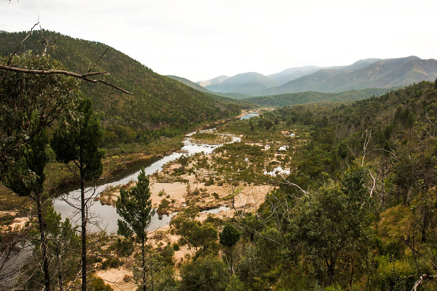
THE RIVER RUNS DEEP Jindabyne is your last opportunity to top-up tanks and tucker before the adventure continues. Find the Barry Way out of Jindabyne and you’ll soon be hugging the steep-sided valley as this twisty piece of dirt road again drops you to the Snowy.
Of course, grab 4WD in your vehicle at the end of the bitumen (around half an hour out of town) and it’s a great idea to take a few minutes at the lookout near the beginning of the ascent to drop tyre pressures – with no more bitumen until close to the coast, they’ll stay that way for the next few days – and take in more of the region’s commanding views.
The Snowy reappears just after its junction with Jacobs River, where there’s a campground. In fact, there are several campsites scattered along the banks of the Snowy as far as the border, which you’ll cross (where the Barry Way on the NSW side becomes the Snowy River Road) just before climbing out of the valley away from the Snowy and toward Victoria’s higher grazing land.
There, you’ll take a sign-posted left turn toward Little River and McKillops Bridge. The Little River Gorge is the deepest in Victoria and the view of the water – a trickle when we’ve visited – must be pretty good when it’s raging through. From there the road again becomes steep and narrow, at first following the gorge, then hugging other valley sides as it quickly drops to the Snowy. It’s a narrow, one-lane, winding, blind-cornered track that requires you to keep your eyes open for oncoming traffic. The blokes who built this road must have had genius, courage and toughness in equal parts.
Near the bottom of the valley there’s a track leading to Little River campsite, close to its junction with the Snowy. Further on, just before the bridge that shares its name, is McKillops Campground, where there are fireplaces, drop dunnies and a few areas to set up a camper trailer.
You will be able to cross the bridge and take a one-minute walk from the carpark to loll around in the Snowy (like we did) and wonder at what the springtime floods would have been like before the river was dammed upstream at Jindabyne 50 years ago.
IN LOW TO GET HIGH Until it was recently damaged by heavy rain and closed – possibly permanently, according to one local we chatted to – the Deddick Track began its steep climb up the mountains almost adjacent to the bridge.
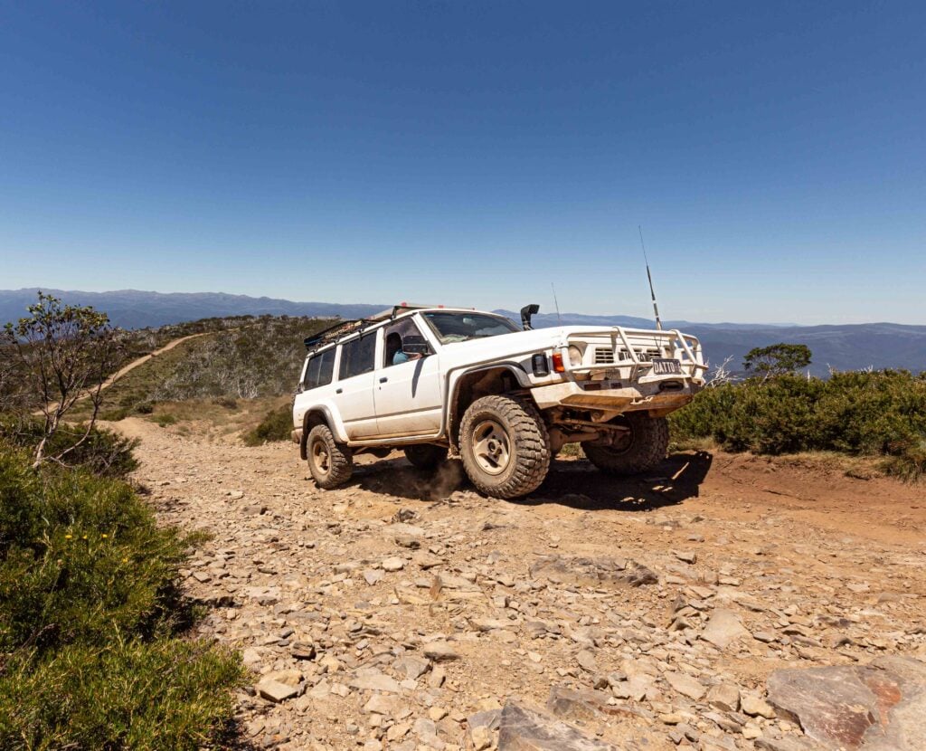
Since the landslip, access to this track is via Colling Road and then Bowen Trail. From here you’ll be in low-range almost immediately. And, over the course of the day, you will ascend the peaks and drop back into valleys several times exploring the stark terrain of quintessential Snowy River country.
Due to bushfires opening up the landscape in recent years, the views from the ridgetops are spectacular and it’s possible to see far further than when the bush was thick. Fire is an eons-old cyclical characteristic of the Aussie bush, but the unfortunate amount of weeds we saw – in many places taller than our vehicles – isn’t.
A day’s touring, much of it in low-range, through this terrain should have you finish your day close to Mountain Creek, a tributary to the Snowy (like all watercourses around here!) and a great little place to camp.
The banks of the creek offer a few flat but tight grassy areas to roll out a swag, set up a tent or pop open a roof-topper. If it’s warm, you can again wash off the dust by languishing belly-deep on the pebbly creek bottom with a cold drink, as we did.
Ironically, you won’t see much of the Snowy itself on this part of the trek as its course runs through gorges inaccessible to vehicles.
CLIMBING THE STAIRS We set up at Mountain Creek early and relaxed for an extra hour or two in the afternoon, as we knew we weren’t far from Mount Joan Staircase. This is a notoriously steep section of track that climbs about 500m altitude in just a few kays.
We had been forewarned by on-coming travellers of the steepness of this section of track and that there were a few loose sections dotted with broken rock. Sure enough, it’s a track that leaves little room for error. Rather than one punishing run, it can be driven in stages, as there are several flat areas between the steep sections where you can prop or wait for oncoming traffic to pass. Trackside signs suggest you radio for oncoming traffic before you commit to the climb. It’s good advice.
Once Mount Joan has been climbed, you’ll hit general forestry tracks for about 15km until the end of the Deddick Track. From here on, you’ll be driving on better-established Yalmy Road as you gradually lose elevation through equally stunning country.
There’s another opportunity to splash in the Snowy at Jackson Crossing. We didn’t stay, but there’s good Snowy-side camping in this area, too; the river banks are wide, but the approach track was quite over-grown when we visited. Crossing the river here can get you out to the Buchan Road.
Our campground for the evening was at the site adjacent to Raymond Creek Falls. With its ancient Kimberley-like blood-red rock, it’s a worthwhile walk and there’s a rock pool.
Continuing south, the Garnet Track meanders through forest from Raymond Falls, gradually dropping to more open country toward the coast. There’s Snowy-side camping available at Wood Point, around 20 minutes from Orbost.
The Snowy meets the sea at Marlo, not far from Orbost, and a beer at Marlo Hotel is a great finish to the Snowy River’s mighty 351km course.
SNOWY RIVER REVIVAL AFTER being dammed at Jindabyne in the late 1960s, the Snowy River choked. This once mighty river that carried much of the NSW snowfields’ spring-time melt to the ocean was reduced to just one per cent of its pre-dammed water flow. This water flowed from a drainpipe at Jindabyne Dam.
That, and the regretful use of non-indigenous willows to stabilise creek banks within its catchment, meant the Snowy was sometimes nothing more than a string of stagnant pools.
It’s incredible to think the McKillops Bridge was raised to reduce the chance of it being swept away again by another Snowy spring-thaw flood; a fate it suffered just weeks after it was built in the 1930s.
Thankfully, decisions have been made to eradicate the willows and increase the Snowy’s flow to around 25 per cent of its original flow. It will never be as healthy as it was in its natural, mighty pre-Scheme days, but it’s healthier now than it has been for four decades. There are now far less of the weeds, alluvial sand and slimy ponds that many of us recall on our first acquaintance.
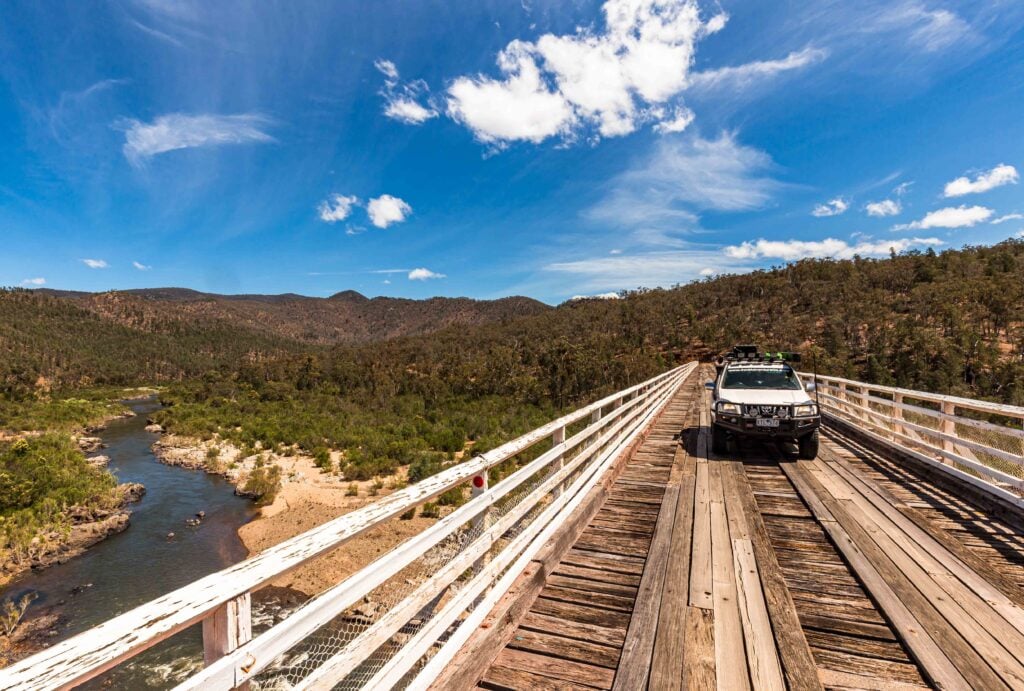
MCKILLOPS BRIDGE MCKILLOPS Bridge (and, before it was built, the ford across the Snowy) was once an important route for cattlemen. Just weeks after it was opened in 1934, the bridge was washed away by the Snowy River. The replacement had its deck raised on steel trusses on the reinforced concrete piers.
It’s difficult to imagine what the immense roar and rumble must have sounded like as the Snowy River, juiced up by the melting snows of the NSW High Country, swirled and ripped its way down this valley each spring.
However, the newer, taller bridge remains, having survived all the subsequent spring-time thaws. The bridge is heritage-listed due to its social and technological significance – the steel trusses’ arc-welded construction was high-tech stuff in the 1930s.
BRUMBIES OR FERAL HORSES? BANJO Patterson’s The Man From Snowy River was published in 1895. It summarised the exploits of several of the region’s expert cattlemen (most notably, Jack Riley) into one character and presented it to the suburbanites of Sydney and Melbourne.
The Man From Snowy River movie was released in 1982 and further cemented the horsemen’s folklore into the Australian psyche. It’s for these reasons some people wrongly believe horses are a natural or entitled part of the High Country landscape.
Chances are you’ll see some in Australia’s high country, especially in the areas of Kosciuszko National Park between the Brindabellas and Jindabyne, where higher, flatter terrain suits the wild horses more than the steeper valleys of Victoria.
Follow 4X4 Australia on Google
Get more 4x4 news, reviews and gear stories from 4X4 Australia in your Google feeds.