The Toyota HiLux flipped the script in July, replacing the Ford Ranger as the best-selling vehicle in Australia.
A total of 4676 Toyota HiLux units landed in driveways last month, placing the venerable ute above the RAV4, Ranger, Everest and D-MAX on the monthly charts. It’s an incredible feat considering the bones of the HiLux date back to 2015, despite facelifts and updates in the years since.
Overall sales for the Ranger (4×4 and 4×2 combined) dipped to 3930 units in July – a 20.0 per cent drop compared to July 2024. Looking only at the 4×4 charts, Toyota shifted 4000 HiLuxes and Ford sold 3696 Rangers.
The Kia Tasman continues to be in its infancy on the sales charts, with the launch of the vehicle taking place toward the end of July. Still, a total of 653 4×4 variants and 30 4×2 variants were registered for the month. However, August VFACTS results will provide a much clearer picture. The same can be said for the LDV Terron 9, with 102 sales secured since its recent launch.
Taking a look at the budget-focused brands, GWM appears to have taken a strong grip on that segment, with a substantial 870 Cannon 4x4s sold in July and 258 Cannon Alphas. It’s an impressive result, especially when putting it side by side with the JAC T9 (102 sales), KGM SsangYong Musso (155 sales) and LDV T60 (316 sales).
| Best-selling 4x4s in July 2025 | |
|---|---|
| 1. Toyota HiLux | 4000 |
| 2. Ford Ranger | 3696 |
| 3. Ford Everest | 2425 |
| 4. Toyota LandCruiser Prado | 2339 |
| 5. Isuzu D-MAX | 1818 |
| 6. Isuzu MU-X | 1635 |
| 7. Toyota LandCruiser 300 | 1406 |
| 8. Mitsubishi Triton | 1332 |
| 9. BYD Shark | 1233 |
| 10. Toyota LandCruiser PU/CC | 916 |
Toyota continues to dominate the sales charts, ending July with 21,722 sales – well ahead of its nearest rivals: Mazda (7452), Ford (7249) and Kia (7402). Year-to-date, Toyota has shifted 142,700 new vehicles, securing a commanding 20 per cent share of the market. In comparison, Mazda sits at 56,394, Ford at 54,579 and Kia at 48,152.
To put that in perspective, five of the 10 best-selling vehicles in Australia in July wore a Toyota badge: HiLux, RAV4, Prado, LandCruiser 300 and Corolla.
Continuing a familiar trend, the passenger vehicle segment is down 19.3 per cent compared to the same time last year, while both the SUV (+11.5 per cent) and light commercial (LCV) (+3.3 per cent) categories saw growth. Digging deeper, the PU/CC 4×4 segment rose 7.4 per cent for the month.
Plug-in hybrid vehicles are also enjoying a purple patch, with sales up 183 per cent year-to-date compared to 2024.
Until the Ranger PHEV arrives, the BYD Shark remains the poster child for PHEVs on the 4×4 charts. In July, a total of 1233 Sharks were sold, down from the 2993 sales registered in June. So far this year, a total of 11,657 Sharks have been sold in Australia. On the flipside, EV sales remain sluggish, accounting for less than eight per cent of new vehicle sales so far this year.
In total, 103,097 vehicles were sold in July – the strongest July on record.
| Best-selling 4x4s YTD (as of July 2025) | |
|---|---|
| 1. Ford Ranger | 30,367 |
| 2. Toyota HiLux | 26,245 |
| 3. Toyota Prado | 17,922 |
| 4. Ford Everest | 14,719 |
| 5. Isuzu D-MAX | 12,774 |
| 6. BYD Shark | 11,657 |
| 7. Mitsubishi Triton | 9539 |
| 8. Isuzu MU-X | 9453 |
| 9. Mazda BT-50 | 7131 |
| 10. Toyota LC79 | 6182 |
His arrogant attitude would give anybody a bad name under any circumstance.
But the fact that he was towing a trailer across the Simpson Desert, and was bogged in the middle of a wet claypan, only exaggerated the idea that many people believe trailers are a pain and should be banned. Most of all, those people believe anyone towing a trailer should get out of the way of the ‘real’ four-wheel drivers – the ones who never tow trailers anywhere, yet somehow still consider themselves experts at towing and trailers in general. I’m not one of them, and I’m sure I’ll ruffle a few feathers with my stance.
For the last 40-odd years, I’ve been towing trailers whenever we head off on a long trip – whether that’s into the desert, along a beach, through the Victorian High Country, or anywhere in between. Thinking about it, back when I was in the Army, I was towing trailers through the desert in the 1970s, so that makes it close to 50 years of experience in all sorts of environments.
If you have a trailer, you need to change your attitude and understand your limitations – both with the trailer and the environment you’re driving in. You also need to know what changes to your driving style are required when you’ve got a trailer on the back. There are times when you may need to leave the trailer behind – like on the Ingeegoodbee Track in the far east of the Victorian High Country. Still, there are plenty of places a trailer will go, regardless of what the naysayers reckon.
Over the last couple of years, I’ve joined my son on trips across the Madigan Line in the Simpson, through the deserts of WA, and along the toughest trails on Cape York – with trailers on the back of nearly every vehicle in our small convoys.
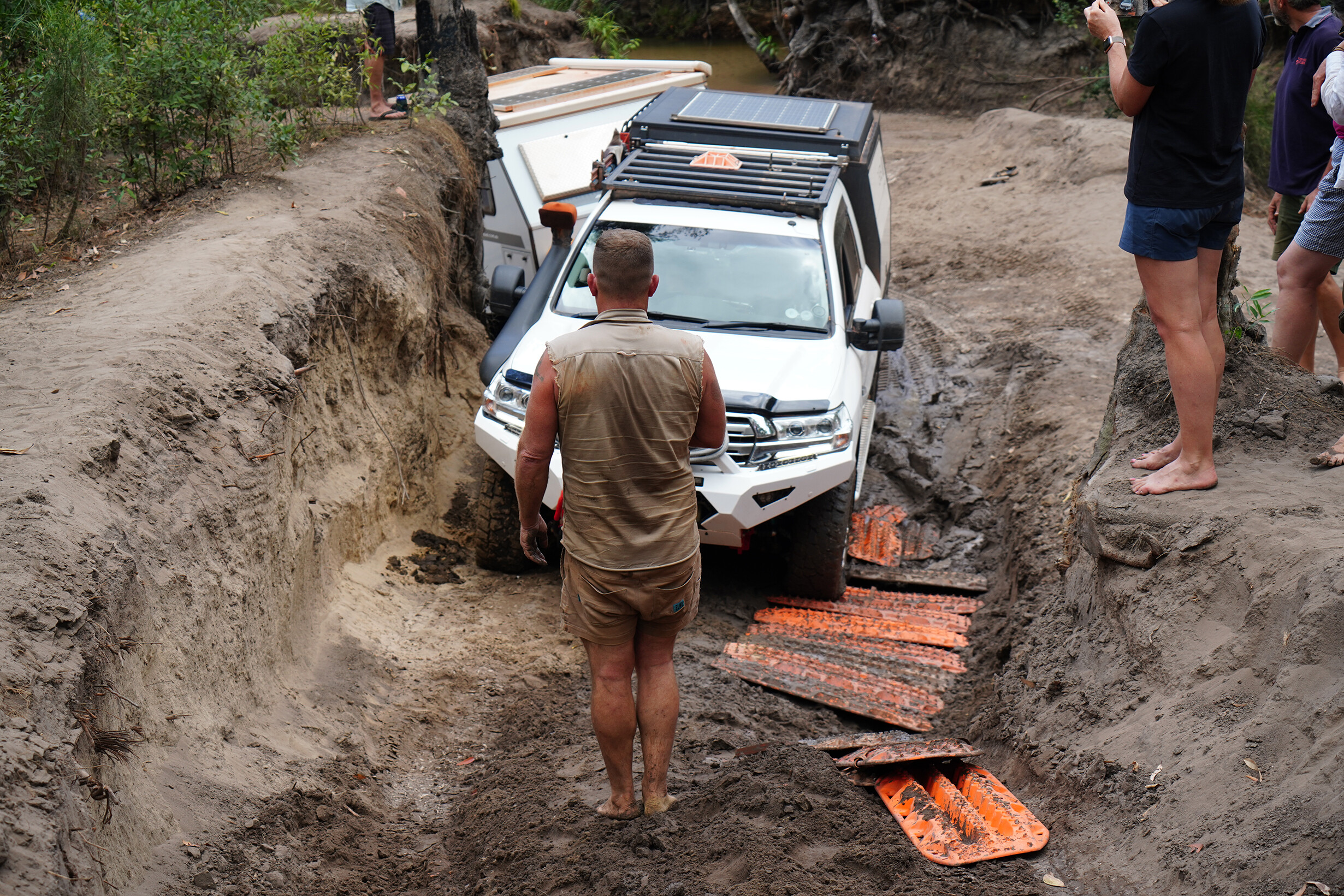
Not only have we traversed these iconic tracks, but with low tyre pressures and the use of shovels and MaxTrax on numerous occasions, we’ve managed to get through with minimal wheelspin. In the case of the Simpson, we’ve actually left the track in better condition after going over a dune than it was before we came along. That’s no bull.
On the Cape, we’ve done far less damage to the tracks with trailers on than the often-seen hoons – V8s roaring, big mud tyres spinning, tearing up the approaches to crossings like Gunshot and Cannibal Creek. They’ve never heard of ‘slow and steady’ – and if they have, that kind of behaviour does little for their ego, which in most cases is much bigger than their brains.
So, before you head off with a trailer on the back, it might be worth doing a towing course and learning how to reverse – and practising that often. Sooner or later, you’ll be caught at the dead end of a track where you might not be able to turn around.
Learn the limitations of your trailer, how it cuts corners, and how best to recover it if the need arises. A set of MaxTrax might just be the thing that gets you out of trouble. Drop your trailer tyre pressures. We often run them considerably lower than the tow vehicle’s, but it depends on the trailer’s size and weight. Start at 20psi and don’t be afraid to go lower.
So, what happened to old arrogant mate? We offered help – water and a sat phone – but he wasn’t having any of it. We left him to his own devices, although some other travellers – more generous with their time – were already helping.
I guess he eventually made it to Birdsville. Hopefully, he learned a lesson or two.
Kia’s new Tasman ute has made waves as a contender in the dual-cab market, but the bigger story might be what comes next.
The industry has started to speculate that Kia could follow it up with a proper 4WD wagon built off the same rugged platform. If that happens, it could challenge the Prado, Everest and MU‑X.
Kia has already hinted that the Tasman’s ladder-frame chassis was built with more than just a ute in mind, which suggests a wagon version would clearly be on the cards – it would just need support from enough global markets to make it viable.
What it could be
Think Everest or MU‑X and you’re on the right track. The Tasman platform is tough, so building a seven-seat wagon on top of it makes sense. The idea would be a family tourer with real off-road ability including coil springs at the rear, low-range, 3.5-tonne towing and potentially a rear locker.
Design-wise, it would likely share the front end with the ute. Expect good boot space, decent third-row room, and proper roof load limits – all the basics you’d expect from a serious touring wagon.
Powertrain: diesel first, hybrid later
The safe bet is that Kia would carry over the Tasman’s 2.2-litre turbo-diesel. It’s not a powerhouse, but it’s proven and makes decent torque (440Nm) for towing and touring.
There’s also talk of a 2.5-litre petrol turbo, and if emission rules tighten further, hybrid power could follow. Kia already has the tech, and NVES targets in Australia could force its hand. Would we like to see a bigger diesel? Sure. Will we get it? Probably not.
Off-road cred
The Tasman ute already runs a full-time AWD system with selectable terrain modes, and it’s been tested extensively in the Aussie outback. There’s no reason an SUV version wouldn’t follow suit.
What we can expect:
- Full-time AWD with selectable low range.
- Coil-sprung rear for better comfort and articulation.
- 3500kg towing.
- At least one locking diff (rear).
- Off-road angles similar to Everest or Prado.
Interior and tech
The Tasman’s dash has already moved away from the usual work-truck look, and the SUV version would likely go even further. Expect all the fruit: wireless phone connectivity, decent storage, and possibly a 230V inverter option for touring setups. The key will be keeping it practical – proper tie-down points, usable cargo space, and minimal glossy surfaces that scratch the first time you throw a fridge slide in the back.
Will it be called the Tanami?
“Tanami” was actually one of the names floated for the ute during early development in Australia, before “Tasman” won out. It wouldn’t be a bad fit for the SUV, especially if Kia wants to lean into the outback touring angle. But nothing’s locked in yet.
When could it arrive?
The SUV hasn’t been confirmed, but insiders say it could be fast-tracked. If the Tasman ute sells well, and if enough global markets like the idea, Kia could have something ready by around 2028. Earlier if they push hard.
The Simpson Desert doesn’t care about your vehicle’s badge, spec sheet or country of origin. It doesn’t matter if it’s a hybrid, electric or runs on orange peel.
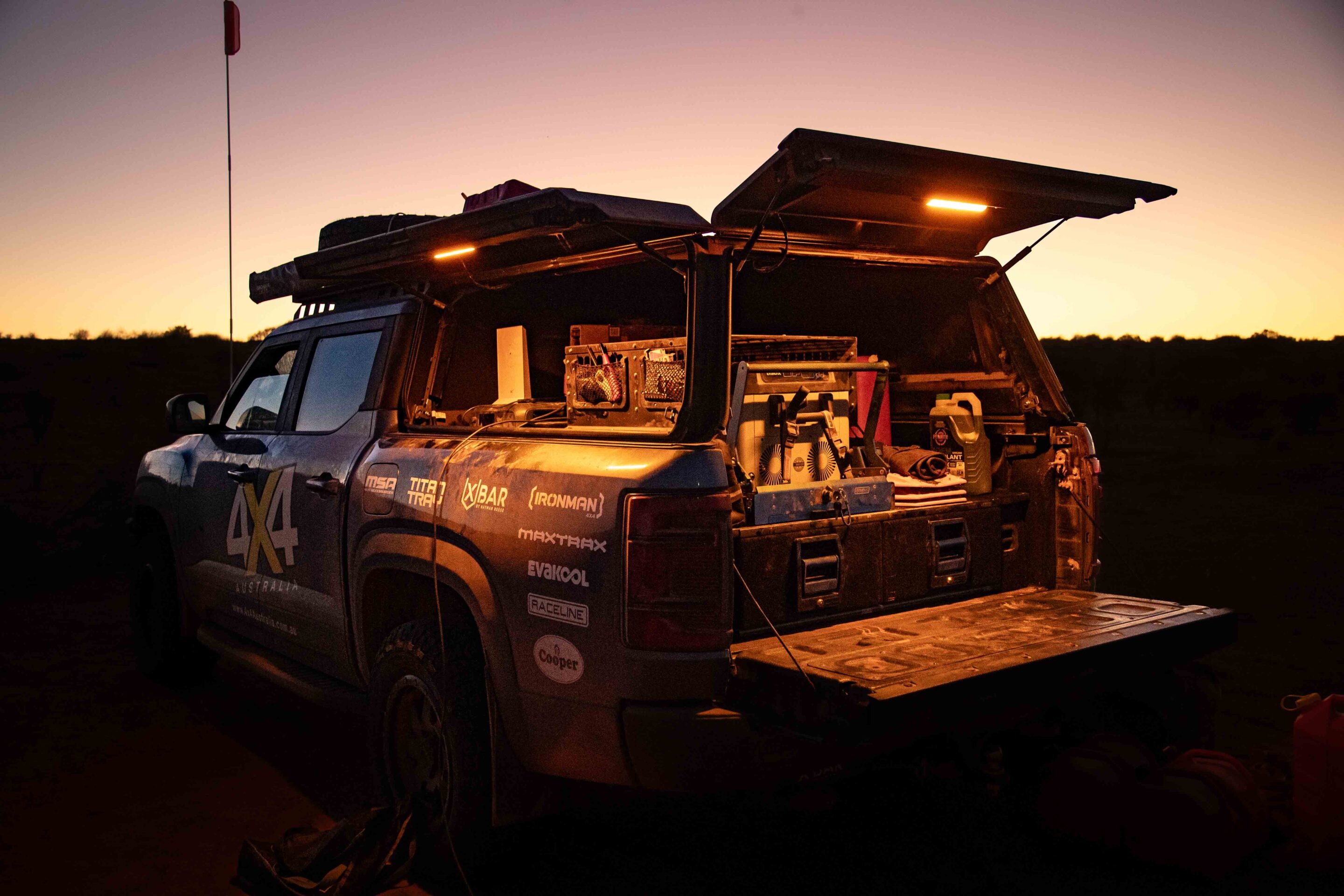
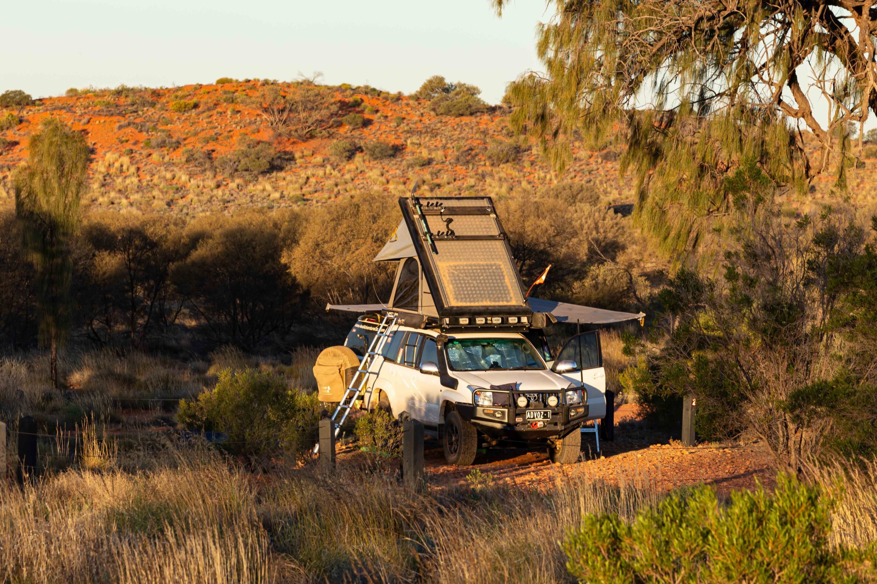
As the largest parallel sand dune desert on Earth, the Simpson has been luring off-roaders into its sandy embrace for decades. So when I announced I’d be taking the BYD Shark across it, let’s just say a few eyebrows were raised. But this trip wasn’t just about me. The real story was setting up BYD’s hybrid AWD ute as a self-sufficient tourer – and seeing if it could handle a full crossing of the Simpson Desert.
To give the BYD a fighting chance, it was fitted out with a range of touring and recovery gear. Ironman 4×4 supplied the bullbar, suspension upgrade, recovery points and driving lights. The build also included Cooper tyres on Raceline wheels, a Utemaster canopy, MSA drawers and DropSlide, a 65-litre Evakool fridge, ICOM UHF radio, Hayman Reese X-Bar, ROLA Titan Tray roof rack, and a set of Maxtrax.
As a precaution, I added our kitted LandCruiser 79 Series to the convoy for back up with my mate Max behind the wheel. He’s a LandCruiser tragic and one of the few people I trust when it comes to remote travel. We’ve spent plenty of nights under the stars, bogged in sand dunes and fixing gear in the middle of nowhere. This time though, we had a new adventure: Melbourne to Mount Dare, then across the French Line to the QAA Line – a full Simpson crossing with two very different rigs.
JUMP AHEAD
- Fuel economy tested
- Into the Simpson Desert
- Wading through Eyre Creek
- Comfort versus capability
- Final verdict
- Specs
Fuel economy tested on the road to the Simpson Desert
We rolled out of Melbourne with the BYD Shark and the 79 Series running side by side. First stop: Adelaide – a solid shakedown run and a chance to gather some real-world fuel economy figures.
At urban and regional speeds, the BYD Shark impressed, returning 14.5L/100km compared to the Cruiser’s 15.5L/100km. Pretty close, but the Shark’s hybrid system handled stop–start traffic far more efficiently. I’ll be honest – at times, the Shark made the Cruiser feel like a lumbering old tractor.
Once we hit the Stuart Highway and started cruising at 110–130km/h, the cracks began to show in the BYD’s performance. The Shark’s fuel consumption climbed, peaking between 20-23L/100km. It wasn’t entirely unexpected — hybrid systems like BYD’s aren’t optimised for long-distance, high-speed highway runs. Once the battery ran low, the petrol engine was doing all the work — and you could feel it.
Still, by the time we pulled into Mount Dare — that iconic last pub before the sand begins — the Shark was holding its own. Unconventional? Absolutely. But dead in the water? Not yet.
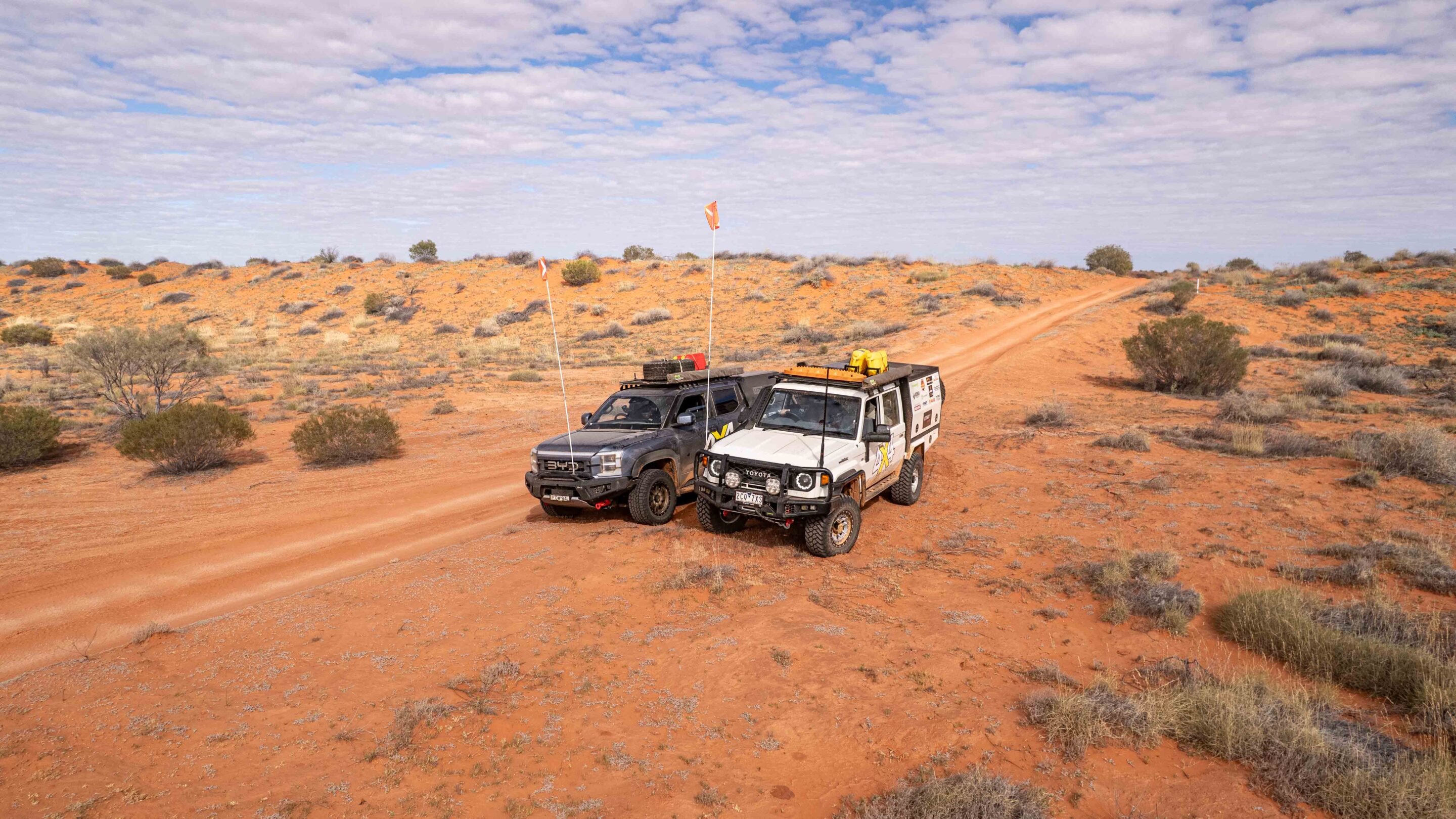
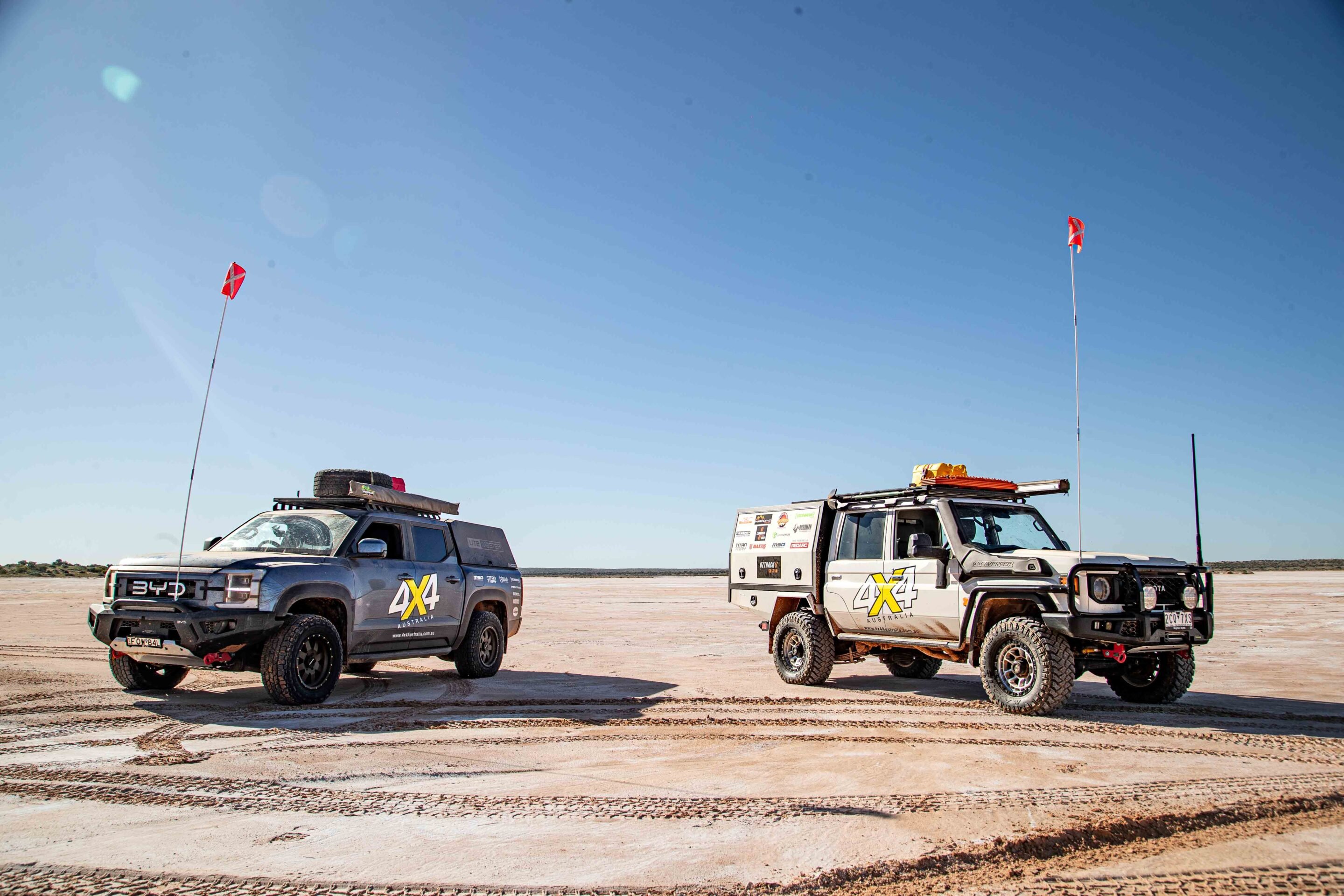
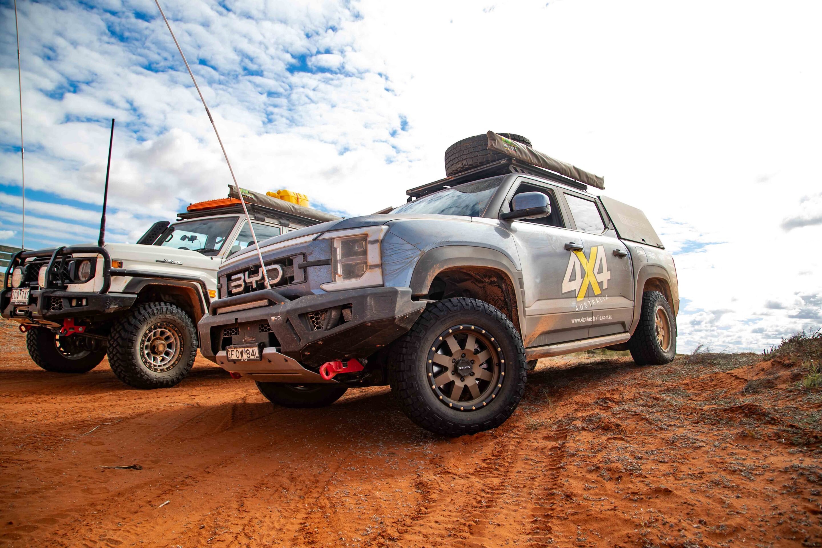
BYD Shark vs Toyota 79 Series: Simpson Desert showdown
At Mount Dare, we loaded up with 10 jerry cans of fuel – a mix of petrol for the BYD and diesel for the Cruiser – plus spare tyres, recovery gear, fridges packed with supplies, a month’s worth of Victoria’s Best, and just enough confidence to give it a red-hot crack.
Tyre pressures were dropped to around 20-25psi in preparation for the soft, sandy tracks ahead. The first stretch from Mount Dare to Dalhousie Springs was rougher than we remembered. Deep ruts, sharp rocks and heavy corrugations quickly made it clear that the Shark’s lower ground clearance was going to be its Achilles heel.
The battery pack mounted under the chassis doesn’t leave much room to play with, and we had a few tense moments scraping and nudging our way over obstacles. It even got hung up in the sand – so we rolled on with fairly low expectations.
The BYD’s electronic traction control proved to be another weak point – it sometimes got confused in the loose sand. Momentum was critical for dune climbs; if you stopped halfway, you were digging holes in no time. Max got into a rhythm in the Cruiser, pulling ahead to spot me through the trickier sections and occasionally laying down Maxtrax to give the hybrid a fighting chance.
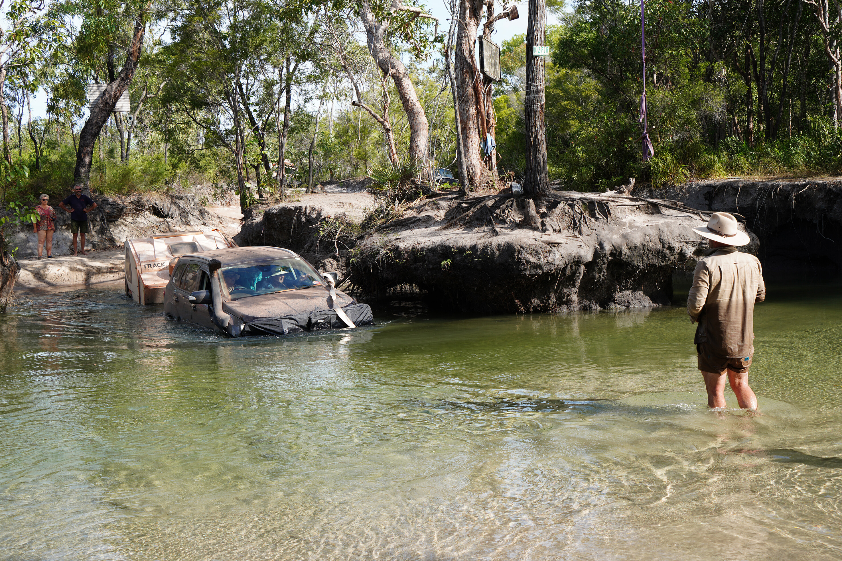
Wading through Eyre Creek: Tackling a water crossing
With floodwaters from further north pushing down through the Simpson in the weeks before our crossing, we expected lower water levels at the Eyre Creek bypass.
As always, Mother Nature had other ideas. What looked like a straightforward water crossing quickly turned into a nerve-racking test of will – and waterproofing. First up was the trusty LandCruiser. It’s a proven desert beast – but even it wasn’t immune to the deepening waters at Eyre Creek. The good old tractor turned submarine for a moment, with water lapping over the bonnet before it climbed out the other side. A solid reminder that no matter how prepared you think you are, the desert always has a curveball up its sleeve.
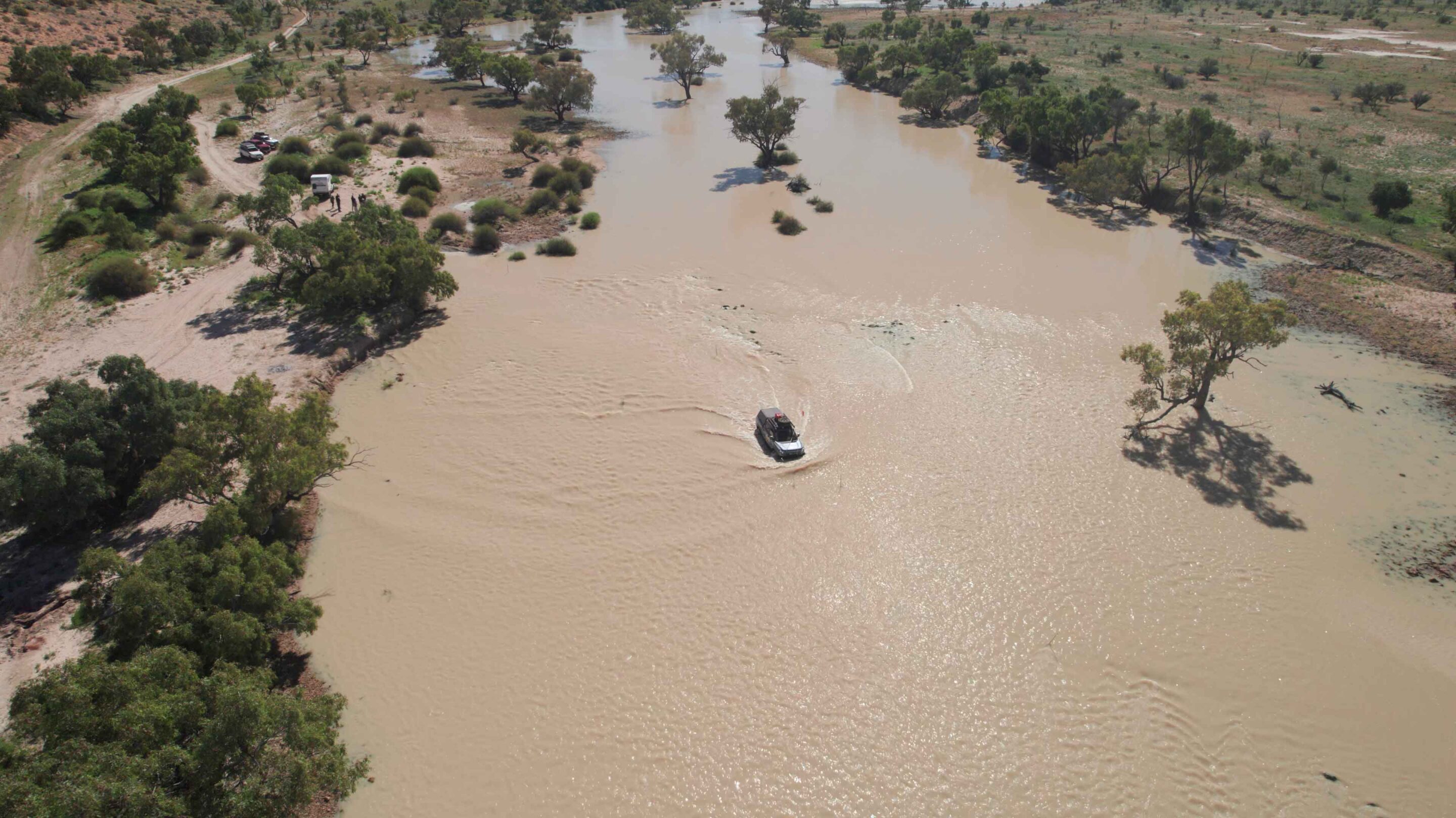
Then came the BYD Shark. I’ll admit, I was a little nervous. A hybrid off-roader with a claimed wading depth of 700mm? It sounded like a recipe for disaster. But after walking the crossing and finding a solid line, I thought, let’s give this a go. Just to be safe, we hooked up a soft shackle and snatch strap to the front – ready to go in case things got sketchy.
I entered the water with my heart in my mouth, watching it rush over the bonnet, but the Shark kept its cool, effortlessly driving the crossing. I made it to the other side without needing a swim, much to the amazement of the cheering crew on the other side. It felt like an absolute win!
Beyond that crossing, the Shark proved itself in the desert as a proper 4×4. Sure, it doesn’t have a massive fuel tank, but with a fuel economy of around 20L/100km, it proved more than capable of keeping up with the big boys. And comfort? Let’s just say if I had to choose between the LandCruiser’s rattling interior and the Shark’s plush ride, I’d be hopping into the Shark every time. The sound system is better than anything I’ve heard on the tracks, and don’t even get me started on the seats… it’s like driving a luxury SUV while tackling Big Red.
Speaking of Big Red, the Shark made the tallest dune in the Simpson look like child’s play. We’d driven up that dune before, but with the Shark, it felt like you could’ve done it blindfolded. The instant torque off the mark meant it climbed everything without breaking a sweat, drawing a small crowd of surprised onlookers at the summit.
“Didn’t think I’d see one of those up here,” one bloke laughed. Me neither, mate. Everyone commented on how easy it made it look. The only time we got stuck was when we deliberately tried to crawl as slowly as possible – just to test the limits. And even then, it felt like the Shark was laughing at us.
The real kicker, though? The Shark’s off-road mode keeps the engine running until the battery charges to around 70 per cent, so you’ve got maximum power on tap when you need it. It’ll maintain that battery level while cruising, ensuring there’s always a burst of electric torque ready to launch you across a dune or through a tough section.
| Fuel consumption through the desert (L/100 km) | |
|---|---|
| Toyota LC 79 Series | 17.6 |
| BYD Shark | 25.2 |
Comfort vs capability: Electric ute or LandCruiser?
The LandCruiser was everything we expected – a reliable workhorse with a GVM upgrade, canopy, lithium power system and heavy-duty storage.
But after hours behind the wheel, it was also, frankly, punishing. Max’s Terrain Tamer suspension seat helped take the edge off, but the old Cruiser’s ergonomics are what they are – basic and unforgiving. The BYD Shark, on the other hand, was plush and quiet, with that excellent sound system making long stretches a pleasure. When the going was smooth, it was hands-down the nicer place to be. But the further we pushed into remote country, the more cautious I had to be.
Coming out of the desert, the Shark’s electric parking brake developed a fault, which knocked out some of the EV drive modes and disabled cruise control. We jury-rigged a solution – with Max setting the pace in the Cruiser so I could match his speed and keep things consistent.
Final verdict: Did the Shark conquer the Simpson Desert?
The BYD Shark did it – and did it while averaging around 20L/100km, putting it right on par with a traditional 4×4.
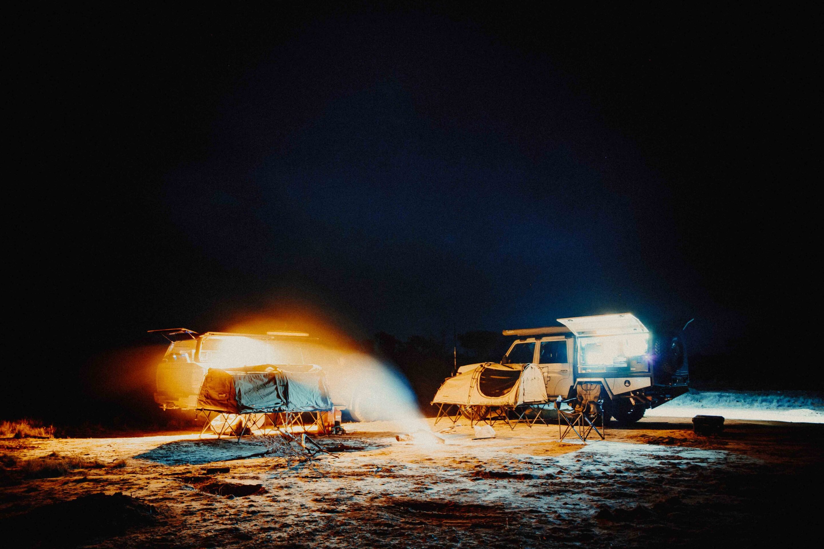
It crossed the Simpson, tackled a river crossing, climbed countless dunes, survived nights under the stars, and endured enough flies to fill a 65L fridge – all without a major failure. Would I recommend it for a solo Simpson run? Not just yet. The hybrid system still has some limitations for long-range remote travel. Ground clearance, traction control calibration, accessory power management – and that parking brake fault – all need to be addressed before you’d confidently trust it that far from help.
As a first hybrid contender for remote touring, I’m genuinely impressed by the Shark. Technology moves fast. Just two years ago, a trip like this wouldn’t have been attempted in anything but a traditional internal combustion 4×4 – but now, we’re having the conversation. And that’s exciting.
The future of off-road touring in Australia isn’t just diesel vs petrol anymore – it’s hybrid vs electric vs whatever comes next. The BYD Shark has thrown its hat in the ring and made it across the desert.
That’s no small feat. And yes – I guess you can now say the Shark does swim.
Specs
| Price | $57,000 |
|---|---|
| Engine | PHEV; turbocharged petrol engine with electric motors front and rear |
| Capacity | 1.5L |
| Max power | (ICE) 135kw, (EV) 130kw (front) 150kw rear |
| Max torque | (ICE) 260Nm, (EV) 310Nm front, 340Nm rear |
| 4×4 system | Individual between front and rear wheels |
| Construction | 4-door ute on ladder frame |
| Front suspension | Independent, double wishbones with coil springs |
| Rear suspension | Independent, double wishbones with coil springs |
| Tyres | 265/65R18 on alloy wheels |
| Kerb weight | 2710kg |
| GVM | 3500kg |
| GCM | 5750kg |
| Towing capacity | 2500kg |
| Payload | 790kg |
| Seats | 5 |
| Fuel tank | 60L |
| ADR fuel consumption | 2.0L/100km |
| Approach angle | 31 |
| Ramp-over angle | 17 |
| Departure angle | 19.3 |
| Ground clearance | 230mm |
| Wading depth | 700mm |
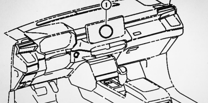
Instagram account @cars_secrets has shared leaked images showing what it reports to be the interior of the next-generation 2026 Toyota HiLux.
The Instagram post, translated to English from Arabic, says: “Patent images of the fourth-generation all-new HiLux have been obtained, with the official unveiling expected in November 2025 in Thailand”.
While nothing is official yet, these pictures suggest a much-needed update, with a focus on better technology and a more practical layout. The biggest change appears to be the addition of two 12.3-inch screens – one for the driver’s instruments and the other for infotainment. That’s a big step up from the current HiLux’s smaller 8.0-inch screen, and it should help to modernise and simplify the cabin.
The system may run the same infotainment software found in the latest LandCruiser Prado – something already available in HiLux models overseas but not yet here in Australia. The dashboard design also borrows styling cues from the Prado.
Earlier spy shots suggest this next HiLux won’t be a complete redesign but more of a solid facelift. It should keep the current platform and much of the cabin’s structure, but with sharper headlights, a new grille and bumper, updated tail lights, refreshed wheel arches, and new wheels.
Under the bonnet, the reliable 2.8-litre turbo-diesel engine is expected to stay on, but with tweaks to improve emissions and performance. Electric power steering is also likely to be introduced, which will help support newer driver-assist features.
One of the more interesting speculations is the arrival of a plug-in hybrid (PHEV) variant, probably using a 2.5-litre petrol-electric setup similar to the RAV4 PHEV. This would join the diesel and mild-hybrid options, helping the HiLux keep pace with other PHEV utes like the Ford Ranger and BYD Shark.
Full details will be revealed closer to its global debut, expected later this year, with Australia likely to see the new HiLux early in 2026. If these leaks are on the mark, the next HiLux will bring a much-needed tech upgrade and fresh styling – both crucial to staying competitive in the tough ute market.
The leak comes courtesy of Instagram account @cars_secrets, a popular Middle Eastern page known for sharing early automotive leaks and spy shots – especially of Toyota and other Japanese brands.
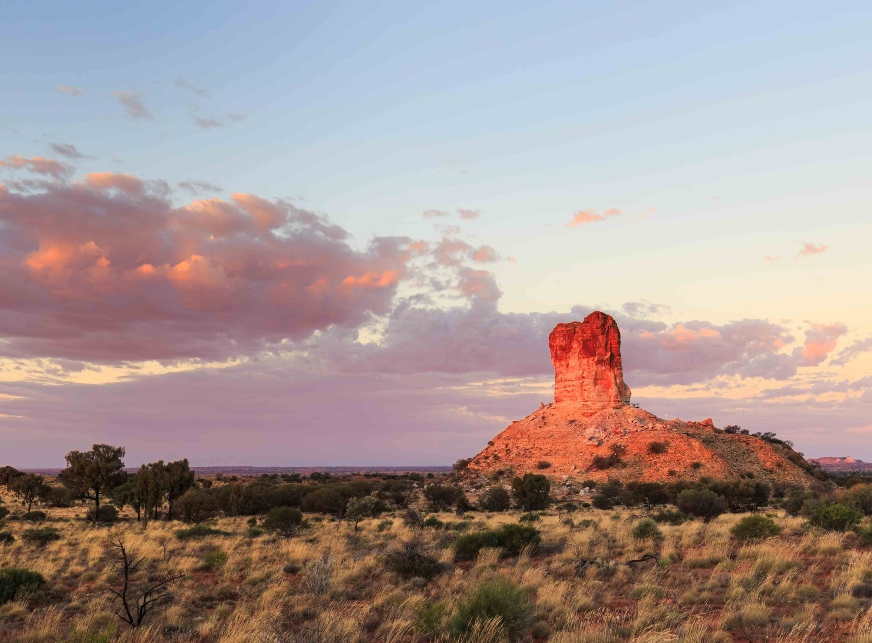
Explorer John Stuart first sighted the sandstone column in 1860. Towering 50m above the surrounding plain, he decided to name it after a mate who contributed to Stuart’s travel fund, James Chambers.
It has remained a significant landmark on the edge of the Simpson Desert ever since and many passers-by have tagged the rockface as a record of their visit. Thankfully, this practice is no longer permitted, as seeing ‘Craig & Shazza’ carved next to ‘WM HAYES’ just doesn’t look right.
Alice Springs is the hub of the Red Centre and is a great place to fuel up, stock up and wash up. On leaving Alice, follow the signs towards the airport and turn right onto Maryvale Road. The bitumen stretches for 35km now, much more than on my last trip this way, but that doesn’t make this adventure any less exciting as Chambers Pillar is an outstanding destination in the Red Centre. It is a spectacular site enjoyed by explorers, pastoralists and graffiti artists since Stuart first discovered it, and I was looking forward to revisiting it.
Following the Old Ghan: Maryvale Road to Chambers Pillar
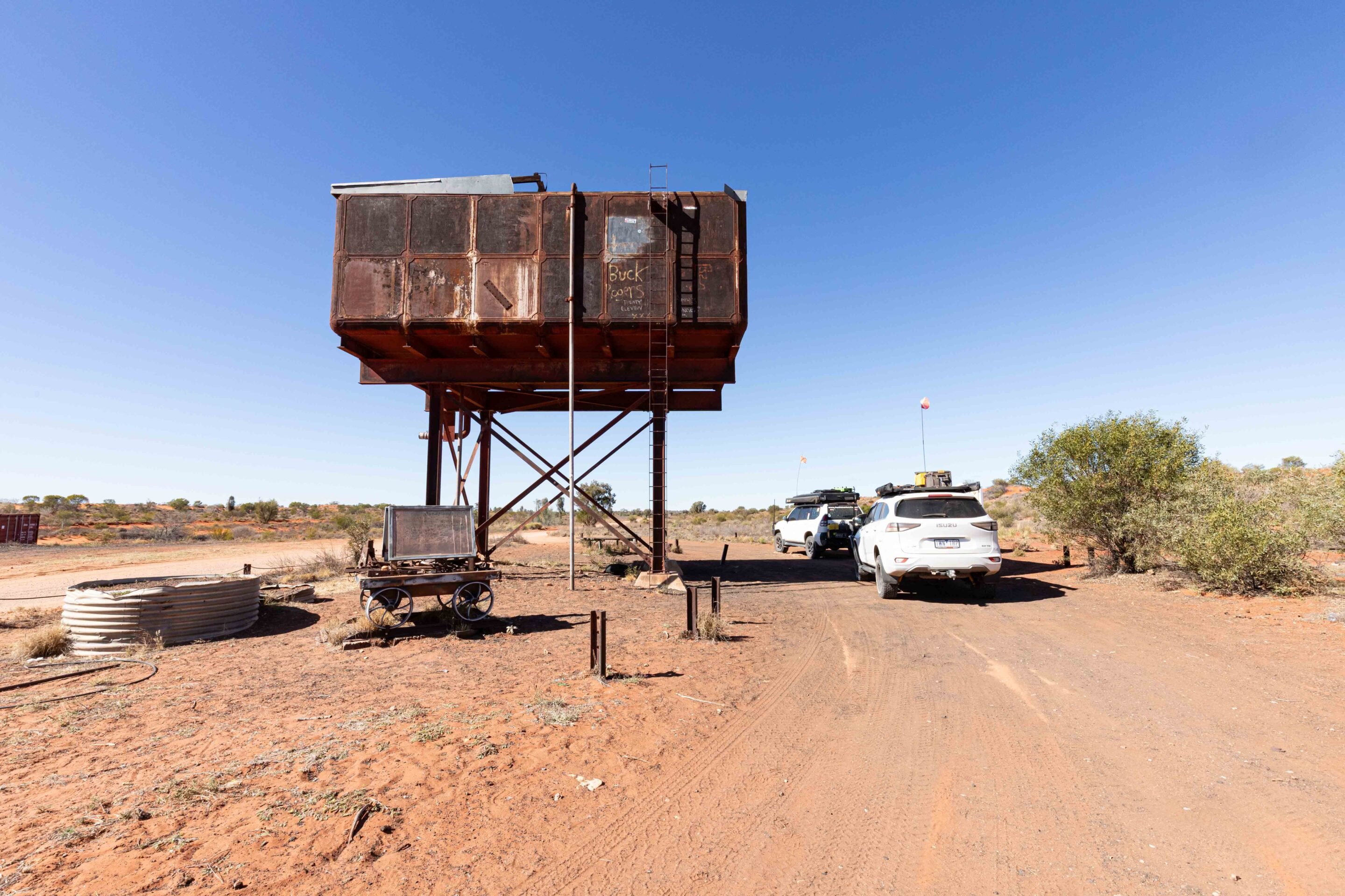
The Maryvale Road follows the Old Ghan Railway through low-lying scrubland and rocky outcrops. The first train left Adelaide in 1891, but the railway line didn’t reach Alice Springs until 1929 and Darwin until 2001. You’ll find water towers and abandoned buildings along various stretches of the road, and you can almost picture yourself back in the days when riding the Ghan was an epic adventure – quite different from the silver service you would experience today.
You’ll pass through low-lying scrubland and rocky outcrops as the Maryvale Road also follows the Finke Desert racetrack, where Australia’s premier desert race takes place in June every year. It is one of the most demanding off-road races in the world for motorcycles, side-by-sides and trophy trucks. Once the blacktop ends, the unsealed road has a well-maintained hard base mainly because of the amount of traffic that travels this route these days.
It is recommended that you stop to explore the Napwerte/Ewaninga Rock Carvings, one of Central Australia’s earliest and richest art sites. The petroglyphs are a sacred site for senior Arrernte men, so photographs aren’t allowed. The marked 680m walk is graded as easy, and the best time to visit is in the early morning or late afternoon. Take your time and absorb the mystical vibe of this sacred place.
As you travel south on the approach to the turn-off to Deep Well Station, one of the region’s historic cattle stations, the landscape transitions into gibber plains and spinifex-covered sand dunes. I was fortunate enough to visit and stay with the Hayes family in 2006, as they were friends with my parents. It was wonderful to have the opportunity to experience pastoral life in this part of the outback.
The road crosses through the Deep Well Range before passing by the Hugh Stock Route, another way to access the Maryvale Road from the Stuart Highway, just south of Stuarts Well Roadhouse. The Hugh River crossing is a seasonal waterway that may have some water after rains.
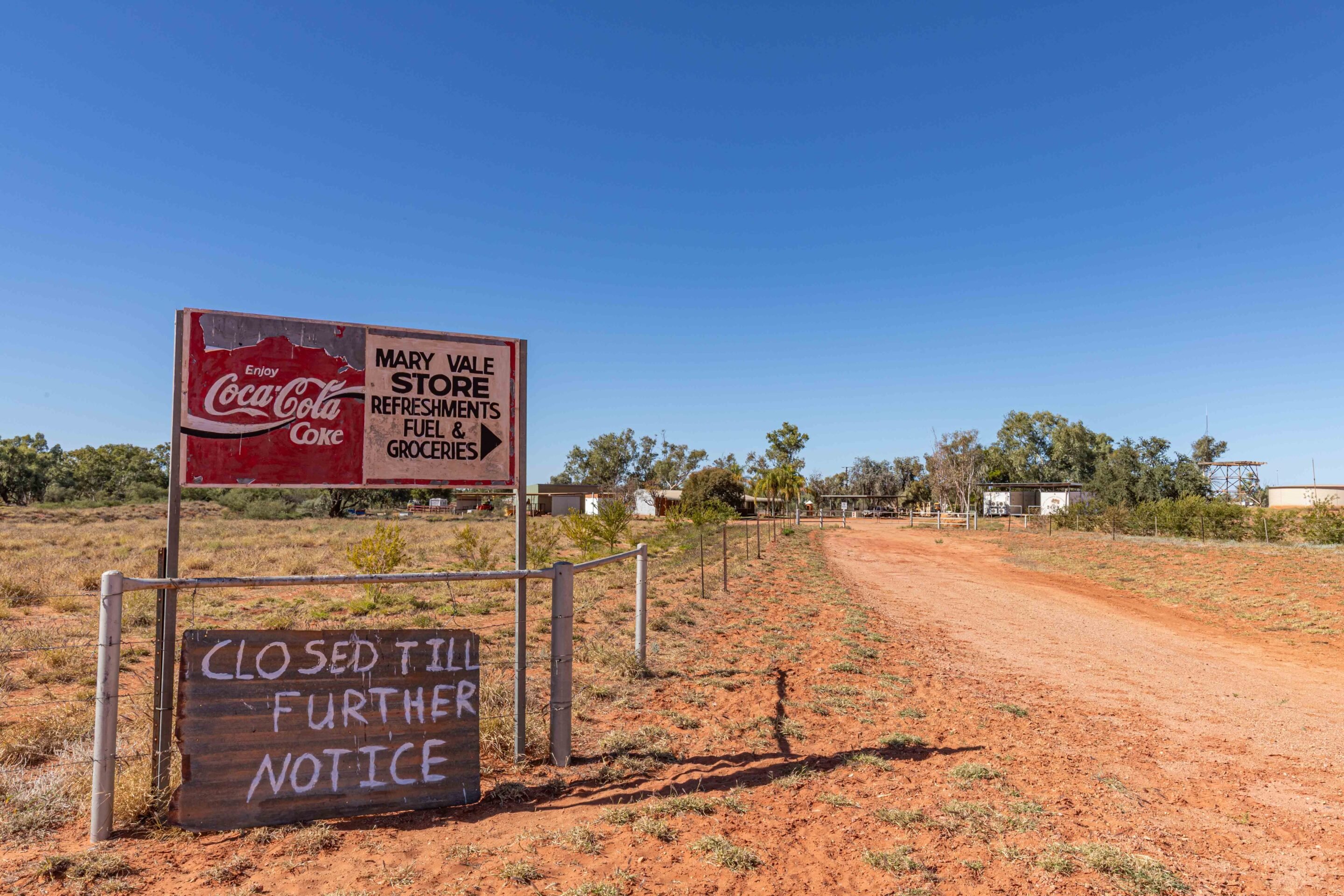
From here, you’ll see scattered groves of desert oaks and mulga with 19km to the Chambers Pillar turn-off. Maryvale Station is a working cattle station with a store, but on this trip, there was a ‘Closed until further notice’ sign, which was disappointing. I was looking forward to an ice cream. Nearby is the small Titjikala Aboriginal community, which has a strong Arrernte cultural presence and is known for its Aboriginal art.
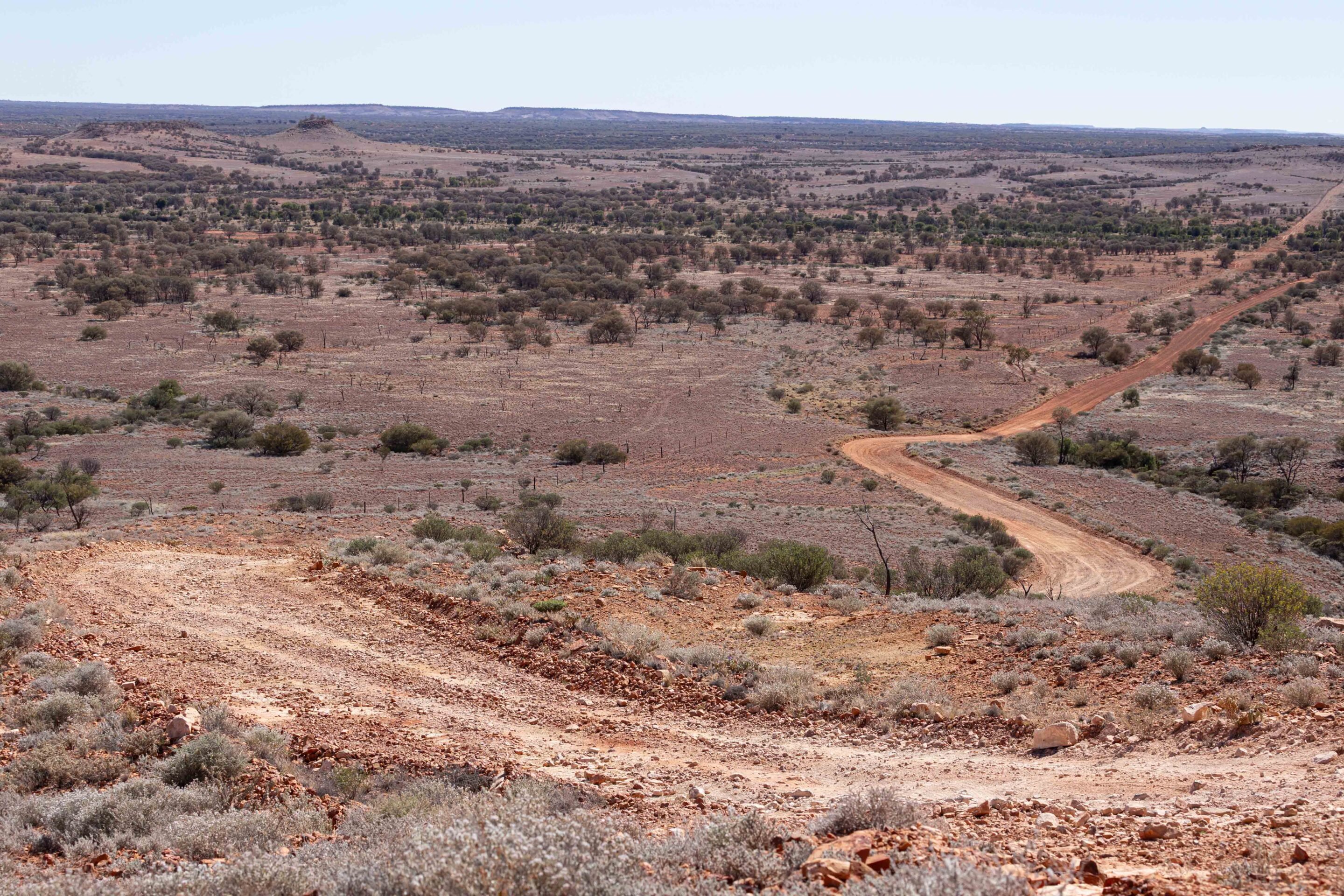
The road from Maryvale Station deteriorates a little, but it’s still a more leisurely drive than it used to be. There are some rough sections and deep sand at the dry water crossings, but it’s not a challenging drive along its 45km length. The landscape is broken with deep red sand dunes and occasional rocky escarpments. Keep an eye out for thorny devils scuttling across the track, well-camouflaged against the red dirt. You’ll see a sign asking for firewood to be collected over the next 3km, as wood cannot be collected within the Chambers Pillar Reserve.
The biggest challenge of the drive is crossing Charlotte Range, and traction control and low-range will prove beneficial in ensuring you get up there without damaging the track or your vehicle. The same goes for descending on the other side, which heads towards Chambers Pillar Campground. Then, you’ll reach a gate; please leave it as you find it.
Chambers Pillar: A Red Centre icon with ancient roots
The recommendation is to fit a sand flag due to the sand dunes on this stretch. If you don’t have one, turn on your lights and take care as you cross the dunes, as there may be oncoming traffic. The second gate accesses the Chambers Pillar Historical Reserve. An NT Parks Pass is required to enter the reserve, and sites must be pre-booked online if you intend to camp. There are two designated campgrounds provided, both with wood fire pits and pit toilets.
On the walk out to the Chambers Pillar, keep an eye out for bearded dragons, Centralian blue-tongued skinks and thorny devils; while you may not spot one, you will see their tracks in the sand. Climbing the sandstone steps to the pillar’s base reveals a vast array of names carved into the rockface, from early pastoralists and explorers to police and Overland Telegraph personnel, as well as 21st century adventurers who have also come to admire the impressive pillar. A walkway has been constructed to provide easy viewing of the rock and to safeguard the fragile sandstone from erosion. See if you can spot where explorer John McDouall Stuart carved his name.
The site holds great significance for the local Aboriginal people, who recount the dreamtime story of Itirkawara, the gecko ancestor. A towering figure, he had a fierce temper as well. During his travels, he killed several of his ancestors with a stone knife.
Confident in his strength, he took a wife from the wrong tribe, which angered his relatives. Banished, the couple returned to the desert, with Itirkawara seething and his wife overwhelmed by shame. They rested in the dunes, transforming into rocky formations: Itirkawara became the pillar and his wife evolved into Castle Rock.
In the morning, instead of waking to the sounds of Major Mitchell’s cockatoos or flocks of budgerigars, I was roused from my sleep by the ghastly sound of diesel heaters starting up in nearby camper trailers. Diesel heaters sound like jet engines, and they are becoming as bad as generators in the bush.
Sunrise at Chambers Pillar is a breathtaking spectacle, as the towering sandstone glows with deep reds, oranges and golds. The desert awakens in soft light, revealing spinifex dunes and ghost gums, while distant bird calls break the silence. As the sun rises, shadows stretch across the ochre sand, highlighting the rugged beauty of this ancient formation. It is a magical, unforgettable Red Centre experience.
Retrace your steps to the junction of Maryvale Road and the Old Ghan Heritage Trail, turning right toward Finke. Nearby lie the ruins of Rodinga Siding, a heritage site set in a remote and arid landscape surrounded by red sand, spinifex and low scrub. The stone foundations and railway relics provide a glimpse into the Ghan’s rail history and make for an interesting stop.
From here, the track runs parallel to, and sometimes on top of, the old railway embankment; beware of the rusting railway spikes on the track. Moving south, you’ll come across several former sidings, such as Bundoona and Engoordina, which feature ruins and rusting water tanks that once serviced the steam trains. The remains of old railway bridges built to cross flood-prone areas are relics of a bygone era. Passing red sand dunes and scattered desert oaks, the track eventually crosses the Finke River, one of the world’s oldest river systems. The riverbed is usually dry but can flow after heavy rains. Ancient river gums line the banks, providing shade and a contrast to the surrounding desert.
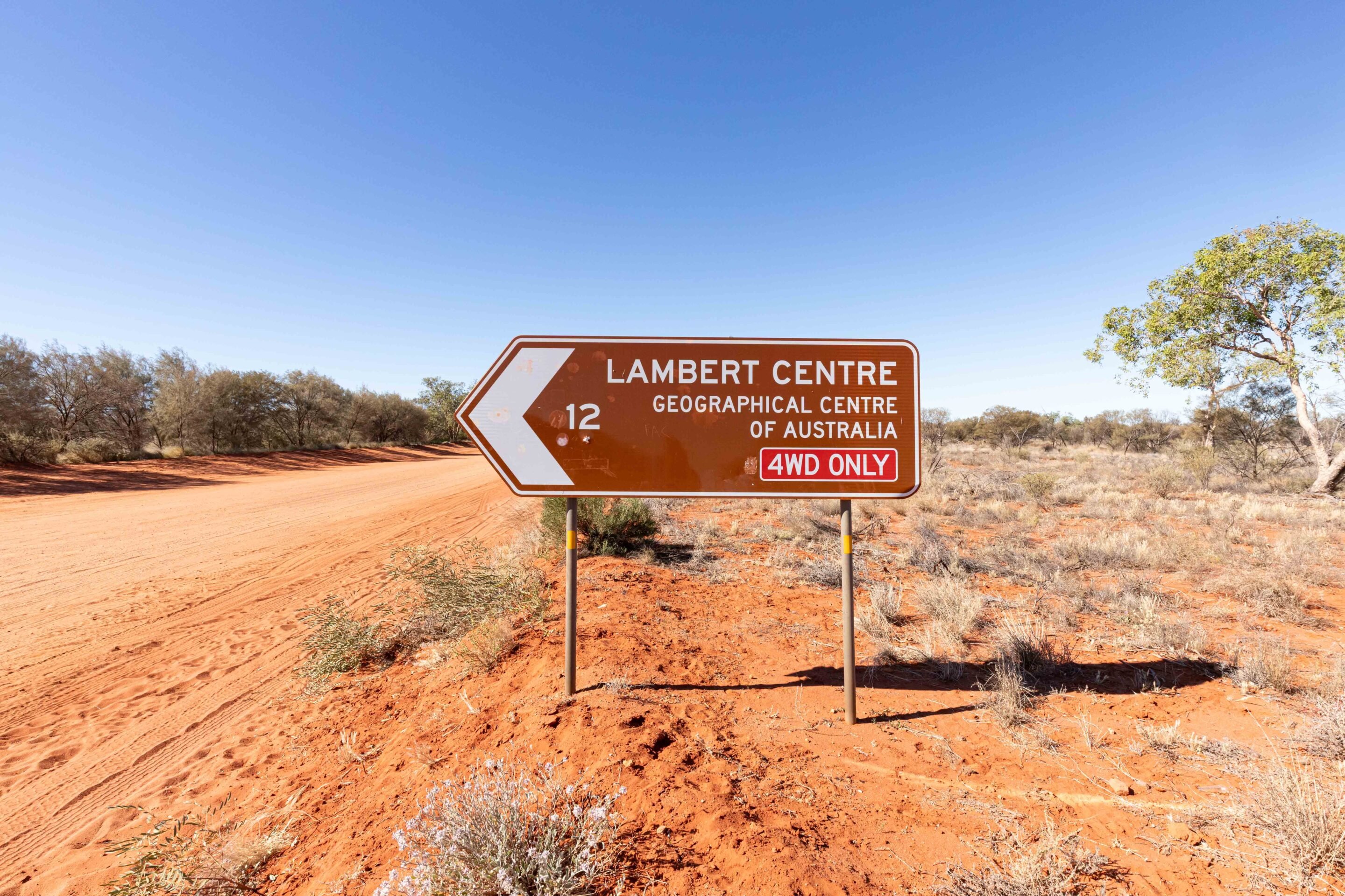
Finke and the Lambert Centre: Heart of the Red Centre
Finke is a small Aboriginal community known for its rich Pitjantjatjara and Arrernte cultural heritage. It is also famous as the southern end of the Finke Desert Race. This is a great spot to refuel, grab lunch and explore a little local history before continuing to the Lambert Centre of Australia. Fuel is available 24/7, but the Aputula Store is closed between 1pm and 2pm on weekdays. It is best to call ahead to check opening times and fuel availability before you get there on (08) 8956 0968.
From Finke, it’s only 35km to the Lambert Centre, the geographical centre of mainland Australia. Take Finke Road and head towards Kulgera before turning north at the signpost. The narrow track is rough and splits in places as drivers seek a smoother route. Lowering tyre pressures made our drive more comfortable, and it wasn’t long before we reached the end of the track.
At the Lambert Centre, you’ll find a flagpole monument that resembles Canberra’s Parliament House flagpole… alongside a million friendly flies. Camping is permitted, and once the flies have gone, enjoy the peace, quiet and remoteness while viewing the stunning night sky. Our destination was somewhere else, though, the historic Old Andado.
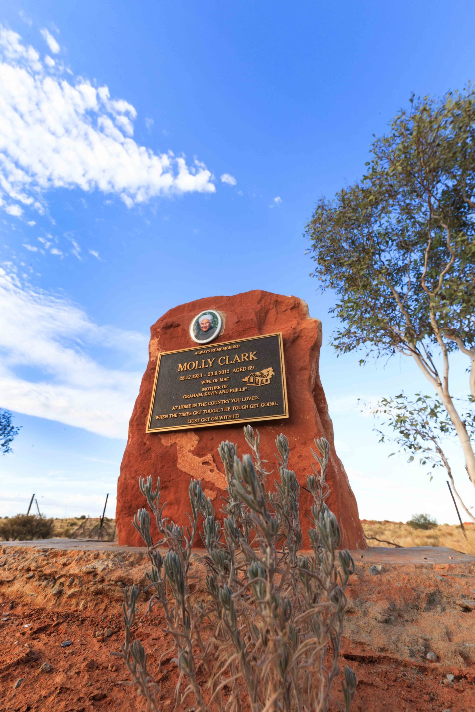
Old Andado: Molly Clark’s Outback Legacy
From Finke, the drive to Old Andado continues the remote 4×4 journey through the arid heart of the NT, covering approximately 120km of rugged desert terrain. The track takes you through red sand dunes, mulga scrub and gibber plains, leading to the well-preserved home of the legendary Molly Clark. You’ll also pass watering holes for the cattle and well-worn paths crisscrossing the open plain. If you encounter a gate, leave it as you found it, and the station owners will be happy. We spotted a dingo enjoying a drink from a leaking waterline; he wasn’t shy and stayed around for some photos.
I’ve admired how tough Molly Clark must have been to live out here for so long. The homestead had no windows, fly screens, air conditioners or insulation. There were snakes, spiders, ants and sand. In summer, temperatures were over 50°C. There was no power until a generator was installed in the 1970s, so Molly and her family had to rely on kerosene lamps for light. Communication with the outside world was via radio telephone until a satellite phone tower was erected in the 2000s.
The first homestead was constructed of mud brick and iron, although little of it remains. The current homestead uses coolabah, mulga and acacia peuce for the frame and whitewashed corrugated and ripple iron for the walls and roof. The flooring in the original two-room section of the house is cement over ash and animal fat. The surrounding verandah was enclosed and partitioned to create extra rooms, while the kitchen and laundry/bathroom were added in the late 1920s.
When Molly sadly passed away in Alice Springs in 2012, she had lived at Old Andado for more than 50 years. At her request, she was returned to the homestead and laid to rest in a place she truly loved. Molly’s epitaph reads, “At home in the country you loved. When the times get tough, the tough get going.”
The campground is spacious and mostly flat, with sheltered fire pits scattered throughout. A rustic camp kitchen has running water, an old barbecue and benches for setting up your camp. When water is available, a refreshing donkey shower and flushing toilet are included in the camping fee. It is an excellent setup for such a remote site.
Exploring the remote tracks of the Red Centre offers a blend of history, stunning desert landscapes and rugged adventure. From the sunrise glow at Chambers Pillar to the relics of the Old Ghan Railway, Australia’s heart at the Lambert Centre and the historic Old Andando, each destination immerses you in outback isolation and beauty. A 4×4 is essential, but the
Trip Essentials – Red Centre 4×4 adventure
Region: Red Centre
Nearest Town: Alice Springs has everything you need for a remote trip, including fuel, supplies, and mechanical support. The Aputula Store in Finke sells basic groceries and fuel, but it’s best to call ahead to confirm availability.
Best Time to Visit: April to September offers cooler weather and more comfortable travel conditions. Be aware that roads may be closed after rainfall, especially in low-lying sections.
Accommodation:
- Chambers Pillar Historical Reserve – Two designated campgrounds with fire pits and pit toilets.
Fees: $10 per adult, $5 per child (5–17), or $25 per family. - Lambert Centre of Australia – Free bush camping. No facilities.
- Old Andado Station – Large bush camping area with a rustic kitchen (BBQ – BYO gas), scattered fire pits (BYO wood), flushing toilets, and a donkey shower (when water is available). $10 per person per night.
What to Take: A tyre compressor and gauge, puncture repair kit, firewood, plenty of food and water, and all waste removal supplies. Leave no trace.
Track Difficulty: The route is suitable for 4WD vehicles, off-road campers, and tough touring setups. Roads may become impassable after rain. Carry extra food, water, recovery gear, spares, and communication equipment such as a satellite phone or PLB.
5 Things You Must Carry:
- Tyre repair kit
- Air compressor
- Water
- Firewood
- A sense of adventure
The Triton is often mistaken for a bit of a cheap rig because, well, they don’t cost as much as some of the others.
However, this is still a top quality Japanese 4×4 with some of the strongest diffs found in a mid-size ute and build quality that’s right up there. Personally, I don’t need a leather interior or a touchscreen that if you lay it flat, you could play a game of pool on. My needs are more basic – all I really want is a punchy engine (which the Mitsi doesn’t have), simple mechanicals (which it kinda has), and a bare minimum of electronics and emissions equipment (let’s call that one a five out of ten).
For that reason, I’m going for the GLX mid-spec model. Mainly because it has a diff lock in the back, which is still better than any traction control I’ve driven (although they’re getting pretty darn close these days to be fair). Assuming I’m in the price bracket for mid-range SR HiLux, which retails for $55,190, the Triton GLX at $43,690 (See, they really don’t cost as much) gives me an easy $12K-ish to take the Mighty-Tritey from ho-hum to ho-lee-s#!7.
Let’s call a spade a shovel here, the 2.4L dizzle, with its 133kW and 430NM of yawn, is never going to be rad. A basic dyno tune will give us an easy and reliable 20 per cent boost in both departments, getting us up over 500Nm and 160kW, which is not going to set any drag strips on fire, but it’ll be a damn sight less fatiguing to drive over the asthmatic stock engine. It’s $2000 or so well spent.
From there it’s barwork time. A lightweight Pegasus front alloy bar from MCC 4X4 ($3500) with a Drivetech 4X4 9500lb dual-speed winch ($1000) and some Narva LED lights ($700) will make animal strikes and self-recoveries much less of a concern.
In terms of the tray side of things, I prefer to keep things as light as is reasonable over the back end of dual-cabs so I’d keep the factory tonneau in place to minimise any chance of being over GVM; which is known to lead to bent chassis’ (not just on the Triton, but all overloaded dual-cabs). The rule of thumb goes: if you have the extra room, chances are you’ll fill it up. By keeping the stock styleside, I’m simply minimising temptation.
This leads me to suspension. The Tritons, since the MQ at least, have always had generous wheel arches that can accommodate big rubber with minimal lift, so it’d be rude not to cram some 33-inch Toyo Open Country ATs (call it $2500) in there. As for shocks and springs, in my opinion, the former is way more important than the latter on utes. The rear leaves can stay as is with nothing more needed than a set of 25mm spacers.
The front can be raised by 50mm, which will have the double advantage of keeping the CV angles within their range of operation and levelling out the factory stinkbug stance. As for shocks, how much have I got left, $2500? I’d be on the phone to Superior Engineering to talk about getting a set of its Icon Shocks for the back and coilovers up front. You really can’t have too good a shock, I reckon.
If I had a few extra bucks, a lithium battery with a Redarc or Victron BMS set-up would be the next cab off the rank to run the fridge and camp lights.
From there, all available money is going on food, drinks and fuel and I’m headed somewhere where there’s a brazillion stars in the sky and next to no people. See ya.
Don’t throw rubbish into the bush – even something as small as a drink can could mean a slow and awful death for a native animal.
We were heading along the Heather Highway – a road that links the Great Central Road, just west of the small Aboriginal community of Warburton, to the famous Gunbarrel Highway, a track that’s a ‘highway’ in name only. Ahead of us was our convoy of nine vehicles on an adventure from Ceduna in SA to Cape Keraudren in north-west WA.
Being tail-end Charlie has become the norm for our on-and-off-again career leading tag-along trips, and we were cruising along, admiring the vast open spaces and distant horizon, when the CB radio crackled to life: “Watch out – there’s a lizard on the road… pushing a tin can!”
That’s not possible, I thought, and after a few seconds of deliberation, I knew what it was. Less than a minute later we saw the lizard, and the can he was ‘pushing’. But he wasn’t pushing it. His head was trapped inside and, without help, he was doomed.
I’d seen – and photographed – such a trapped animal before somewhere in Central Australia, but I couldn’t recall which trip or where I might find the pic. That lizard had died, his head stuck in a drink can while his exposed body had been picked clean by crows and ants.
As we jumped out of the Patrol, the lizard, feeling our vibrations as our feet hit the dirt, turned to bolt but ran into the ridge of sand that lines every outback track and road. Before he could recover, I grabbed him – his struggles strong and insistent.
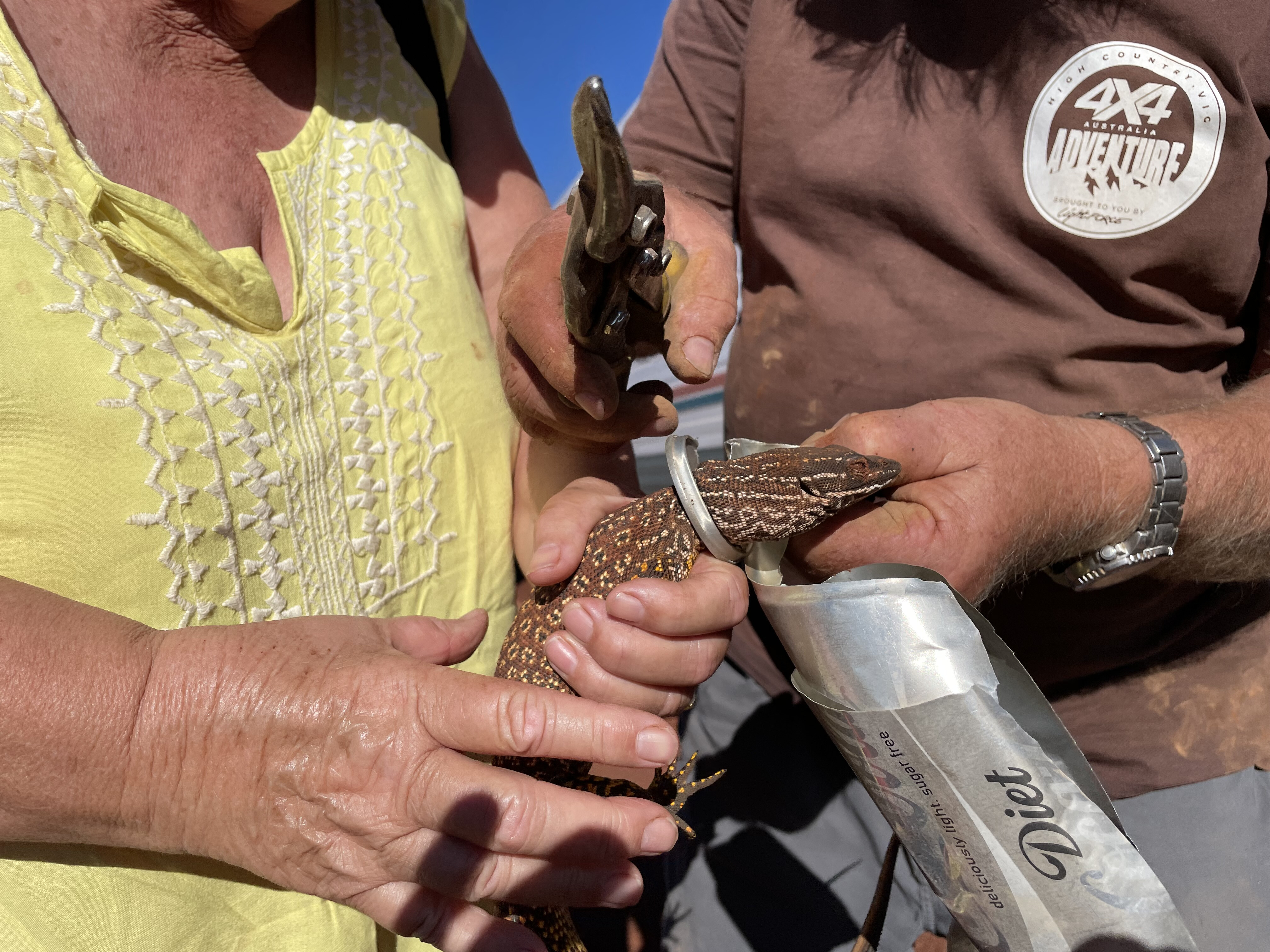
But his head, shaped like an arrowhead, had slipped into the can while he searched for a splash of moisture – or the ants that are almost always found inside such containers – and was now jammed tight. The backward-facing scales and the shape of his head made it impossible to pull free.
While Viv restrained the animal, I went to the toolbox and grabbed a set of tin snips. What followed was a delicate operation as I cut the can from around his neck… if lizards even have necks. At first, he was belligerent – he bit me – but soon settled down as I worked the tin off his body.
He was lucky. His tough hide hadn’t even been marked by the sharp metal. Once he was free, we offered him a drink from our cupped hands. He slipped his mouth in and sucked away. We guessed he’d been trapped for less than 24 hours (how long could a lizard survive like that?), but he was still clearly thirsty.
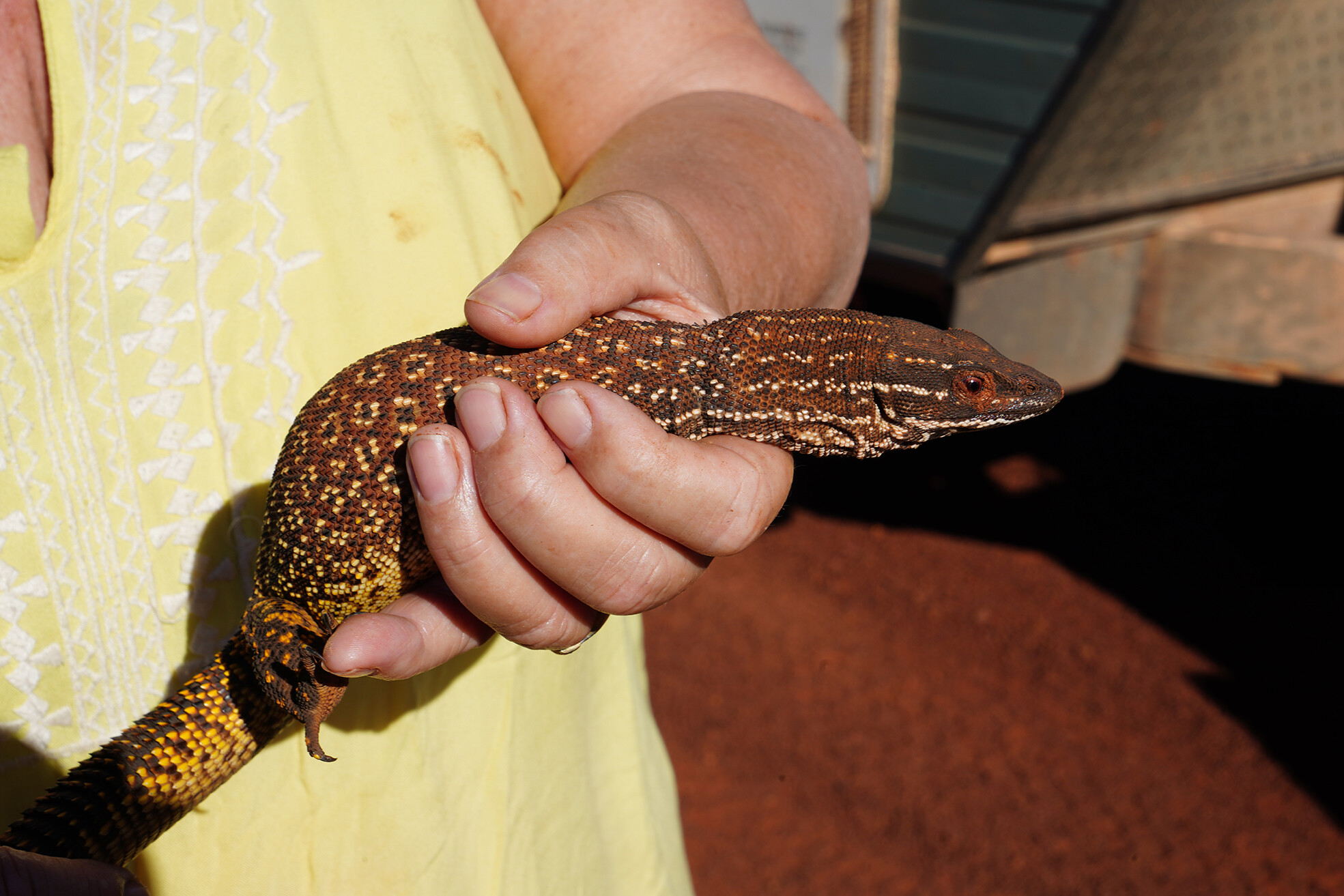
It took four handfuls of water before he finally looked up, as if wondering what else the day had in store. We put him down just off the road. He stood, dazed, for a few seconds, then shot off into the scrub. We got back into the Patrol, feeling pretty good about rescuing a beautiful lizard – a magnificently marked desert monitor – our good deed done for the day.
The moral of the story? Don’t throw rubbish into the scrub or out of your vehicle. Something as simple and seemingly harmless as a drink can could end a native animal’s life in an awful way. Crush your cans – and dispose of them properly.
Kia has confirmed pricing for its Tasman cab-chassis range, with dual-cab chassis models set to arrive in Australian showrooms from August, followed by single-cab variants later in 2025.
The single-cab chassis will be offered in three versions when it launches late next year: the base S 4×2 at $38,010 (RRP), the S 4×4 at $45,010, and the top-tier SX 4×4 at $49,520. Dual-cab chassis models will arrive this month, with the S 4×4 priced at $48,240 and the SX 4×4 at $52,740.
All Tasman variants are powered by a 2.2-litre four-cylinder turbo-diesel producing 154kW and 440Nm, paired with an eight-speed automatic transmission. The full-time 4×4 system comes standard on all but the 4×2 base model.
Underneath, the Tasman rides on Kia’s new ladder-frame chassis. Across the broader line-up, five trim levels are available – S, SX, SX+, X-Line and X-Pro – but cab-chassis models are limited to S and SX grades only.
Payloads across the range exceed 1000kg, with a GVM of 3250kg and a GCM of 6200kg, giving all 4×4 models a 3500kg braked towing capacity. Every Tasman comes standard with an Integrated Trailer Brake Controller (ITBC), and unbraked towing is rated at 750kg.
Dual-cab pick-up variants are already on sale and offered with a reduced-payload option to meet novated lease thresholds below 1000kg.
Beyond the Genuine Accessories steel tray available for cab-chassis models – with options like under-tray drawers, toolboxes and water tanks – Kia offers a broad accessories range for the Tasman. This includes roof storage setups, canopies, tonneau covers, sports bars or sail planes for pick-up models, plus multiple bull bar, side step and tow bar configurations. There’s even lifestyle gear such as a 36L portable fridge.
The Kia Tasman cab-chassis pricing sits competitively against its main rivals. By comparison, the HiLux single-cab 4×4 begins around $40,965, with the dual-cab chassis starting near $48,000.
The Ranger offers single-cab 4×4 models from about $47,980 and dual-cab chassis variants from roughly $48,980.
Full Tasman pricing
| Trim | Drivetrain | Cab | Body Type | RRP | Drive Away |
|---|---|---|---|---|---|
| S | 4×2 | Single | Cab chassis | $38,010 | TBC |
| S | 4×2 | Dual | Pick-Up | $42,990 | $46,490 |
| S | 4×4 | Single | Cab chassis | $45,010 | TBC |
| S | 4×4 | Dual | Cab chassis | $48,240 | TBC |
| SX | 4×4 | Single | Cab chassis | $49,520 | TBC |
| S | 4×4 | Dual | Pick-Up | $49,990 | $53,890 |
| SX | 4×4 | Dual | Cab chassis | $52,740 | TBC |
| SX | 4×4 | Dual | Pick-Up | $54,490 | $58,490 |
| SX+ | 4×4 | Dual | Pick-Up | $62,390 | $66,490 |
| X-Line | 4×4 | Dual | Pick-Up | $67,990 | $70,990 |
| X-Pro | 4×4 | Dual | Pick-Up | $74,990 | $77,990 |
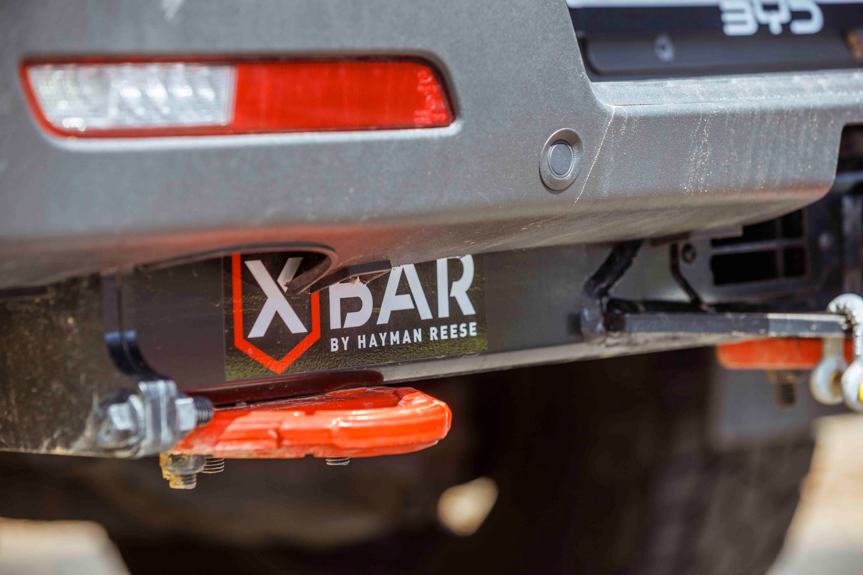
When you’re setting up a modern dual-cab for touring or towing, a solid towbar isn’t optional. The Hayman Reese X-Bar is as serious as they come.
Fitted to our BYD Shark project car, it immediately shows it’s designed for 4WDs and off-road conditions. High clearance, integrated recovery points, and a solid bash section underneath make it more than a towing solution – it’s a proper off-road upgrade.
The X-Bar is built from thick-gauge steel with custom-forged 700-grade steel recovery points and tow ball mount. Side arms are thicker than typical bars for extra rigidity, and high-tensile AS Grade 10.9 fasteners ensure strength and durability. The premium Metalshield eCoat plus powder coat finish provides long-term corrosion protection.
It has been designed and tested to meet Australian Design Rules (ADR) and AS/NZS 4177 in a NATA-accredited lab, covering static overload, durability and recovery loads. That testing underlines just how tough this bar really is.
Recovery points and off-road features
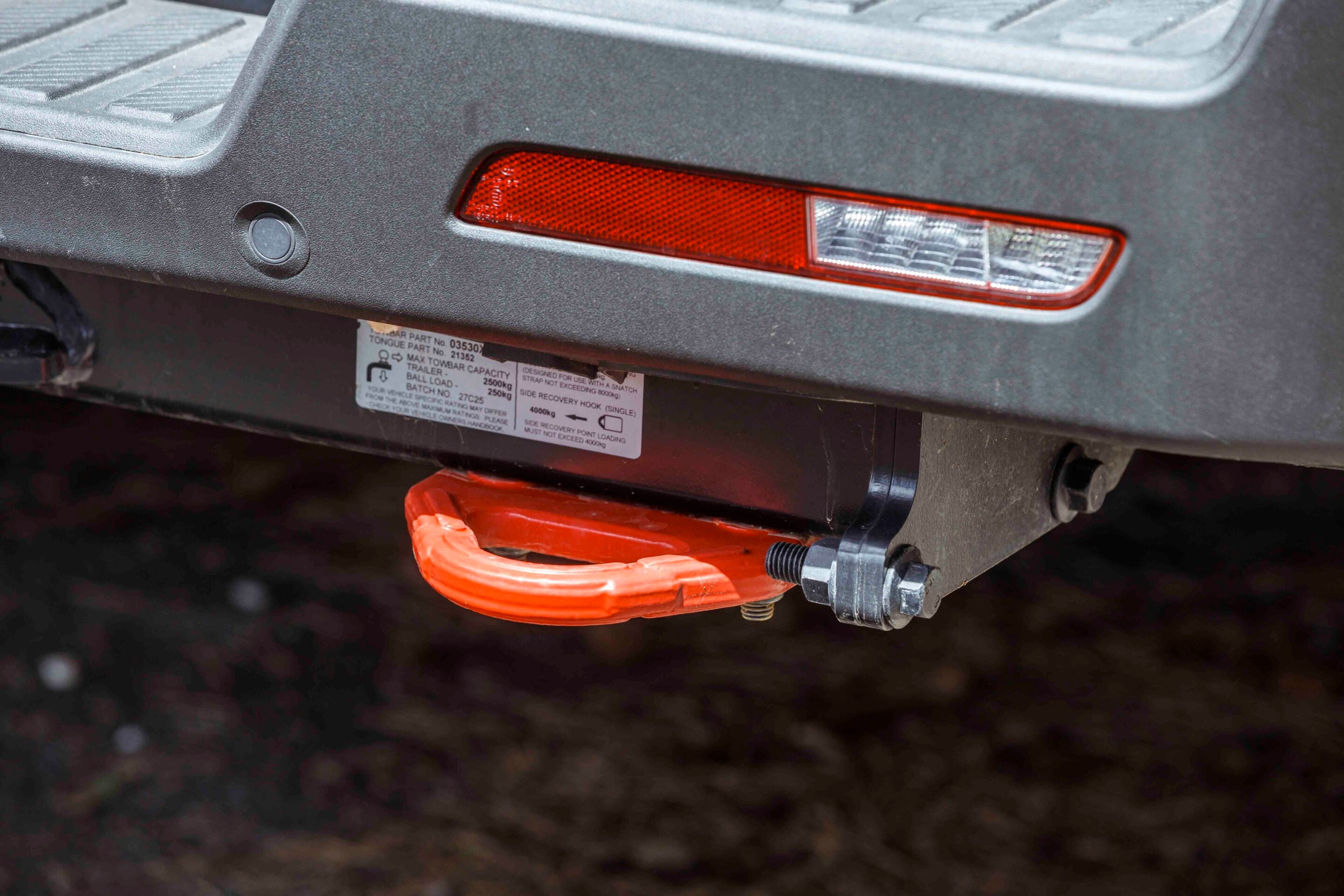
The X-Bar usually includes three rated recovery points – a high-rated centre point (~8000 kg) and two side points (~4000kg each, vehicle-dependent). This setup allows safe snatch or winching connections, far safer than relying on a hitch.
The bar sits higher than most OEM or aftermarket towbars, improving departure angles by around five degrees and reducing snagging on rough terrain. An integrated bash plate protects the rear diff, exhaust and underbody from trail obstacles.
Real-world use
On the BYD Shark, the X-Bar handled towing camper trailers and heavy recoveries with ease, including pulling a mate’s LandCruiser out of a dune bowl in the Simpson Desert. The recovery points are well-positioned for symmetrical pulls, making recoveries safer and more predictable.
Other practical touches include twin protected trailer socket mounts (accommodating 7-pin, 12-pin, and/or Anderson plugs) and a SmartClick vehicle-specific wiring harness supplied as standard. Many models also feature a SmartPin anti-rattle hitch pin, cutting down hitch noise on the road.
Installation is a bit fiddly due to the extra bracing and recovery brackets – expect more time on the tools than with a standard towbar. The price is higher than basic options, but you’re effectively getting three pieces of kit in one – towbar, bash protection and robust recovery points – making it worthwhile for serious off-roaders.
Verdict
The Hayman Reese X-Bar isn’t a cosmetic upgrade. It’s functional, strong and ready for real-world adventures. Whether towing across the country, performing recoveries, or just having the confidence that your recovery points won’t fail, this bar delivers.
Key details
- Rated recovery points: Centre ~8000kg, sides ~4000kg (vehicle-dependent)
- Tow rating: Up to 3500 kg (braked) – vehicle dependent
- Bash protection: Integrated underbody plate for rear diff, exhaust, and underbody
- Construction: Thick-gauge steel, custom-forged 700-grade steel recovery points and tow ball mount
- Side arms: Increased thickness for rigidity
- Fasteners: High-tensile AS Grade 10.9
- Finish: Metalshield eCoat + powder coat
- Wiring and electrical: Twin protected trailer socket mounts, SmartClick wiring harness, SmartPin anti-rattle hitch pin
- RRP: ~$1300 – $1500 (depending on model)