Explore
Gallery 1
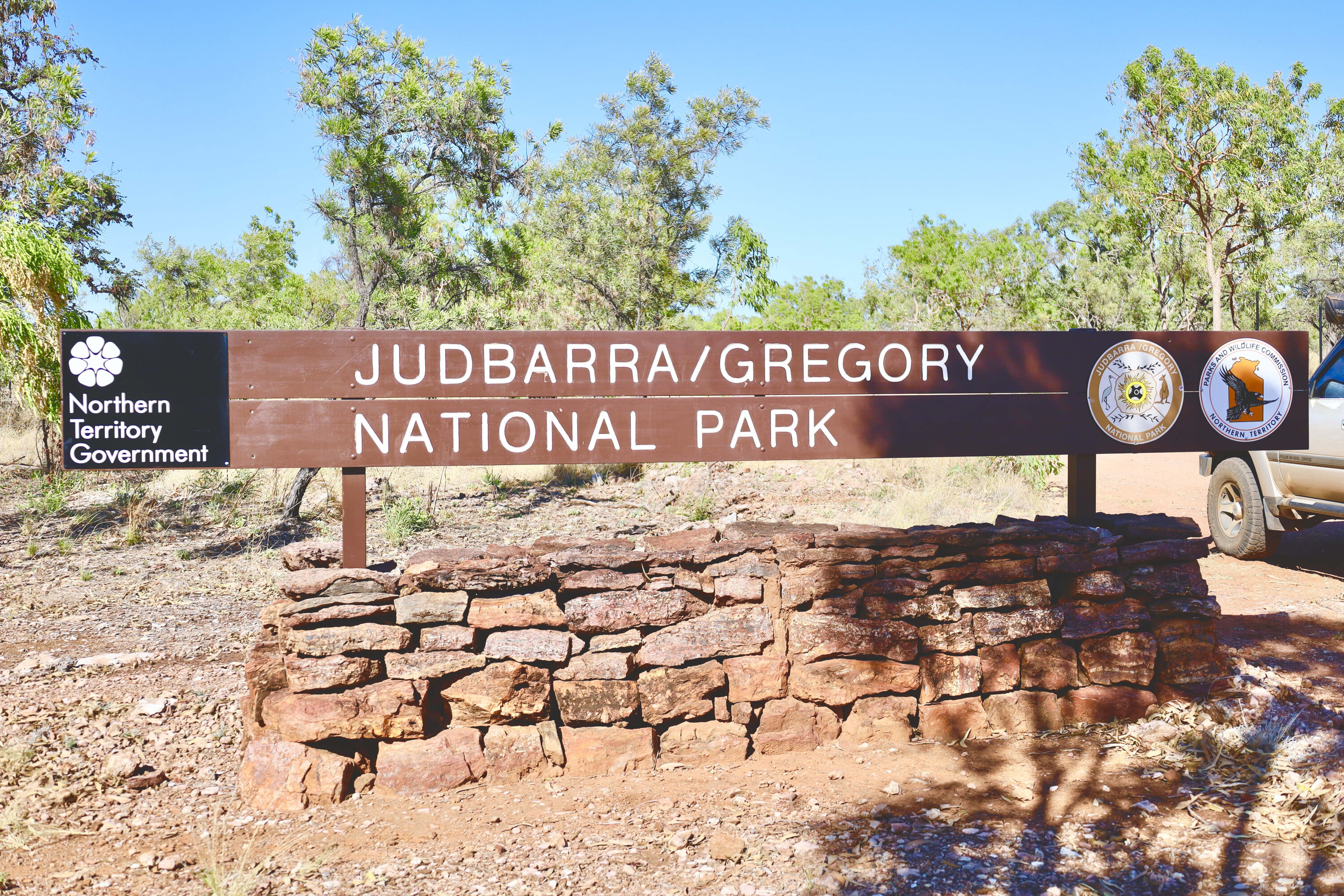
Everything in Judbarra National Park is big: the landscape, the history, the animals, the four-wheel driving challenges and the weather that passes through it each year. And the park itself is big, covering just over 13,000km², making it the second biggest in the Territory after Kakadu NP.
Judbarra was once named Gregory National Park, after Augustus Charles Gregory, who in 1855 led several exploratory parties up the Victoria River and penetrated nearly 500km south towards the Great Sandy Desert on what would become one of the longest overland rides in Australian exploration.
The park was renamed Judbarra in 2021 to recognise the traditional owners.
1
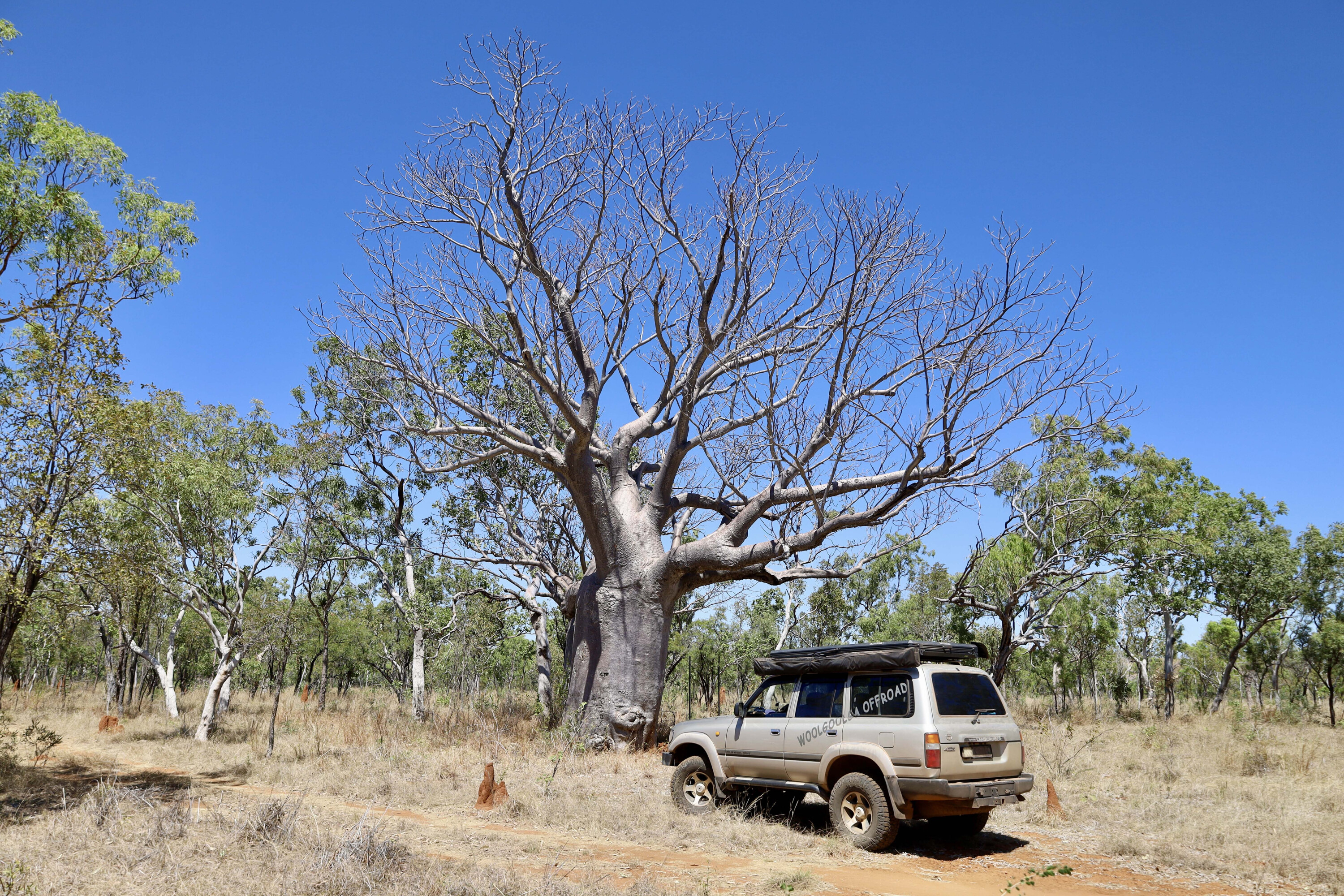
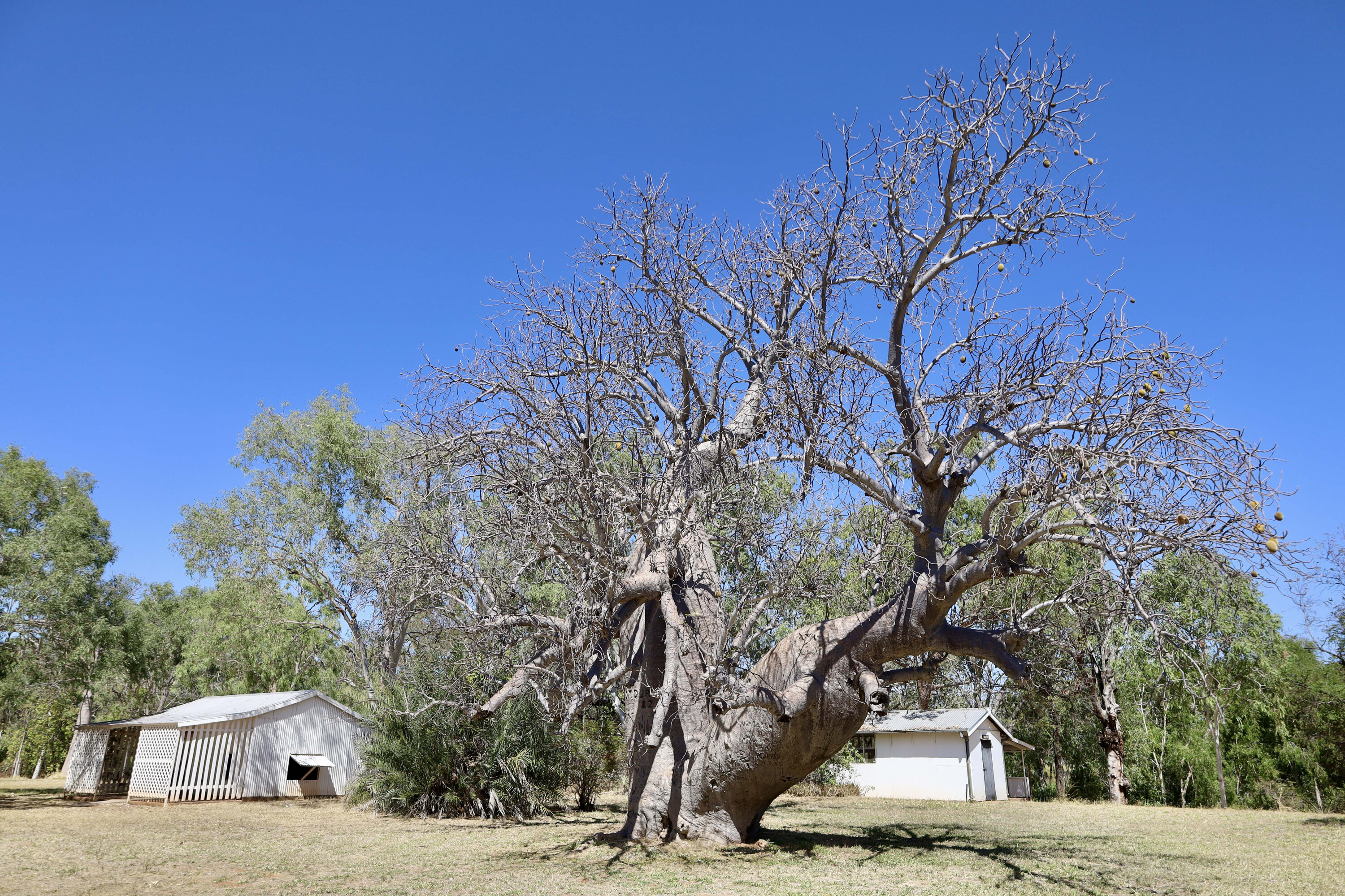
Just off the Victoria Highway is the famous Gregory’s Tree, an age-old boab that is an aboriginal sacred site as well as a marker for Gregory’s travels.
Setting up camp near the huge boab, Gregory instructed artist and storekeeper J Baines to carve the dates of their arrival and departure from the area into the tree. It is now a registered heritage site, and there is a boardwalk and signage to inform modern-day explorers about the travels of the early explorers.
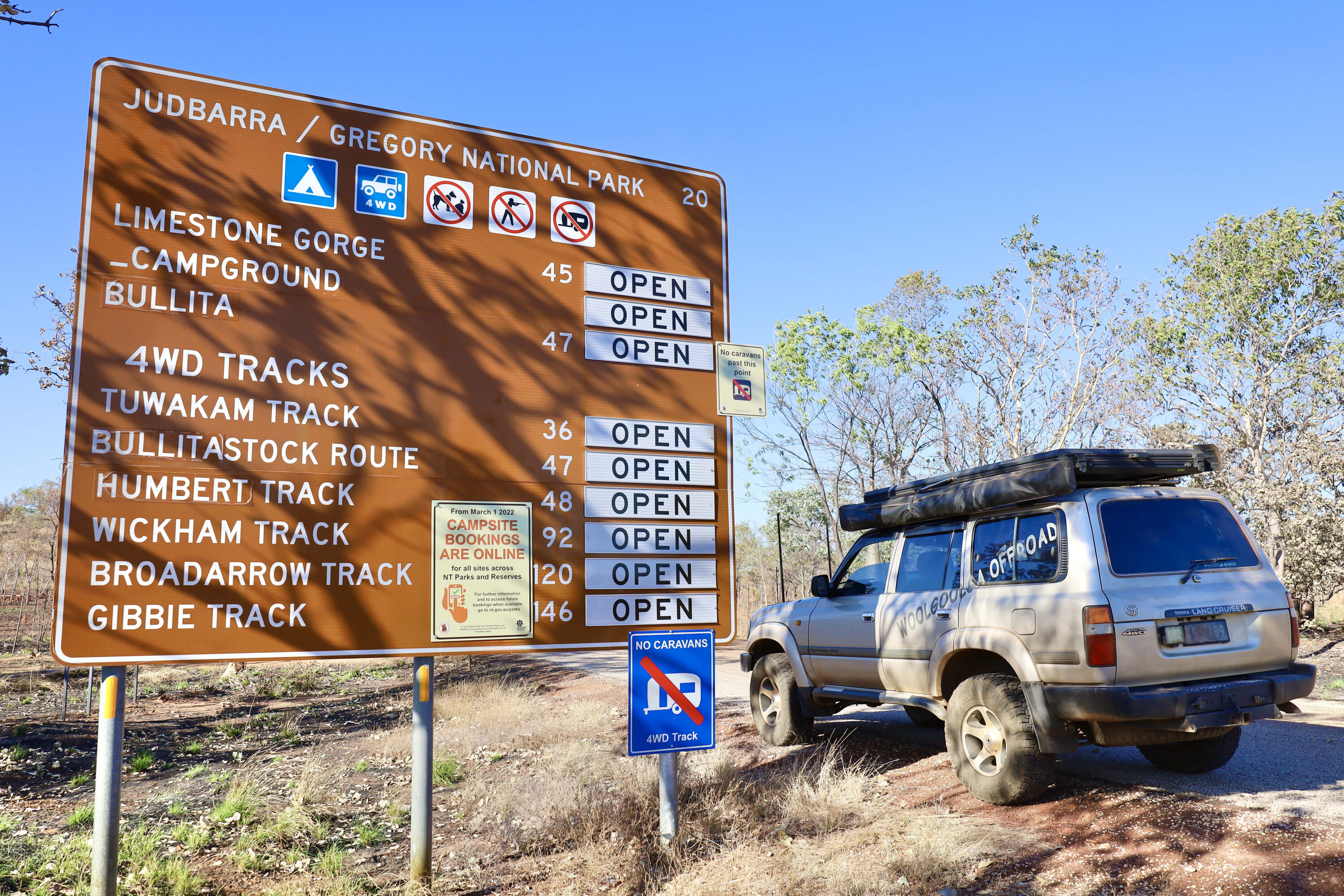
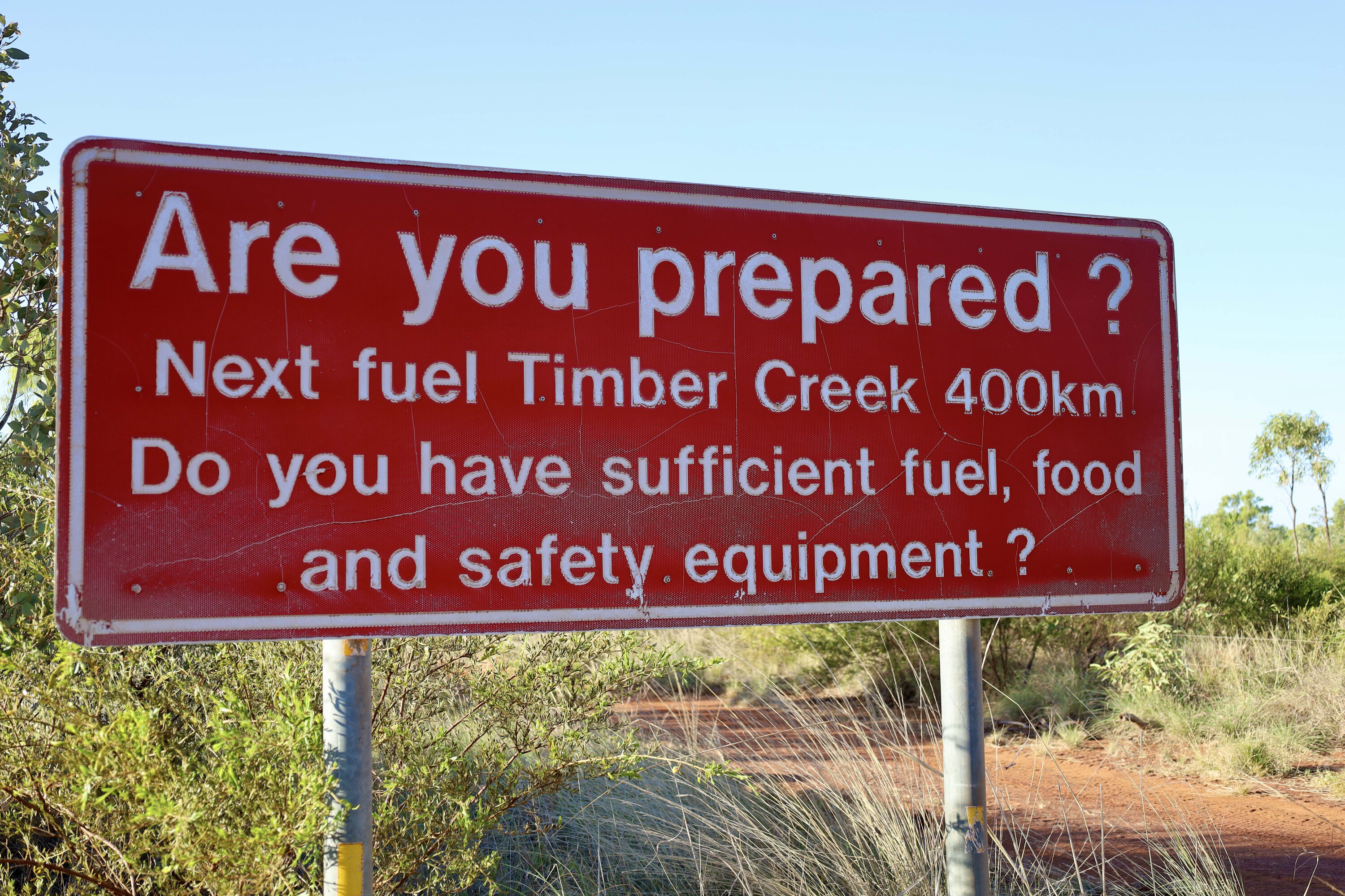
Further down the road at Timber Creek is the last stop for any supplies for those entering Judbarra from the north; make sure you have all the fuel you can carry as it’s more than 400km through the park and down to the nearest fuel stop if you decide to drive along the longer 4×4 tracks.
Technically the park has two sections – the east and the west precincts. The east takes in the Victoria River Roadhouse and the Sullivan Creek campground, but the western sector is where the real adventures lie.
1
Journey into Judbarra
My journey into Judbarra began about 20km from Timber Creek on the northern side of the park at Gregory’s Tree, a great start point where you’ll find absolutely all the information you’ll need on Judbarra, including on the flora, fauna, history, track directions and more, as well as details on park or track closures.
I have always had Judbarra on my must-visit list, and I had heard some of the tracks were pretty rough across the Black Range. Also, being an isolated and remote park, Judbarra is only open a few short months of the year.
During summer it is closed due to the extreme heat, while during the wet season it’s closed due to the intense flooding. Even in times (as I found out) it can be closed due to either fires or damage from recent rain.
1
Before heading into the park, you need to be absolutely confident with remote travel and ensure you have enough supplies for at least a few days.
Thankfully, planning a trip through the park is pretty simple due to Parks NT naming all the tracks and providing decent signage at all the turn-offs.
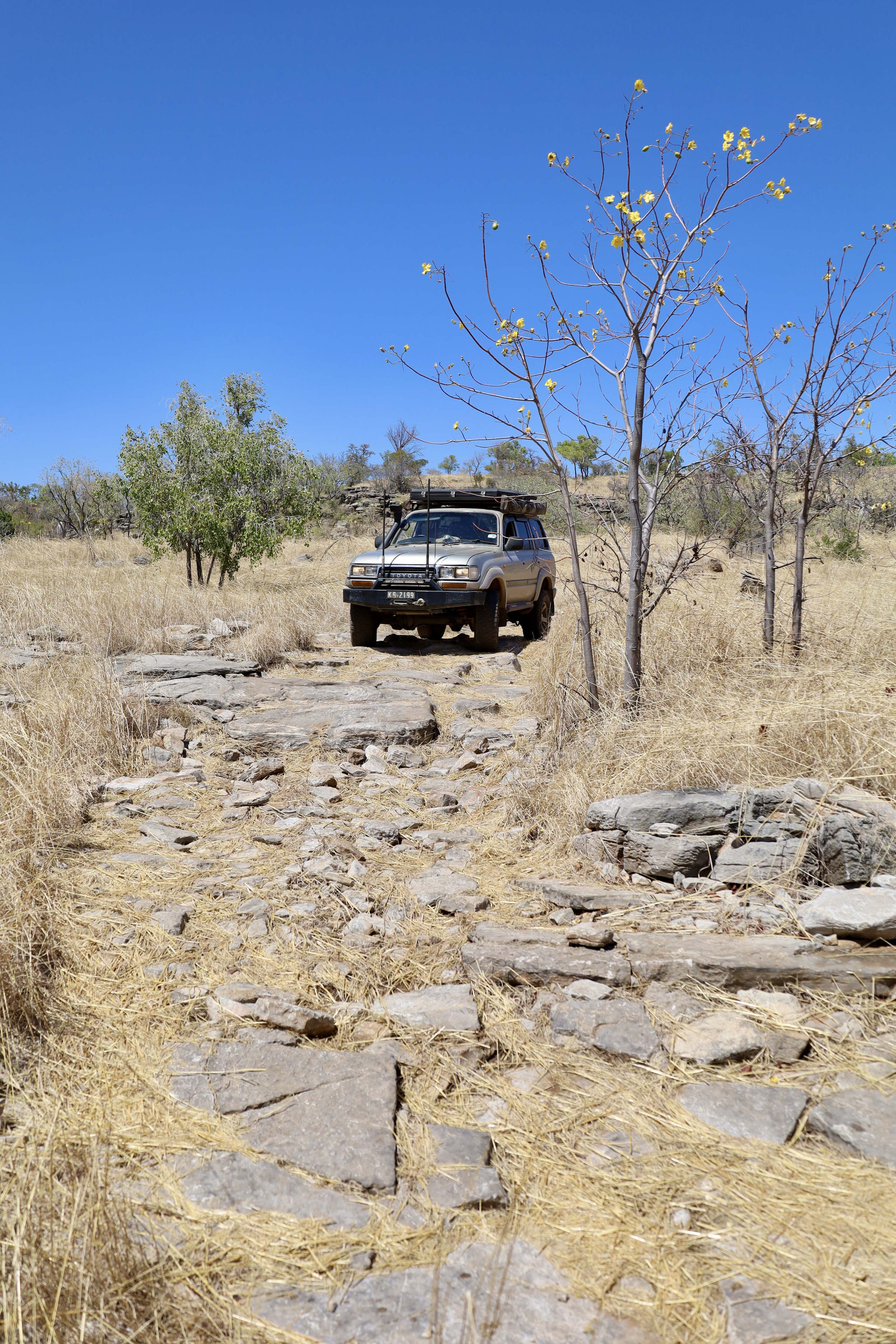
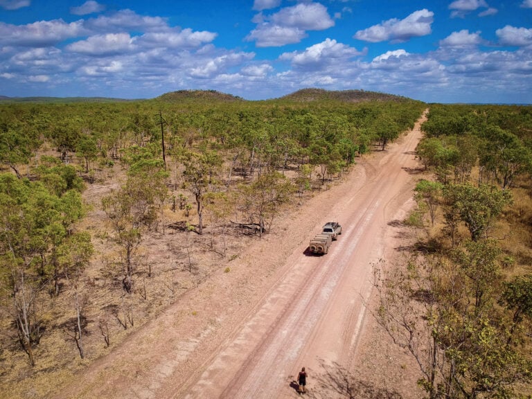
Heading east out of Timber Creek, I soon found the Bullita Access road that heads south into the park. Some of the 4×4 tracks in Judbarra loop back to the main road, and these are a great way to explore all the features in the park.
1
One-way ticket
My first track was the Bullita Stock Route that heads one way from Bullita Homestead. Around the turn of the century two massive cattle stations dominated this area; the Bullita and Humbert River stations.
The stock route was used by the stations when they sent cattle further northwest to Wyndham in WA for export and slaughter. Today some of the buildings have been restored and there’s a great camping area on the bank of the East Baines River. Relics, detailed sign boards and the old cattle yards are fun to explore while reflecting on the good and bad times of days gone past.
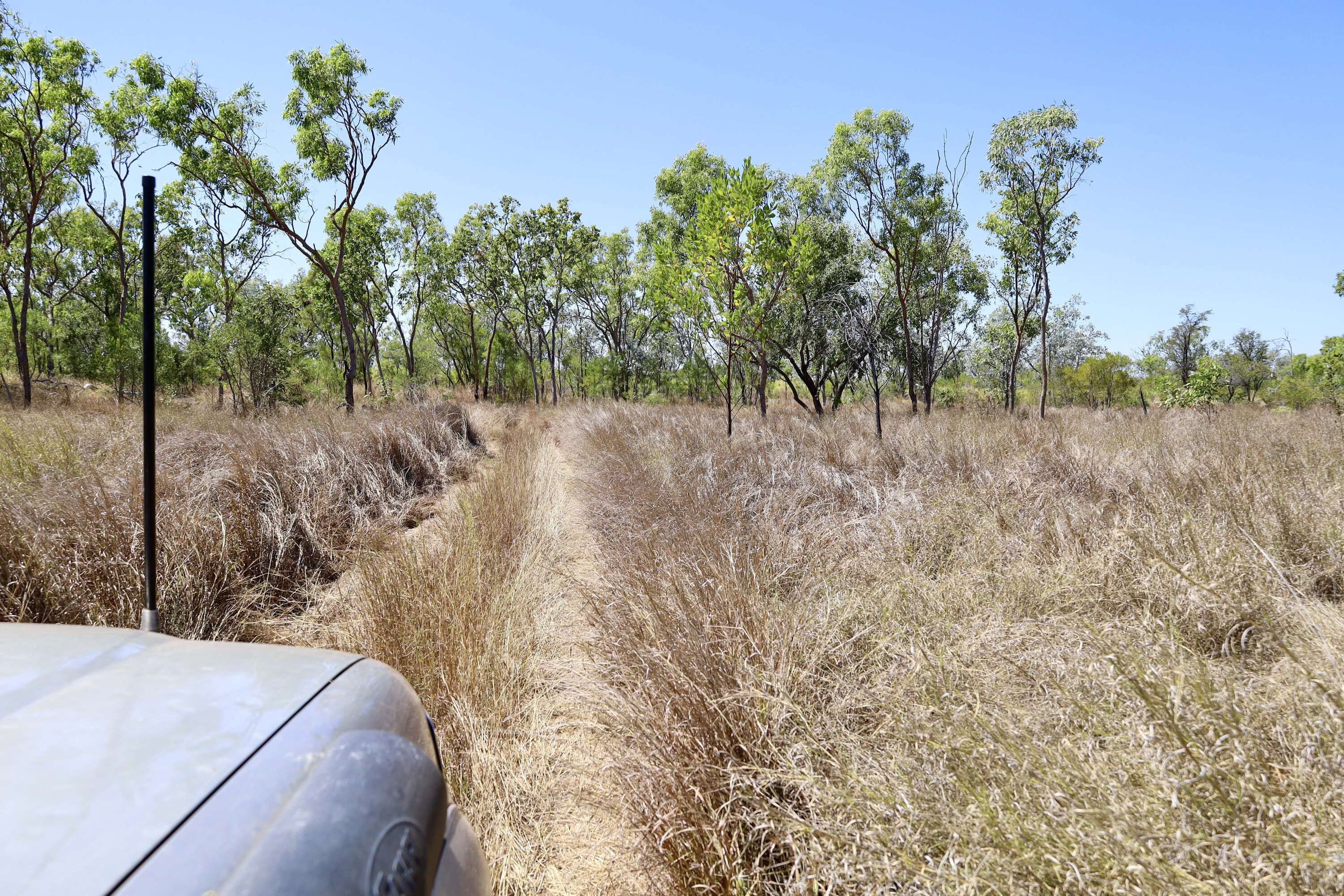
The Stock Route track really only has two obstacles, one being the Baines River when in flood, and the jump-up, midway along. With spectacular scenery around this rocky track it’s a great way to settle into the park.
1
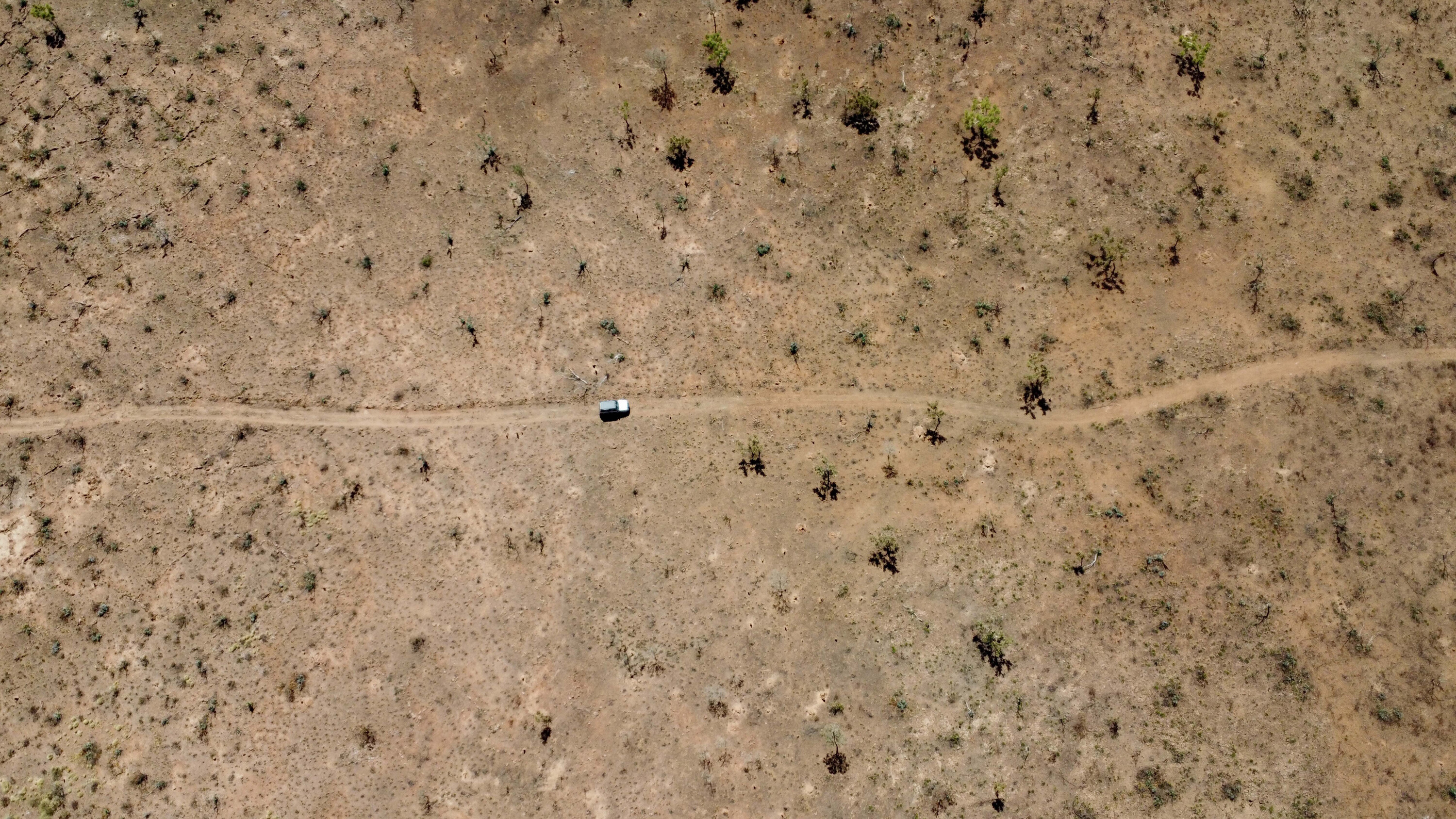
Interestingly the stock route track was also called the donkey track, as donkeys were used to help move freight through the area, and yes, I saw dozens of them along the way. It takes around eight hours to cover the 95km because of the rough terrain and the many sights to see along the way.
Halfway back to the Bullita Homestead I was hoping to check out an unusual limestone gorge, but with the roads still under repair after a massive dump of rain all I could do was to find the Tufa dams.
These unusual walls in the creek have been formed by a combination of a limestone deposit and algae growth where water spills over rocks, creating a calcium buildup over time. These Tufa dam walls are estimated to be 1600 years old.
1
Heading back down past the Homestead (remember it is a one-way track), I jumped onto the Humbert Track to head south crossing the Humbert River which surprisingly still had some flow in it late in the dry season.
I was tempted to go in for a dip, but croc signs had me thinking otherwise. Across the river the Humert becomes the Wickham Track for the next 30km to the intersection of the Broadarrow and Gibbie Tracks. Just near this major intersection another track leads to some old stone cattle yards, but again with the unusual rain, this too was closed.
1
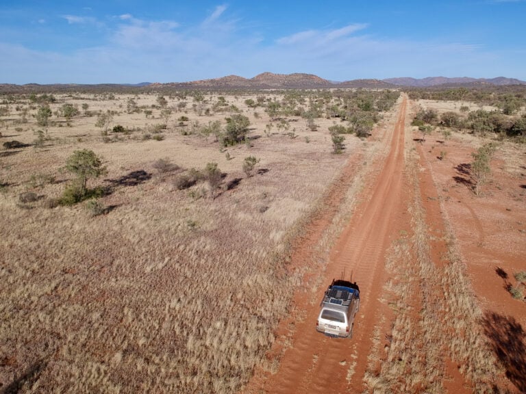
Broadarrow Track
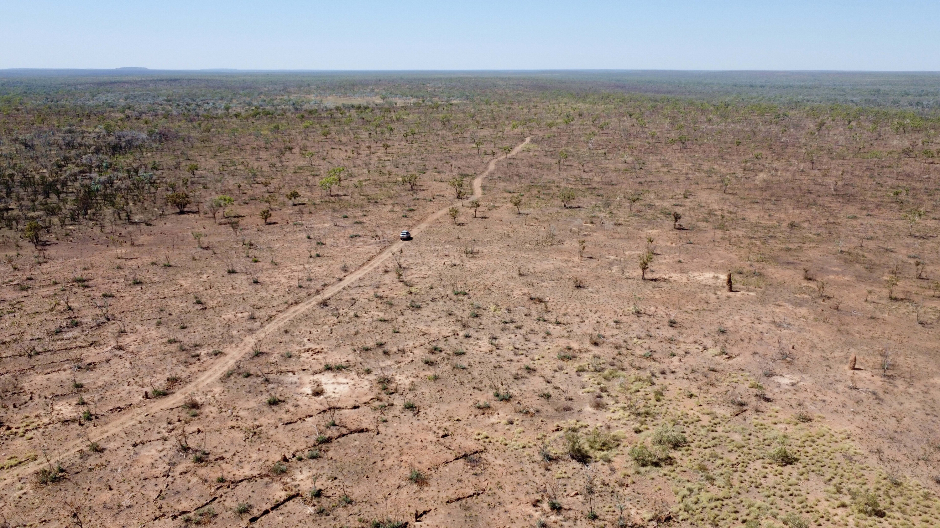
My aim was to explore the very remote Broadarrow Track that had recently reopened after the unusual wet this area had early in the season.
With a total of around 230km to cover, it’s best to allow a good two days for this track. The Broadarrow Track was also used by packhorses and donkeys, to bring supplies up from Victoria River Downs Station in the south.
Word around was that the track was notorious for staking tyres due to sharp sticks in the long grass and the unseen rocky surface. In the scale of things, the Broadarrow Track isn’t overly challenging, but the remoteness and isolation can make it difficult for new travellers.
1
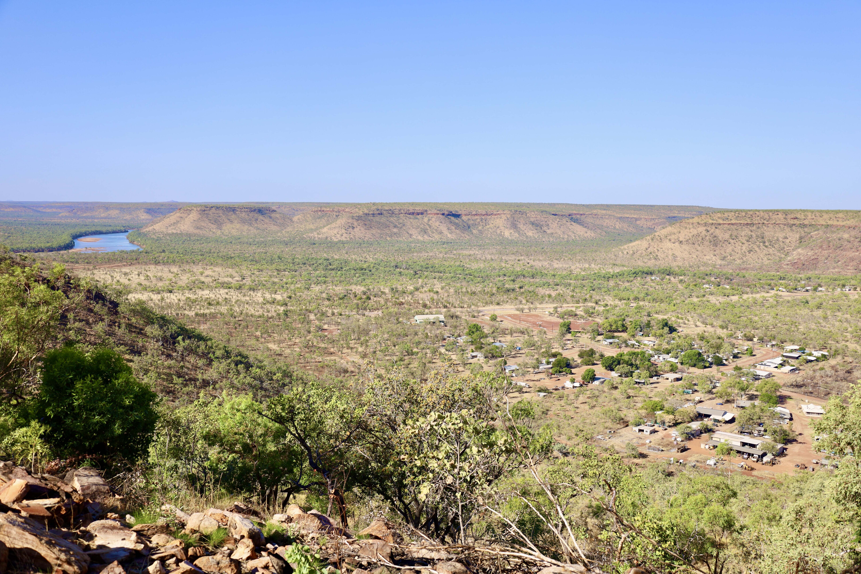
There are plenty of camping opportunities along the way, whether to catch a stunning sunset or sunrise along the escarpment section or maybe a riverside camp on Depot Creek, the headwaters of the Baines River, or the new Wilingarri remote river camp.
I set up at Camel Point Campground, giving me a high point to spot camels, of which I spotted several herds late in the afternoon. My other camp choice was at the Escarpment Lookout Campground where I had absolute stunning views to the east, deep into a valley I would explore the next day.
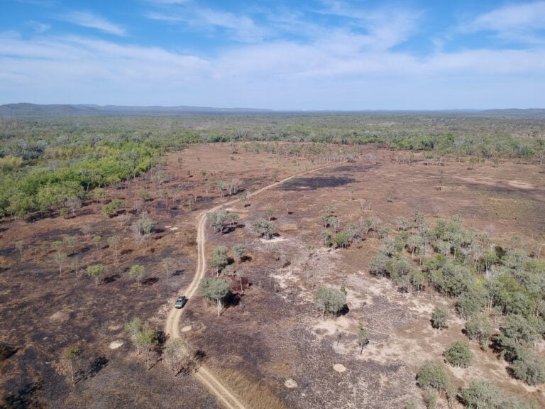
The Broadarrow Track is similar to many tracks around the Kimberly area – very stoney and rough terrain, with scattered timber and magnificent boab trees throughout. There are several large jump-ups on the track but driving in low-range they aren’t anything to worry about. Finding your way along the tracks is as easy as following the blue boab markers positioned every 10km, and blue arrows to help guide you through the park.
1
Final fling
I drove most of the tracks in high-range 4WD, which provided better traction and a little bit more control on the rougher sections.
The section across to the Black Range is the last (or first depending on what way you’re heading) area where the boab trees grow. The track crosses the headwaters of the Wickham River and Depot Creek, which really shouldn’t cause any issue as the water flows north towards Victoria River and into the Joseph Bonaparte Gulf.
The last 40km section of the Broadarrow Track heads pretty much south in a straight line following fence lines all the way down to the Buntine Highway.
1
From here Wave Hill is 70km to the east and Halls Creek nearly 300km to the west, so keep these distances in mind when doing your fuel calculations.
I thoroughly enjoyed exploring Judbarra NP, learning about its early pastoral history, spotting wild camels, donkeys and horses, and seeing the magnificent old boabs in this stunning landscape. This is one National Park I can’t wait to get back to.
Fact file
Where:
Judbarra NP is around 600km southwest of Darwin. It is the second largest national park in the NT after Kakadu, covering 13,000km², and it offers plenty to see and do. Bear in mind that it is a very remote and isolated park close to the WA border.
What to see and do:
The sheer ruggedness and isolation is a main drawcard for many visitors, but there’s also some pretty cool 4×4 tracks through the park.
There’s also plenty of fauna including a huge array of birds and animals from wild camels and donkeys through to crocodiles, venomous snakes and countless numbers of northern Australian birds.
Indigenous groups, early explorers, pastoralists and drovers have all made their mark on Judbarra over the years.
Important Information
Judbarra NP is very isolated and remote so travellers need to be well prepared for their visit. During the warmer months Judbarra can be closed due to the excessive heat, and during the wet season flooded rivers and creeks also close the park. I made my way through Judbarra in spring when daytime temperatures were nudging 30°C but the nights still had a cool chill.
Contact:
For up to date conditions, closures and warnings see nt.gov.au/parks/find-a-park/judbarra-gregory-national-park [↗]
Follow 4X4 Australia on Google
Get more 4x4 news, reviews and gear stories from 4X4 Australia in your Google feeds.
We recommend
-
 Explore NT
Touring Kakadu National Park, NT
One of the world's great National Parks is easy enough to get to by road, but to fully experience this jewel of the Top End you need a 4WD
-
 Explore NT
Touring Pine Creek in the NT
Still very much a mining town, the Top End’s Pine Creek is also an interesting museum of its past success
-
 Explore NT
Exploring Plenty Highway and Binns Track in the NT
An exploration of the eastern end of the Plenty Highway and south on to the Binns Track