Explore NT
Gallery 1
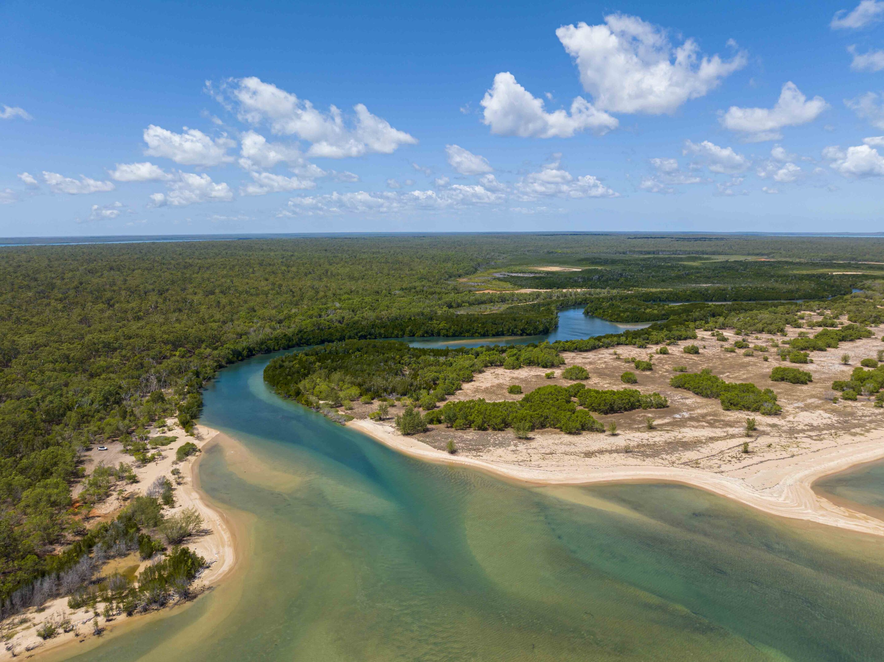
Garig Gunak Barlu National Park is as far north as you can go on the mainland in the Northern Territory, and the reward is pristine white beaches, sparkling blue waters, spectacular scenery and saltwater crocs.
Better known to many adventurers as the Cobourg Peninsula, this park sits on the Van Diemen Gulf and the Arafura Sea. Getting here is challenging – the roads are only open during the dry season and access is limited – however, this place is worth visiting time and time again.
This adventure began at Cahills Crossing, the notorious river crossing on the South Alligator River on the edge of Kakadu National Park. You would expect to see a plethora of saltwater crocodiles guarding the crossing, but on this occasion, there were none to be seen on the causeway – plenty floating about upriver, though.
1
I expected the water to be higher – according to the tide chart provided as part of my Cobourg information pack, it was close to high tide in this neck of the woods. It was, in fact, hardly flowing. You receive the information pack when the required permits have been accepted and paid for.
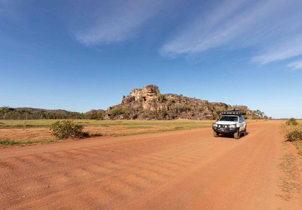
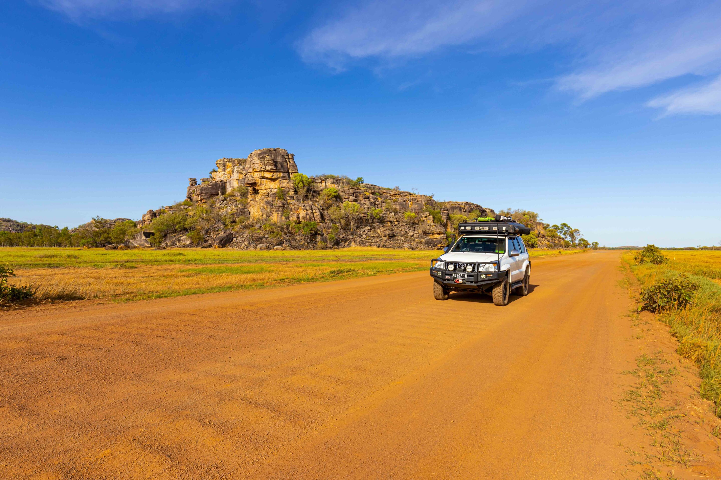
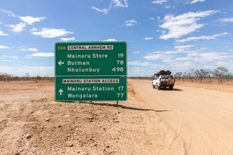
The unsealed Arnhem Highway runs past Red Lily Lagoon and some stunning rocky outcrops, and once past the Gunbalanya community turn-off, the conditions improved after a few bulldust holes and corrugations. The backdrops in this section are jaw-dropping, especially for a landscape photographer, but time was against me so I couldn’t spare the time waiting for the right light.
Into the park
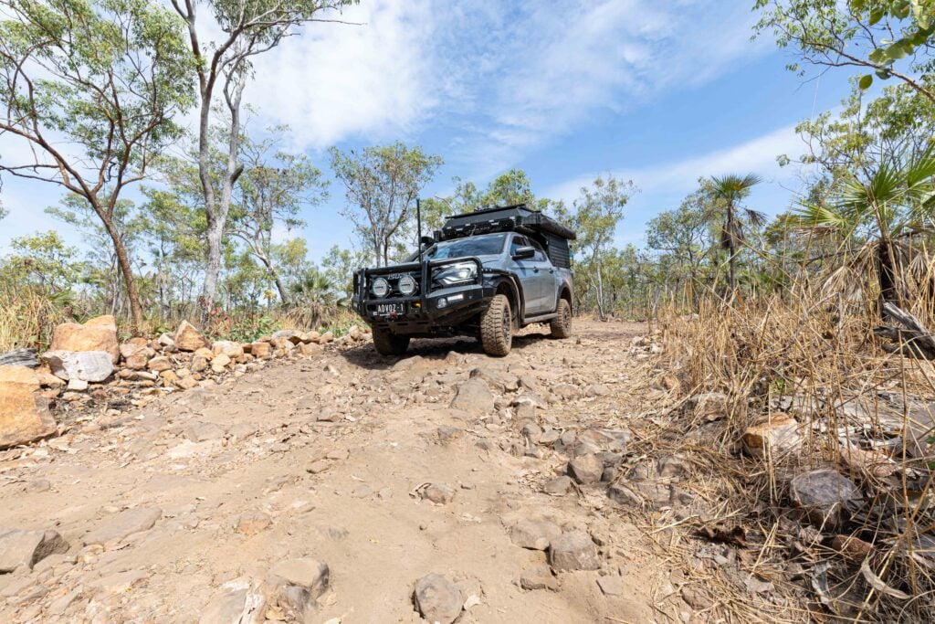
It didn’t take long to reach the turn-off towards Garig Gunak Barlu NP, some 235km north.
Murgenella Road was a little rougher, but dropping some more air out of the tyres helped a lot. Once the track smoothed out, it was good going, but keep an eye out for the Outback Spirit buses; they don’t like slowing down and stick to the middle of the track regardless of oncoming traffic. There are sections of bad corrugations and patches of bulldust, but for a remote Arnhem Land road, I found the conditions to be surprisingly good.
It’s interesting the number of trees that have had strips of bark removed along this section of road – I assume for use in creating bark paintings by the local Indigenous people. Also, I couldn’t get over the number of feral donkeys that roam Arnhem Land, and I wondered where they had all come from. The landscape is dominated by woollybutt and termite mounds, recent slow burns having cleared away the grasses and weeds. There was a section with Livingston palms and pandanus mixed with some native grevillea that reminded me of the Mitchell Plateau.
1
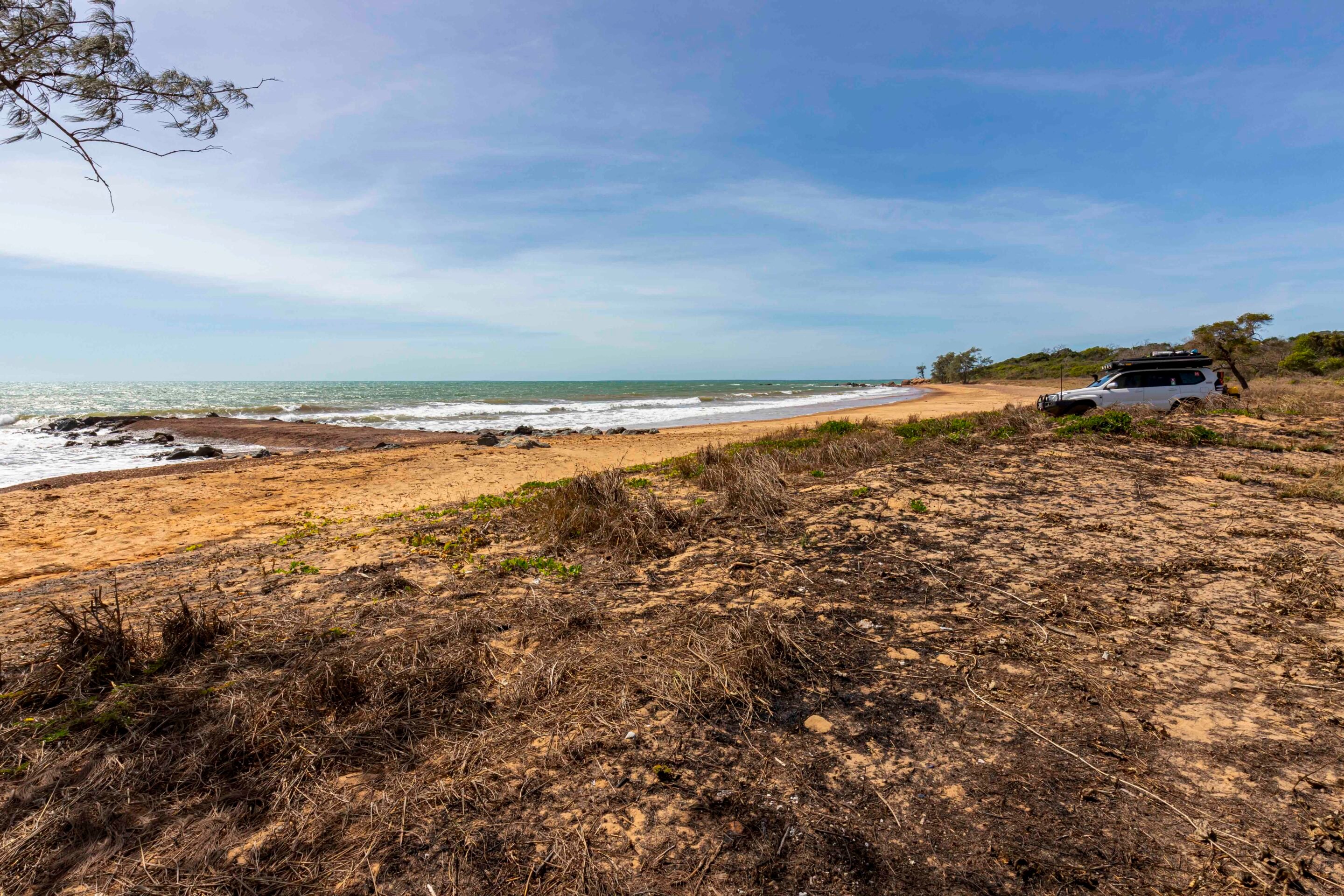
There is a signposted track that you can follow a short way to Wanyu Beach, which is extremely wind-swept, coming straight off the Arafura Sea. Here you will find what appears to be an old barge landing point, and the sand is deep and soft, so take care that you don’t get bogged. Retracing your steps back to the main road, you will track close to the coastline along this section before suddenly sweeping west towards Murgenella.
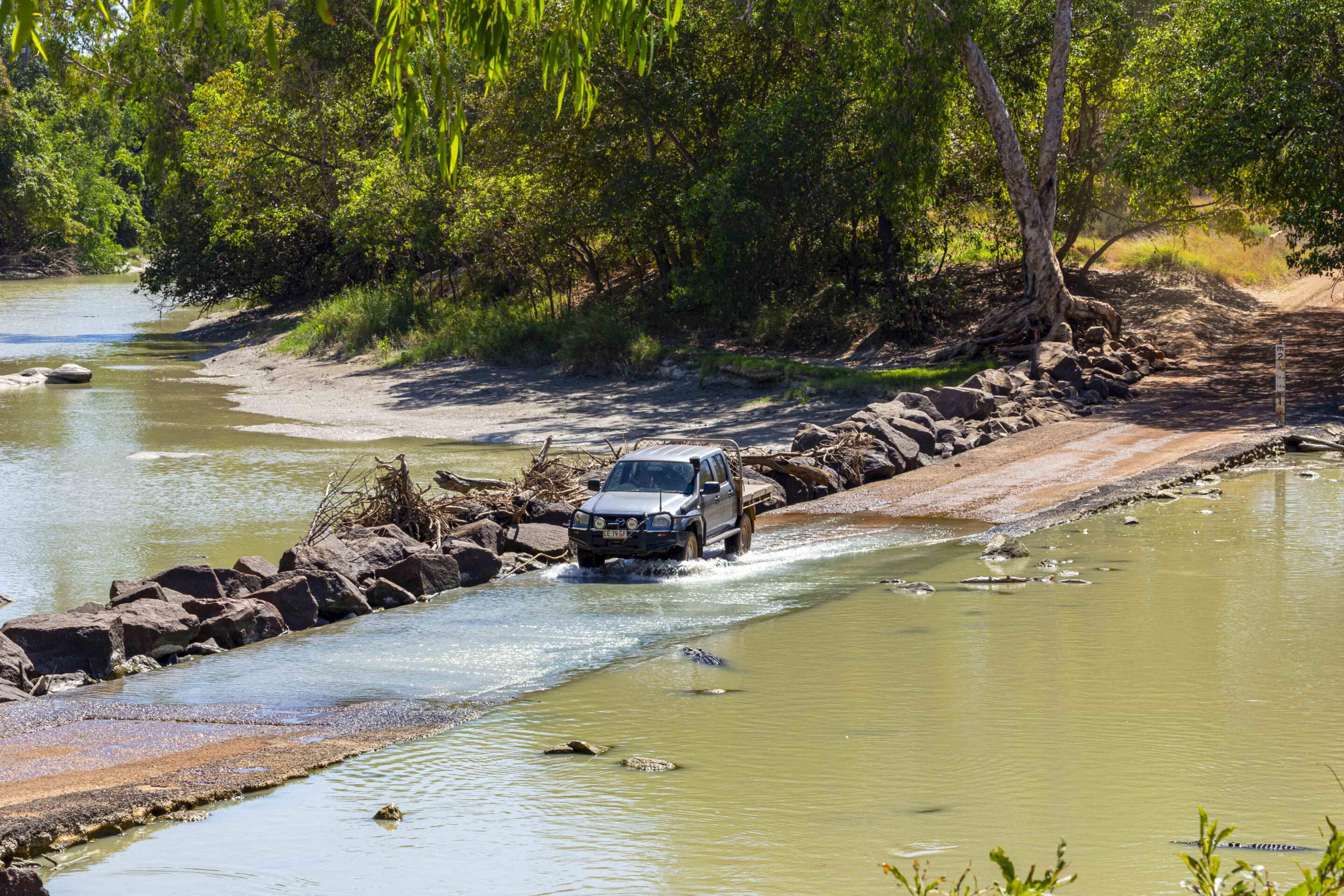
The river crossing just before the small community is pretty and there were plenty of pied herons, ibis, nankeen night herons, and a large school of fish enjoying the water. It is stunning – except for the resident crocs hiding in the shadows. The road continues west before heading north again towards Wiligi Outstation. Once past the Wiligi turn-off, the road narrows as it crosses over the range. It is slower going as the track winds its way through, with sharp bends and plenty of thick bulldust.
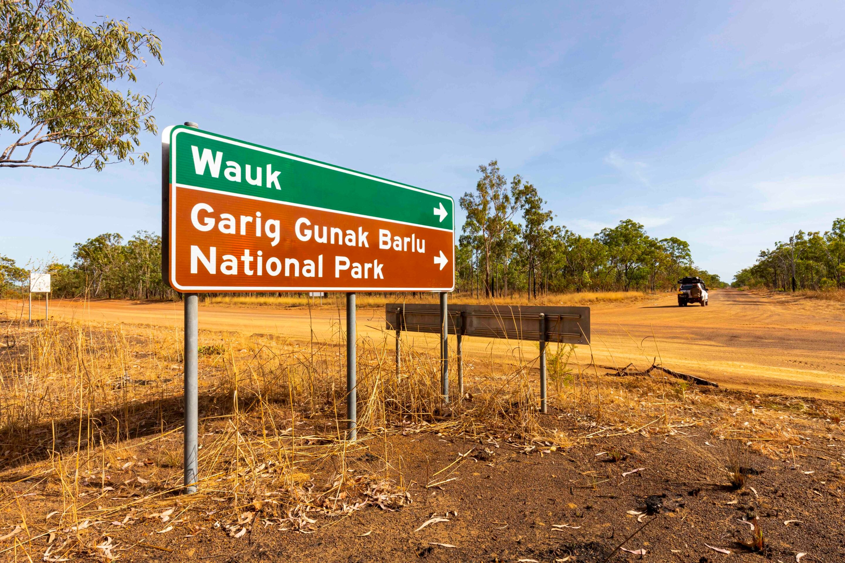
Upon reaching the national park boundary, the track becomes a single lane, and depending on when it was last graded, it can be rough going, so drive with caution. Only 20 vehicles are allowed into the national park at any time, which is why it’s such a serene place to visit.
Indigenous and introduced fauna
The park is populated with water buffalo, saltwater crocodiles, wild pigs and banteng – the latter introduced from Indonesia between 1829 and 1849 at Victoria Settlement… and they have since proliferated throughout the park and are an important resource to the Aboriginal people. They look like stocky cattle but have a characteristic white rump. They are full of fat, and while the park ranger didn’t enjoy the taste, his elders did – drinking hot tea while eating, as the fatty meat would stick to the roof of their mouths.
Having survived the corrugations and massive bulldust holes, I reached the Black Point Ranger and Cultural Centre. It is worth spending some time here, with plenty to learn from the storyboards. You’ll discover that the national park lies within various clan estates of the Iwaidja-speaking people of the Cobourg Peninsula and that custodianship is shared between the clans. There is a spiritual link between the land and sea and their ancestors from the Dreamtime that created the land and all it contains. The name of the park translates as Garig (a local language name of the Madjambalmi and Ngandjaharr clans for the central areas of the Peninsula), Gunak (land), and Barlu (deep water).
1
The park protects rare species that include the dugong and six marine turtles (green, loggerhead, hawksbill, olive ridley, leatherback and flatback turtles). The park was also the world’s first wetland to be recognised as a RAMSAR site on 8 May 1974. The Cultural Centre is also the start of the Wuwwurdi Walk, an easy 2km loop around a small coastal wetland. The walking track is a mix of hardened surfaces and sandy patches, and the early part of the day is the best time to walk it before it gets too hot.
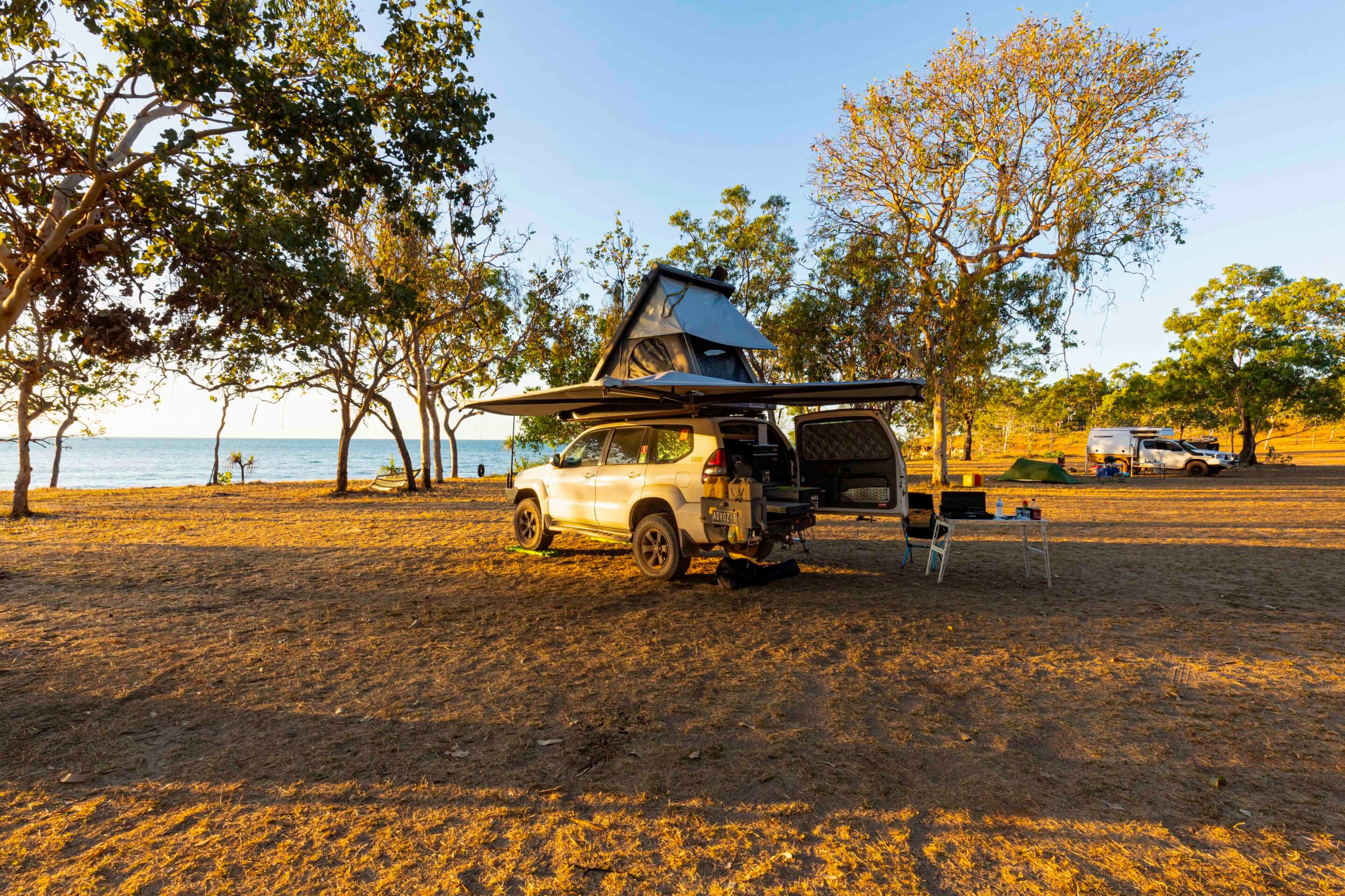
If available, a ranger will check you in and provide directions to your campsite – and if not, your campsite will be on your booking confirmation. It is a corrugated track that leads around Smith Point to the designated Camping Areas No. 1 and 2. I was in Area No. 1, with most campsites containing shade cover over a table and a rubbish bin, and only a short walk to the ablution shed that houses composting toilets and a cold shower. Firewood can only be collected within the park, not Arnhem Land, and you are only allowed to collect fallen timber.
The rangers are continually cleaning up the beaches and nearby islands from all the rubbish that comes from Indonesia. They struggle to find volunteers to come up and assist, so Clean Up Australia or a few 4×4 clubs would do well to get involved and lend a hand.
Exploring the area
It had been a long day of driving, so my afternoon was spent setting up camp and relaxing before enjoying a refreshing shower at the ablution shed to wash off the sweat and dust. Once dinner was consumed and the dishes were done, I climbed up into the rooftop tent and enjoyed an early night.
There are a couple of self-drive loop tracks that show off some of the highlights of this remote park, and I also recommend checking out the historic beacon at Smiths Point, which was originally constructed in December 1845 by Royal Mariners from the Victoria Settlement to assist vessels navigating around the reefs as they approached Port Essington. If you are lucky enough to book a boat that visits the Victoria Settlement ruins, I’m told it is well worth it, as this was one of two failed British settlements on the Cobourg Peninsula.
The wetlands drive is best undertaken in the early morning or late afternoon to fully experience the colours and see a variety of water birds feeding. You can expect to see brolgas, herons and whistling kites, and also plenty of evidence of banteng. October is when the pelicans arrive at the wetlands. The track is tight in places as you scout around the wetlands in a loop that takes you from the campground across to the ranger’s station; the woodlands are predominantly melaleucas and it is certainly a great experience tackling this drive.
The coastal drive is a 40km loop that takes you along the coast, with beautiful scenery and then onto Banteng Plain. There is a waterhole with plenty of birdlife including ibis and spoonbills. This drive provides plenty of options to pull over so you can get out and explore the beach. Just remember that you are in croc country, and they may be watching you without you even knowing it.
Upon leaving Stewart Point, the track heads into the woodlands before providing a final viewing of the bay. From all appearances, it looks like the sea floor is covered with grass and so would be a feeding ground for dugongs.
1
The coastal track then cuts across the peninsula to come out onto the main road into the park. Expect to cop some bush pinstriping as you wind your way along the track. Some sections are a little bit washed out, so take your time and enjoy. Keep an eye out for banteng because this is the type of terrain and bush they like.
The drive to Caiman Creek is a doozy because there are plenty of tree roots growing in the track, washouts, water diversion humps and the occasional rock or two. At the end of the 2.9km track is a very inviting-looking creek with crystal clear water and beautiful colours that is home to a big crocodile – not that I could find him, even with the drone. This is a beautiful spot for a picnic; it just needs a table and a shelter and it would be perfect.
On the way out of the park, you may spot small wallabies and kangaroos to add to your wildlife count – which will be exciting seeing as the banteng are so reclusive. I only saw one in the whole time I was here. Don’t forget that the care you took coming in should also be taken on exiting the outstanding Garig Gunak Barlu NP.
Wiligi Outstation and back to Kakadu
If you can’t obtain a camping permit for Garig Gunak Barlu NP, a great option is Wiligi Outstation, which is approximately a three-hour drive from Smith Point. This remote outstation is nestled on a cliff overlooking Mount Norris Bay and Copeland Island. Here you will be welcomed by Reuben and Liz, and there is a choice of accommodation options, including a log cabin, two safari tents with a kitchen and ensuite, two small cabins with ensuite, or bush camping along the beachfront with flushing toilets and cold showers.
You can drive down the beach to Crocodile Creek to try and spot the five-metre resident male saltwater crocodile or his smaller girlfriend; I spotted plenty of footprints, but that was all. You can bring a boat or hire the Wiligi boat for fishing. The Wiligi Outstation beach is stunning with its white sand, and while people do swim there, I didn’t take the risk.
37
The return journey to Kakadu via Cahills Crossing isn’t complete without a visit to Injalak Arts Centre in Gunbalanya. A permit is required from the Northern Land Council and Injalak Arts prefers that you make contact before you plan a visit by calling (08) 8979 0190 or emailing [email protected].
Injalak Arts has more than 200 active artists, weavers and craftspeople from Gunbalanya and the surrounding homelands, and you can spend hours browsing the bark paintings, carvings, paintings, prints and weaved products. Local artists are often onsite creating new works and they are very happy to have a chat and tell the story of their works.
Arnhem Land is such a special place and I felt privileged to be able to spend time exploring the remote Garig Gunak Barlu NP, Wiligi Outstation and Injalak Arts Centre. The people I met were so welcoming, the country so diverse, the scenery spectacular and the drive breathtaking. If you get the chance to visit this special part of the Northern Territory, know that you are one of the few people who have had the chance to do so.
Travel Planner – Garig Gunak Barlu National Park
Where
Location: Garig Gunak Barlu National Park is located 570km northeast of Darwin on the Cobourg Peninsula.
Entry and permits
Park Permit
- From $232.10 per vehicle (includes transit and camping for up to 5 adults for 7 nights)
- Children under 16 are free
- Must be booked at least six weeks in advance
Injalak Arts Centre Permit
- Apply via NLC
Kakadu Parks Pass
- Required for access to Kakadu National Park
- Valid for 7 days
What to see and do
- Remote 4WD self-drive tracks
- Excellent fishing and boating
- Birdwatching and wildlife viewing
- Beachside and bush camping
What to take
- Water, food and fuel (self-sufficient travel required)
- First aid kit, tool kit, spare tyres, vehicle spares
- Shade awning, fishing gear, camera, binoculars
- Sunscreen, insect repellent, suitable clothing and footwear
- Satellite phone or Starlink (no mobile coverage past Gunbalanya)
- A well-maintained boat and extra fuel are highly recommended
Other Useful Links
- NT Road Conditions: roadreport.nt.gov.au
- Kakadu Road Updates: kakaduroadreport.wordpress.com
Follow 4X4 Australia on Google
Get more 4x4 news, reviews and gear stories from 4X4 Australia in your Google feeds.

We recommend
-
 Explore NT
Tackling the Finke River 4WD route
This route offers an exciting journey through the Finke Gorge National Park, showcasing stunning desert landscapes
-
 Explore NT
4x4 trip to the stunning Palm Valley
Palm Valley is home to ancient and unique palms and the mighty Finke River, and it’s ready to explore
-
 Explore NT
Unforgettable top-end escape to East Arnhem Land
Solo travel is mind-cleansing, especially when it takes you to a place as beautiful and remote as the Gove Peninsula