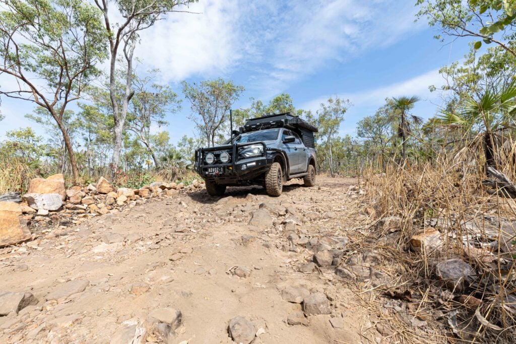
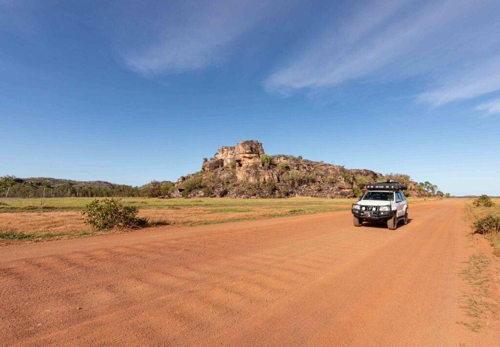
Explore NT
Gallery 1
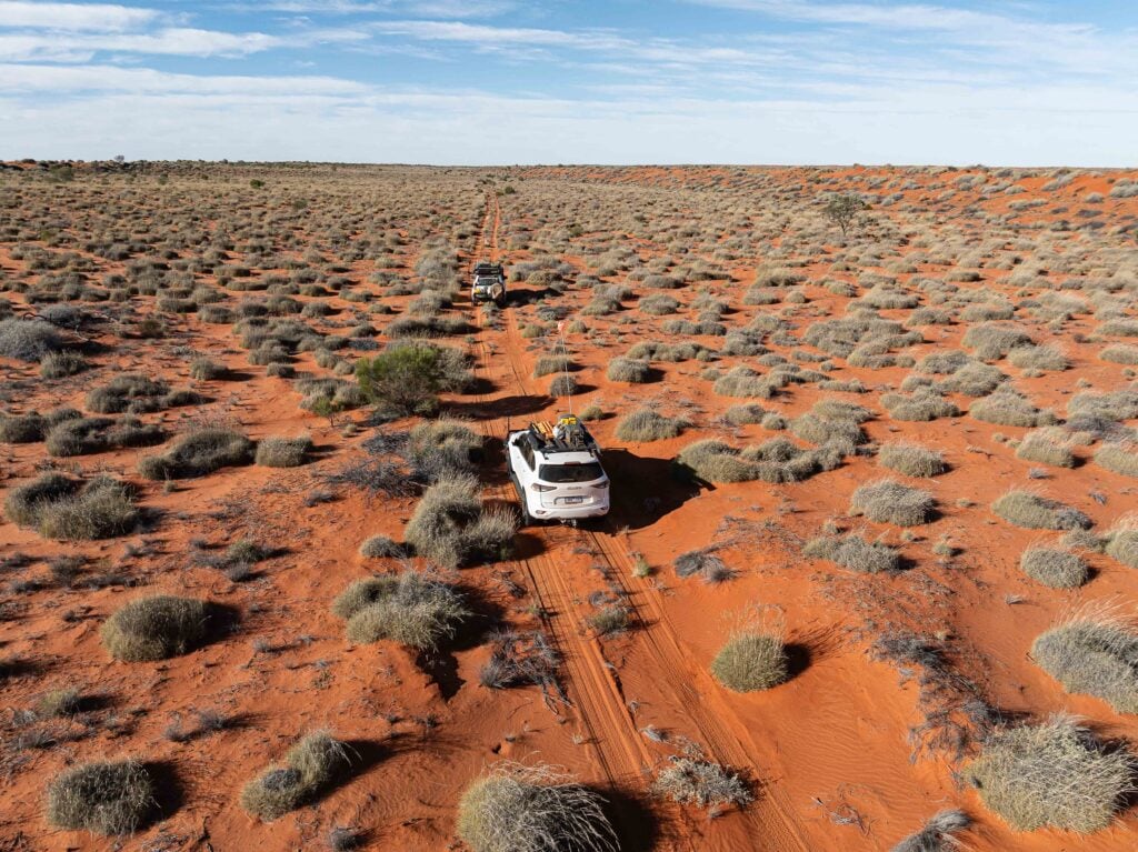
Our small two-vehicle convoy ground to a halt on top of a soft, red and raw dune as the faint shot line we had been following completely vanished.
Despite being marked clearly on maps, the route had varied all day from barely visible to absolutely non-existent and now we were faced with the prospect of another section of cross-country travel. This time, though, there seemed to be even more thick scrub and vegetation between the dunes and the depressions as well as around the saltpans and short-lived creeks.
Off in the distance there was what looked like a corridor of thinner vegetation. Problem was it was to the east – the complete opposite of the direction we wanted to go. Keeping in mind that, sooner or later, we’d have to swing west, we decided to head that way and see what the next inter-dunal valley would hold.
Just as we were about to head off, the sound of barely audible wheezing of air from a slowly deflating tyre on my mate’s Nissan Patrol caught our attention. Out came the spray washing fluid and the tyre plug kit and within five minutes we had managed to plug the offending leak.
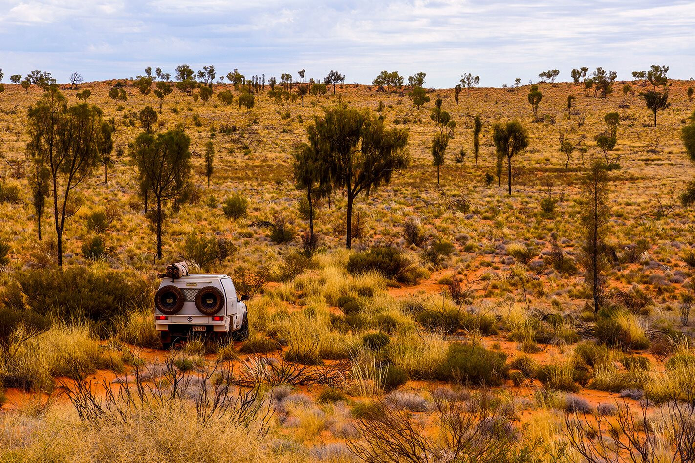
My Patrol was wearing its normal attire of Cooper ST Maxx rubber – not exactly the set-up for cross country and trackless travel – and while I hadn’t got a puncture yet, it was more good fortune than anything else. In such conditions I prefer to run older but tougher cross plies; I even have a set of solid MRF M77 tyres at home which have proven to be darn near puncture-proof in scrubby and stakey conditions. I was the lucky one though – my mate Brenton unfortunately ended our latest outback foray with a couple of punctures.
Our adventure had started a few days earlier when we had travelled from the Aboriginal community of Papunya down to the much smaller community of Haasts Bluff. This route can be an alternative to or from Alice Springs to the Tanami Road, or the route west via the Gary Junction Road as it passes the great distinctive peak of Haasts Bluff, which is worth the drive just for that.
Brenton had been in touch with Douglas Multa, the chairman of the Haasts Bluff community and the Traditional Owner of all the country in and around the Cleland Hills. Our trip was to be a recce to see if a guided tour could be arranged to the enigmatic hills as a commercial venture for the community and their newly formed indigenous rangers to engage in.
We dropped in, saw Douglas and, after our introductions, got the latest information on the track and the access to the hills. His words “You’ll have trouble heading much further west to Kintore, but you can try” were to come back to us quite a few times as we pushed west from the ranges.
With full tanks of fuel – both Brenton’s and my Patrol carry more than 250 litres of fuel when fully loaded, along with a 100 litres of water plus two spare tyres and all the assorted gear you need for a remote desert trip – we cruised westwards on the red, sandy and graded road, away from the small community. This track almost sits on top of that imaginary line of Longitude that marks the Tropic of Capricorn.
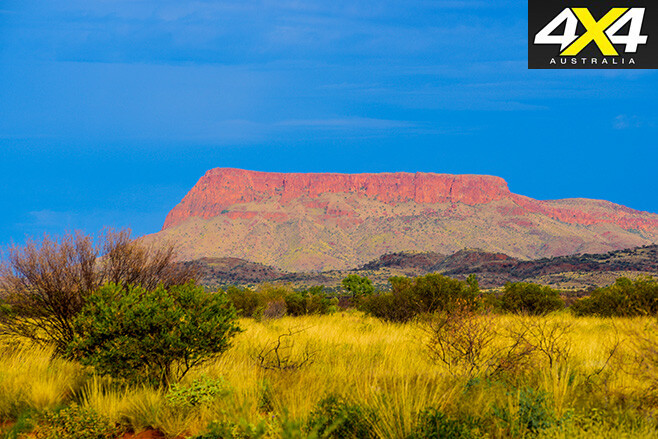
To the north, Mt Crawford, a big sheer-sided massif, stood high above the sandy plain. Mt Crawford is the most dominant point of this range, with Blanche Tower (Winparku in native tongue) visible behind it. Sadly we didn’t have permission to go there, so with my curiosity held in check we pushed on to Limestone Bore. With the track striking south-west we headed for the more remote Tarawara Bore. Both bores showed signs of the pastoral occupation of this country before it was handed back to the Aboriginal people.
After taking the wrong track at Brown’s Bore we became slightly misplaced geographically but, after a few hundred metres, we realised we were heading the wrong way. We retraced our steps back to the bore, with tumbled-down fencing and troughs marking the spot, and picked up a track that first headed north before striking west once more.
It quickly became obvious the route was seldom used, with tall seeding spinifex dotting the middle of the track. It wasn’t long before we fitted grass blinds to the front of both Patrols to protect the radiators from blocking with junk and overheating.
We passed yet another ‘No Entry’ sign and pushed on, dodging through a gap in a low rocky range where an ephemeral creek had washed away all signs of wheel tracks and modern man. Close to the range’s low cliffs we found signs of Aboriginal people who had once used this favoured area to camp and hunt.
After traversing another 50km west we swung onto a more subtle track and headed towards the eastern ramparts of the Cleland Hills. We pulled up at a small camping area used by Traditional Owners (TOs) and indigenous rangers when they come out here for sacred ceremonies or environmental work.
This spot was close to the Muruntji Rockhole (however, this is marked on most maps as Muranji) but it was too late in the afternoon for any further on-foot exploration.
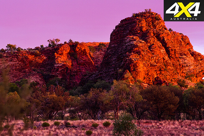
The next morning we woke to a glorious sunrise which lit up the nearby cliffs in a blaze of rich colour. Unfortunately, while the omens seemed in our favour, our search for the ‘faces’ of the Cleland Hills, made famous by Michael Terry in the 1960s, was to no avail.
The ‘faces’ and stylised figures that have made the Cleland Hills famous have previously been attributed to interplanetary visitors, but other researchers aren’t quite so liberal with their theories (see Michael Terry’s theories about ‘secret visitors’ at Austhrutime and search ‘Cleland Hills faces’).
Similar petroglyphs have been found in other Australian desert environments, but the Cleland Hills engravings remain unique. And while a nearby occupational site has been dated to 22,000 years ago, the age of the faces has still not been determined.
It’s important to do your research before embarking on a remote desert jaunt, and this became painfully and embarrassingly clear as we realised we were searching in the wrong area. The offer, however, to come to this remote place had suddenly appeared and I wasn’t going to miss the opportunity, poor research or not.
It was probably for the best that we didn’t find the faces, as we later found out that we didn’t have permission to visit Thomas Reservoir (as named by Terry) where the ‘faces’ can be found with some diligent searching. Next time we’ll hopefully have a TO or a local ranger with us to guide our exploration of these unique hills.
We attempted to explore around the escarpment of the ranges until the rising sun and heat drove us back to camp. In that short time we managed to find some rock shelters and pools of water hidden in the hills along with some faint Aboriginal art and grooves where spears or tools had once been sharpened. Small victories, but still well worth the trip.
With little more to gain from staying at that location we fired up the Patrols and headed south around the great arc of the Cleland Hills to continue westward and then north towards distant Kintore.
While we had the latest maps, Google Earth satellite images and Hema navigators to guide us, the quickly eroding and overgrown tracks forced us to go cross-country. Established more than 40 years ago in the 1970s, most of the shot lines have disappeared from lack of use – so as to make some maps near useless.
Two days after leaving our camp at the Cleland Hills we unexpectedly came upon a modern track network south of Johnstone Hill which wasn’t marked on any of our maps and invisible on Google Earth. Our maps showed a track to the south, so, despite it being in the wrong direction again, we headed that way. Luckily, our hunch paid off and we drove onto a well-used mining and oil exploration road, about 70km east of the Sandy Blight Road.
Our speed increased from the frustrating 5-8km/h we had been averaging for the past day or so to a relatively quick 40-50km/h. We camped just short of the Sandy Blight Road with the impressive Mt Strickland as a backdrop. The next day we were back on a good dirt road, our annual adventure over as we headed back to Papunya. All that remained was lengthy discussions with the Traditional Owners on further access for tour groups, which are still ongoing!
1
TRAVEL PLANNER
Papunya is 250km west of Alice Springs via the Western Macs and Haasts Bluff. The community has a general store that supplies fuel and food to passing travellers.
Kintore is 520km west of Alice Springs along the Gary Junction Road. There is also a well-stocked store supplying fuel and supplies.
Visiting the Cleland Hills is only possible with permission from the Haasts Bluff Traditional Owners or from the Central Lands Council in Alice Springs. Guided tag-along tours may be available in the near future.
What’s your next off-road destination? Find out and explore.
1
Follow 4X4 Australia on Google
Get more 4x4 news, reviews and gear stories from 4X4 Australia in your Google feeds.