Explore QLD
Gallery13
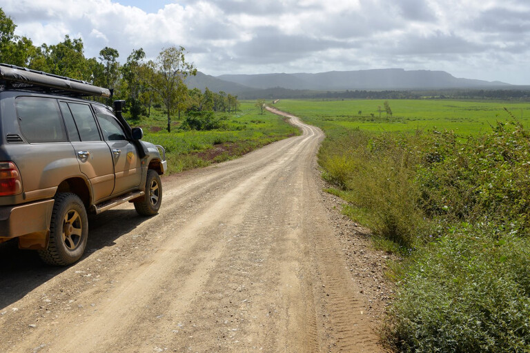
THE Cape York Peninsula is a wilderness region that defies imagination.
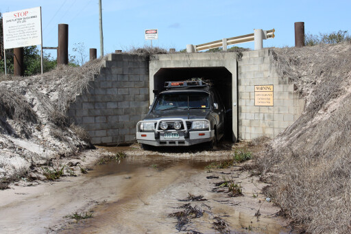
It’s not all about wrecking the fourbie by dropping it off the Gunshot Creek bank, or being the first to ‘conquer’ the Telly Track after the Wet. No, the Cape is more than that.
It has some of the best river and sea fishing, amazing photo opportunities, the best bird watching, the largest tract of lowland rainforest in Australia, and the longest parabolic sand dunes in the world.
The Jardine River is the largest perennial stream in Queensland, while just to the north the Kennedy-Escape Rivers Aggregation has the largest mangrove tidal forests in the Sunshine State. The Jardine National Park is the wettest place in Australia, having more streams born from bountiful springs than anywhere else in the country.
 This is the region that also has the world’s only ‘Wet Desert’, as the Jardine Brothers named it during their epic cattle drove from Rockhampton to Somerset, via the west coast, in 1864. The wet season caught up to them on the Mitchell River, where they fought off hostile natives protecting their country.
Past the Wenlock River they struck sandy heartland country and heavy rain, yet 10 minutes after a downpour there was not enough to drink for the stock, hence they named it the Wet Desert. Yet the historical significance isn’t found in the Heathland Reserve name – which is a common scrub environment found on the east coast and across to Western Australia.
How to prepare your 4x4 for a trip to Cape York
While three weeks is enough for anyone living north of Townsville to have a great time on the Cape, travellers residing in Melbourne, or farther afield, need to add at least a week or more to cover the extra travel time to Mareeba or Cooktown to stock up, check the vehicle, and have a break for a day. Let’s have a closer look at what this region has to offer.
FISHING
ARGUABLY, the most common recreation on the Cape is fishing – and why not? You can catch a barramundi, trap tasty mud crabs and cherabin, or take a charter out of Port Douglas or Cooktown to fish the waters of the Great Barrier Reef for the whole gamut of tropical fishes. Bait fishing, either with live or dead bait, is highly favoured and, of course, cheap.
Lure fishing with both soft and hard bodies is hugely popular. Problem is: most southern-based anglers are under-gunned for hard-fighting tropical fishes. You need at least 100 metres of 20-pound braid line and a solid spin or baitcasting reel and rod combo to handle a 60cm barra when fishing in snags.
The choice of lures is extremely important, as tropical fish are tough and smash lures. Buy your lures in the north; there are plenty of tackle shops manned by people who live and breathe fishing. They will give you all the expert advice needed to make the trip a success story.
 You can buy tackle at southern prices or cheaper in Atherton, Cairns, Cooktown, Weipa and New Mapoon. They only stock lures and colours that work on the local fish and will provide all the information needed to catch a feed in a freshwater stream, beach or in the sea.
Consider budgeting for a day barra-fishing trip from Cooktown, Weipa or Bamaga. It will teach you about the local fishing scene and the dangers of fishing in crocodile country.
Something to think about is that Kowanyama, Pormpuraaw and Aurukun have campsites for visiting anglers. Cost is $35 per night per vehicle. You don’t get much as far as site comforts are concerned, but it gets you right into the heart of the best fishing country on the west coast.
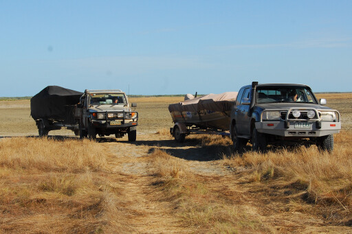
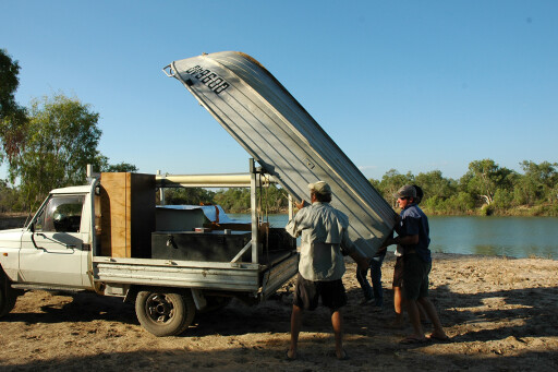
 A tinnie or a trailer boat is almost a must for successful river fishing. However, with roads maintained to a high standard, this is no problem, apart from having to launch directly from muddy tidal banks in most areas.
Both Cooktown and Seisia have some of the best land-based fishing platforms anywhere on their wharves. There is excellent fishing from all Cape beaches – especially near stream mouths – with barramundi, cod, northern flathead, whiting, trevally and queenfish being targeted.
The same applies to estuaries – if you can get to them, as most are fringed by mangroves and deep mud.
Australia's best off-road destinations
In brackish and fresh water you can trap cherabin with an opera house trap, and they are much tastier than other prawns. You can boil muddies in saltwater, or toss them on campfire coals.
CROCODILES
MOST people never see a crocodile when on the Cape. Take a river cruise on the Daintree or Endeavour Rivers and get real close, but stay well away from the water and keep kids and dogs away. Observe and heed the warning signs, including of box jellyfish, late in the season.
It’s easy to get stung as many fishers do when wading, dragging or casting bait nets, because unseen tentacles are caught in the mesh.
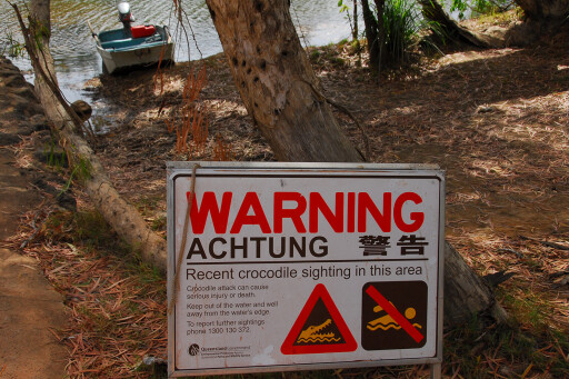 Camp and stay well away from water when on beaches and river banks. Always check the water when fishing or boarding tinnies for crocodiles which may have taken up an ambush position under the boat.
On the Coleman River camps at Pormpuraaw, there is no choice but to camp on a narrow grassy strip between the tidal river and the tidal flats, sometimes only metres away from the steep slippery bank.
BIRDWATCHING
WITH more than half the number of our 800-odd species of birds calling the Cape home, it stands to reason that birdwatching is a big attraction here. There are species inhabiting these parts that you won’t find anywhere else.
The Iron Range National Park, which has Australia’s largest tract of lowland rainforest, is amazing for its variety of bird species.
5 things I don't head bush without
Chili Beach is another great spot, especially when myriad shining starlings roost for the night on the little island. There are also many waders flitting back and forth on the water fringes when they feed at low tide. Take a drive at the turn of the tide from high to low and head south to Chili Creek.
It has great birding en route and good fishing at the mouth. It’s also an amazing scenic drive that takes in much of the coconut-palm-fringed beach.
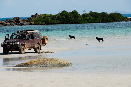
BEACHES
OKAY, the Cape’s beaches mightn’t be safe for swimming, but they are absolutely stunning. It all starts north of Cairns along the Daintree Coast to Cooktown. Elim Beach at Hopevale and its coloured sands is not to be missed on a venture north. Campsites are cheap and, with walks, beach drives and excellent fishing, Elim Beach is a great family spot.
To the north, across the Morgan River, is some 20km of hard beach that ends at Cape Flattery. It’s accessed from the Starcke Track before Mount Webb National Park. The track is not marked and, depending on the duration of the wet season, it can be awfully damp.
Air the tyres down to 16/18psi and, more importantly, check the tide chart as you don’t want to be caught in a rising tide. It’s an awesome feeling to look across the Coral Sea towards Elim Beach and Cape Bedford before plunging down on the dune track to the beach.
There are campsites on the Morgan River and beautiful wind-protected Connie Beach on the northern end of Cape Flattery. A track turns off the beach about 2km before the sand-mine loading jetty.
 The Starcke Track is maintained as far as the Starcke River. There is a boat ramp and a campground with no facilities near the mouth. Freshwater is available from two dams on the way in.
The Cape Melville National Park, Ninian Bay, and Bathurst Bay, have beach campsites. It’s wild country, with even rougher tracks that offer great fishing and total adventure escapes. Oddly, they are not that popular with Cape visitors, though locals love them to death because of the fishing.
Further north is Port Stewart, which is reached via the Running Creek track near Olive Vale Station, and from the PDR, via the Port Stewart Road, south of Coen. Most beaches are not accessible by vehicles.
Encounters with outback wildlife
Across the Jardine River the Nanthau Beach Track, south of Somerset, is a great spot for fishing and remote camping – provided the southeast tradewind isn’t blowing hard. This track is also called the Five Beaches Track. It’s a fairly easy drive, though, again, air the tyre pressures down.
The west coast beaches are accessible at several spots between Loyalty Beach and the Tip, and at Mutee Heads. Unlike the east coast, the west coast has wind protection for about 2km from shore before the wind ‘touches’ down. It provides a calm strip along most western beaches.
The Vrilya Point track has been closed by the traditional owners.
 Pennefather River estuary, north of Weipa, is very popular with anglers. Beach access north of Aurukun is in limbo at the moment due to mining in the region. To the south, the 8km long beach between the Chapman River and Mungkan Creek at Pormpuraaw has full access. If you need a place to park up, there are camp sites at the mouth of both estuaries.
There are, of course, many other options. The most underutilised parks on the Cape are the separate grounds within Oyala Thumotang National Park, formerly known as Mungkan Kandju. The Coen section is bound by the Coen and Archer Rivers.
The Burke Developmental road, Queensland
There are plenty of campsites and, with very few visitors, this park is the remote Cape escape you may be searching for. The Archer section is on the Archer River, and there are waterholes and billabongs to explore as well as top fishing and camping to be had.
Further south is Rinyirru National Park (Lakefield), with eight rivers emptying their bowels into Princess Charlotte Bay. All have long tidal reaches and deep permanent pools upstream, backed by numerous billabongs and lagoons. Rinyirru is certainly a place you could call home.
WWII HISTORY
THE JACKY Jacky airfields at Bamaga, Horn Island and Iron Range were strategic bases in the defence of Australia, where Japanese war planes bombed the military installation. Evidence of those dangerous days remains with the remnants of pill boxes, earth banks where planes were parked, and planes that were shot down. It’s well worth the effort to go and see.
THE TORRES STRAIT
PEDDELL’s Ferry Services and John Carlton Cape York Adventures operate day cruises to Thursday and Horn Islands, and no Cape visit is complete without visiting these historic places.
 Here you will learn about the early Tip settlements, the Russian Invasion fear and the resultant Green Hill Ford, WWI and WWII defences, the bombings of Horn Island, the Indigenous Torres Strait Garrison, the pearl industry, and much more. The trip is very informative and scenic and well worth budgeting for. The Torres Strait people are very different in culture compared to mainland people.
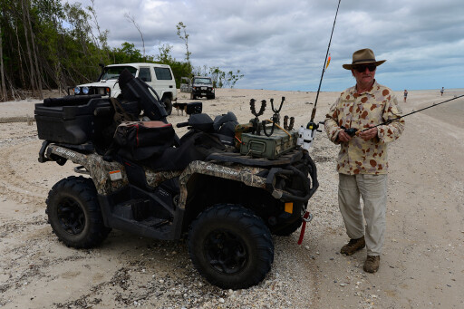
ATV/UTVs
QUAD and side-by-sides aren’t allowed in Queensland national parks and reserves. Elsewhere on the Cape, they are restricted to private lands, non-park beaches and Indigenous land, provided permission has been granted. There are no restrictions on the Telly or Frenchman’s Tracks as far as I am aware, though take care when riding on remote tracks and beaches.
FOSSICKING
VISIT the Queensland Natural Resources site for fossicking areas on the Cape, permits, camping and permission. There are historic sites with the remains of machinery, buildings and diggings that give an insight to yesteryear on what true pioneering was all about.
 TIP OFF
VISIT the various Cape websites for birdwatching, camping, fishing, fossicking, hunting and relevant information. Fly the Cape with Google Earth for hidden tracks, but most of all, do your own research and don’t rely on Facebook Cape ‘experts’. There is much more to it than merely getting to the Tip.
FACT BOX
National Park Information and Camping permits: www.npsr.qld.gov.au/camping
Phone: 13 QGOV (13 74 68) to book using a credit card. Camping permits can also be obtained at NP offices at Cairns, Cooktown, Coen, the Atherton Visitors Information Centre, Cooktown’s Lure Shop and Moreton Telegraph Station. Self-servicing facilities are at some ranger bases – credit card only.
Emergencies: Dial 000 or 112 with a digital phone or satellite phone. Carry a Personal Location Beacon (PLB).
Fossicking: www.dnrm.qld.gov.au
Alcohol Restrictions: www.tourismcapeyork.com/know
Road Conditions: www.131940.qld.gov.au or www.cook.qld.gov.au
Waste Disposal Sites: www.lawmac.org.au
Quarantine: www.daf.qld.gov.au/quarantine
Please enable JavaScript to view the comments powered by Disqus.
COMMENTS