Explore QLD
Gallery32
North Queensland has an amazing history of mining, some endeavours of short duration and others that continue to operate today.
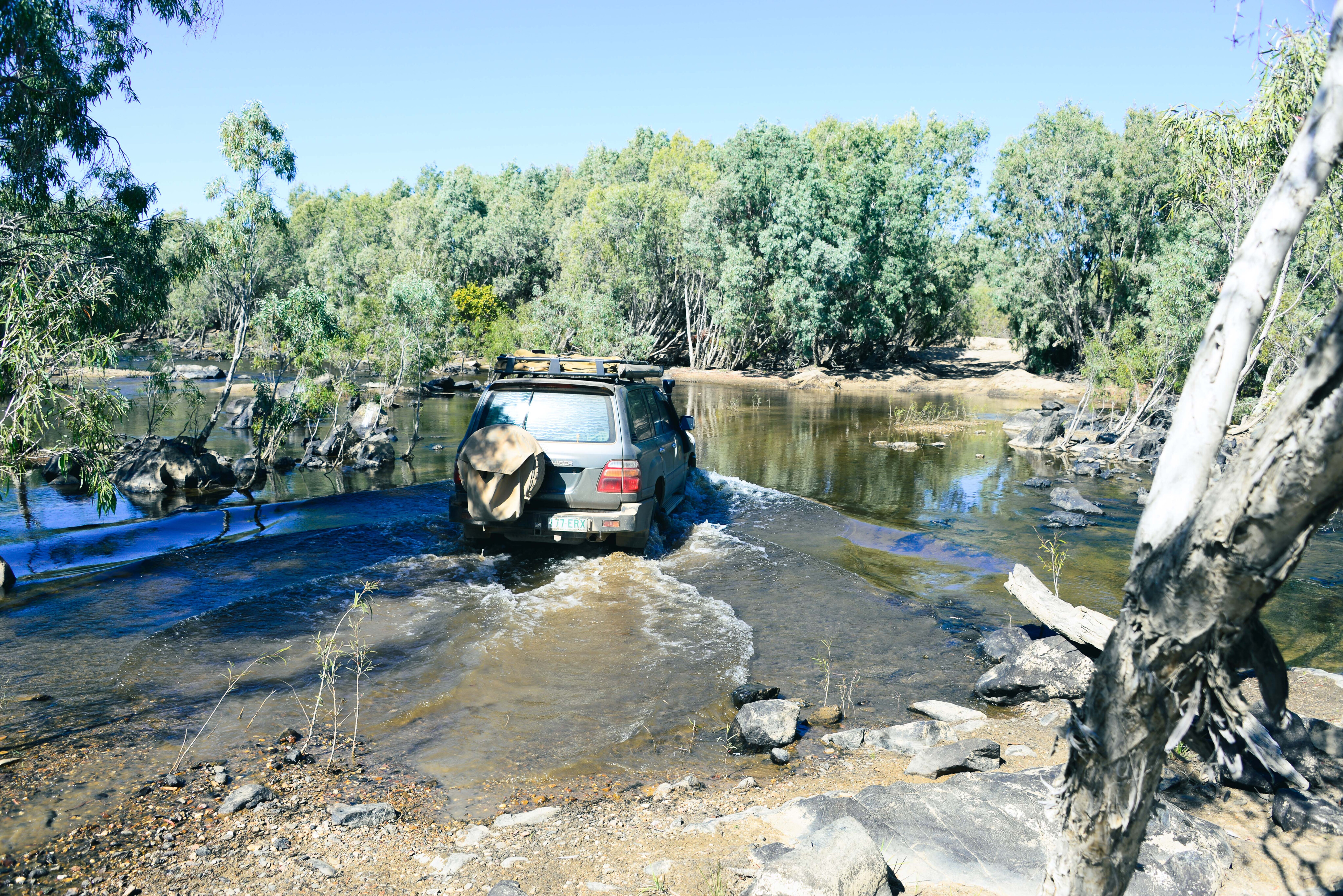
Many mine sites are closed to the public due to being on private or restricted Aboriginal land, and while others can be accessed at your own risk, the tracks can be treacherous and dangerous due to washouts and their isolated locations.
I love old mine sites and their once-bustling but now abandoned townships, and the legends and history of rags to riches for those who dared, finding the ore, mining and processing it, reaping the financial rewards or enduring the loss of bad investments.
The silent, often ghostly ruins tell tales about the people who settled the most remote locations in the country; men, women and children who dared to challenge the wilderness, walking and carrying their possessions on their backs, or on a pushbike or wheelbarrow. Some rode horses, or drove drays and wagons loaded with lengths of galvanised iron that would become their new homes.
32
Droughts and floods dogged their way while the unfortunate fell victim to long spears or were waddied to death as they slept by hostile tribal people who objected to their country being overrun by the newcomers.
Mining ruins and towns are about our history, the hopes and the ambitions of our pioneering settlers, and the dwellings and settlements they lived in under trying conditions.
Children died from heat stress, men and women went mad, and they endured sorrow and sadness beyond the imagination of modern people. They were heroes who made such an amazing contribution to building our nation as we know it today.
Here are some of North Queensland’s old mining sites…
32
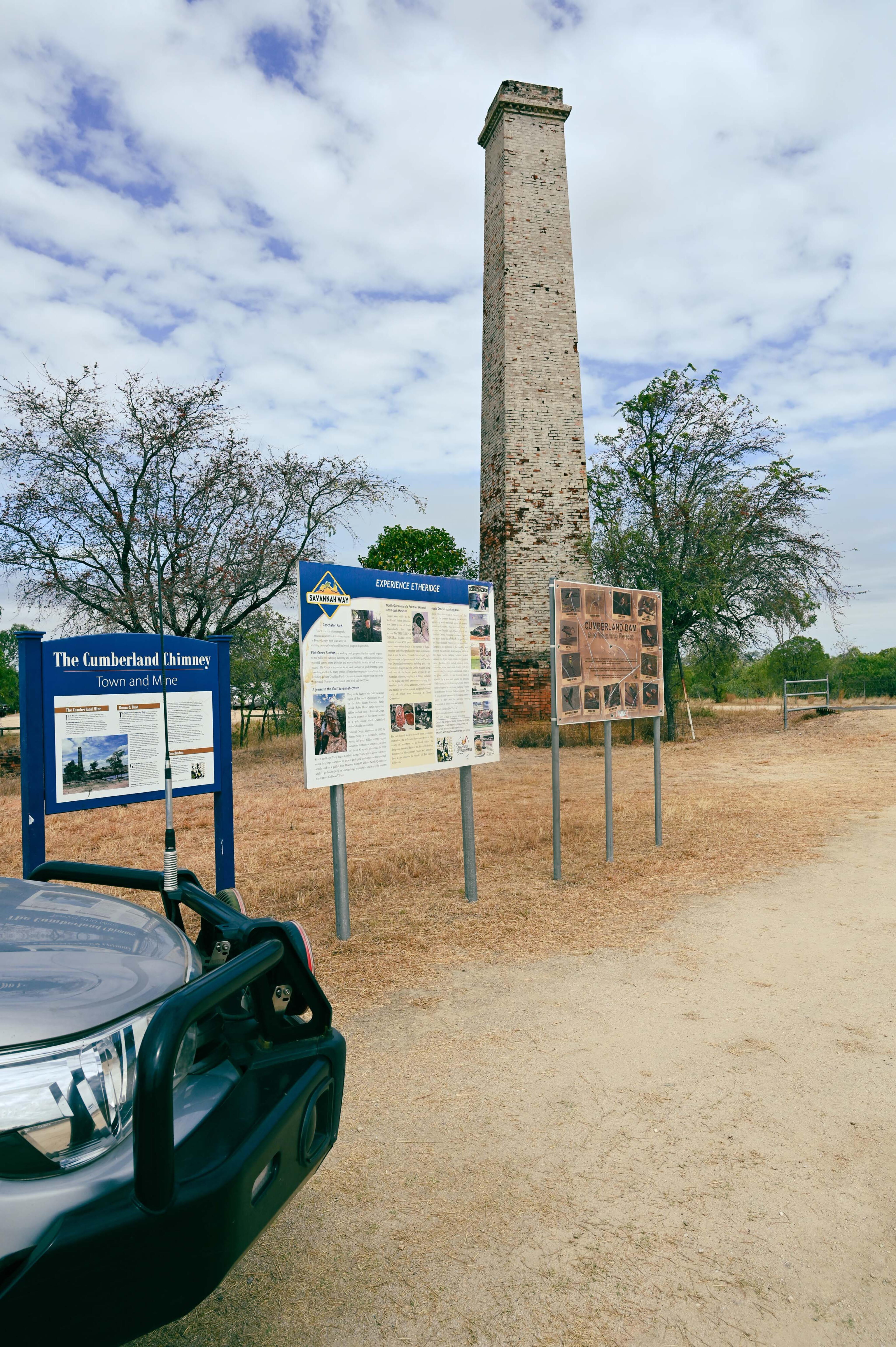
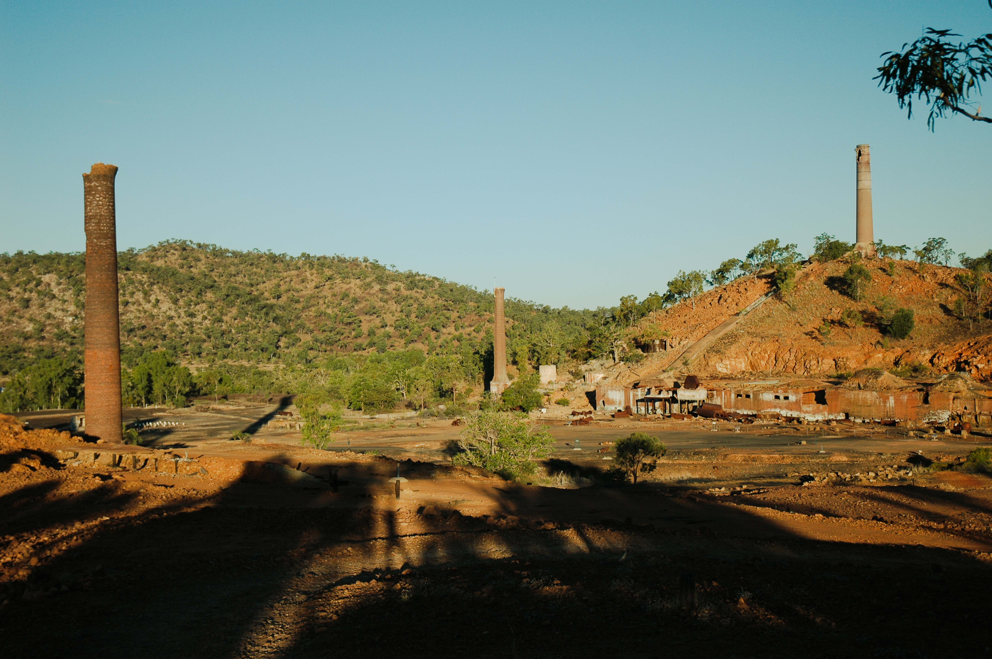
Cumberland gold mine
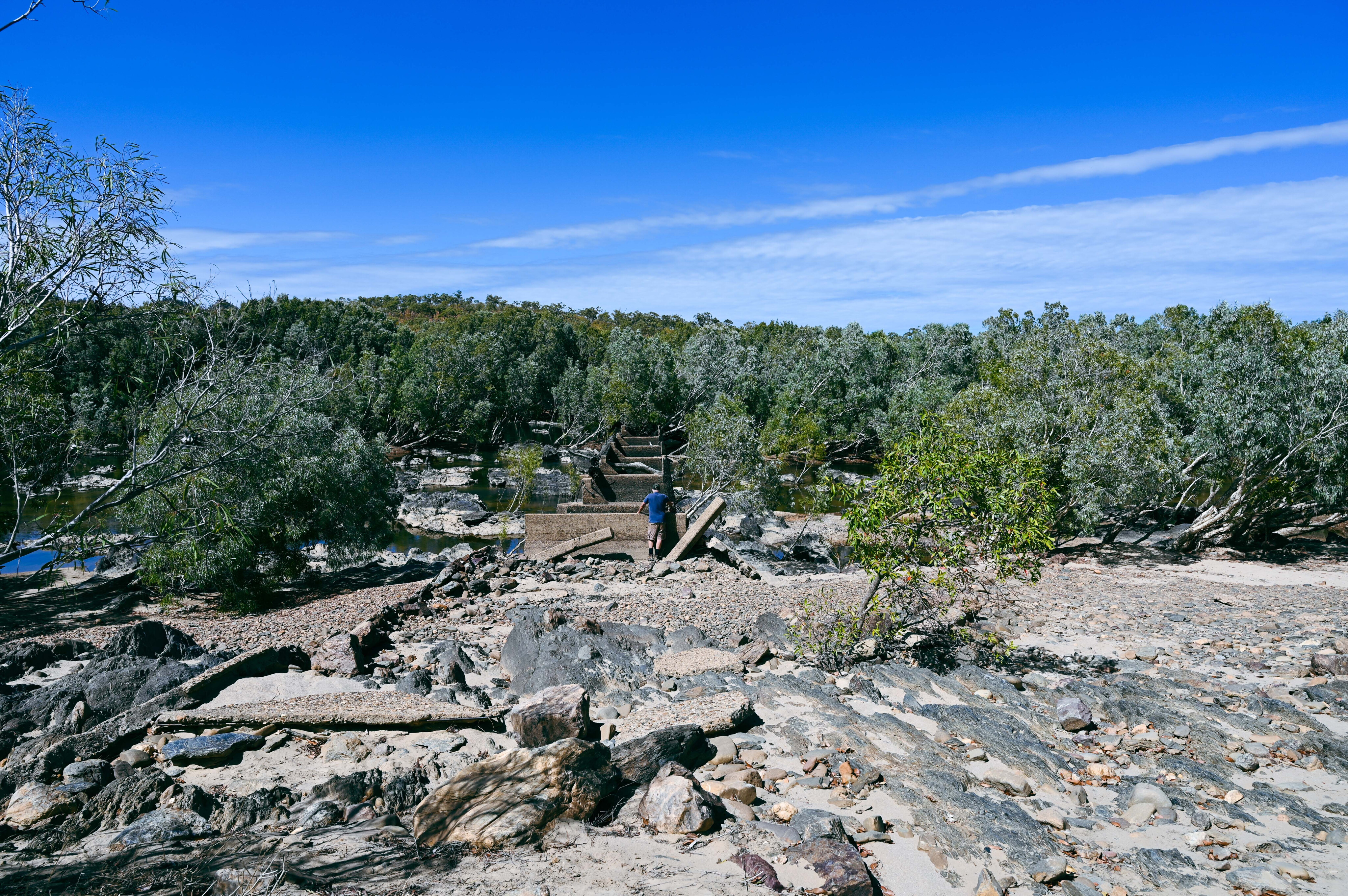
Located along the Savannah Way, west of Georgetown, Cumberland is easy to locate as you can spot its tall chimney rising out of the open woodlands and above the hills before you arrive. It’s only several hundred metres from the busy highway and is well signposted.
Today the dam that once provided water for the mine is alive with waterfowl that frolick about colourful water lilies where melaleuca and gum trees provide shade for the annual invasion of dry season grey nomad travellers.
As in other places along the Savannah Way, councils have established unofficial campsites with no facilities and it’s up to people to do the right thing with night soil and rubbish disposal, or these sites will be closed.
32
In its day Cumberland was the richest and largest gold mine on the Etheridge Goldfields.
It was registered by Parks, Smith, Hardie and Steele on 18 December 1872, and it sold 14 years later to the Cumberland Mining Company Ltd. The vendors were smart, because in addition to being retained as managers, they received £100,000 in cash and £60,000 in fully paid £1 shares.
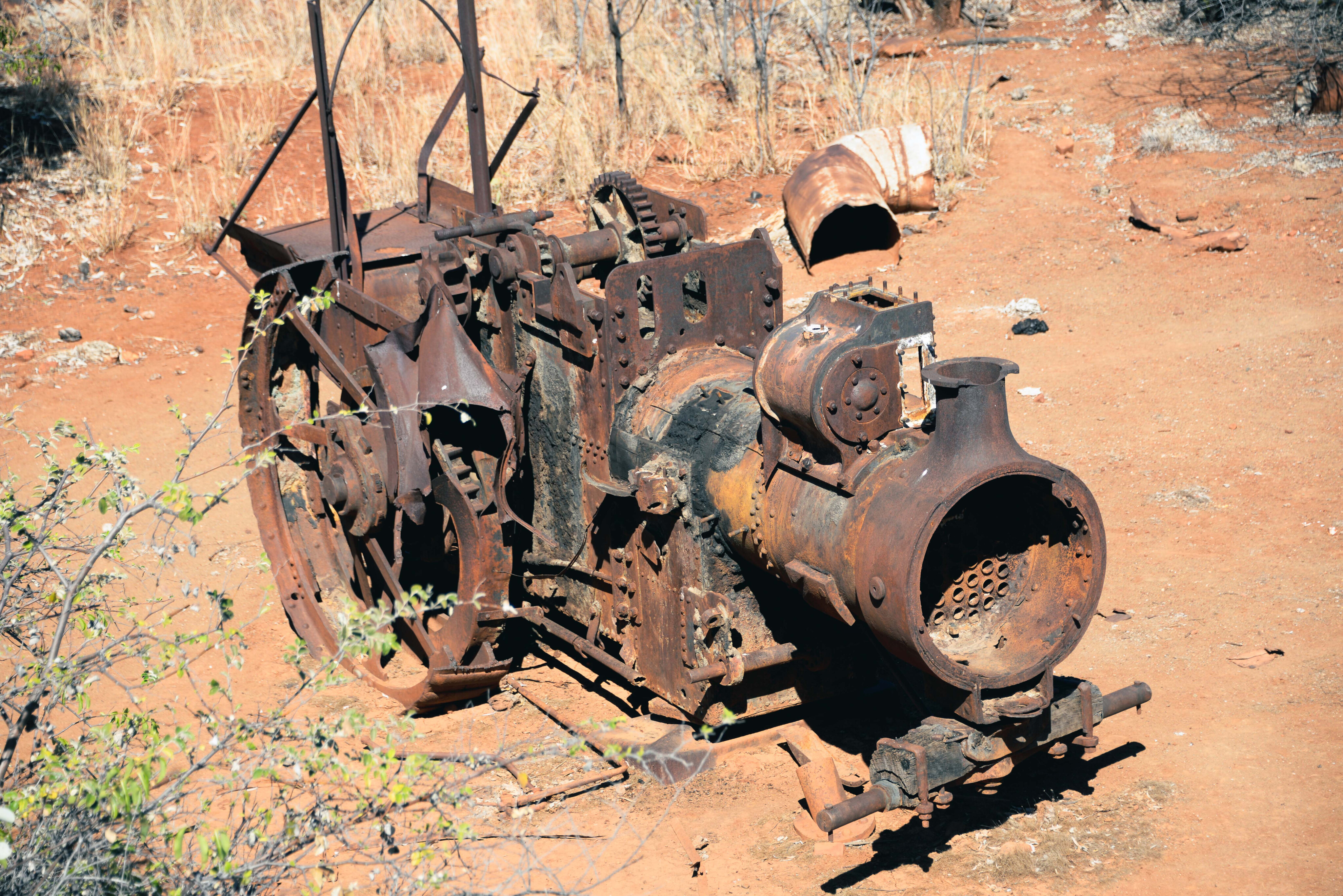
The new owners expanded and modernised the operation with steam-driven engines, tramways and winding gear that serviced the underground operation and its 380m shaft.
32
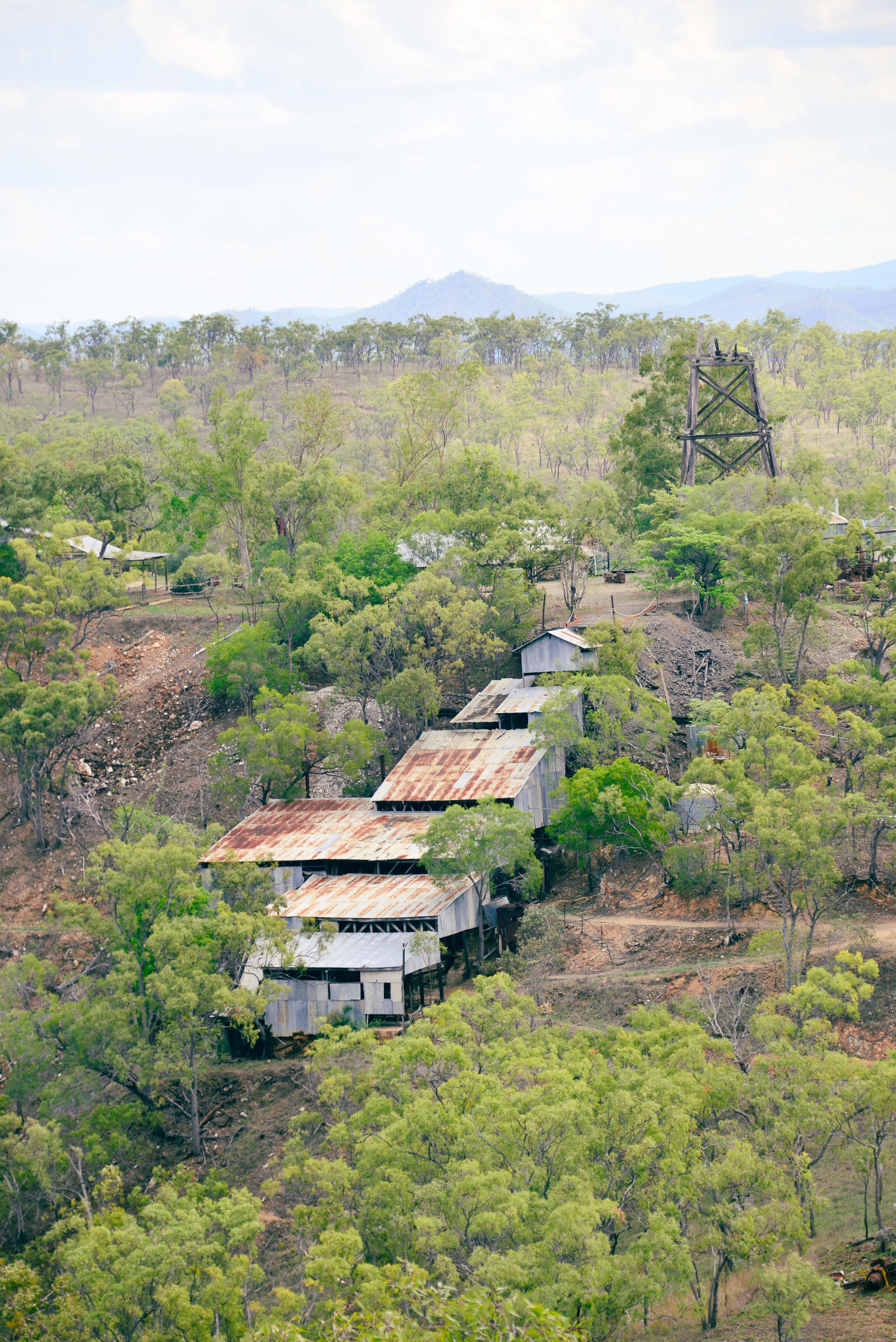
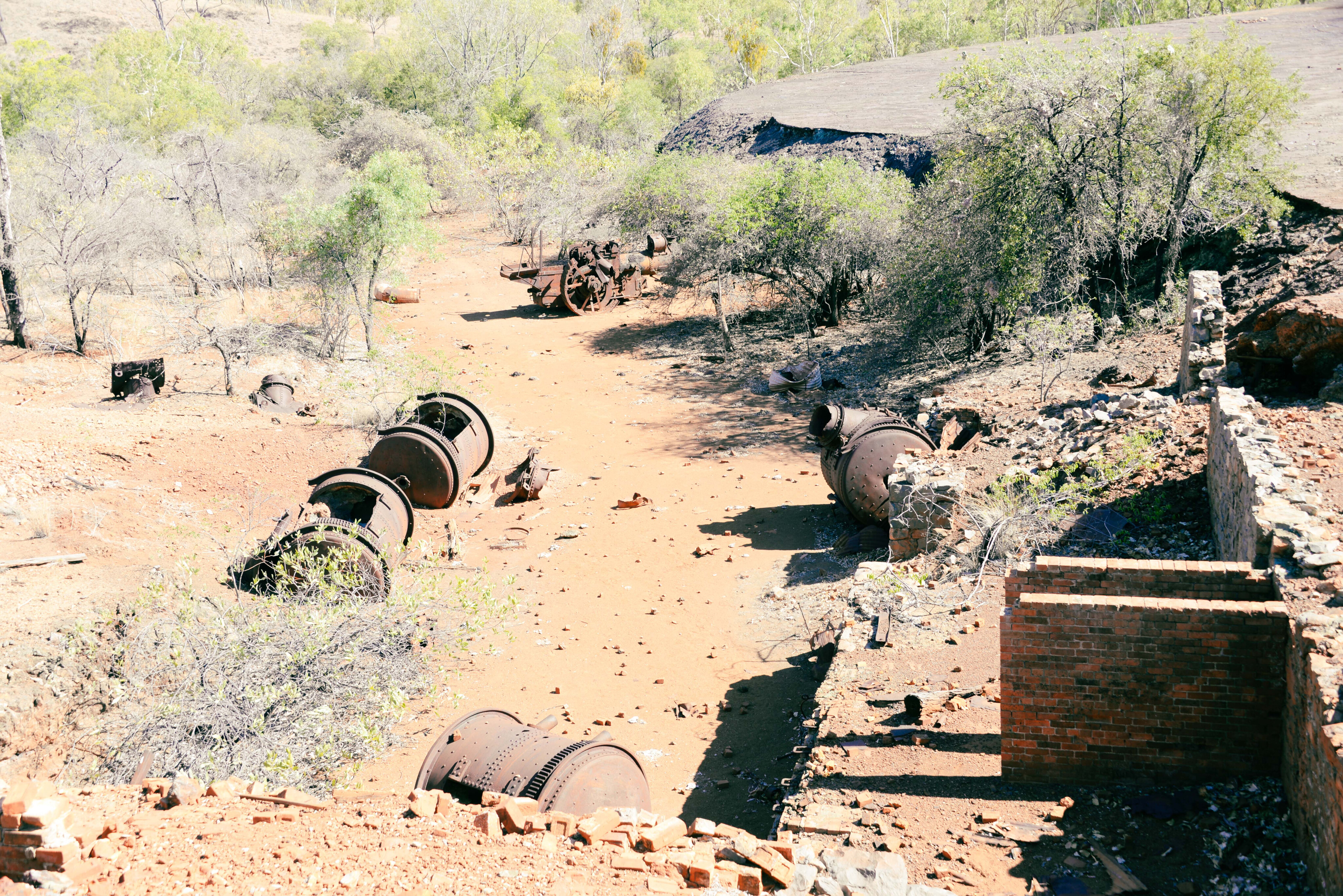
But today only the 25m high chimney and concrete foundations remain of what was once a bustling mine serviced by a nearby township of 400 people, one that had all the mod cons including shops, school, hospital, police station and three pubs.
A big flood in 1893 washed the tailing and water dam walls away, and with it the hopes of the mine, which was struggling at the time, with the best gold having petered out. Drought created a water shortage in 1888-89, and then a cyanide gold process was introduced in 1894 to recover fine gold.
By 1898 only one hotel remained as people walked away from their homes, though the school remained open until 1915 when no pupils registered. The company shut down in 1897, but others scratched about the mine until at least 1934.
32
The Palmer Goldfields region
Fredirick Walker, a member of the 1871-72 Hann Expedition to the Cape, discovered gold in the Palmer and Normanby Rivers in 1872, but James Venture Mulligan was given the credit for it when he followed up on Hann’s reports in June 1873.
It started an amazing rush that founded the Port of Cook’s Town, later Cooktown, while others came from Georgetown, Croydon and Charters Towers, people heading into the unknown, surviving floods and hostile natives.
Determined, they founded townships and large camps in the wilderness; Lukinville, Palmerville, Maytown, Uhrstown, Chinatown and Byerstown serviced dozens of diggings and mines along the Palmer River and its feeder creeks.
32
Another rush started to the Normanby River in 1874 as hopefuls packed up and headed to the new ‘El dorado’. Ephemeral settlements were quickly founded and abandoned even faster when the gold petered out.
A railway headed west from Cooktown, but the project was abandoned when it reached Laura. The Palmer gold had run out. These days the hills are silent and only the calls of the dingoes, crows and the raucous cries of blue-winged kookaburras break the silent torpor of the bush.
Some mining continues, but the best gold has gone, some say to China after the Chinese rolled over the field in what was said to be ‘like a yellow wave.’
32
The Palmer River diggings can be accessed from the Mulligan Highway at Maitland Downs and the Palmer River Road.
Keep in mind that prospecting may incur the wrath of a leaseholder who won’t take kindly to their grounds being poached. Some years back a prospector was shot, his body was never found but the then owners of Palmerville Station are doing life for the alleged crime.
Bush camping is available on the field, but the best way to avoid any trespassing problems is to camp on the comfortable grounds at Palmerville Station and do day trips from there. It is, of course, 4x4 country… and then some.
32
The Limestone Creek Rush
Gold was discovered in May 1889 on Limestone Creek, south of the Palmer River. The mines were sited in rugged and waterless hills, but two villages – Groganville and Harbord – were founded here.
Little remains of the townships today apart from broken bottles, rusted iron and discarded cans. The mine site can only be reached via a creek bed and it is not marked.
A nearby cemetery tells of the hardships that people faced here, including babies, some of whom died within days of being born due to the extreme heat in the hot valleys. Most dwellings were nothing more than rough shelters built from bush timbers that were no better than the gunyahs of the Aborigines.
32
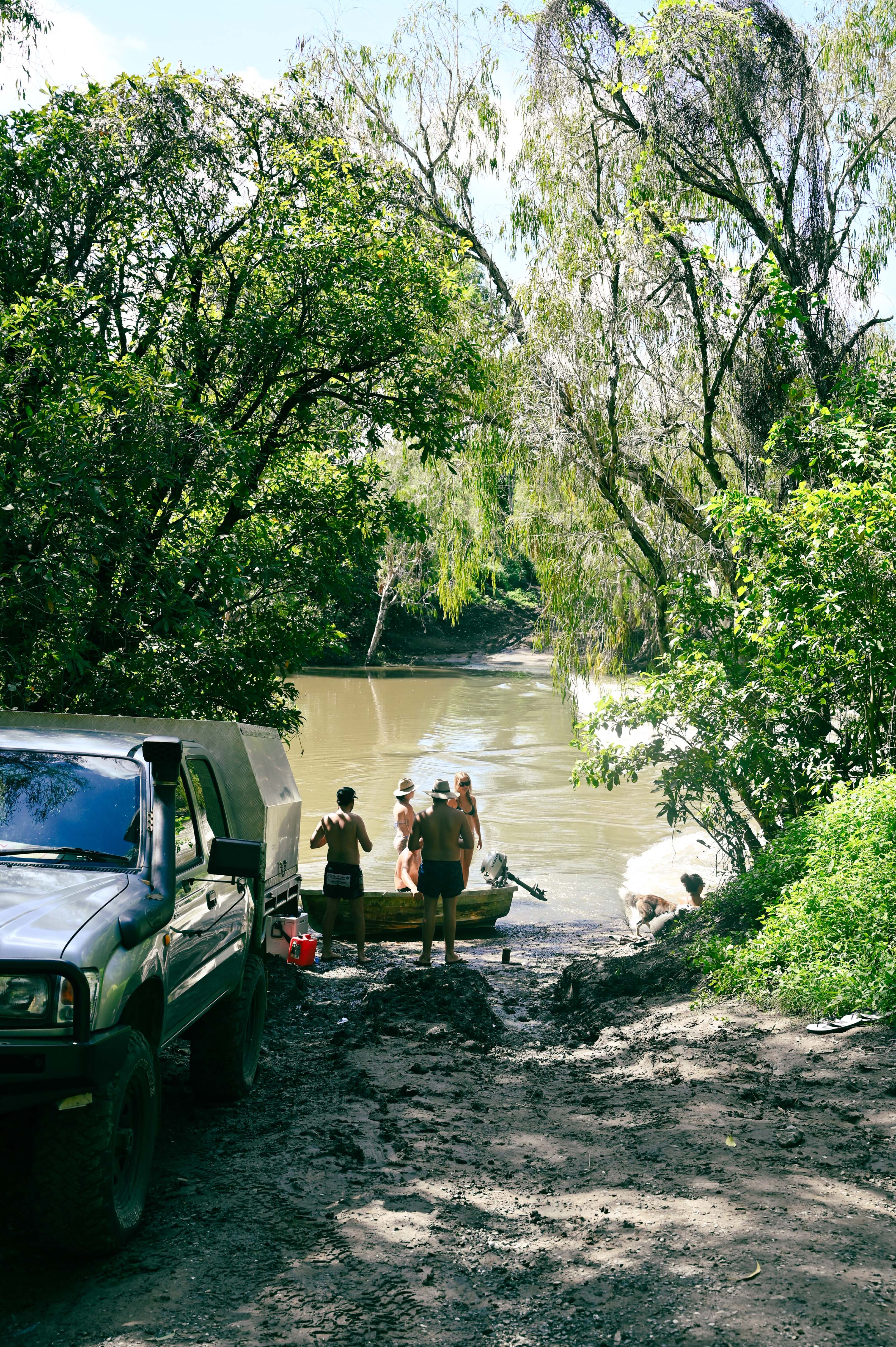
Access is north of Mount Carbine, on the Karma Waters Station turnoff. Curraghmore Station and Karma Waters have campsites along the river, including on the old Cooktown Crossing, the original track that extended to the Palmer and to Cooktown from the south.
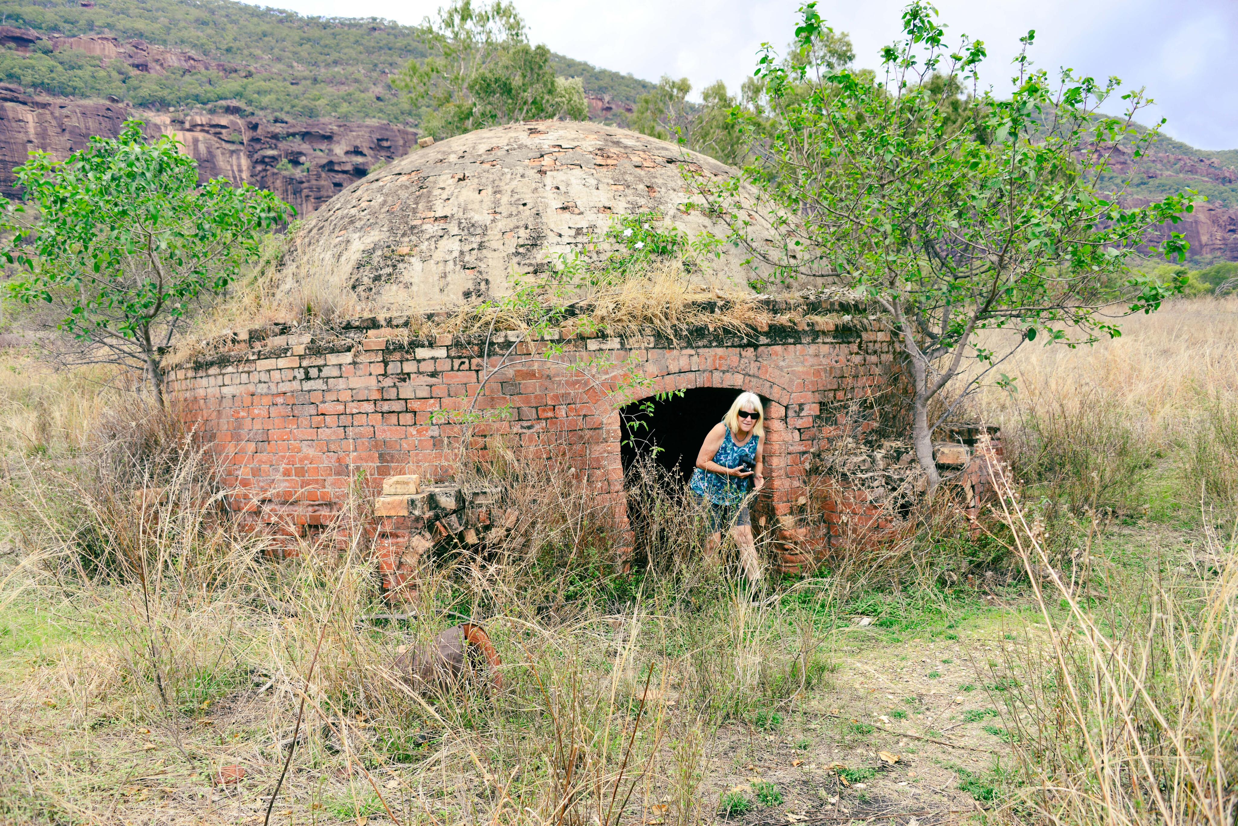
Mount Molloy and Mount Carbine are former mining towns that were once part of the mining trails of the region. Another route is from Chillagoe, which has more than its fair share of abandoned mines and relics. The original road turned north to the OK Mine and to the Palmer, via Groganville.
Part of the track runs through Bellevue Station, but it’s private and not open to visitors without permission. It’s an interesting route that cuts across hills and valleys, while the remains of an extensive concrete bridge built across the wide Mitchell River is worth seeing.
Only concrete pylons remain. It was constructed by the Burma-Singh Mining Company to access the Hannibal Copper Mine, but was abandoned when the mine closed in 1953.
32
The Hodgkinson Field
Situated south of the Mitchell River, the Hodgkinson Field came into prominence when gold was discovered there by James Venture Mulligan on 23 October 1875.
It led to a huge rush, but the new arrivals wanted to lynch Mulligan as they had believed that it was alluvial gold, but instead it was reefing gold that was beyond the means of the diggers. The first machinery arrived from the Ethridge Field, which was now in decline, while a track was cut down the impossible rainforest-clad coastal ranges to Cardwell.
Another tracked across the high ranges from Port Douglas, via Mount Molloy. It’s astonishing how people and pack animals managed to haul heavy and bulky mining machinery up these seemingly impossible ranges.
32
Today the field is silent other than the cries of crows that disturb the peace where once busy mines and smelters operated.
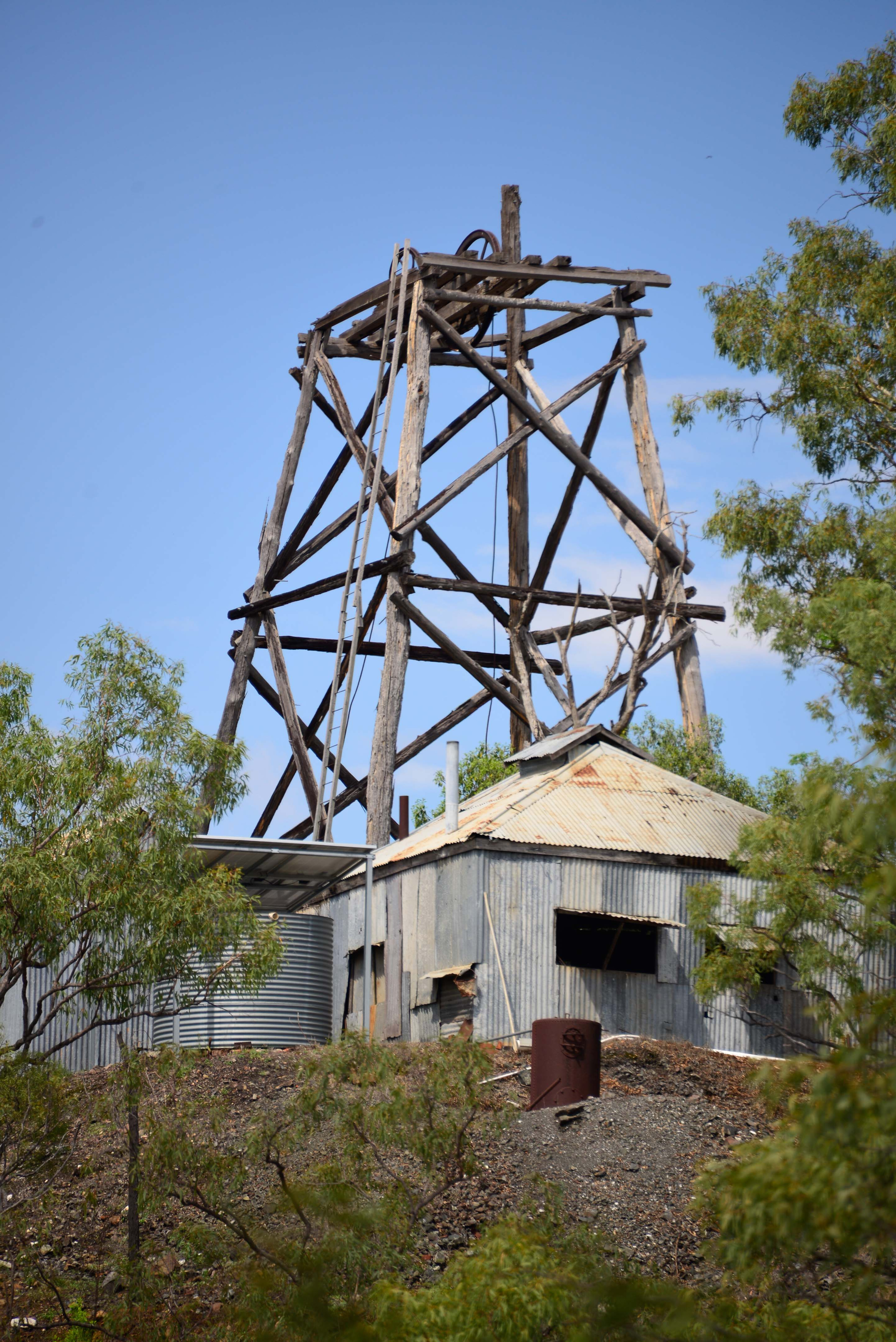
Thornborough, Kingsborough, Beaconsfield and Northcote were the first towns, and these housed almost 2000 people, while other smaller settlements grew up about the mines. But by the 1880s a rush for the tin mines at Herberton and Irvinebank saw the beginning of the end for the Hodgkinson Field.
Coal was discovered under Mount Mulligan, which overlooks the former goldfields, and a town plan was laid out in 1913. Unlike today, coal was rare in Queensland and the government constructed a railway line from Cairns to the mine.
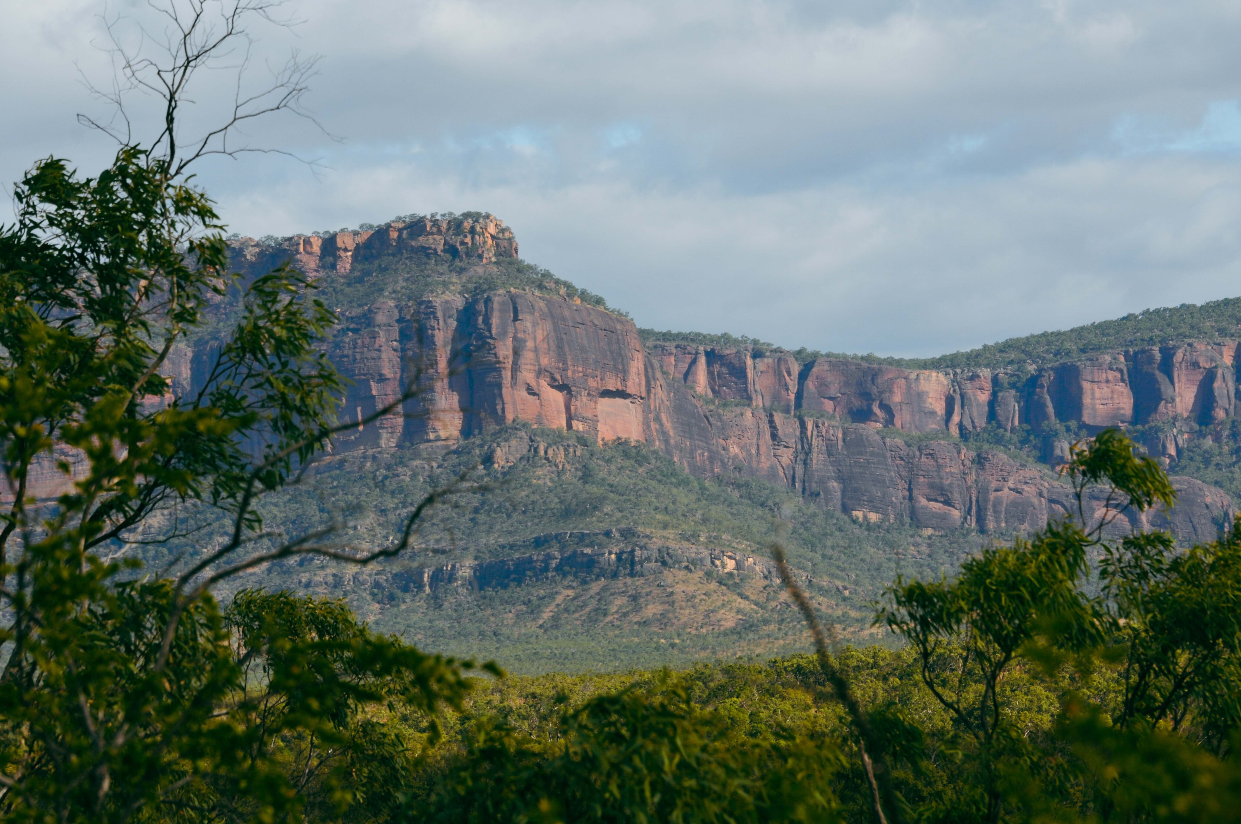
32
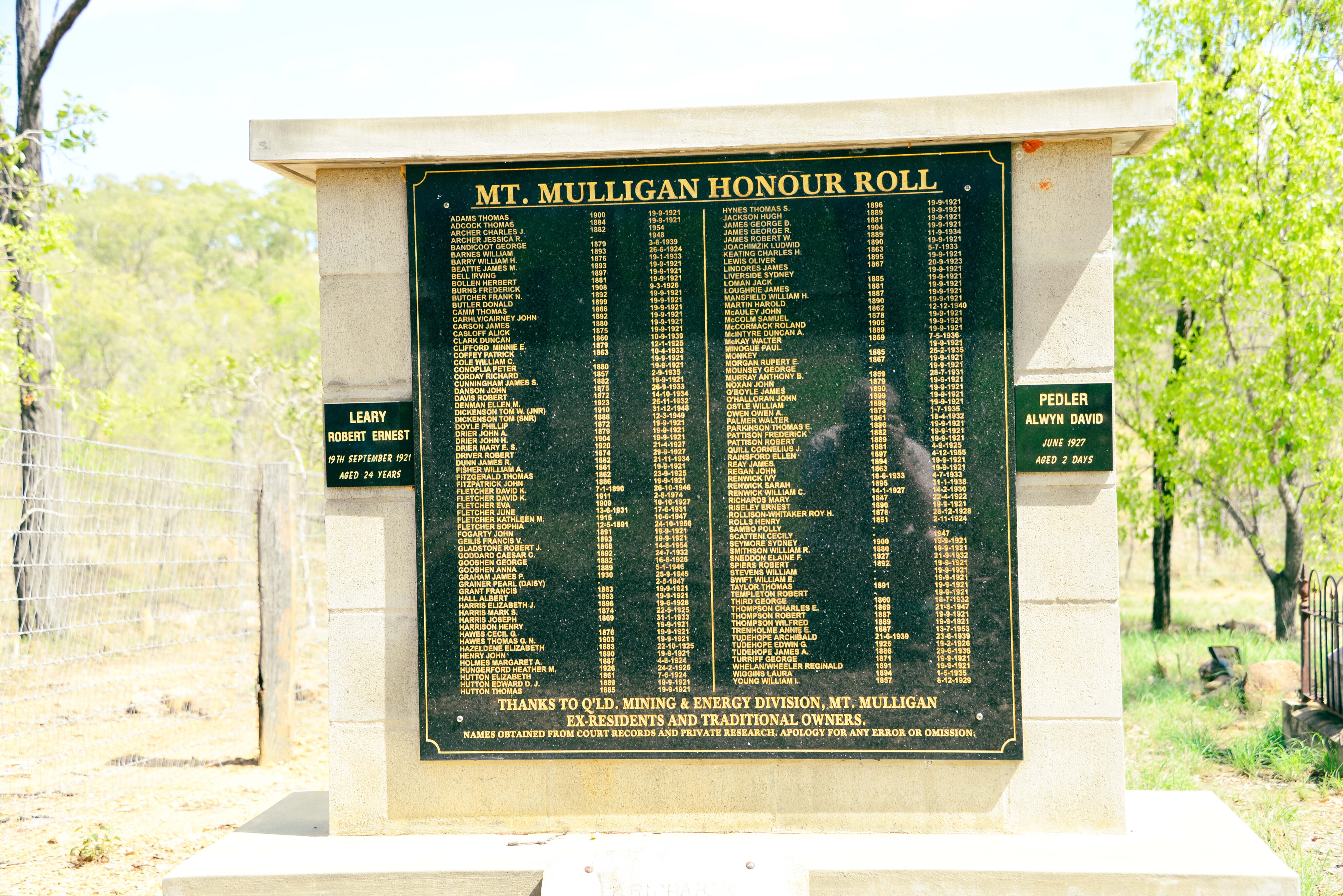
A terrible accident occurred on 19 September 1921 when the underground mine blew up killing all 75 men who had just started their shift, making every woman and child in town an instant widow and orphan respectively. To this day it remains the second worst mine disaster in Australia.
The mine reopened soon afterwards, the coal needed for the Queensland Railways, but it closed in October 1957. At its peak, Mount Mulligan had a population of 500. Only a tall chimney, foundations and relic machinery remains, and the nearby cemetery where 74 miners are interned.
32
A life of hardship
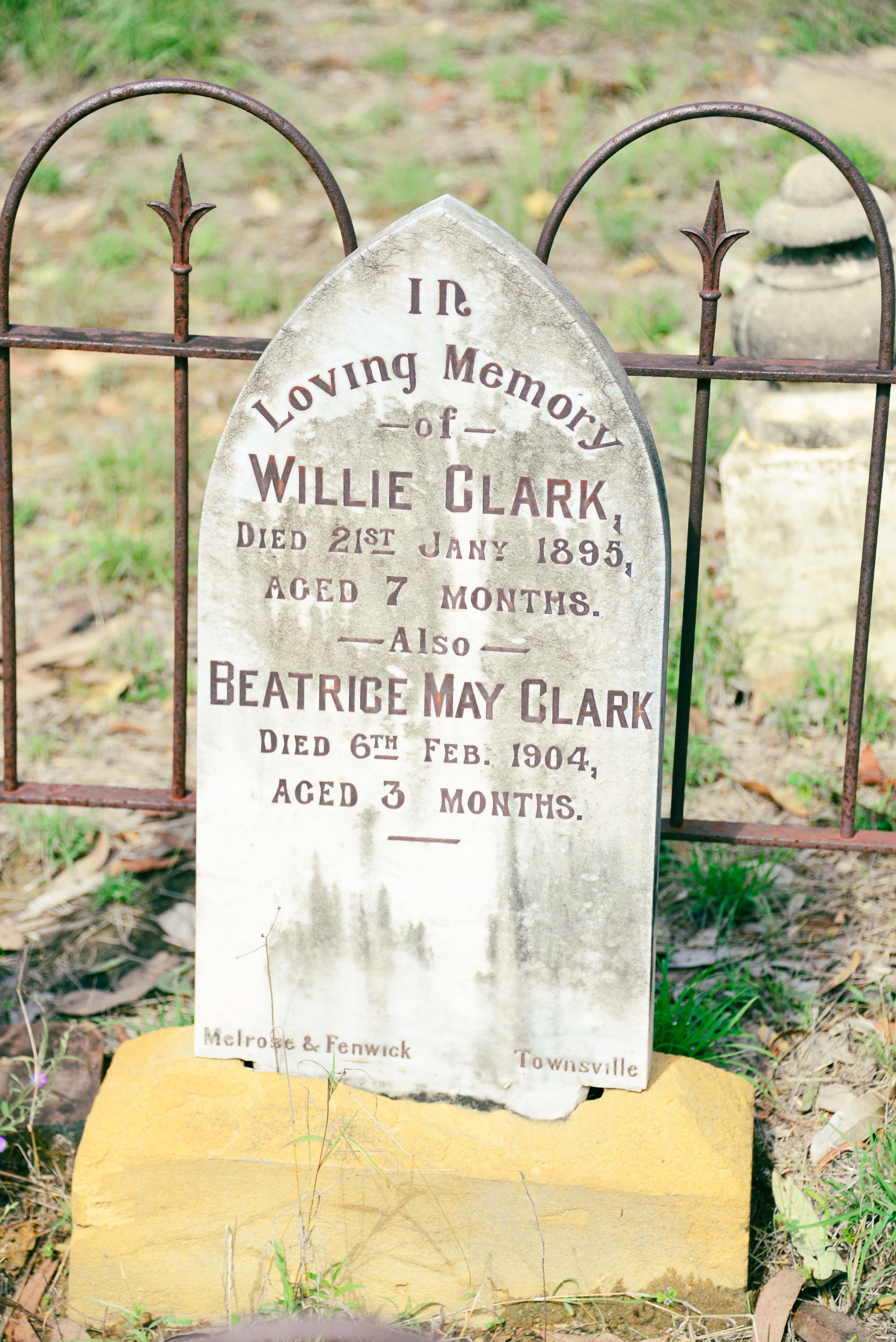
Often the only evidence of human settlement in many remote areas are the cemeteries and bush graves, simply marked ‘Killed by Black,’ or ‘Died of Fever.’
The former mining town cemeteries are a grim reminder of hardships and accidents that people had to contend with.
Nation building was tough as Australia struggled through its infancy, in harsh country that tried to kill settlers off with bushfires, floods, droughts, diseases, accidents and attacks from the natives who resisted the newcomers at every turn.
32
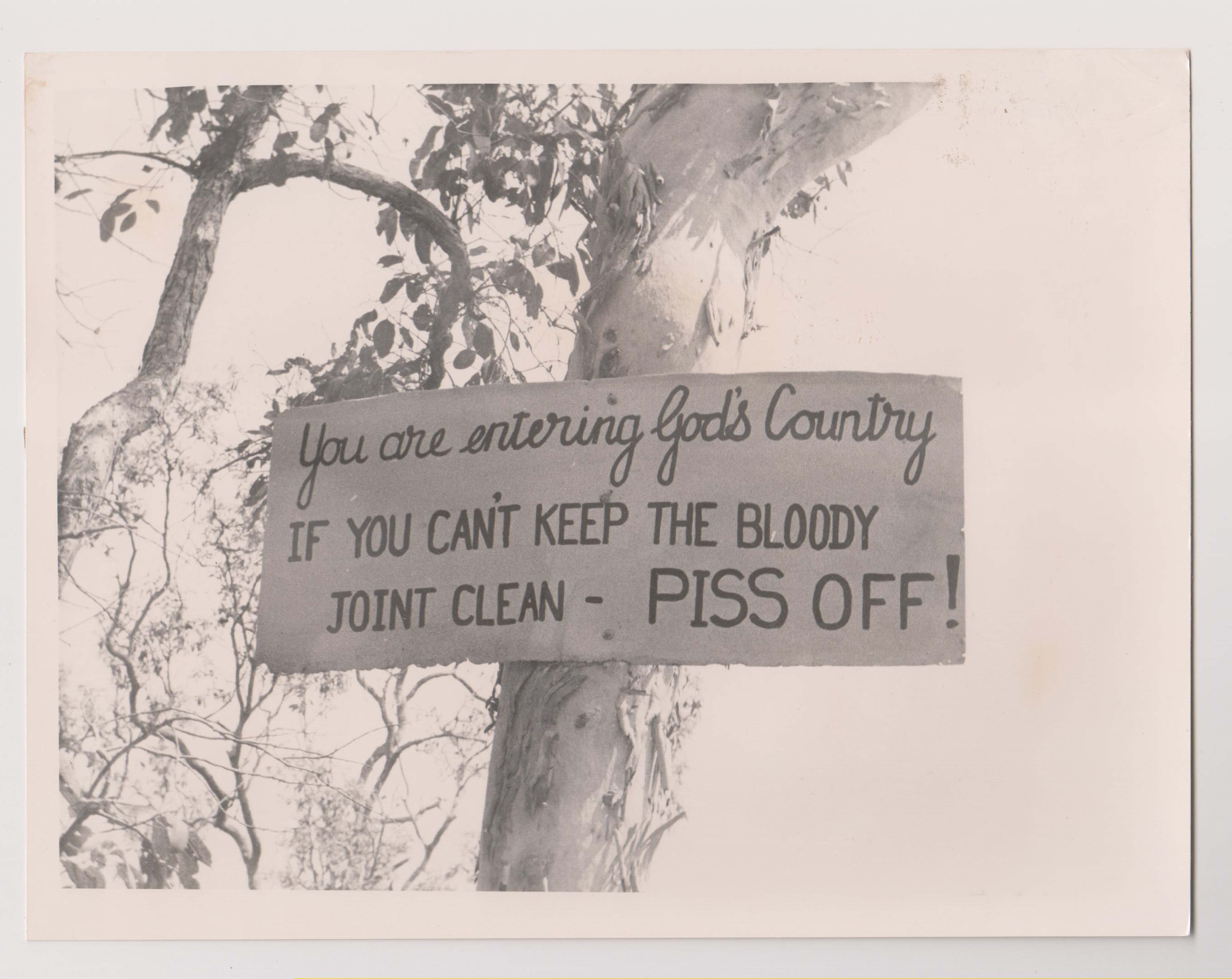
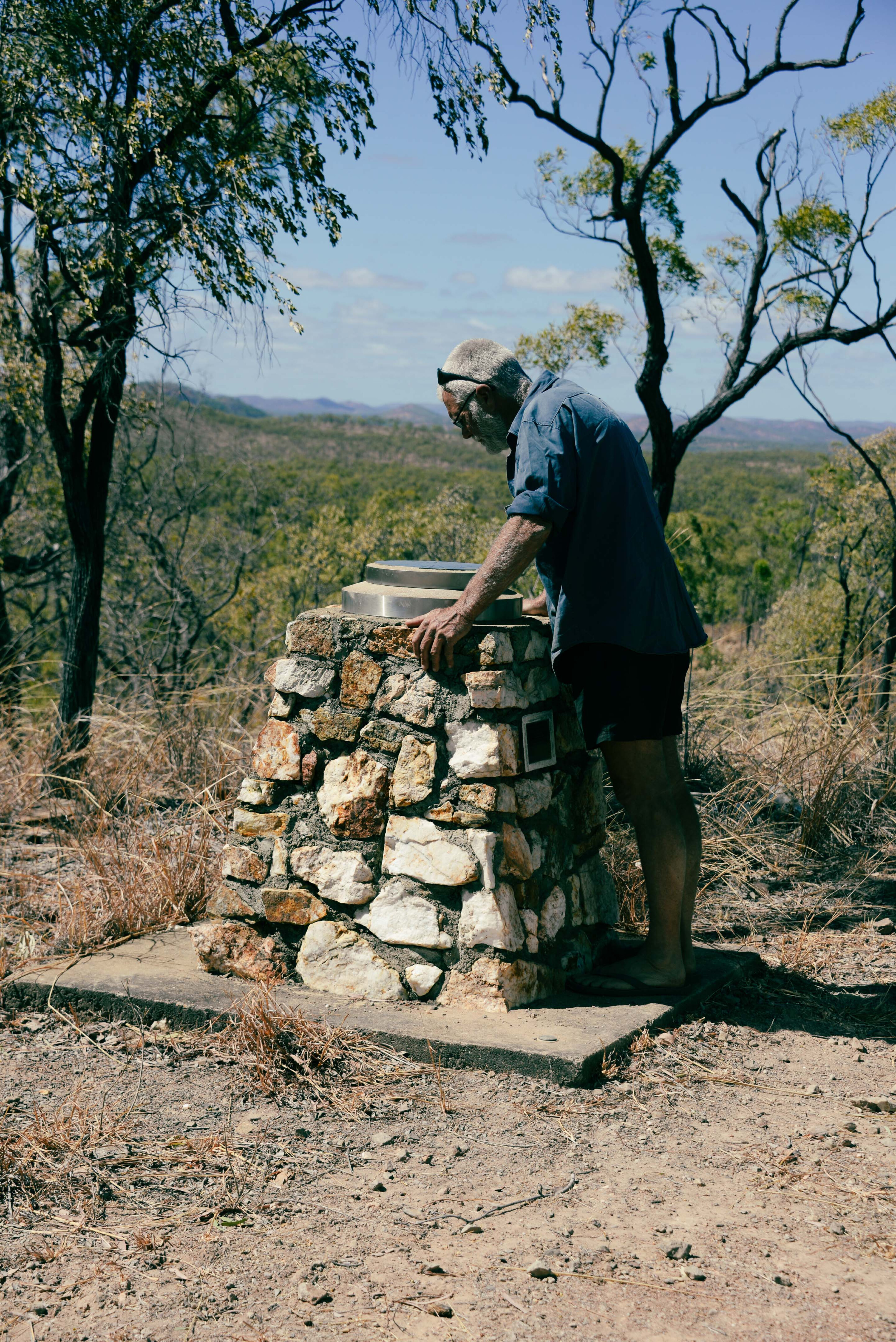
Make sure you don’t miss the graves on your mining trail quest; the country has not changed and the tracks are rough, the distances long and the isolation is real.
Leave things as they are and don’t take relics home with you – they belong where they are – and most importantly, don’t rubbish the bush. The greatest threat to the physical reminder of our history comes from those who pick things up and take them away, or the bottle collector who smashes what he can’t carry out thus increasing its value and scarcity.
Respect our history and enjoy the drive… and most of all, remember our brave and struggling pioneers.
Please enable JavaScript to view the comments powered by Disqus.
COMMENTS