Explore WA
Gallery4
When a late wet season threatens to destroy all your meticulous travel plans, the only option is to adapt and enjoy the ride.
After a challenging hike in the early dry-season heat, you reach the famous waterfalls cascading over tiers of red sandstone, sending whirlwinds of spray into the air. Hot and sweaty, you plunge into the deep sapphire waterhole and emerge breathless from the chill, utterly rejuvenated.
Or so I’ve read.
That is, while I was researching the imminent trip I was supposed to be taking to Mitchell Falls in the far north-west Kimberley, WA, in early June this year.
But as the Australian Geographic Expedition I was attending in El Questro [4X4 October 2011] drew to a close – with my partner, Paul, due to arrive in Kununurra in just a few days – the bush telegraph was in full swing, and the news wasn’t good. A record-breaking wet season meant the Kalumburu Road, which turns north-west off the Gibb River Road, was weeks away from opening.
After a year at 4X4, the boss had finally released me from my desk and into the wilderness. I’d spent weeks imagining sleeping under the stars, deep water crossings, red dust, big, blue skies…
So, I got out the maps and learnt my first lesson in outback travel: Flexibility is vital.
I knew we had to be in Darwin to fly home exactly one week after Paul arrived, which left us six days to travel what is a nine-hour drive on the highway. The first 24 hours were set: there was no way I was letting Paul fly all the way here without seeing the spectacular gorges at El Questro – not to mention sampling the four-wheel driving on the privately owned, near-million-acre station property.
However, I knew that sunsets at Saddle Back Ridge lookout, swimming in fresh waterholes and (don’t tell the boss) dinner at the El Questro steakhouse weren’t the true objectives of the trip, so we packed up the Pajero and headed east.
First stop: Purnululu National Park, home of the Bungle Bungles.
BUNGLED
Purnululu NP is located 304km south of Kununurra, the last 53 of which follow the 4X4-only Spring Creek Track through Mabel Downs cattle station before reaching Purnululu.
Closed to caravans (but not off-road camper trailers), the track winds through spectacular country – even before reaching the national park itself – and comes complete with teeth-chattering corrugations and plenty of fun water crossings to splash through along the way. Your vehicle will need plenty of clearance, but we got by happily without a snorkel. The crossings can, however, become chopped up and muddy after rain or with increased traffic, so you may need to engage low-range, depending on conditions. Off-road tyres are a must.
We were amazed to find a Subaru Liberty a quarter of the way along the track with its bonnet up (how did it even get that far?!) and later discovered it had been stranded there for days, and even started to compete with the Bungles as the local tourist attraction.
Still, with an able 4X4, the track is quite accessible (but conditions vary) and you’ll only need to engage low-range once or twice. Allow at least three hours to complete the track once you turn off the Great Northern Highway. There’s no point rushing through those views over the red rock escarpments, particularly at sunset.
The region that now includes Purnululu NP and the Bungle Bungles existed well out of the spotlight as largely pastoralist land up until 1983, when an internationally screened television documentary called Wonders of WA lent the spectacular geological formations fame. By 1987, the Western Australian government had gazetted Purnululu NP and, in 2003, it became World Heritage Listed. It now ranks in popularity with the likes of Uluru.
There are two public campgrounds in Purnululu NP and, after filling out the relevant paperwork and parting with some cash at the visitors’ centre (this can be done after hours), we set up at the southern Walardi campsite just before dark. We chose it over the northern Kurrajong site because it’s closer to Cathedral Gorge, which we planned on reaching first thing the next morning – hopefully well before the tour groups arrived.
The campgrounds are grassy and pleasant, with a communal fire pit, untreated tap water and a drop toilet. We certainly weren’t alone – the site was almost full, and we even ran into a couple of 4X4 subscribers who offered us a much-needed shower out of their impressive camper trailer set up (thanks Wolfe and Esther!). Despite the numbers, we slept peacefully through the night having chosen the quiet camping area over the generator/group section.
The good thing about coming from the east to the west half of the country is that, if you don’t let your body clock shift, getting up early is relatively painless. So just after 5am, before brekky – or even a cuppa – we got back on the track towards Cathedral Gorge, determined to experience the marketed serenity of this ancient site on our own.
Unfortunately, navigation isn’t my strong point. But I swear the sign along the walking track that signals the turn off to Cathedral Gorge was hidden behind some scrub. You see, Cathedral Gorge is about two kays along the 30km-long Piccaninny Gorge track. We were thoroughly enjoying the walk along the open river bed, but, as the sun rose higher in the sky and more and more hikers materialised around us, I thought I’d better double check we were headed in the right direction. I wasn’t quite sensing ‘cathedral’ yet.
Having asked and received the predictable answer, we turned around and joined the no doubt well-slept and breakfasted throngs to Cathedral Gorge.
The enormous sandstone amphitheatre is truly something to behold – and we even had it to ourselves for long enough to test out the acoustics and take a couple of snapshots. Not to mention, we can now say we’ve experienced at least part of the epic Piccaninny Gorge track – something I’d love to complete one day.
The afternoon’s itinerary was to visit the Echidna Chasm, named simply after an echidna once found there (we didn’t find any, but did come across a stunning bottle-green magnificent tree frog).
Echidna Chasm is best visited around midday when the sun shines directly into the towering, narrow incision that constitutes the walking track through the rock (at places just a couple of metres wide), lighting up the red sandstone walls within. The walk in is over flat, pebbly ground, with a short scramble over a few boulders before you reach the end – arriving at which was like stumbling in on some sort of group therapy session.
We found at least half a dozen tourists lying on the ground and watching the wisps of cloud pass over the small gap in the rock above. Not wanting to miss out, we joined them and lay quietly for a few minutes, enjoying the silence and the chance to escape the midday heat outside the chasm walls.
Had we had longer, I could have stayed at least another day in Purnululu and tried out more of the Piccaninny Gorge track (intentionally this time), and more closely explored the Bungle Bungles. But the road ahead beckoned.
PUB WITH NO BEER
It’s not a big deal (I swear), but there’s really nothing like a cold beer after a day of dust, heat and corrugations. Unfortunately, as it turned out, I’d botched that part of the grocery shopping in Kununurra, passing through before 5pm when, under the liquor restrictions imposed there – and in many other communities throughout the region – alcohol isn’t sold. Luckily, we were also travelling through Halls Creek before turning on to the Duncan Road, so we could pick up a few cold ones there. Or so I thought.
Turns out, Halls Creek is a ‘light town’, meaning the Halls Creek Liquor Store doesn’t sell liquor, wine, or full-strength beer. Still, a couple of light beers in the fridge are better than nothing, so we bought them and continued on our way.
The little-used, unsealed Duncan Road (or Duncan Highway, as it is also known) heads east across the NT/WA border from the Great Northern Highway for 170km, then turns north where it meets Buntine Highway, and continues for 270km until it reaches Victoria Highway, which intersects the Stuart Highway at Katherine.
This is red dirt and spinifex country, with plenty of isolation – rewarding enough in itself, but there were also a couple of real gems along the way.
The first point of call along the Duncan Road is just 16km in at Old Halls Creek, a town that flourished during the gold rush in the late 19th century and clung to life until as late as the 1950s before relocating to its current site. Now all that remains are crumbling ruins, which are fascinating to roam through.
Another 40 kays along the road, Palm Springs appears like a mirage at the roadside. An idyllic spring-fed waterhole surrounded by date palms, it offers an inviting contrast to the sparse country travelled through to get to that point. We hadn’t travelled far along the Duncan Road yet, but had to stop for a dip – although not for long. We already had our camping spot for that night lined up, and wanted to reach it before sunset.
The plan was to set up camp at Marella Gorge, located on Nicholson station, just 20km before the Duncan Highway makes its turn north. The turn-off to Marella Gorge is unmarked, and we would have surely missed it, had we not been studying closely Ron and Viv Moon’s Kimberley guidebook, which provides the precise GPS location (18'08’39.6”S 128'42’19.9”E). The track to the small camping spot (call for permission to use, 08 9168 7393) is rough at places, with a steep, rutted section at the end – which was a novelty after hundreds of kilometres of long, straight, corrugated dirt road.
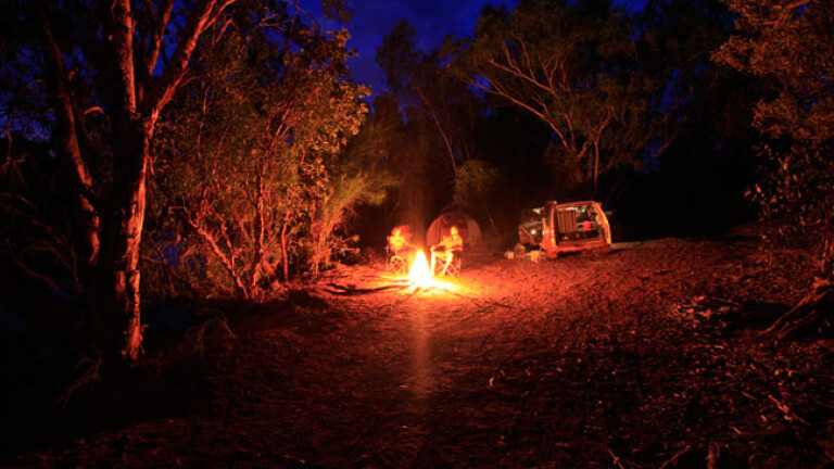
We couldn’t quite believe our eyes when the coordinates on the Pajero’s built-in GPS finally correlated with those in the guidebook. We imagined we’d be pitching our tent among spinifex by the road; instead here was a sandy spot by the water, surrounded by towering eucalypts – and we had it entirely to ourselves. The stars must have aligned, because there was even a small neat pile of chopped firewood (and, thankfully, no rubbish) left by a previous camper.
Sure enough, the 4X4 then decided to inexplicably blow a fuse – threatening a fridge full of sour milk and warm beer – but that was quickly fixed with a replacement (fuse, not 4X4). We soon had the tent up, chairs out, a fire crackling away and were sipping the best tasting light beers imaginable.
CLOSED ENCOUNTERS
The next day, rather than take the Duncan Road north, we decided to continue east along the Buntine Highway, which would take us to Top Springs and eventually back to the Victoria Highway towards Katherine.
In keeping with the unintended theme of the trip, we had enquired in Halls Creek about the state of the tracks in Gregory NP – accessed by four-wheel-drive tracks off the Buntine Highway. Again, we were too early in the dry season (particularly one that followed a wet season courtesy of a moody La Nina) and all of the tracks were closed. So, we fuelled up and passed through the Aboriginal community of Kalkarindji on the Buntine Highway – which should have been our entry point to a spectacular national park – and continued on to the Top Springs Roadhouse.
There is a campsite at Top Springs, but we forewent the $20 fee and headed a short distance away for a bush camp, removed from the pub and the thrum of the roadhouse generator.
I resolved not to dwell on missed opportunities, and instead embraced camping out under the stars in outback NT. I was also looking forward to our last night’s camp the following evening in Nitmiluk National Park (Katherine Gorge) east of Katherine and south of Kakadu NP, before returning to Darwin.
The stretch between Top Springs and Nitmiluk NP is all bitumen, so we pumped up the tyres – ready for the NT’s generous 130km/h speed limit – and finally bade the dust farewell. Katherine Gorge would be our last stop, and I happily anticipated one more day of bushwalking and a final swim before our trip drew to a close.
There would be no bush camping or unmarked turn-offs here, but we weren’t really all that against the idea of an amenities block, or the poolside bar.
That night, the shampoo suds were red with dust and resembled something out of Psycho as they spiralled down the drain. We fell asleep to a local strumming John Williamson covers at the bar.
The next day, we weren’t surprised to discover that swimming was closed to most of the waterholes around Katherine Gorge, waiting for water levels to subside and an official croc survey to be conducted. All bar one, that is. So, we paid our $14 ferry fee and crossed the Katherine River, then hiked for an hour in the early dry season heat to the Northern Rockhole.
A cascading waterfall sent whirlwinds of cool spray into the air, over enormous, prehistoric boulders and water-logged pandanis. Hot and sweaty, we plunged into the deep sapphire waterhole and emerged breathless from the chill, utterly rejuvenated.TRAVEL PLANNER
WHEN TO GO
Dry season, from May to September. Some roads open later in the season than others, although expect the company of plenty of other travellers during the peak of the dry.
SUPPLIES AND FACILITIES
Kununurra and Halls Creek are the two main service towns in the vicinity of the Great Northern Highway, and offer all facilities including groceries, fuel and camping supplies. Fill up at Halls Creek before turning on to the Duncan Road. The Doon Doon Roadhouse (08 9167 8004) is a good place to top up fuel if travelling south on the Great Northern Highway towards Purnululu NP. Top Springs Roadhouse (08 8975 0767), at the junction of the Buntine and Buchanan highways, offers fuel and accommodation.
TRIP STANDARD
A high-clearance 4X4 is essential for the Spring Creek Track into Purnululu NP. Caravans are prohibited on this track (off-road camper trailers are fine).
The Duncan and Buntine highways are unsealed and corrugated. Reduce tyre pressures and always give way to road trains.
VISITORS’ CENTRES
Kununurra, 08 9168 1177
Halls Creek, 08 9168 6262
Katherine, 08 8972 2650
RESTRICTIONS AND PERMITS
A permit is required to enter and camp at Purnululu NP, available for purchase on arrival. The Buntine Highway passes through Aboriginal land, but as long as you are only passing through, you won’t need a permit.
MAPS AND GUIDES
HEMA’sNorthern Territory State Map. HEMA also has maps specifically covering Purnululu NP and the Kimberley region.
Ron and Viv Moon’s The Kimberley: An Adventurer’s Guide and Hema’s The Kimberley Atlas & Guide both proved valuable resources on this trip.
Please enable JavaScript to view the comments powered by Disqus.
COMMENTS