Explore QLD
Gallery1
The south-east corner of Queensland is fortunate to have some of the best and most accessible 4X4-only coastal hideaways in Australia.
This article was originally published in 4x4 Australia’s July 2012 issue
While the sand islands of Moreton and Stradbroke are familiar to many off-road enthusiasts, Bribie – the most northerly of the three Moreton Bay islands – remains a bit of a mystery to most visitors to the region.
 Situated 65km north of Brisbane via the Bruce Highway, Bribie has thankfully remained a relative backwater compared to the high-density tourist developments that have sprung up along the Sunshine Coast further to the north. Separated from the mainland by a narrow ribbon of water called Pumicestone Passage, the island is approximately 34km long and about 8km at its widest point.
Bribie is the smallest of the three Moreton Bay islands and the only one you don’t need to board a barge to reach. While many people were happy when the bridge from Sandstone Point to the island was completed in 1963, a few older residents who remember quieter times would prefer to turn back the clock to the pre-bridge days.
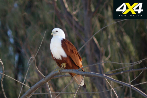
Prior to European settlement, Aboriginals were thought to have lived on the island they called Boorabee for thousands of years. Abundant bush tucker – kangaroos, emus, goannas and possums in the thick forests, and plenty of fish, crabs and other seafood along the coast – meant the place was a true sub-tropical paradise for the island’s original inhabitants.
 Early European settlers began arriving on Bribie Island in the 1840s to exploit its abundant natural resources. Fishing was the main business, especially the large schools of mullet netted along the shoreline and sent to the fledgling settlement of Brisbane to the south. The harmless dugong was slaughtered in huge numbers for its oil and blubber and before long these once-common marine mammals were virtually extinct.
Introduced diseases along with shooting by European thugs decimated the native population as well; by 1891 no Aboriginals were reported living on the island. Today, Bribie Island has a population of about 16,500 – most of whom live in the southern end of the island.
 Nearly half of the 14,800ha island is now under the control of the Queensland National Parks and Wildlife Service. Rangers based at White Patch, on the south-western side of the island facing Pumicestone Passage, patrol the park on a daily basis and rigidly enforce the driving rules and camping permits.
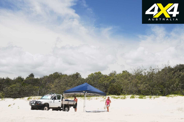
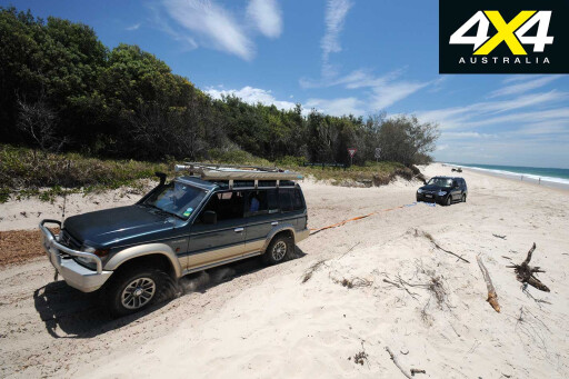
A thorough knowledge of correct sand-driving techniques is important when using on the island’s ocean beach and deep sandy inland tracks. Try to keep your driving on the eastern beach to within two hours either side of low tide to avoid excessive wear and tear on your vehicle by having to drive on soft sand.
MOREDriving on sand
Every year on Bribie several four-wheel drives become stuck and swamped by the incoming tide, which usually spells the end of your precious 4X4.
 With birds such as the pied oystercatcher nesting in the fore dunes is also not an good idea to drive high on the beach as their nests are easily destroyed. Lower your tyre pressure to between 18 and 22psi and keep it that way until you exit the national park.
Driving too fast along the eastern beach can bring grief. Tides can cause the lay of the beach to rapidly change, often resulting in wash-outs that were not there the previous day. Hit one of these at speed and you will flip your vehicle. The speed limit of 50km/h is strictly enforced by the island’s police, along with other road rules such as the wearing of seatbelts.
 Every vehicle entering Bribie National Park needs a current access permit clearly displayed on the windscreen. These permits are good for either a week or a year and can be purchased online and picked up at a number of spots, including Gateway Bait and Tackle (1383 Bribie Island Road) or at Bribie Passage Kiosk at Sandstone Point.
Permit tags for camping can also be picked up at these two shops, but always book online before you leave as there are only a limited number of spots and these are quickly taken up during school holidays and long weekends.
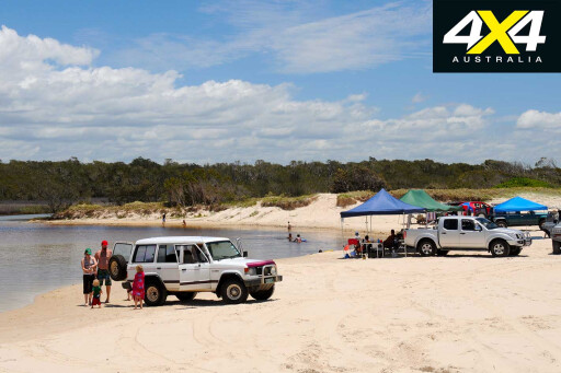
 Being so close to Brisbane and other large population centres, Bribie receives big numbers of daytrippers. Many other people choose to put up at one of the caravan parks or motels where they can enjoy a hot shower and a few other home comforts.
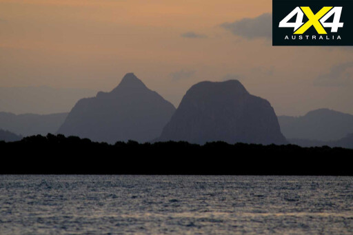
Visitors who camp in the park, however, will be rewarded with some of the best sunsets and sunrises that you will see anywhere, plus the chance to have close-up encounters with the park’s wildlife.
There are two camping areas on the western side of Bribie, facing Pumicestone Passage, plus another one on the east coast at Ocean Beach which is the largest and most popular. My favourite is Gallagher Point, three kilometres north of the ranger station at White Patch.
 With just six numbered sites and no facilities, it’s the most private and smallest of Bribie’s camping areas and a great place for watching sunsets and fishing. Mosquitoes here can be vicious so make sure you take plenty of insect repellent.
Carrying ample fresh drinking water is a must when visiting Bribie as there is no drinking water available on tap anywhere in the national park.
Mornings at Gallagher Point can be particularly beautiful when calls from honeyeaters and other small birds filter through the surrounding tree canopy. The six-kilometre sandy inland track that winds its way through the bush from Gallagher Point up to Poverty Creek Camping Area can be quite deep in places, so don’t stop or you could become bogged.
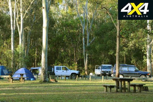
 Poverty Creek Camping Area is much more open than Gallagher Point and has an adjoining area for big groups or camper-trailers. Facilities include picnic tables, fireplaces and micro-flush toilets. The collection of firewood on Bribie is prohibited; if you want a small fire you must bring in small, sawn timber off-cuts with you. Many visitors with young children like Poverty Creek for its large grassy areas on which kids play, as well as shallow protected waters for them to swim in.
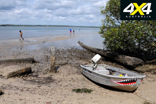
Facing Pumicestone Passage near the northern end of Bribie Island, Lighthouse Reach is only about 10km south of the popular beaches of Caloundra on the Sunshine Coast. There is a large shelter shed with a picnic table here that is popular with fisherman in small tinnies who can easily wade ashore through the shallow waters to use the facilities.
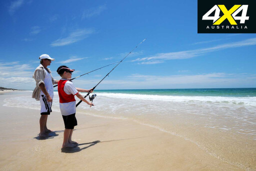
The sandy banks off the coast are excellent for fishing, with good catches of whiting, bream and flathead being caught throughout the year. About 100m from the picnic area is the spot where the old Bribie lighthouse once stood.
 Visitors will have better luck exploring the heritage-listed remains of the gun emplacements and searchlight buildings that were constructed about 2km east of the old lighthouse during World War II. With two huge six-inch guns guarding the north-west channel, it was hoped Fort Bribie would stall the feared Japanese invasion.
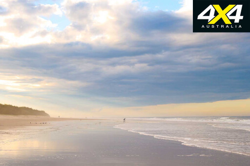
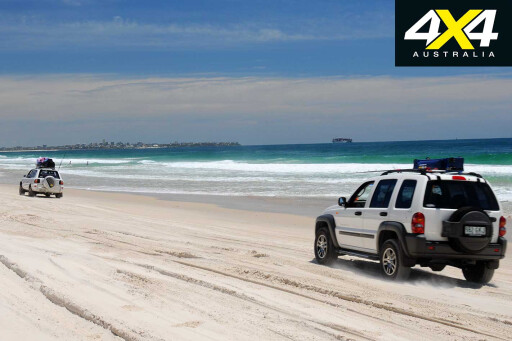
It’s only 200m from the Fort Bribie Walk parking area to the deep sandy entrance track onto Ocean Beach. Extending for 19km south to Freshwater Creek, this glorious expanse of golden sand is by far the most popular part of the Bribie Island holiday experience.
If you visit Bribie on a weekend during the height of summer you’ll probably have to share it with hundreds of other visitors but if you are there midweek during winter you might just be lucky enough have the beach to yourself.
Travel Planner
 WHERE
WHERE
Bribie Island is 65km north-east of Brisbane.
WHEN TO GO
It’s an ideal destination throughout the year.
WHAT TO BRING
If you are camping bring adequate drinking water, sawn timber off-cuts for campfires, and insect repellent.
FOOD AND FUEL
Food and fuel are readily available in the southern part of Bribie outside the national park boundary.
PERMITS
Vehicle access and camping permits are essential when visiting or sleeping in the national park.
IMPORTANT CONTACTS
For national park information and camping bookings, phone 1300 130 372 or visit www.derm.qld.gov.au. For driving and camping permits, call Gateway Bait and Tackle on 07 5497 5253 or Bribie Passage Kiosk on 07 5497 5789.
MAPS
Hema South-East Queensland.
Please enable JavaScript to view the comments powered by Disqus.
COMMENTS