Explore NSW
Gallery38
One of my favourite spots is not far from home, just a couple of hours west of Coffs Harbour, heading into the heart of the New England region.
It’s a place where early explorers deemed the land perfect for pastoralism, and bushrangers roamed. Today the whole area is a mix of tourist drives, farmlands and boutique villages.
The New England region covers an area from Newcastle in the south up to the Queensland border on the top of the Great Dividing Range. Across the west side the farmland is very much similar to the UK, with wet winters with blizzard conditions and pretty warm summers.
38
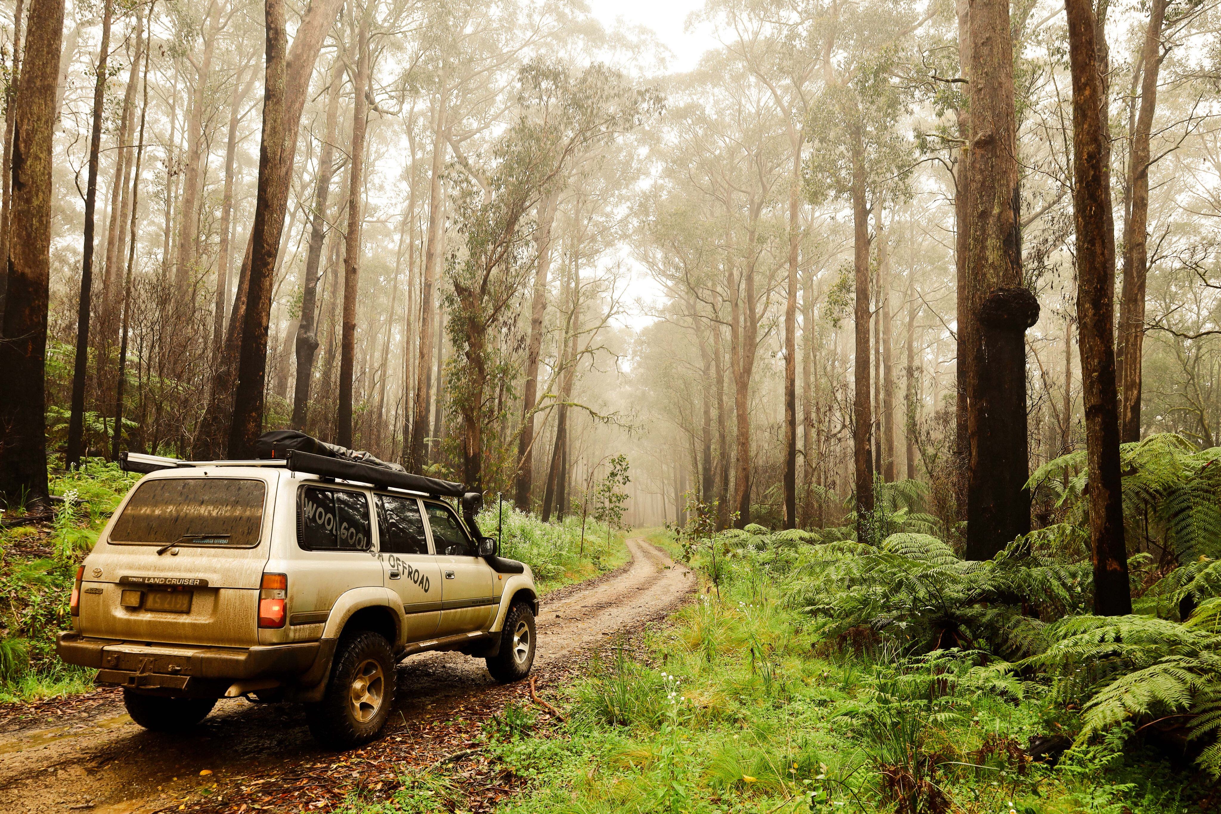
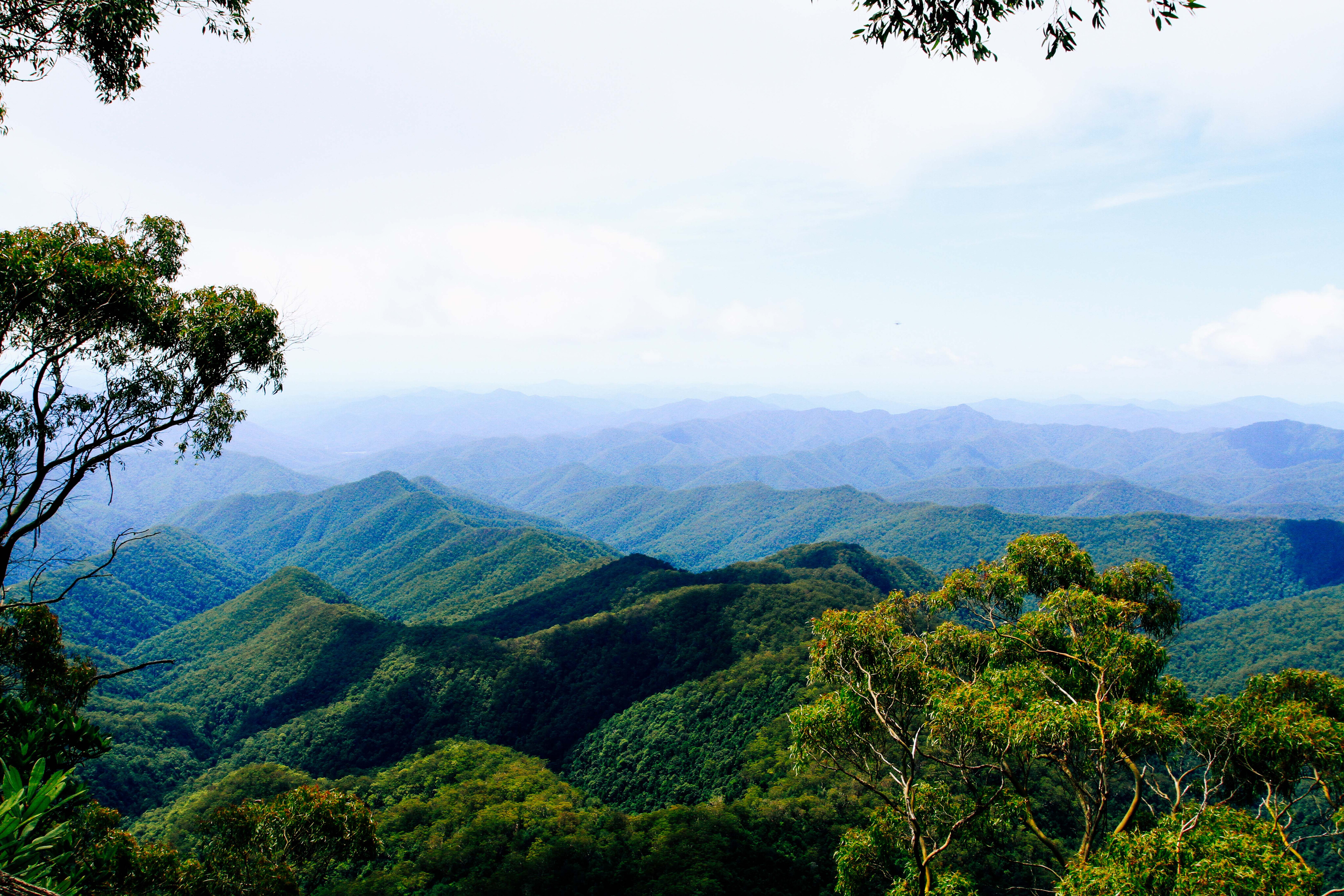
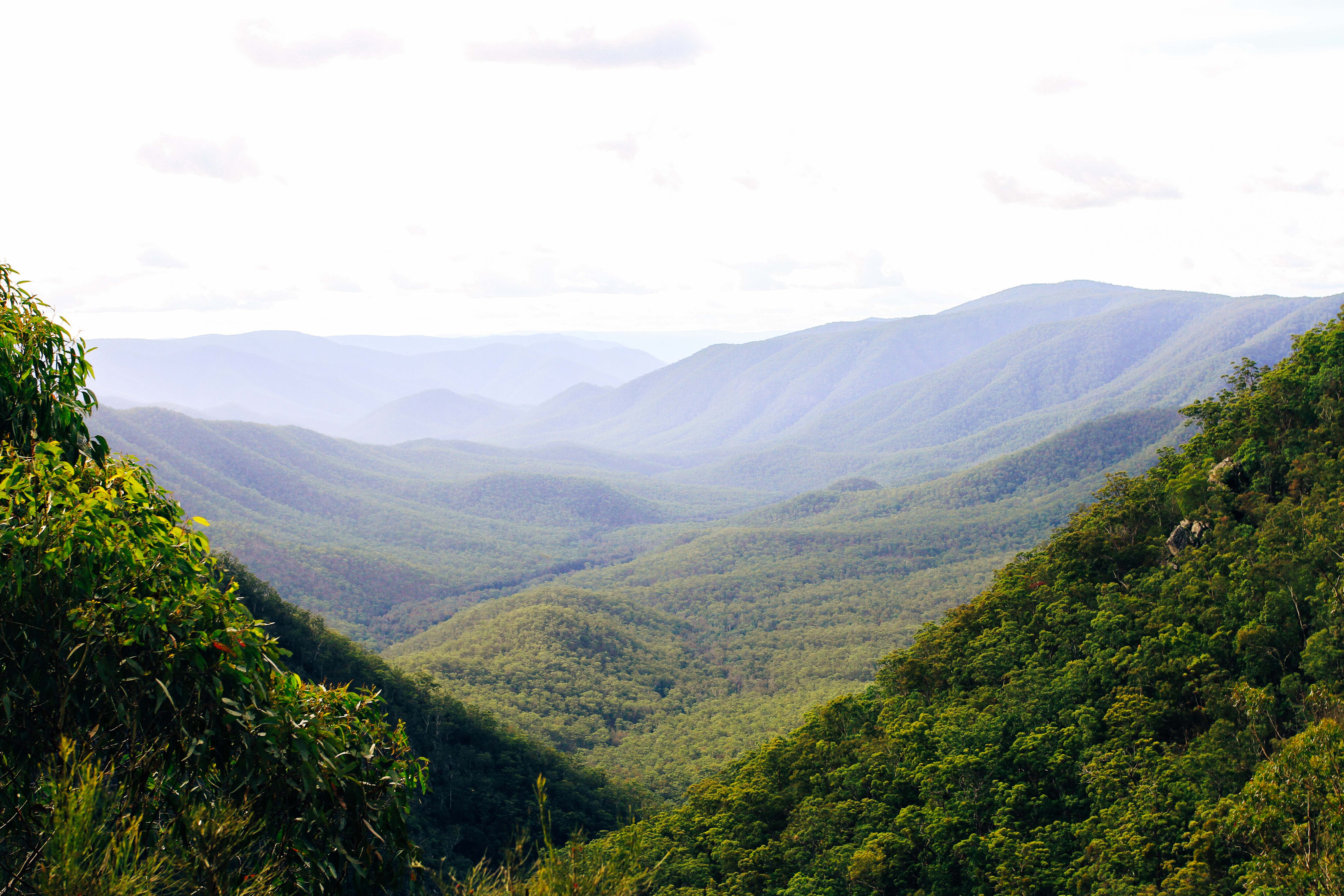
To the east where the Great Divide drops down to the coast there’s some cool forest regions with a diverse range of plants and animals.
The tourist trade flocks to these areas for the multitude of wineries, coffee emporiums, boutique stays, natural wonders and festivals.
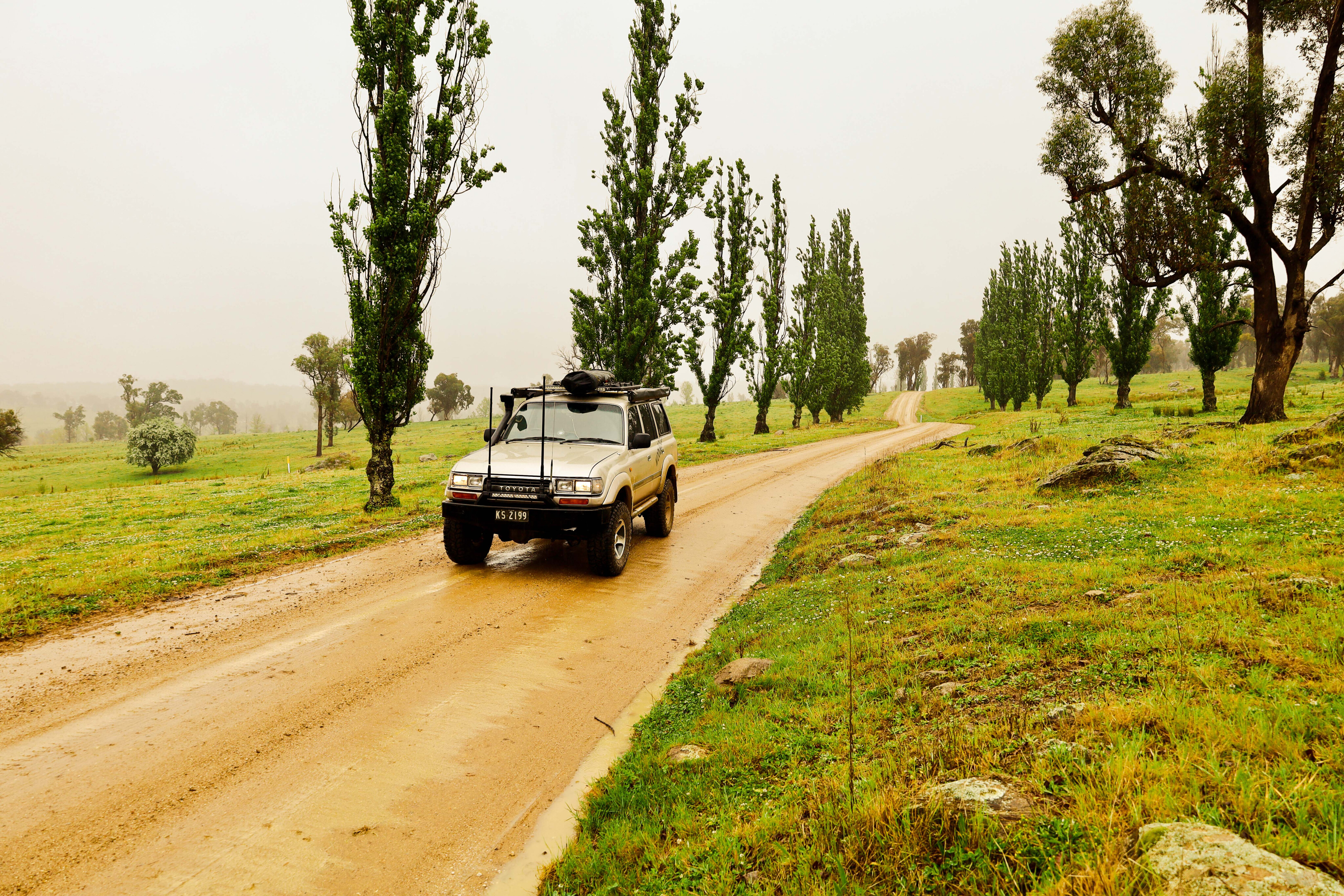
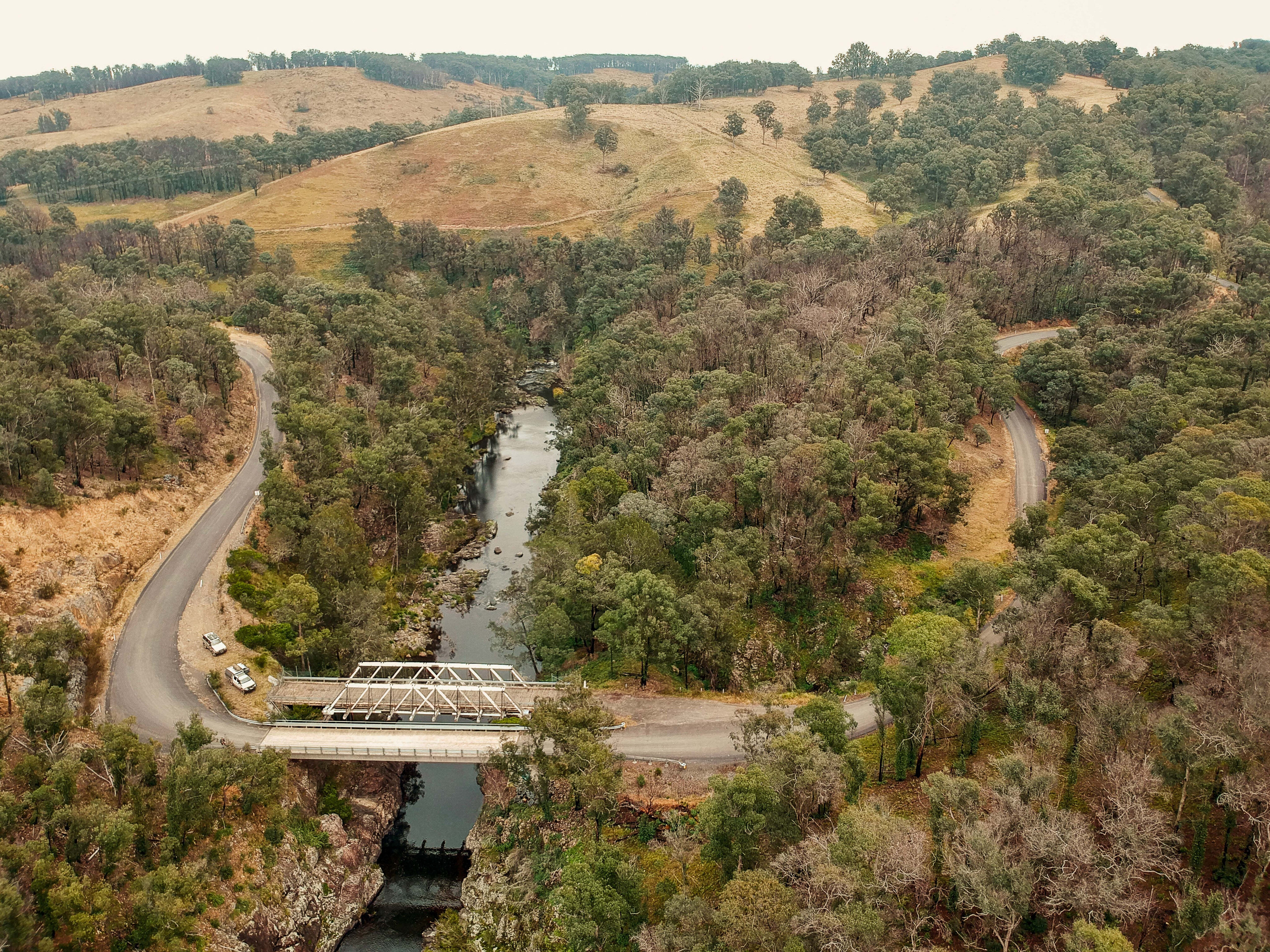
Now while there’s not really a lot of challenging four-wheel driving in the area, it’s a great place to explore for a few days. One area in particular is around Ebor, midway between Sydney and Brisbane on the tablelands. This is true gorge country, where over millions of years the constant weathering has carved out an amazing landscape.
38
Grab one of the many tourist maps and create your own adventure out here.
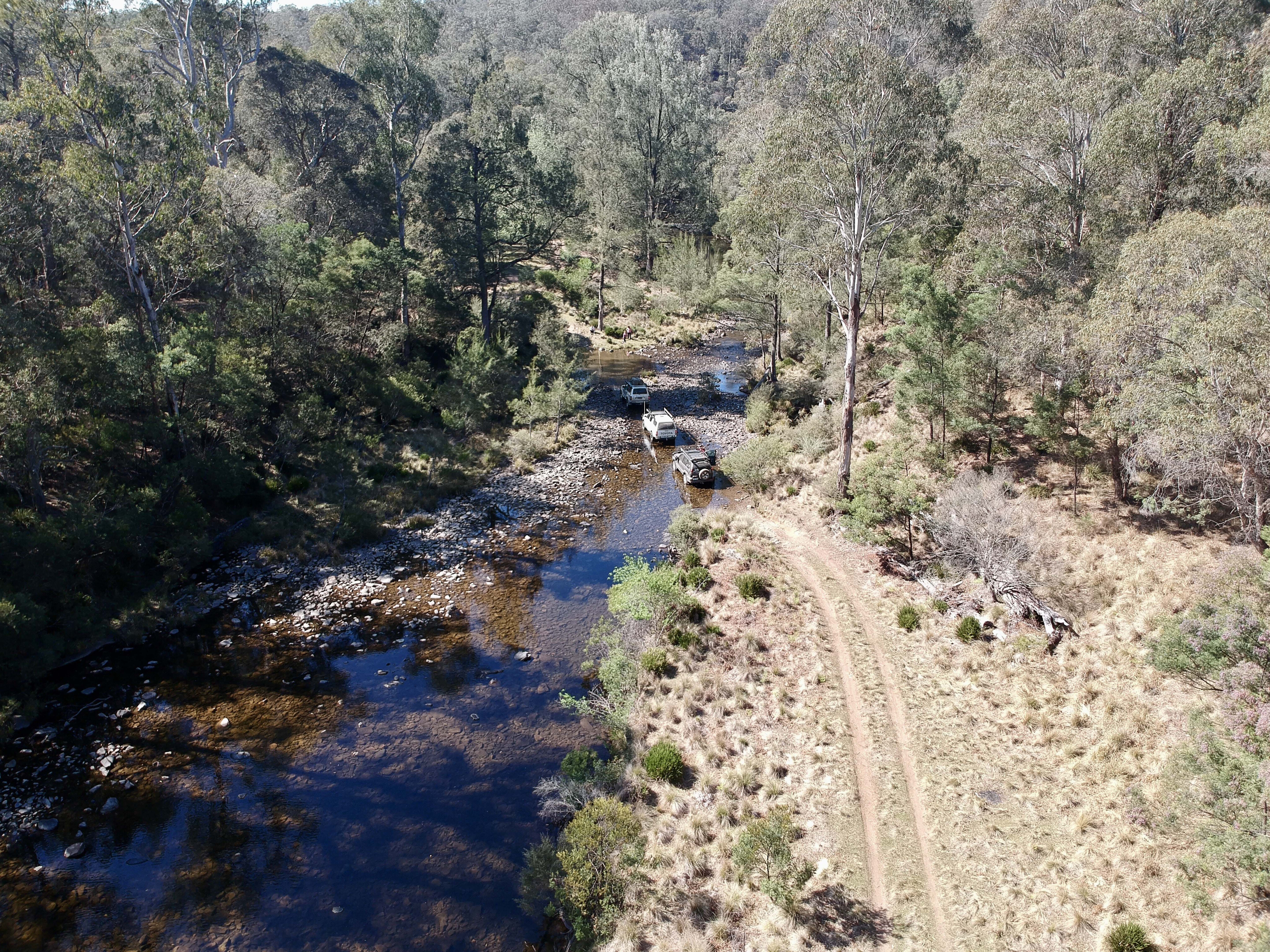
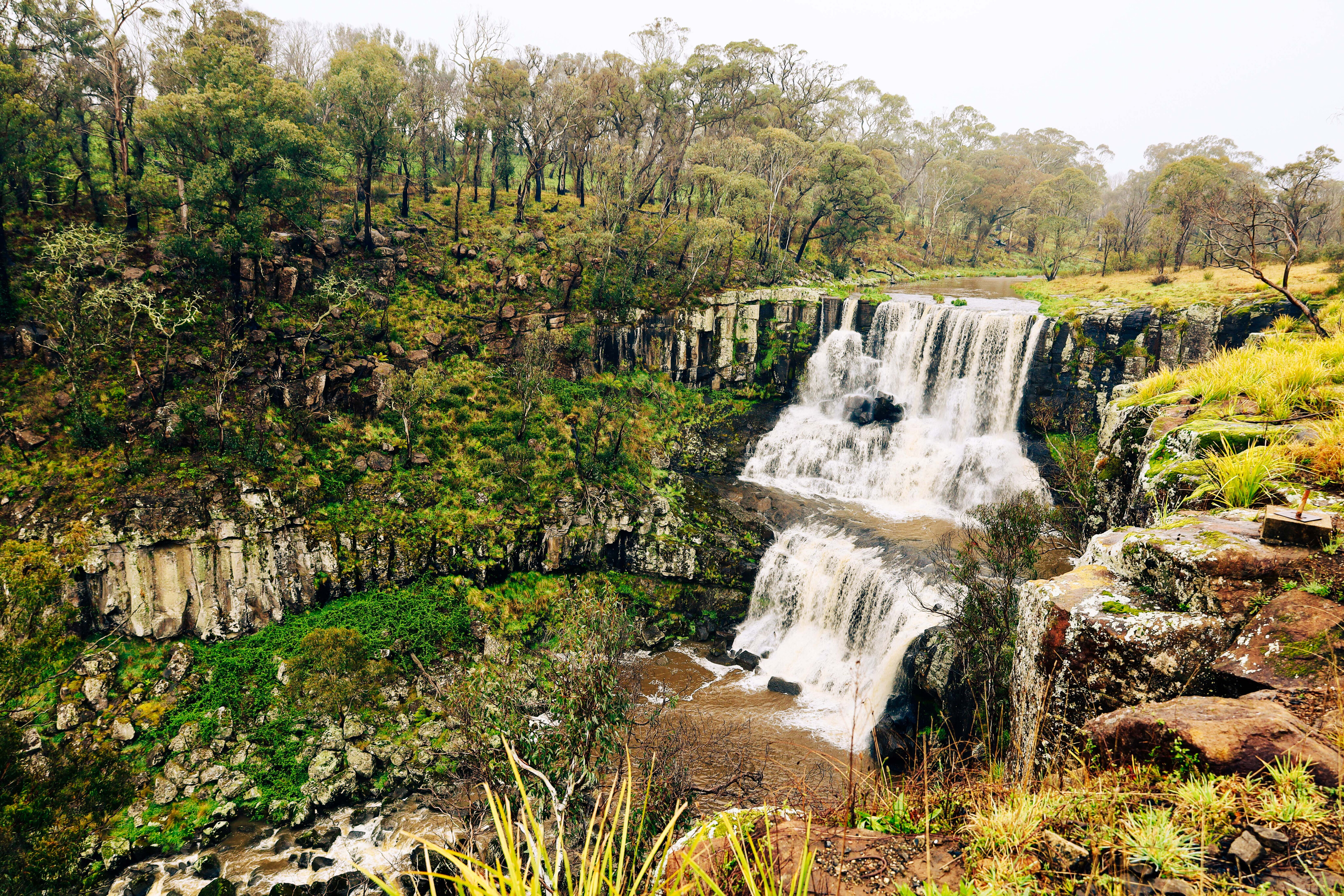
The area is surrounded by national parks and wilderness areas, but there’s still some amazing touring tracks, plenty of history to explore and the waterfalls in the area are said to have some of the longest drops in the country, while Round Mountain in Cathedral NP is the highest point north of the snowfields.
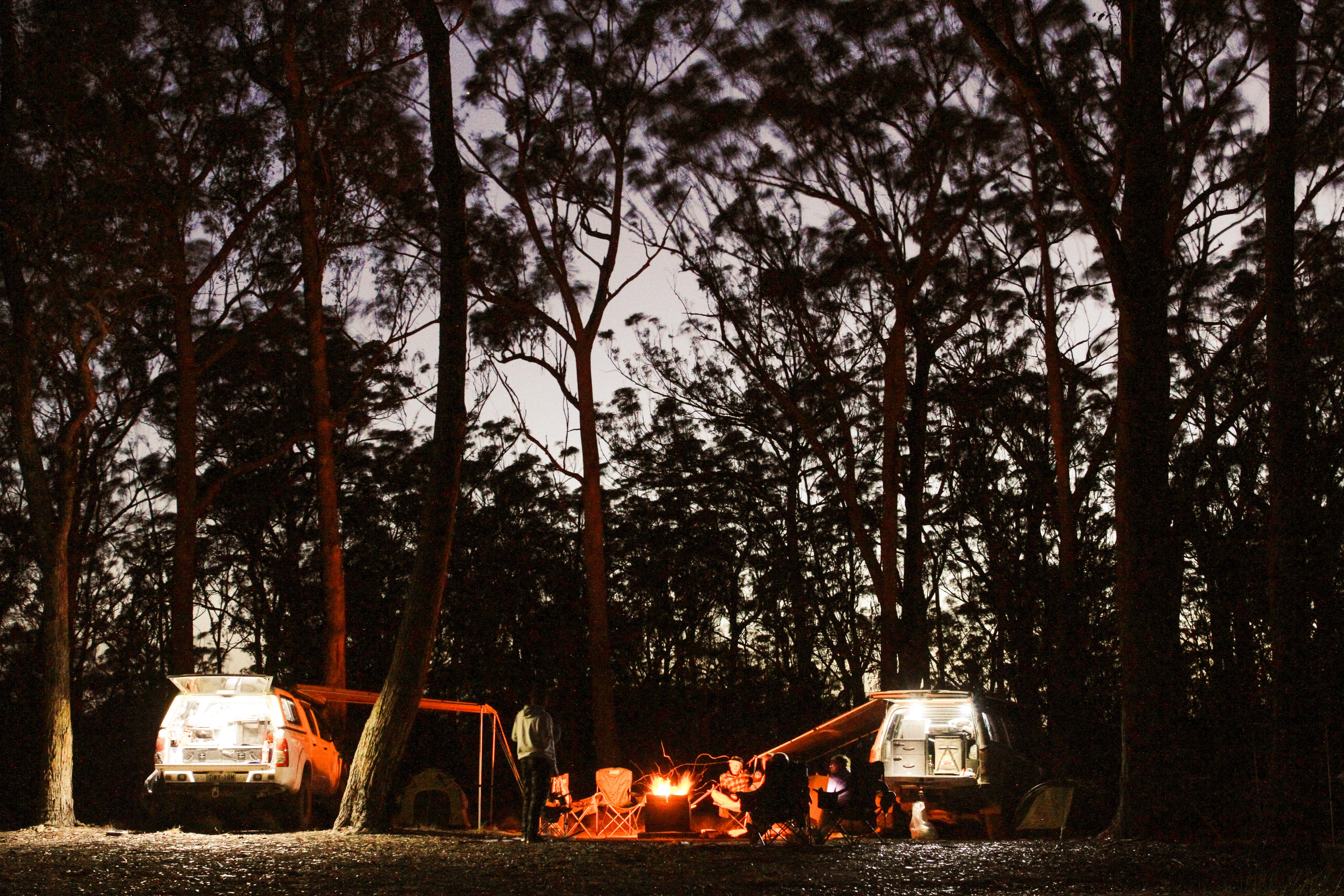
One of our favourite camping spots is in Styx River State Forest. Surrounded by national parks it’s a beautiful little pocket where tree ferns grow under tall gums in the cool climate and where camping is free down on Wattle Flat beside the river. The area is peaceful and while you won’t find much in the way of diff-busting tracks, it’s all about exploring the region and winding down.
My advice for exploring New England? Grab one of the many tourist maps and create your own adventure out here. With a good GPS or the right map, the listed locations are easy to find. Be prepared for weather changes as you can get three seasons in one day.
38
The Ebor volcano
Many, many years ago before man walked the earth, the east coast of NSW was alive with active volcanic eruptions and upheaval.
One of the most significant in the area was the Ebor volcano, 65km east of Armidale. It’s reported to ahev been very active over a period of 30-60 million years ago.
The lava flows from the massive upheavals that this volcano created extend for several hundred kilometres in a 360 degree arc all the way to Barrington Tops and west to Mount Kaputar. This is evident from the rich red farming and grazing land that the mid-north coast is renowned for, and the floodplains to the west where the basalt soils are black.
38
From the potato growing area near Dorrigo to the lush rainforest areas that run along and meet the coast to the north and to the south, this is known as Gondwana land.
The New England National Park, which surrounds the Ebor Volcano, plays a significant part in the protection and preservation of a wide diversity of flora and fauna, and this was recognised in the late 1980s when it was declared a World Heritage listed area.
While there’s no four-wheel driving here, the walking tracks and lookouts make up for it. Some walking tracks wind their way into the wilderness areas and others loop around the ridge through the cold climate forest.
The 300m thick rim of the Ebor Volcano can be viewed from the nearby Point Lookout on a clear day, which at 1565m above sea level offers stunning views into the wilderness areas that surround the rim and down across the coast.
38
The afternoon is the best time to visit but as it’s so high the mist and clouds can roll in unexpectedly, hiding the valleys below.
At this altitude you can see cold-tolerant snow gums covered in thick moss, yet in the valleys below the gorges are filled with near inaccessible rainforest pockets. This area has created its own environment: there are high rainfall periods that flood the surrounding lower lying land; freezing winters where snow falls on a regular basis; and summer periods where the dry heat can leave you feeling dehydrated.
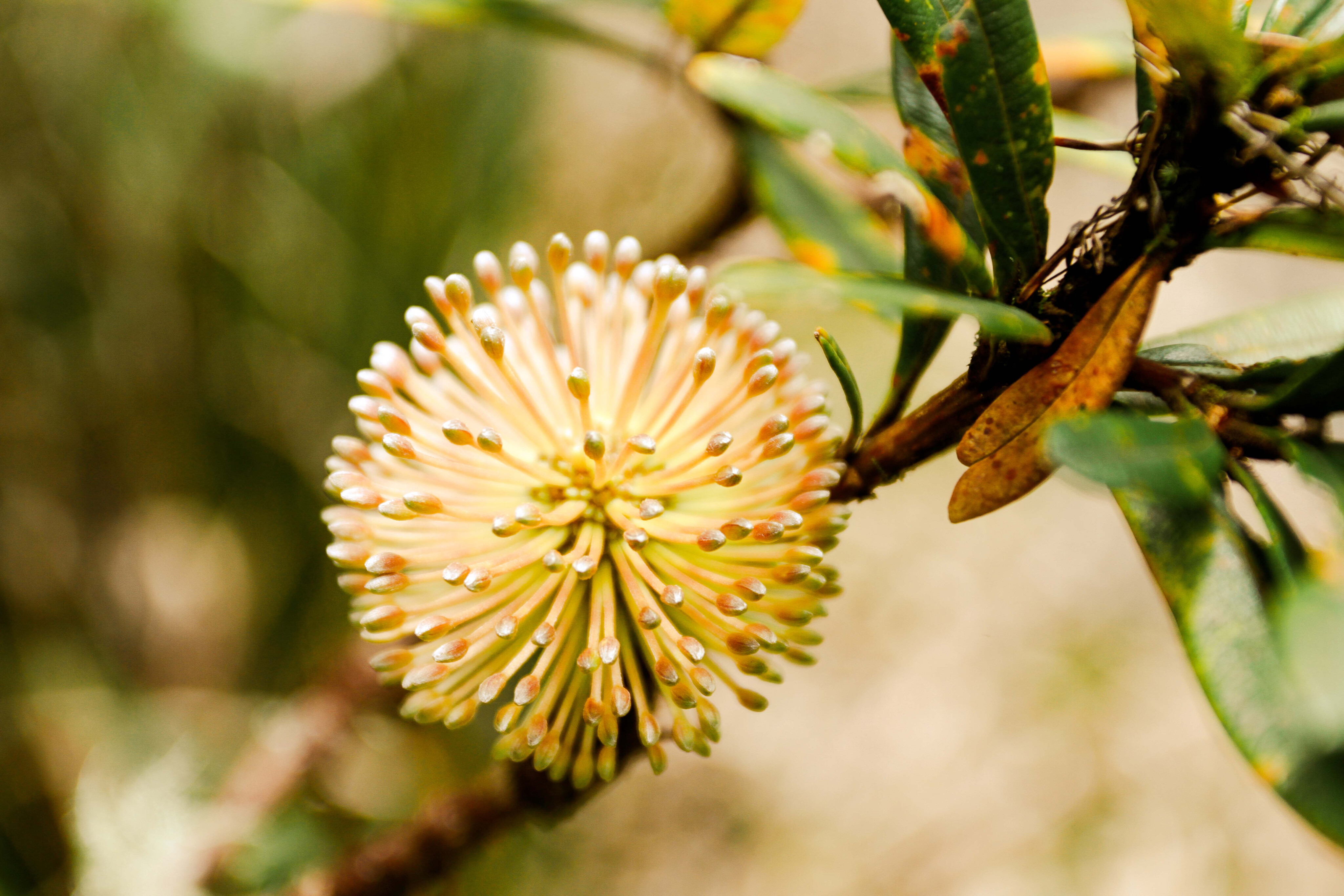
This volcanic area is reportedly home to more than a thousand different species of plants and trees, with the altitude ranging from sea level to 1610m, and some species are found nowhere else in Australia.
38
Cathedral Rock NP
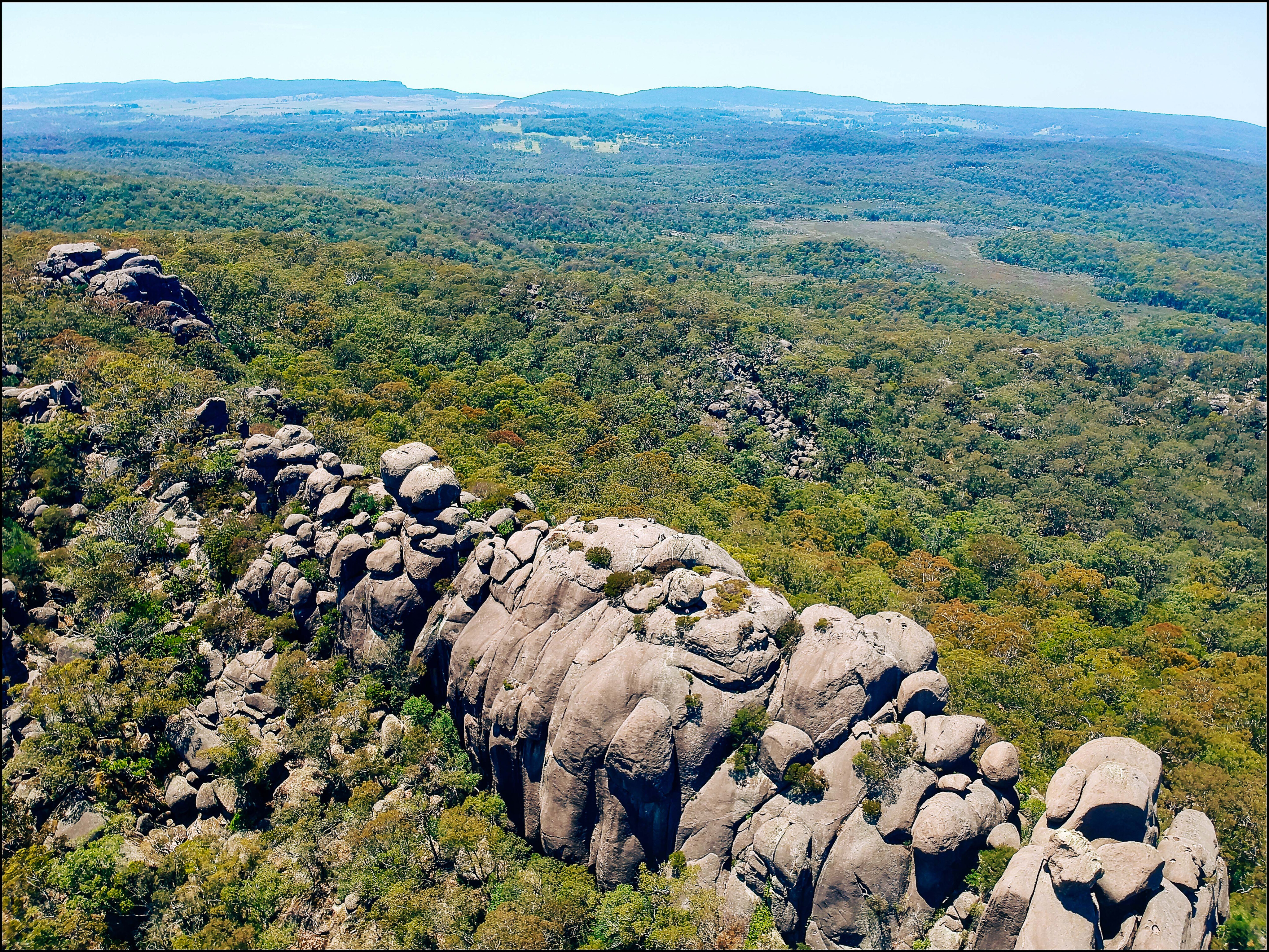
Cathedral Rock NP is a relatively small park and some may find it an underrated destination. The only vehicle entry into the park is located 65km west of Armidale, towards Ebor.
Entering the park there’s a great information board that provides an insight on what you can expect to find within the park, such as camping, history and the ecology of the area. It’s an easy 8km drive that winds its way around huge granite boulders and through the cold-climate forest to the camping areas.
Barokee Campground caters for both daytrippers and campers, with a pit toot, fire places and supplied firewood. The main focus of the park is the three-hour return walk to the top of Cathedral Rock.
38
Getting to the base of the rock climb is pretty easy but it’s the last gut-busting 500m that will have you questioning your decision to take it on.
The track follows the rock formations, and you’ll be ducking under overhangs before the final challenge of scrambling over boulders. You’ll need to grab the chain to pull yourself up the last rock.
When you reach the summit the 360° views are stunning, looking over valleys and across to other granite tors (free standing rock formations) in the distance. It’s interesting to note that these granite formations are located only within Cathedral Rock NP, and nowhere else in the region.
38
On our last visit we sat here for more than an hour trying to comprehend the area with its breathtaking views in every direction, and just how peaceful it is at 1550m above sea level.
We watched soaring raptors at eye level as they looked down for prey, and also spotted some of the biggest rock skinks we have ever seen, scrambling around on the rocks and keeping an eye on our every move.
After the scramble back down, the loop track heads around the base of these giant granite boulders and back to camp. You will pass the walking track to Native Dog campground on the outskirts of the park. The rocks here are from the Ebor Volcano eruptions that occurred millions of years ago.
38
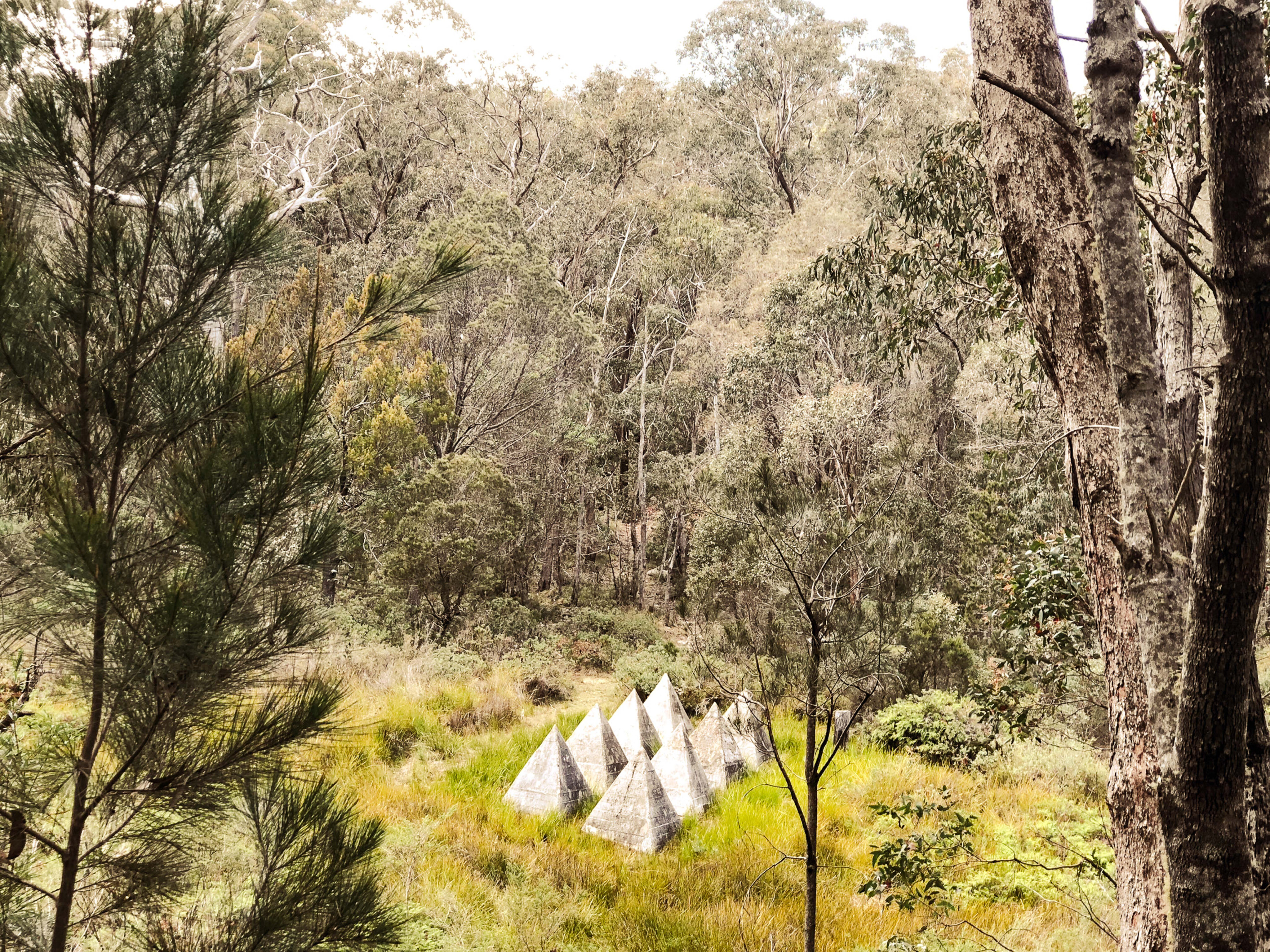
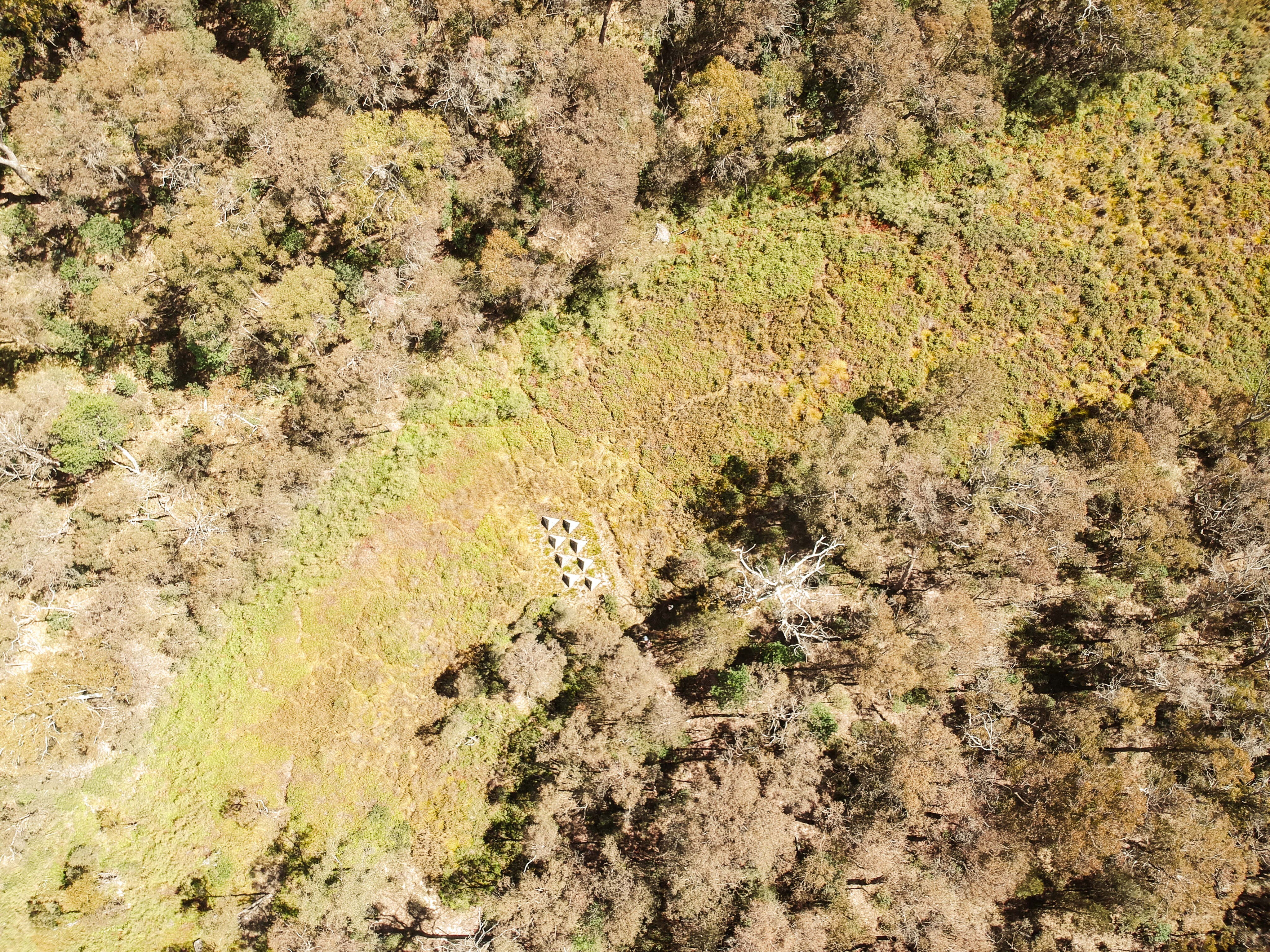
Yooroonah Tank Trap Barrier
Located in the New England Tablelands 12km southwest of Ebor, the Yooroonah Tank Trap Barrier is well hidden from modern day traffic, located well away from the main road.
Strategically placed here back in 1942 in case the Japanese were to invade Australia, the barrier was designed to slow progress to the tablelands. Reportedly a 75-post barrier, we spotted about 50 odd, as several others had been burnt, attacked by white ants or had been knocked over.
There are eight triangle tetrahedra (triangle blocks) placed on the higher ground down near the swamp area, and these were positioned to force the tanks into the marsh areas.
38
We found several rock lookout platforms and funk holes (where the troops would lie if there was an attack) but unfortunately we couldn’t find the foundations of several buildings that were here, or the old stone chimney.
One amazing find, however, was the tunnel under the old road that would have been loaded up with explosives and ignited if the enemy was on the road. There would have been a ton-and-a-half of explosives set for charge in the steel boxes that can still be seen inside the tunnel.
The digging of the tunnel initially involved two shifts of two men each, working 15 hours per day, six days per week. The tunnel is about 60-feet long with two arms branching off the end, and reports say it was 10-feet high; it’s now about 5-feet high and seems to be about 4 feet wide.
38
Historical records say that in nearby Armidale, there was a system in place to race the explosives out here to the tunnel if the enemy was approaching.
It’s hard to believe walking around here that this might have actually happened so far down the coast. I’m not sure why the enemy would want to target the cold New England area instead of staying down on the coast, but it was certainly viewed as a real threat.
This enemy deterrent was one of many along the east coast of Australia and in fact the steepness of the terrain from the tableland to coast, combined with the prevalence of deep gorges, the absence of navigable rivers and the heavily forested nature of the surrounding countryside, meant that the few easterly roads that existed in 1942 were of critical strategic importance. Now this area is listed by the National Trust. There are several walking tracks around these points of interest, and it’s an easy walk for the kids too.
Look at this
Ebor: https://www.visitarmidale.com.au/explore/ebor [↗]
Styx River SF: https://www.forestrycorporation.com.au/visit/forests/styx-river [↗]
Ebor Falls: https://www.nationalparks.nsw.gov.au/things-to-do/lookouts/ebor-falls/learn-more [↗]
New England NP: https://www.nationalparks.nsw.gov.au/visit-a-park/parks/new-england-national-park [↗]
Cathedral Rock NP: https://www.nationalparks.nsw.gov.au/visit-a-park/parks/cathedral-rock-national-park [↗]
Yooroonah Tank Trap Barrier: https://www.nationaltrust.org.au/news/yooroonah-tank-traps-listed-on-national-trust-register [↗]
Please enable JavaScript to view the comments powered by Disqus.
COMMENTS