Explore VIC
Gallery1
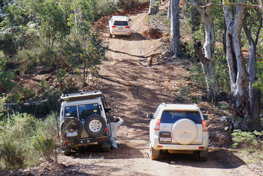
It had been a while since I had driven the route between Woods Point and Jamieson, but as I cruised along this good dirt road, skirting along the edge of a nascent Goulburn River, I wondered why it had taken me so long to return. This time I was back with the 4X4 Australia crew on a road test but it would make for a great weekend escape for any Melbournite.
This article was originally published in the June 2014 issue of 4X4 Australia.
Our trip had begun at Healesville in the morning and we had headed to a picturesque and rejuvenated Marysville and then travelled east of Cambarville, before passing through the scattered remains of the old ridge-top village of Matlock.
This one-time town of 11 hotels and numerous stores grew up as a handy staging point at the junction of the tracks from Woods Point to Jericho (on the Jordon Goldfields) and the Yarra Track from Melbourne.
 These tracks were once bridle-horse trails between the goldfields around Jamieson, south to Woods Point and on to Walhalla, but they quickly became stagecoach routes as more gold discoveries were reported in the area. Today, much of the road network and a majority of the four-wheel drive tracks owe their existence and their actual routes to those early gold prospectors and miners who cut their way through the virgin scrub in search of their Eldorado.
Want to explore more of Victoria's great outdoors?
Striking north from Matlock, we dropped off the high ridges and down into iconic Woods Point. Gold was discovered near here at Gooley’s Creek in 1861 and it wasn’t long before the fabled Morning Star reef was found and underground mining commenced.
 This became one of Australia’s premier gold mines and in the following 100 years it produced more than a million ounces of gold. Today it is owned by Morning Star Gold and promises even more riches.
Heading north, the road sticks close to the Goulburn River for a short distance, quickly passing Scotts Reserve and climbing the range to Frenchmans Gap before winding on to the A1 Mining Settlement, the site of another rich gold producer. Gaffney’s Creek, a short distance on, was the site of the first gold discovery on the Jamieson-Walhalla goldfields in 1859. Little remains of the town, the result of raging bushfires, most notably in 2006, while the once famous hotel here was burnt down by two escaped convicts in 1993.
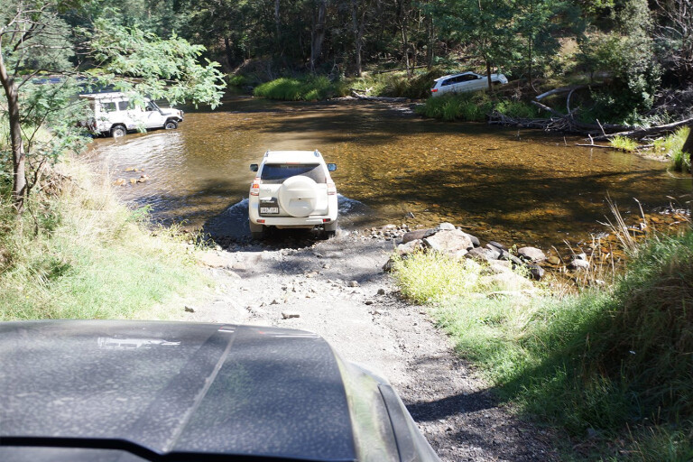
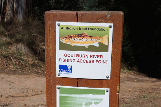
 The route north rejoins the Goulburn River north of Knockwood and from here to Kevington the road sticks close to the river, passing many delightful camping areas, including Snake Edwards Reserve, Picnic Point and Tunnel Bend.
Along the way, 4WD tracks on both sides of the river climb deeper into the ranges and in most cases they lead to old mines and the scattered remains of ephemeral hotel and town sites. Some that head east, such as the Snake Edwards Divide Track, meet with the Jamieson-Licola Road. At Kevington there is a pleasant camping area right beside the famous hotel that has been here since 1862.
 While the main road north of Jamieson enters more gentle farming and grazing country on its way to Mansfield, we headed east towards Granny Flat, a delightful camping area on the Jamieson River. A 4WD track crosses the river here and climbs steeply to the top of the ridge to Mitchells Track before joining the more sedate Steiners Road, which will still require a 4WD.
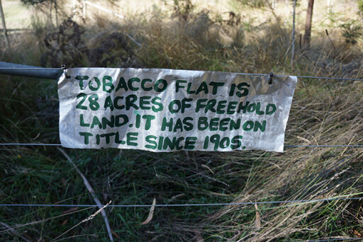 The descent from here to Fry’s Flat via Tobacco Flat (private property) is pretty steep in parts and can be a challenge when it’s wet.
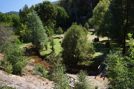
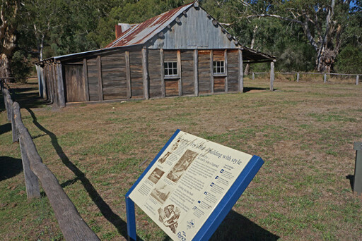
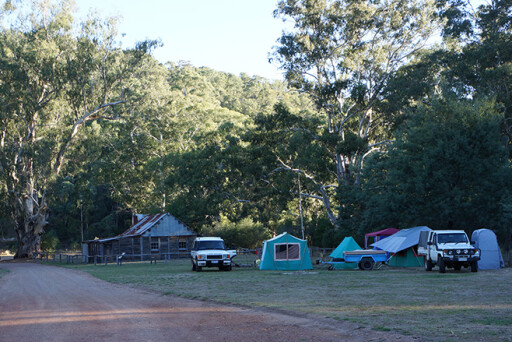
Fry’s Flat on the Howqua River, enclosed by the Howqua Hills Historic Area, is one of our favourite camping areas and is a bit quieter than the nearby 2WD-accessible Sheepyard Flat. Fry’s Flat owes its name to Fred Fry, who built the nearby hut and lived here until his death in 1971. Fred’s legendary standing among the mountain people was due to his skill as a bush carpenter.
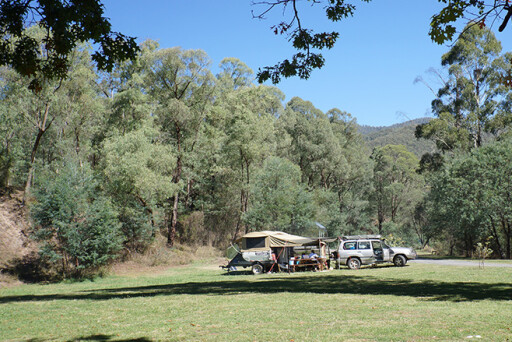
 The next morning we tore ourselves away from the Flat and headed to Merrijig before taking Buttercup Road into the Mansfield State Forest. This dirt road skirts along the edge of Buttercup Creek, where there are a couple of designated campsites that were a bit too close to the road.
Winding deeper into deeply forested hills covered with woollybutt and mountain grey gums, we came to Tomahawk Hut, one of the first huts built in the High Country by the Forest Commission of Victoria. While logging had probably begun in this region in the 1920s, this was greatly expanded in the 1930s and after World War Two.
 Passing through Tomahawk Gap, we took the Buckland Spur Track, which skirts the western edge of the Alpine National Park. It’s an easy run at first, our passage only disrupted at times by fallen trees, but the descent into the King River valley is one most people would remember if they have ever done it. Luckily for us it was dry and the descent uneventful, but I wouldn’t want to travel this route if it was wet.
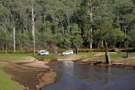
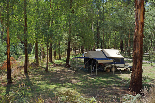
At the bottom of the descent, you are basically at the very back end of Lake William Hovell. There’s a maze of tracks around Sandy Flat and a couple of crossings of the river, along with a number of pleasant campsites. As we camped on the King River, we were treated to a flight of ducks, clear starlight skies and the coughing bark of nearby deer.
 It’s a relatively easy drive out to the main road near the dam wall, where the bitumen leads you north to Whitfield and the gastronomical delights of the King Valley. That makes a fitting end to a weekend of travelling some of the finest mountain country in Victoria.
TRAVEL PLANNER
ACCESS
No permits are required to travel this area.
Most of the area detailed is state forest, although the route does skirt the edge of the Alpine National Park in places and passes through the Howqua Hills Historic Reserve.
Some of the tracks are closed during the winter.
See Four Wheel Drive Victoria and go to ‘Track Information’ for updates.
 ACCOMMODATION & CAMPING
- Woods Point
- Upper Goulburn River within the surrounding state forests.
- The Kevington Hotel
- Jamieson
- Merrijig
Camping is not allowed around Lake William Hovell, but there are camping spots on the King River, upstream from the dam at Sandy Flat and Top Crossing Hut.
Also look into Whitfield, including the boutique Mountain View Hotel.
BEST MAPS
Hema Maps produce a couple of maps that provide a good overview of the whole region. Rooftop Maps produce more detailed maps of the area, while the Adventurer Maps (Ghost Town series) by Paoletti’s Maps show great detail on tracks and mine sites.
What's your next off-road destination? Find out and explore.
Please enable JavaScript to view the comments powered by Disqus.
COMMENTS