Explore TAS
Gallery17
APPROACHING Tasmania's Queenstown, I couldn’t help but feel melancholy. A visit had been suggested, but the idea of environmental destruction as a tourism attraction seemed more than a little depressing.
This was first published in 4X4 Australia’s July 2012 issue.
Still, with two days to spend in nearby Strahan, we decided to make the winding bitumen drive late one afternoon.
Mined intensively for copper since the early 1900s (a copper mine still operates there, with tours available), Queenstown suffered dire environmental damage as a result of the surrounding hills being cleared to fuel the smelter. Acid rains then almost irreparably eroded the bare landscape.
 As Queenstown sits in a valley, the denuded hills are the first thing to greet you on approach. A famous town relic is the gravel football oval (from a time when even grass struggled to grow), which local players continue to use out of a combination of nostalgia and local pride, despite the slow return of vegetation.
The day was still stiflingly hot despite being early evening, so we retreated to the historic Empire Hotel (built in 1901) for a cold beer, where we met long-term local Joyce Appleby. Neither she nor Kylee Shackcloth behind the bar seemed all that optimistic about the future of Queenstown with its shrinking population and the increasing prevalence of non-resident miners, but both were clearly proud locals.
They told us about a 24-hour charity walk being held that day around the gravel oval to raise money for locals with terminal illnesses, and were clearly chuffed to show us the hotel’s National Trust staircase. Made of Tasmanian Blackwood, it was shipped to England to be carved in the early 20th century – an impressive feat then or now, and evidence of the vastly different standing of Queenstown at the time.
In the end, I was glad we made the trip, if for no other reason than to get a first-hand view of the mining that is such a big part of western Tasmania’s identity and economy, in a state with a split personality: Tasmania is also the birthplace of the Green political movement and remains at the forefront of environmental debate in this country.
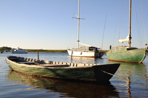
 Unlike Zeehan (see part 1) or Queenstown, Strahan on the west coast thrived into the 21st century as a popular tourism centre thanks to its idyllic seaside location and the enduring market for Tasmanian smoked salmon.
Having shivered our way along the hiking tracks of Cradle Mountain National Park just days earlier, a record-breaking heatwave kicked in by the time we arrived in the picturesque port town. We spent a lot of time in the shallow, tannin-stained waters of West Strahan beach behind our caravan park accommodation.
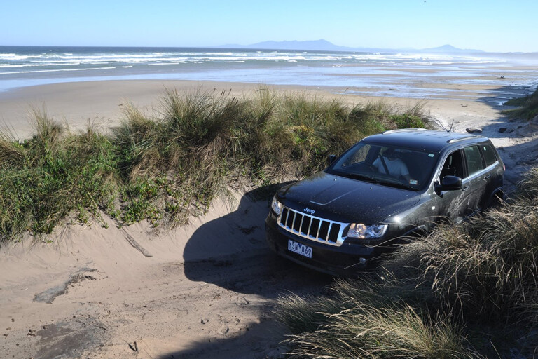
Off-roaders visiting Strahan can take their 4X4s for a spin on the Henty Dunes or simply along Ocean Beach where sand driving is permitted. Strahan is also home to a Huon pine sawmill and adjacent woodwork shop.
Native to Tasmania, Huon pine is sought after for its waterproof and rot-resistant properties, and is one of the longest-living organisms on earth. Fires, mining and logging have reduced existing stands to about 10,500ha – almost all of which is now protected. Only dead and fallen trees can be harvested, but luckily the wood retains its qualities long after falling, and can even be dredged from rivers for use after decades.
 After two nights, we were sad to leave Strahan, but felt oddly comforted to be passing through Zeehan for the second time on our way up the coast. I commented on this to Paul, who suggested a traveller needs to leave and then return to a place to experience that comfortingly familiar feeling. It reminded me of that oft-said phrase ‘many happy returns’.
Before hitting the Western Explorer Highway (dubbed The Road to Nowhere by environmentalists in the late 80s), we took a (signed) left turn towards Trial Harbour about 10km out of Zeehan.
What follows is a 24km narrow, slippery gravel road – but where it led, I have to admit, we were vague. Like Queenstown, a visit to Trial Harbour had been suggested, so I’d penned it into the itinerary on our way to Corinna and left it at that.
 I was therefore surprised when the ocean opened up before us and a smattering of cottages nestled into the valley below came into view. What exactly was this place?
We pulled up at the beachfront and – first things first – went for a swim. The calm bottle-green waters (in fact renowned for often being unruly and having taken several lives over the years) looked irresistible.
A sign told us Aboriginal people still live in the area and hunt for fish and abalone, adjacent to which was a pile of whale bones – collected, it seems, for us tourists. I took a few photos to add to our growing whale-bone album. Are we that predictable?
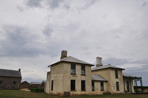
We chatted to Shirley Smith, owner of the History Room (a private home doubling as a museum showcasing the town’s history) on her deck, looking out over her clifftop garden framed by an expansive ocean view.
 Once a port for the (then) thriving mining town of Zeehan, Trial Harbour today has a permanent population of just 11 and is disconnected from the electricity grid and mains water (homes use wind turbines, solar panels, gas generators and tank water).
Apparently there have been residents in the past who have looked at connecting to the rest of the world, but on the whole the locals remain averse to the idea – they define themselves by their seclusion, which adds to the village’s away-from-it-all appeal.
There is a 4X4 track connecting Trial Harbour to Granville Harbour in the north, along which there is apparently a campsite. However, the track was closed until further notice due to a broken bridge when we were there, so we returned to the Road to Nowhere… which would in fact take us to the north coast, via Corinna.
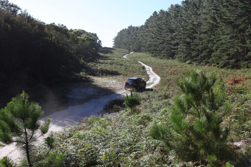
Initially surrounded by wide grassy fields and logging sites, the unsealed but well-graded Western Explorer Highway was soon bordered with towering, dense forest as we were enveloped by the Tarkine wilderness.
 The Tarkine – named after the original inhabitants, the Tarkineer – constitutes 447,000 hectares in the state’s north-west and is Tasmania’s last untouched wilderness area yet to be gazetted national park, largely because of its mining and logging potential.
We passed just one other vehicle before reaching the Pieman River, crossable on the Fatman Barge ($20 one-way). It was our last obstacle before reaching Corinna, a gold-rush town that contracted in the early 20th century and remained largely abandoned until 2008 when the Tarkine Hotel was re-opened and the town transformed into an eco-tourism destination by a couple of entrepreneurs from the mainland.
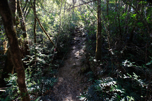
Activities of choice are kayaking, bushwalking and river cruises. We chose a shady forest walking track to spend a few hours and dunked ourselves in the icy Pieman River before dinner at the Tarkine Hotel.
 We saw out the day on a jetty overlooking the Pieman. The chatter of diners and clink of cutlery from the hotel faded into the background as we sat quietly, feet dangling over the dark-green water flanked by lush, ancient and seemingly impenetrable forest.
Some say, if the Tasmanian tiger were to live on anywhere, it is here, in the Tarkine – Corinna is the Aboriginal word for a young Tasmanian tiger. Leaving Corinna the next morning, the heatwave seemed to dissipate as quickly as it arrived. Clouds gathered and rain fell in bursts for the rest of the day.
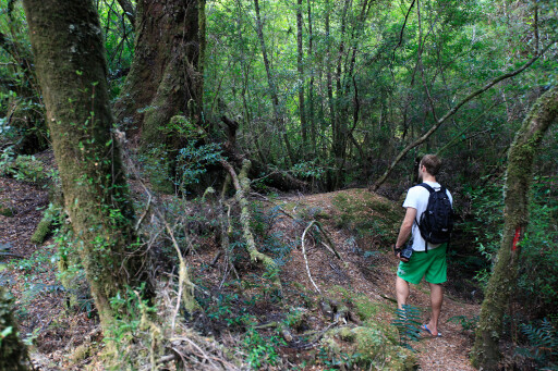
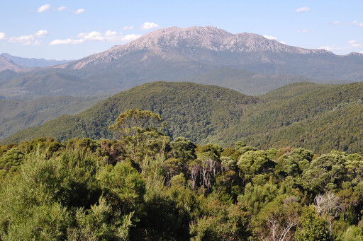
We stopped just 10 minutes along the road out of Corinna (the turn-off is directly after the bridge crossing Savage River, a Pieman tributary) and donned rain jackets to hike to the top of Mount Donaldson. This is a well-graded track over what is more like rolling hills than a mountain. It takes around three hours to reach the summit, with spectacular views over the Tarkine.
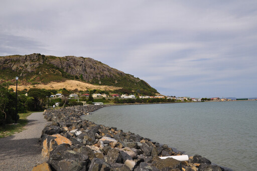
 Our final evening was to take place in the north-coast town of Stanley, which sits at the foot of an enormous rock formation for which it is famous. Named Circular Head by Bass and Flinders in 1798, the 152-metre-high and 2km-round ancient volcanic plug is more affectionately known as The Nut.
We rose early on our final morning met by cool, clear weather to accompany us on our climb to The Nut’s wide, flat summit. The steep walk (a chairlift is also available) rewards with views over the historic village and up the north coast to where the Spirit would soon arrive to take us and the Jeep on our journey home.
The phrase ‘many happy returns’ sprang to mind. We’ll be back.
Please enable JavaScript to view the comments powered by Disqus.
COMMENTS