Explore QLD

Gallery1
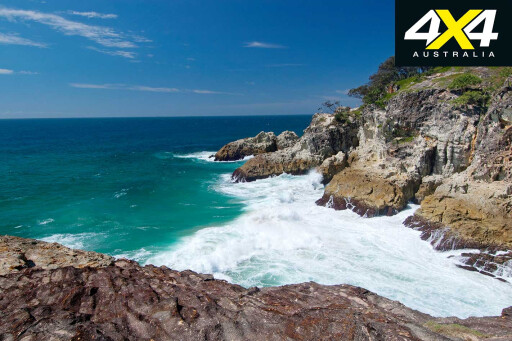
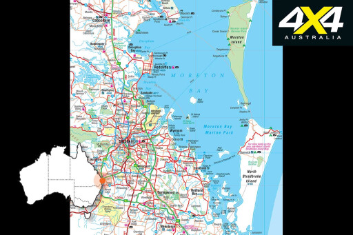
Anyone near Brisbane might look west for their next 4X4 adventure, but it is to the east, in Moreton Bay Marine Park, that a fabulous 4X4 holiday destination lies across two sand islands that will make you forget Fraser Island even exists.
This feature was originally published in 4x4 Australia’s December 2011 issue.
If possible, allow at least ten days to experience both Moreton Island National Park and North Stradbroke Island (Straddie). We suggest Moreton first so you start with full supplies and restock on Straddie, where there are more facilities. And remember the barge between the islands only operates Thursday to Monday.
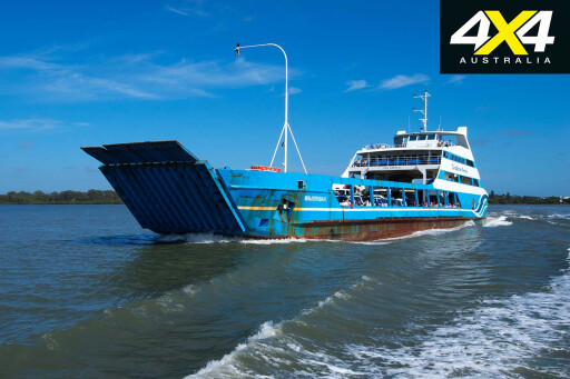
 Board the MiCat ferry and take the opportunity to lower vehicle and camper-trailer tyre pressures before disembarking at the Wrecks. The Wrecks campground is walk-in/tents only, while about 1.4km north Ben-Ewa offers vehicle camping.
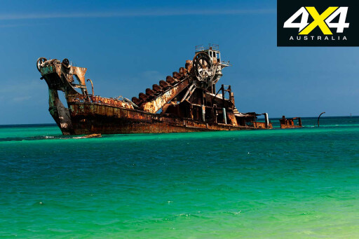
Another option is to take the MiCat on its Tuesday run to Bulwer and camp at Comboyuro Point campground. A swim at the Wrecks beach is a must, with a protective artificial reef and breakwater just offshore, formed by 14 old barges and dredges sunk to provide safe anchorage for boats.
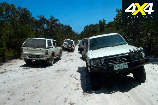
Middle Road consists of two one-way tracks bisecting the island. The western end is just 500m south of Tangalooma; travel east on Middle Road for 1.5km, then turn south on the Tangalooma bypass track (a sign indicates East Beach) for 3km. To the left is a 2km track to the Desert with a walking track to the dunes where sand tobogganing is permitted. It is another 6km to the beach – debris and soft sand drifts here make for challenging driving.
For experienced beach drivers in a convoy with recovery gear, a 12.1km run south to Big Sandhills is a great way to explore this part of the island. The Foreshore Flats begin 2.5km further. Explore the tidal pools at low tide before returning north.
 At 0.8km north of Ben-Ewa, the 3.5km Cowan Cowan bypass track exits on the beach just past Cravens Creek (S27°06’40” E153°22’11”). Curtin artificial reef is offshore with good fishing and snorkelling. Bulwer is 4km north. This is basically the end of beach driving on the bay side of the island, although a wander around Comboyuro Point is worthwhile.
Middle Road is best driven from a base camp, since towing is not recommended on the soft sand (use the Bulwer-Blue Lagoon Road instead). From the east entrance of Middle Road, travel for 7.2km to the Mount Tempest turn-off. A track leads to a parking area with a 2.5km return steep climb to a lookout with panoramic views of the island.
For those who wish to camp on the windier ocean side of Moreton, the Northeast camping zone extends from Middle Road to about a kilometre north of Blue Lagoon. The Yellow Patch camping zone is west of North Point and the Southeast camping zone extends from Middle Road to Little Sandhills.
 Behind the N2km marker is Eagers Swamp and Mount Tempest rising to 280m. The N6km marker is near the Bulwer-Blue Lagoon road; use it for the Blue Lagoon camping ground and both the Northeast and Southeast camping zones if towing a camper trailer.
Up the beach is a track to Blue Lagoon, a pristine freshwater lake. The N8km marker indicates the Blue Lagoon campground. Spitfire Creek flows across the beach near the N10km marker. Continue past the N12km marker to Braydon Beach. Stop at N14km (S27°02’24” E153°27’50”) for a picnic or a swim.
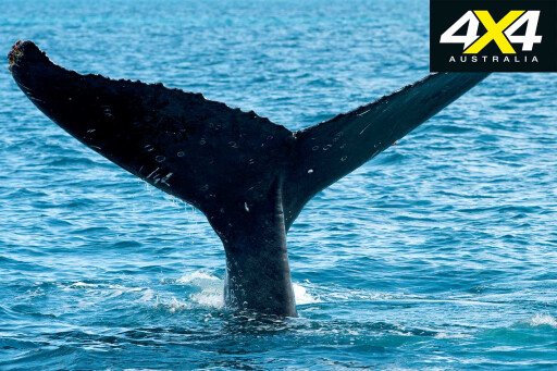
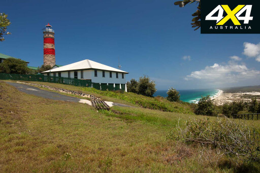
Afterwards, check the tiered track for oncoming vehicles, then make a steady run uphill along the wooden slats. After 1km, branch right for the Cape Moreton Conservation Park with the QPWS information centre, the Cape Moreton Lighthouse (no access) and a short walk to a lookout. This is the best place on the island to look for whales.
 From the North Point carpark, turn left and drive on the beach for 1km, exiting on the left near the Yellow Patch sandblow, then turn right on the Bulwer-North Point road. Head west for 3.7km to a short walking track to the Five Hills Lookout providing views of the Heath Island. The Bulwer-North Point road ends after another 3km.
To the left is the Bulwer-Blue Lagoon road to the ocean beach, to the right is the road to Bulwer. Turn right and travel for 1.5km, and then turn left for 2.6km to Bulwer. The Bulwer bypass to the beach is the only way to get back to Ben-Ewa.
Make sure you are not caught on a rising tide, and drive south on the beach for 3km to the Cowan Cowan bypass track which runs for 3.5km and delivers you back on the beach just 0.8km north of the Ben-Ewa camping ground. Consider spending a few nights at Blue Lagoon; bushcamping extends from just north of there to the south of Rous Battery.
Time to take the Amity Trader from Kooringal? Plan your beach drive south around a low tide. There is no camping here, so take the barge when it is scheduled to leave.
 From Middle Road, navigate south on the beach. Continue past S3 and S5; at S7km, White Rock is said to have good beach fishing. S9 is still in the Southeast camping zone, as is S11 in the Rous Battery area, where bore water is available.
About 1km south of S17 is the bypass track to Short Point and Kooringal; driving is only permitted to S19 and around the ocean side of Mirapool one hour either side of a low tide with a 30km/h speed limit.
The barge lands at Straddie’s Amity jetty. If you don’t have a beach permit to drive on Main Beach and Flinders Beach, pick one up at the Amity General Store on Ballow Street. Fuel and supplies are also available in Dunwich and at Point Lookout.
If you are bushcamping behind the foreshore of Main Beach or Flinders Beach, you’ll need to access a site no more than two hours either side of a low tide. You won’t be able to drive on the beaches at all one hour either side of high tide. Flinders Beach offers 200 designated, BYO-everything sites with four composting toilets.
 The camping zone on Main Beach begins 7.5km south of the Causeway accessed via Tazi Road from Dunwich, from Fisherman’s Road off the East Coast road with a 7.5km beach run to the Causeway, or a 9.5km beach run from Point Lookout. This zone, with 400 designated sites, is ideal for those who want a quieter (though windier) camping experience. For more comfort, Cylinder Beach camping ground is within walking distance of Point Lookout and surf beaches.
Although most internal tracks are off-limits on Straddie (sand mining vehicles only) there is great four-wheel driving. From the Amity jetty, head to the north-west point of the island via Claytons Road and Sovereign Road; veer to the left just past Gore Street and follow the track to Flinders Beach.
Turn right (4X4 access is not permitted to the left), and stay keep the low- and high-tide markers. The camping zone begins at 2.5km, with numbered tracks running up from the foreshore. The Flinders Beach run ends at about 9km from the start (S27°25’18” E153°30’44”).
 To access Main Beach from Point Lookout, proceed along the East Coast road and turn right on George Nothling Drive with 2.5km to the beach. To the left towards South Gorge is a great surf beach (no 4X4 access).
Turn right for the Main Beach 4X4 run. It is 2km to a deep, sandy, rutted track; turn right, continue for 500m then turn left on Fisherman’s Road to the Keyholes (about 2km, watch for deep potholes filled with water). Walk the short trail to the Keyholes, a pristine freshwater lake with superb swimming.
Return to Main Beach via the same route (S27°27’44” E153°31’38”). From there it is 7.5km to the Causeway, from which you can continue driving on the beach for another 24km to Jumpinpin. The beach widens into a dune system near where it ends with a spit that encloses Swan Bay. There is no access beyond this point. Return to the Causeway (S27°31’22” E153°30’09”) via Main Beach.
For the only 4X4 track accessible to the public, turn left at the Causeway and drive 500m before veering left to Tazi Road. The Tripod track enters after 2km on the right (S27°30’44” E153°28’47”). Expect tree roots running across the track, steep ascents and descents that may require low-range, and two-way traffic on a single-lane track.
 At 6km from the start, several fire trails converge at Five Ways. Tripod track bends around to the left and then almost immediately branches to the right. At 8.5km veer right: Tripod Lookout offers views of Moreton Island to the north and Jumpinpin to the south. Tripod track ends after 11km at the intersection with East Coast Road.
Back on Tazi Road, about 1.5km west of the Tripod track, is the parking area for Blue Lake; this is Straddie’s original national park. Two trails enter the park with a 6km return walk to the Neembeedda Lookout, and the Karboora 5.2km return walk to Blue Lake (no swimming).
For freshwater swimming, continue on Tazi Road to the Brown Lake Recreation Reserve. At Point Lookout, a scenic walking track bends around the north-east tip of the island with access to Cylinder, Deadmans, Frenchman’s beaches and lookouts at North Gorge, Point Lookout and South Gorge.
 Eventually, your time on these islands must come to an end. Time to head to Dunwich for the ferry to Cleveland. You’ll be planning your next trip to Moreton and Stradbroke islands the moment you leave. Both are, in short, unforgettable.
MOREExplore
Travel Planner
 WHEN TO GO
Humpback whales migrate along the east coast of both islands from June to October. School holidays are always crowded.
WHAT TO TAKE
BYO everything, including food, water, firewood, fuel stove, rubbish bags and a first-aid kit.
TRACK DIFFICULTY
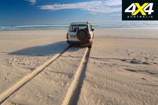
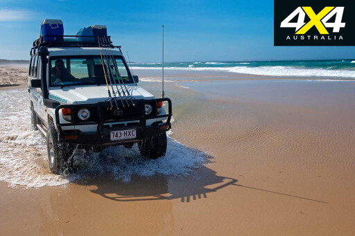
Plan all beach driving on both islands for 90 minutes either side of a low tide. There are no sealed roads on Moreton Island – expect soft, sandy tracks with deep ruts.
CAMPING
Moreton has five campgrounds with toilets, cold showers and untreated bore water. Generators are not permitted. There are however five bush camping zones where generators are permitted. There are seven campgrounds on Straddie, all managed by the council. For information, including peak periods, phone on 1300 551 386.
FEES AND PERMITS
Moreton NP camping and vehicle access fees must be paid in advance. Visit derm.qld.gov.au or phone on 13 74 68. Straddie camping fees can be paid at the campgrounds. Or, to book in advance, call 1300 551 253. A 4X4 permit is required to drive on Flinders and Main beaches.
Please enable JavaScript to view the comments powered by Disqus.
COMMENTS