Explore QLD
Gallery12
CULGOA Floodplain National Park, a place where you can switch off and enjoy the remoteness and serenity of this area, is only 800km west of Brisbane.
Getting there from Queensland’s capital is a bit of a zig-zag along several highways and backroads, but that’s all part of the adventure. Along the way a great little stop can be found at Hebel, close to the NSW/Queensland border, where you’ll realise this area is full of history. There’s not much at Hebel anymore, just a typical general store which operates as a shop, tourist information centre, post office and coffee stop.
Across the road the quirky Hebel pub has been decorated with colourful graphics by a local artist, while at a nearby park you can spend an hour reading about the area’s historical significance. Free camping is available at Judd’s Lagoon on the banks of the Bokhara River, complete with town water, a flushing toilet and barbecue shelters. From here you can walk to town or along the river to where the old and new weir holds the water for the town. There’s also a significant historical spot near the Bokhara River, as back in 1846 Sir Major Thomas Mitchell passed by on his way north towards the Gulf from Sydney.
Within the town of Hebel, at the town’s historical circle, there are 10 tall timber posts where you can learn about the town’s history, and while you spend time pondering the history the kids can play in the nearby playground. The posts represent significant historical events, starting when explorer Mitchell passed through the area and saw local Aboriginal habitation including small fires near huts, piles of harvested grass, scars on trees and well-worn paths.
When NSW and Queensland separated in 1859, nearby Currawillinghi Station was home to the customs office and police station. With this came responsibilities for custom duties, as apparently stealing sheep and cattle, smuggling booze and evading taxes were running rife back in the day. A hotel was also built for the passing Cobb and Co coaches to provide a stopping station for passengers on their way to the goldfields. Hearing about this, bushrangers soon roamed the area. Hebel was known as Kelly’s Point prior to 1889, as legend has it that Ned Kelly’s brother Dan and another gang member lived here after escaping from Glenrowan.
If you need last-minute supplies (bread, milk or fuel) as you head towards Culgoa, Hebel is the most reliable. And if you’re heading out the other side it’s a further 200-300km to another fuel stop.
THE origin of Hebel’s name is a bit of a mystery; some say it came from a German settler, yet others say the local Aboriginal meaning is ‘hot place’. In 1899 it was declared Hebel by the government.
Upon leaving Hebel you’ll depart the bitumen and land on unsealed black-soil roads, which can sometimes become impassable after a little rain. It’s 45km to Goodooga, a small town with only 300 people and no facilities. The landscape is barren and flat yet part of an ancient landscape that was covered with water 200 million years ago. Following millions of years of weathering, the only thing left are hard, flat-topped rocks that rise ever so slightly above the ground.
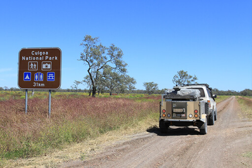
Once you leave Goodooga along Brenda Road it’s not long before you cross the Culgoa River and pass the boundary of huge wheat farms. The entry to Culgoa Floodplain National Park is well sign-posted, and it’s mandatory to stop at the office and let the rangers know you’ve arrived. Fees can’t be paid here as they must be paid online, and due to no phone service in the park it’s impossible to do this at the ranger’s station.
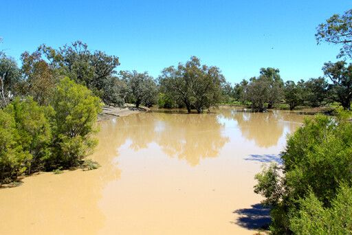
At the office you’ll be given advice, a walking map for the four walks in the park, and a map to where the camping areas are. Close by the entrance there’s camping beside the lagoon, which is a birdwatcher’s paradise with an estimated 170 species of birds including parrots, spoonbills, Australian wood swallows, emus, falcons and many more. Along with the birdlife there are other animals that frequent the lagoons, and if you’re lucky you can spot several different kinds of kangaroos, wallabies, skinks and planigales, which are small creatures that hunt at night in search of small insects. From here there are several walks that range from 1km to 8km that explore the areas around the wetlands, Culgoa River and through Coolabah Woodlands. Remember this is a remote park, so take a backpack with water, GPS and a first-aid kit. Also, wear good boots and let the ranger know your plans.
If you’re after a more remote experience, the ranger can lead you to the Redbank Hut camping area. This is bush-camping at its best. Getting to Redbank is as easy as following the map for another 12km west along the park trails. A 4WD is necessary due to the soft sand and sometimes high brush that you need to drive over. The landscape is barren and harsh as you head towards the hut and open camping area. Stands of Mulga and Gidgee trees line the road, with desert Mitchell grasses underneath all looking for nutrients in the red sand. Don’t expect anything at Redbank as the camping area is an open area with little shade, but you can camp near the dam at the hut.
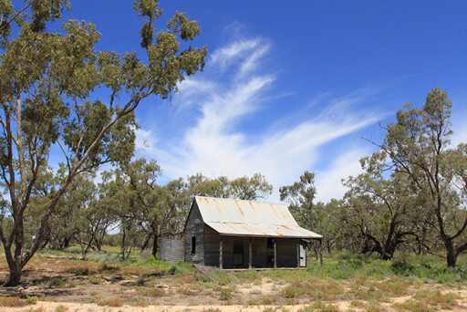
Back at the turn of the century there were several large stations that ran sheep and cattle on the land that Culgoa now occupies. Over the years these stations have been acquired to increase the park’s size. Redbank Hut was a pastoral homestead with an artesian bore nearby. The hut and surrounding relics have been preserved by the current ranger Andy Coward, who has been stationed at Culgoa for the past 13 years. While scouting around the hut it’s pretty easy to find old relics like the outhouse, bottles, marked fence posts and old implements. Show respect here and leave things as you find them, so that when the next visitors come along they get the chance to experience the surrounds. If you’re lucky at night you might get to hear and see brush tail possums and pied bats.
A well-beaten road through Culgoa heads west to Jobs Gate and then Cunnamulla. If there has been no rain the roads are generally in good condition, with the usual red gibber rock strewn across the sandy roads. Be aware of the dangers and risk involved when exploring here. The summers are extremely hot, so you may see little or no other travellers. There’s no phone signal or facilities, and it’s essential to carry a first-aid kit, plenty of food and water, a map or GPS, and have a reliable vehicle with spares.
Even though it’s a remote destination the area is known for having an ecological rich floodplain that supports a diverse array of wildlife within the Coolibah Woodland pockets. The park is best experienced in the cooler months, and it’s a great stopover when exploring Western Queensland.
TRAVEL PLANNER
WHERE
CULGOA Floodplain National Park is situated 800km west of Brisbane on the NSW/Queensland border. It’s a very remote park that requires planning and a 4WD to visit the area. While not a huge park it does hold special meaning to the local Aboriginal people and has numerous relics from pastoral and grazing days. Hebel, 140km east of the park, has an interesting past and is well worth a visit.
CAMPING AND FACILITIES
THIS is a very remote park with no facilities. There are two bush camping areas: Redbank Hut, which is 12km from the ranger’s station, and Byra Lagoon area, which is only 500 metres from the station. Being remote you need to be self-sufficient with food, water, fuel and accommodation, as the nearest town with facilities or help is nearly two hours’ drive away. The Royal Flying Doctor Service operates in this area.
THINGS TO DO
CULGOA Floodplain National Park features walking trails (the park ranger can provide a map), remote camping, photo-ops, bird and animal watching, and plenty of local history.
FURTHER INFORMATION
MOST relevant information including booking a campsite, warnings and park features can be found on Queensland’s Department of National Parks website (www.npsr.qld.gov.au). Maps can also be downloaded highlighting basic information and points of interest. The park ranger provides an up-to-date map with relevant information. The Hebel general store can provide further information and can be contacted on (07) 4625 0920.
Please enable JavaScript to view the comments powered by Disqus.
COMMENTS