Explore QLD
Gallery3
BACK in the days of yesteryear the cry of gold would start a ‘rush’ and people, full of hope and anticipation, would head to the new goldfield.
The well-to-do had wagons, carriages and horses, but the poor walked carrying their worldly possessions rolled up in a swag. Others did it even harder and pushed a wheelbarrow with supplies and mining equipment. Legend has it a bloke named Russian Jack pushed a wheelbarrow from the Palmer River in North Queensland to Hall’s Creek in the Kimberley.
The Hodgkinson Goldfields, northwest from Mareeba, became a natural extension of the Palmer and Groganville Goldfields when gold was discovered on the Hodgkinson River in 1874. But it was not only gold but other rich mineral strikes that attracted people looking for a better life; like at Chillagoe, where copper was discovered, mined and smelted from 1899 until 1942.
 There were no tracks in the wilderness, let alone roads, but undaunted the pioneer miners carved one as they rushed successive finds. Roadside grog shanties were located on strategic resting places, generally waterholes, while on the field, tent townships were quickly replaced by iron shacks if the find was a rich one.
THE WHEELBARROW WAY
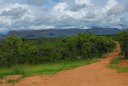
THE northeast section of Burke Developmental Road (BDR) dates back to those heady gold days. The section from Mareeba to Chillagoe is known as the Wheelbarrow Way, and it commemorates a time when the nation was finding its foundations and roots. The road is sealed now, though to this day the pioneering spirit still prevails along much of its route. Chillagoe is 215km west of Cairns on the BDR which ends at Kowanyama, with the unsealed Normanton Road section of the BDR entering at Dunbar Station.
 The BDR is largely ignored by Cape York Peninsula travellers, but there are five turn-offs that connect to the Peninsula Developmental Road. They offer exciting alternate routes going to the Cape – the road less-travelled. However, these routes are impossible early in the dry season as they traverse mostly lowland country, while the mighty Mitchell River is impossible to cross following the wet season. Check with the Mareeba and Cooktown Shire Councils if travelling before mid-June.
Mareeba is a good place to start your adventure and stock up, and the Mareeba Rodeo Grounds have free camping and ablution blocks. West from Mareeba the Wheelbarrow Way crosses the Great Dividing Range. It’s pretty scenic country, where rich farm fields are surrounded by hills and ranges. Further on is Mutchilba, which has fuel and basic food supplies, and then Dimbulah, a small township with fuel, shops, a hotel and a caravan park.
THE GOLDFIELD TRACK
THE Old Cooktown Crossing is located as you swing north on a dirt road from Dimbulah to Hodgkinson Goldfields, where it crosses the Mitchell River at Onkaparinga Station.
3
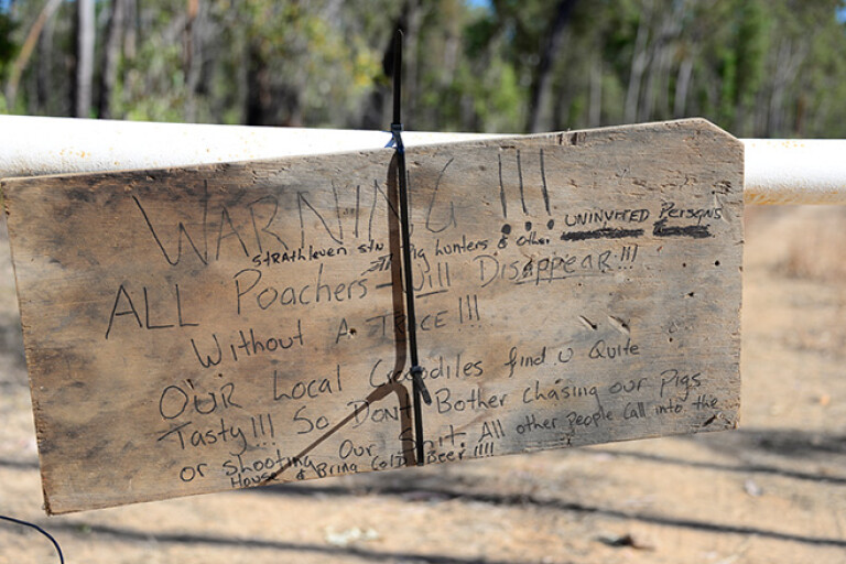
Signs offer handy hints for what should be common sense.
Beyond the river, the road turns west to the ruins of Groganville and east to the Mulligan Highway north of Mount Carbine. Karma Waters Station has campsites on the Mitchell River. There is a track from Groganville to Palmerville Station, though last time I was out that way it was closed due to wash-outs, and unless someone starts a new mining operation and brings a dozer in to repair the track it won’t be fixed anytime soon. There are active mines in the area, so keep out and respect the “No Entry” signs.
The many tracks that junction with the road are on private land. Several stations have successfully managed to have them closed to the public in an effort to thwart cattle thieves and to keep out vandals and idiots who give us all a bad name. If a track is signposted, turn back and do not proceed unless permission to do so had been given by the right people. A prospector vanished without a trace on Palmerville Station a couple of years back, and the owners were successfully charged with his murder and are in jail. The current operators are also far from friendly to trespassers.
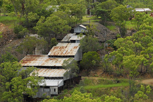
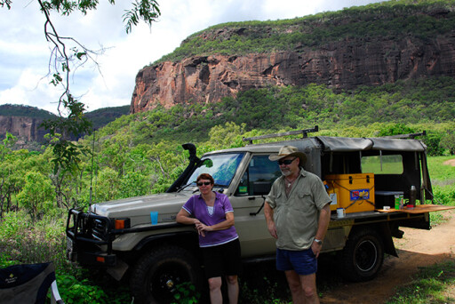
Onkapringa Station has good campsites with grand views of Mount Mulligan, which matches Uluru in size. En route from Dimbulah, pay a visit to Wolfram Camp, and the Thornborough, Kingsborough, Tyrconnell and Mount Mulligan Mines. The Tyrconnel Mine is intact and still has the original gold stamper, and it also has a campground and period cottage accommodation. Up the road is Mount Mulligan, which was once a coal mine that supplied the Queensland Railways and Chillagoe Smelters.
 However, Mount Mulligan has a dark past that started on a fine morning on September 19, 1921. It was 9.25am when a cloud of black dust suddenly propelled at tremendous speed from a mine tunnel. A second later a huge shockwave slammed the children and teachers of a nearby school to the ground. Sadly, 74 miners died in that dreadful coal-dust explosion, the third highest death toll of mine disasters in Australia. Every woman in town became an instant widow, and every child an orphan. Pause when passing the Mount Mulligan cemetery, lest we forget the huge toll mining has on its workers.
Still, it’s amazing wild hill country out there and well worth the detour when heading to the Cape. Here you can visualise what the prospectors, miners, and the women and children endured. Life was harsh and unforgiving and there was no law. Claim jumpers were shot, while race wars between the Chinese and Europeans diggers left dozens of people dead. In the bush, the long spears of the Aborigines ruled.
CHILLAGOE
WEST of Dimbulah the rich farm fields soon retreat as the road enters hilly country highlighted by tall peaks, valleys and gorges. Emu Creek Station has nice campsites and farther on is Petford, once a railway junction that connected to Irvinebank. Next is the Lappa Junction’s ‘pub with no beer’. Bring your own and sit at the bar in the museum-like galvanised iron pub, drinking in the atmosphere of bygone days when travellers and railway fettlers made it their own.
Ahead is another junction, Almaden. It has a Railway Hotel with beer and a caravan/campground. Locally it is known as Paddy Town, not because of the Irish but the cow paddies that litter the little village. During the dry season cattle are attracted by the green lawns and camp about the perimeter of fenced gardens hoping for a handout.
3
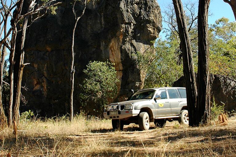
Getting some shade beneath this limestone tower karst.
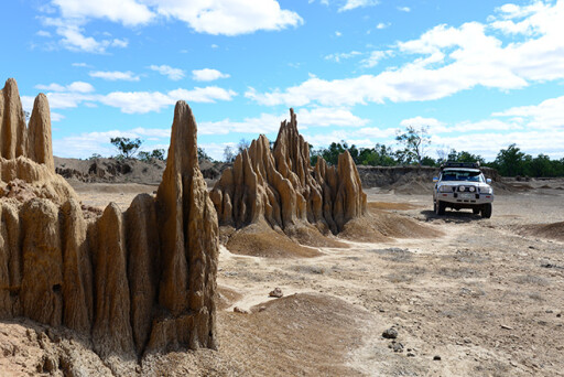
Chillagoe was founded on copper and has a history of being a bust and boom town. It’s currently undergoing a resurrection, with new mining projects underway. Chillagoe is sited at the southern end of a 200km-long limestone belt that starts just south of the town and ends at Musgrave Station to the north. The bulwarks of the limestone escarpments, karsts and spires surround you as you enter Chillagoe. Marble is also mined here, and while the mines appear to be deserted, they operate on markets and contracts.
Chillagoe has most facilities, albeit on a small scale, to cater for its floating 600-odd population. The Chillagoe Roadhouse and Caravan Park has the biggest and best burgers in the business, while the information centre and museum (The Hub) are well worth a visit. Book a tour for National Park and Wildlife conducted cave tours, as the limestone ranges have many grand caverns and tunnels that defy the imagination.
Day tours are conducted by experienced park guides in the Donna, Trezkinn and Royal Arch caves. In the caves you’ll find ancient marine fossils, cave corals, crystals, stalactites and stalagmites, and tiny insectivorous bats and the snakes and frogs that prey on them. You can also do your own cave exploration, provided you have a good pair of shoes and a torch.
 The Archways, in the Mungana National Park, is very popular. There’s a picnic table – first come, first served – inside the entrance, which provides a great spot for lunch on a hot day. Some Aboriginal rock art is located near the first karst, and 600m to the west is the historically intriguing Mungana Township cemetery.
Bauhinia Cave near the Donna Cave carpark is better suited for the adventurous, being a tight squeeze to get into before opening up into large chamber. Nearby Pompeii Cave, noted for its roosting insect bats, is also accessed from the carpark.
There are also the amazing and rare panoramic views offered from high vantage points that overlook the maze of limestone ranges and karsts. Don’t miss Balancing and Dome Rocks, or the variety of wildlife – birds, wallaroos, wallabies and reptiles – that surprise at every turn.
NORTH OF THE BDR
APART from short sections of bitumen to Mungana, west of Chillagoe, the BDR is maintained dirt road; its condition is dependent on how many road trains are using it at the time. It’s a 400km drive to the Aboriginal community of Kowanyama, which has four campgrounds that cater for visiting anglers and outdoor lovers. The sites must be booked ahead of arrival, and under no circumstances is alcohol permitted.
The country settles into monsoon woodlands after crossing the Walsh River, west of Chillagoe. The landscape near Wrotham Park Station changes to open plains and dispersed woodlands and scrub. A further 14km past the park, the Mount Mulgrave/Palmerville Stations Road turn north to Fairview Station and Laura, via Maytown, on the Peninsula Developmental Road.
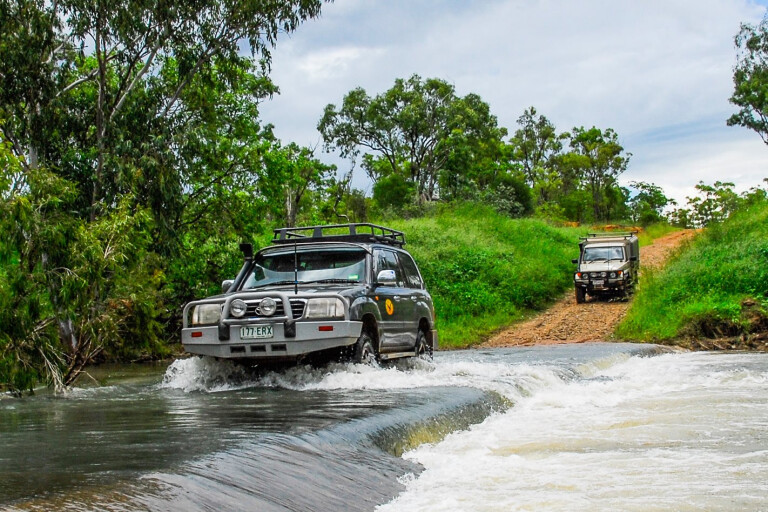
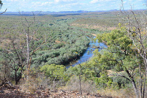 It crosses the Mitchell River, one of the largest rivers in northern Australia. The river is a raging, mindless torrent in the wet season that at times washes away the causeways and crossings or covers them with sand, making the river impassable until they are cleared, repaired or replaced.
The next crossing is at Gamboola Station. This road takes you to Fairview or Artemis Stations, via King Junction Station on the Palmer River. Camping is permitted at the Junction with the owner’s permission. Shortly after crossing the Mitchell a road turns west to Koolatah Station, via Drumduff Station, where it junctions with the Dunbar/Artemis/Fairview Stations Road.
All these places and roads may be confusing, but study the Hema Cape York map and it all falls into place. Unlike the PDR, these roads and tracks see little traffic apart from local stations and illegal pig hunters who haunt these roads on long weekends in search of hogs.
The roads are maintained by both the Mareeba and Cook Shire Councils. As mentioned, the Mitchell River can wash away causeways, and sometimes it’s not until mid-June before these station access roads are open to vehicle traffic. It all depends on the duration of the wet season and the amount of flooding rains.
 This is cattle country, with wild, open spaces that spread to far horizons, billabongs, swamps, and dry and wet rivers. There is an amazing display of wildlife, which make these alternate routes to the Cape a once-in-a-lifetime adventure. These roads and tracks are not for the meek, as the distances are long, though not difficult. The journey is best undertaken with another vehicle for added security and safety.
Check with both shire councils if tackling any of the above routes after the wet season. Check the distances and carry enough fuel – the last fuel is at Chillagoe and Kowanyama, with much distance between there and Laura and both the Hann River and the Musgrave road houses on the Peninsula Developmental Road.
BDR TO PDR
Route 1: Dimbulah to Mulligan Highway, via Old Cooktown Crossing (107km).
Route 2: Wrotham Park Station to Fairview Station (128km). Alternate route from Palmerville Station, Maytown to Laura via Old Coach Road (111km). Permission required from Palmerville Station. Route 3: Gamboola Station to Fairview Station (157km). Alternate route to Artemis Station from Kimba Station junction (143km).
Route 4: Gamboola Station to Koolatha Station (185km).
Route 5: BPR to PDR, Koolatha Station to Artemis Station (206km).
USEFUL WEBSITES
Mareeba Shire Council
Cook Shire Council
Ranger-guided cave tours
Kowanyama Aboriginal Shire Council
Please enable JavaScript to view the comments powered by Disqus.
COMMENTS