Explore QLD
Gallery12
Whether you’re a first time visitor making your way to ‘The Tip’ (the most northern point of Australia) or you’re a regular traveller to the Cape searching for remote and hidden locations, the following guide will give you plenty of options for your trip.
The Peninsula Developmental Road (PDR)
If you want, or need, to travel quickly north from Cairns, the PDR is the way to go. Officially starting at Mareeba, it will take you 62km inland from Cairns. The 760km to Weipa is blacktop as far as Laura (250km), passing through the hamlets of Mt Molloy, Mt Carbine and Lakeland.
After Laura, the well-maintained dirt road passes the Hann River Roadhouse, the old telegraph station (now the pleasant Musgrave Roadhouse), the ‘big smoke’ of Coen and finally the Archer River Roadhouse. North of the Archer River, the PDR leads to the Portland Roads community and the Telegraph Road on its way west to Weipa.
To Cooktown
The easiest and fastest way to get there is the all-bitumen route along the PDR to Lakeland, 185km north of Mareeba. From here it’s an easy run of 82km on the Mulligan Highway. Two other routes to this destination also exist.
The more coastal route starts at Daintree, about 105km north of Cairns. This 140km route cuts through the Daintree National Park and is an easy run to the seaside delight of Cape Tribulation. From there, it becomes a dirt road which is a relatively easy drive during the dry season to the Aboriginal community of Bloomfield. The road continues north to Helensvale and the famous Lions Den Hotel, before meeting with the blacktop, south of Cooktown.
The famous CREB Track begins inland from Daintree and crosses the Daintree River at a normally shallow ford before climbing through steep and rugged ranges to Bloomfield, travelling a total of 65km. This is the most adventurous route through this region, often with steep and slippery climbs and descents. It’s not the place for a camper trailer, the unwary or the inexperienced. A permit to travel this route is required from the Jabalbina Yalanji Aboriginal Corporation – phone (07) 4098 5500.
The Burke Developmental Road (BDR) –East to West
Stretching across the southern side of Cape York is the BDR, which links Cairns and the east coast to Normanton and the Gulf Country. Beginning in Mareeba, it’s 700km to Normanton, the first 140km of which is bitumen. The rest is a good dirt road but it gets chopped up with bulldust patches and corrugations. This road gives access to a number of lesser-used routes north into the Cape, including the road from Gamboola.
The West Coast Route
This route begins at Dunbar, 300km west of Chillagoe on the BDR and takes you 105km north-west to the Aboriginal community of Kowanyama and onto the Mitchell River’s delta. This is a popular fishing destination and a permit from the community is required to visit or camp there (www.kowanyama.qld.gov.au). It’s not cheap and the small number of camps, especially the good fishing sites closer to the coast, are often booked out at certain times of the year.
North of the community, the track swings inland to cross the Mitchell River at a natural rock bar called Shelfo Crossing. The route then passes through what was the Mitchell and Alice Rivers National Park, now known as Errk Oykangand National Park, before crossing the Alice River and swinging back closer to the coast. It’s 120km from Kowanyama to the Aboriginal community of Pormpuraaw. Once again, the spot is popular for fishing, and the community offers access and camping at a price (www.pormpuraaw.qld.gov.au).
From Pormpuraaw, a good dirt road heads 215km east to meet the PDR just a few hundred metres south of Musgrave.
Dunbar to Musgrave – the Swampy Way
A shorter, more remote and often more challenging route exists from Dunbar across to the PDR, south of Musgrave. This route is rarely used by travellers. It’s about 230km from Dunbar to Musgrave via this track and you first need to cross the very wide and sandy Mitchell River. The river is now tamed somewhat by rubber matting – although the mats can sometimes be washed away before the end of touring season.
North of Koolatah Homestead, the route begins to cross the floodplain and swamp country of the Alice River and its tributaries. It can be a challenge if wet.
Cooktown to Musgrave via Starcke and Lakefield
The 260km route to Lakefield National Park is another challenging route. Early in the dry season, swampy sections and steep boggy creek crossings can plague the route, while later in the season it can be disrupted with bulldust and soft sand.
The section north of Starcke Homestead to Wakooka is even worse. And, if you want to go to Cape Melville or Bathurst Head, the easiest way is to approach them from the Lakefield end.
The east coast can be accessed at a number of places – Elim Beach at Cape Bedford is pretty easy and is reached via the Hope Vale Aboriginal community. A permit from the community is required. Reaching Cape Flattery, further north, is a harder, more challenging run. Getting to the beach south of Starcke early in the dry season can be daunting.
Once on the beach, it can be a good run north but watch the creeks that flood across the sand. The best camps are on the north side of Cape Flattery. Again, you need permission from the traditional owners.
The Cape Melville track, 75km northeast of Kalpowar Crossing in Lakefield National Park, leads from Wakooka to Bathurst Bay east of the Muck River mouth and can be a challenge. Early in the dry season, swamps near the coast present a serious obstacle, while later in the season soft sand can catch travellers out.
The track to Cape Melville along the beach is situated a short distance inland and parallels the beach before coming out onto the soft steeply shelving beach. Ninian Bay, in Cape Melville National Park, can normally be accessed off the main Cape Melville track, but was closed off in late 2013. It may reopen again this year.
Access to Bathurst Head and the mouth of the Marrett River – and its popular camping area – is found 35km north of the Kalpowar Crossing. The track is pretty good for the most part but again, closer to the coast it can be plagued by sections of shallow saline water.
Kalpowar Crossing leads across the Normanby River where you enter Lakefield National Park and there’s a pleasant but popular campground located nearby. From here, you can strike north-west for about 110km, meeting the PDR at Musgrave, or head 90km south to meet the PDR just north of Laura.
To Portland Roads and Chili Beach
The 140km diversion off the PDR is a relatively easy run through country range into the small eclectic community of Portland Roads, the Lockhart River Aboriginal community and Chili Beach. It includes some impressive rainforests in the Iron Range National Park.
Camping is only allowed at Chili Beach and in the rainforest. While the coastal camps are wind-blown, camping in the rainforest at spots like Gordon Creek and Cooks Hut can be humid.
Instead of backtracking on the main road, many people choose to use Frenchman’s Road. This track leaves the main access road 50km east of the PDR, and strikes directly west crossing the Pascoe River at a rock-strewn, fast-flowing crossing which can be dangerous if it’s running deeper than 80cm. This route meets Telegraph Road just 22km south of Moreton Telegraph Station.
The Telegraph Road and Bypass Roads
The Telegraph Road leaves the PDR 145km east of Weipa and some 50km north of the Archer River and its roadhouse. While this road follows the original route of the The Overland Telegraph Line (OTL) Track, it has been upgraded with all resemblance to the old track lost. For one, the crossing of the mighty Wenlock River is now bridged.
The old Moreton Telegraph Station offers accommodation and pleasant camping. Likewise, Bramwell Junction, at the intersection of the OTL Track and the bypass roads, offers meals and a pleasant camping spot. Nearby, Bramwell Station offers accommodation, camping, a lively bar and restaurant along with a self-drive track towards the remote east coast (www.bramwellstationcapeyork.com.au).
The bypass roads are split into southern and northern sections. The southern section takes you 110km from Bramwell Junction north-east and then west to meet with the OTL Track north of Sailor Creek. After 9km, the northern bypass road swings west away from the OTL Track for a little more than 60km to the Jardine Ferry.
The Jardine Ferry will cost you $130 return – more if you have a trailer. The fee covers the ferry ride as well as your permit to camp at places such as the Jardine River mouth, Mutee Heads, Somerset and Vrilya Point.
The Overland Telegraph Line (OTL) Track
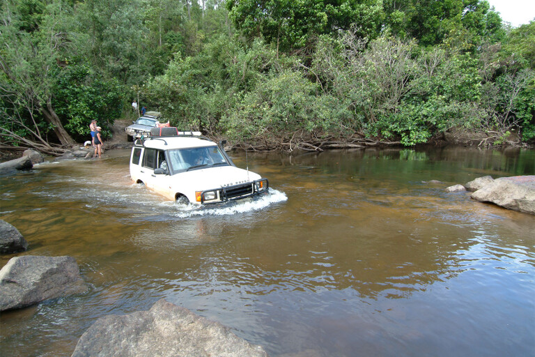
The OTL Track is the original route to Cape York and remains not only a challenge for four-wheel drivers but also one of the favourite attractions of the Cape. Each year, the many creek crossings can change but there are detours around some of the most challenging sections. Everyone should drive some, if not the entire route. This is what the Cape is all about.
North of Bramwell Junction, it’s just 70km to where the Southern Bypass Road joins the route north. You cross numerous westward flowing streams, all with their own challenges. There are some fabulous camping spots, with some of my favourites being at the Dulhunty and Bertie Creek crossings.
Once the Northern Bypass Road swings west, the OTL Track continues directly north giving access to Fruit Bat Falls, Twin Falls and Indian Head Falls. These are places not to be missed and a few nights at the Indian Head Falls is highly recommended.
North of the Twin Falls, for the 40km to Jardine River, you cross a number of eastward flowing streams in very quick succession – Canal, Sam, Mistake, Cannibal and then Cypress Creek. Bridge Creek, or Nolan’s Brook, is a little further north. Deep clear water can be a trap for the unwary and this narrow crossing has claimed an untold number of radiators and engines in the last few years.
There can be some swampy mud holes between here and the southern bank of the Jardine River – which is a good spot to camp close to the old vehicle ford.
The ford itself is used very rarely these days and once you’ve been there, you’ll understand why. Most people choose to travel to the ferry via a couple of shortcut tracks to get across the river.
North of the Jardine
Once on the northern side of the Jardine, good dirt roads lead to Bamaga and other Torres Strait Islander or Aboriginal communities on the Cape. While Bamaga may be the most important centre here for travellers, the Islander community of Seisia has the most to offer with a good camping ground (www.seisiaholidaypark.com), accommodation and a supermarket – along with one of the best fishing jetties in Australia. Importantly, it also has a good range of repair places.
From Bamaga, a good road heads north to Lockerbie and from here you can veer off to Punsand Bay Lodge which is a great camping spot (www.capeyorkcamping.com.au). The main track continues north for a short distance before providing a choice of turning right to the historic settlement – and great beach – of Somerset or left toward The Tip.
A short walk through the jungle and across a rocky bluff on a well-marked track brings you to the northern most point of Australia. You’ve made it.
Camping permits
Don’t forget, to camp in any of the national parks on Cape York you need a camping permit before you arrive.
For more information, visit www.nprsr.qld.gov.au.
Get the latest info on all things 4X4 Australia by signing up to our newsletter.
Please enable JavaScript to view the comments powered by Disqus.
COMMENTS