Explore QLD
Gallery11
Cairns is a unique part of Australia, aptly described by the catch-cry, ‘rainforest to reef’. Lush vegetation stops just above the high tide mark, mimicking a photo straight out of a touristy postcard.
Beyond the coast, as you travel inland, you are greeted by the contrasting landscape of thundering waterfalls which spill into crystal clear pools and spill into the winding rivers that interrupt the tropical beaches you have left behind.
The rain that drives these waterfalls is the devil in the detail when it comes to a holiday or weekend getaway in northern Queensland. The Great Dividing Range runs close to the coast in this area and forms a barrier to the precipitation, except for during heavy monsoons.
Just a short drive from Cairns, over the range, travellers are greeted with a baldly different environment from those portrayed in the postcards. Growing in popularity, the Undara Lava Tubes and the Chillagoe limestone caves are just a couple of attractions in this drier region. Between these two well-known destinations is a network of back roads that hold secrets from the mining booms of the 19th and 20th century.
Roads and rail lines opened up this country to prospectors and mining companies chasing the mineral of the month. The remnants of these essential links to the outside world remain a fascinating access route to some truly brilliant countryside that is accessible for nine months of the year and is characterised by dazzling blue skies and refreshing rivers and streams.
A great alternative to the sometimes unreliable weather of the coast, this area has a distinct wet season between December and April, when monsoonal deluges can occur charging the rivers and rendering unsealed roads impassable.
North Queensland itinerary
Most trips in the hinterland can be completed in a day or as an overnight journey but a four-wheel drive is essential in some spots. Here are three great drives in the area:
Petford to Herberton
West of Cairns you pass through the township of Mareeba which is the last major town for stocking up on supplies and reasonably priced fuel on your way west towards Chillagoe.
Beyond the next small town of Dimbulah the road gradually rises through dry vegetation with forests of northern cypress pine and silver-leaved ironbark before dropping into Emu Creek’s valley. Emu Creek is one of the many picturesque streams that traverse this country and make it exceptional.
After crossing the Emu, you soon arrive at the small township of Petford, about 144km from Cairns. Here you leave the bitumen and head south, running alongside the creek, towards Irvinebank and Herberton.
The best of the many creek-side stops you’ll come across is at Castle Rock. This stop, about 6km from the bitumen turn-off, is popular with campers. There is plenty to do here with safe swimming, pleasant creek-side exploration and spectacular views from the top of the rock. Continuing south, the road follows the creek to the old mining town of Emuford about 18km from Petford.
Emuford is famous for the well looked after remains of the old mine stamper battery which can be found by turning right just before the bridge crossing of Emu Creek. There’s an amazing collection of relics from a bygone era here, some still in working order and generally open to the public.
After crossing the Emu, the road veers east and some care needs to be taken along the winding dirt track. About 6.5km from Emuford, Gibbs Creek flows close to the road and a track leads to some nice camping and swimming areas.
To the right of the main road there are several useful camping sites next to the permanent pool. The main road continues east following the meandering Gibbs Creek through some picturesque countryside until you get to Irvinebank where there is fuel, food and accommodation in a town rich in mining history. The pub is a good source of information on the area and it’s pleasant just walking around.
From Irvinebank it’s not far to the bitumen and the lush forests and pastures of the Atherton Tableland. For a tad more adventure, try the scenic drive up to the unfortunately named Mount Misery, which is signposted from the town.
You can take this route up over the mountain, through tall wet sclerophyll forest and then down to the Silver Valley Road where you can go left to Herberton or right toward Mount Garnet.
Lappa to Mount Garnet
This is a beautiful drive. For most of its length it follows the old mining railway line that was constructed in 1902 and closed in 1960. The road passes through many narrow cuttings and across high embankments above stone pitched tunnels that survive in excellent condition despite the ravages of many wet season floods.
These have endured much better than the rail bridges, evident only from the stone headstocks. Definitely of interest to railway buffs but always worth an exploratory stop.
About 7km past Petford, up near the crest of the Featherbed Range, is Lappa Junction. The old pub sits near the Mount Garnet turnoff and the public is welcome to drop in and have a look through the collection of memorabilia, although the hotel’s licence has long since expired.
The road south to Mount Garnet was upgraded by the local council in 2012 so, with the exception of some of the creek crossings and any detours, it’s easy to sit back and enjoy the scenery. First point of interest is Frazers Lookout which is the big orange bluff a couple of hundred metres to the east of the road, 5km after Lappa Junction. When the grass isn’t too long, it’s an easy walk with rewarding views.
You cross many small streams along the road and one of the larger ones is Deep Engine Creek, about 11km along the road. The road detours through the creek and the rail bridge is long gone. There is an area to stop on the south-east bank and a track that leads you away from the road. The sandy creek bed allows for an easy explore upstream and the birdlife is prolific.
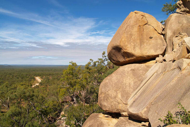
For the energetic cross-country walker, a boulder-capped hill rises 100m above the surrounding countryside for excellent views and curious rock wallabies. At the 22km mark along the Lappa – Mount Garnet road, a track veers off to the east at a signpost – the barely legible old signs indicates it goes to Mareeba and Emuford. This can provide a more testing and scenic detour as it rises through granite boulder country. A little further along the road, a well-formed road leads east to Gurrumbah mining area and beyond that sits California Creek – the largest stream along this road.
California Creek flows for a good part of the year and can be a bit tricky to cross at the end of the wet season due to its sandy bottom and strong flow. It does provide a good spot to cool off and a small grassy area makes for a good, low-impact overnight campsite.
Beyond here, the road rises steadily until it passes through a gap in the range at about 760m – late afternoon is a great time to be driving through. The eastern hill is an easy ascent – be sure to stop at the 800m summit ridge for one of the most spectacular views. Through the gap and you start to re-enter civilization. Once you’ve passed the gap, you’re just 16km from Mount Garnet. However there are some fairly earnest 4WD detours that can be incorporated in this drive.
The two turn-offs before the California Creek crossing meet at a high plateau after negotiating some rough and steep ascents. The northern-most road is shown on some maps and GPS files as Woepen Road.
The southern road, which heads east about 800m before California Creek, passes through the old mining area of Gurrumbah at around 5km from the Lappa Road.
A new mine has opened, so while it’s okay to explore around the old diggings, keep away from any areas of recent activity and obey warning signs. Eventually, you come to a fork in the road with the option to turn right to cross a creek or to go straight on a less distinct track which ascends the ridge next to the dam.
Driving straight ahead higher into the country is a rough climb and not one you want to try when towing a trailer. It can be done without diff-locks but good tyres and reasonable clearance are essential.
If you decide to travel right at the fork, the road will lead you straight into a sometimes slippery crossing of Wet Creek. This seems to be the more regularly used road and is in better condition. Past a photogenic old shack, this track follows Wet Creek then up and over into the Reid Creek Valley.
When you reach the intersection, Mount Garnet sits to the south or a left turn will lead you on an easier climb into the high country
In less than 4km you will be up and over the ridge, rejoining the first road at a creek crossing. Enthusiasts can return to the Lappa Road via this route but it’s tough going. Otherwise it’s a pleasant drive of about 6km of winding road, descending the Gregory Creek Valley towards Emuford.
A highlight is a very nice little campsite next to an usually dry waterfall about 3km from the Emuford Junction. The road comes out just a couple of hundred metres north of Emuford.
Woepen Road to the west has some short, steep and very rough, rocky sections and is a better “down” route.
Further down the track you will find a series of bluffs, just a few metres to the south of the road, which provide some of the best views in the area. Self-sufficiency is the order of the day in these areas. Roads are mostly decomposed granite or coarse gravel and rocks.
Almaden to Mount Garnet
Almaden lies about 25km further west of Lappa Junction. The road roughly follows the railway line to the south and forms part of the Savannah Way as an alternative route.
West of town you will come to an intersection with a hard-to-miss signpost. The road to Mount Garnet is broad and wide to accommodate mining trucks, so watch your speed on loose gravel and on tight bends, and keep to the left over crests.
There are three majors watercourses en route: the Sandy Tate, the Rocky Tate and the Lynd rivers.
Then there are a couple of noteworthy detours. About 7km from the turn-off is an interesting rocky pinnacle. A quick scramble to the top provides the best views anywhere along this road, but if you travel further a track to the left leads you to “Sheba’s Breasts”, a jumble of boulders, and an easier climb to the summit.
The Sandy Tate is a broad stream with anabranches and tracks to campsites of varying quality, mostly downstream. The place is full at Easter with hundreds of campers but outside of holiday periods, the place is often empty.
You will need your 4WD to get to some of the better spots and there is room for smaller camper trailers.
Despite its size, the river usually dries up by September so, depending on the season, it’s either swimming and rafting or easy walking along the sandy riverbed. The rail bridge crosses just upstream and the Savannahlander to Mount Surprise rattles through a couple of times a week.
Continuing south, the Rocky Tate comes up after a further 31km. Another big seasonal stream, the camping opportunities here are less inviting due to a lack of shade.
After the crossing you come to an intersection and a choice. The left fork takes you to the Gulf Developmental Road, just to the west of Mount Garnet. To the right, a longer route also takes you to the Gulf Developmental Road, but to the east of Mount Surprise.
Both roads cross many seasonal streams that are pretty after the wet, however the Mount Surprise route crosses the scenic Lynd River. The usually permanent river is a great lunch stop with its beautiful avenue of tall paperbarks lining the banks.
A 4WD is usually required to get across the soft, sandy bottom safely. This is also the best way to go if you are continuing your adventure through north-west Queensland and the Savannah Way.
All these main roads are driveable for most of the year, with the optimum times being from April to September.
The temperatures are cooler (mid to high twenties during the day and cold at night), everything is green and larger streams are mostly still flowing. The wildlife is exceptional, particularly the bird life with red-winged parrots and bustards being notable.
Responsible camping is essential as anything you leave behind will end up floating into the Gulf of Carpentaria. Take it with you.
Accommodation
Official free camping with some facilities at Eureka Creek, main road west of Dimbulah; and Archer Creek, Kennedy Highway between Innot Hot Springs and Ravenshoe.
Informal roadside camps along Lappa Road, Tate River roads and Emu Creek Road (use common sense and good camping practices). Private camping, caravans and accommodation at Dimbulah; Mt Garnet; Irvinebank Tavern; Mt Surprise; Innot Hot Springs.
Small tourist accommodation sites at Almaden (Tamarind Gardens) and Emu Creek Holiday Station (cabins and camping) between Dimbulah and Petford, look for the sign just near the railway crossing.
Planning a trip to North Queensland? Find accommodation near Cairns.
Please enable JavaScript to view the comments powered by Disqus.
COMMENTS