Explore NT
Gallery1
TO OUR urban population, Arnhem Land is just someplace, somewhere in the great Australian Outback.
The formation of the Kakadu National Park in 1979 on its western border did a lot to make people aware of it, but, unfortunately, due to the urban mindset, it was not Kakadu but the Crocodile Dundee movies that brought the hidden world into our living rooms, though many still have no idea where it is.
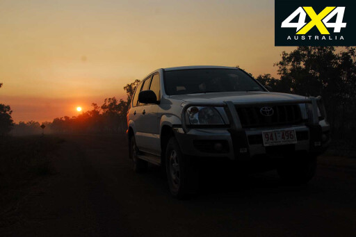
 I have been associated with the Top End since the early 1960s and have made many trips into Arnhem Land. I lived in Kakadu from 1979 until 1989, and my first trip into Arnhem Land proper was in May 1975 when my wife, Eileen, drove our new Series 3 Land Rover trayback across Cahills Crossing on the East Alligator River and headed north from Oenpelli to Malay Bay on the Arafura Sea.
MORELand Rover
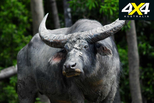
A week earlier we had been in southern Arnhem Land and visited Aboriginal outstations, Beswick, Weemol and Bulman. I hunted my first Asiatic water buffalos and caught metre-plus barramundi in the Wilton River – the meat was given to the locals.
 We did other trips into Arnhem Land over the years, and I spent three weeks in Maningrida in 1978 while recuperating from an operation as a guest of old mate, Wally Brummell. I fished almost every day and spent a lot of time exploring this amazing region.
More trips were undertaken – mostly hunting trips north of Oenpelli on the headwaters of the King and Goomadeer Rivers – when I lived in Jabiru. I used to drive up from Jabiru to Maningrida, on a road that was little more than a bulldust track and no wider than a Toyota Land Cruiser.
When Alex Julius took over the Arnhemland Barramundi Nature Lodge at Maningrida, it resulted in more fishing trips. I often drove vehicles and towed boats up to the lodge from Darwin, a 500km trip, with just over half of the roads sealed.
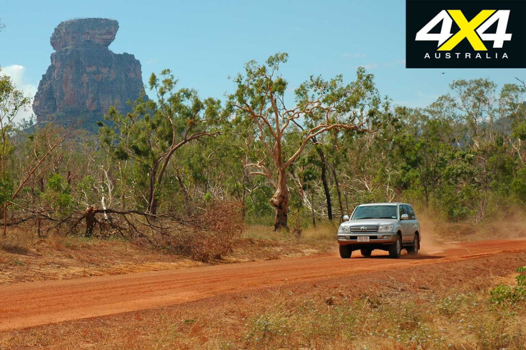
 Beyond Cahills Crossing is an encapsulated world that is still largely forbidden to travellers. Here, vast flood plains unfold to the base of the Arnhem Land Escarpment, which rises up to 250m in some places. Much of this area was chosen for the Crocodile Dundee movies due its jaw-dropping scenery. Lily-clad billabongs alive with waterfowl – and home to the largest and meanest crocodiles in the world – fringe the sandstone escarpment and outliers.
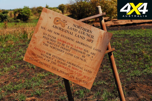
The nearby community of Gunbalanya has an outstanding art gallery, where local art is displayed and sold. Visitors are welcome but a permit from the Northern Land Council must be obtained before crossing the river. Permits to travel beyond the community are harder to obtain but not impossible – the Cobourg Peninsula is controlled by NT National Parks, who allow a limited number of vehicles in.
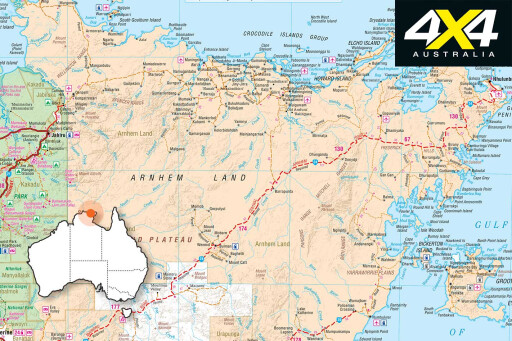
I have travelled to the Peninsula several times, but mostly to Maningrida via the Central Arnhem Road. It has evolved from the original bulldust track of the 1980s to a wide, maintained road where locals drive cars; although, judging from the dead, rusted hulks beside the road, many don’t make it – it’s also the reason a 4WD is highly recommended.
 Due to my connection with the Barra lodge, I have driven the road in all sorts of weather and conditions. One memorable trip was when Ken Phillips, a retired NT copper, and I towed a 5.2-metre plate boat from Darwin to the lodge.
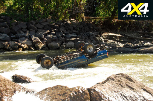
The road had just opened, with reports from the lodge that a road inspector had made it in. That was enough for us to take off before daylight in a 100 Series Land Cruiser wagon. Cahills Crossing was still running high after a bountiful wet season, but we had timed the incoming tide properly and, when both currents were level and becalmed, we drove across it – the water about 80cm deep.
The King River was running high, but the heavy sand in the Goomadeer River gave us some anxious moments. Beyond it we struck mile after mile of overfilled table drains that flowed across the road. It was slow-going and it took us ages before we reached the metre-plus deep and strongly flowing Liverpool River. ‘Knock-em-down’ storms were forming all about us, and there was no turning back. We wound the windows down and, with no seatbelts, drove into it.
 Three-quarters of the way across I became aware that the trailer and boat were floating behind us and threatening to pull the wagon downstream, but the front wheels dug in and we drove onto the hard bank, shouting with glee.
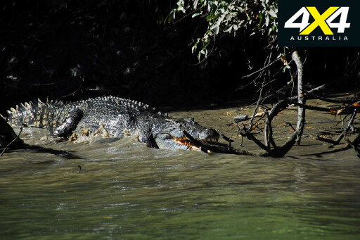
Between us and the Mann River lay more treacherous bogs, overflowing table-drains and flooded creeks. Had we met anyone coming the other way, someone would have had to back-up for a long way. The Mann has two crossings separated by a small island, and both were waist-deep as I waded across it to take some photos of the crossing. Crocodiles, what crocodiles?
 Ken made it easy and we drove out of the river banks into a huge storm that lasted all the way to the lodge. Flooded creeks, washouts and drains slowed us down, and it was almost dark when we arrived. That was one hell of a trip, and thinking back we had a lot of luck on our side.
Yet I repeated it a few years later in a Toyota Troopie. It was the end of the dry season, when early storms were creating flash flooding and wreaking havoc across the north. With me was fishing guide, Grassy; he drove the first stage to Cahills Crossing, which was running high, but with two tonnes of supplies in the back, the load kept the vehicle on track. Arnhem Land is an alcohol-free zone, but lodges have special concessions for clients.
We met a truck driver near the Goomadeer River, and he said the Liverpool was un-crossable for the Toyota as the water was up to the top tray of his semi-trailer. Grassy was all for turning back while we could, as we were now surrounded by big storms. Seeing we had come this far I decided we should at least have a look.
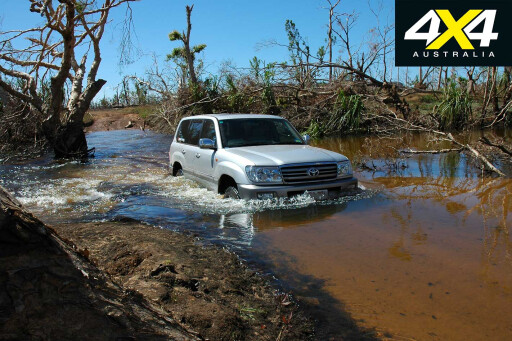 The Liverpool was deep but it wasn’t flowing too hard, and I had crossed the river twice that year and knew where the deepest spots were on the 40-metre-wide stream. So I drove into it as Grassy worked my Nikon camera. It was deep alright, and the water splashed over the bonnet and onto the windscreen before it shallowed and I drove jubilantly out onto high ground.
The Mann River was a metre deep in a couple of spots, but the Toyota never faltered. The beer cartons had fallen apart and the bottle labels had vanished when we unloaded the Troopie. It was a guessing game for clients on the beer they were drinking, but in the end it all tasted the same.
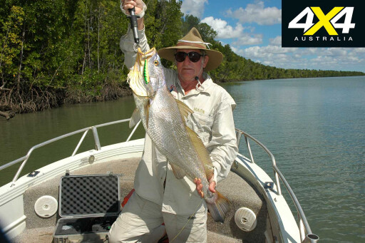
During the cooler months there’s often a lack of fishing clients at the lodge, due to the myth that barra don’t bite when the water is cold. So I suggested to Alex Julius that birders might take up the space, and we did a survey on what species were present. It was beyond expectations, as the three-day survey turned up 194 species within a 50km radius of the lodge. That was amazing, especially when it included rare species that had never been recorded in the region.
 In the coming years I did many stints as a bird guide in Central Arnhem Land and added another 30-odd species to the list, making the lodge one of the premier birdwatching destinations in the world.
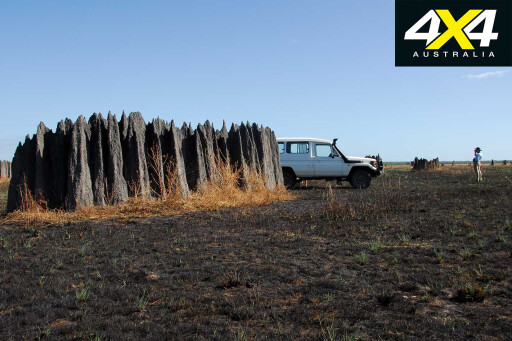
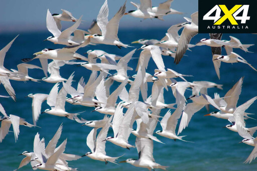
The nature of Central Arnhem Land is outstanding – almost 300 species of birds, more than 20 species of frogs, 70-odd species of reptiles and about 50 mammals call it home. The region has coral cays, beaches, sand dunes, mangroves, tidal flats, flood plains, crater lakes, billabongs, escarpments, rainforests and scrub. It’s possible to visit a bird-rich coral cay in the morning and sit in a cool shelter under the lee of the Arnhem Land Escarpment in the afternoon.
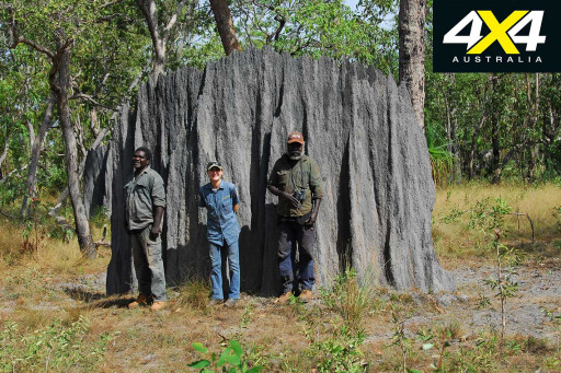
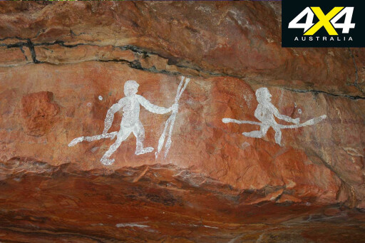
Years ago these shelters were the homes of Aboriginal people, who lived on the plains and along the watercourse in the dry season; they moved inland for the wet season. The evidence of their passing is in the remains of partly burned logs, sticks and fire ashes, but most of all in the friezes of rock art that adorn the walls. The smooth rocks, from thousands of years of people sitting on them, and the indents on rocks where seeds and ochre were ground with stones, also provide evidence.
 The landscape’s features – monsoon rainforests, pools, billabongs and, in particular, rock shelters – have important cultural significance to Aborigines. These feelings are very strong in Arnhem Land, as the bonds to the country have never been severed by settlers.
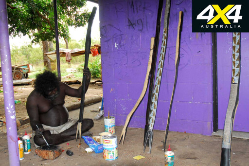
It’s a privilege sitting beneath a cool shelter, listening to the dreamtime stories from an elder. The condition imposed on the lodge insists that an elder always accompanies a tour group, to ensure they don’t stray into a forbidden area.
To the casual visitor, identifying sites of significance is impossible, and should visitors walk or trespass into a site of a dangerous nature, either by accident or intentional, bad things may happen – not only to them, but to the custodians and the land itself. It’s one reason why visiting Arnhem Land is difficult for the casual visitor and, to ensure no laws are broken, it’s often a condition of entry that a traditional owner is present, especially in the stone country.
 Many people living in Arnhem Land have never been outside their own ‘country’, and many don’t speak or understand English or Kriol. They live to traditions that go back thousands of years and fear that any unauthorised intrusion by outsiders may bring sickness, bad luck and even death upon the tribes.
Many such sites are associated with the Rainbow Serpent, the creator of all things and the most powerful religious being in Aboriginal mythology and religion. Often such sites are difficult to define because many elders fear to go near them, an indicator of how important these sites are.
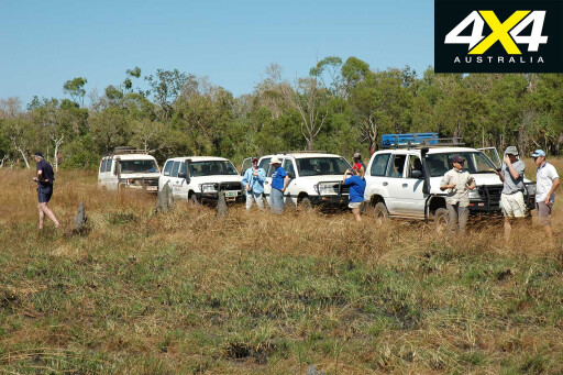
There has been much talk to open Arnhem Land up to tourism, but so far this is only possible by joining an organised tour group or as a guest of a nature/fishing/hunting camps and lodges. Self-drive tours have so far been restricted to conditional entry areas only.
 It’s not as easy as just opening the borders and letting the masses in – like what happens on the Cape York Peninsula every dry season – because visitors need to be educated and they must respect the land, its owners, culture, values and beliefs of the locals. And, judging from the minority of grots that are defiling the Cape, this unfortunately doesn’t happen in the real world.
There is also the matter of supplies, vehicle repairs, fuel, reliable maps and track access from main routes into places of significance and beauty. Arnhem Land is an extremely valuable study area on how other parts of Australia once were before settlements, farming, mining and industry were introduced. We have much to learn from this truly unique region.
Before its borders are opened to the masses by the removal of the permit systems – as advocated by self-interest groups – significant studies must be undertaken on the consequences to the people, flora and fauna.
 It’s our last true tropical frontier and, by making sure an orderly process of access and support industry is implemented, it is highly recommended we continue to protect Australia’s last remaining true wilderness.
MOREExplore
History lesson
 ARNHEM Land was first discovered by Europeans when Commander Jan Carstensz noted its shores from his ship the Aernem, in 1623. Dutch ships visited Melville Island in 1705, well before English seafarer Lt. James Cook ‘discovered’ Australia in 1770.
This was a time when Macassans from Sulawesi had already established Australia’s first export industry: trepang. Others came: King, Wickham and Stokes were sea-land explorers searching for the great mythical inland river that was supposed to extend right into the very bowels of the continent.
The Macassans had spent more than 100 years of trepang fishing on our coasts by the time the British established a military settlement at Fort Dundas on Melville Island in 1824-29. It was followed by Raffles Bay in 1827-29 and Victoria on Port Essington during 1838-49. All failed.
The British military presence on our northern coast was to prevent French or Dutch claims to it. The settlements brought the British in contact with the natives and the trepangers, with whom they enjoyed a little trade. The Brits imported animals – buffalo, pigs, Timor ponies, banteng cattle, dogs and cats – into the settlements, which brought vast changes to this fragile country when the British abandoned the north and left the animals to their own resources.
 Victoria was moderately successful had it not been for its utter isolation and diseases, as well as the deadly attacks by pirates on supply ships from Singapore and India. One notable event was when a ragged party of explorers arrived from overland in 1846: the Dr. Ludwig Leichhardt expedition.
It had left the Darling Downs, west of Brisbane, 18 months earlier, a rare feat that went largely unrecognised by the NSW Government Surveyor-General Mitchell at the time, because Leichhardt was a Prussian and had undertaken the trip without his permission – or, as some sources report, Mitchell had plans to do it himself.
South Australia annexed the Northern Territory and chose Escape Cliffs on the Adelaide River for the first civilian settlement, but it was abandoned and Palmerston in 1869 (later Darwin) became the first successful settlement in the tropics.
Travel Planner
 PERMITS
The region is Aboriginal land, so it requires a permit stating your reason to visit. Permits are issued by the Northern Land Council: visit nlc.org.au
Cobourg Peninsula permits are issued by the NT Government: see nt.gov.au
Please enable JavaScript to view the comments powered by Disqus.
COMMENTS