Explore NT
Gallery1
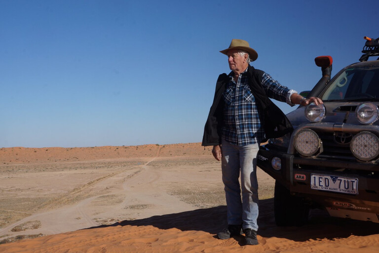
OUR small convoy of vehicles crested a low sand dune, with a line of scattered trees in front of us marking the main channel of the ephemeral Hay River.
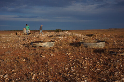
We quickly came to the dry, gutter-like creek and propped beside a small sign that marked Madigan’s Camp 15. Here we met the well-used and distinct Hay River Track, which now runs between Poeppel Corner in the south and Batton Hill’s small campground in the north, just south of the Plenty Highway.
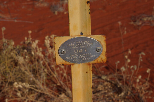
We turned south for a relatively quick and painless 17km drive to Madigan’s Camp 16 and the gum tree he blazed that still stands tall and healthy.
It’s now surrounded by a scrappy wire fence and a plethora of star pickets and signs denoting who has been there and when.
 This visual blight occasionally gets thinned out, leaving only a couple of the more historical signs such as the DNM (Division of National Mapping) plaque from 1974 and the small yellow signs that mark each of Madigan’s camps across the desert. Those small signs were first erected in 1994 by David Owen and Robert Correa, then operators of Owen Correa Outback Adventurers.
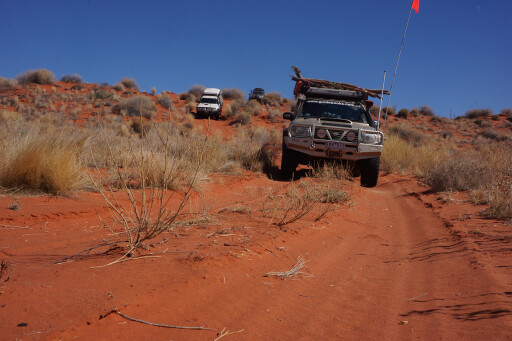
Their research and subsequent marking of all of Madigan’s camps have made it easier for later travellers to follow the route – an oft-used two-track has been developed between camps. The track also makes it a lot easier on vehicles, as the route is much smoother than travelling cross-country.
The easy-to-follow route also eliminates the need for comprehensive navigation. In 1939, when Cecil Madigan and his team first crossed the desert, they filled in one of the last great blanks on the map of Australia. The desert had been penetrated by early explorers from the time of Charles Sturt’s expedition in 1844, but not very far.
In 1886 David Lindsay almost crossed the entire desert from west to east, but turned back before doing so. Then, in 1936, Ted Colson, then owner of the Bloods Creek pastoral lease on the western edge of the desert, became the first white fella to cross the sands to Birdsville and back.
 From Bore No1, north of the Old Andado Homestead, Madigan’s group of nine men loaded their string of 19 camels and headed north towards the junction of the Hale and Todd rivers before striking east across the desert.
This journey across the Simpson was without any drama and was wet for much of the time, meaning the camels had plenty of food and ended the trip in better state than when they left. It took nearly four weeks to cross the desert and, from Birdsville, they continued their walk south to Marree.
Francis Birtles Australia’s greatest overlander
The French Line became the first route pushed across the desert in 1963 and 1964, with the Colson Track being graded around the same time. Reg Sprigg and his family, as part of the exploration work for the drilling companies, became the first to drive across the desert between Mt Dare and Poeppel Corner in a Nissan Patrol, in 1962.
The Leyland Brothers followed in a couple of Land Rovers in 1966, using the French Line to cross the desert as part of the first vehicle crossing of Australia from Steep Point to Cape Byron. The QAA Line used by all modern-day travellers between Birdsville and Poeppel Corner was constructed in 1979, while the other routes across the desert were also graded between those years.
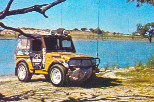 Denis Bartell started crossing the desert via the French Line in the mid ’70s, and he set out on his crossings of the desert in 1977 as part of a record-breaking double crossing of Australia. What was unique about the trip was the cross-country section through the very centre of the desert between Dickerrie Waterhole in the east and Dakota Bore in the west.
It was also against the steepest face of the dunes; all in an underpowered three-cylinder two-stroke LJ50 Suzuki that displaced 539cc and produced a mammoth 24kW and 57Nm. When Denis drove the Madigan Line in 1979 – in an updated LJ80 Suzuki with a 31kW four-stroke engine – the northern Simpson was completely untracked as it was when we followed the route in 1989.
In both situations, the going was a lot tougher than today and we each took seven days to cross the desert from Old Andado to Birdsville. On this latest trip we rolled north from Oodnadatta and stopped off at the Abminga railway siding on the Old Ghan Railway line.
Deserted ever since the railway through the heart of the country was shifted farther west back in 1980, the buildings have slowly fallen into decay with the corrugated iron roofs of the fettlers’ cottages being ripped off by a wind storm a few years back.
 Madigan’s party left the train here to head for Charlotte Waters, this first leg in a truck driven by a younger – and later to become the legendary Birdsville mailman – Tom Kruse. From the deserted buildings at Charlotte Waters, Madigan’s party followed Coglin Creek, traversing the Finke River flood-out country before crossing a couple of dunes to arrive at Old Andado Homestead.
We journeyed to Charlotte Waters (only scattered ruins remain, with most of the functional building material being used to erect the New Crown HS in the early 1980s), but, like most modern travellers, we diverted to the civilised delights of the Mt Dare Hotel and campground.
The next day, after replenishing water and fuel stocks, we headed north on a bulldust-shrouded track to cross the Finke to Old Andado. This was, up until recently, the home of the legendary pioneer Molly Clark and her family. Today it is maintained by a family trust and a caretaker is in residence.
Camping is available nearby, and a walk through the old historic homestead, left much as Molly had it, is a must-do. Molly lies buried in the country she loved, just a couple of hundred metres to the east of the old homestead.
 We left Old Andado and headed north, passing through the Mac Clark Conservation Reserve, established to protect one of the three groves of waddy trees in the world; the other two stands exist north of Birdsville and south of Boulia. In 1939, Madigan commented on how few trees there were here after most had been removed for the construction of fences and cattle yards.
Today, after Molly’s husband had fenced the area in the 1970s and it was declared a reserve in 1982, these hard-wooded, slow-growing trees seem to be thriving, with many now outside the fenced area designed to protect the young ones from grazing cattle.
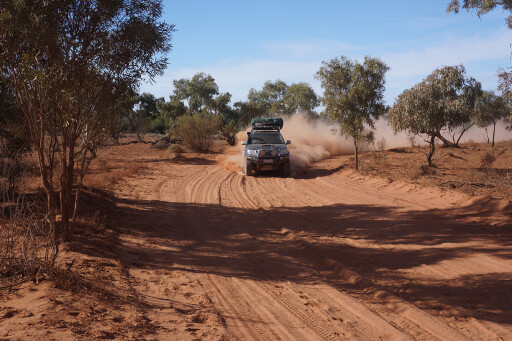
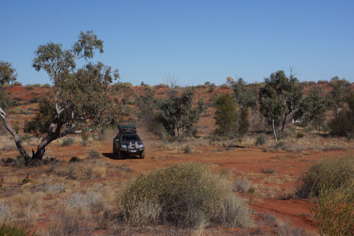
Heading along little-used station tracks and across flat sandy plains with the odd patch of small gibber stones, Denis reminisced about how good such country was to travel across in the little Suzuki – the going being quick and relatively comfortable compared to the spinifex-lumpy sand dunes.
That night we camped at what is marked on most maps as Camp 1A, located beside the station track and east of Madigan’s Camp One (MC-1). Back when the camps were found and marked by David Owen and his crew, the station owner didn’t want people going to MC-1, hence MC-1A.
 The next morning we headed north along the edge of a low range of jump-ups, the most prominent peaks being named after members of Madigan’s original party: Marshall Bluff and Crocker Hill.
We climbed the nearby Poodinitterra Hill’s small cairn where, between the peak and the convoluted line of the low range on a section of flat ground cut by some narrow threads of transient streams, was where Madigan made his Camp 2.
Just north of here we passed a derelict Case tractor (you’ll find a ‘Geocache’ around here) and arrived at The Twins, two distinctive conical-shaped hills that lie side by side. Madigan had climbed these and found a small cairn, probably built by the surveyor T.E. Dale while on a traverse from Charlotte Waters to the East MacDonnell Ranges in 1916.
Plaques erected by the RGS (SA branch) and Reg Sprigg, both in 1967, now adorn the cairn, but, thankfully, no other markers have been left here. We clambered to the top of the steep-sided hill and admired the great view the peak gives of the surrounding country and dunes, which begin not far to the east.
 We only stopped for a morning brew, but there are a couple of reasonable spots to camp. We turned south and then east from The Twins and followed a clear set of tracks across some big dunes and wide swales. This route crossed the flood-out country of the Hale River, which would make a pretty reasonable spot to camp among the scattered clumps of trees.
We turned north after meeting with the Colson Track, passing a crossroad, the western side of which leads to the site of a relatively new mining camp. Heading a short distance north we came to MC-5, to the west of the Colson Track.
There’s not a lot to keep one here for long, so we headed east again on a well-worn two-track, cutting the old mining road and striking on towards MC-6 and camping that evening between MC-7 and MC-8. We had done an unprecedented 176km for the day; something impossible to do in earlier times.
The next day we crossed some of the tallest dunes of the trip, passing through MC-9 and MC-10 before coming to Madigan’s Camp 11. There was water and good feed for his camels here, so Madigan stopped for the night, even though he had left his previous camp just an hour or so earlier.
 In 1981 this was one of the first campsites relocated and marked by the Division of National Mapping (DNM), the two claypans here being very distinctive. Denis had passed this spot a short distance to the north, while on my trip in 1989 we had the good fortune of a DNM member who led us to the claypans.
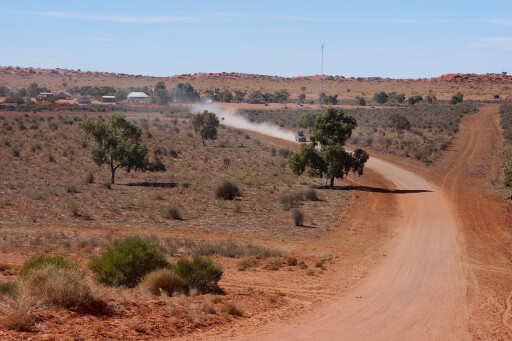
Today, the track makes navigation easy. We passed through MC-14 the next day, and then a short distance later came to the Hay River, MC-15 and turned south to MC-16.
Madigan wondered when he blazed the small gum tree (the biggest he could find in the Hay) who would be the next person to see it – that could have been oil seekers who were pushing north, while in 1974 a DNM group passed this way while establishing benchmarks along the Hay River as part of their survey of the Simpson.
Denis was almost certainly the next to arrive here, close to last light after a long day bumping across the dunes. He and his travelling companion, Michael Richardson (then editor of Overlander magazine), opened a bottle of red wine and saluted Madigan and his men, who on their crossing were feeling pretty happy with themselves and had opened a bottle of whiskey to celebrate at MC-15.
 Many modern-day travellers opt to continue down the Hay River to Poeppel Corner and the more well-known public access routes across the desert. Heading east on the Madigan Line demands permission from Adria Downs Station and the Queensland NP&WS to cross the Munga-Thirri National Park.
We received permission from both organisations and continued east, crossing more dunes on a track that was still pretty well-defined, but certainly a lot less used than the route west of the Hay River. As we closed in on the border, the desert’s dunes grew farther apart and more claypans and stands of gidgee trees arrived on the interdunal valleys.
MOREdestinations
We took a diversion and found Mudloo Well in among a large stand of gidgee scrub – well, we found a star picket and sign that indicated the well. This often-elusive watering point, with a sloping man-made funnel-shaped shaft, was once a very important Aboriginal native well.
Reportedly 30-foot deep, it’s a bit of an enigma and, neither Denis (who rediscovered many native wells through the desert and was acclaimed by researchers and Aboriginal people for his endeavours) nor I, were reluctant to confirm our most recent ‘discovery’.
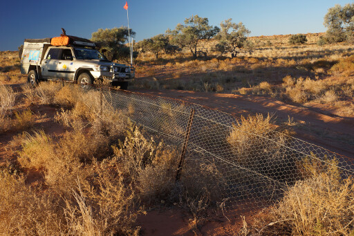
 I would like to spend a bit more time here and confirm where the well actually is... or was. We pushed on as the going became easier and faster. Our run that day was a long one of 149km (in nine hours) as we tracked south, crossing out of the park where the old vermin-proof fence marks the park boundary.
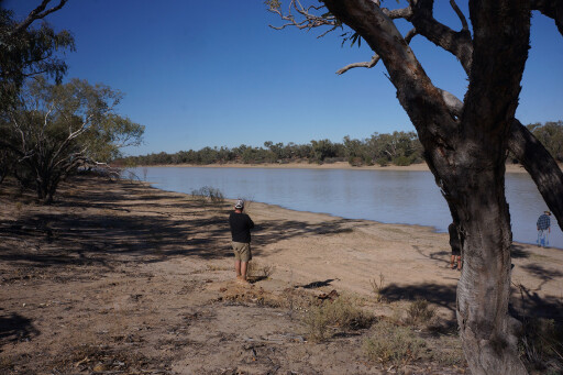
The sun was making tracks to the western horizon as we crossed the dry and dusty flood-out country of the Mulligan River, and it was near last light as we pulled up to camp at Kuddaree Waterhole on the Eyre Creek – Madigan’s Camp 20. Surprisingly we found the waterhole dry, but the next day we were delighted to find the Annandale Waterhole along a pleasant stretch of gum tree-lined water.
Nearby, the ruins of Annandale Homestead can still be seen and admired. Sadly we didn’t dally long and headed south on good station tracks, stopping at Dickerrie Crossing where Denis had started the cross-country leg of his double jaunt across Australia, 40 years previously.
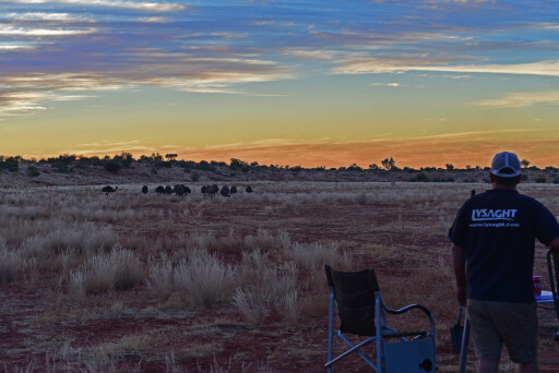 That evening we camped at the base of Big Red, the dune Denis had named in 1977 after sitting atop its fiery crest on a number of previous occasions. Like most Simpson travellers we sat on the great red dome and paid homage to that great sandy expanse and to what Denis referred to then as his, “desert of dreams”.
Today, his desert of dreams is a dream for all of us. Get out there and enjoy it.
This area is remote and you need to be well-equipped and experienced at desert travel. Any recovery out here is time-consuming and very expensive. The route was easy to follow, but dry, windy conditions may cover the tracks, making good navigation essential.
TRAVEL PLANNER
This area is remote and you need to be well-equipped and experienced at desert travel. Any recovery out here is time-consuming and very expensive. The route was easy to follow, but dry, windy conditions may cover the tracks, making good navigation essential.
PERMITS
A permit is required from the Central Lands Council (CLC) to travel the Madigan Line. It’s easy to get and free: www.clc.org.au/articles/info/application-for-an-entry-permit
If you have any queries, phone: (08) 8951 6211. If you head south on the Hay River Track to the public access routes, you require a Desert Parks Pass from NPSA: www.environment.sa.gov.au/parks/entry-fees/parks-passes/desert-parks-pass
DISTANCE AND FUEL
It’s approximately 720km from Mt Dare to Birdsville via this route. Fuel usage can be heavy depending on conditions. Both Patrols and the Hilux consumed 130 to 140 litres of diesel. We each carried 200 litres, and it’s advised to carry similar. Petrol vehicles would need more.
MORE INFO
Pink Roadhouse, Oodnadatta: www.pinkroadhouse.com.au
Mount Dare Hotel: www.mtdare.com.au
Old Andado: www.oldandado.com.au
Birdsville: www.queensland.com/en-ie/information/wirrarri-visitor-information-centre
GREAT READS
Crossing the Dead Heart, by Cecil Madigan
Desert Walker, by Denis Bartell (www.desertwalker.com.au)
Please enable JavaScript to view the comments powered by Disqus.
COMMENTS