Explore NT
Gallery4
Outback travellers may already know of Keep River National Park, but the park isn’t half the story. Ron and Viv Moon investigate.
The track had vanished for the second time in the past half hour, but this time it looked as if it was gone for good. I pushed the Nissan into the hunched fronds of the spear grass, the once-proud three-metre-high stalks now bent by time, the dry season and the wind into a metre-high mass of jumbled rotting vegetation.
Suddenly, a fence line presented and while the ‘moving map’ on the Hema Navigator had predicted such an object, its instantaneous appearance still startled us a little. I swung the wheel hard left and we then bumped our way along beside it. A gateway loomed, its entry and exit virtually hidden by the mass of grass and low scrub that had grown up since the last vehicle had passed through here.
We were heading for the NT/WA border near the northern coast of Australia and a long way from anywhere. When we got to a stream about a kilometre later, its waters tamed by the dry season into long shallow pools and trickles in between, we wandered the banks looking for any sign of the track. There wasn’t any, even though the GPS said we were close – and even right on it at times.
Conflicting thoughts battled in my head; should we go on or turn back? I really wanted to continue, but we were on our own and not really set up for such an undertaking. I had staked a tyre on a cattle grid the previous day, leaving us only one spare; food (and beer) were short, and the trip to the coast could take another day or more, even though it was so tantalisingly close. We chickened out and turned back. What do they say about saving the fight for another day?
Our travels north of Kununurra, in the far north of WA, had started a couple of days previously as we headed out of town and drove this way and back on the crisscross of roads that cut across the irrigation area north of the town. Phase Two of the Ord River Irrigation Area is now well under way with the land being prepared for irrigation and cutting up into farm blocks.
Crossing the border, we left all the development behind, although the irrigation system will reach out this far when it’s completed. Just before the Keep River crossing 9km further on and well north of the national park of the same name, we turned onto a little-used track and headed north.
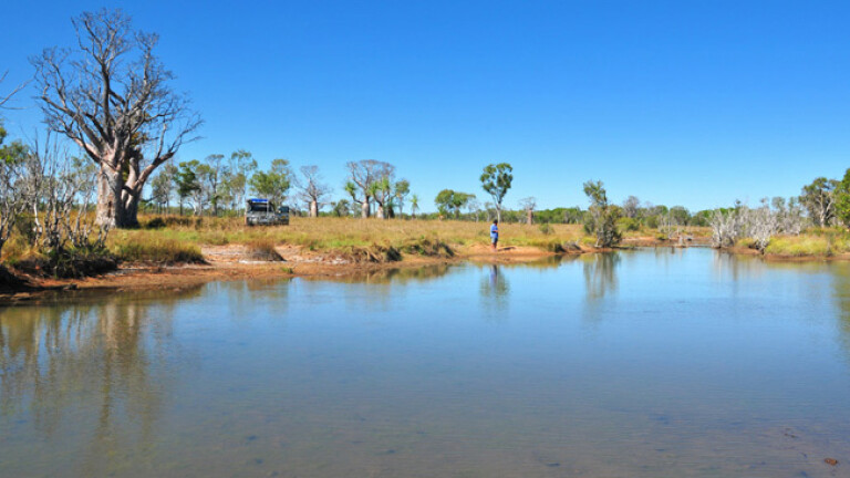
A small creek which normally has water flowing in it well into the dry season is crossed shortly afterwards and then about 10km north a number of tracks lead off to the left a short distance to the high banks of the Keep River. A few spindly trees cast a minimal amount of shade while rough-hewn steps make access easier to the water. We set up camp for the night.
Here the river is generally fresh because rock bars a short distance downstream help keep the salt incursions to a minimum and it is still a long way to the mouth. Crocs though – freshies and estuarine – dot the exposed rocks in the middle of the river, making swimming an absolute no-no. Still, those with a small tinnie could launch it from around here, but you’d need to pay attention to the rock bars that stretch across the stream and are easily visible at low tide.
Shortly afterwards on the track north another deeper creek is crossed, but luckily it has a solid rock bottom and, unless the water is deep and fast-flowing, it shouldn’t be too much of an issue.
By following the large almost-right-angled bend of the Keep River, the track heads east passing several old station ruins before swinging north. Along here the river is mainly salt and greatly affected by the tide – but for those searching for barra and other big fish, the camps along here are some of the most popular. It’s still a fair haul from the river’s mouth, though.
The track network north from here becomes a lot less used as large areas of salt-wracked flood plain begin to dominate the landscape. These plains might only flood during spring tides or when the Keep is in full spat but, even so, narrow soft channels wend their way across the plains waiting to trap the unwary.
Well west of the river on a grassy plain we passed among magical boabs and the occasional kapok and kurrajong tree, the track narrow and little used, before we came to yet another boggy creek crossing. After that the track disappeared, for the first time, but we pushed on – the border looking ridiculously close and easy to get to. We were wrong.
Turning around we headed back to the river and a campsite, tried our luck at a bit of fishing but the tides were wrong, while “You should have been here last week” was the only really relevant advice we received.
No doubt we’ll return, possibly for the fishing, but certainly for the adventure of actually reaching the border.
Please enable JavaScript to view the comments powered by Disqus.
COMMENTS