Explore TAS
Gallery8
ONE OF our party was bogged!
The soft sand between the edge of the lagoon and the open sea was super soft – a bit like quicksand really – while the narrow, shallow outlet channel the lagoon had carved through the sand towards the sea, had a sheer, but luckily, low bank on each edge; just enough to slow one’s approach and exit. The sea itself was remarkably calm, with just a low swell rolling in onto the beach; but the tide was running in, which was not the best time to get bogged.
The last vehicle in our convoy to drop into the outlet channel climbed up the little step onto the surrounding sand, but with its speed washed away it quickly went down in the squelchy sand. We parked two of our convoy out of harm’s way and went to the rescue with the well-equipped 4x4 Australia Ranger.
A couple of shovels were quickly deployed ensuring we didn’t dig down too far, as the water table wasn’t that far below the surface. Then we employed a couple of MaxTrax, hitched a snatch strap and the little Hilux popped out and was soon on terra firma. That was our only incident on our run south from Temma on the west coast to the low rocky headland of Sandy Cape. We were lucky!
MACQUARIE HARBOUR
WE HAD left Queenstown a couple of days earlier and wound our way down the range from that historic enclave where, perched on the edge of Macquarie Harbour, one of the largest natural harbours in Australia, is the small but important village of Strahan.
Originally established in the 1870s as an access point for the nascent mining industry, it soon became an outlet for the Huon pine and fishing enterprises that sprang up around here. Today it thrives on tourism and is well worth a stop of a few days or more.
The narrow outlet of the vast inlet is at Macquarie Heads, and this raging, rock-strewn opening has earned the name of ‘Hell’s Gate’. The harbour’s sinister reputation was added to when the area’s first settlement was a convict prison on Sarah Island, established in 1822. During its 11 years of existence the prison gained fame as one of the harshest in the country … and that is really saying something! Today the ruins can be visited via a cruise of the harbour (and heads), and it’s an informative, enjoyable way to spend a day.
8
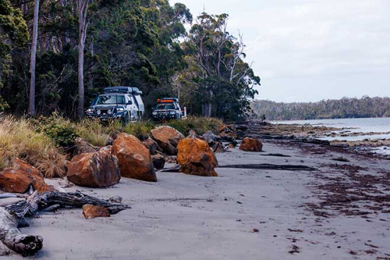
Out at Macquarie Heads, we set up camp for the evening, the camping area a bit more crowded than normal as it was a long weekend in the state. Next day we dropped on to the sand at the Heads and drove the Ocean Beach 10km north and took the exit which led back into Strahan.
MOREEpisode 1
MOREEpisode 2
MOREEpisode 3
We had a pretty easy drive on this last trip, the sand being firm and effortless to drive on; but it’s not always so, with winter storms stripping the beach of sand and leaving very little, if any, to drive on. If in need of more adventure, this beach drive can be extended as far north as 8km to the mouth of the Henty River, the river being generally too deep and wide to cross to go any farther.
From Strahan we headed off to Zeehan and checked out its great little museum, before finding our way on to the Montezuma Falls track. This route follows the easement of the North East Dundas Railway which was opened in 1898 to service the rich mines in the area. Today it’s a challenging and often wet and muddy 4WD trail, the route being much more eroded and rougher than the times I have driven it in the past. Still, the view of the falls, one of the tallest in Tasmania, at the end of the 4WD track, is impressive and worth the drive.
8
For those who don’t want to accept the 4WD challenge, the falls are also accessible via a walking track (again following the railway easement) from the other side of the chasm that guard the falls. This route begins at Williamsford, which is accessible via a good road from near Rosebery.
Back at Zeehan, after our drive to the Falls, we headed to the Zeehan Bush Camp for the night before exploring the town and enjoying the local museum, which I reckon is one of the best in all of regional Australia.
GOLDEN MAGNET
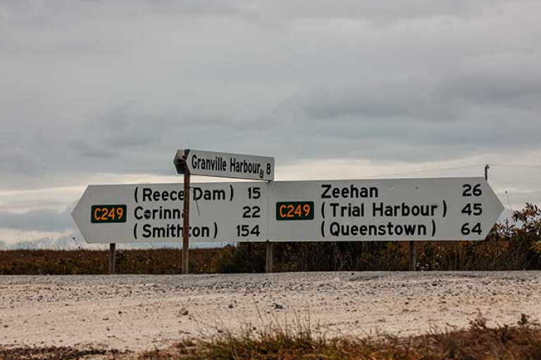
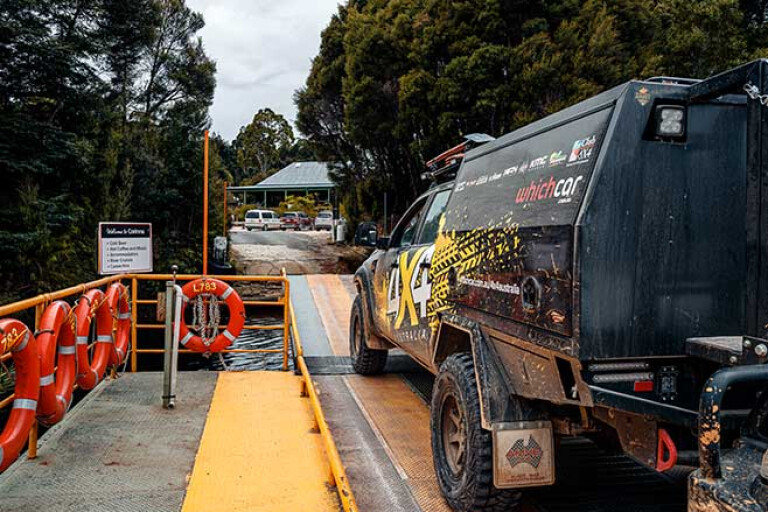
WE headed north, taking the drive to Corinna and the ferry across the mighty Pieman River. Established in 1881 when gold was discovered in the tributaries of the Pieman, Corinna once had a population of around 2500 people which is pretty hard to believe now. Back then the town was serviced by two hotels, a post office, and a number of stores and shops.
8
In 1883 the largest gold nugget found in Tassie was unearthed near here and weighed in at a goodly 7.5kg, worth around $567,000 today. Legend has it, though, that the nugget was smuggled into Tassie from Victoria to boost the area’s gold potential and attract more people!
The town, sitting on the edge of the river and the Tarkine Wilderness, the largest temperate rainforest in Australia, is a lot quieter today, while the Tarkine Hotel caters for the passing throng and those wanting to stay awhile. Apart from enjoyable cruises on the river onboard the MV Acadia II, there are a number of walks in the surrounding forest, while canoeing, boating and birdwatching are extremely popular ways to pass the time.
On this latest foray we didn’t stay too long, just long enough to have a beer and a meal before heading north on what is officially known as the Western Explorer Highway. It’s a pretty good gravel road for most of the way, crossing the major streams of the Savage, Donaldson and the Lindsay rivers on bridges and passing through some magical rainforest before climbing onto high button grass plains.

8
Before reaching the bitumen east of Couta Rocks the road passes the junction of the Balfour Track. Eastward leads a short distance to the old mining town of Balfour and the scattered ruins of this once important mining settlement. Westward, the Balfour Track leads to the Sandy Cape Track and is very much a challenge, even for the best set-up and experienced four-wheel drivers.
This time around we chickened out as the area had been receiving some heavy rain and the bog holes along the way would have been extremely deep … plus our time in the ‘Apple Isle’ was getting short.
Instead we headed for the tiny fishing outpost of Couta Rocks and then north to the bigger settlement of Arthur River where we set up camp in the national park campground, went and found some fuel and a beer or two before calling it quits for the night, with the weather forecast warning of rain and strong winds.
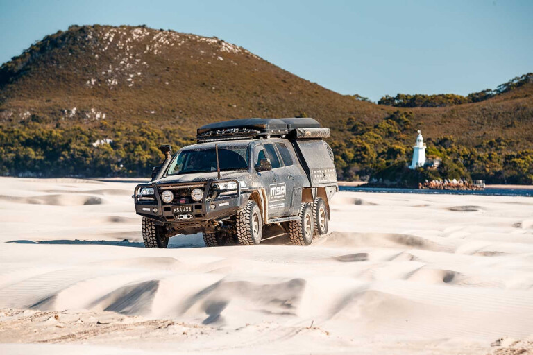
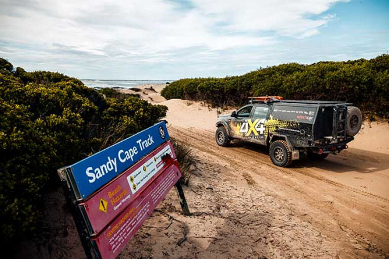
SANDY CAPE
We woke next morning to patches of cloud which cleared a little as we backtracked to Couta Rocks and pushed on to the small scattered fishing hamlet of Temma, where we lowered our tyre pressures and slipped onto what was the Sandy Cape Track. We stopped briefly at Lookout Point that gave a splendid view south towards our destination, Sandy Cape.
8
The beach looked benign enough from our vantage point, while the long strip of sand stretched away in a gentle arc into the haze of sea mist, which hung thin and vapourish over both the land and water. The sea itself was nearly as calm as the proverbial mill pond, but a weak sliver of white water oozed its way along the shore where a wave, if you could call it that, washed onto the white sands.
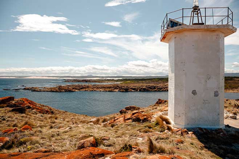
The beach itself was backed for much of the way by thick, verdant scrub, but at its mid-point a series of tall sinuous dunes, a few hundred metres inland from the sea, broke the strip of green into two. At the beaches' farthest end a smudge of darkness indicated where sand ran into stone, while a speck of white marked the whereabouts of the lighthouse that perches on these distant rocks. Above us the sky was a rich cobalt blue; we were lucky the weather forecasters had got it so wrong!
8
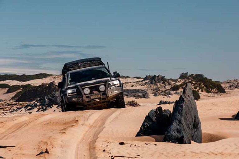
Soon after our expansive view south we dropped onto the beach, crossed Greens Creek and ran south, the waves just washing up a short distance away from our vehicle tracks. The tide had dropped to its low point an hour or so earlier and would start running in strongly in the next hour or so; it’s not the best time for a run along a dicey beach, but one we had to live with and hope we didn’t have too much trouble with.
The Thornton River was next, its tannin-stained water backed up into a large lagoon just behind the steeply shelving beach. A thin strip of running water was the lagoon’s outlet as it raced its way towards the open water. The first vehicle skipped through the creek, bounced over the lip of sand on the far side and ploughed its way across the soft intervening beach between ocean and lagoon.
The second vehicle in our convoy did the same, carving deep tracks in the soft sand and I followed staying away from the furrows, but still bogging down in one soft section before reaching safety on the far side. Our fourth and last vehicle wasn’t so lucky. After a quick recovery we pushed south along the sand crossing the next two creeks flooding across the beach easily and without an issue.
8
Once at the Cape we found our way via a maze of sandy tracks and checked out the view from near the lighthouse, which is more a cement box with a light on top than a ‘real’ lighthouse. I was surprised to find we had good Telstra mobile phone reception here – aaah, the wonders of modern technology, just when you had thought you’d gotten away from civilisation!
The calm, sunny weather was way too much and we wandered back to the protected beach on the inside of the cape and enjoyed an invigorating swim in the cool waters of the Southern Ocean. Then, with the tide beginning to run out, we turned our heads for home; sadly our quick circumnavigation of Tassie was over … but we’ll definitely be back.
TRAVEL PLANNER
THE best guide to 4WD touring/camping in Tassie is, 4WD Tracks in Tasmania, by Chris Boden.
QUEENSTOWN: West Coast Wilderness Railway: www.wcwr.com.au
STRAHAN: www.strahanvillage.com.au/en/explore.html
The bush camping at Macquarie Heads is basic but pleasant. A small fee is payable. See: www.campingtasmania.com/macquarie-heads-camping.htm
Zeehan Museum is one of the best regional museums in Australia: www.discovertasmania.com.au/attraction/westcoastheritagecentre
You can bush camp at Trial Harbour and Granville Harbour. There are no facilities, so be prepared.
At Corinna (https://corinna.com.au/) you can stay in the small camping area near the pub or in a range of accommodation. Take a cruise on the MV Acadia II along the Pieman River. Take note: The ferry at Corinna has a 6.5-tonne GVM capacity and a max vehicle length (wheelbase) of 9m – inc. tow tug and camper or caravan.
The Arthur-Pieman Conservation Area takes up much of the coastal area of western Tasmania from Arthur River in the north to the Pieman River in the south.
For access info and a Drivers Recreational Pass go to:
https://parks.tas.gov.au/explore-our-parks/arthur-pieman-conservation-area
Camping fees are also required. At Arthur River you can choose between the national park campgrounds or the excellent Arthur River Cabin Park, see https://arthurrivercabinpark.com
Note: There is no fuel at Arthur River or Corinna. The nearest fuel in the north is at Redpa or Marrawah, or in the south at Zeehan or Waratah.
Please enable JavaScript to view the comments powered by Disqus.
COMMENTS