Explore SA
Gallery6
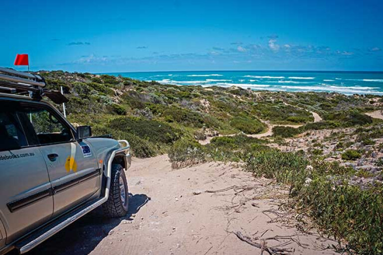
OUR route, once past the rubbish dump and where we had dumped air from our tyres, wound for a short distance through the dunes to a sandy track junction.
From past experience I knew going right would drop me quickly onto a short, soft – very soft – beach where on numerous escapades I had always got bogged. Knowledge and discretion being the better part of valour, we turned left and wound our way south behind the first line of dunes that border this impressive coast and crossed the unmarked boundary into the Little Dip Conservation Park.
6
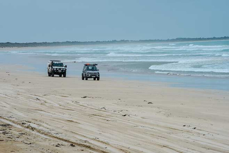
A few hundred metres and another track took us to the beach where we cruised along the sand – still soft – to a string of low, rocky headlands known as the Stony Rises. The track swings inland here to skirt these bluffs, but there is plenty of opportunity to stop and wander down to the small beaches that are somewhat protected from the full force of the sea by the offshore reefs that are such a part of this wild, turbulent coast.
Nearby, the Stony Rises access track leads away from the beach to a carpark and camping area and then another kilometre or so to the main access track that leads back into the coastal village of Robe.
POPULAR ROBE
ROBE, where our morning adventure had started from, is fast becoming a bit of a trendy tourist destination with some 50 historic buildings and classy cafes along with a couple of good pubs. However, it has long been a haunt for fisherman, divers and four-wheelers wanting to explore the nearby coast, while its protected marina shelters a small but important crayfishing fleet. We first went there back in the 1960s chasing abalone (before licences) and crays, not that we were very successful in either as the untamed seas often laid waste to the best-laid plans.
This stretch of coast though, has long been inhabited by Aboriginal people and you’ll see signs of their feasts in the many shell middens that are scattered, mainly on the rocky headlands, above the sea. For the most part the Bungandidj clan took in the country from around Robe south to the Victorian border, while the Meintangk group took in the country north to around Cape Jaffa.
In 1802, Guichen Bay, on which Robe lies, was named by the French Baudin expedition after a French Admiral, while the Baudin Rocks, at the northern end of Guichen Bay, were named by Matthew Flinders in 1802 after Nicolas Baudin who he had met at Encounter Bay some time previously. For the next 30 odd years the bay was frequently visited by sealers and whalers, and their relationship with the original inhabitants of the area, you’d have to say, wasn’t the best.
6
In 1846 the town was officially settled and within 10 years was the second busiest port in South Australia, with the town’s famous obelisk on Cape Dombey, used to help guide ships into the port being built in 1852. A couple of years later, the first of the Chinese gold miners, trying to dodge the taxes imposed at Victorian ports, landed here and walked to the Victorian goldfields. Two years later, around 15,000 Chinese disembarked while some 32 foreign ships from the USA, Holland and England also arrived.
In the 1930s the town had become an important crayfishing base which it remains today and along with tourism, its prosperity is ensured and with its couple of picturesque and ideally located caravan parks, makes for a fabulous base to explore the coast and hinterland.
BISHOPS PATE
OUR journey south of the Stony Rises continued, sometimes on the beaches and sometimes just behind the first line of dunes as we skirted around and over a rocky headland, the limestone bluffs and reefs becoming ever more common as we got closer to the Bishops Pate.
TOP TRACKS: Best 4WD tracks near Adelaide
This prominent headland and bay, where another track heads east and out of the park, skirts around the edge of the relatively large Lake Robe and is a popular access point for many. While the lake is officially a game reserve, its shallow saline waters attracts a lot of waders and waterbirds while the surrounding melaleuca scrub, the dense border of rushes and samphire flats is a haven for other smaller bush birds. It’s a top spot for birdwatching and there is always a few ’roos around along with the occasional emu to add variety to the nature viewing.
6
The route south continues much the same as before with a few steep pinches and some puckering side slopes amongst some of the dunes, where it’s easy to misjudge a gear change or the required momentum to get you through easily. On these steep slopes, once stopped it’s difficult to get going again, the wheels digging down through the soft sand. Then you are in for a heartrending reverse back down the dune to start all over again.
About 20km from Robe you come to Errington Beach where you need to swing east along the southernmost access track and head out to the main dirt road which takes you a few kilometres to the small protected bay of Nora Creina. This bay has a small settlement of fishing and holiday shacks close by and once you’ve enjoyed the protected waters of this bay, the route south leads onto Stinky Beach for the long challenging drive south to the seaside town of Beachport. By the time you get there, with luck the sun will not have set and you can enjoy a beer and/or a meal at the pub before returning to Robe via the main road.
Of course, there’s more beach and sand driving south of here, with one of the most challenging sections being south of the small community of Southend though the Canunda National Park to the even smaller hamlet of Carpenter Rocks. The beaches through this section remain very soft all year and we’d recommend you not chance your luck unless you are very experienced, have all the right gear and travel in the company of others.
6
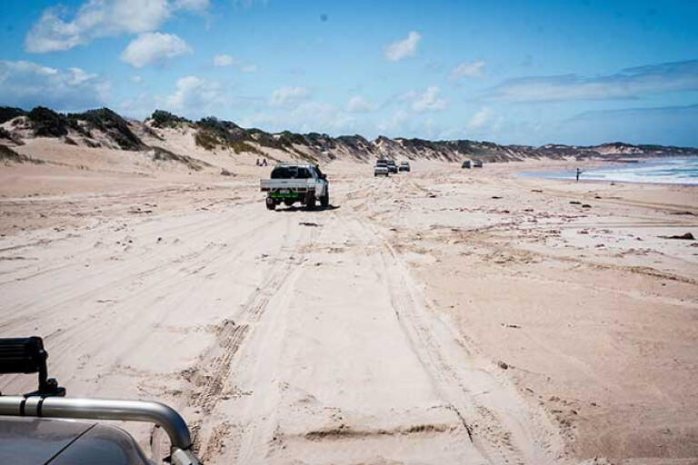
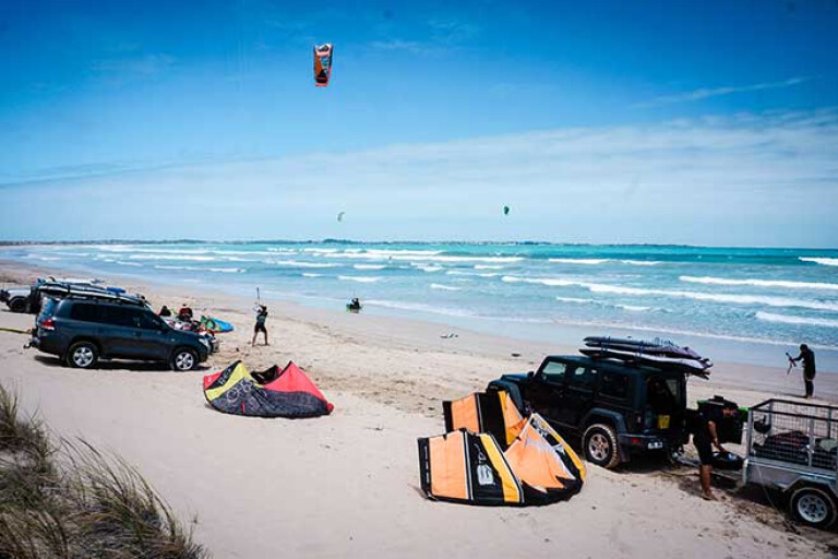
For something a little different we headed back to Robe and next day on to the town’s favourite stretch of sand, Long Beach. This beach is popular with many people as its firm sand stretches away to the north for quite some distance and its relatively protected waters makes it ideal for swimmers and kite boarders.
As you close in on the northern end of the beach, about 10km from the Robe access point, you’ll find the sand is softer and you’ve left the crowds far behind. Just south of the small beach hamlet of Boatswain Point, a low bluff marks an exit point from the beach. We later found out you can cross the headland just inland from the sea and continue along a short beach to the small township. We headed inland and on dirt roads found our way north to Wright Bay where a small farmer-owned camping ground is popular with those in the know.
CAPE JAFFA
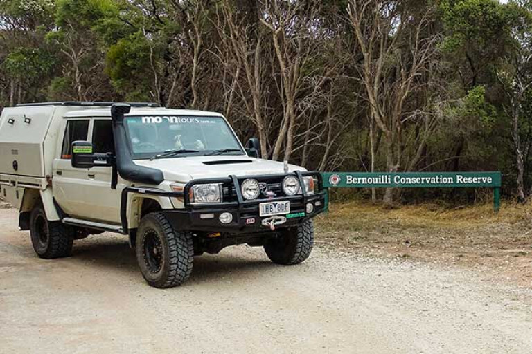
FROM Wright Bay a farm road heads north just inland from the beach which after a few kilometres, degenerates into a sandy bush-lined track as it heads into the Bernouilli Conservation Reserve. This narrow strip of bushland leads to Cape Jaffa, and amongst the scrub and low dunes near the tip of the headland you will find the remains of the Cape Jaffa Lighthouse cottages.
These cottages were built in 1872 for families of the lightkeepers who actually lived on the Cape Jaffa Lighthouse platform eight kilometres offshore on the Margaret Brock Reef. It was, and still is, a wild and unprotected reef and the seas that swept in and around the manmade platform just above the reach of the tide would have been a little intimidating. Still, the posting here for the men and their families was considered pretty easy and acted as a trial for new staff to see how they coped with the isolated life and the duties of a lightkeeper.
The cottages were abandoned in 1929, while the light remained in active service till an automatic light was installed on this treacherous reef in the early 1970s. Then, in a mammoth undertaking, the original light and its structure was dismantled and taken to the mainland where it was erected and now acts as the centrepiece for the Cape Jaffa Lighthouse Museum in Kingston SE. Its striking steel structure is well-worth a visit.
6
From the remains of the cottages you can drive along the beach northwards – or at least just behind the beach – but the deep seaweed along this stretch put us off and we headed inland on better tracks, then dirt road before meeting the bitumen just south of the small town of Cape Jaffa. The short wooden jetty here has been superseded by a big, new marina which has kind of proved to be a bit of a white elephant with few boats using it and the surrounding blocks of land unsold and unattended.
We headed on to Kingston SE quickly finding the bakery in this pleasant seaside town where we enjoyed a coffee and reminisced about our latest adventure, one we hadn’t done before in all the many times we have been to Robe.
That’s one of the great attractions of the beaches around Robe – there is always something new to discover and places to explore. I know we’ll be going back!
TRAVEL PLANNER
For info on Robe and its accommodation and facilities go to www.robe.com.au
The Little Dip Conservation Park covers 2150ha and offers four very separate camping areas all of which demand you book a camping spot online.
To check out what the small town of Beachport has to offer see: www.beachportsa.com.au
The Canunda NP protects 9625ha of coastal dunes south of Southend. It has five separate camping areas.
The Cape Jaffa Lighthouse is maintained and operated by the National Trust of SA. For more info see: www.nationaltrust.org.au/places/cape-jaffa-lighthouse
Please enable JavaScript to view the comments powered by Disqus.
COMMENTS