Explore NT
Gallery1
When it comes to bush adventure, there’s nothing quite like driving over untravelled country – not to ‘bush bash’ it, but to open up alternative routes for people who’ve already driven Australia’s major tracks.
The Hay River Track was once a set of tyre tracks running north from Poeppel Corner on the main Simpson Desert crossing to Jervois on the Plenty Highway. This track was blazed by Aboriginal elder, the late Lindsay Bookie, and Jol Fleming, and is now a popular trip with bush adventurers, and a source of income, via permits and camping fees, for the Aboriginal people at the Bookie Family’s property, Batton Hill.
This new track, which I think should be called Jol’s Track, will also contribute to the Bookie Family funds, because visitors will drive via the Hay River Track and Batton Hill to access it.
 At this early stage of development the track is permit-only, sourced from Jol Fleming’s Direct 4WD Awareness business in Alice Springs. The permit covers transit through Aboriginal Lands and also includes through-travel access to the Bush Heritage-owned property of Ethabuka, located north-west of Bedourie.
Bush Heritage is an organisation dedicated to protecting the natural environment, by acquiring and preserving properties that have high conservation value or environmental significance.
Ethabuka is a haven for desert wildlife and is home to a wetland system of national significance, brimming with shrimp, fish and waterbirds (following good rains). It also has one of the richest lists of reptile species in Australia, including Australia’s largest goanna, the perentie.
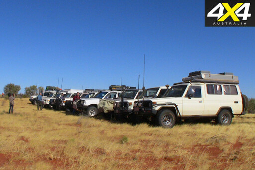 At the request of the Bookie Family and the Bush Heritage organisation, the initial trips will be tag-alongs, run by Jol Fleming.
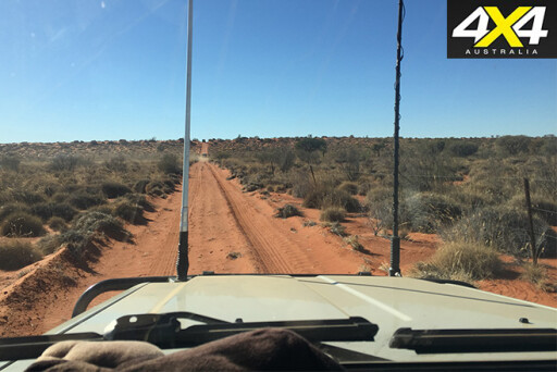
The Hay River to Bedourie Track runs east from the Hay River Track, close to the turnoff to Lake Caroline. The initial tag-along groups will meet up at Jervois, allowing access on the Plenty Highway via Alice Springs or Boulia. They’ll then head south-east, on the northern section of the Hay River Track, to Batton Hill.
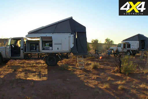
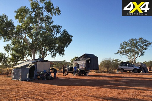
Camping there is excellent, with flushing loos, donkey-fired hot showers, fire pits and even a wood-fired oven. From there, the convoy will head south and cross the Hay River’s sandy watercourse, before visiting the dry bed of Lake Caroline to camp the night on a firm claypan.
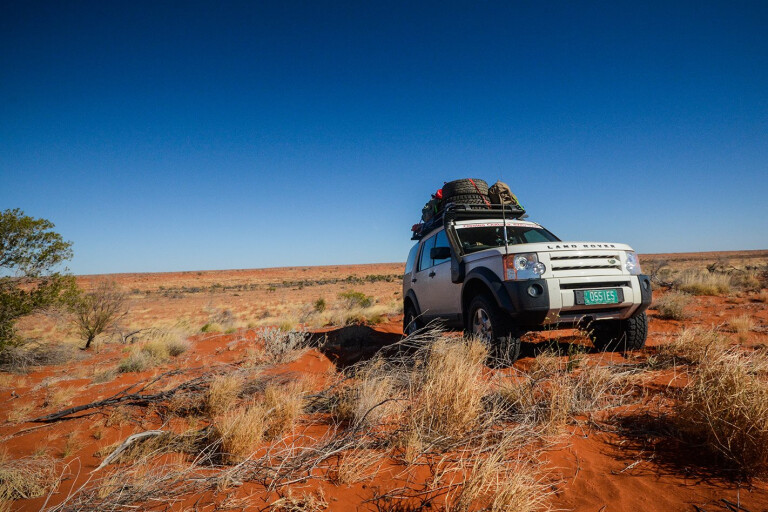
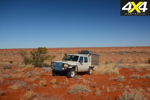
 The starting point of Jol’s Track is on the eastern side of the Hay River, where the new adventure begins. As with the Madigan Line, there has been no official track construction, so drivers will follow our 2015 tyre tracks through low scrub and over spinifex humps. Another similarity with the Madigan Line is that the dunes have much steeper eastern faces than their western sides.
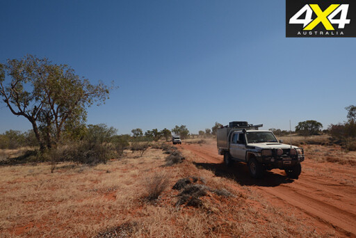
The track traverses vegetated dunes and swales that gradually increase in size as the track nears the Queensland border. The permit conditions specify no deviations from the track and no deviations from graded private property tracks, other than campsite access. On the inaugural trip, we found great Gidgee campsites close to our tyre tracks so there was no need to stray.
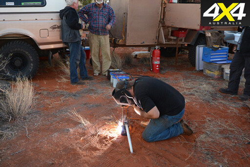 There are no significant landmarks on this trip, but the enjoyment comes from travelling through desert country that has probably never been traversed by anyone. Driving through such country is tough on vehicle suspensions, because much of the route is through spinifex country. Negotiating grass mounds is a lumpy business that uses full suspension travel. One of our vehicles had a spring breakage and a cracked bracket that required some bush-welding attention.
Key GPS points along the route are the national park marker post at the Northern Territory-Queensland border and the east-west fence line on Ethabuka Station.
The dunes on Ethabuka are high, but progress is eased by the fact that these fence line tracks are graded regularly.
 Needless to say, this track is remote and there are no water sources or services between Jervois on the Plenty Highway and Bedourie.
Most diesel four-wheel drives should manage the Jervois-Bedourie trek on one and a half tanks of fuel, but extra capacity is wise. Petrol vehicles use much more fuel in sandy conditions, so double tank capacity is essential.
Jervois sells fuel and is also your last chance for an ice-cream until Bedourie some five to six days later.For more information on Jol’s Track or to book your permits, go to www.direct4wd.com.au or call Jol Fleming on (08) 8952 3359
Diamantina National Park
Diamantina NP covers 5000km² of Queensland’s channel country. The park encompasses weathered sandstone ranges, floodplains, expanses of Mitchell grass, claypans and sand dunes.
The land, a former grazing property called Diamantina Lakes, was sold to the Queensland Government in 1992. The property is well-sited alongside one of two permanent waterholes created by the ‘Diamantina Gates’ – two gaps at the junction of the Goyder and Hamilton ranges – that concentrate the Diamantina channels into narrow streams, running between the low limestone hills.
 The narrowing is clearly visible from ‘Janet’s Leap’, a vantage spot above the river. It is so named because, at the handing over of the Diamantina Lakes Station, one of the onlookers said: “Janet Holmes à Court might as well jump off the cliff as sell the property to National Parks.” She didn’t jump and we all can appreciate the results of the transfer.
A visit to the park properly begins at the old homestead, at the Ranger’s Headquarters. Hunters Gorge campsite has a deep waterhole and sits on the Diamantina, and the other site at Gum Waterhole is on Whistling Duck Creek.
 Shady campsites behind waterfront coolabahs let campers witness a display of birdlife unexpected in such a remote region. Kings of the waterhole are undoubtedly the pelicans that ‘sail’ up and down the water courses, taking time off to fish and to squabble with one another. Cormorants, ducks and swamphens take their chances, fishing beside the much larger pelicans. The waterhole trees are home to thousands of birds, with the noisiest being corellas and galahs.
Bedourie
Bedourie, meaning ‘dust storm’, is a small town with a population of 120 people and is situated between Birdsville and Boulia. There’s an artistic representation of a dust storm in Herbert Street.
Set on a sand ridge and surrounded by Eyre Creek, Bedourie is the administrative centre of the Diamantina Shire’s 95,000km².
In the 1880s, Bedourie was a major watering and rest stop for drovers moving cattle from the Northern Territory and north-west Queensland to the customs collection point in Birdsville, 200km south.
 The town has an airport, hotel/motel, caravan park, hot spring baths, a restaurant and tavern, general store, wireless internet, fuel services, a police station and a medical clinic.
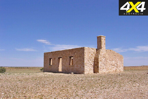
Attractions around Bedourie include the Vaughan Johnson Lookout, the wetland at Cuttaburra Crossing, Carcory Ruins and Diamantina National Park.
Cuttaburra Crossing, a permanent waterhole and wetland on Eyre Creek, is located between Lake Koolivoo and Lake Machattie and is home to many species of birds. This birdlife can be viewed from a roadside rest and viewing area.
Please enable JavaScript to view the comments powered by Disqus.
COMMENTS