Explore SA
Gallery46
We were back in amongst the ranges and I couldn’t be happier.
With permission from a friend, who had given us approval to camp on her property, we poked along the Glass Gorge Road north of the historic town of Blinman.
The town owes its existence to the discovery of copper back in 1859 and while there were many other discoveries of that ore in the surrounding hills and valleys, Blinman managed to survive longer and more substantially than most.
46
Today there’s a pub offering camping and accommodation, a nearby café, and the Blinman Underground Experience, which is a tour of the old mine workings, and well worth doing.
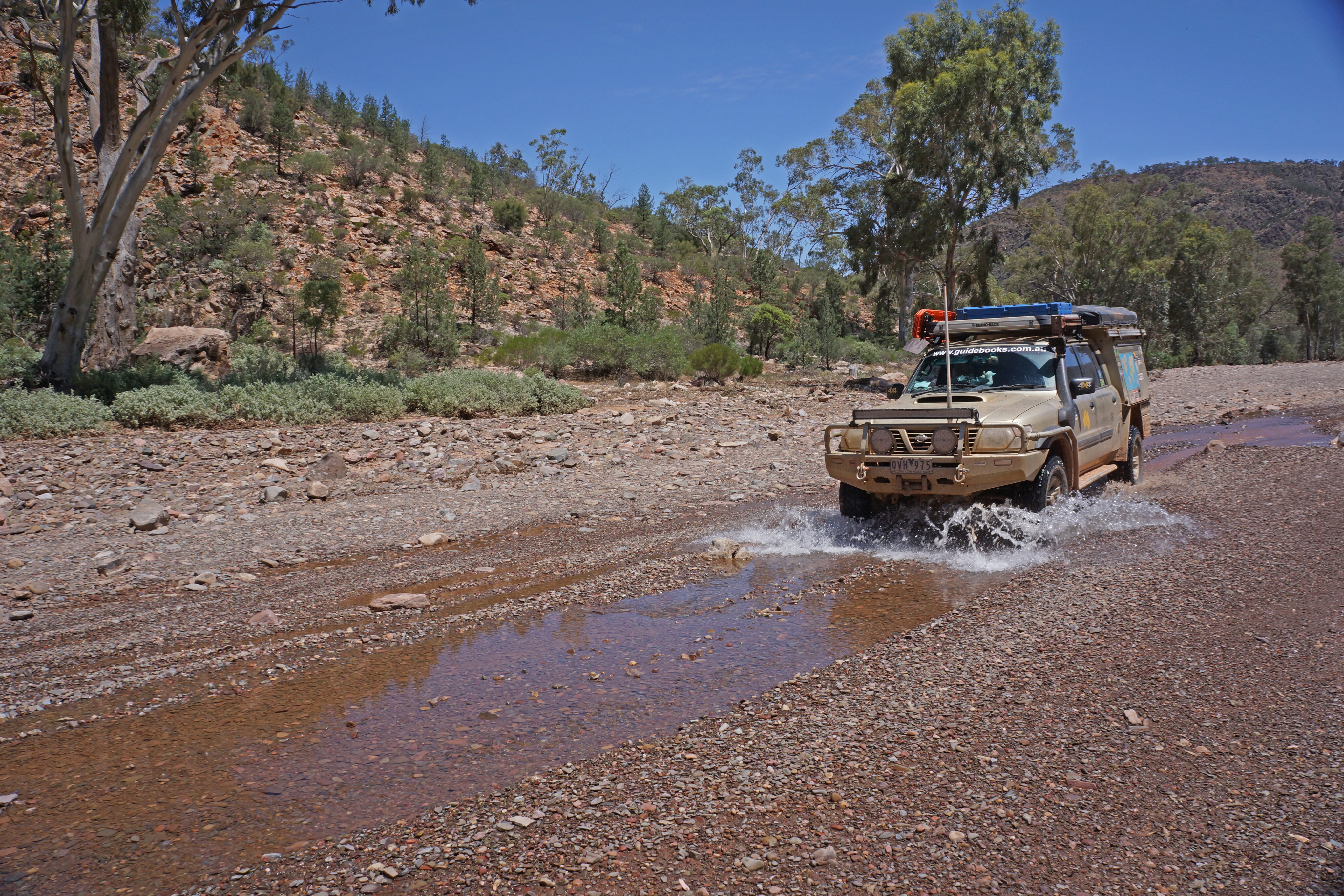
When we passed through the café and pub were doing a roaring trade with parking near impossible to find in the short main street. It was the busiest I’ve ever seen the town, so with that we drove on, getting our permission to camp before wandering on through the low rugged ramparts of Glass Gorge.
Explore Australia


46
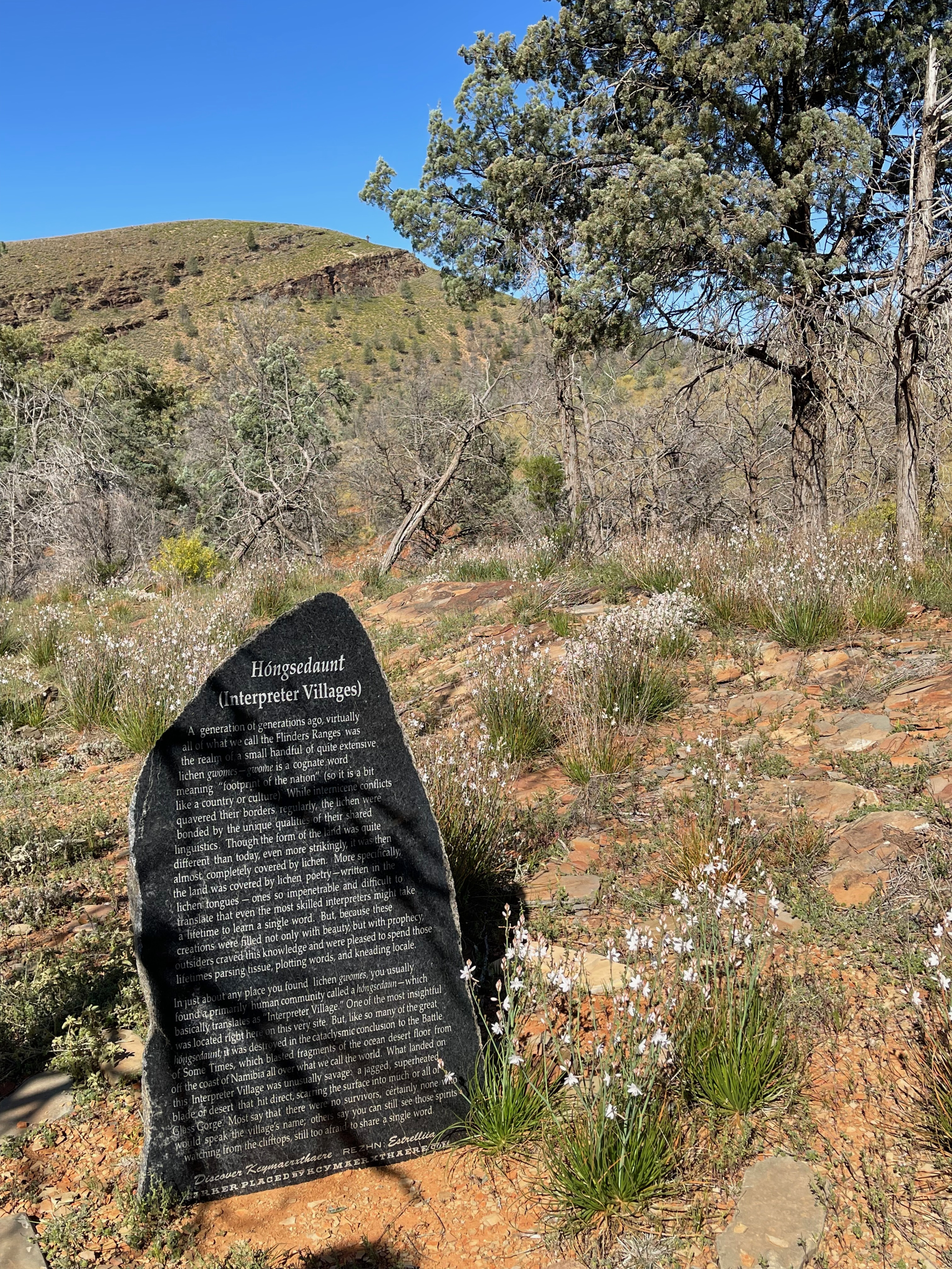
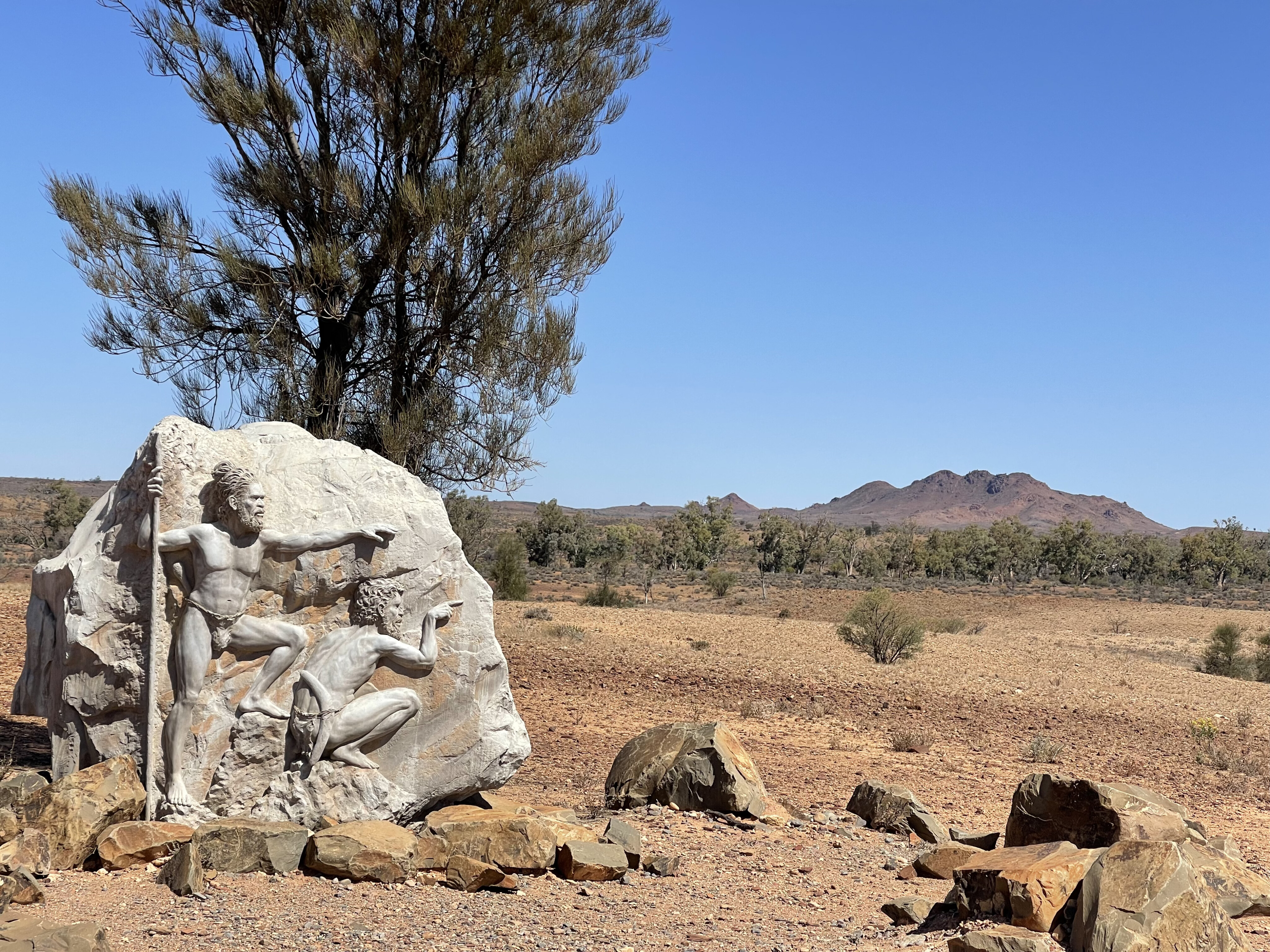
Just off the road we checked out a small, ‘interesting’ monument which is, by all accounts, a signpost to another universe. While I’m not saying I understood any of what the small marble monument was about (or its website: kcymaerxthaere.com), it does indicate that there are people out there on a different planet to me and I guess, most of us. In all, there are 12 of these installations in Australia with more than 143 spread around the world.
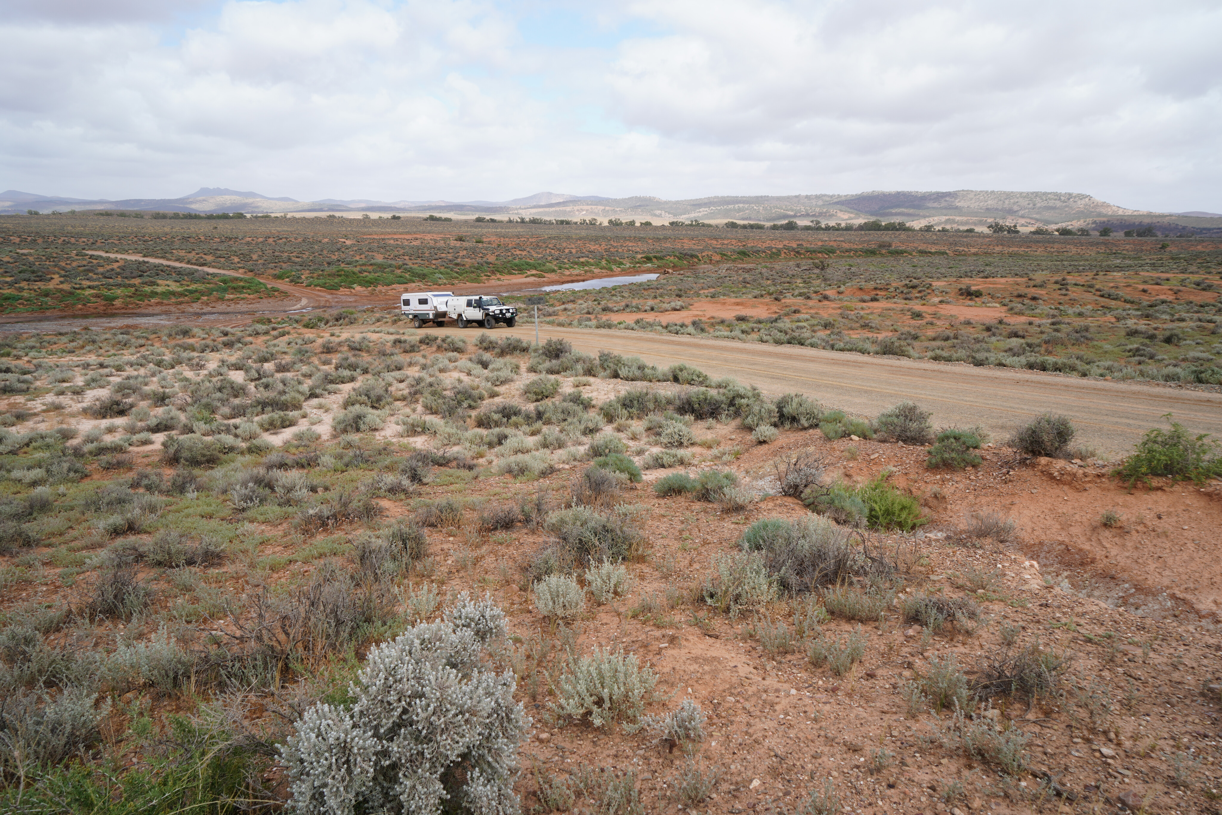
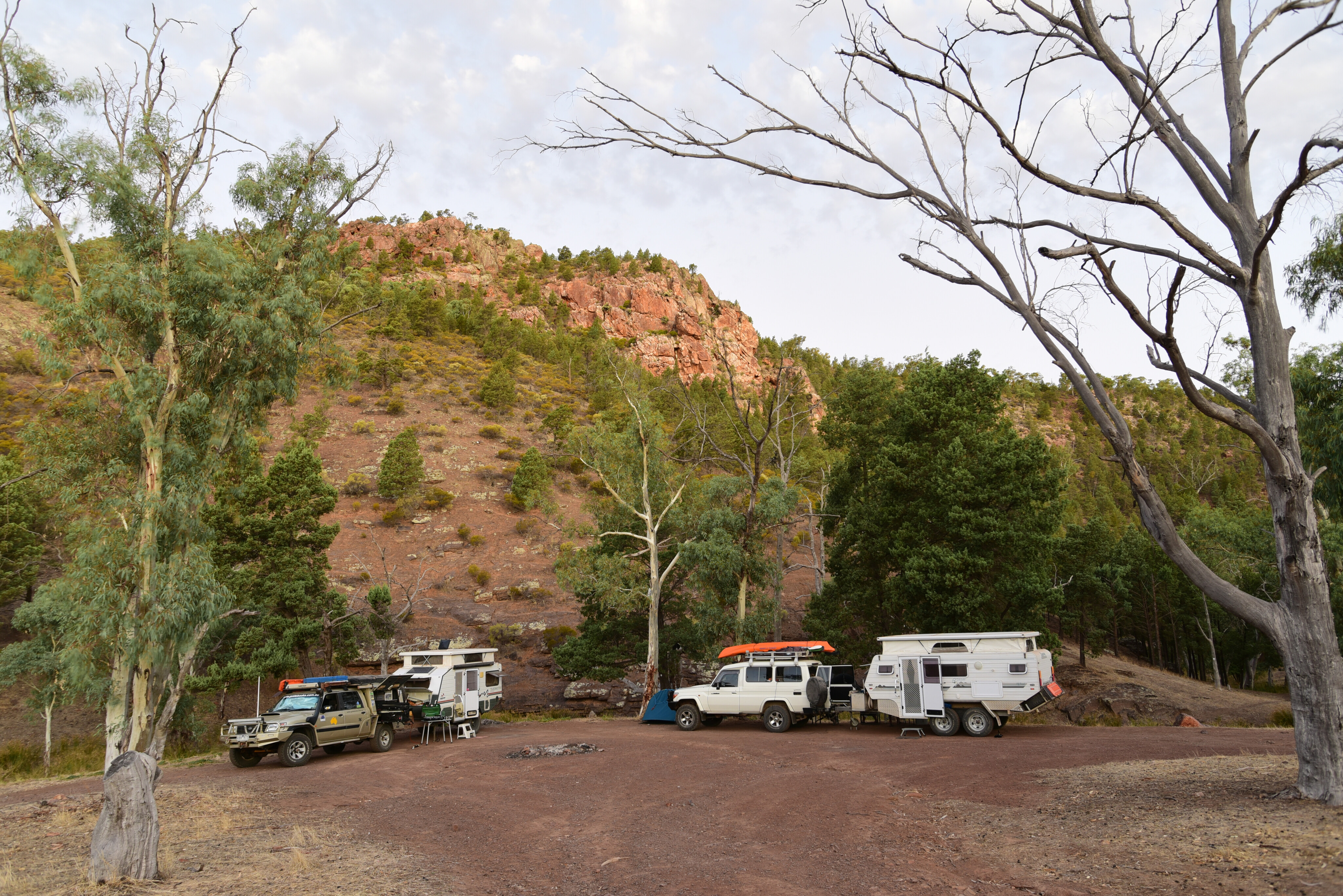
A short distance further along the road we turned off and followed a creekbed deeper into the hills and stopped at a wide bend in the dry gravel and called it ‘camp’ for the next few days.
Into the Flinders
Our travels through the Flinders Ranges had started a few days earlier when we had turned off the Strzelecki Track and headed across the low undulating rocky plain bordering the very northern fringes of the range.
Mt Hopeless, the most northern point of the Flinders, was barely discernible in amongst the other gibber-strewn low hills and bumps that make up this section of the ranges, and we crossed a succession of braided streams that emanated from these high points, but they only flow with life-giving water on the rare occasions that heavy rains fall over the countryside. And while the country was looking pretty good from recent downpours the creeks, as per normal, were dry.
46
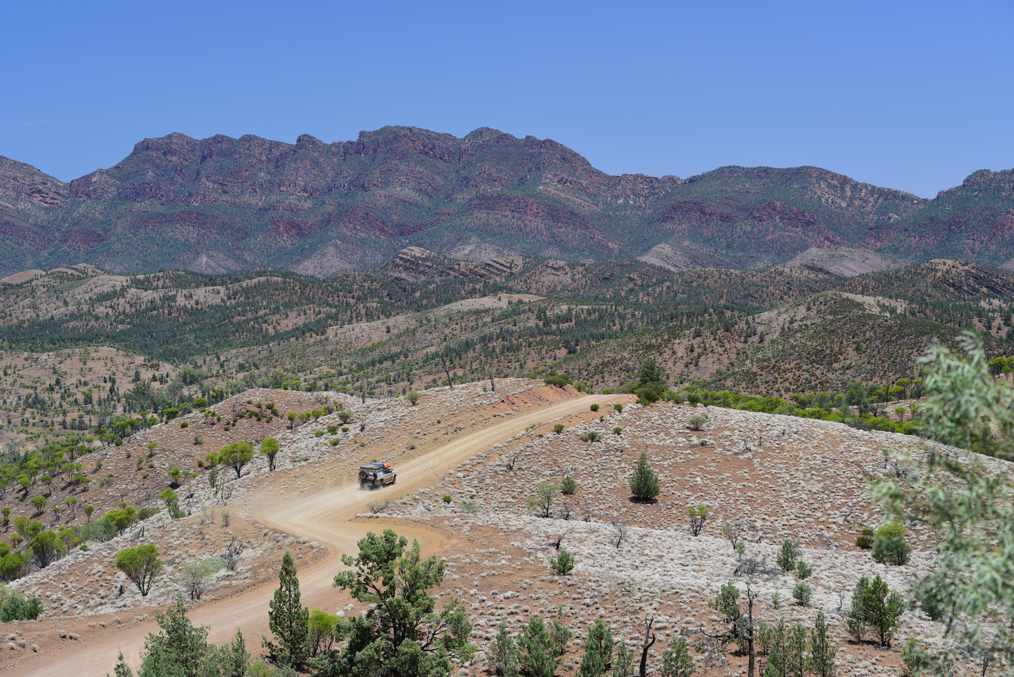
As we headed south the ranges drew ever closer, and became more rugged and appealing near the Balcanoona Homestead, which is now the headquarters of the Gammon Ranges NP. We turned into the mountains and followed the good dirt road to Arkaroola Wilderness Sanctuary.
This low-key resort lies tucked in amongst the ranges just north of the national park in some of the most rugged mountain country you can see and experience in Australia.
This trip was an entirely different experience to our last adventure here when the country was gripped in a long-lasting, seemingly never-ending drought. The low-lying scrub which had been withered and dead was now green while the trees that had survived the years of drought looked fresh and vibrant. The nearby creeks were still trickling water while long pools of still water lay in amongst the protected glens of the hills.
Arkaroola to Mount Chambers Gorge
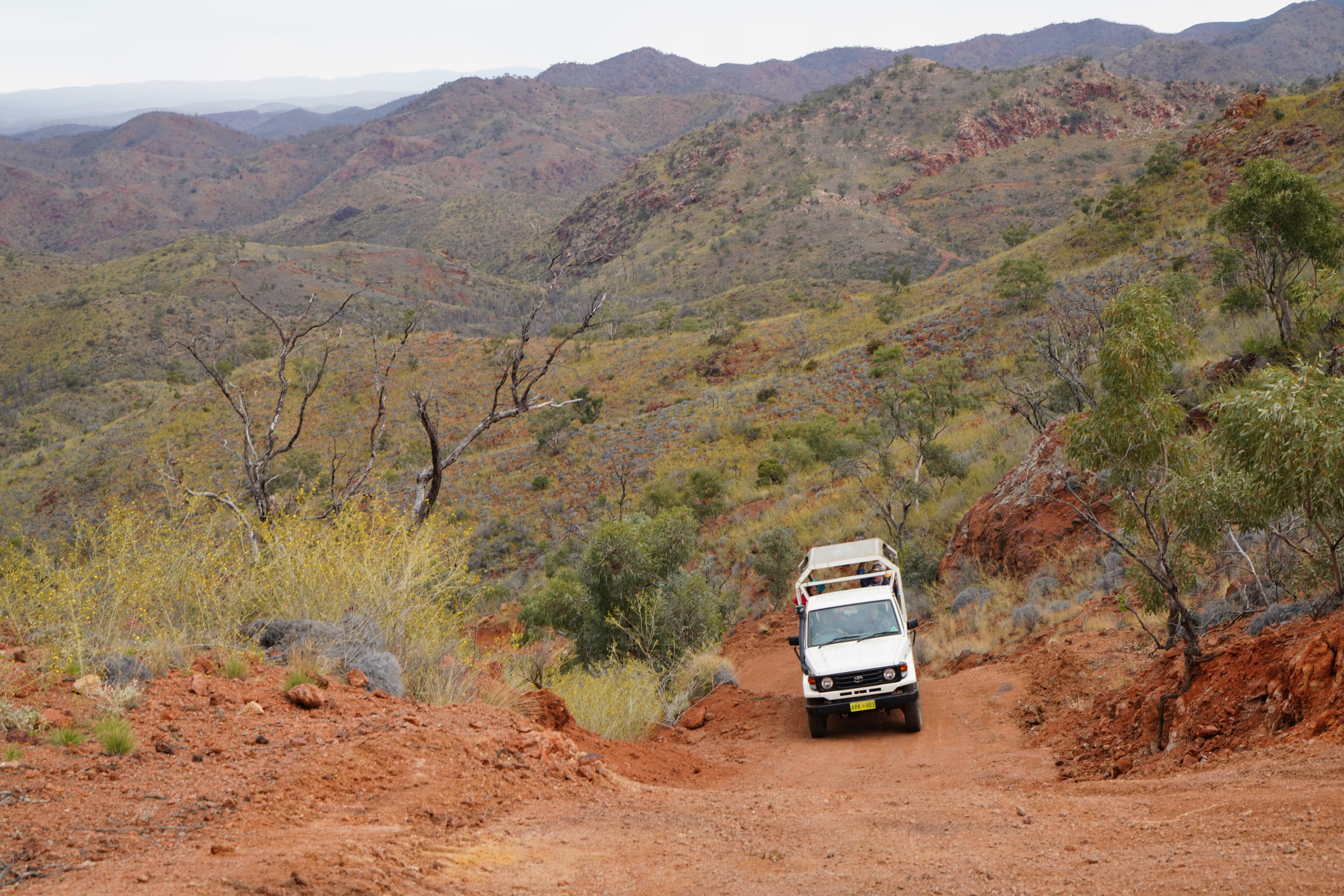
After setting up camp in an out of the way spot, but still close to the main resort area, we opted for a Ridgetop Tour, one of the highlights of a visit to Arkaroola. We’ve been here many times before and have done the tour at least a half-dozen times but it is a journey and a learning experience we never tire of.
After driving through the expansive and craggy country where the Mawson Plateau and the Freeling Heights overlook the separate peaks of The Armchair, Mt Gee, Humanity Seat and Mt Painter, to name just a few, we arrived at Sillers Lookout.
From this eyrie-like spot there were sweeping views to the east that took in the headwaters of Mt Painter Creek and its radioactive source, along with East Painter Gorge and out onto the distant flat plains, where the white expanse of Lake Frome glistened in the evening light.
46
After a couple of nights at Arkaroola we headed south and turned off the main dirt road and took the lesser track into Mount Chambers Gorge. For the first time in a long time, we splashed through a couple of shallow, trickling creek crossings before pulling up at the track’s end near a low bluff overlooking the wide creek bed.
A short walk from here and up a narrow feeder creek leads to what we consider to be the best Aboriginal rock art site that is open to the public in the whole of the Flinders Ranges. The petroglyphs here predate painted art, the artists long ago having chiselled their markings into the solid canvas of the rockface. There are hundreds of simple designs and motifs to be seen, indicating a once rich and vibrant society. A sign nearby gives an indication of what the markings represent, adding to the experience.
Public access
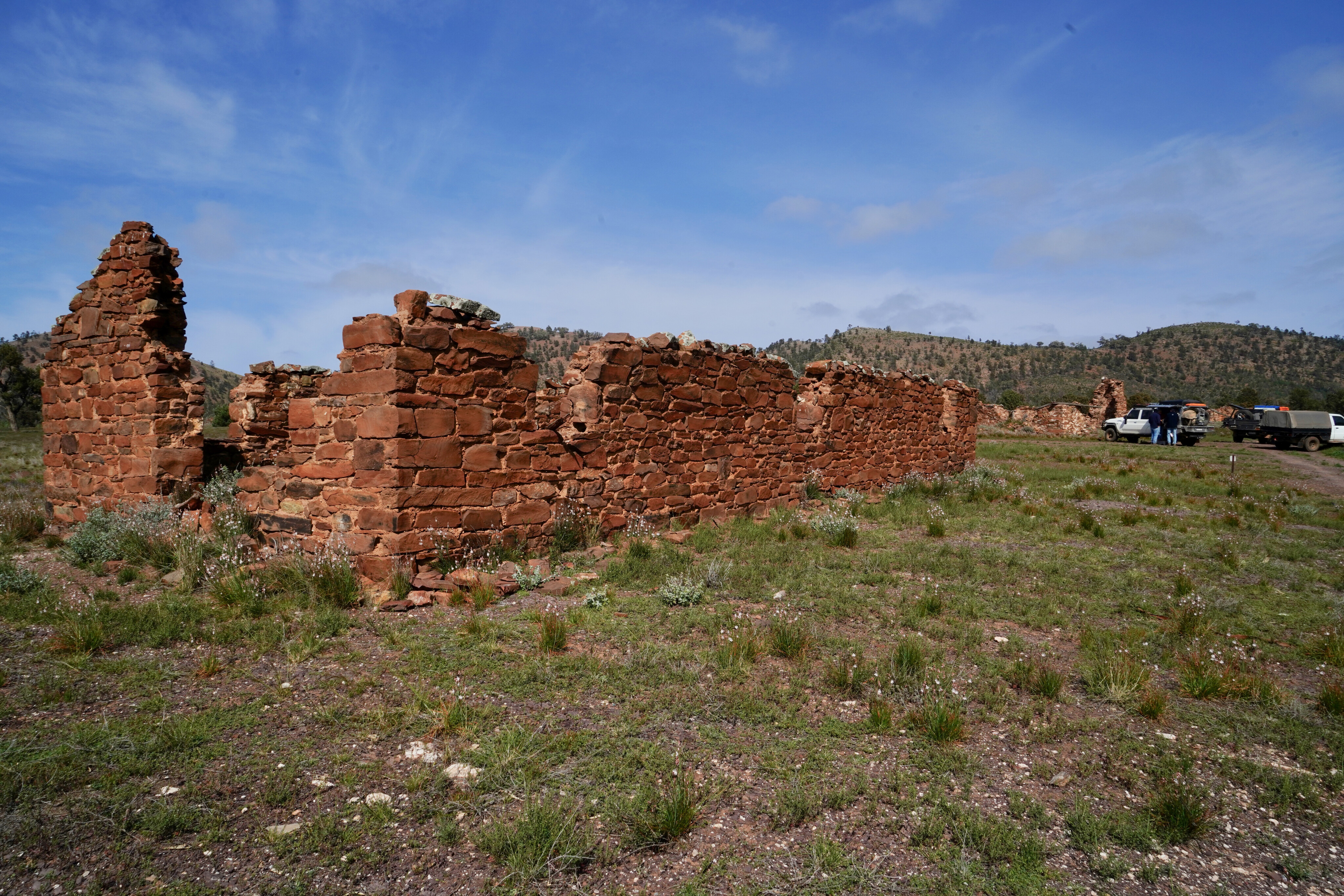
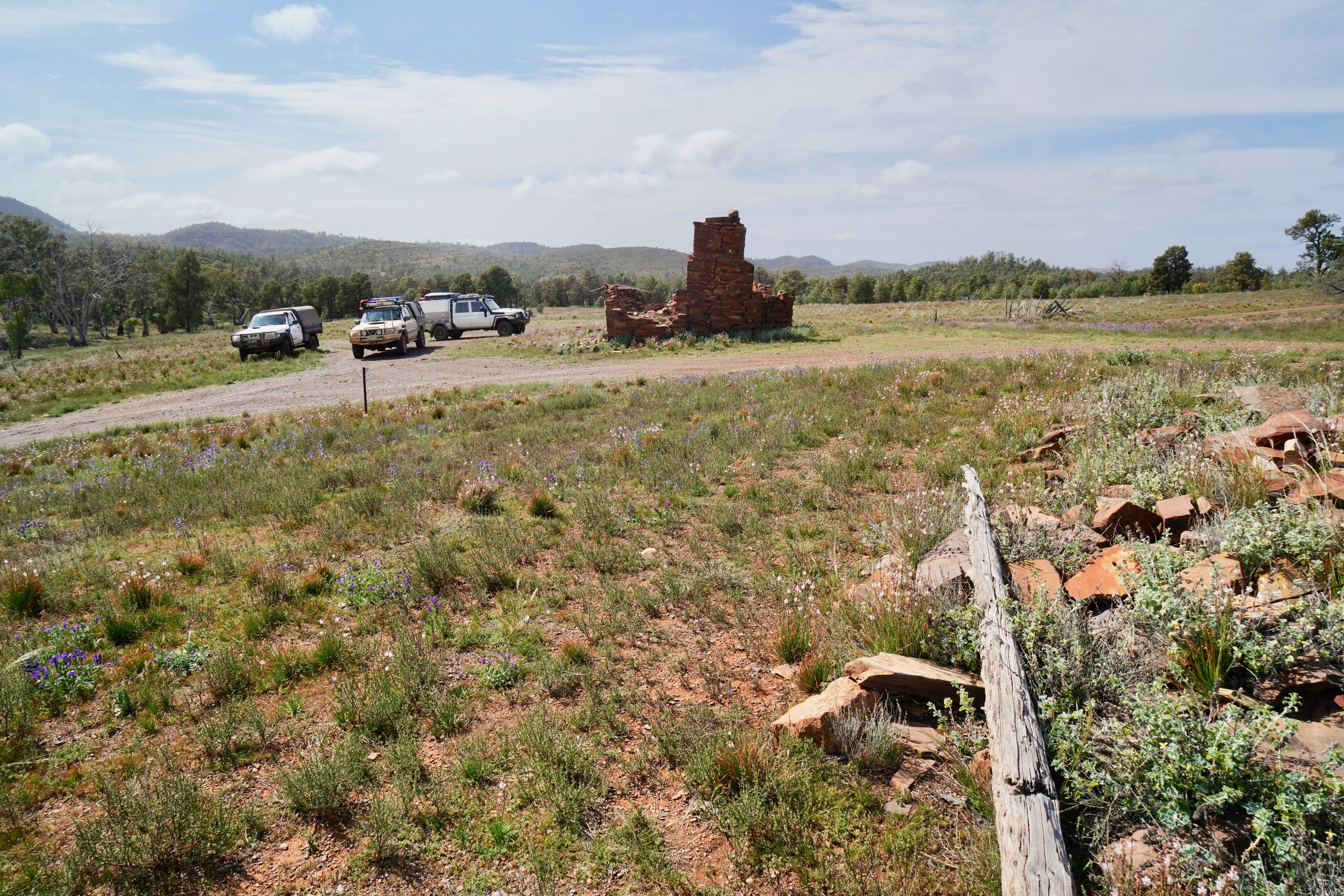
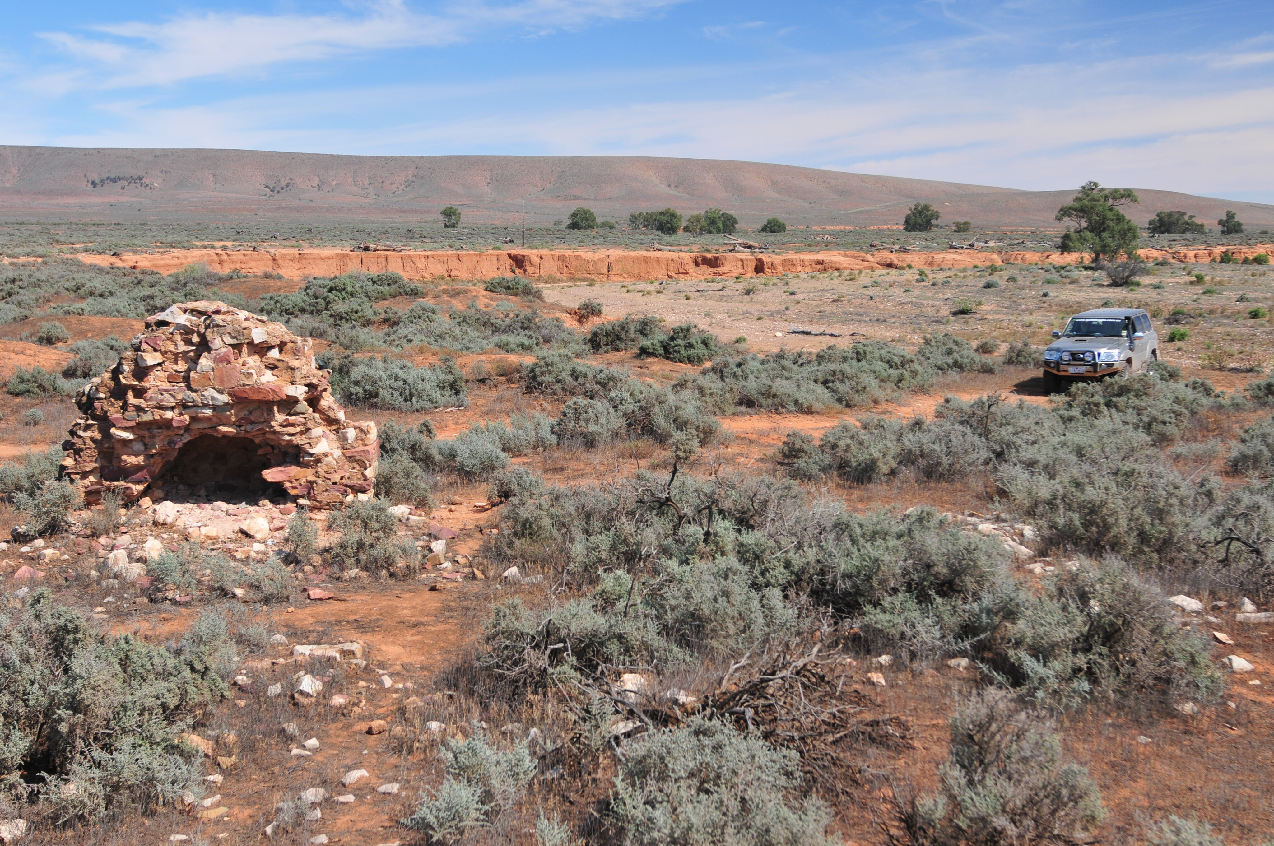
We bumped back along the track and, once on the more major road, we headed to Blinman and our creek camp. The next day we headed out on the Public Access Route (a unique SA arrangement that allows access through selected pastoral properties to points of interest) to the historic Artimore ruins.
It was a slow, jarring trip and we appreciated the stop at the ruins to soak in the history and ambience of the place
The once prosperous Artimore sheep station lies in a secluded valley dominated by the pyramid shaped, ragged summit of Patawarta Hill. The peak was made famous in Hans Heysen’s famous 1929 painting The Land of the Oratunga; the original oil on canvas now displayed at the Art Gallery of South Australia.
46
The track that runs to the valley, the ruins and on through Hannigan Gap is normally in reasonable condition, with no big challenges for a well set-up 4x4 vehicle, but the recent rains the area had been subjected to meant that the track was crossed by numerous small but sharp run-off gullies, while the bigger creeks had steep and eroded banks.
It was a slow, jarring trip and we appreciated the stop at the ruins to soak in the history and ambience of the place, the property once running in excess of 100,000 sheep, and taking in the surrounding views of hills including, of course, Patawarta Hill.
46
Sadly, as in many places in the Flinders, especially in the Flinders Ranges NP a little further south, native cypress pine is making a comeback, smothering the open glens and valleys in a sea of sticks, and depriving the area of one of its many attractions. Declared an invasive weed in many areas of Australia, there’s no such luck in South Australia, and the bloody pine has run rampant wherever Aboriginal traditional burning or sheep grazing has been stopped.
Once north of the ruins, the track passes through picturesque country before zig zagging through Hannigan Gap and passing to the south of Moolooloo Hill. A short time later the main access road to Moolooloo homestead is reached and then the Glass Gorge Road and our campsite, the trip being a leisurely day jaunt.
Solo tour
After bidding farewell to our travelling companions of the last few weeks, we headed south, passing through the Flinders Ranges NP.
Here we took one of the most spectacular drives in the country through Bunyeroo Gorge and then Brachina Gorge; this is a drive not to be missed and even though we have done it literally dozens of times, it never loses its natural attraction nor its visual appeal.
46
On the blacktop for a short distance, we went searching for the rather spectacular grave of Douglas Bruce, who is buried just off the main road north of Hawker. Killed when his horse fell on him back in 1873, his friends erected his impressive tomb close to Wonoka Creek in an area that was more crowded then than it is today. Near Bruce’s grave are another couple of grave sites, but when the town of nearby Wonoka was abandoned those graves were re-interred in Adelaide.
Scattered through the nearby hills that make up the Flinders, away from the central spine of the range, are more lonely graves, townsites and the crumbling ruins of farms that once promised so much in good seasons but died when the more normal dry times returned.
46
Further west along Wonoka Creek is the site of the small town of Hookina, which was established in the late 1850s on the route between the copper mines around Blinman and Port Augusta on the coast. By the time the town was surveyed in 1862 it was already home to a blacksmith shop and a 12-room inn, where sometimes more than a hundred bullock teams would camp thanks to the good nearby water supply.
The pub closed in 1896 when the town was bypassed by the railway, at which point Wonoka came into existence just a few miles away. Not far from the ruins is yet another lonely set of graves.
A harsh history
From the crossroads at Wonoka you can head further west and then skirt the western edge of the range before you finally hit civilisation and the blacktop near Port Augusta. Or you can be like us on this latest trip, and head south on what is Bobby’s Creek Road, passing even more deserted homesteads. Some of these, such as the Wild Dog Glen ruins, are close to the road and cry out for a little more exploration.
The route south crosses Kanyaka Creek and then comes to the scattered ruins of Simmonston, another failed venture of the 1870s when the country was opened up for wheat farming, although Simmonston was established in preparation for the railway, which ended up passing further to the east at the now deserted township of Gordon.
46
Swinging south-west at Simmonston, we stopped at Hugh Proby’s grave, who died near here while mustering a mob of spooked cattle in a flooded Willochra Creek. Earlier in 1851, Proby had taken up a number of leases totalling over 26,000ha which was the start of the famous Kanyaka run. Today, the expansive ruins of the homestead, which had grown in size to 94,500ha and employed over 70 families, lie just off the main Quorn-Hawker road and are well worth a visit.
After a brief stop to pay our respect to poor old Proby, we pushed on, the dirt road improving as we neared our destination for the night. Warren Gorge has been a favourite of mine since I used to go wandering and rabbit shooting out this way as a kid and today it makes for a favoured campsite.
It’s popular with the touring crowd too, and progress has seen a few fences erected to protect the environment, a small fee introduced for overnight camping, along with the addition of toilets and the odd fireplace.
46
Despite these amenities, nothing can take away the sheer grandeur of the rugged red bluffs that tower over the small creek, while in the early morning or late evening the occasional yellow-footed rock wallabies come out of their rocky fastness to feed on the grass beside the creek. Such moments are pure magic.
On nearby private properties, there are a number of 4x4 trails that take you through some of the most spectacular country in the region, and to the top of Mount Arden, first named by Matthew Flinders from his ship, when anchored at the head of Spencer Gulf in 1802.
We skipped these exciting adventures this trip, choosing instead to revel in the serenity and solitude of the ranges before heading south to more settled regions, but we know we’ll always return to the heart of the Flinders.
Five essential stops
Camp at Arkaroola and take the Ridgetop Tour
It’s a rough and jarring ride in the back of a LandCruiser ute, but the view from Sillers Lookout makes it all worth it. See www.arkaroola.com.au for details.
Explore the rock art of Mount Chambers Gorge
The petroglyphs chiselled into the rock walls at Mount Chambers Gorge are several thousands of years old and are some of the best rock art in the Flinders Ranges.
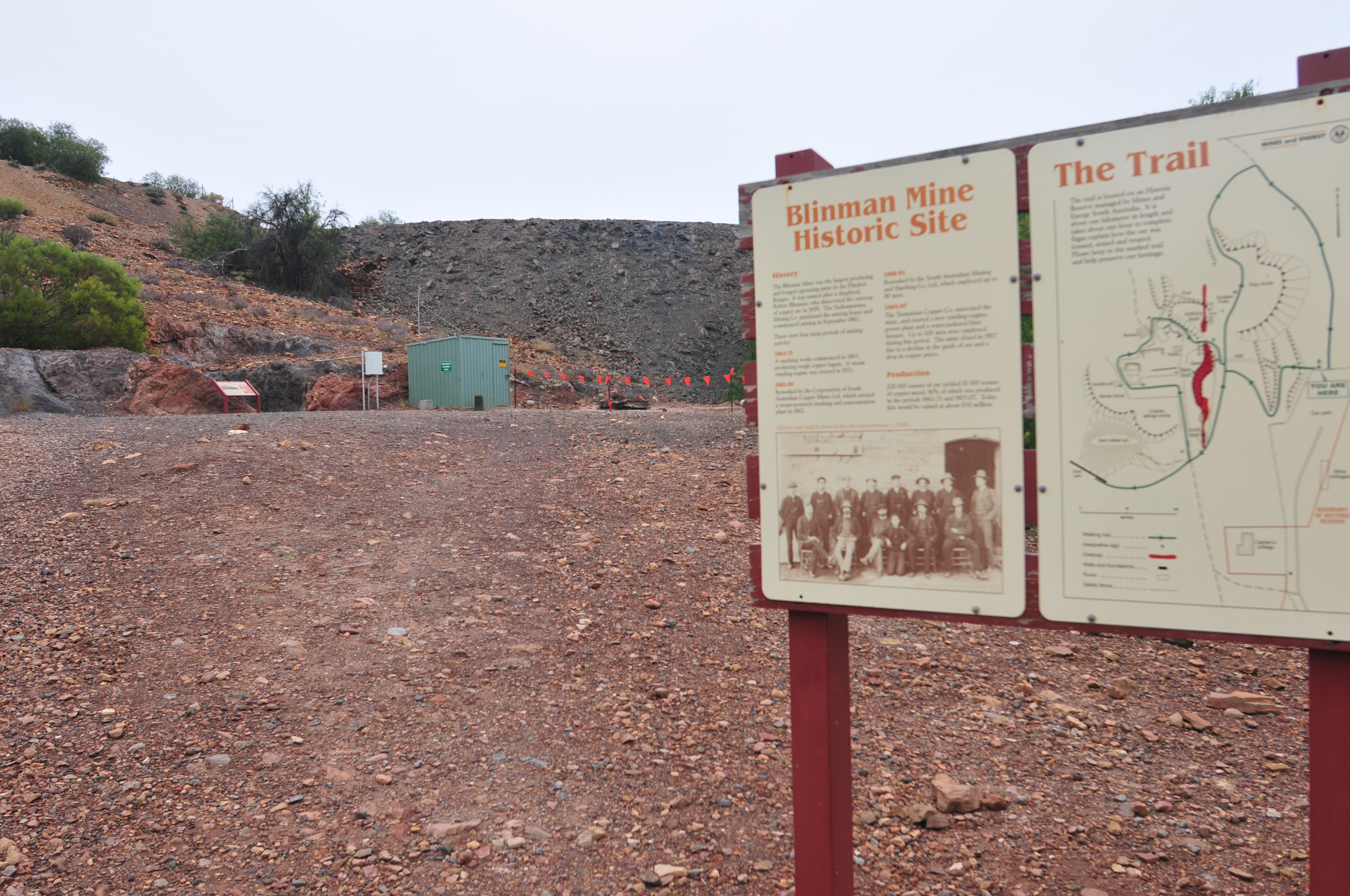
Enjoy a tour underground at the Blinman Mine
The Blinman underground experience offers a journey into the heart of the historic copper mine led by experienced guides and with music and light boxes. See heritageblinmanmine.com.au for details.
Drive the Bunyeroo-Brachina Gorges circuit
To see some of the most spectacular geology, flora and fauna of the Flinders Ranges, a drive through the Bunyeroo and Brachina gorges is not to be missed.
05 Explore the area around Quorn and Warren Gorge
The impressive and imposing Warren Gorge is just 21km from Quorn and has bush camping with pit toilets. Register in Quorn or at the gate (cash only).
Public Access Routes
Public Access Routes (PARs) are unique to South Australia, providing access through selected private pastoral lands to various points of interest in the Flinders Ranges, including Artimore ruins. Take a look at www.4wdsa.asn.au/?page=pars for details.
Please enable JavaScript to view the comments powered by Disqus.
COMMENTS