Explore SA
Gallery48
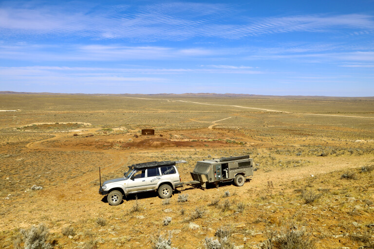
The definition of a shortcut typically means a shorter route than what is usually taken, and that’s what I thought when we veered off our intended route on a recent off-road trip – little did I know what we were going to find along the way.
The original plan was to head across to the Flinders Ranges, from Broken Hill into South Australia and up to Wilpena Pound, to hike and revisit the area after recent rainfall. However, with an overnight stay at Yunta in South Australia, we found we could cut across the desolate plains towards the Flinders and maybe save some time – or so we thought.
Yunta, on the Barrier Highway between Broken Hill and Adelaide, has a population of less than 100 people and is now used as a stopover for fuel, but it was once a bustling railway town.
48
Established in 1887, Yunta was an extremely busy place where more than 5000 miners passed through on their way towards new goldfields at Teetulpa and Waukaringa to the north, as well as being a busy railway town on the growing Adelaide to Broken Hill line. Around Yunta, there are still a few rail relics standing from this bygone era.
Yunta is also known as being a base for the well-known Harry Ding, who took on Arthur Kruse’s business in 1934 which included a general store and a post office. It was from here that the legendary Tom Kruse, at the ripe old age of 22, first started his iconic runs to Birdsville on January 1, 1936.
48
For nearly 20 years, Tom and his aboriginal offsider, Henry Butler, worked tirelessly to get the mail truck to Birdsville and back, enduring a range of conditions and hardships. It wasn’t until 1957 that a road was graded for an Ampol car trial to Birdsville, which made life easier for Tom and the crew.
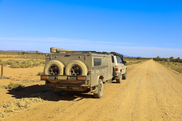
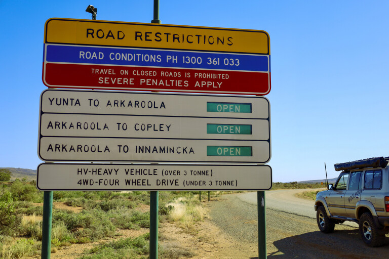
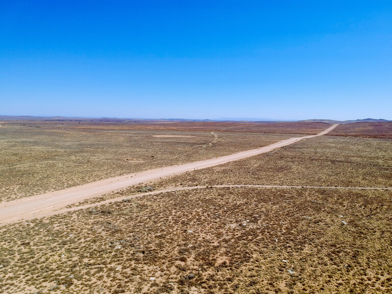
Heading out of Yunta, I spotted an alternative route towards Arkaroola and Innamincka, and was hoping we could track across to Wilpena. Tea Tree Road heads north, which was at least in the right direction, and warning signs indicated the entire road was open, going straight to dirt just out of the town’s limits. The land is barren out here, with mountain ranges in the distance, and it was surprising to see pastoral stations – it made us wonder what the stock would feed on.
Waukaringa Gold
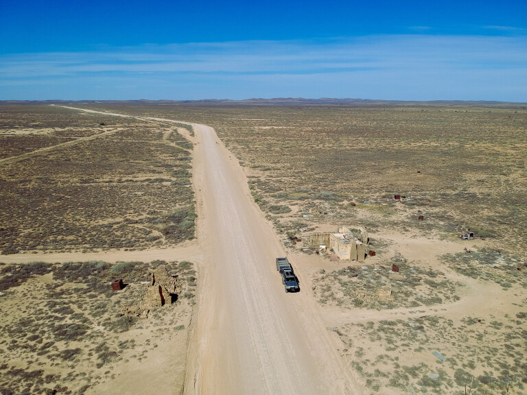
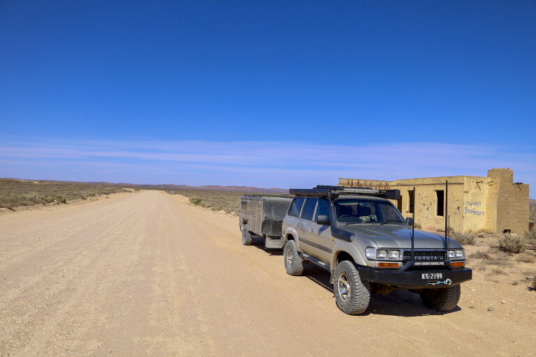
With just 35km under our belt we came across roadside ruins and, always one to check them out, it turned out to be more than we bargained for – the roadside info signs told us this was the Waukaringa Goldfields area.
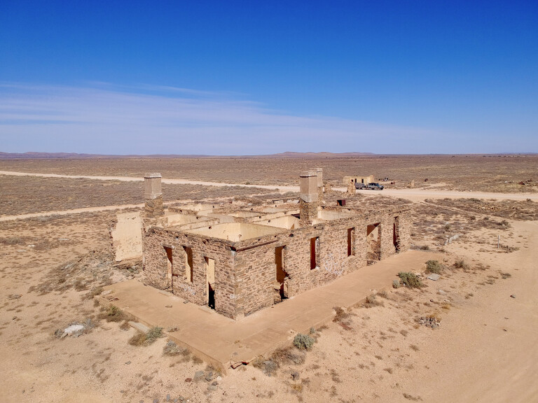
The sandstone-block building beside the road was the post office that was manned from 1875 through to 1984; it also ran as a general store and the local bank. It moved to its present location in 1903 after a fire burned down the original building. Reading the postmaster’s sign, it seemed the job was handed down through many family members over the years.
48
Across the paddock, the large and significant ruins of the Waukaringa Hotel – which was built in 1889 and served its last drink in 1964 – still stand. The township was proclaimed in 1888, where a population of nearly 500 was driven by the local goldfields.
The massive, crumbling ruins have multiple rooms on the ground level and underground cellars can be seen; plus, the building has three huge chimneys which would have been used for heating and cooking. Other ruins in the surrounding area include smaller walls, huge brick pits used for underground storage, and a massive amount of metallic materials like vehicle wrecks, large square water drums and thick metal plates.
The town of Waukaringa was built due to gold-bearing reefs found nearby in 1873 by James Watson, who was a shepherd on a local pastoral run. Originally, there was chatter it would be perfectly useless to search for gold in that direction to the north. At the time, gold was being freely found more to the west at Kooringa where it could be seen in the quartz and ironstone, so Waukaringa developed slowly over a number of years and was to become one of the longest lasting goldfields in SA.
48
Starting as alluvial goldfields where independent miners claimed small fortunes, larger companies soon moved in and commercial operations began. The nearby fields and ranges soon became full of deep gold mines and shafts, and lead was also found in abundance.
Good gold was being found and there was an intention to run two shifts a day to make it more profitable, but, in most cases when large companies come in, there was conflict as the miners refused to work after 1pm on Saturdays. Consequently, all the miners were sacked on the spot and others were transported from Victoria. It’s reported that 1427kg of gold was pulled from the ground here.
Scanning the horizon, two huge chimneys caught my eye on a ridge nearby, as well as a massive sunken roof in a gully. Exploring the area, the stacks (one huge stone stack and a smaller metal one) were part of the mining set-up. Close by, it was easy to find where the boilers, stampers and crushers were going by the massive threaded steel bolts protruding from the ground.
48
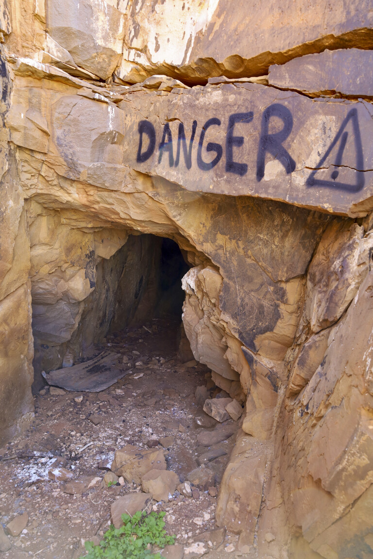
There’s plenty of stonework still around the area including basic shelters, chimney flues, walls and relics scattered about. The main mine, the Alma, can still be found, where documents say it’s more than 500m deep, has 14 different levels and more than 1600m of tunnels – truly impressive. Other mine tunnels can be found, but with warning signs declaring bad air inside – it’s unwise to go in, even though it was tempting.
Down in the gully, the massive low roof that seems to be sitting on the ground actually covers the old water supply, where water run-off was channelled to the undercover tanks from a couple of different areas. Still holding water today, the water supply attracts an abundance of birds and insects.
Like most towns that have steady population growth, two cemeteries were built: a Catholic cemetery near town and a general cemetery away from town in the town common. The entire area was finally abandoned in 1982.
48
When we finished exploring the area, we tracked north on Tea Tree Road for another hour, hopefully to find a crossroad towards Wilpena and the Flinders. Road conditions were pretty good, with long stretches of desert-like sections, plenty of dry creek beds (these were rough) and small rocky ranges.
We often chatted about being an early explorer in these areas and how tough it would have been climbing up to a range to see more of the same in the distance. Definitely soul-destroying.
Eventually we found a turn-off just past Curnamona Station and swung left on to Martins Well Road, with the Flinders in the far distance. The closer we got to the Flinders, we noticed there were more creek beds, the gums were bigger, and the mountain ranges were more solid. Out here these are known as ‘calcareous plains’, where there are small rises and low hills covered in bladder saltbush, sandhill wattle, desert cassia and a mixture of undergrowth grasses.
Pugilist Hill
Passing the huge Martin Wells Station, we were on the last leg of the ‘shortcut’, with the Chace Range towering beside us to the south.
Our last stop was up to the very impressive Pugilist Hill Lookout. The short, steep track to the top led us to the most amazing 360-degree view towards stunning prehistoric ranges that are claimed to be the oldest rocks in the world, holding many secrets from the past.
48
Across the landscape below, it was easy to trace where old creek beds were with trails of green gums that have been soaking up the water for many years, and it was easy to see other travellers pass by with their trails lingering without a breeze to disperse the dust.
Our journey was nearly over, as it was only a few kilometres to Flinders Ranges Road and to camp. While the shortcut got thrown out the window because we spent a day at the ruins, it definitely was great exploring the goldfields and getting off the beaten track.
Top 5 things to see and do
01: Yunta
The last town on the SA side of the Barrier Highway before hitting the NSW border and Broken Hill. Yunta lies on the T-intersection with Tea Tree Road, and following that track was a new shortcut to our Flinders Ranges-Wilpena Pound destination. The town has a hotel, two roadhouses (one with caravan sites), a post office, an airstrip, and a rest area with public toilets located opposite the hotel.
02: Waukaringa
Very much a ghost town, the former gold-mining town of Waukaringa was abandoned in the 1950s and officially ceased to exist in 1982, 96 years after it was established. The former Waukaringa Hotel is one of several remaining ruins, with more visible in the nearby goldfields. Waukaringa is on Tea Tree Road, 35km from Yunta.
03: Ikara-Flinders Ranges NP
The Flinders Ranges is the biggest mountain range in South Australia, and a bucket-list item to visit. The area is noted for its stunning scenery, wildlife and classic outback vistas, with the national park offering several camping sites (all with toilets, bar one) where park entry and camping fees apply.
04: Wilpena Pound
The natural amphitheatre that is Wilpena Pound is among Australia’s most famous geological wonders, and is located in the heart of the Ikara-Flinders Ranges National Park. It is accessible via a sealed road and is the highest section of the Flinders Ranges, dominated by St Mary Peak at 1171m. The popular 7.8km Wangara Track has panoramic views across Wilpena Pound’s interior.
05: Pugilist Hill
Not far from the Flinders Ranges NP and Wilpena Pound, turn right off Flinders Ranges Way on to Martins Well Road and to the Pugilist Hill Lookout. From here are fantastic views of the Chace Range to the south and the ramparts of Wilpena Pound to the north. The drive to the lookout follows a short and steep track to the top, with fantastic 360-degree views.
Please enable JavaScript to view the comments powered by Disqus.
COMMENTS